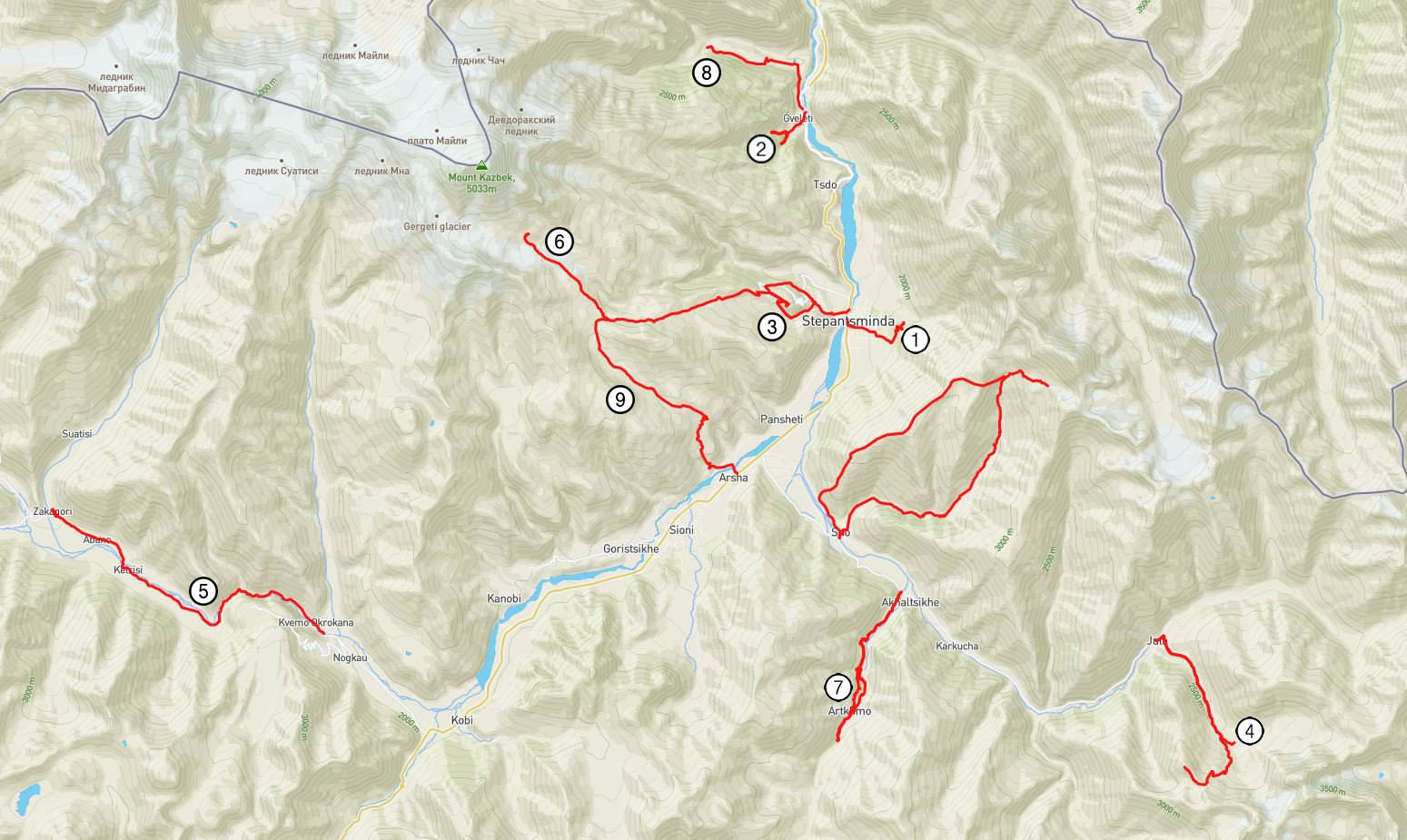
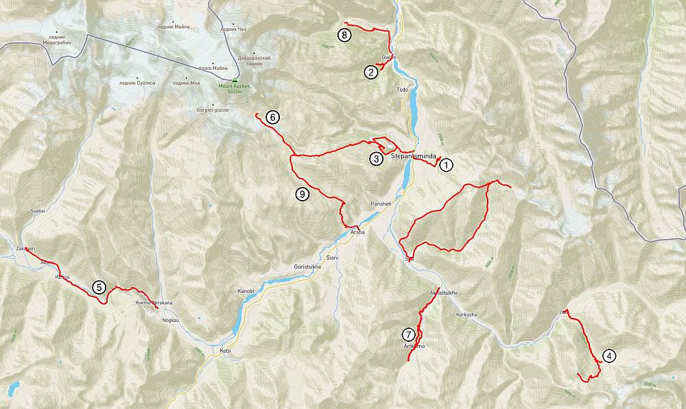
Stepantsminda village is the administrative center of Kazbegi district and, thanks to its easy accessibility, also the most popular mountain destination in Georgia. Yet, majority of visitors spends here a very little time - they just visit Tsminda Sameba church and leave. But the region has so much more to offer! While it´s true that not that many trails start right at the village, Stepantsminda is still the best base to explore the region (if you don´t have a car). Due to its position on the Georgian Military Road and abundance of local drivers, you can easily reach any trailheads in the vicinity.
Below, I listed day hikes which can be done while using Stepantsminda as a base. I split them into three categories based on their difficulty and popularity - so you will if you will meet also other hikers or there is a good chance that you will have the trail just for yourself.
| Distance | 5 km |
| Trail type: | Roundtrip |
| Duration: | 1,5 hours |
| Total climb: | 250m |
| Total descent: | 250m |
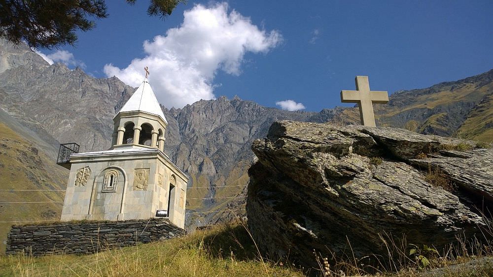
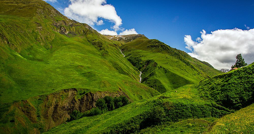
This pleasant walk climbs from the village center to the east, onto the hillside opposing the Tsminda Sameba church. Eventually, it reaches the church of St. Eliah. The church is not that interesting from an architectural standpoint since it´s new but it is picturesque and offers postcard views of Mt. Kazbek and Gergeti Trinity church. So I think it´s worth the effort.
When to go: all year round
| Distance | 4km |
| Trail type: | Roundtrip |
| Duration: | 1 hour |
| Total climb: | 191m |
| Total descent: | 191m |
A simple walk to a couple of waterfalls, located in a small valley 7km north of Stepantsminda village. While the smaller one is unremarkable and you won't miss much much if you skip it, the larger one is pretty nice (even though there are several more impressive waterfalls around Georgia).
The larger waterfall forms a small pool where you can have a fresh shower. But only if you don't mind cold - the sun shines into the gorge only early in the morning.
When to go: all year round
| Distance | 6,4 km |
| Trail type: | Roundtrip |
| Duration: | 2,5 hours |
| Total climb: | 472m |
| Total descent: | 472m |
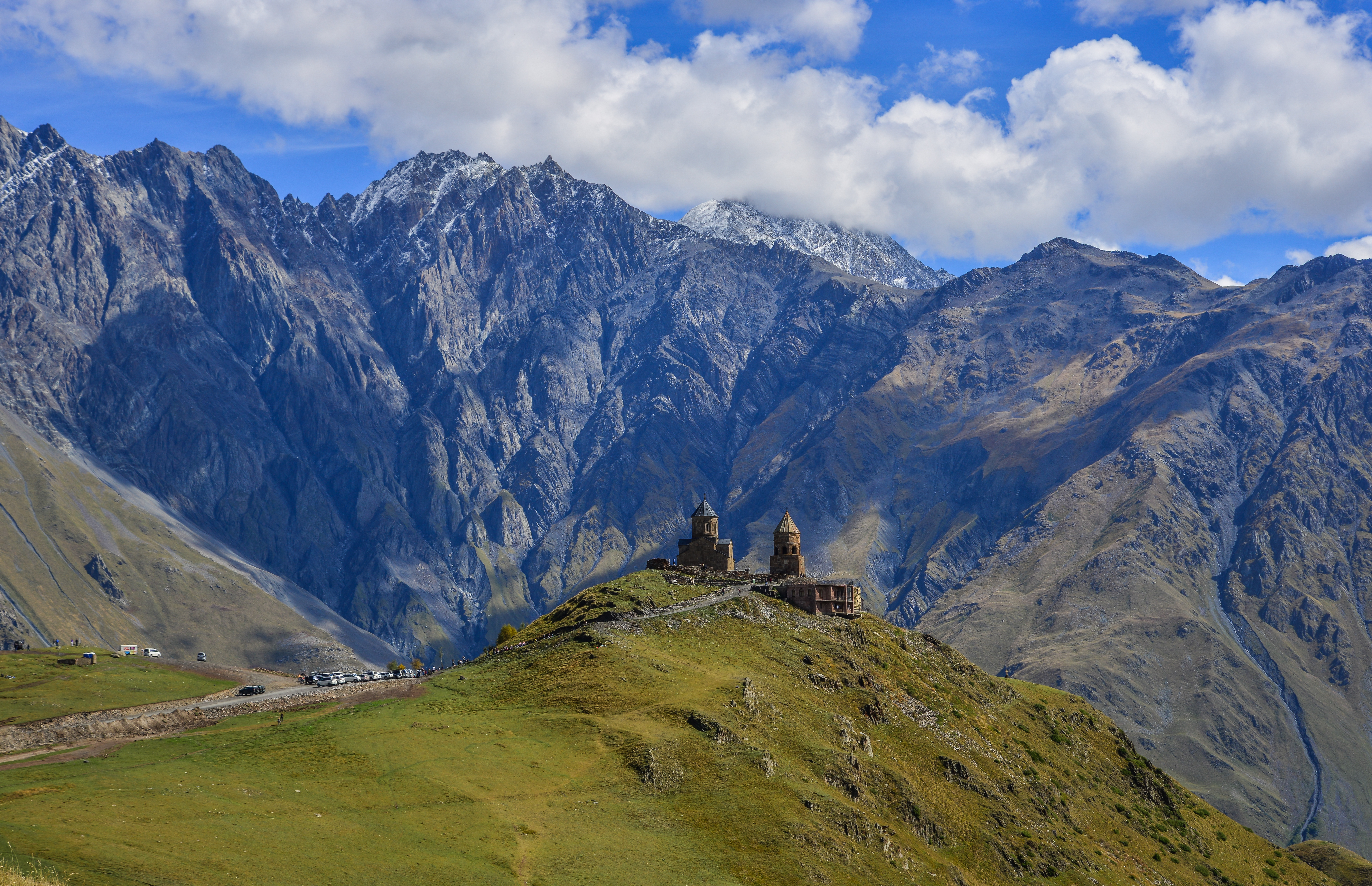
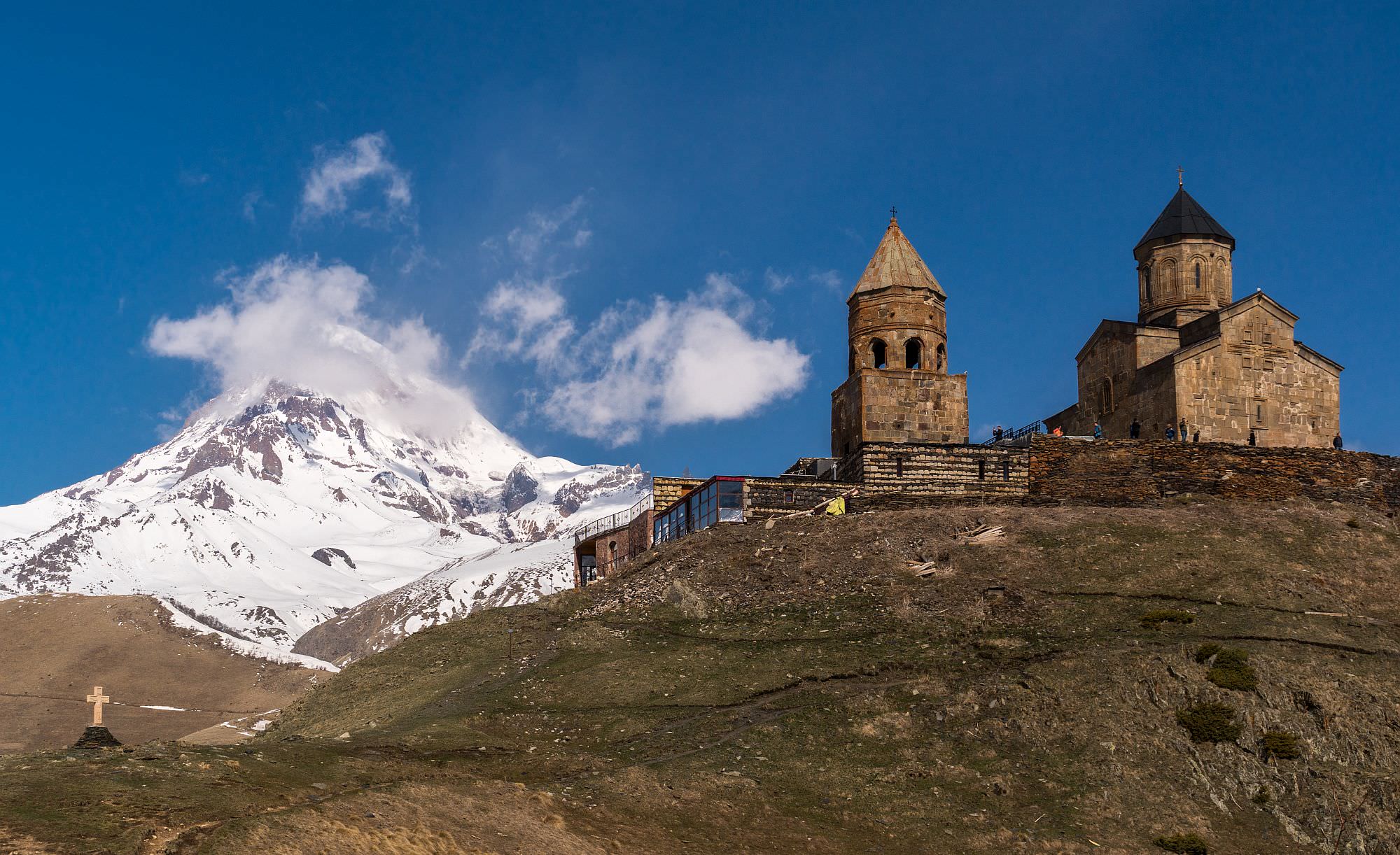
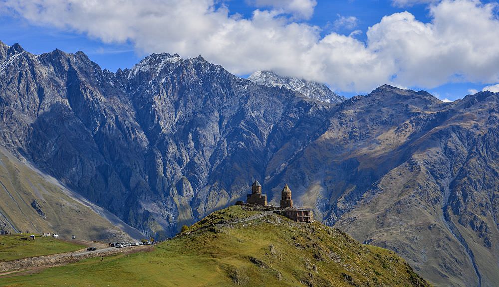
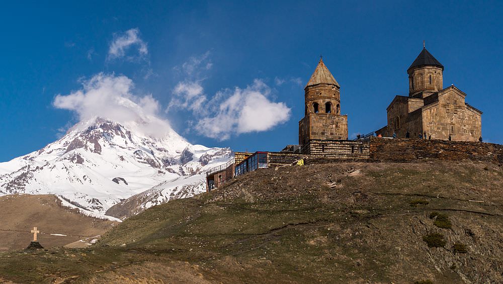
Picturesque Tsminda Sameba church is one of the most iconic sights of Georgia and certainly the main reason why so many tourists flock to Stepantsminda. You can reach it also by taxi but if you have time and want to soak in the atmosphere, it's certainly better to walk.
Several routes of various length and steepness climb to the church. If the church is your final destination (so you are not in hurry), I recommend to take the trail which starts at Gergeti Summer Cafe, follows the valley of Bashi river and climbs to church from south - it's the longest one, but also least steep and far from jeeps and traffic.
When to go: all year round
Looking for a good guesthouse in Stepantsminda?
These are my favorite ones.
| Distance | 7,9 km |
| Trail type: | Roundtrip |
| Duration: | 3 hours |
| Total climb: | 378m |
| Total descent: | 378m |
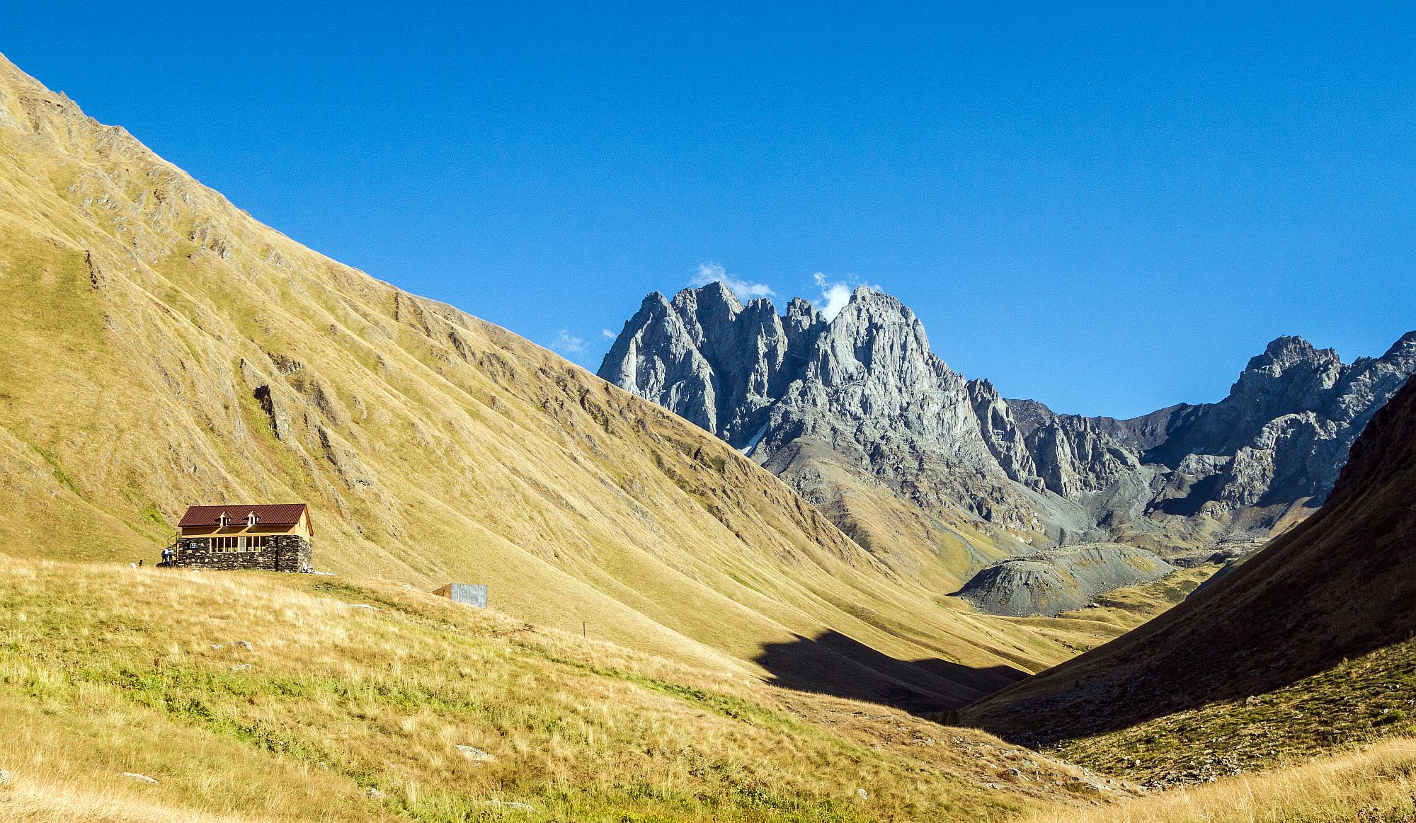
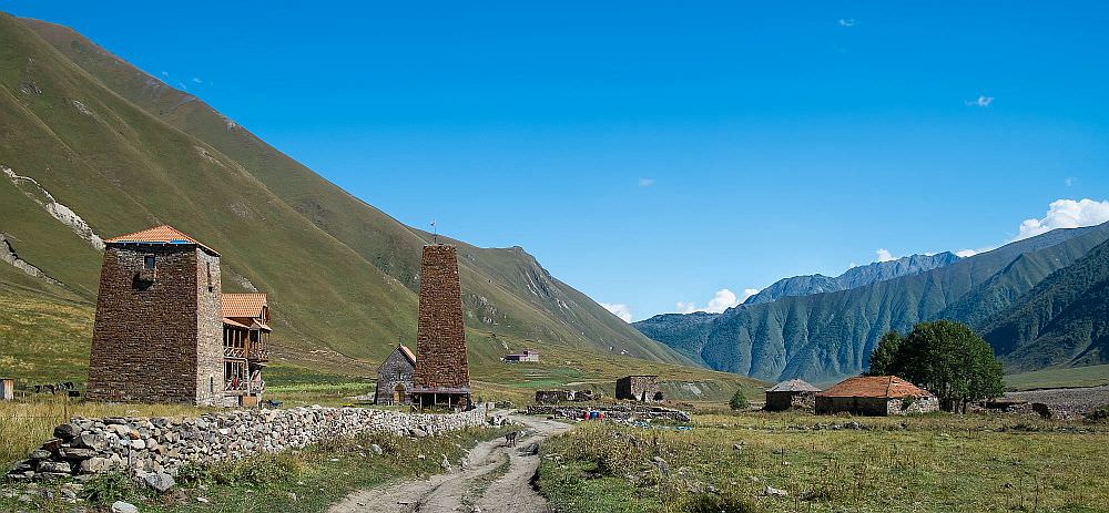
Juta village is a popular destination for daytrippers staying at Stepantsminda. Most of them follow the popular "Roshka" trail towards the jagged peaks of Chaukhi massif. Of course, Chaukhi pass is too far for a daytripper - most of them finish their journey in the pub at the bank of a small Chaukhi lake, some 3 km into the trail. You can walk even further, but the views don´t improve too much during the next hour.
When to go: April - November
| Distance | 21 km |
| Trail type: | Roundtrip |
| Duration: | 5 hours |
| Total climb: | 463m |
| Total descent: | 463m |
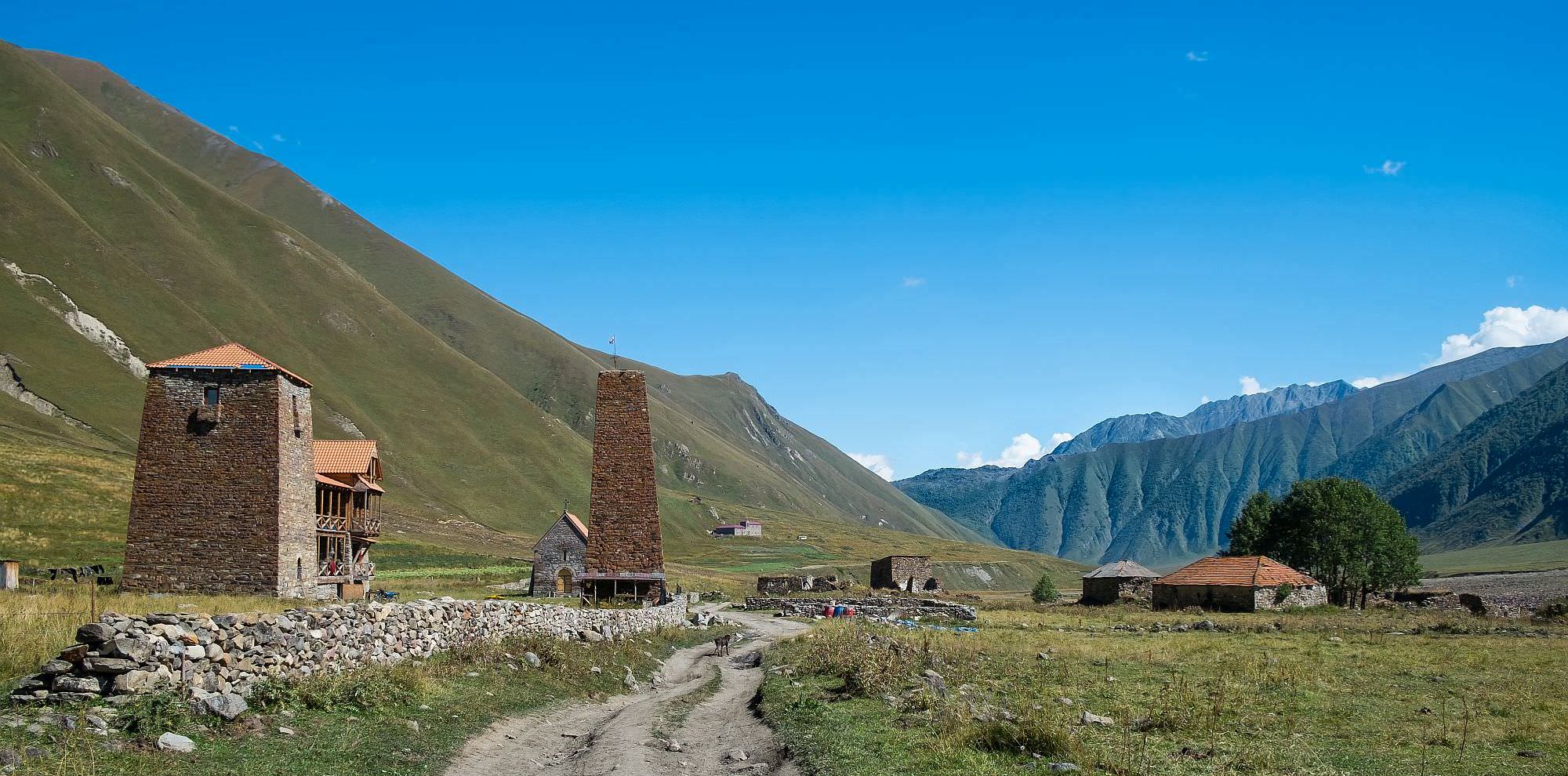
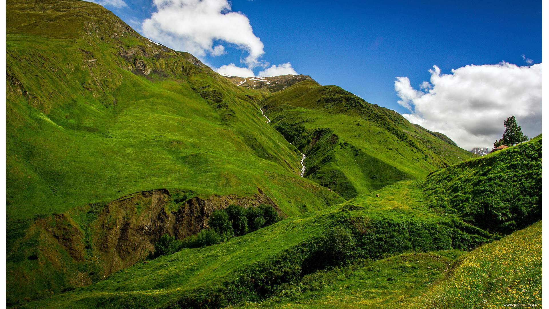
A pleasant walk in an almost abandoned valley located some 20 kilometers south of Stepantsminda. Here, you will find several colorful travertine formations, derelict villages, two monasteries and one ruined fortress. That´s also where your journey ends - it´s not possible to continue further due to proximity of the breakaway region of South Ossetia. The whole track is flat and accessible even to cars, but the traffic is minimal.
Just a few years ago, there were almost no people apart from a few shepherds or border guards. But in past years, life is slowly returning them - last summer was opened an official campsite with several cabins to rent as well as a cafe and a snack bar in the Ketrisi village.
When to go: Mid April - November
| Distance | 20,4 km |
| Trail type: | Roundtrip |
| Duration: | 8-9 hours |
| Total climb: | 1552m |
| Total descent: | 1552m |
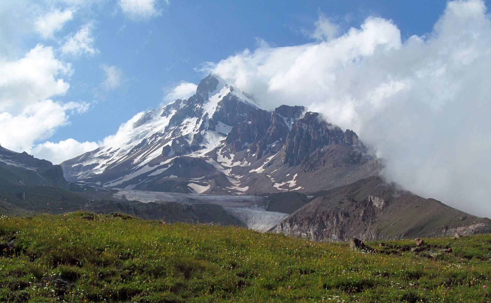
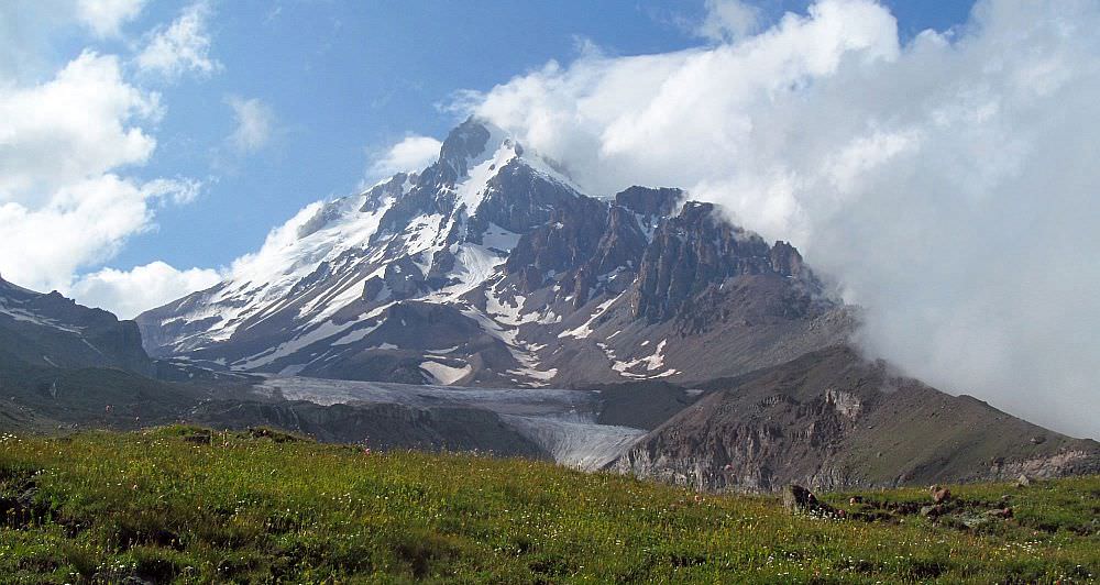
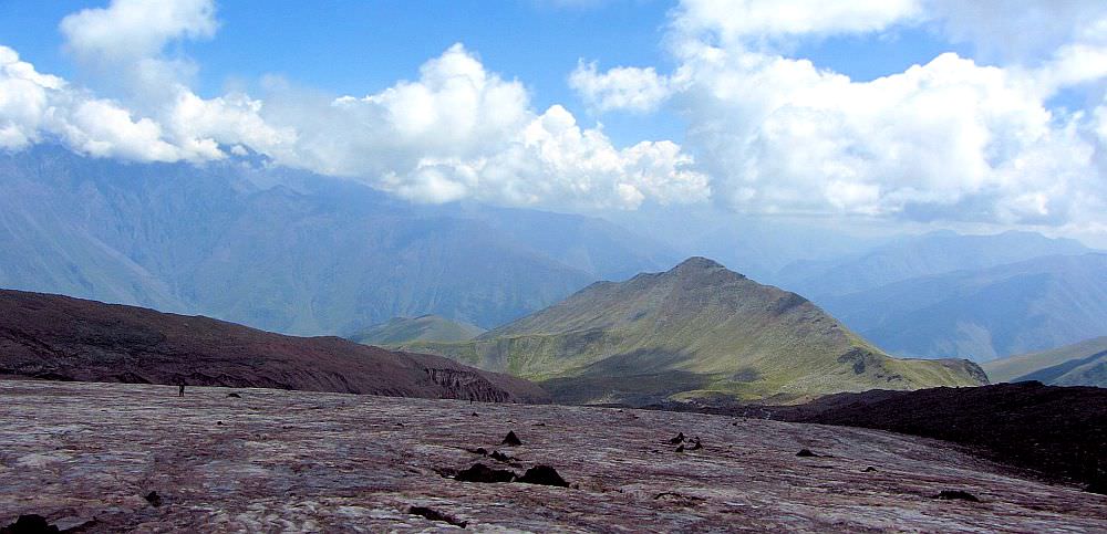
If you have a whole day, reaching Gergeti Trinity church is not much of a challenge. Therefore, hikers often continue further west, towards Mt. Kazbek. After one hour of tiresome climbing, they reach a stone cairn - this place is known as Arsha pass and offers first views of Gergeti glacier. This is also the place where many people turn back. Only those persistent keep walking, cross a few streams, walk past newly built Altihut and reach the foot of the glacier. And if you start early you can even reach former meteostation Betlemi hut, located at 3600m (and return on the same day) - but this is a feat reserved only for extremely fit hikers.
When to go: early June - mid October
| Distance | 11,8 km |
| Trail type: | Roundtrip |
| Duration: | 3-4 hours |
| Total climb: | 521m |
| Total descent: | 521m |
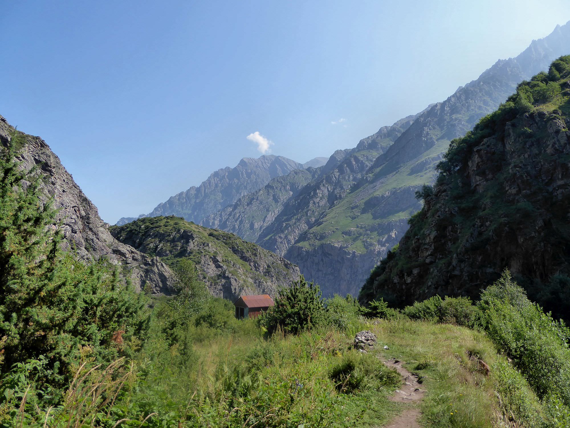
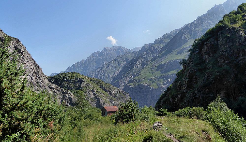
Small, almost forgotten valley branching off the Snostskali gorge by the Akhaltsikhe village. Two trails run through the valley - there is a dirt track running at the bottom of the valley as well as a trail higher in the mountainside. Both routes meet at the abandoned Artkhmo village. One can continue even beyond the village, but the trail soon becomes difficult to follow
Views during the walk are good but what makes this trail truly special is the eerie atmosphere and the feeling of stillness. There are no tourists, taxi drivers or café bars, only a few cows at the bottom of the valley. And the only sounds you hear most of the time is the buzzing of insects.
When to go: Early May - November
| Distance | 7,6 km |
| Trail type: | Roundtrip |
| Duration: | 3 hours |
| Total climb: | 472m |
| Total descent: | 472m |
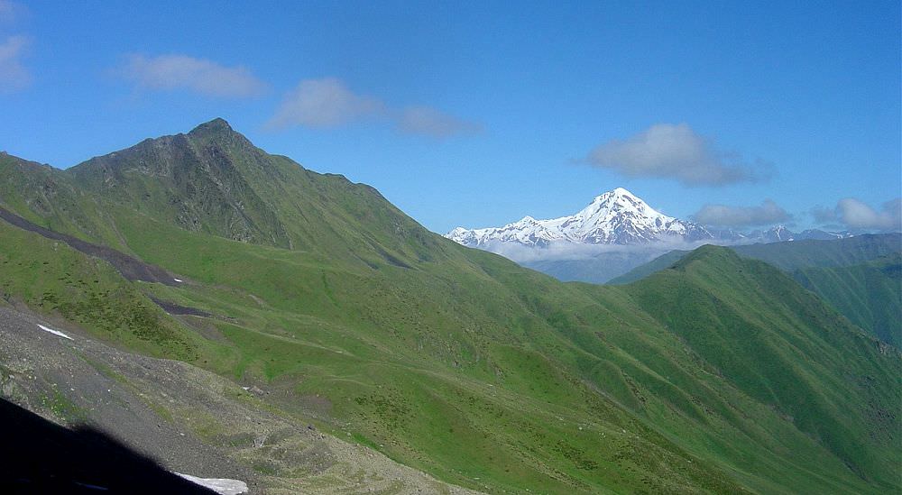
Devdoraki glacier covers eastern slopes of Mt. Kazbek and is the largest glacier in the region. Even a few years ago, it could be accessed by a long, strenuous trail through the valley of Kabakhi river, running in close vicinity of the Russian border.
Unfortunately, not anymore. After deadly landslides in 2014, when the mudflow from the valley temporarily blocked Georgian Military Road, the upper side of the valley got closed for public. These days, you can walk only halfway - just follow an old mining road starting at the Gveleti village. One hour later, you will reach a newly build checkpoint, the farthest one can currently get into the valley. Still, it is a very pleasant walk which can be easily combined with Gveleti waterfalls.
When to go: November - April
| Distance | 22 km |
| Trail type: | Roundtrip |
| Duration: | 9 - 10 hours |
| Total climb: | 1630m |
| Total descent: | 1630m |
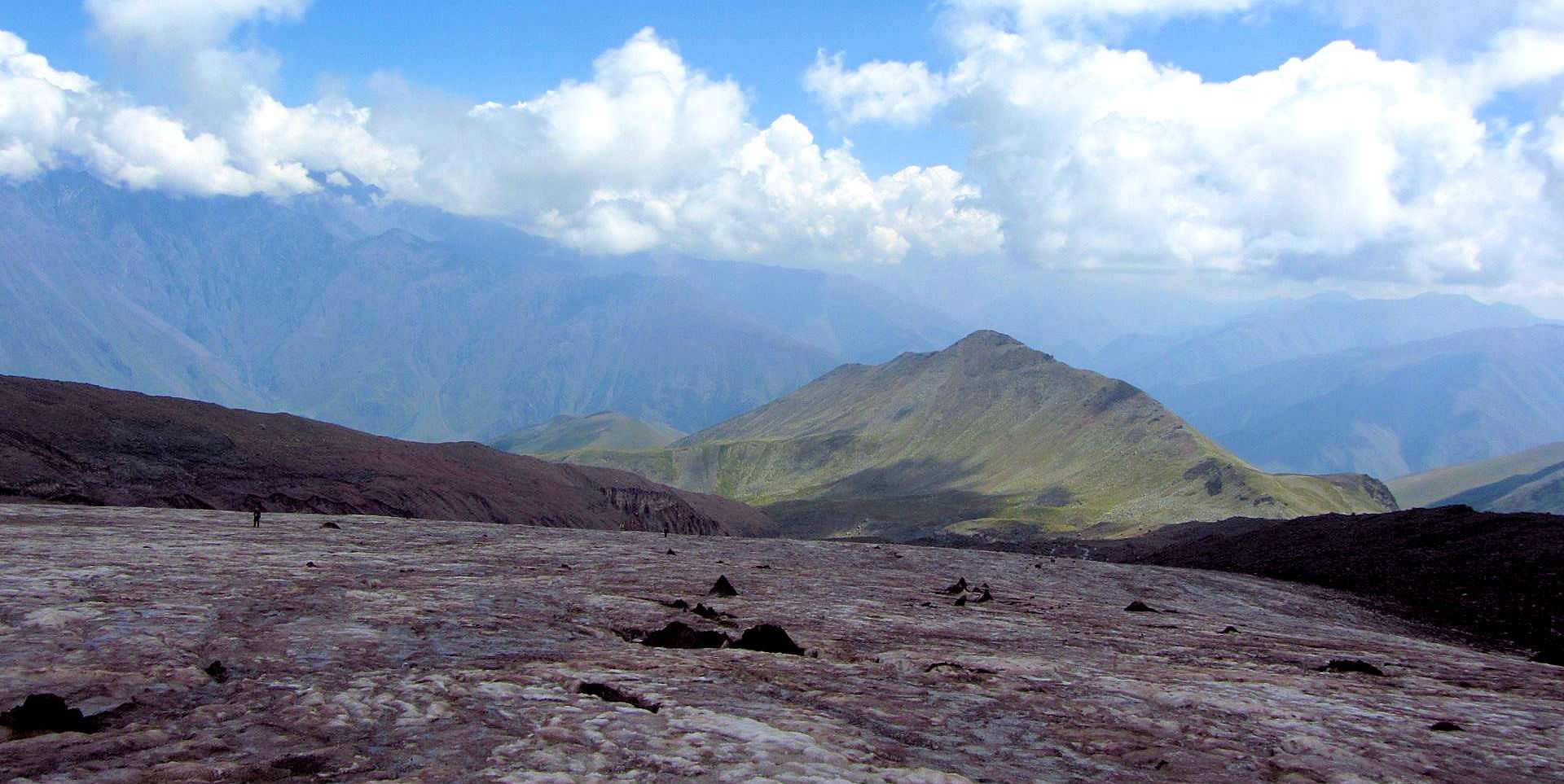
Not many people know that but there is one more hiking route climbing to the Gergeti glacier - compared to the classic route, it is longer and harder, but also sees little to no traffic. Shortly after Arsha village, it passes two waterfalls, then it climbs up the Chkhati valley, crosses the ridge and rejoins the classic trail at Sabertse meadows. A good alternative for people who don´t want to return the same way.
When to go: June - October
| Distance | 23,6 km |
| Trail type: | Roundtrip |
| Duration: | 9 - 10 hours |
| Total climb: | 1850m |
| Total descent: | 1850m |
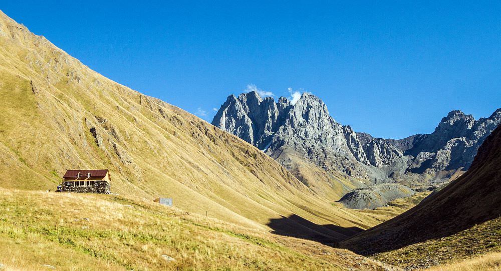
Stunning, but also very difficult treks which let you admire familiar places from a completely different perspective. There are two routes that meet not far before the pass. The first, more scenic one climbs the ridge north of Sno, reaches Angel's mountain (3095m) and then follows the top of the ridge towards the pass. The second one follows the valley of Khvedisistskali river and climbs the ridge only later.
Since walking all the way to the pass and back would be extremely hard, it´s completely OK if you turn back earlier - either after reaching Angel's mountains (in case of the first variant) or after climbing to the top of the ridge (in case of the second variant).
When to go: late June - early October
| Distance | 14,6 km |
| Trail type: | Roundtrip |
| Duration: | 6 - 7 hours |
| Total climb: | 1187m |
| Total descent: | 1187m |
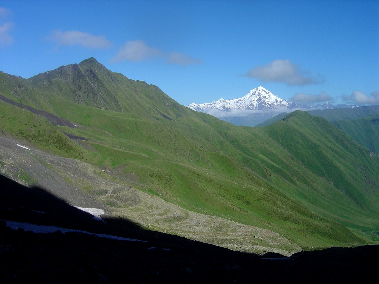
An alternative route for hikers who think that a mere walk in the Chaukhi valley is too easy. It leaves the classic trail at huge boulders (climbers often camp here), climbs south onto a ridge extending from Chaukhi massif to the west and then follows its top to the top of the mountain. From here, one can enjoy great views of Chaukhi massif as well as of all mountains to the west, including Mt. Kazbek.
In spite of its altitude, the climb is not technical and involves only a very little of scrambling.
When to go: June - October