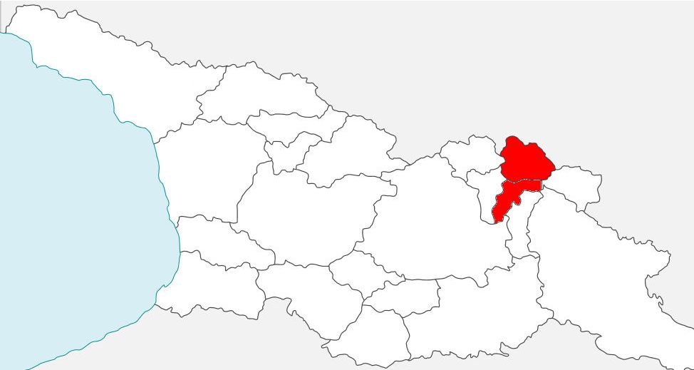
Khevsureti
"Khevsurs, a people of the Caucasus, kinsfolk of the Georgians.
Their name is Georgian and means "People of the Valleys.
They like to call themselves Christians, but their religion is a mixture of Christianity, Mahommedanism and heathen rites. They worship sacred trees and offer sacrifices to the spirits of the earth and air.
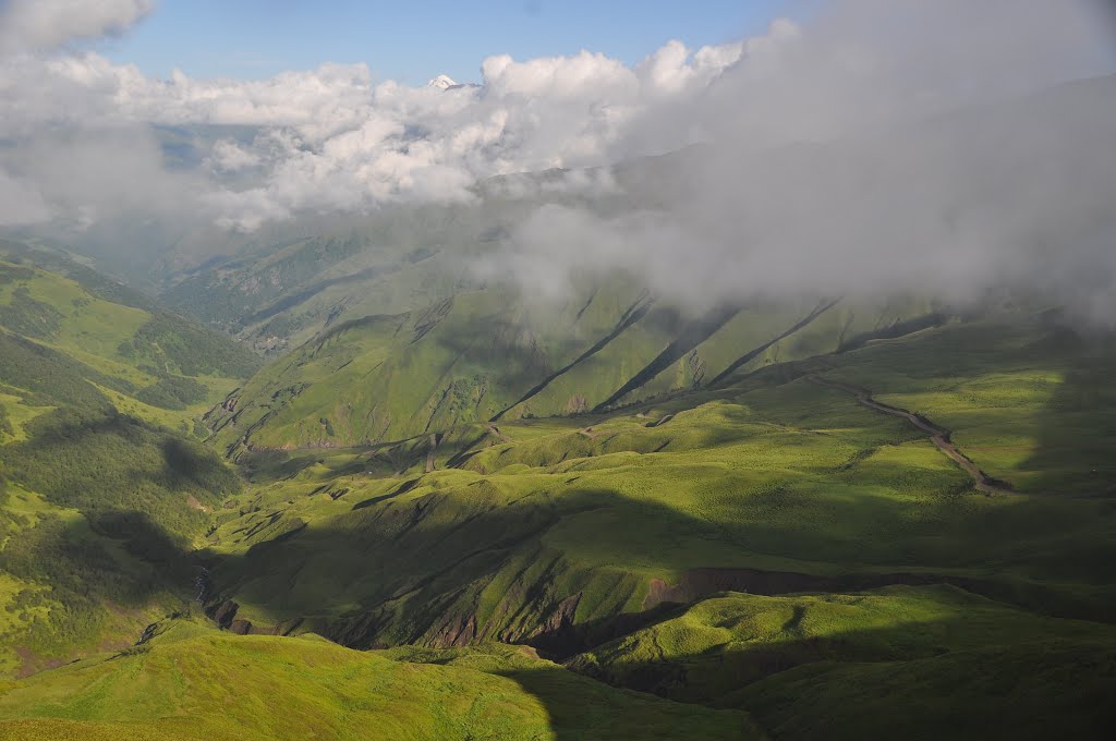
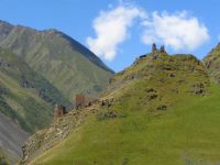
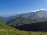
Khevsureti is another beautiful mountainous region and probably the one I like the most.
I like its majestic mountains, wild rivers, fortified villages,
atmospheric abandoned settlements, ancient shrines scattered on the slopes and minimal tourist infrastructure.
Khevsureti lies in northern Georgia, tucked between more famous Kazbegi and Tusheti regions. Its main roadsplits from Georgian military highway before Zhinvali water reservoir and heads north, following the Pshav Aragvi river. Khevsureti consists of 2 parts - Lower Khevsureti lies on the southers slopes of Caucasus and its main centre is Barisakho village. Upper Khevsureti lies on the northers slopes, behind Datvisjvari pass and its centre is medieval fortress Shatili (also the greatest tourist attraction of the region).
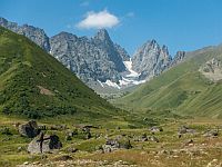
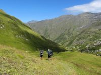
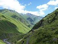
Khevsureti is the trekker´s paradise. Is has an extensive network of marked (!) trails, courtesy of Polish trekkers. And even though some of the country's most famous hikes are passing through the region, there are still many wild valleys and plenty of unspoiled wilderness. However, if you plan to abandon marked trails and start exploring, you should be very careful - many trails marked on old maps don't exist anymore, valleys are deep, slopes steep and rivers cold and fast.
Just like neighbouring Tusheti, Kvevsureti is not accesible all year long as Datvisjvari pass gets usually blocked by snow in October and becomes passable again in May.
Khevsur people have been for a long time known as formidable, yet chivalrous. warriors and great poets. Due to isolation, they kept high level of authonomy. They had no feudal lord, communities were led by councils of elders - in return for this privilege they protected northern frontiers of Georgian kingdom. Khevsurs considered themthemselves to be a servants of holy item, icons and crosses (cross of Gudani).
However, from the end of 19th century region faced depopulation, even accelerated during Soviet period. Today, great portions of it lie almost abandoned, with only a few families staying in most of the villages. Hopefully, this trend will be reversed with greater influx of tourists and yet region will be able to regain its culture.
If you want to learn more about Khevsureti, its nature, people and traditions, I strongly recommend you this excellent e-book.
How to get there:
How to get to Shatili:
Marshrutka to Shatili leaves Didube bus station in Tbilisi on Wednesday and Saturday mornings at 9. am. Tickets can be bought at the ticket counter serving Mtskheta direction. It may be hard to find - basically, after leaving the metro exit, walk straight until you cross the car road, then turn right and soon left again into a narrow passage occupied by fruit sellers. Then, on the left side, you should see a small ticket counter with marshrutkas parked in front of it. Better come at least 30 minutes in advance to secure your spot. If you speak Russian, you can also try to call the driver Temuri (+995 599 27 29 04) and secure your spot in advance. The price of the ride is 30 GEL.
If you miss the direct bus, another one leaves from Didube daily at 5. pm to Barisakho, halfway to Shatili. From there, you need to hire a driver (price for Barisakho-Shatili drive should be around 150 GEL) or hitchhike. Of course, you can hire a driver also in Tbilisi, but it would be much more expensive - 300 GEL at least.
However, most of the people attempting this trek come to Shatili on foot from Omalo.
How to get to Barisakho:
There is a daily bus from Tbilisi to Barisakho at 4 pm. leaving from Didube station on Tuesday, Wednesday, Friday and Sunday (sometimes, it leaves the main road not far before Barisakho and goes to Shuapko, so better confirm it with the driver). Twice a week (Wednesdays and Saturdays) at 9. am in the morning you can also use marshrutka to Shatili.

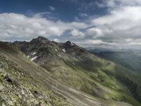
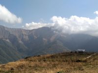
View from Datvisjvari pass
Shatili
Shatili is a fortified medieval village lying at the northern slopes of Caucasus mountains, near the border with Chechnya. It is located in Arghuni gorge at the elevation of 1,400 meters.
What makes in unique? There are many stone towers in Georgia, there are even many villages full of defensive towers. But only in Shatili (and ruined Mutso) are these towers connected together
and form a single chain of fortifications. And as there are about 60 towers, village looks more like a fortress. Inside lies a small maze of towers, narrow walkways, archways,
ladders, bridges and terraces built on flat roofs. Few towers are turned into guesthouses, but most of them are abandoned. You can sleep inside if you wish, but interior is very dusty.
Little can be found about early history of Shatili (at least online) - should have asked more while I was there. First note I was able to find is about assault of 5000 Chechen and
Daghestani invaders at the beginning of 19th century, which the defenders of Shatili were able to repel with just 50 men (but I guess those numbers got a little distorted over time).
Population of Shatili was in 1950s, along with most of Khevsureti resettled by Soviet authorities to Kakheti. Later was built a new village not far from the fortress and
some of them were allowed to return. Nowadays, Shatili is a favourite destination of tourists and trekkers.
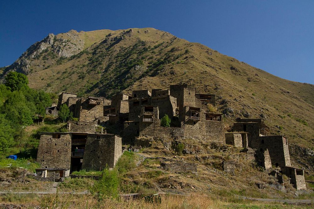
Shatili
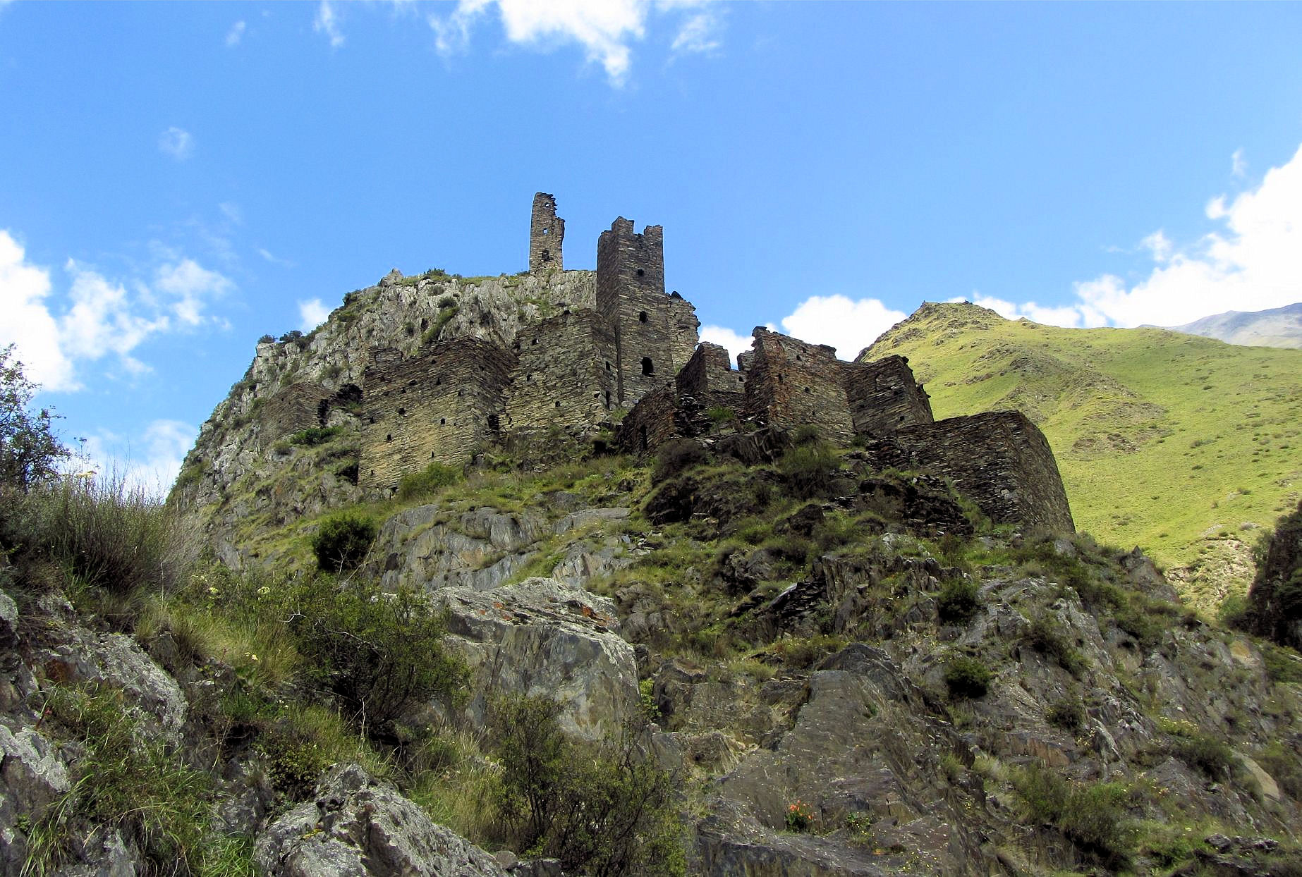
Mutso
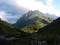
Mutso is a fortified village lying at the confluence of Ardotistskali and Mutsostskali rivers, some 12 km behind Shatili. It stands high on a rocky summit at the elevation of almost 1900 meters.
Even though the village was abandoned century ago and now lies in ruins, it is still a magnificient sight - partly to the location, partly to the 30 medieval stone dwellings.
It's nice to admire them from below, but even better to climb up - it takes some 30 minutes of steep ascent. Only when walking narrow pathways of the fortress one can truly grasp
how magical and atmospheric it is. You will pass several viewpoints and at the top you will find nice khati - ancient shrine built of slate with several small offerings.
A little is known about history of Mutso. According to the legend it was founded by five brothers of the clan Shetekauri. It was inhabited between 10th and 19th centuries
and for a long time was a strongest outpost at the northern borders of Georgia. According to another one Mutso people for a long time guarded Broliskalo
(word mean "crystal threshing floor") icon of Archangel. Icon is still hidded in surrounding mountains, but one day it will show its location to a honest man in a dream.
Currently, there is a major reconstruction project going on (works should be finished in 2018), so some areas turned into a building site.
I must admit I liked it more when Mutso was empty and quiet, but looking forward to the time when whole reconstruction is finished.
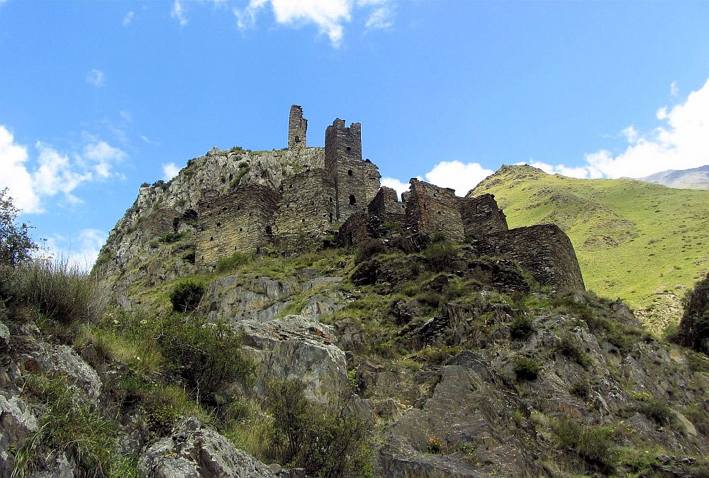
Mutso fortress
Anatori necropolis
“The tombs were larger than those of Mutso though built in the same manner.
Windows, similarly smashed open, were barred. Through the bars we could see
skulls and bones lying thick within. In one massive charnel house a shrivelled
hand pointed out, ribcages, legs and arms strewn around.
Here were the ancient dead, still visible and present,
halfway between this world and the next, hanging in precipice.
Curiously, the tombs here and in Mutso were unadorned
and bore no marks or symbol of Christianity or any other faith.”
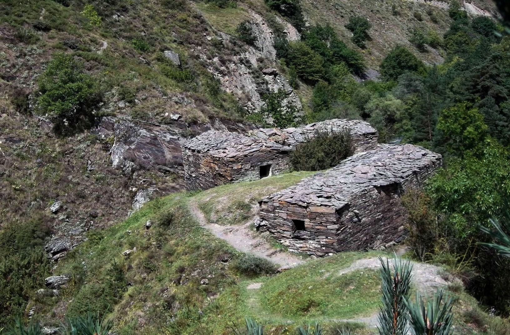
Anatori is a group of several stone houses few km behind Shatili, at the the confluence of Ardoti and Arghuni rivers. Once an actual village, it's inhabitant perished in a plageu epidemics. Since then, it served as a "plague houses" - when a deadly disease struck the region, those infected would come here and wait for death in solitude, so they do not infect their neighbours and family.
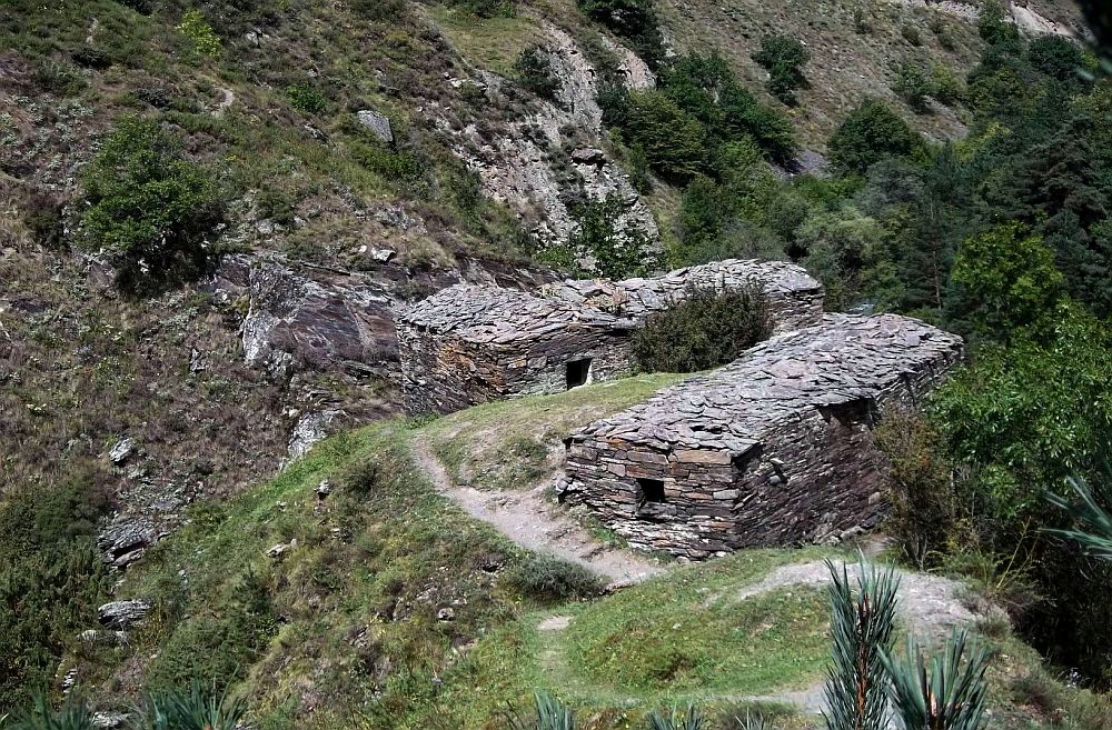
Hoses of Anatori
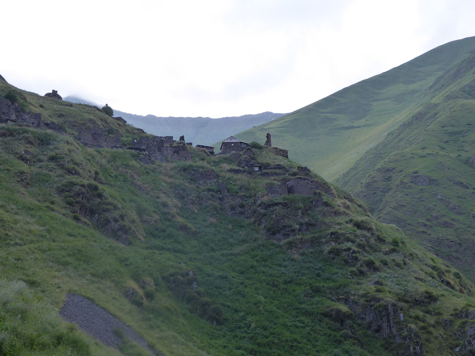
Ardoti
Ardoti is the another evelated village lying on a hill above Andaki valley, some 5km southwest of Mutso. The village is almost abandoned, only the uppermost house is occupied in summer.
When I was climbing there in the evening, walking past ruins and abandoned houses, towards the only shining window at the top, I felt like Jonathan Harker in Transylvania. Luckily, I found there
just a nice family willing to sell beer and fresh bread. From the top, there is a great view not only down to Andaki valley, but also into the adjacent valley. During a Chechen wars, a MI-8 helicopter
belonging to Chechen rebels crashed here - the locals have since converted it into the livestock barn.

Ardoti village from below
From Omalo to Shatili
Amazing 5-day trek connecting villages Omalo and Shatili, historical centers of regions Tusheti and Khevsureti - both are still quite unspoiled due to poor roads. Its intriguing not only by natural sights, but also by traditional middle-age villages dominated by stone towers
- Duration: 5 days
- Difficulty: Hard
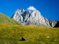
From Juta to Roshka via Chaukhi pas
Well-known Georgian trail connecting Kazbegi region with Khevsureti. It very interesting due to proximity of imposing Chaukhi massif with its seven sharp peaks and necessity to scale 3341 meters high Chaukhi pass.
- Duration: 1 Day
- Difficulty: Hard
From Roshka to Juta by Sadzele pass
Alternative, less demanding hiking trail connecting Juta village with Roshka which crosses 3060m high Sadzele pass.
- Duration: 1 Day
- Difficulty: Moderate
From Juta to Roshka via Arkhoti valley
Another great 2-day trek from Juta to Roshka, less frequented that classic Chaukhi route. It crosses two mountain passes and wild Arkhoti valley.
- Duration: 2 Days
- Difficulty: Moderate
From Kistani to Akhielli through Kalotana pass
This remote trek truly presents the vastness of Caucasus. It starts by the Kistani tower, climbs up the ridge and follows it all the way to Kalotana pass, from where it descends to Akhielli.
- Duration: 2 Days
- Difficulty: Hard
From Tusheti to Khevsureti through Borbalo pass
The ideal pick for hikers who want to cross from Tusheti to Khevsureti and look for something more difficult and remote than Atsunta trail.
- Duration: 5 Days
- Difficulty: Hard
Crossing of Chanchakhi gorge
The hike starts in the upper part of Chanchaki valley and navigates it all the way down to Mutso fortress. On the way, you will pass ruined villages Khakhabo and Ardoti.
- Duration: 1 Day
- Difficulty: Hard
From Shatili to Juta through Isirtghele pass
Very demanding 6-day trek connecting Shatili, historical center of Khevsureti with Kazbegi region. Crosses two mountain passes and leads through little visited border areas of Georgia
- Duration: 4-5 Days
- Difficulty: Very hard
Hike from Artani to Chargali
A pretty solid weekend hike, ideal for trekkers based in Tbilisi.
- Duration: 2 Days
- Difficulty: Easy