Very difficult 5-day trek crossing a little visited border areas of Georgia.
Very demanding 5-day trek connecting Shatili, a historical center of Khevsureti with Kazbegi region. It leads through little-visited border areas of Georgia, especially at Georgitsminda - Amgha stretch there are no roads or civilization except a few shepherds huts and one border post.
Some people managed to finish the trek in four days, but overall, due to the difficult terrain which will greatly slow you down, expect to spend at least five days on this one.
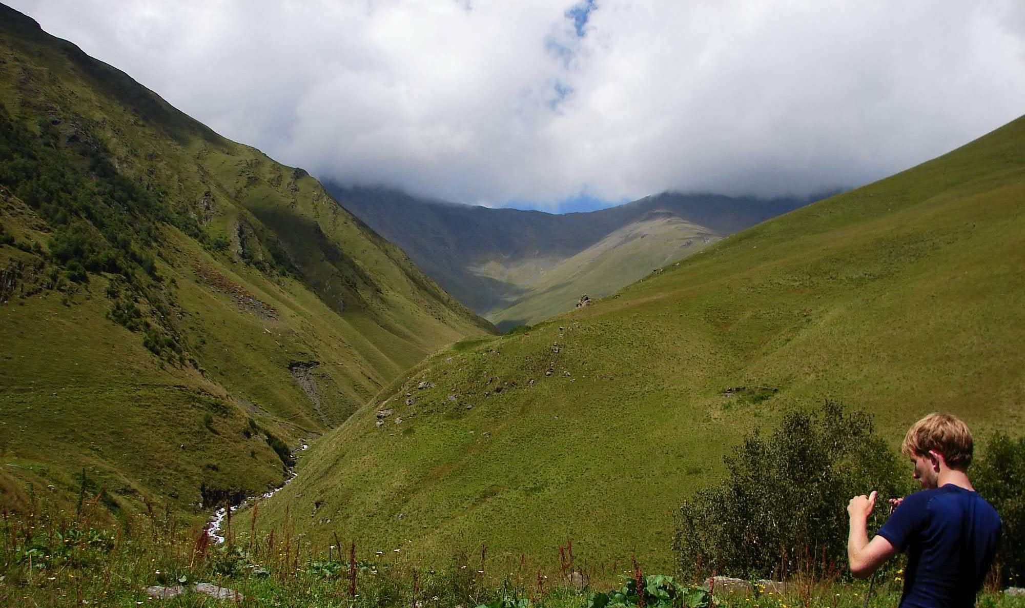
You will spend more than a day in narrow, overgrown valley without a solid path. Several possible dangerous river crossings and almost no other hikers around for the most of the time.
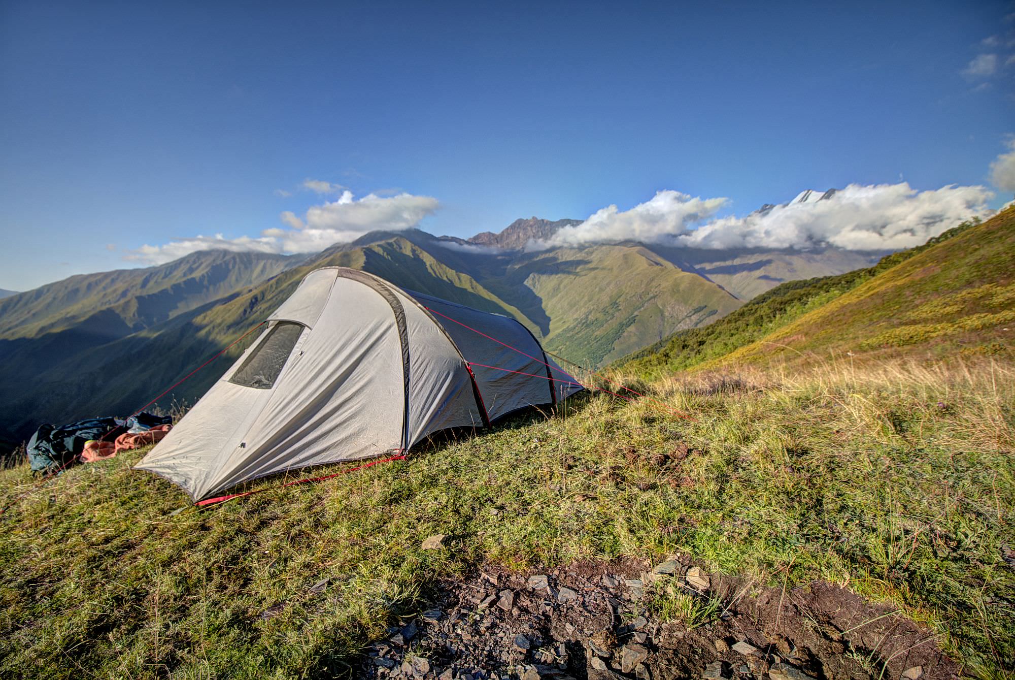
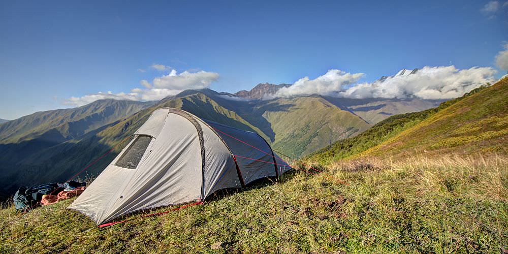
You will have to carry a tent. There is only one guesthouse along the route, in the Akhielli village.
Trek is not recommended until the second half of July. Earlier, the water level of Kovgra river is quite high and crossings are more risky.
People usually start from Shatili, so they don't have to walk uphill in the Kovgra valley. But both directions are viable.
Marshrutka to Shatili leaves Didube bus station in Tbilisi on Wednesday and Saturday mornings at 9. am. Tickets can be bought at the ticket counter serving Mtskheta direction. It may be hard to find - basically, after leaving the metro exit, walk straight until you cross the car road, then turn right and soon left again into a narrow passage occupied by fruit sellers. Then, on the left side, you should see a small ticket counter with marshrutkas parked in front of it. Better come at least 30 minutes in advance to secure your spot. If you speak Russian, you can also try to call the driver Temuri (+995 599 27 29 04) and secure your spot in advance. The price of the ride is 30 GEL.
If you miss the direct bus, another one leaves from Didube daily at 5. pm to Barisakho, halfway to Shatili. From there, you need to hire a driver (price for Barisakho-Shatili drive should be around 150 GEL) or hitchhike. Of course, you can hire a driver also in Tbilisi, but it would be much more expensive - 300 GEL at least.
However, most of the people attempting this trek come to Shatili on foot from Omalo.
You will need a car to get out of Juta. Luckily, especially in the afternoon is the small parking lot at the beginning of the village full of taxi drivers. So you should be able easily able to find someone willing to drive you to Kazbegi - the usual price is 40-50 GEL.
If you are really low on cash, you can also prolong the walk and get to Kazbegi on foot, it takes 4 to 5 hours and Juta valley is quite nice (at least for the first 2 hours).
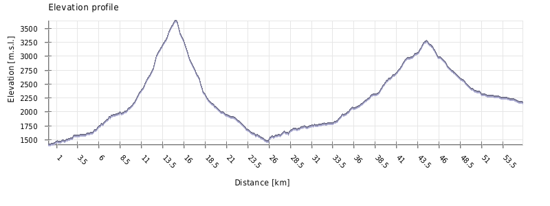
| Distance | 58,03 km |
| Trail type: | AB trip |
| Max. elevation: | 3631m |
| Min. elevation: | 1410m |
| Total climb: | 2727m |
| Total descent: | 2160m |
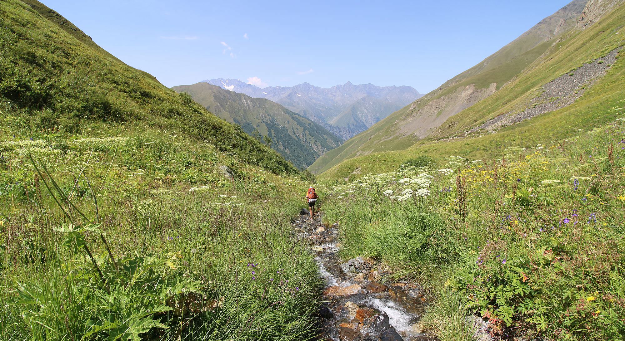
From Shatili head south on the main road, upstream the Arghuni river. After two hours, you should come to the mouth of Giorgitsminda river. Turn-off from the main road can also be recognized by ruined farmhouse.
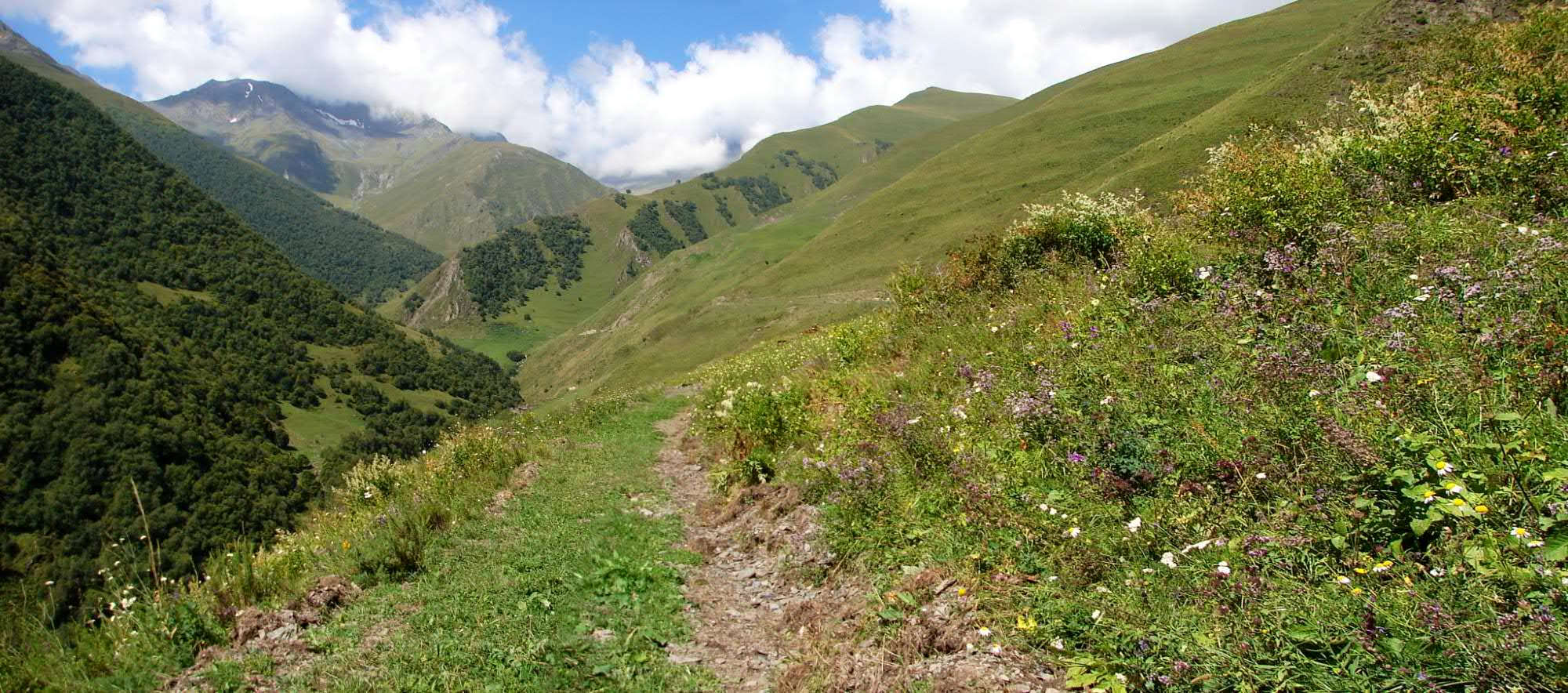
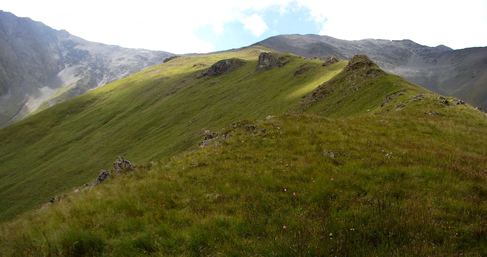
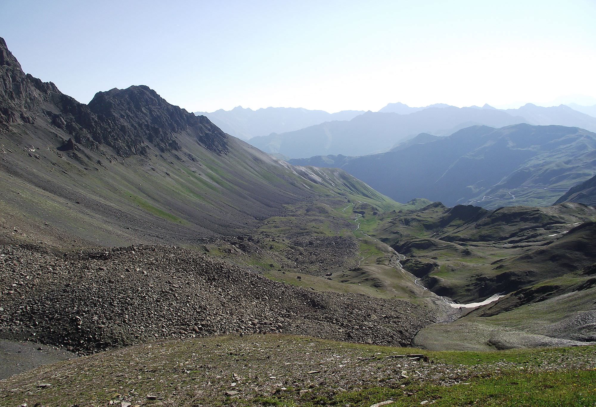
Walk up the Georgitsminda valley. Pathway doesn't follow the river, but in serpentines ascends to the slope to the right. For a few kilometers it traverses the hillside, then crosses the stream and continues on its southern bank. At the confluence of two streams, it crosses the water again. Start climbing the ridge to the north while looking for a suitable camping spot.
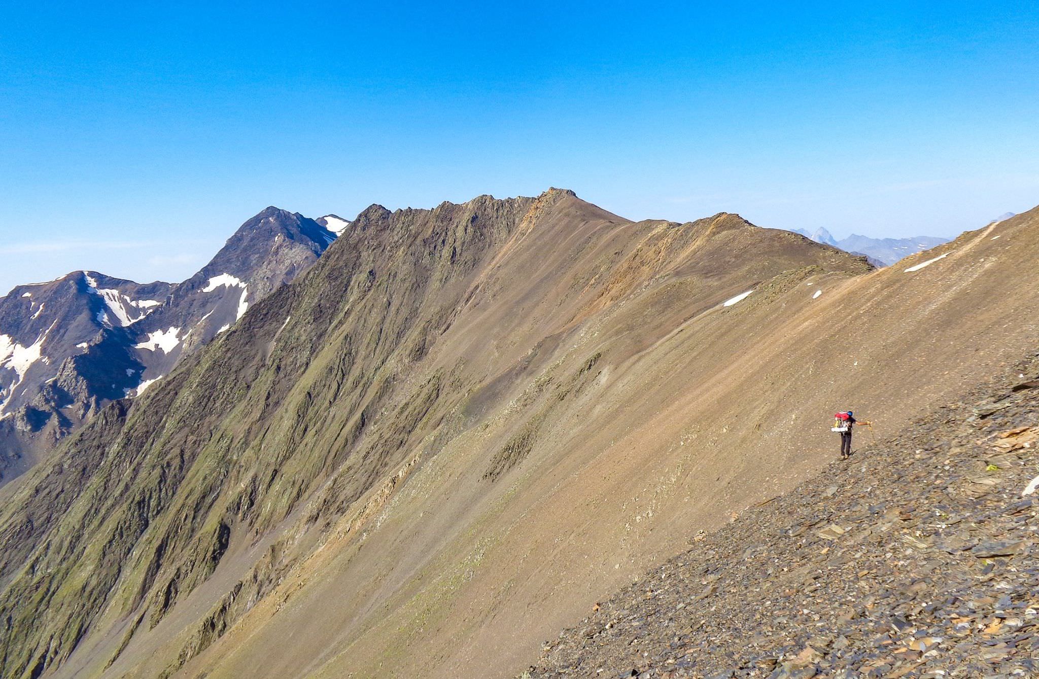
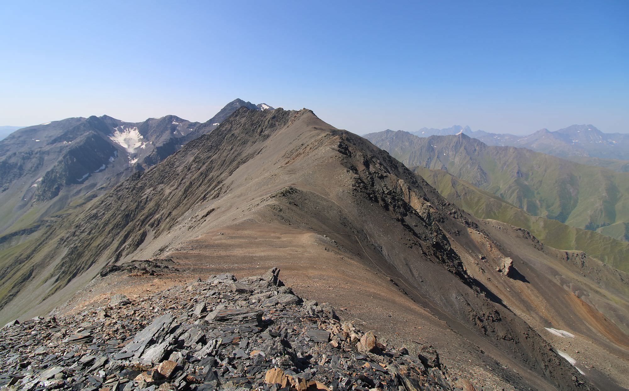
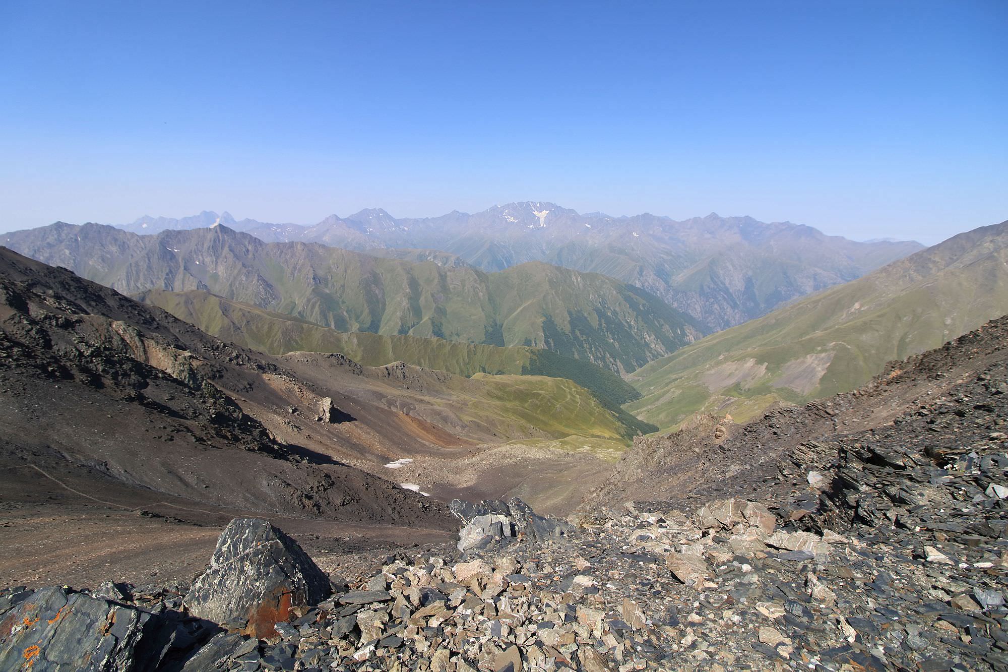
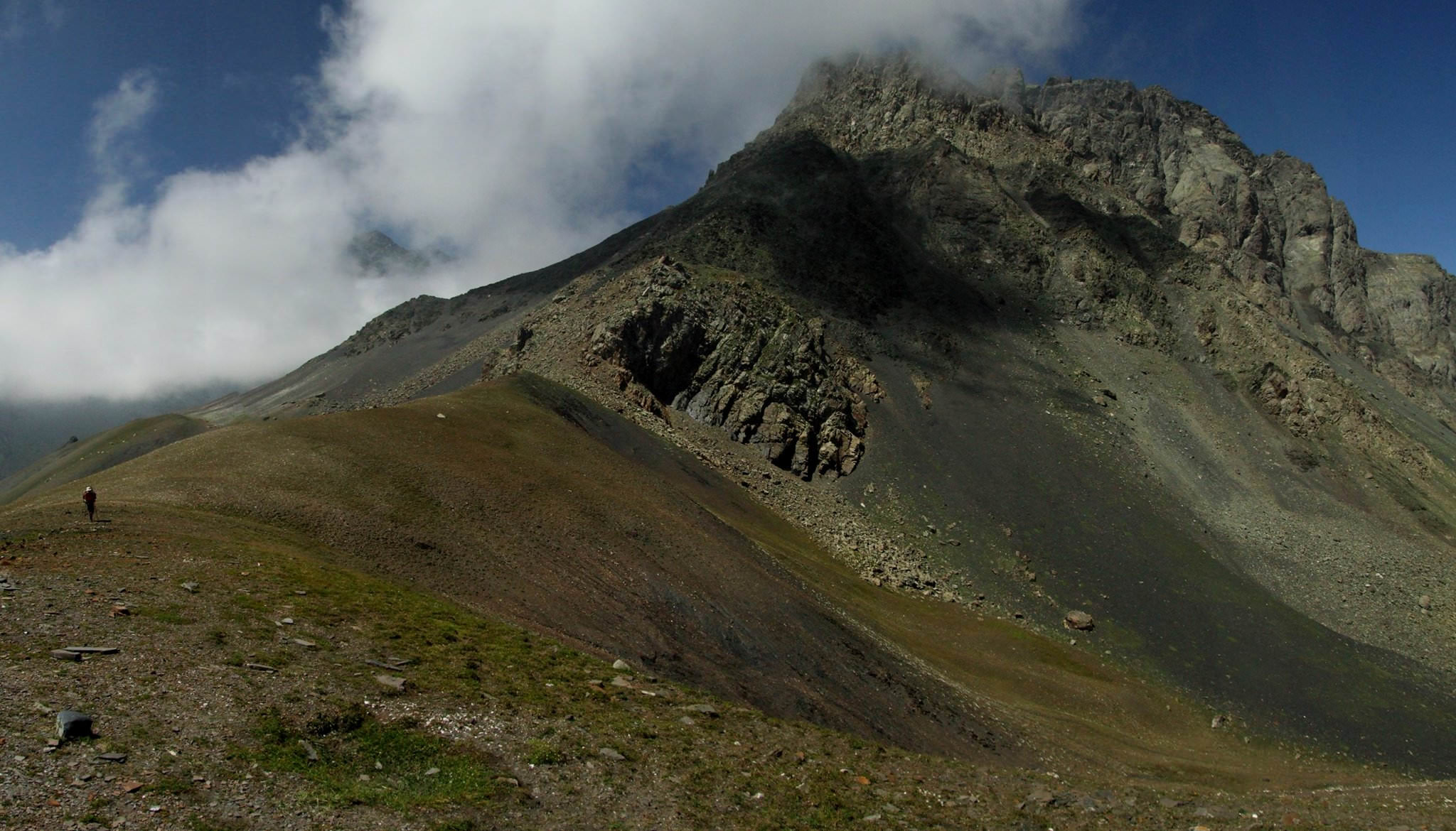
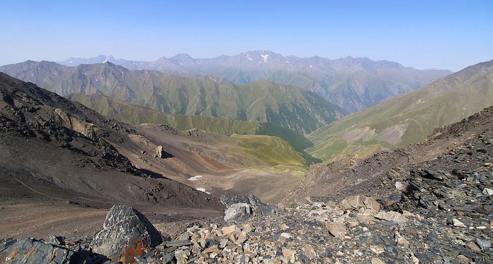
Before the noon, you will haver to climb the Isirtghele pass. The best way to climb to the Isirtghele pass is to climb the side ridge which joins the main ridge to the north of the pass and then descend a bit to it.
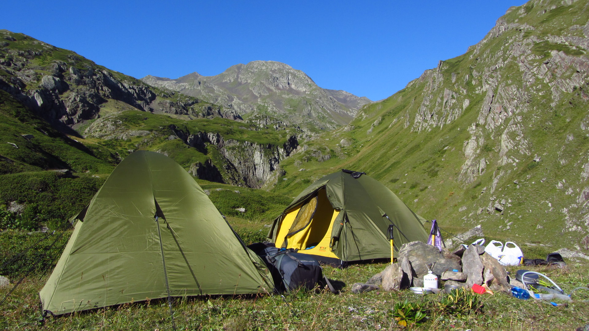
An the other side, a trail becomes visible again - there is also a flat terrain not too far behind the Isirtghele pass if you need to break a camp. A trail then sharply descends into the overgrown valley, where the camping possibilities are very limited.
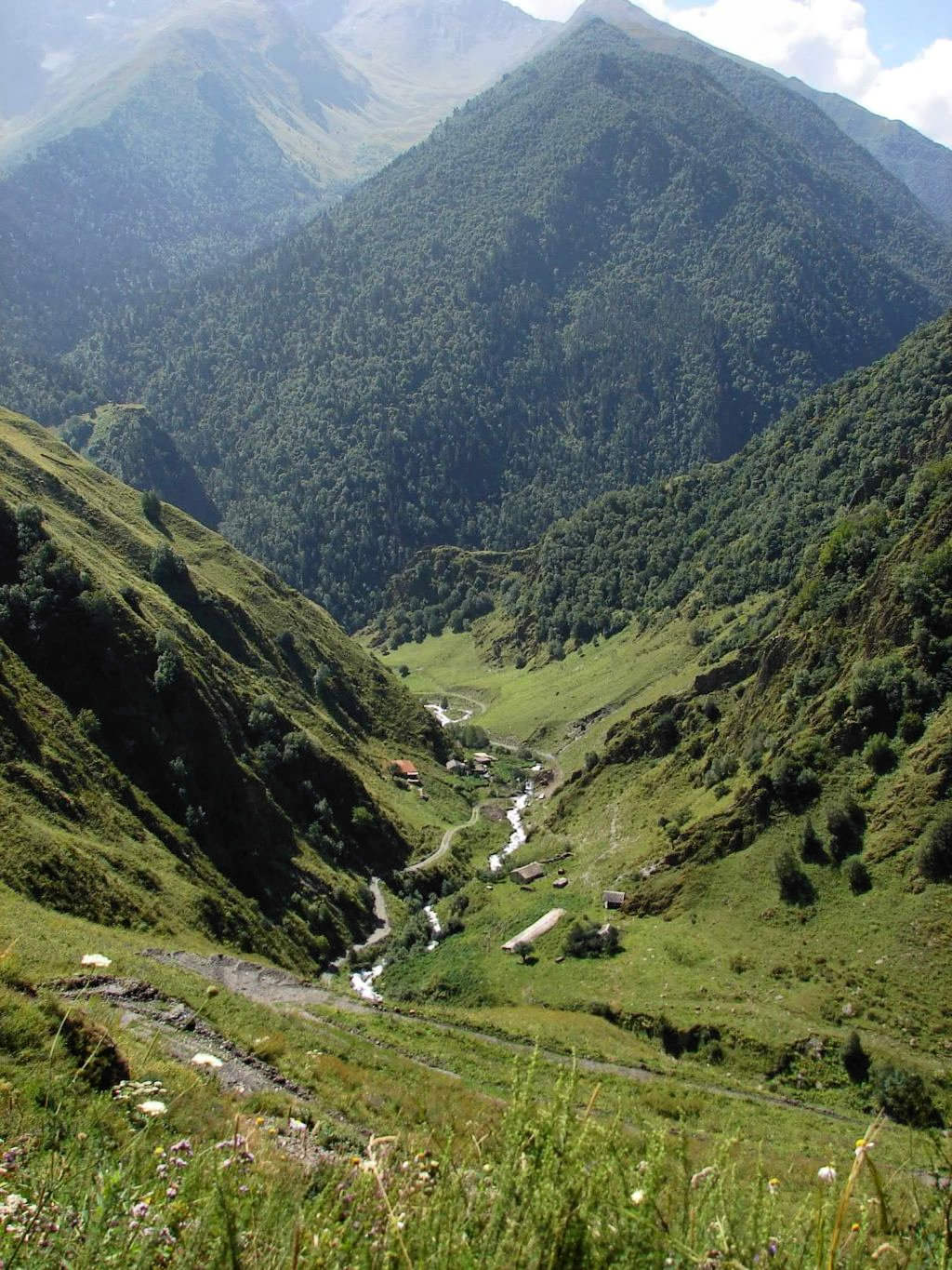
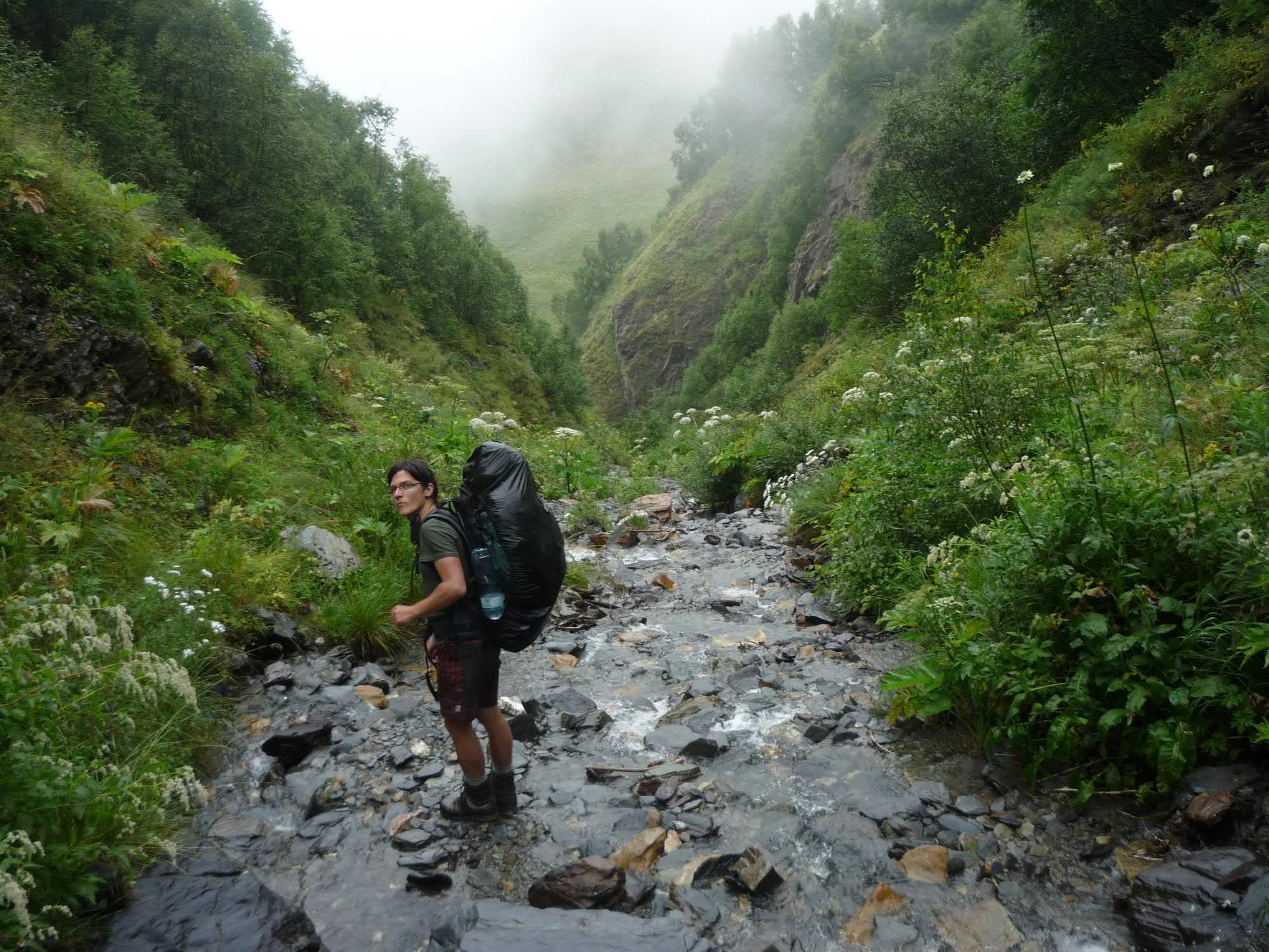
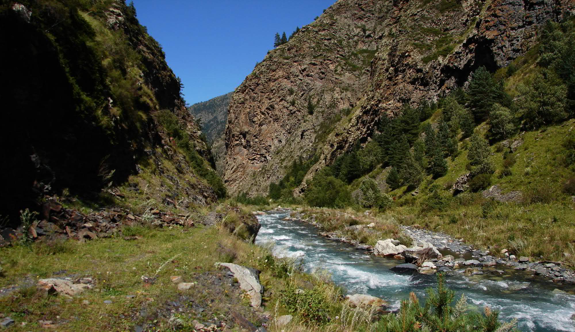
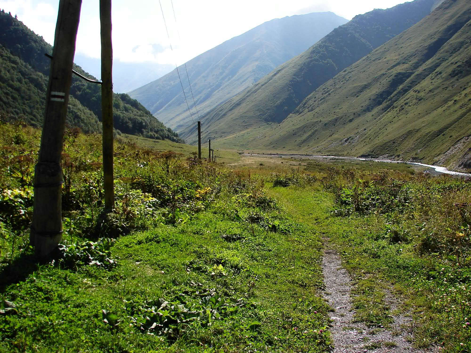
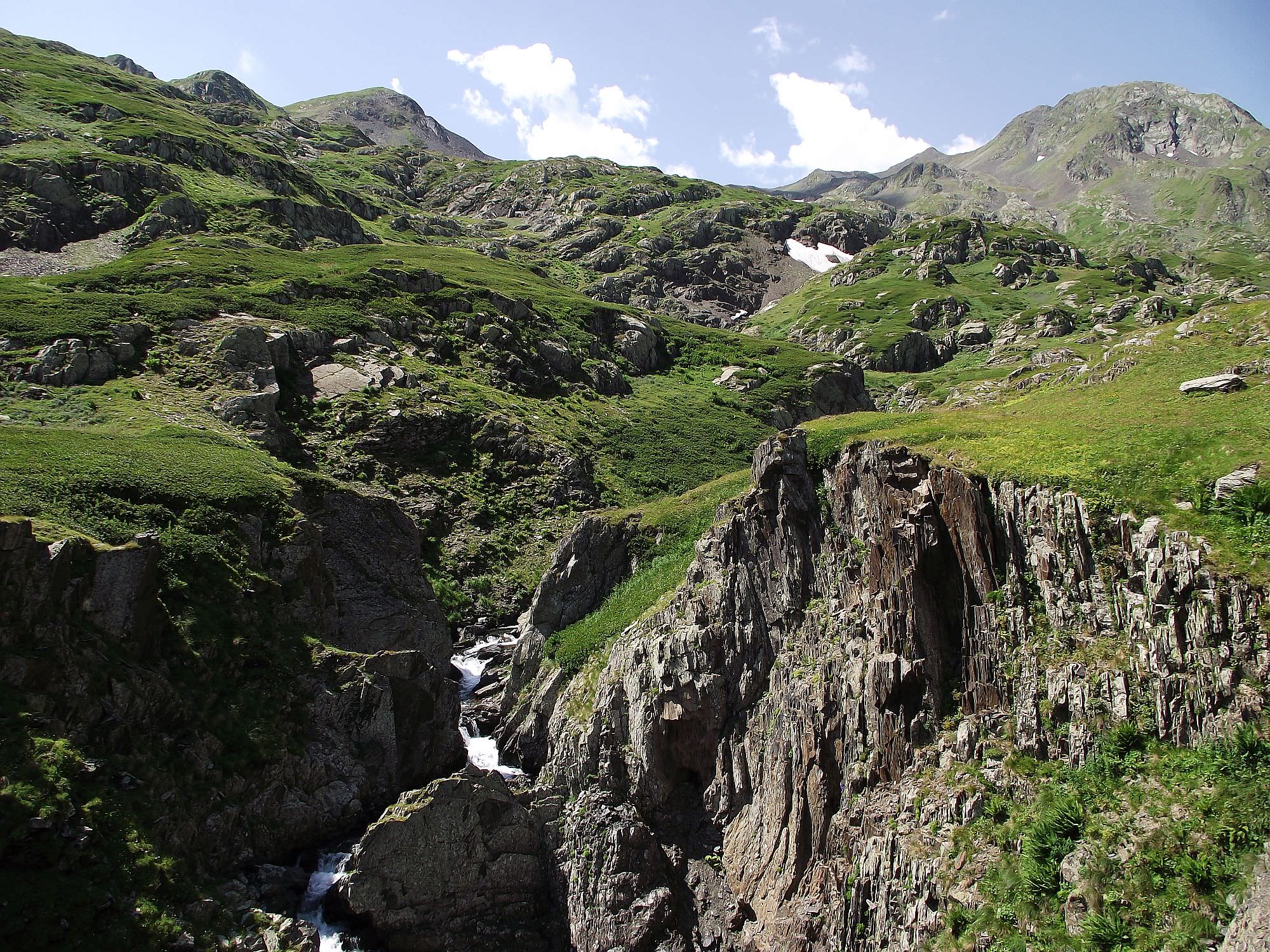
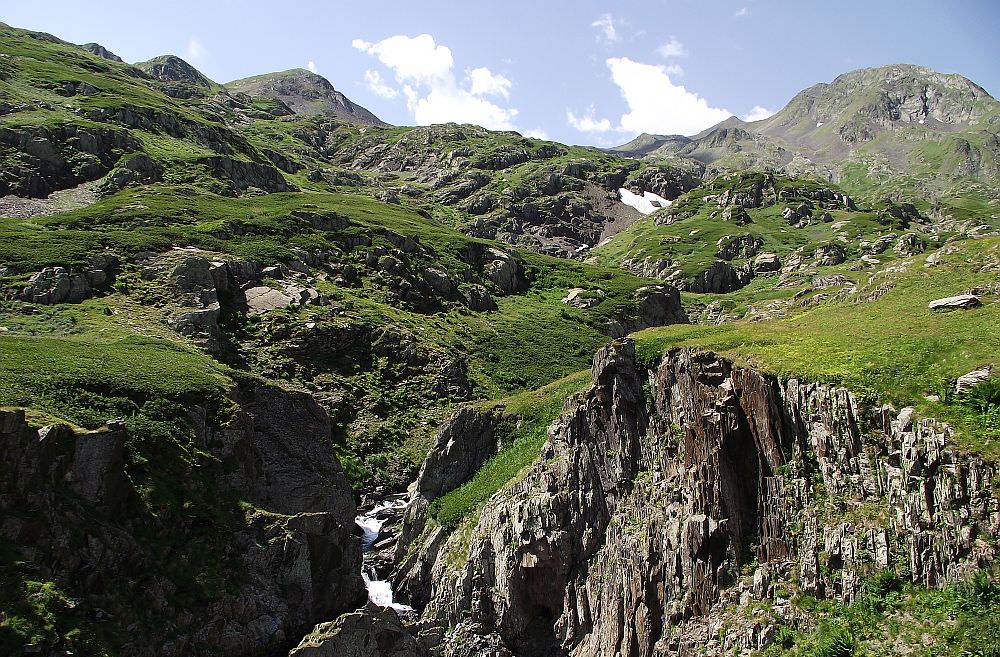
The crossing of Kovgra valley is short on the map, but difficult and time-consiming in reality. You will have to fight your way through the narrow, overgrown valley of Kovgra river. Path is at some sections visible, at others you will have to create your own. People usually walk right in the stream, but it's possible also to climb little uphill and traverse.
Later the stream merges with another small river and becomes stronger, so it's no longer possible to walk in it. You will need to traverse the hillside on the right. Just follow the river, everything else is on you.
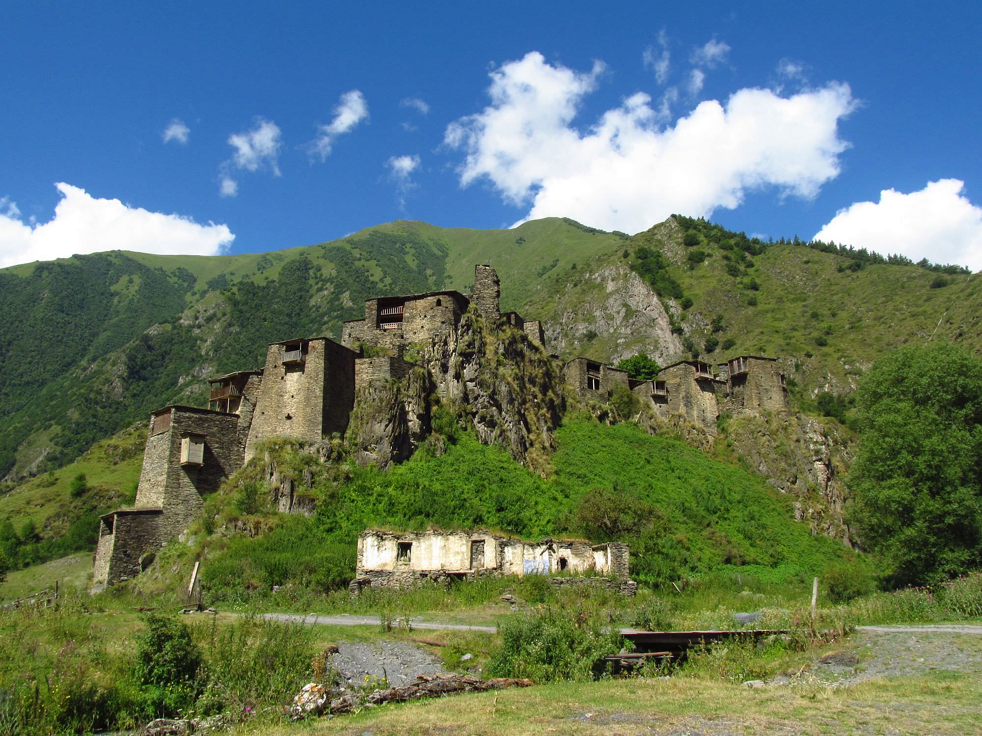
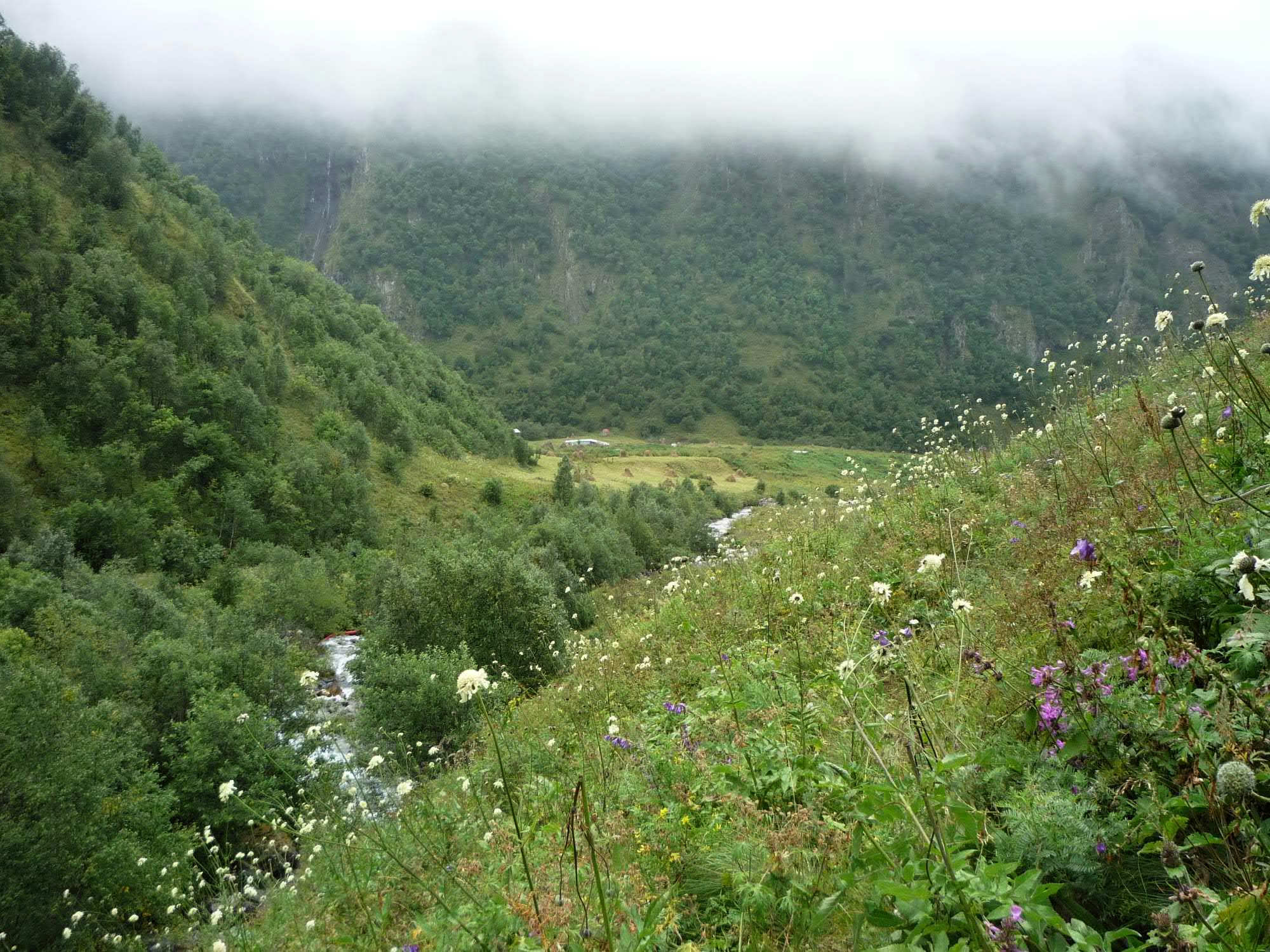
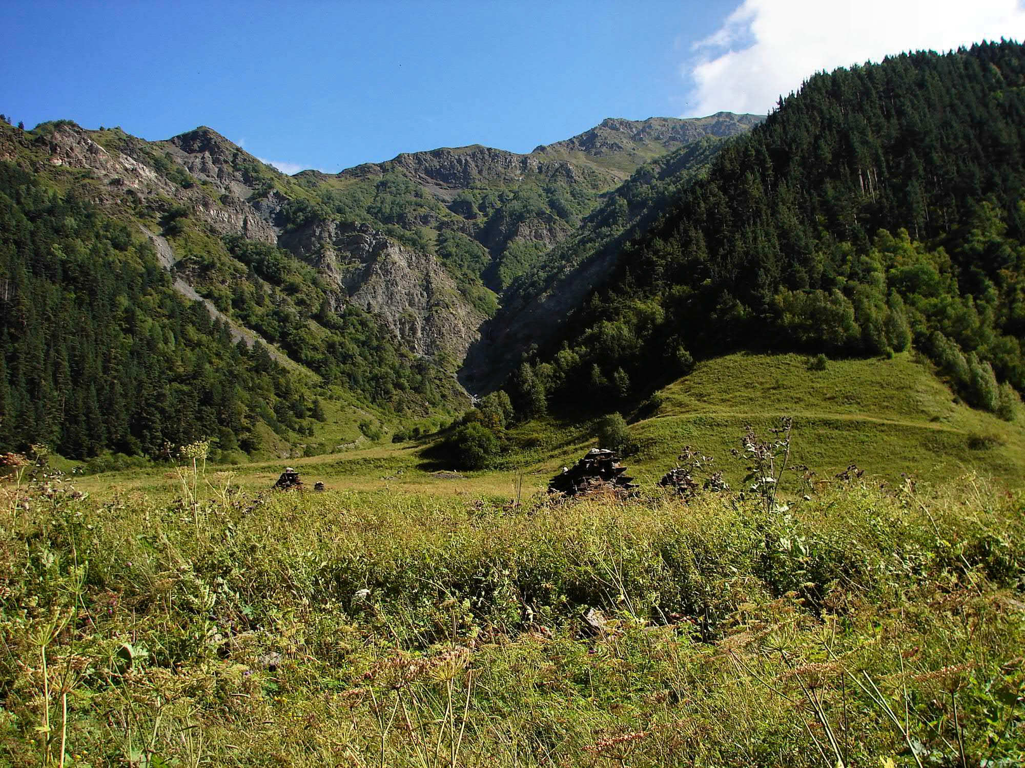
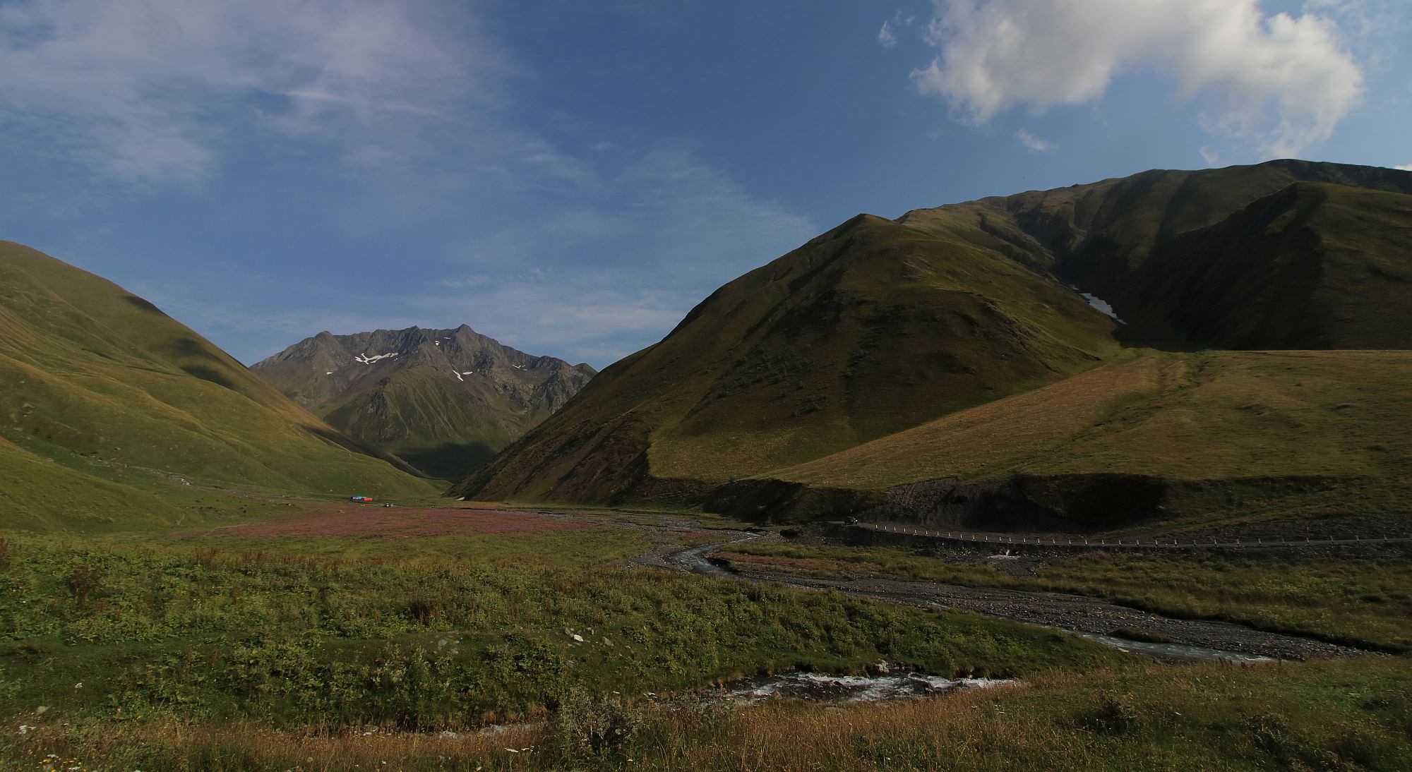
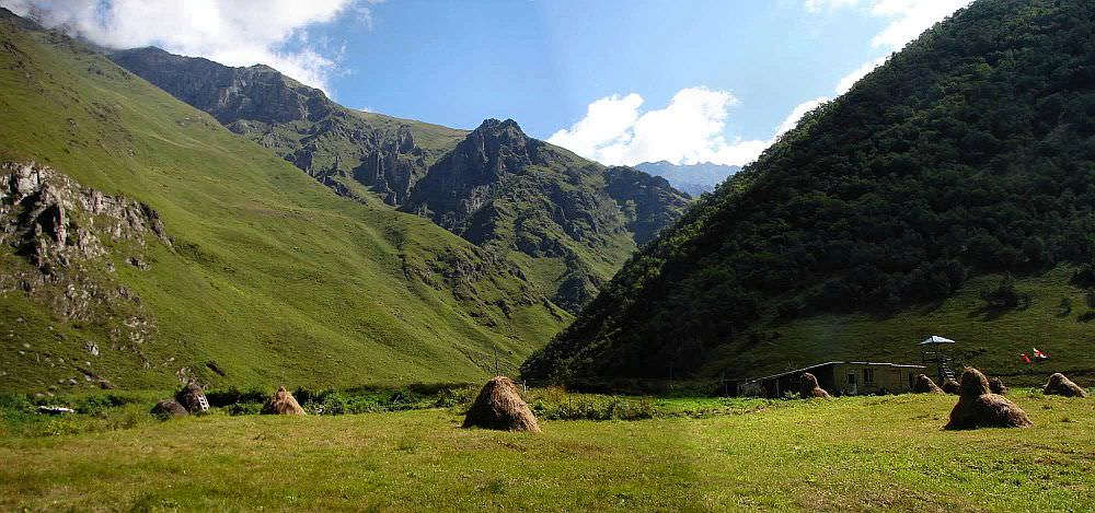
After several hours, you should come to the confluence with Taniestskali river; there is a big meadow with Georgian border guards post (don't forget your passports!). This is a great place to camp and get information about the area (bridges, safety etc.)
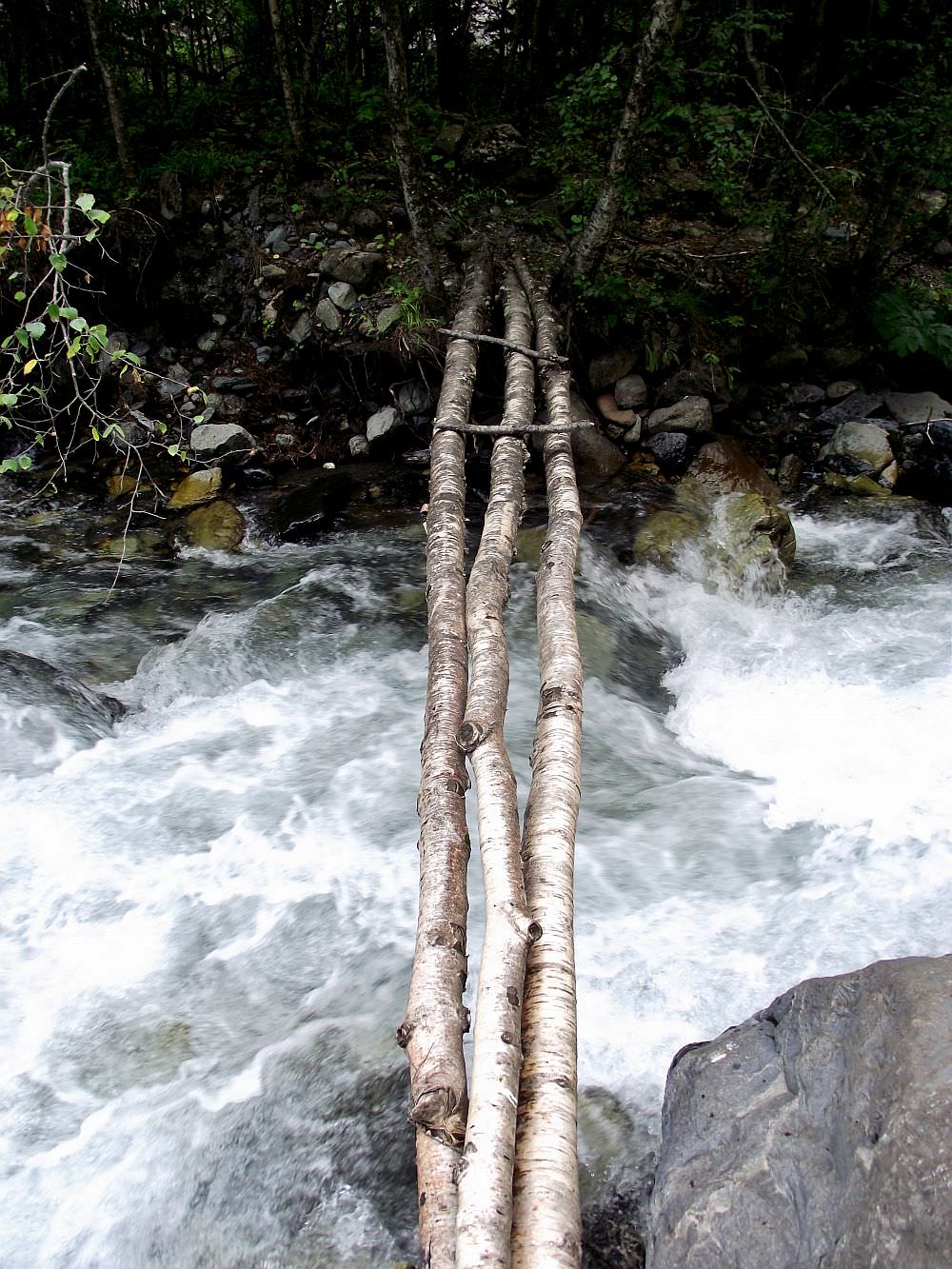
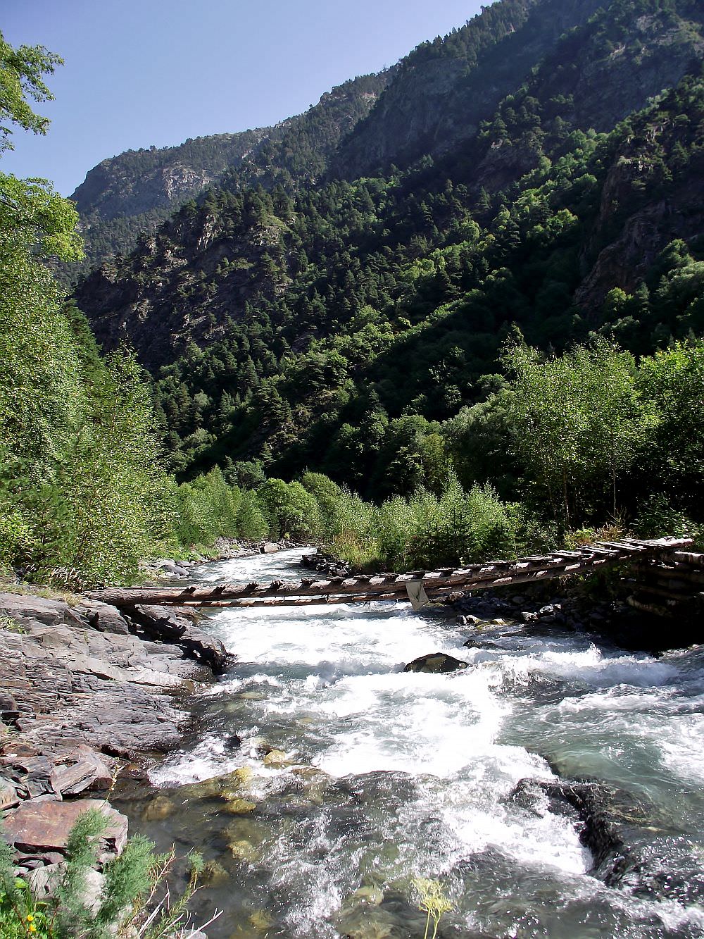
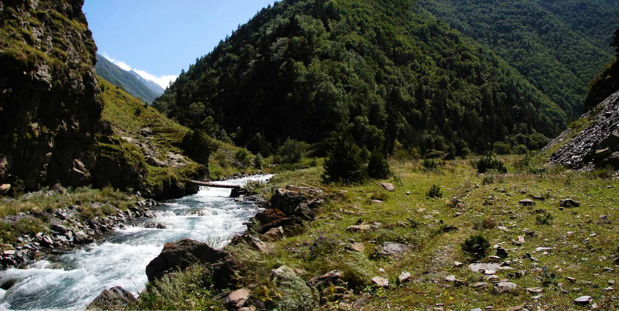
Continue fighting your way through the river valley. The basic rule is: If you see a footbridge over the river, use it - if you don't, you will soon have to ford the river anyway. Also, pay good attention to the trail - it´s visible almost all the time, but there are other side paths which may lead you astray. In total, there are six bridges till the confluence with the Asa river. However, they occassionally get destroyed by spring floods so the situation here could be different each year. So it's essential to ask any local you meet (there will not be many) about the actual situation.
This valley sectionis only 7 km long, but could easily take you almost the whole day (depending on the status of bridges). Finally , you should make it to the confluence with river Assa. This used to be the trickiest part of the trek as the river is quite fast and deep. However, in 2015, a new sturdy bridge was built. It got destroyed in 2021 and rebuilt on the next year, right now (August 2023) it's standing. It lies some 50 meters upstream from the confluence of Kovgra and Assa rivers.
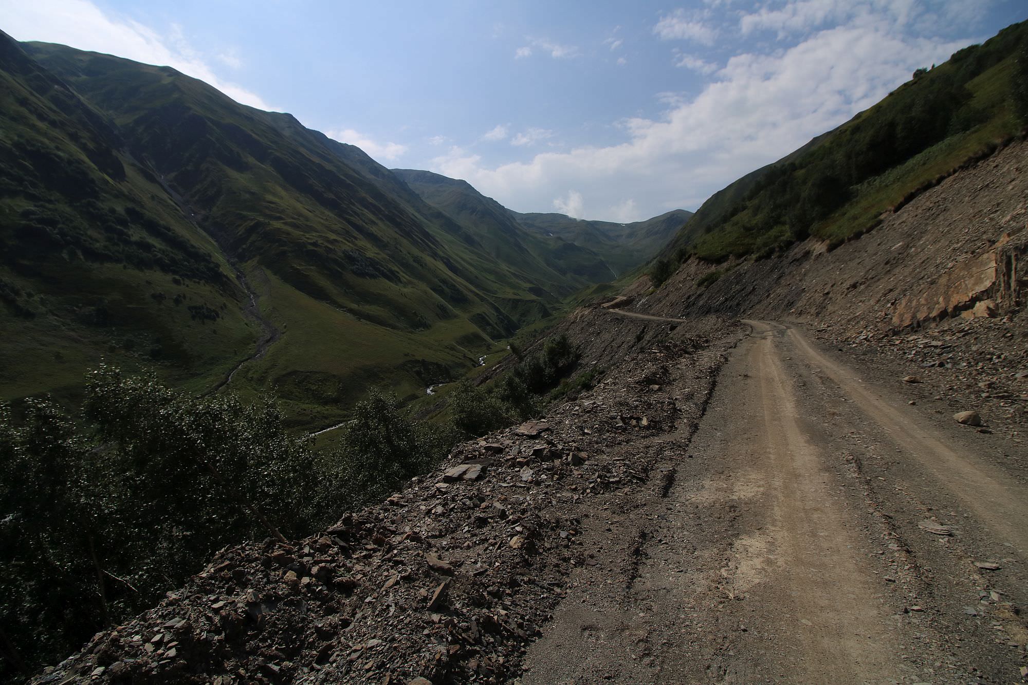
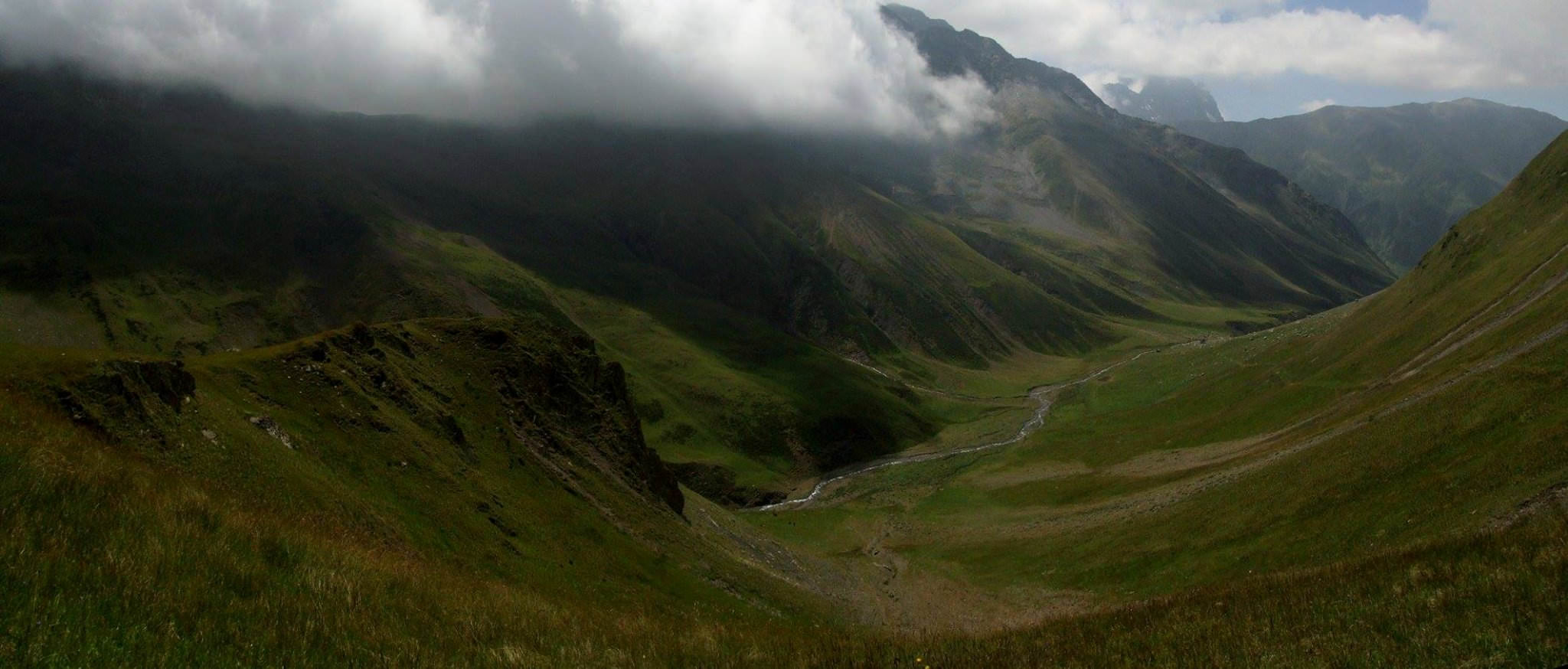
After river crossing, turn south. Soon, you will have to cross the river again, back top the eastern side of the river. The trail hugs the river for several kilometers, then crosses back to the left bank of the river - these new bridges over Asa are new and sturdy, there is nothing to worry about.At the other side of the river, to the south, you shall see a large valley - a route from the Kalotana valley comes from here. Soon, the terrain around the river becomes more flat, so unless you are a really fast hiker, you should start looking for a place to break a camp.
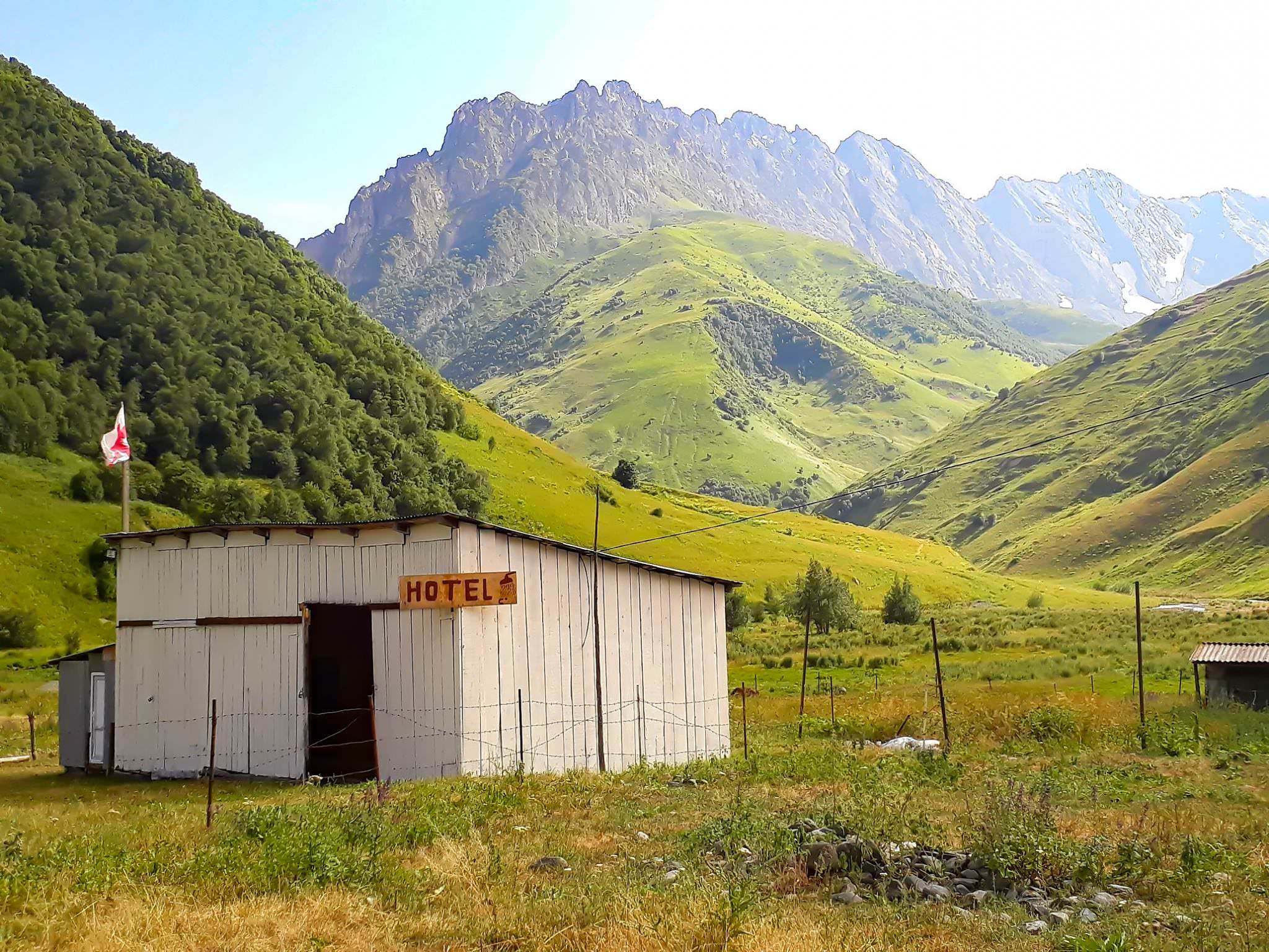
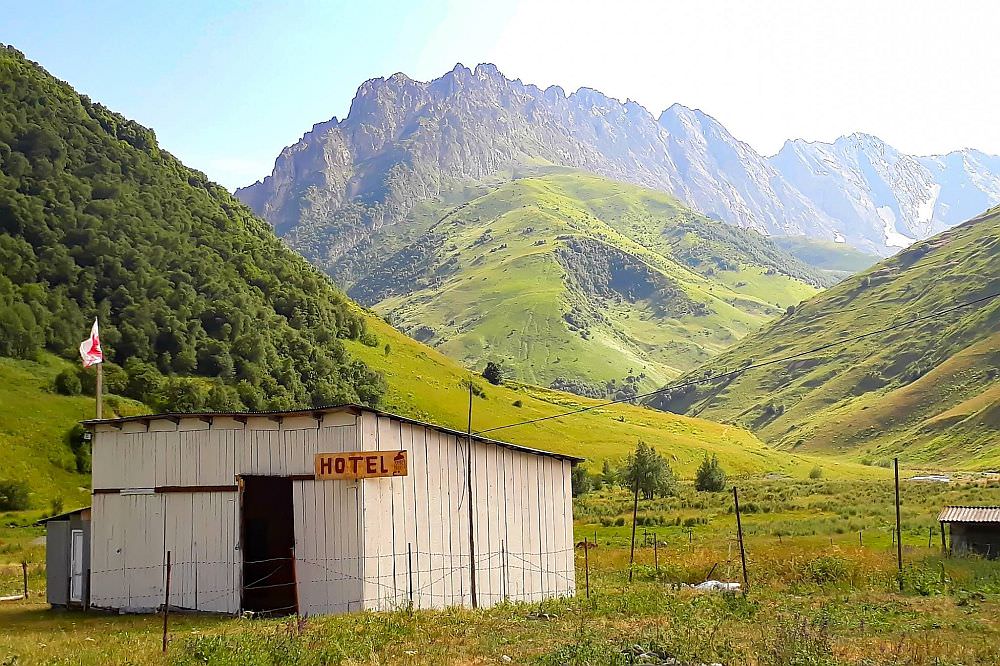
Cintinue towards the Amgha village. In past years, a new road replaced the old trail here so the walk is easier and more dull at the same time. Once past Amgha, the next village in line is Akhielli - there's a nice guesthouse in Akhieli (Hotel Atkhoti), which I can recommend to anyone who needs some good food after the demanding first days. Here the valley splits, but we just follow the new road to the south. After some 1,5 hours of walking south it bends again to the west - here you will have to cross the stream again (and finally leave the road).
From here its just 20 minutes of uphill walk to the camping spot. Follow the path, don't stray away from the river and soon you will see a waterfall on your right. look to the left - some 10-15 meters higher is a grassy mound with nice flat terrain. You will have to leave the road here since it continues south to Roshka
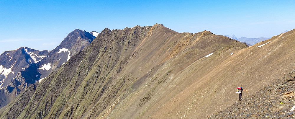
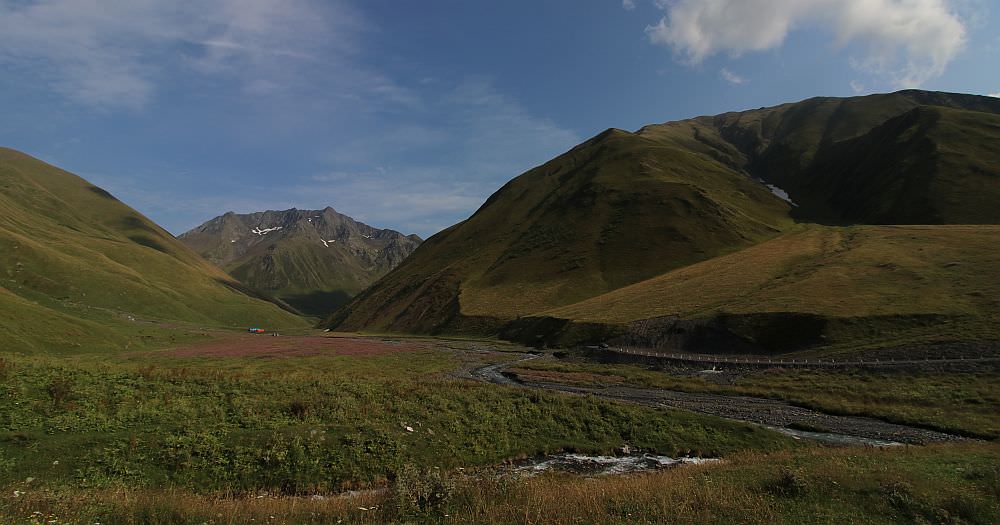
In the morning cross the stream not far from the camping spot and continue east to the pass. The path is pretty straightforward, after some 2 hours you should reach Arkhotistavi pass. From here descend to the other side, to the bottom of the valley. Here you will find a stream, which will accompany you all the way to Juta.
The path first heads southwest, then after some 2 hours your valley will join another one and you will turn west. Another 2 hours, one river crossing and one Georgian border post later you should arrive at the Juta village.
Finding an accommodation in Juta is easy. The village is already quite "guesthousified" and combined with the fact that the majority of people visit it only on a daytrip from Kazbegi means there are always some good places to choose from.
MetiTsa guesthouse - beautiful, modern place in the upper part of the village, on the way to the Chaukhi mountain. Nato is a great host, really attentive and caring - moreover, she is fluent also in English and Russian. Also, the food is plentiful and tasty, overall, this is one of the best places in Juta.
Levan & Megi's guesthouse - pleasant guesthouse located at the beginning of the village, down by the river. Rooms are not modern by any means but the place is very cozy and has welcoming owners who really care about the satisfaction of their guests. Moreover, Megi is an excellent cook and it shows each morning and evening :)
Fifth Season - a modern guesthouse/mountain hut lying above the Juta village. I am not exactly a fan, but this place cannot be overlooked since it has the best location in Juta with best views of the Chaukhi mountain. In my opinion, the place has an incredible potential but there is also lots of room for improvement.
It is not exactly the serene, calm place in the mountains as it looks to be. It has friendly, party atmosphere but staff is not always effective when it comes to enforcing the rules so earplugs are recommended. Also, they could turn down the volume of music they tend to blast into the valley. And the last but not least, they start serving breakfast only at 9 am. which is very inconvenient if you plan some longer trek such as crossing to Roshka.
Zeta camping - traditional camping place located above Juta village, on the way to the Chaukhi mountain. It offers accommodation in cottages as well as in tents - not a place for me since I always carry my own (and there are way nicer camping spots upper in the valley), but if you don´t have it and still want to camp in some beautiful location, this is a great (tho a bit expensive) pick. Also, the staff is very helpful and friendly. Overall, a very pleasant place.
Many photos in this post were taken by Jim Visschers, Lubo Ostrovsky and Luca Anasta. And by one dude named Ado, but I don't know his other name :) Thanks to everybody!