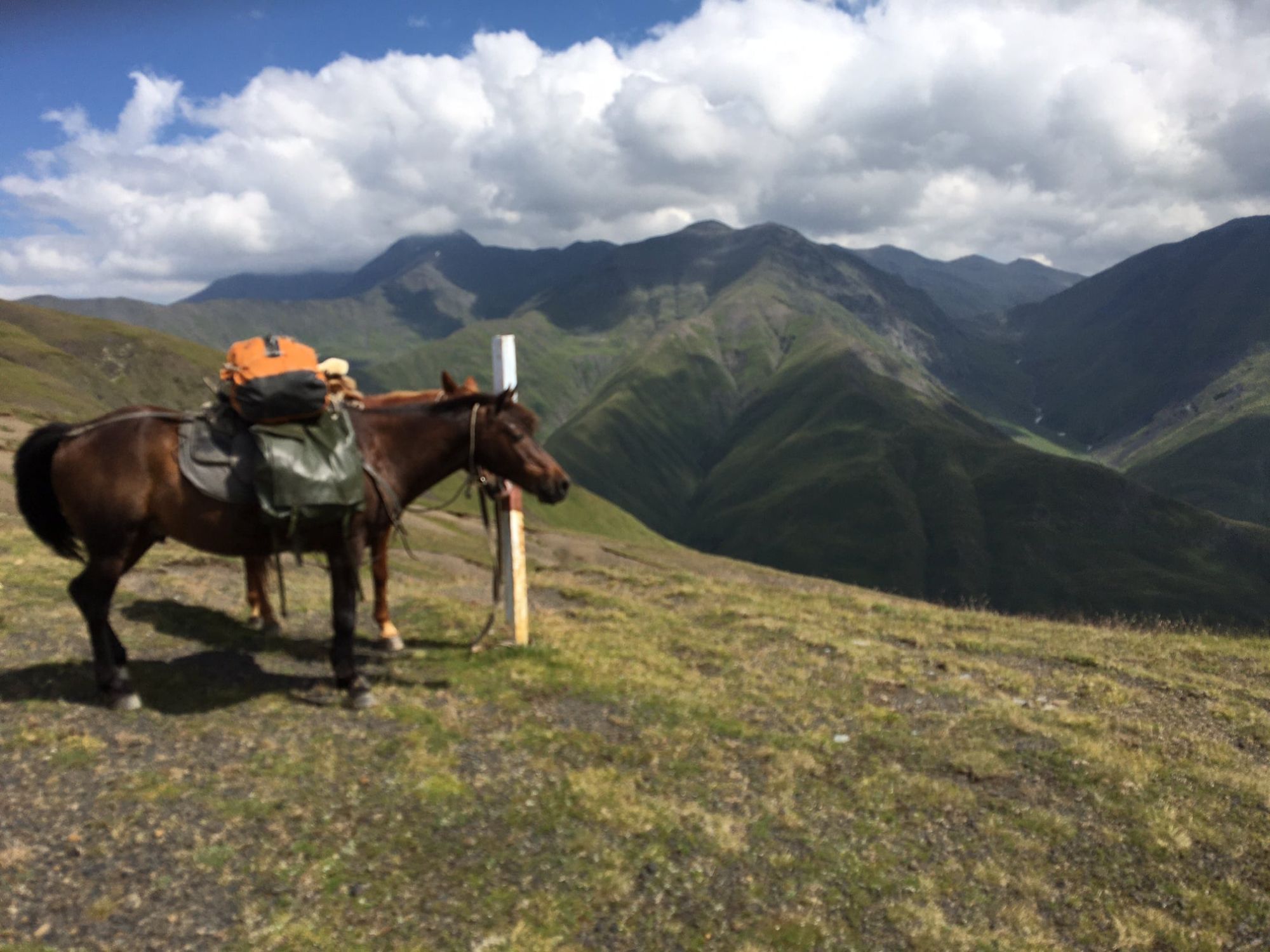
A remote shepherd's path connecting both mountain regions.
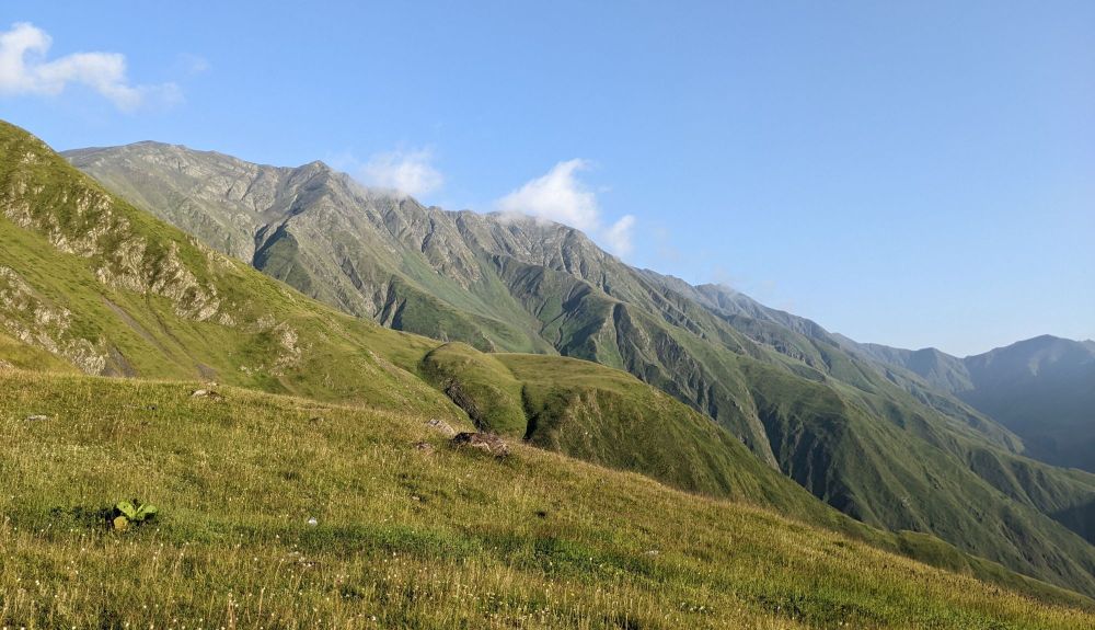
For centuries, shepherds from Pankisi Gorge led their herds into the mountains to the north. The tradition is still alive in this corner of the mountains, but their paths are currently being rediscovered also by another sort of people - trekkers. So far, only slowly - on this trail, you probably won't meet any other hiker. This is kinda surprising, but won't last forever since this is the most direct route into Tusheti and offers a pretty nice scenery. So let's look into it in more detail.
If you hire a jeep both at Pankisi side and also at the first Tush village, you could make it to Omalo in 3 days (but it will cost you at least an extra 500 GEL). And if you decide to complete the whole route on foot, expect to spend 5-6 days on it, depending on the route you pick in Tusheti.
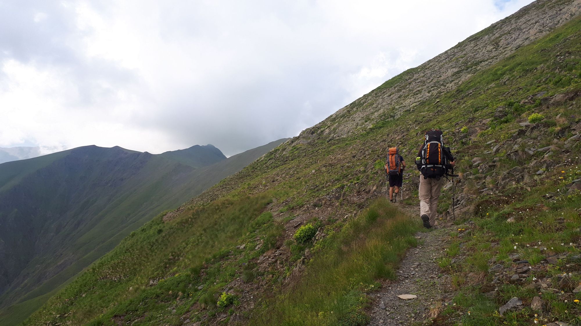
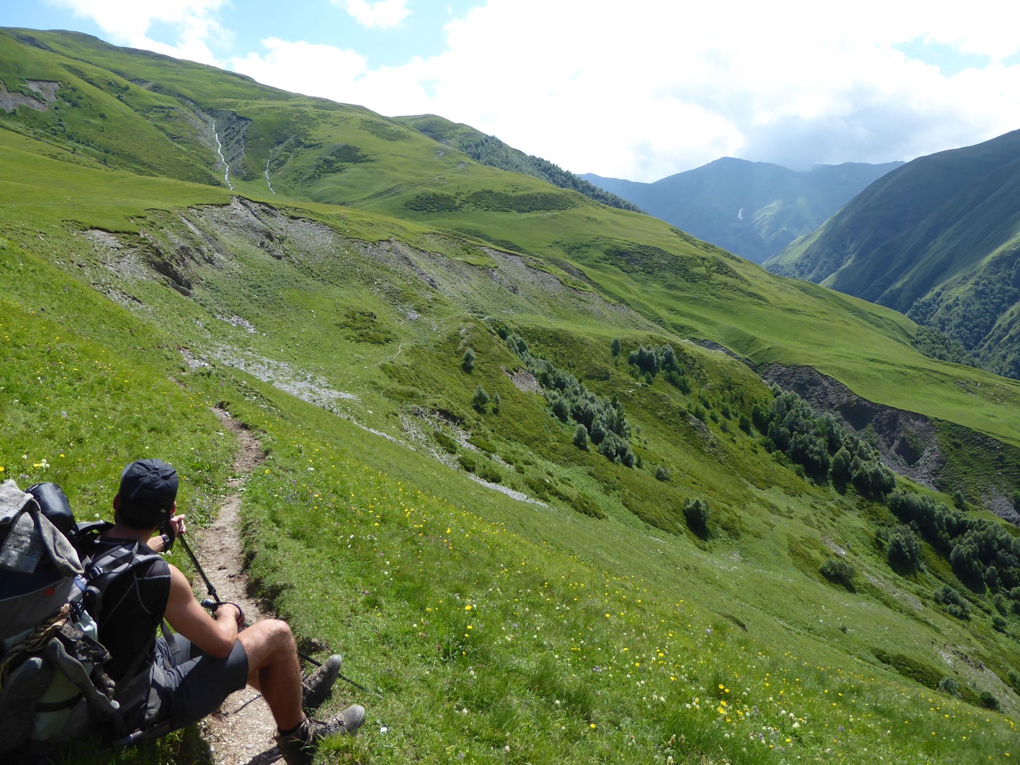
Yes, there is one rather exhausting climb, but apart from that, the trail is well-trodden and relatively pleasant. Overall, the trek itself is not particularly difficult, it just navigates through a pretty remote area.
As with most of these treks, early July till late September is the way to go. Earlier, you might struggle with swollen rivers, and later with fresh snow and short, cold days.
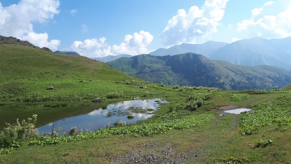
The water is rather abundant. There are some higher sections with limited water sources covered during the day, but you will always have water at your campsite.
As for the shelter, you will need a tent - you will be camping for at least two nights.
Tricky question. Ultimately, there is no single correct answer, it shall mainly depend on your other travel plans. But that doesn't mean that both directions don't have their pros and cons.
If you start from the direction of Pankisi Gorge, you can skip quite the boring Day 0 "road section" if you hire a jeep down at the village. If you are coming from the opposite direction, this is much harder to arrange because the phone signal appears only around Tbatana and is unreliable - luckily, we prepared the needed numbers in advance, but still, it took us lots of running around to be able to make a call.
Also, the objectively hardest day, the crossing of Sakorne pass is easier from the direction of Pankisi since it involves only one major climb, not two.
On the other hand, the most beautiful trail linking Omalo with Jvarboseli, the traverse of the Pirikita range, is much more pleasant from the direction of Omalo. When coming from Pankisi, your day would start with a brutal climb, which is not something you would prefer at the veru end of the trek. And even if you manage to cross the whole ridge, you would end 5km from Omalo and would have to walk (while you would get a jeep for this if starting from Omalo).
Pankisi gorge can be easily reached from Tbilisi. Marshrutkas depart from Ortachala bus station (daily at 7:30 and 14:20). This trip takes 3 hours and costs 15 GEL. Another option is to take a minibus to Telavi or Akhmeta (hourly from 7:30 from Ortachala station), from where you can take a bus or cheaper taxi to Pankisi valley.
Taxi from Tbilisi to Pankisi will cost you at least 100 GEL. You can either hire the whole car or try to get a spot in one of shared taxis which depart from Isani bus station.
By jeep:
There is no public transport to Tusheti. To get to Omalo, you will need to hire a driver with 4WD. If you are traveling from Tbilisi, you will first need to get to Kvemo Alvani village - this can be done by marshrutka or a taxi.
The marshrutka departs from Ortachala bus station in Tbilisi at 9.am and arrives at Alvani two hours later (price 20 GEL). Drivers are used to tourists and often arrange them further transport to Tusheti. Just confirm with the driver that he is going all the way to Alvani, they sometimes try to drop passengers in Telavi in order to make them hire another taxi to Alvani. Or they simply want to hook you up with the jeep driver from Telavi but that is OK if the price is right.
If you want to take a taxi from Tbilisi to Alvani instead of a bus, the price can be anywhere 100 and 150 GEL (it grows with your distance from the Ortachala station :))
In Kvemo Alvani, the bus or taxi will drop you at the main (and the only) junction. This is the place from which depart jeeps to Tusheti so if you get here before noon, you should be easily able to hire a driver.
The ride to Omalo takes about 4-5 hours and costs about 100 GEL per passenger (or about 350-400 GEL for the whole jeep). BBC once placed it among the "10 Most Dangerous Roads in the World", but with a good driver, it definitely doesn´t feel like that. In navigates pretty steep mountainside but the road is usually wide enough and unless you are passing another car and need to navigate to the very edge of the road, there is no reason to feel nervous. Still, the accidents happen here and the road claims a few lives every year. Therefore, even if you have your own car, for this stretch of the road, it may be better to use the service of the local driver.
By hitchhiking:
Hitchhiking can be "hit or miss" since jeeps traveling to Omalo are usually booked by tourists and full. And even when they are not, tourists might be reluctant to pick someone who just walked a few hundred meters beyond the departure point and raised a thumb (especially if he is dressed up in Arc´teryx gear like a couple of "travel hackers" we saw there the last time :)). Professional drivers will rarely pick you up for free. Therefore, your best bet will be locals heading to Omalo for a visit - but it may take a while until some show up.
Another option is the Kamaz truck which brings supplies from the lowlands to Omalo. These drivers usually pick up passengers for a symbolic price but the truck has no fixed schedule. It departs like each other day in the morning, so it can´t be relied upon.
Again, you will need to hire a jeep with a driver. Price should be the same as what you paid to get there.
We took the bus to Tbilisi which was leaving at 6:15 am from the bus stop in Jokolo and from what we heard, there should be another one in the afternoon, around 2 pm. Still, you should consult your host at Pankisi to get update about the current timetable and ask him to book a place in the bus for you.
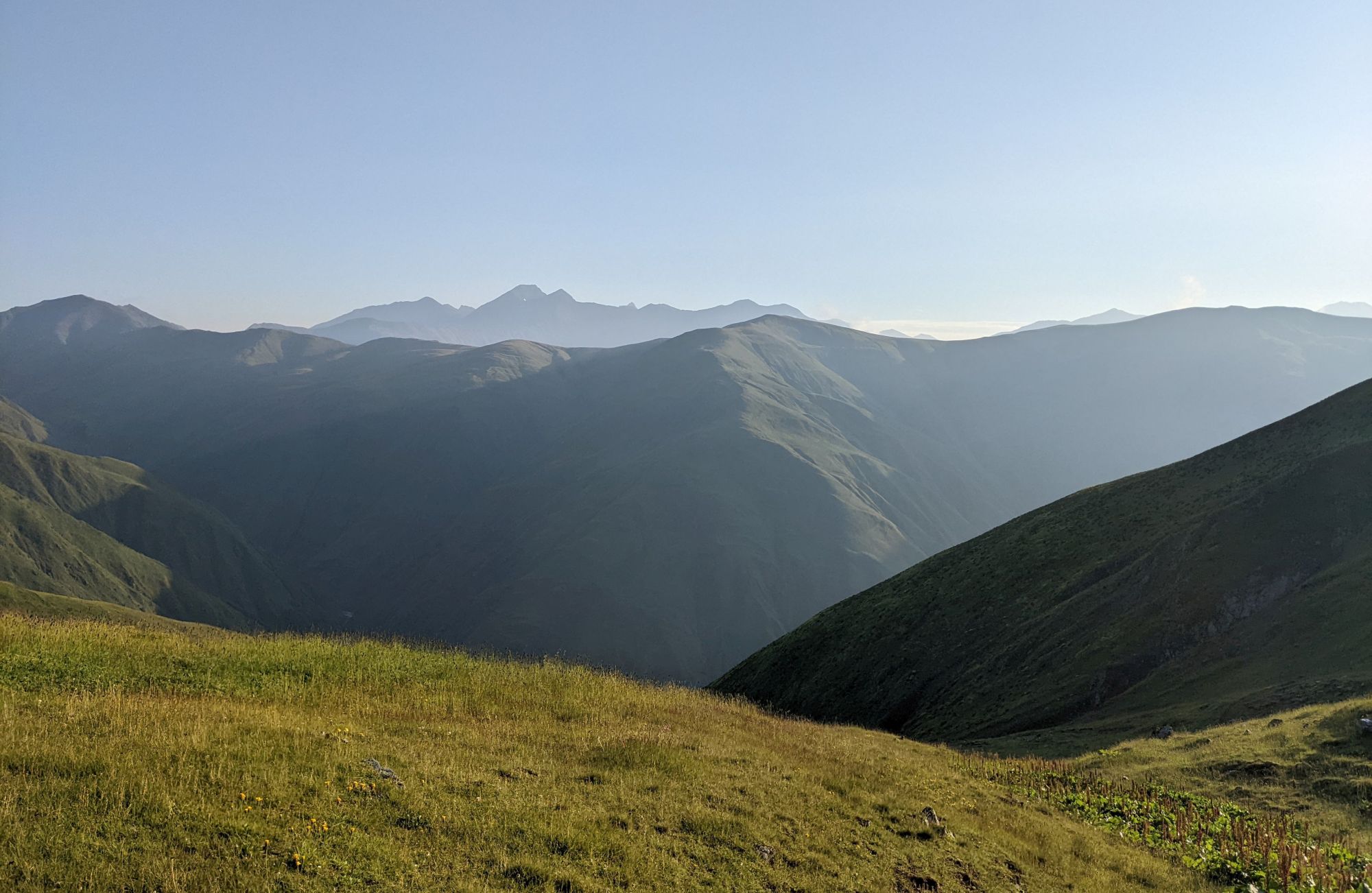
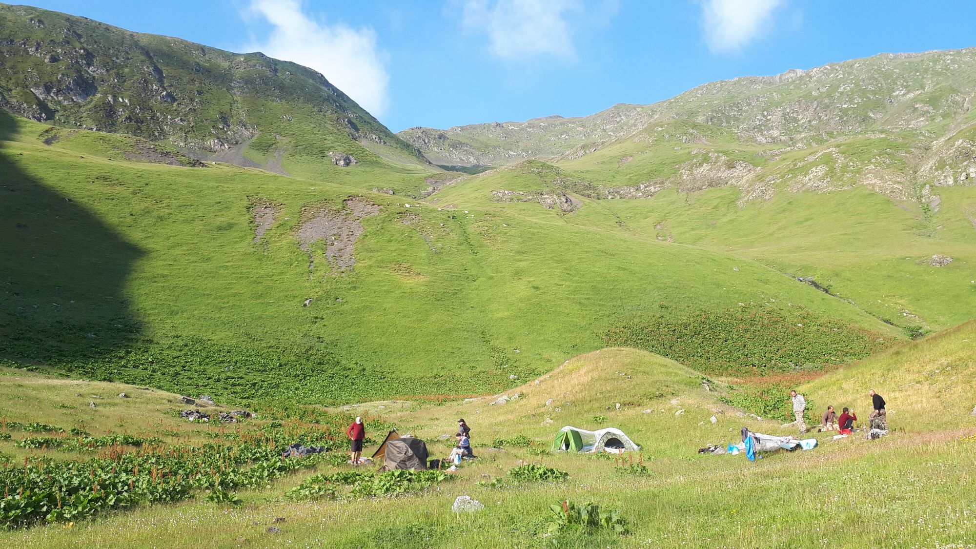
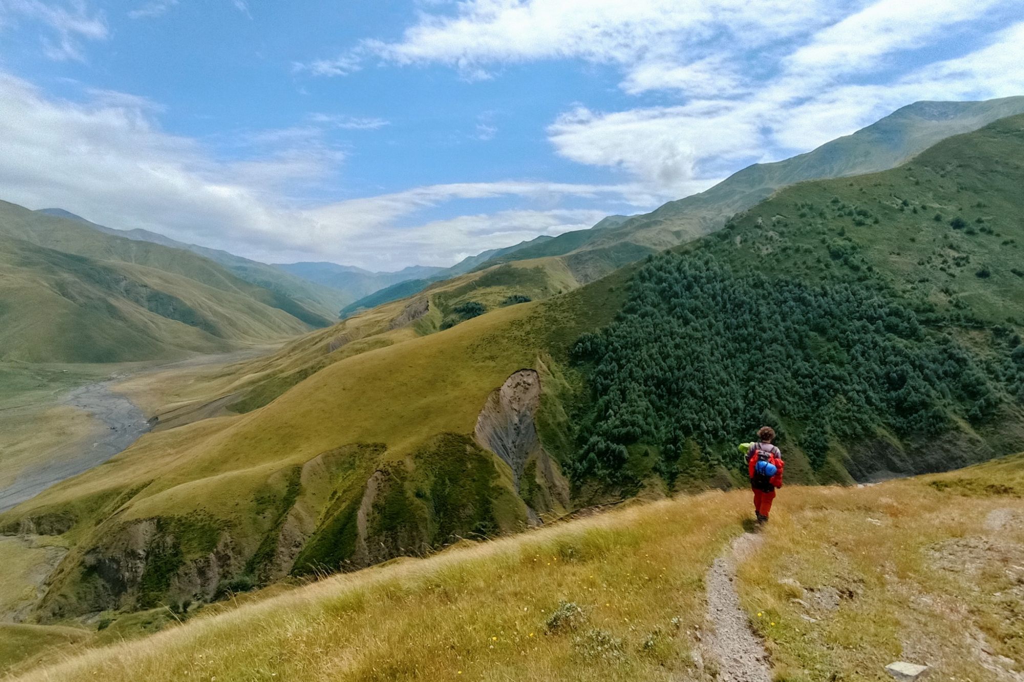
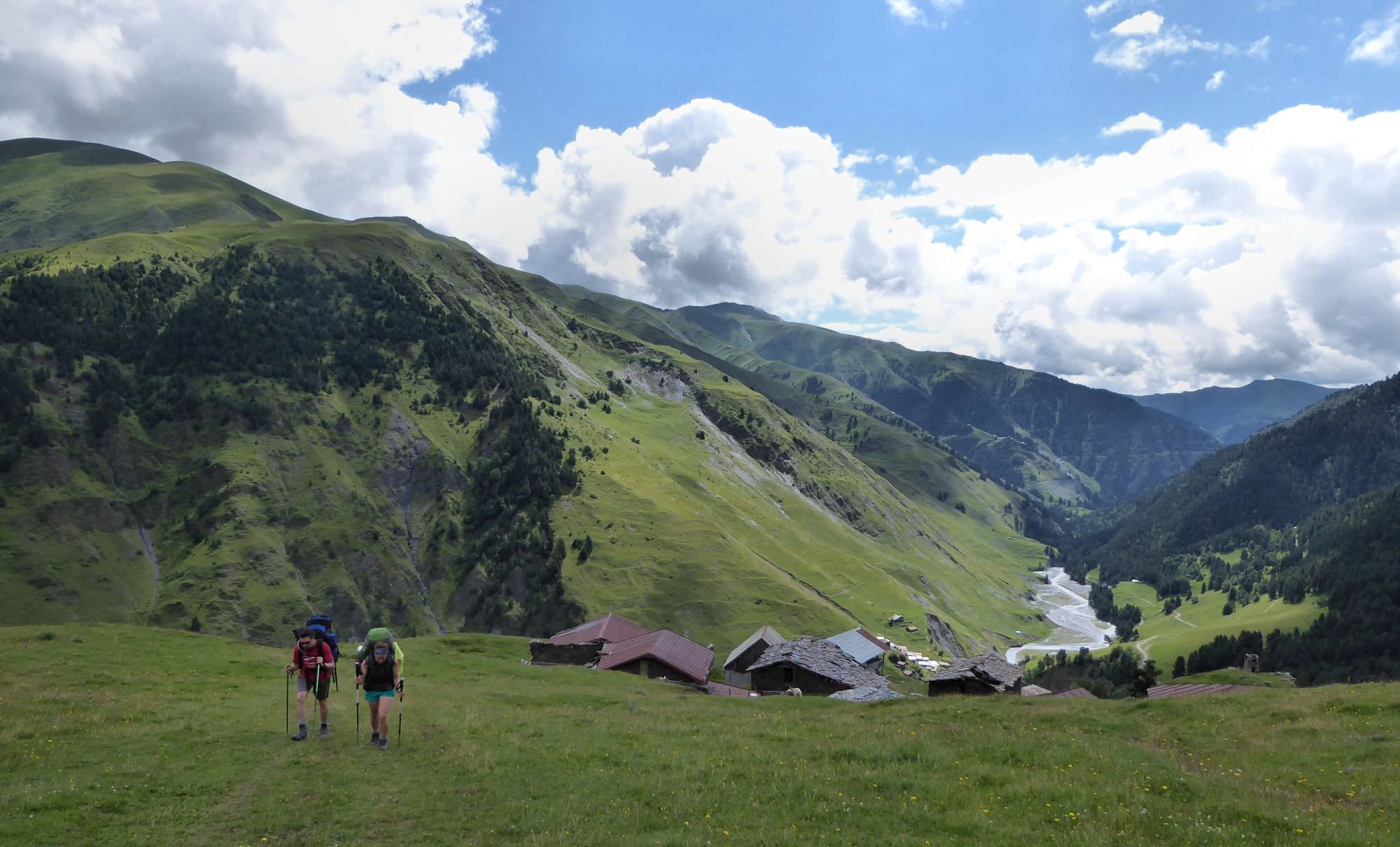
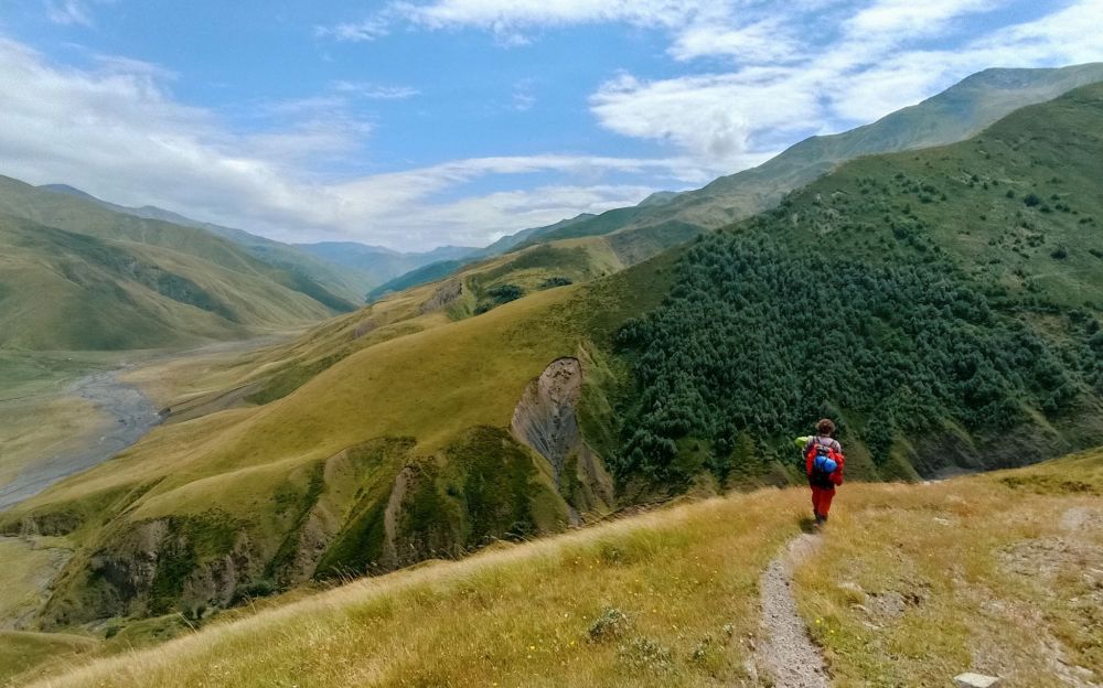
Views along the route to the Masara campsite
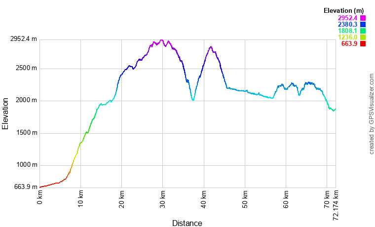
| Distance | 74 km |
| Trail type: | AB trip |
| Max. elevation: | 2955m |
| Min. elevation: | 906m |
| Total climb: | 5212m |
| Total descent: | 4345m |
This is the part I suggest skipping, especially if you come from Pankisi and can more easily arrange a taxi. It's long and not that interesting - you just follow a dirt road with minimal views.
The taxi to the top will cost about 350 GEL. Looking at the distance covered, it might look like a lot but doesn't seem to be expensive once you see the condition of the road and how easy it is to damage a car there.
Still, if you decide to do this on foot - starting from Jokolo, follow the main road to the north. Pass villages Birkiani and Dzhibakhevi. The road then crosses the bridge over the Batsara River - once at the other side, turn left onto a prominent dirt track. The road follows Batsara for a while, then turns left to follow its subsidiary, Toloshis-Khevi. Some 500 meters later, there is a small junction. A smaller track follows the river, but the larger one sharply turns left and starts climbing. This is the route you need to take.
From here, there is not much to write about. The road steadily climbs through the forest, there are no resting places or water springs. After several hours, you shall emerge from the forest and see the Tbatana settlement some 30 minutes ahead. It consists of a bunch of scattered, closed shacks. There is a marked freshwater spring in a small gully to the left of the road and plenty of flat space suitable for camping, but I would be reluctant to spend a night in the middle of the hamlet cos we met several pretty nosy kids there. Better just refill the water and break a camp a bit further behind the village.
At the Sakisto lake
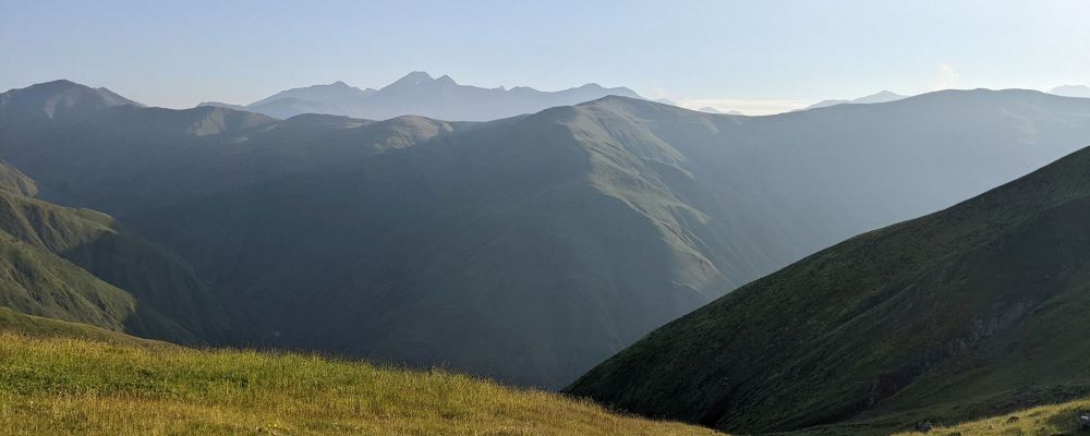
Follow the dirt track beyond the Tbatana hamlet. This section is flat and offers nice views since you are at the top of the ridge.
Some 20-30 minutes later, you shall reach Sakisto Lake. With some flat spots and water spring at the western side of the lake, it might be a decent place to camp, but be aware of sheep dogs - the ones we met here were some of the most aggressive I've experienced in Georgia.
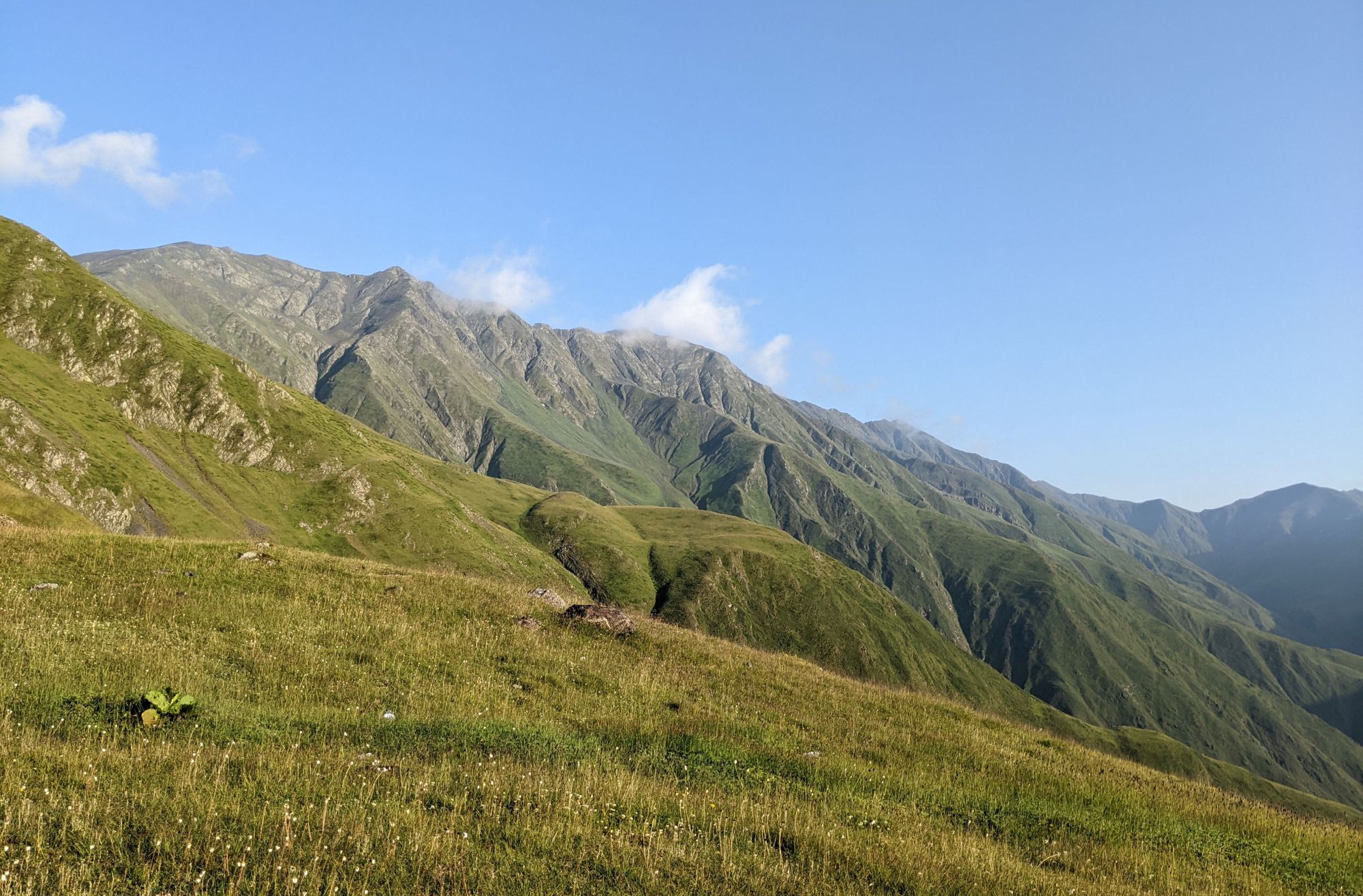
At the lake, you will find a tourist pointer - the trail is marked by blue markings. Beyond, the dirt track is replaced by a nice, wide footpath - which starts ascending almost immediately. Overall, you have to climb about 300 altitude meters, which should take less than an hour. A little below the top of Mt. Tbatana trail flattens and turns to the north, passing a couple of little lakes (or rather larger puddles).
For a while, the trail follows the ridge, offering some nice views, until it reaches a place marked on maps as Sakistos-Tskaro. There are some flat spots for camping and supposedly also a water spring in a gully below. In August, we didn't find water there, but didn't try too hard since we were stocked - water should appear if you follow the gully further below.
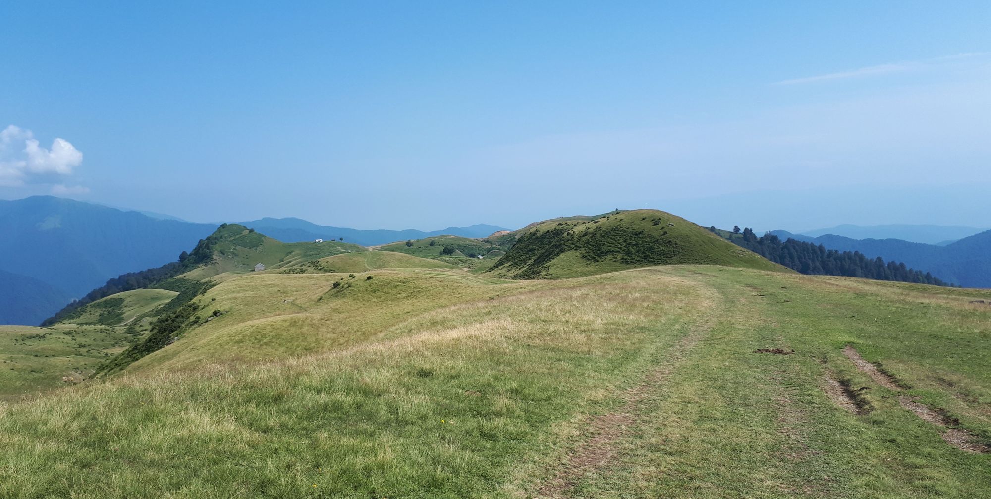
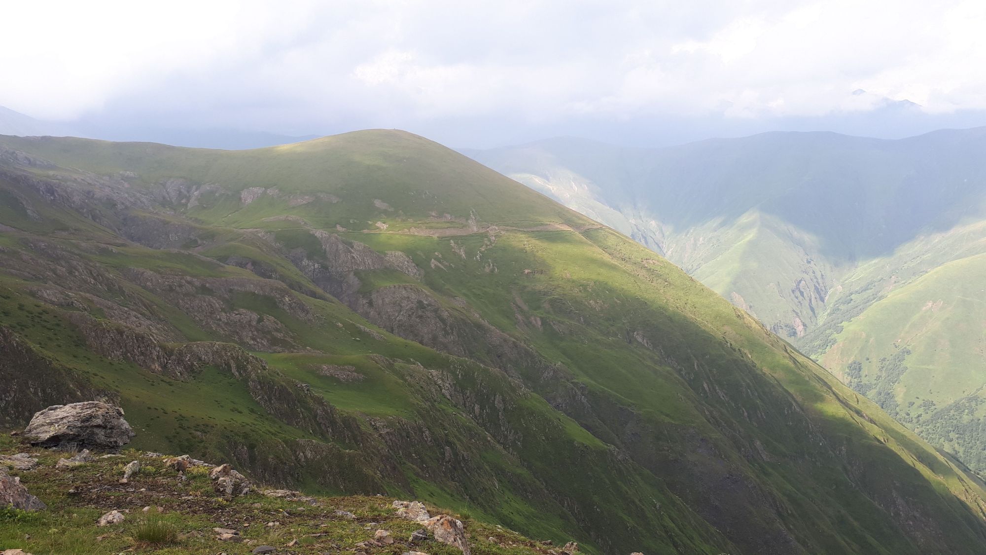
Beyond the spring, the trail meanders a bit through meadows and finally drops a bit onto a wide plateau, known as Sakvavia crossroads. From here, a major trail branches off to the west (to the left), passes Lagais mountain and descends into Iori gorge. But that's not the route we need to take. Ahead and to the right, you can see a mountain range with two nameless, not-too-prominent mountains (2700-2800m) and a small pass between them. The trail heads right here, steadily climbing the mountainside - but again, nothing too serious, no more than 200 altitude meters to cover.
Traversing the hillside behind the Sakvavia crossroads
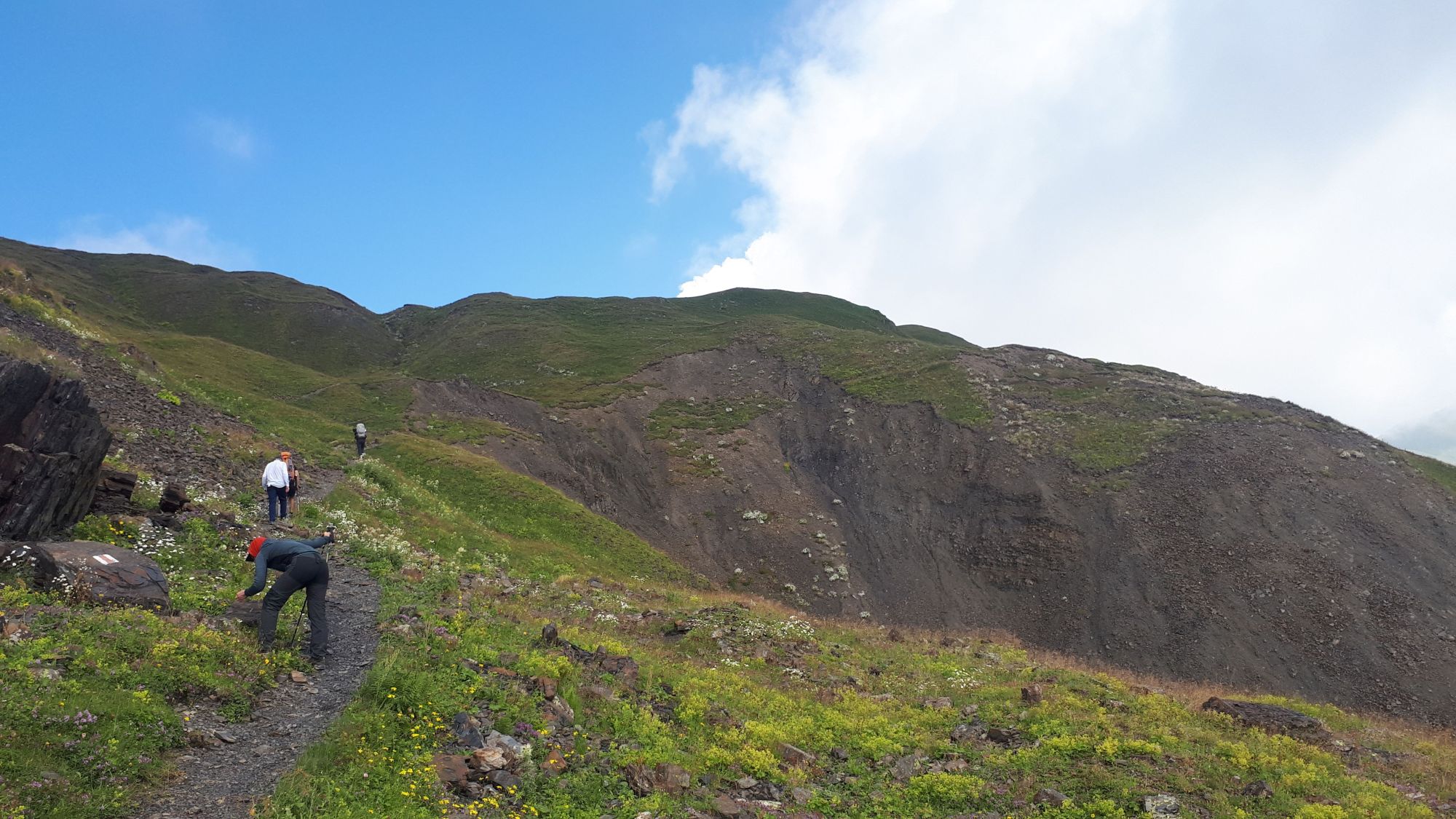
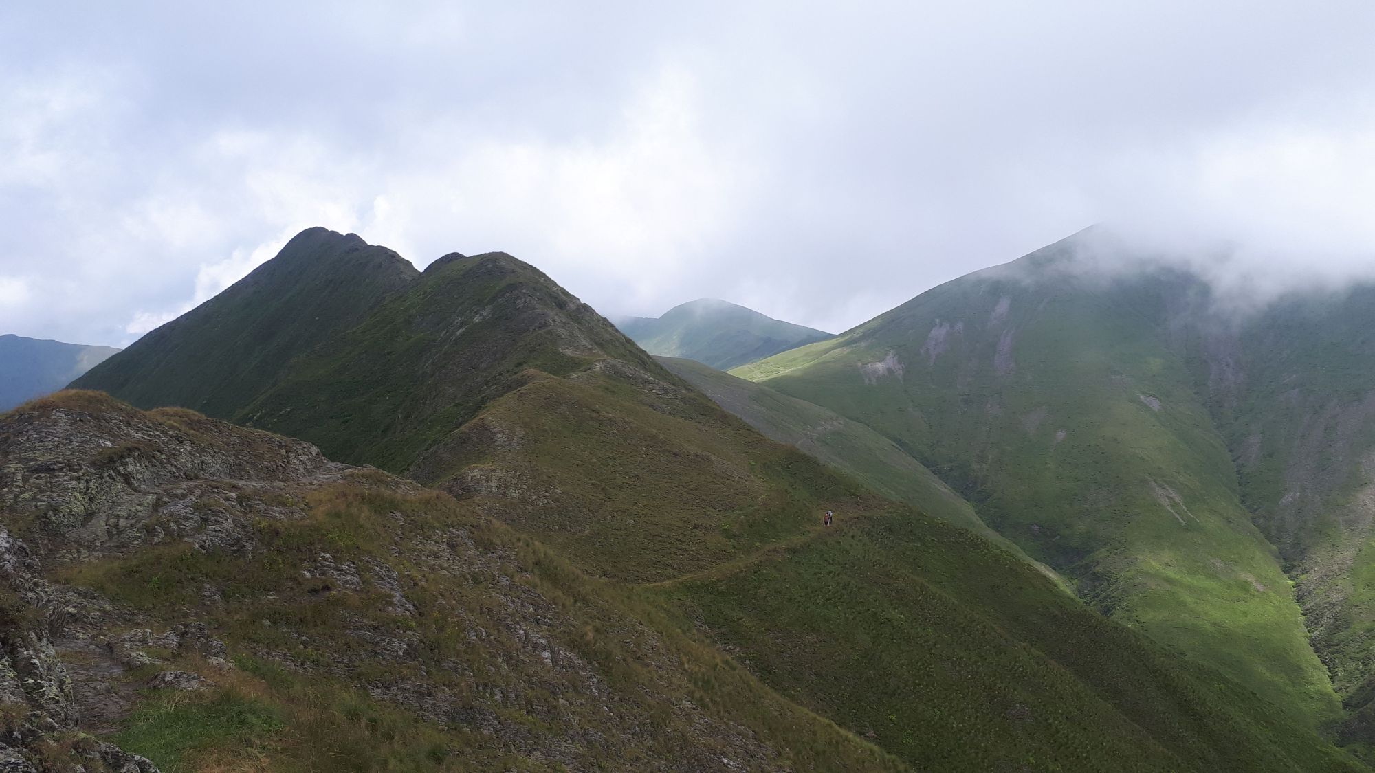
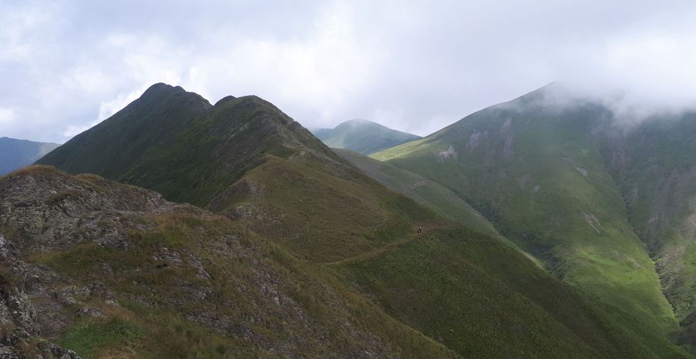
Behind the pass, the trail keeps steadily climbing until it reaches 2900m. It crosses to the eastern side of the mountain range, follows it for a while and then crosses back to the western side. Here starts the so-called "Iron Mountain trail" (probably named due to ferrite rocks along the route). It is a rather long traverse on a rocky, but otherwise mostly pleasant and flat trail. It leads you to another small pass in the mountain wall.
At this last pass, you flip again to the eastern side of the mountain range - not far to the left, you can see the top of the ridge while wide views open in the eastern direction. The trail just traverses the hillside, losing and gaining some altitude. This way, you will cross two smaller side ridges, until a wide Masara mountain appears ahead, with a clearly visible trail circumventing it from the right side. Masara campsite lies on the other side of it, on a small plateau on the side of the mountain some 3km ahead. If offers a lot of flat space and a water spring, what more is needed?
At the Iron mountain trail
From the campsite, backtrack almost 200 meters till you reach a trail branching down into a valley. In a series of switchbacks, it loses altitude pretty fast. About one kilometer later, it crosses to the left back of a creek, for a while descends of meadows, and then dives into a young forest. Here, it keeps on descending right towards a valley bed, only to turn left once it approaches it and go upstream a bit, towards the Alazani river crossing. Once you reach a smaller subsidiary, it's time to cross the river (might be problematic after strong rains, especially in the early summer).
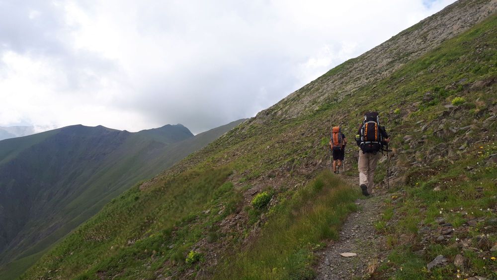
Then comes the moment of truth - a tedious, endless climb to the Sakorno pass. Overall, you need to cover 1000 altitude meters at a distance of 4,5km which means one thing - it is pretty steep. This climb shall take you about 4 hours.
Overall, the trail is well-trodden. The first half is mostly switchbacks, then, once you make it onto a side ridge rising towards Mt. Sakorne, the terrain becomes a bit less steep so the trail can be more straight. However, the trail doesn't go for the mountaintop, but for a pass to the right (2835m). Congratulations, you made it to the border of Tusheti!
The path down mirrors the route up - a steady descent through the mountainside which turns into a series of switchbacks once the trail makes it to the top of the side ridge. But at least it's not that far - "only" 650 altitude meters to lose, which means you will be down in 1,5 - 2 hours.
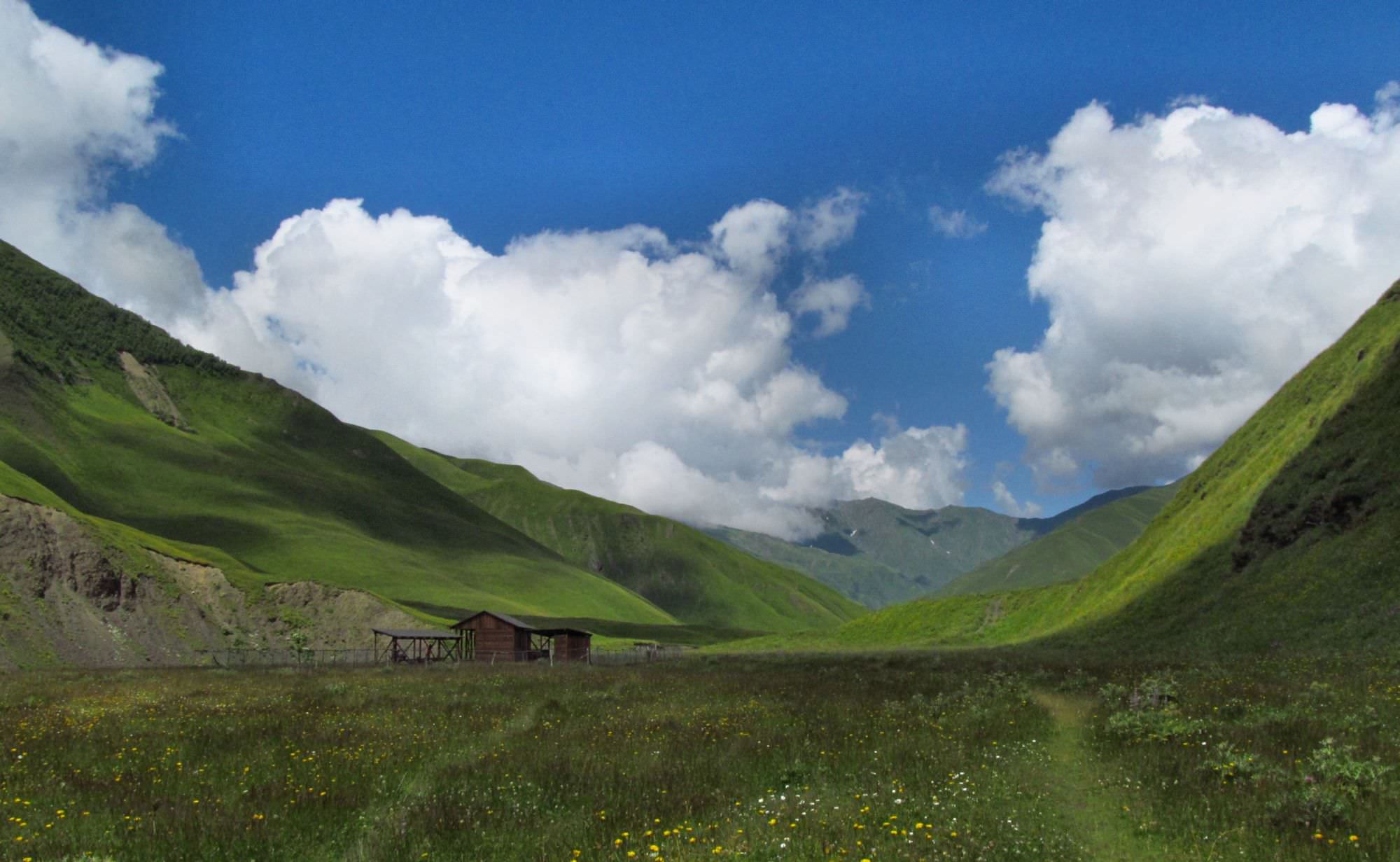
Once at the bottom of the valley, follow the trail running downstream at the opposite bank of the Tushetis Alazani River. Soon, you will need to cross several smaller tributaries, the largest one being by the shepherd's hut. From there, it's less than 30 minutes to the Alazanistavi tourist shelter.
Alazanistavi shelter is quite a surprise in such a remote valley. It's a rather large building with like 10 bunk beds. However, some are broken and dirty so, unless it's raining, you might want to camp outside anyway - there is a lot of flat space around. There is no visible spring right by the shelter, so you should collect water at the smaller Alazani tributaries you cross at the approach to the shelter.
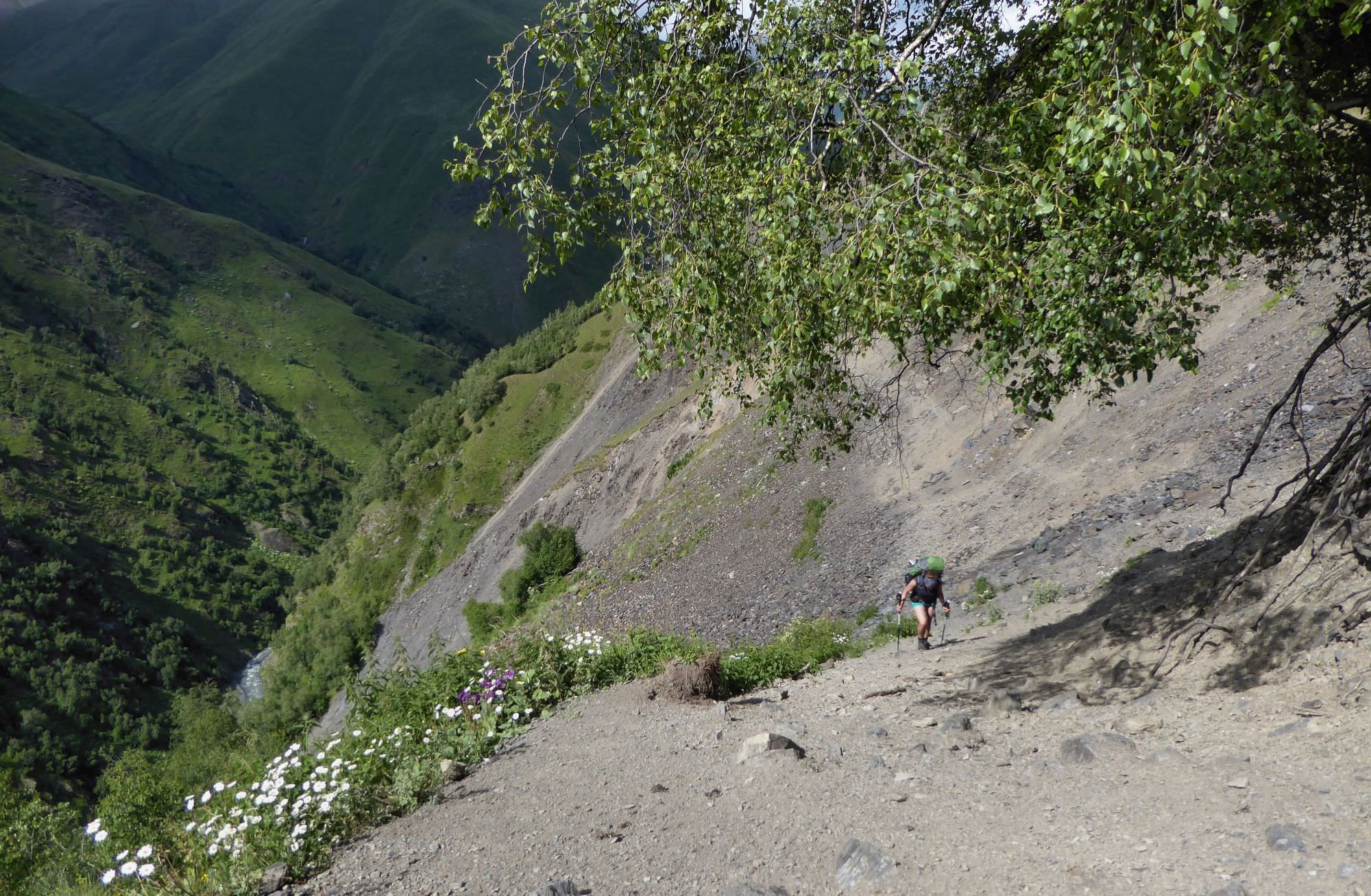
Descent from the Sakorno pass
A rather long day, so better start early. Follow the trail on the left side of the river. Mostly, it's well-trodden, but there are also a few short sections where it got damaged by erosion so you will have to traverse an overgrown hillside.
Two hours later, you should make it to a small makeshift bridge and cross to the right bank. Shortly afterward, you will make it to the Alazanistavi cheese farm. This is a place known for the famous Tushetian "guda cheese" (not to be confused with some similarly named cheese supposedly made by Dutchmen). Guda is a local cheese ripened in inverted sheep skins - yes, that means that the wool is inside, not out. Which might be the reason why this taste has a stronger aroma and flavor compared to the average Georgian cheese. Alazanistavi also offers paid accommodation in a newly built farmhouse.
Beyond the farm, the trail gradually moves away from the river, while still running in parallel with it. Over the next three kilometers, it gains 200 altitude meters to the local maximum before it starts slowly descending again.
There is nowhere to get lost, especially when walking in the downstream direction. The trail then goes up and down through the meadows and thickets, but only slightly, with the main obstacle being two sections where it got damaged by a landslide. You shall pass also two shepherd´s huts along the route. There will also cross several streams, but I am not sure about their water quality since we often see sheep grazing above.
Some 3 to 4 hours later after the guda cheese farm, you shall cross a small pass into a valley of a nameless tributary of Tushetis Alazani river. Here starts a rather new, bulldozered road. Follow it through the meadows many sheep around) towards the Koklata settlement - the road passes it from the left side and turns into the forest. Here, it descends via several rather steep switchbacks to the main road running at the bottom of the valley.
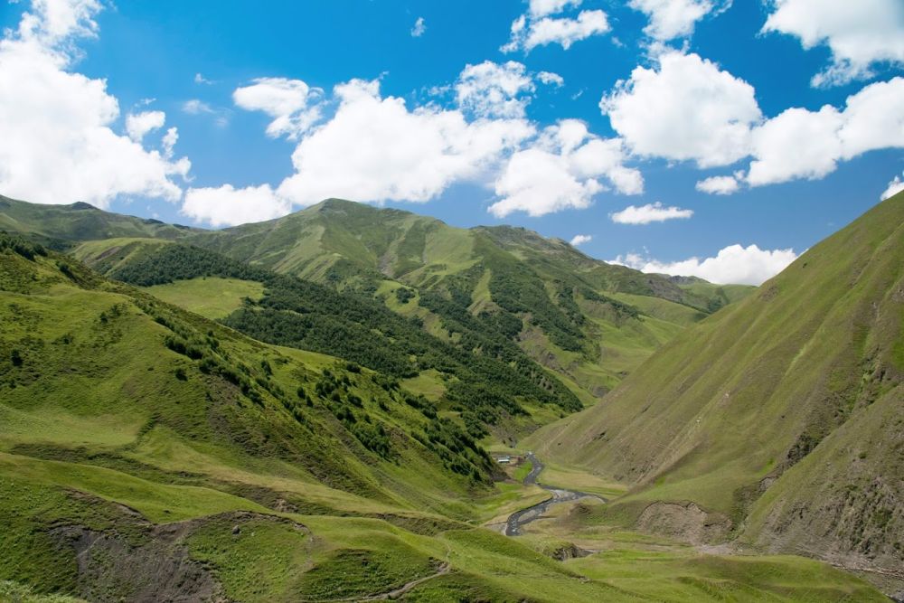
On the other side of the river, you see Verkhovani village, but the bridge is destroyed, you won´t get there. So follow the road. Twenty minutes later, you shall see another village at the other bank - Jvarboseli. On the junction, turn left and cross the river - here, it is not running in a gorge, but is rather wide, so it should be manageable. If you don´t feel like trying it, try to catch the attention of locals or follow the river a bit downstream - locals tend to build also a footbridge, but it does not always survive the spring snow thawing. Or call Posholi guesthouse () - they can either arrange a car or direct you to the bridge if it exists. Congratulations, you made it to the first proper Tush village (Koklatians will excuse) :)
Looking back at the Alazanistavi cheese farm
1. Traverse of Pirikita range - the most difficult and scenic of all available variants. You climb straight to the Nakle-Kholi pass and then follow the top of Pirikita range to the east, to the Ghele meadow about halfway between Omalo to Dartlo. Then continue to Omalo.
Honestly, this route works much better if you start this trek from Omalo, so you have to cover less altitude and can taxi to Ghele. It is extremely difficult if starting from Jvarboseli and most people will be probably too tired from previous days to finish the trek with such a difficult day. But views are great.
2. Crossing Nakle-Kholi pass to Parsma - also a pretty tough walk because you have to climb to Nakle-Kholi pass, but then you just descend at the other side, towards Parsma. There, you can camp or stay in the guesthouse and follow the valley route to Omalo on the next day.
3. Trek to Gogrulta - rather an easy walk that takes you to remoter parts of Tusheti and lets you visit Gogrulta, one of the most spectacular Tush villages. There is even a pensioneer couple running a guesthouse there. On the next day, there is another trek of moderate difficulty where you have to cross Apakurta pass towards Khakhabo and ultimately Omalo.
4. The main road to Omalo - the easiest and shortest route to Omalo. You just follow a dirt road, which is not too romantic, but the road still has its charms. The scenery is decent and you will pass several interesting Tush villages. Don't miss views of Dochu village below the road!