Barely known hike through famous mountain resorts allowing unique views of Black Sea
While hiking Georgia, you may have realised already that your favoured mineral water from the supermarket is not only a spring but often also the entrance gate to a new adventure: Kobi for Truso Valley and Kelitsadi Lake; Sno for Juta to Roshka; Borjomi for the same-named national park, Bakuriani for great winter experiences, and Sairme for the Zekari Pass and beyond. The same accounts also for Nabeghlavi and Bakhmaro, which share the same valley. By many known only as a summer retreat and close-by Gomismta with its peaks in the clouds, Bakhmaro also promises barely discovered hiking possibilities on the ridges separating Guria and Adjara. Passing isolated villages and mountain lakes, every step will bring you closer to the Black Sea.
From Bakhmaro to the Khinotsminda Monastery, the first location in the Kintrishi National Park connected by a dirt road, it will take you four days. If you need a fifth one highly depends on you either organising a pick-up at the monastery or being able to fetch a ride with one of the park visitors. Otherwise, you have to walk another 25 kilometres through the valley until the official end of the reserve.
You can also just walk the most populated section between Bakhmaro and Gomismta, which will take you two days. Both villages are connected by a big street and tourists stroll in and out throughout summer. Anyhow, you would miss the seaside…
Physically rather easy, the trail may challenge you especially on hot summer days mentally. This is valid for hiking the dirt road from Gomismta to the Jvarimindori Shelters on Day 2, which might be burning hot, dusty and without any distracting view, as well as the sheer endless walk on Days 4 and 5 through the Kintrishi valley in very humid conditions. In case you decide to head from the coast up to Bakhmaro, the significant rise in elevation will certainly turn the difficulty into hard.
For the ambitious ones, this hike can also be a section of a big thru-hike from the capital Tbilisi to the Black Sea coast or vice versa. Bakhmaro can be reached by foot from Jaji Lake, then further along the Meskheti Ridge through the Sairme and Zekari Pass as well as the Borjomi National Park, then to Bakuriani or in parallel further north the Ateni Valley, the Algeti National Park and finally to Tbilisi. Based on your physical condition this might be possible in up to three weeks.
The latest activities on public Facebook groups like Bakhmaro • ბახმარო and Gomismta ● გომისმთა are probably the best indicator on snow level, weather and general accessibility. Many house owners reach the area between late May (in a good year) and mid of June (in a bad year). The season then goes at least until mid of September. Only a few weeks later the streets up to Bakhmaro may be completely restricted for traffic already, such as in early November 2022, due to high snow and risk of avalanches.
Considering the extreme change in elevation in the Kintrishi valley, going from Bakhmaro down towards the coast is definitely the more appealing option. At the same time, getting a ride in a crowed summer resort is probably much easier than in a less-visited nature reserve.
There will be sufficient water sources along the way to fill-up your reserves at least once a day – either in the settlements you cross or along the rivers you pass. Camping is the safer option and will give you more flexibility.
Anyhow, there should be a way to leave your tent at home (not your mat and sleeping bag, you will need those at least once) if you plan a bit in advance. It is not Mestia – Ushguli but it should be possible to arrange accommodation for each night. This would change your days as follows: Day 1 from Bakhmaro to Meria Keli (16 km; guesthouses available); Day 2 until Jvarimindori Shelters (18,5 km; modern public huts); Day 3 until the Khinotsminda Monastery without seeing the Tbikeli mountain lake (16km; you should consult the park authorities for a contact); Day 4 until the Ranger Station (17km; at the station for 15 GEL); Day 5 until the end of the Nature reserve in the village Chakhati (12km). As mentioned, Days 4 and 5 are skippable in case you can organise a ride out of the reserve.
Mt. Khoni valley
To make it clear, public transport to Bakhmaro is rather poor. There is no direct marshrutka from Tbilisi, Kutaisi or Batumi. Anyhow, according to locals that we met in the town of Chakhatauri, the last noteworthy settlement before Bakhmaro, there seems to be a minibus leaving Ozurgeti somewhen 10ish (rather when full enough) and pass Chakhatauri around 10:30 am; anyhow, we waited there for more than 30 minutes but nothing happened, and we never saw one afterwards on the road.
Therefore, in case you have no car / driver at hand, the following is probably your best shot: when coming from Tbilisi or Kutaisi take a Batumi marshrutka (normally running every 30 minutes) and get off at the Sajavakho roundabout / Gulf gas station. From here, try to fetch a ride until Chakhatauri. In the town centre (where in theory also the Ozurgeti bus passes by) go on the Bakhmaro road and put your thumb up again. It took us one marshrutka and four rides to the starting point but it's for sure possible. Leaving Bakhmaro is probably much easier as there are constantly people on their way home.
As tricky as getting to Bakhmaro by public transport is leaving Kintrishi NP. Once you reach the Khinotsminda Monastery, you are connected to the (dirt) road system again and there are smaller dwellings along the way. Hence, your chance to catch a ride with locals or tourists is increasing with every step. The official end of the trail and start of the nature reserve is in the village of Chakhati. Anyhow, from here you have to manage another four kilometres until the village of Kokhi where a marshrutka commutes at least until 5:00 pm constantly back and forth to the seaside town of Kobuleti (1 GEL; about 20 minutes). In Kokhi you may also find a taxi, which can charge you about 20 GEL.
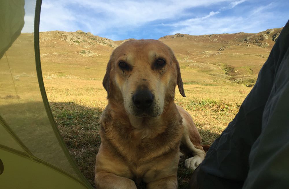
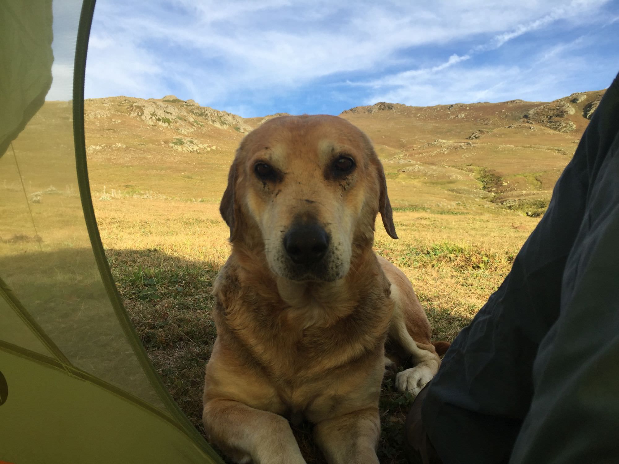
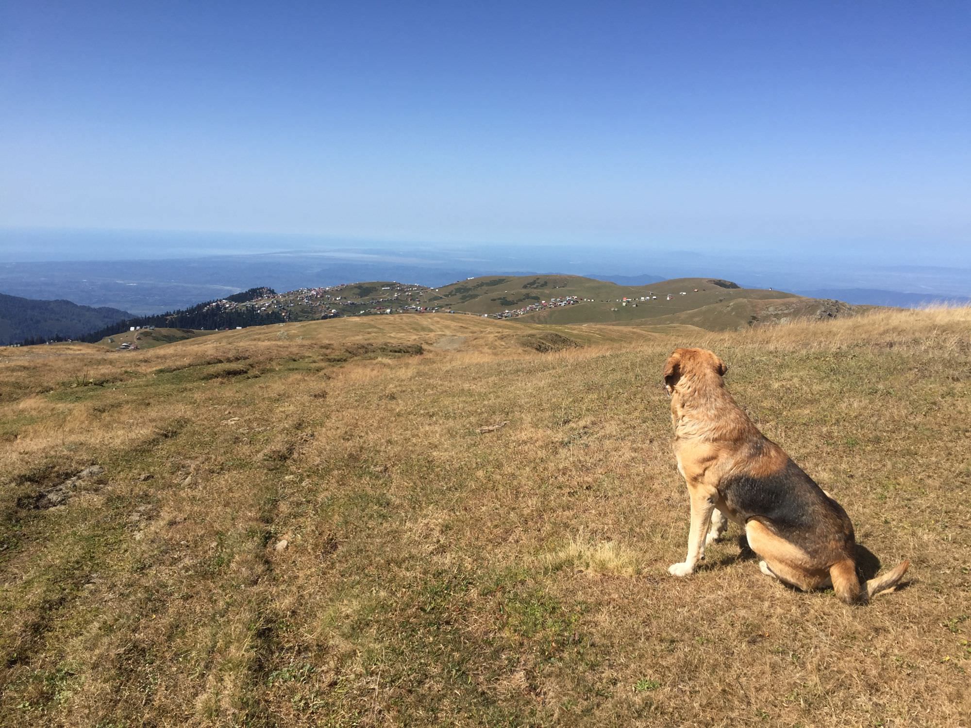
A friendly visitor
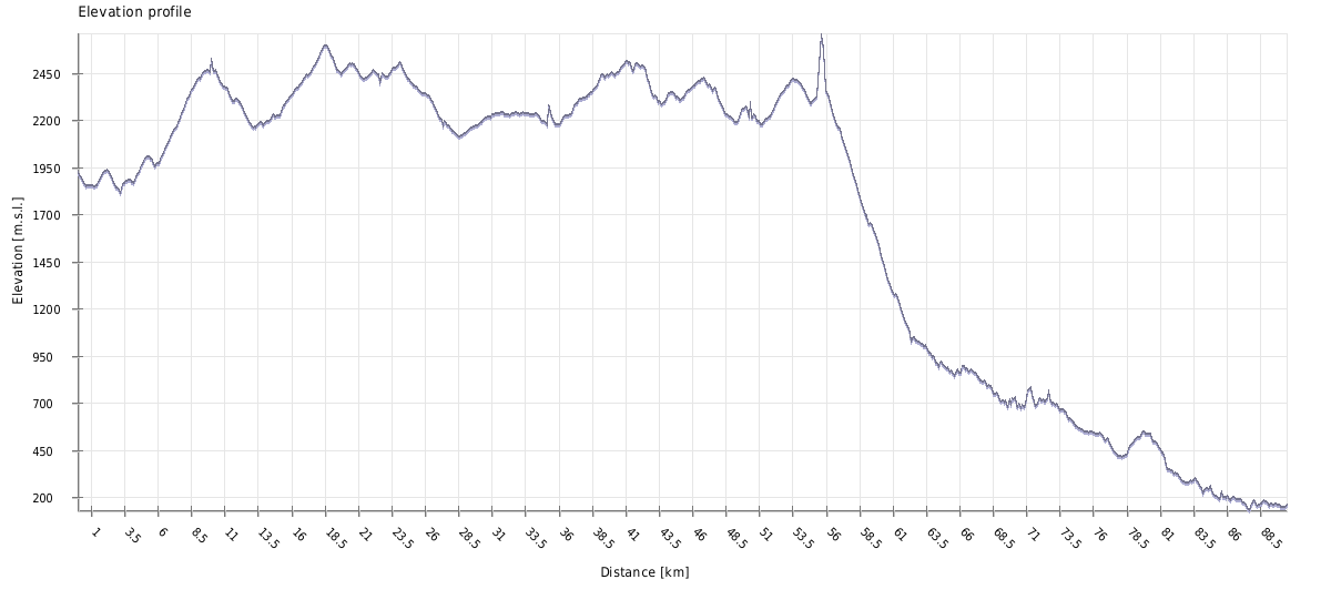
| Distance | 60.1 / 85.3 km |
| Trail type: | AB trip |
| Max. elevation: | 2600m |
| Min. elevation: | 1013 / 132m |
| Total climb: | 4455 / 5239m |
| Total descent: | 5042 / 7189m |
Before heading towards the coast, feel free to explore the local mountains around Bakhmaro. While the Sunset Mountain (2.190m) may only take you an extra hour, Mt. Shekrekili (2.490m) and Mt. Gadrekili (2.508m) may take you up to half a day.
The actual hike starts around Bakhmaro’s village centre (you can find a small shop there), leads you some metres down into the valley and across the river. You will follow the latter towards the west and slowly ascend through the huts on a rather proper mud road, which is called ‘Meria Keli – Bakhmaro’ in various apps. Anyhow, don’t be afraid, there won’t be too much traffic.
Look back at Bakhmaro
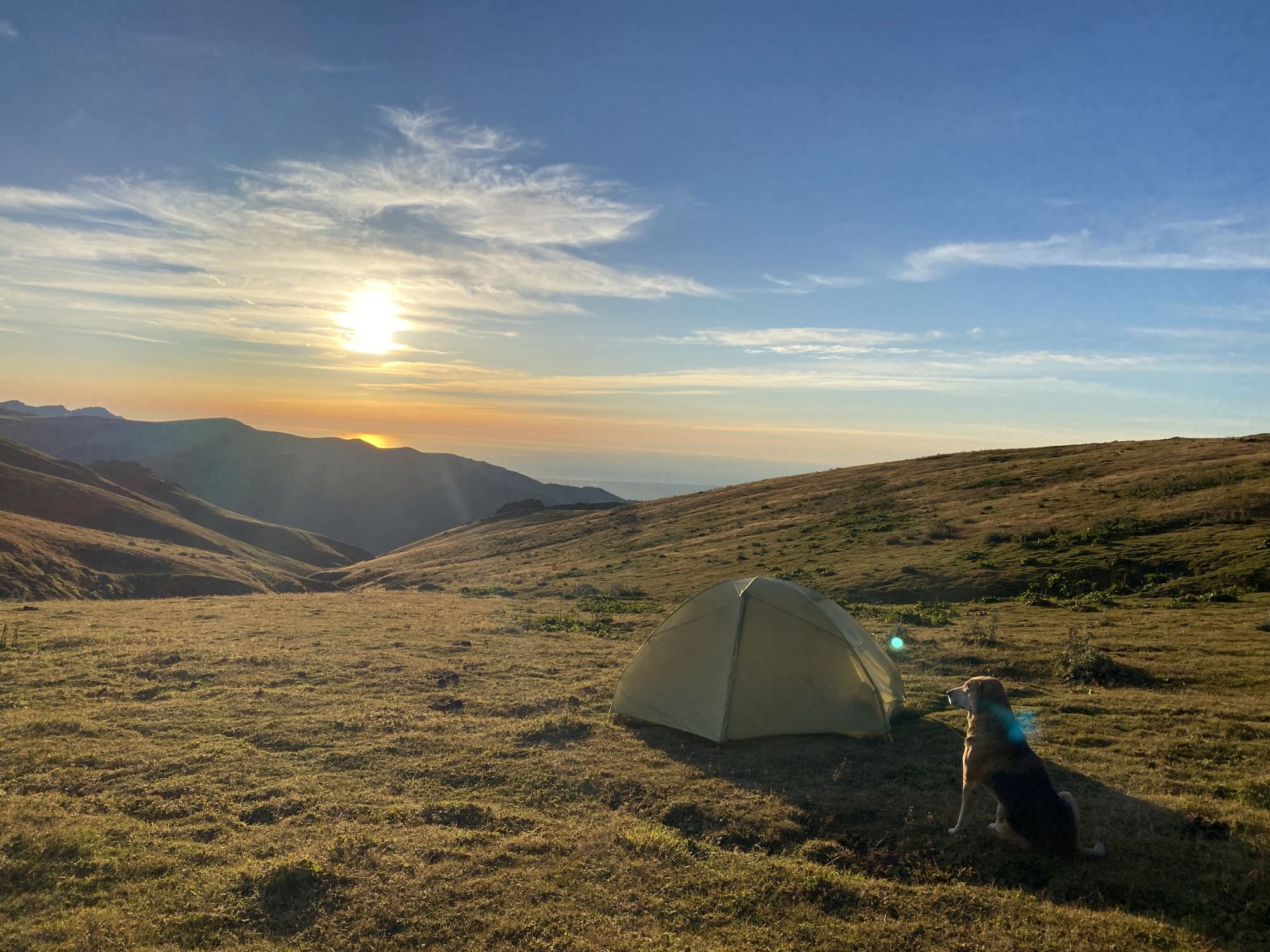
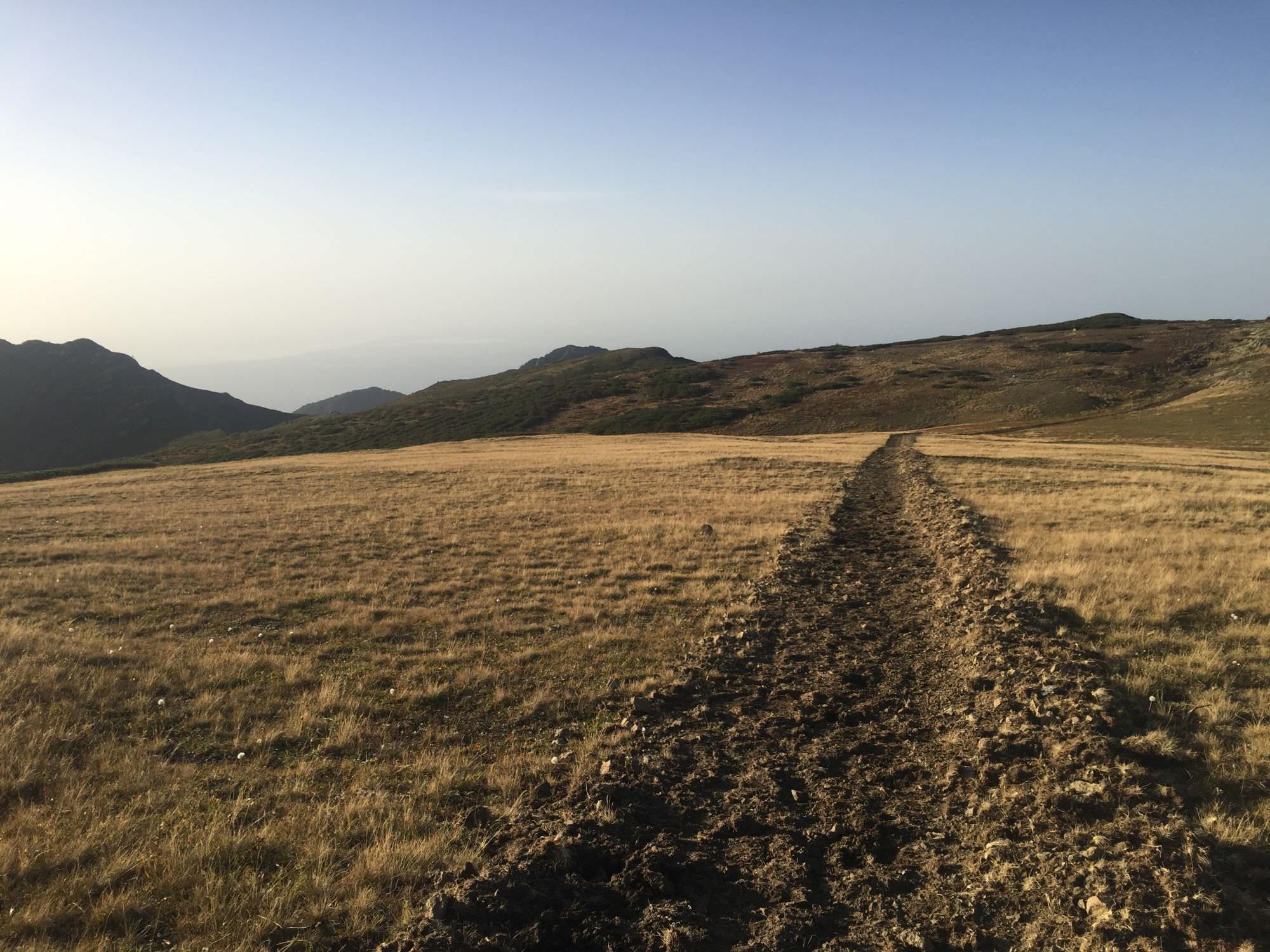
Throughout the next nearly 10km you will cross several smaller rivers, pass by huts spotting the landscape and finally climb up to a wide meadow on about 2.450m. If you left Bakhmaro just around midday, you can call it a day there. The camping spot marked in the gpx-file is only some metres from a small creek and from the turn to Meria Keli, which you should not miss. From there, you’ll have a nice view including green hills as much as the Black Sea.
In case you feel like continuing, Meria Keli is about 6km further. The rather narrow Natanebi vale towards the settlements is not too inviting for camping (also due to shepherds and their dogs) and you'd have to make it all the way to the end of MK to find another nice spot.
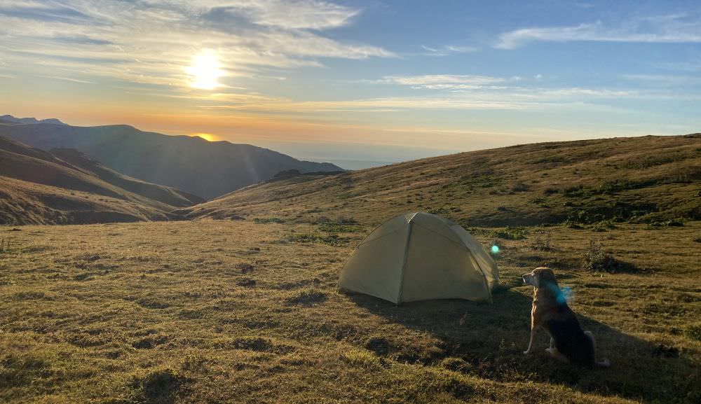
Sunset on the Black Sea
Day 2 will be long and exhausting - physically due to the overall change of elevation but especially mentally as the last eight kilometre will be on a very dusty road in the burning sun without any shade. Hence, start early to allow you enough times for breaks when needed.
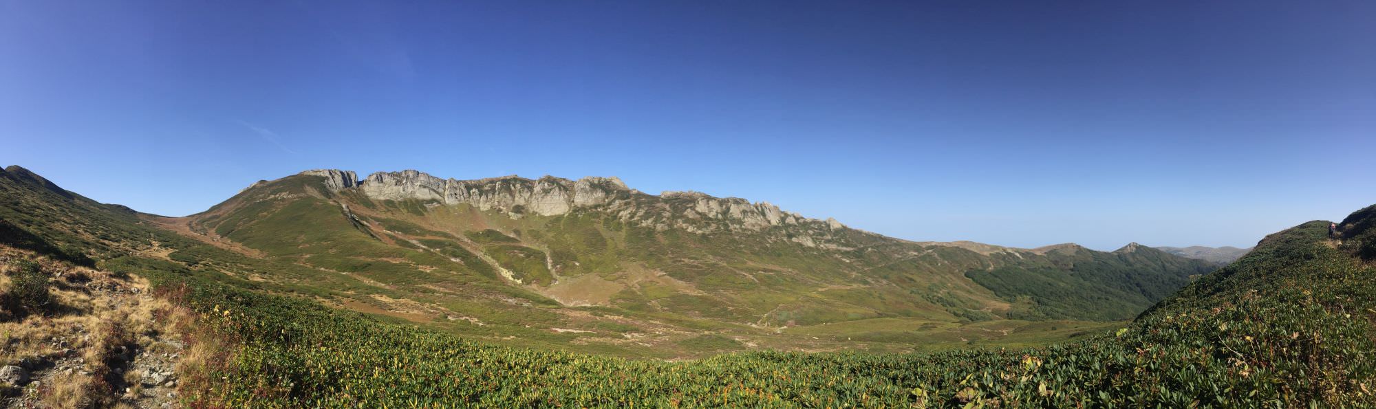
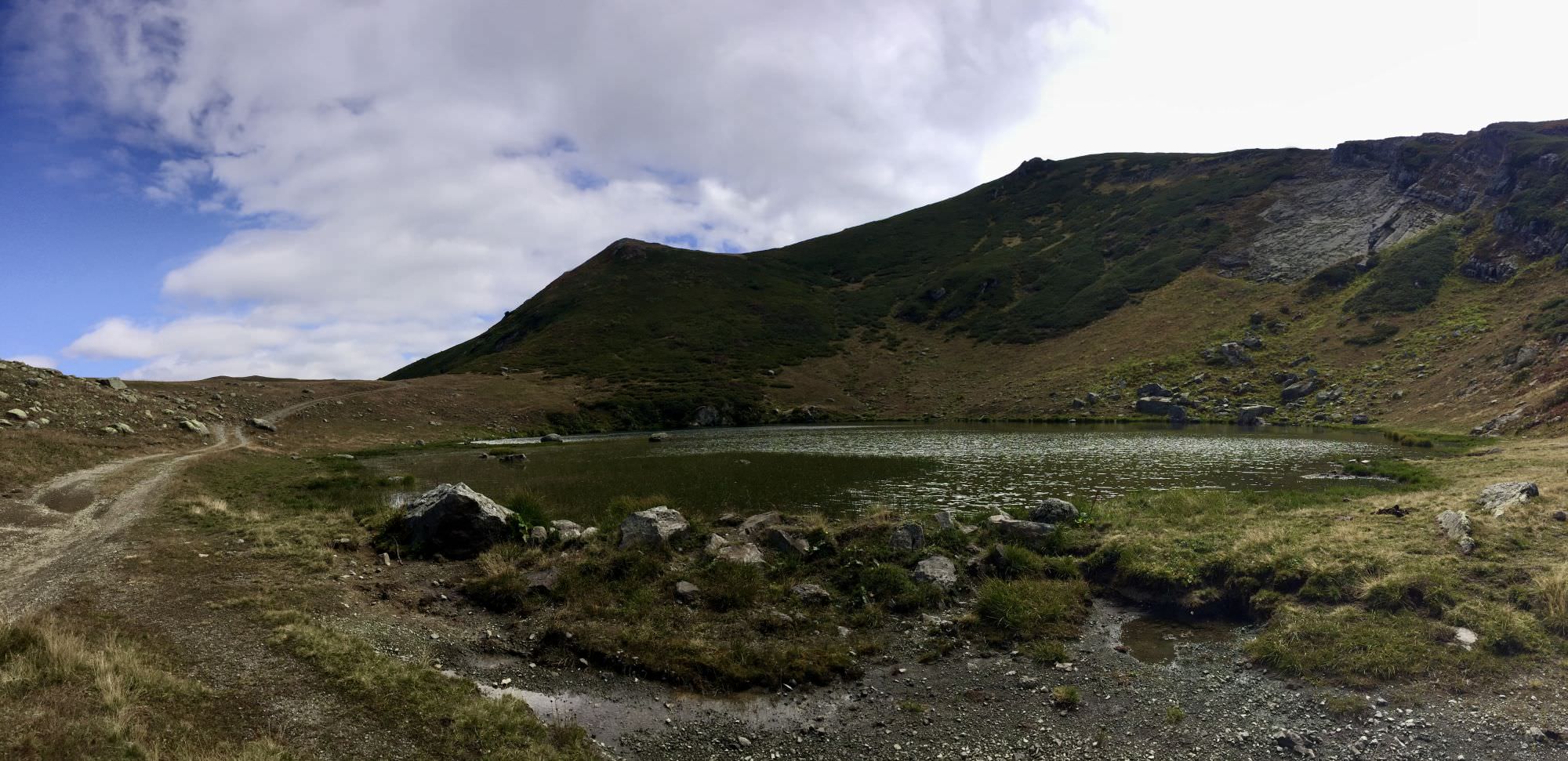
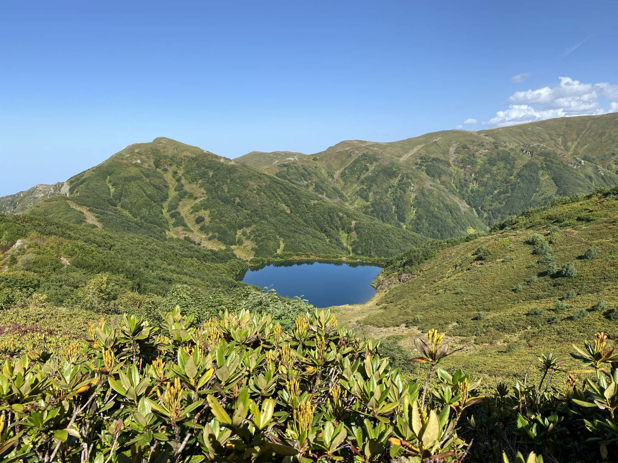
From the campsite follow the dirt road down to Meria Keli, pass the village and climb all the way up again to the top of the ridge on about 2.600m. Around there, you not only have a permanent 360-degree panorama but also traverse constantly between Adjara and Guria and soon also slowly descend towards the Chinchao mountain lake – a perfect lunch spot, where you can also snack all the blueberries which you find throughout the end of the summer on the last metres before the lake.

Chinchao lake
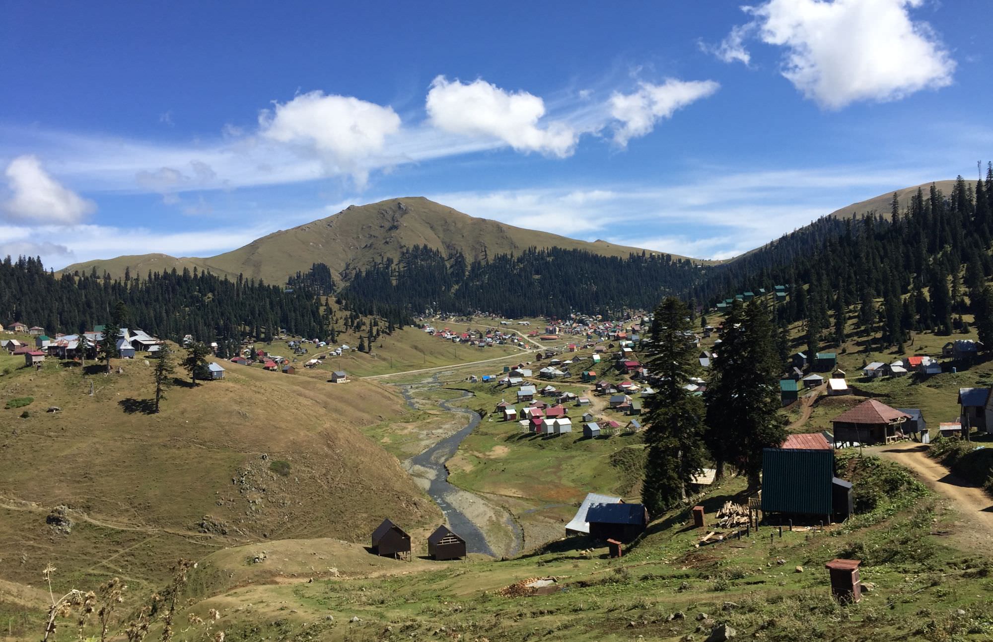
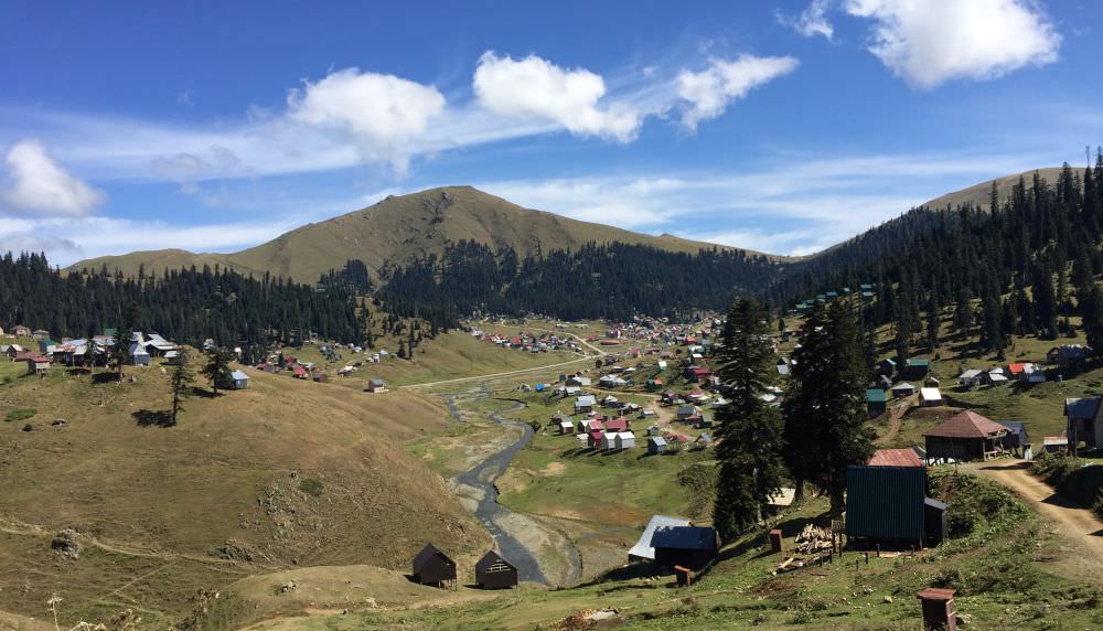
After this rather smooth up and down towards the lake, you will soon lose about 400 metres of elevation in just three kilometres and find yourself already next to Gomismta – mystic in many pictures with all its clouds (just google it) but also quite overcrowded and loud in summer. If you don't feel like staying at a guesthouse or actually end the two-day hiking option here, you’d best continue rather soon.
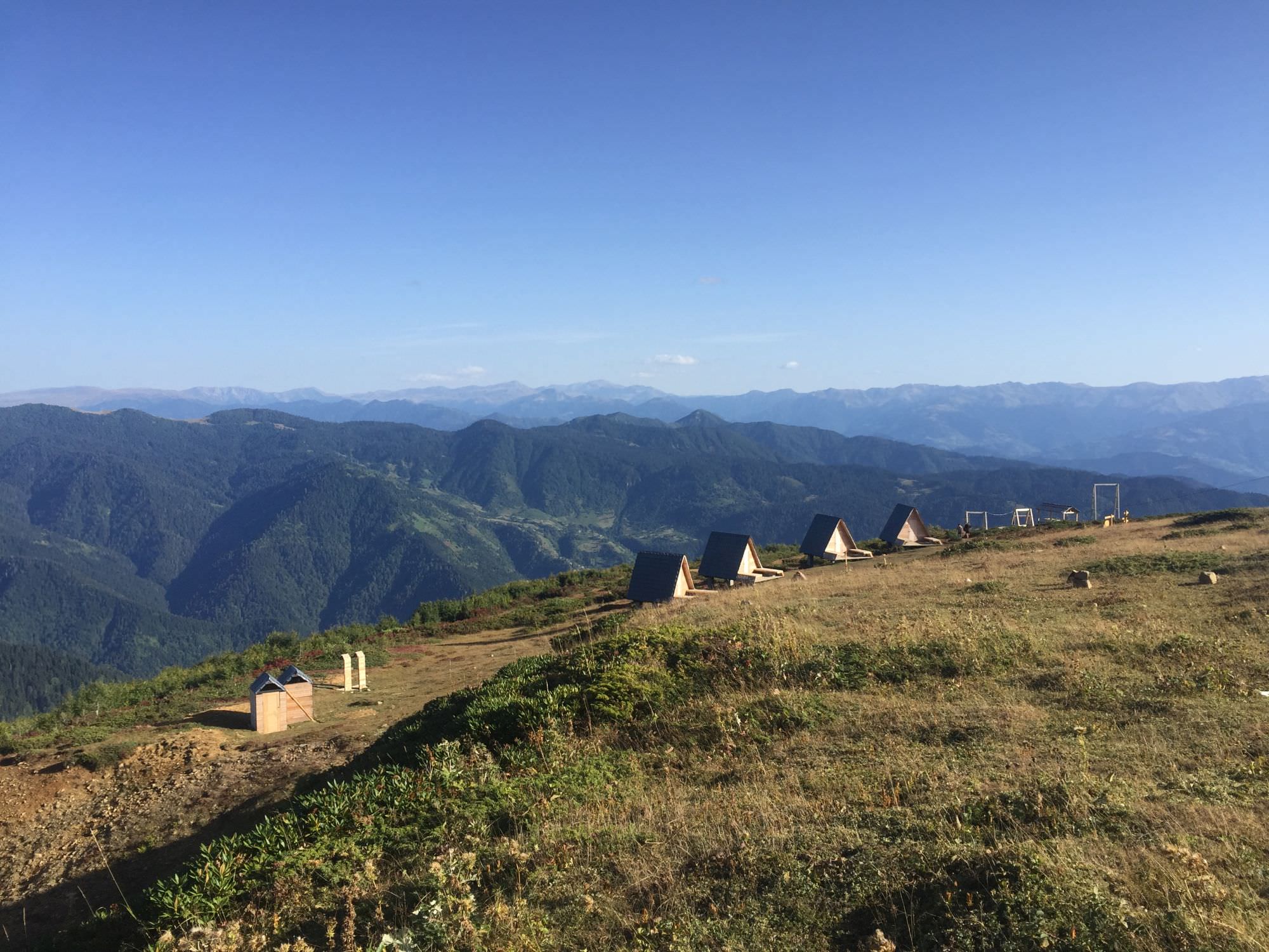
You still have another seven kilometres to go, and the dusty dirt road is everything but pleasant – especially in the hot midday sun. Nonetheless, be sure that these efforts will be rewarded by the four newly erected (2021) and spacious Jvarimindori Tourist Shelters ("cross field"). The triangle huts with panorama view can hold up to three people on a wide wooden flatbed, where you can rollout your mattress and sleeping bag. The area also includes two panorama swings, fire pits, as well as simple toilets and showers (they were unfortunately already damaged). In September 2022, the facilities were accessible free of charge.
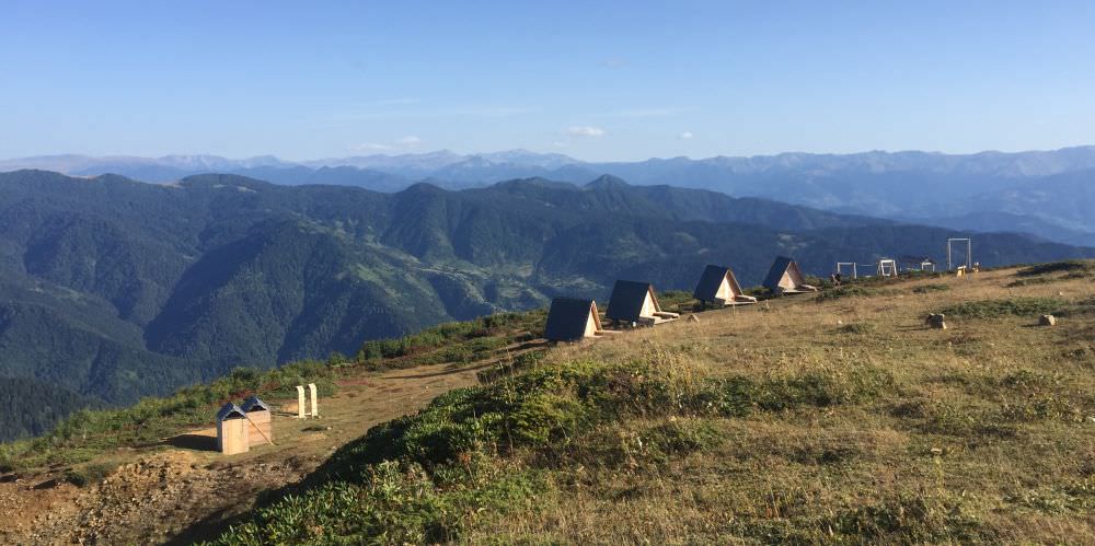
Jvarimindori shelters
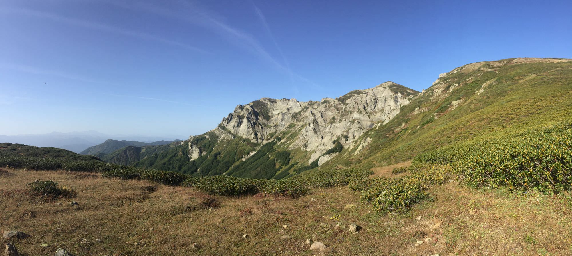
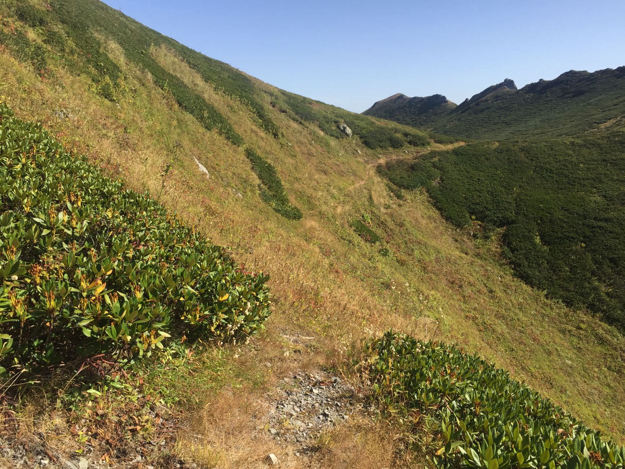
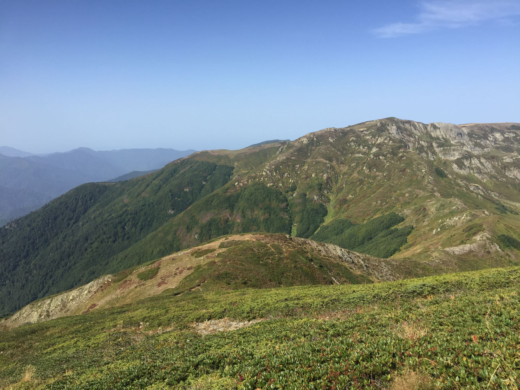
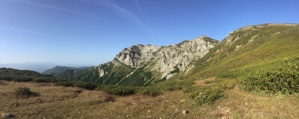
From Jvarimindori you head westwards away from the populated area into Adjarian no-mans-land. The small, partially marked path will lead you continuously upwards for the next hour through rhododendrons (no Georgian hike without them!) and blueberry-bushes, first along some partially visible waterpipes and then a small creek. You will find yourself in a wide, open space facing a rocky massif right in front of you and the mountains of the Georgian-Turkish border in distance. Here, turn northwards and continue your ascent until you are on the backside of the massif you just faced some minutes earlier.
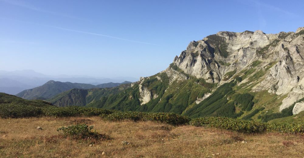
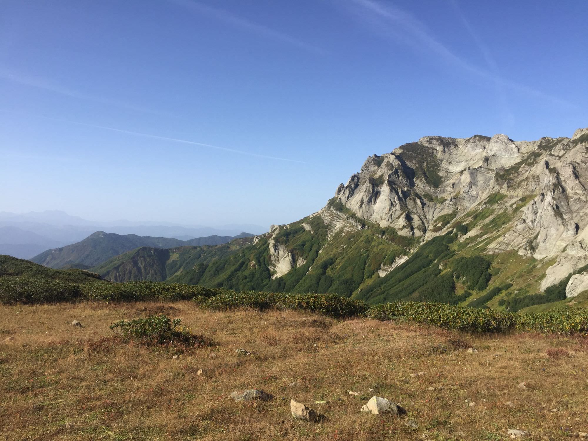
Rocky massif
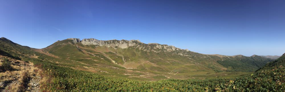
After roughly 4,5 kilometres don’t feel tempted to follow the slightly wider path leading along the valley but take the upper route and continue to gain altitude until you reach a small pass on the south-eastern side of Mt. Khoni (2.599m). The trail turns narrower and traverses along the slope. You will pass by a free-standing bolder, which invites to take some Instagram-pictures, and soon reach a yellow trail sign – from here, Mt. Khoni’s peak assembles a five-fingered hand protruding from its green surrounding.
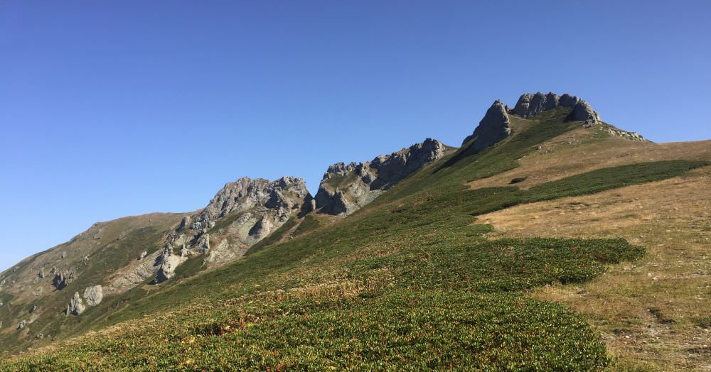
Hand of Mt. Khoni
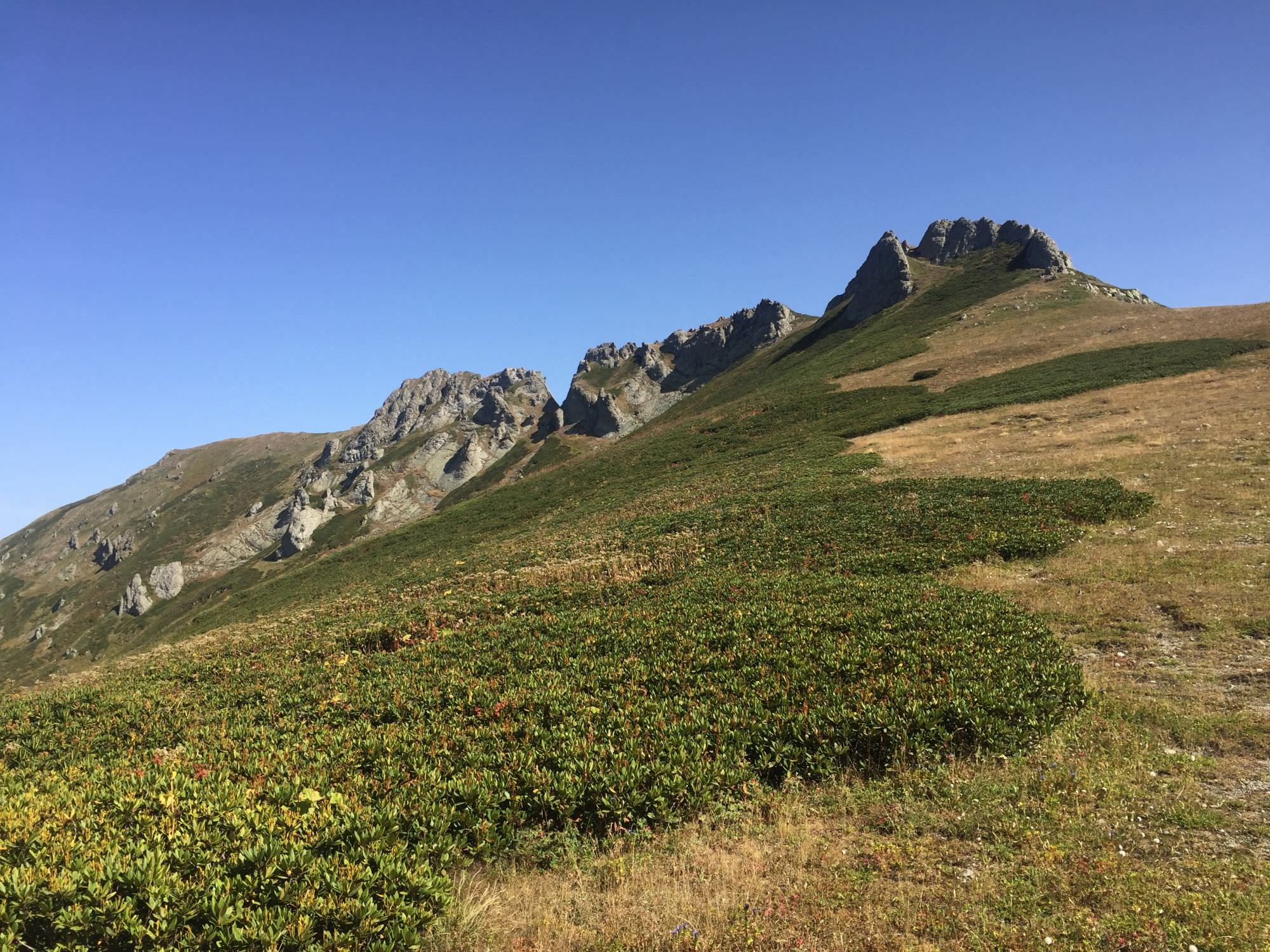
Here, pay high attention to the path: the way which seems easier to walk heads south-west along a nice viewpoint, some castle ruins and a lake, and finally down to the village Tskhemlisi (about 14 kilometre); probably a nice route as well but your way leads westwards through many more rhododendrons. Even through the trail disappears regularly, it is good to follow once on it. Simply look out for opposing Mt. Sarbiela (2.471m) and follow the dominant ridge towards it; once on the other side, slowly hike up along the mountain’s slope. Soon you will find yourself at the “Kintrishi Crossroad” (kilometre 10).
You have two options here: exploring (northwards) or skipping Tbikeli lake (southwards). In case you want to skip it be aware that you have barely any camping options until you are down at the monastery in the Kintrishi valley; so, you might call it an early end of the day here or go all the way.
For the mountain lake be aware that you will come back to the crossroad at the end of the day or latest the next morning (if you camp at the lake) to descend into the Kintrishi valley; it is unfortunately a one-way detour without real alternatives to continue. The first 3,5 kilometres of the path were maintained recently, and the last kilometre should be cleared and reinforced before the 2023-season according to the locals we met while they were working on it – let's hope! Because as of now, it's quite some bushwhacking once you left the open space into the forest. There is always a chance to cut through the woods towards the lake on the last metres (we did this on the way back and it became unpleasant "treewhacking"), but the official paths will first lead you up halfway towards Mt. Nabadziri (2.364m) before you finally head down to the lake.
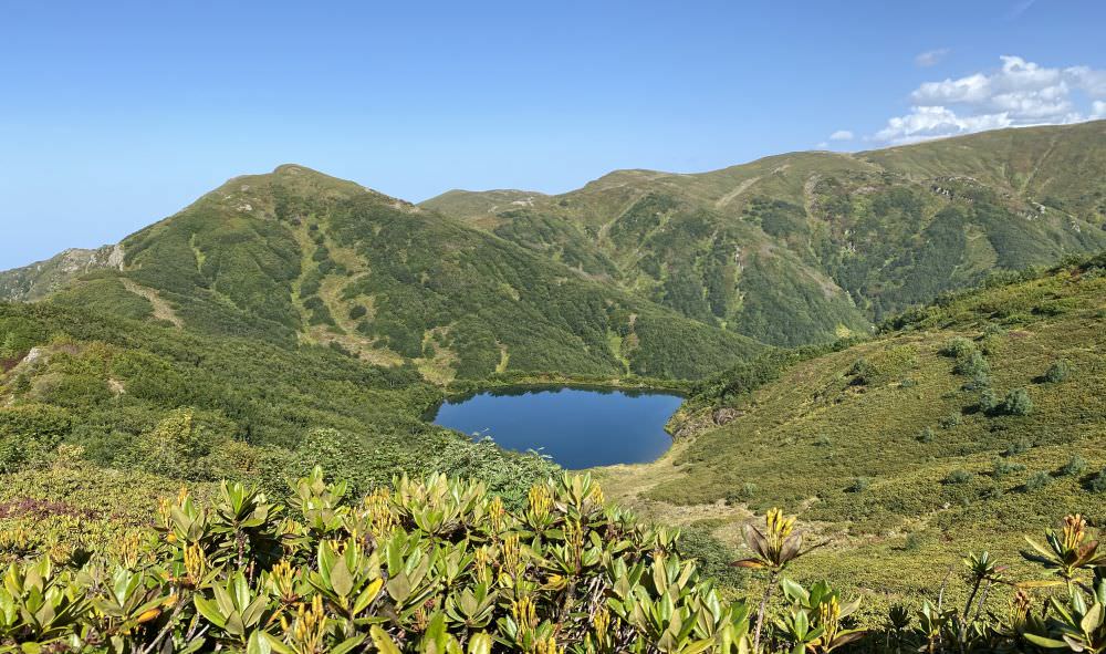
Tbikeli Lake from Mt. Nabadziri
There is enough space and firewood for a cosy camp for a tent or two but remember, that you'll have up to two long days still in front of you until the coast. So, after a nice refreshing dip in the icy lake, you may already return to the crossroad the same day. Note that there is a small path which seems to surround the lake and to offer an alternative back. Anyhow, it’s a "trap" and you’ll end up even more bushwhacking than on the main path. It’s up to you.
The path down (1.600 metres of elevation!) is restored as well, easy to walk and easy to follow. The next seven kilometres will be a constant down without particular highlights and the air will get more and more humid with every metre. About halfway you will pass a small picnic area with water some metre further on the way. Some hundred metres before the Khinotsminda monastery you will cross a small meadow, from where you could also explore the Khino waterfall.
From there, you have to walk another 26 kilometres up and down along the Kintrishi river passing by small hamlets; even though there is no hill to climb you will make hundreds of metres of elevation on this dirt road (nearly 800m up, nearly 2.100m down!). While the hike might be appealing the first hours, it will turn more and more dully due to the never-ending sameness of the road. You will find the ranger station about 17 kilometres from the monastery, some Queen Tamar bridges along the way, and finally leave the national park at the village Chakhati.
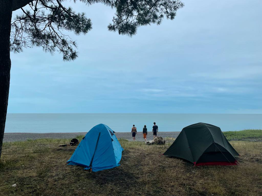
The next marshrutka station is still another four kilometres from there on an asphalted road (not included in the hiking distance). Anyhow, once you reach Kobuleti, stroll along the beach and put up your tent at the seaside in the city’s north, you can relax and realise that all the hassle was worth it. J
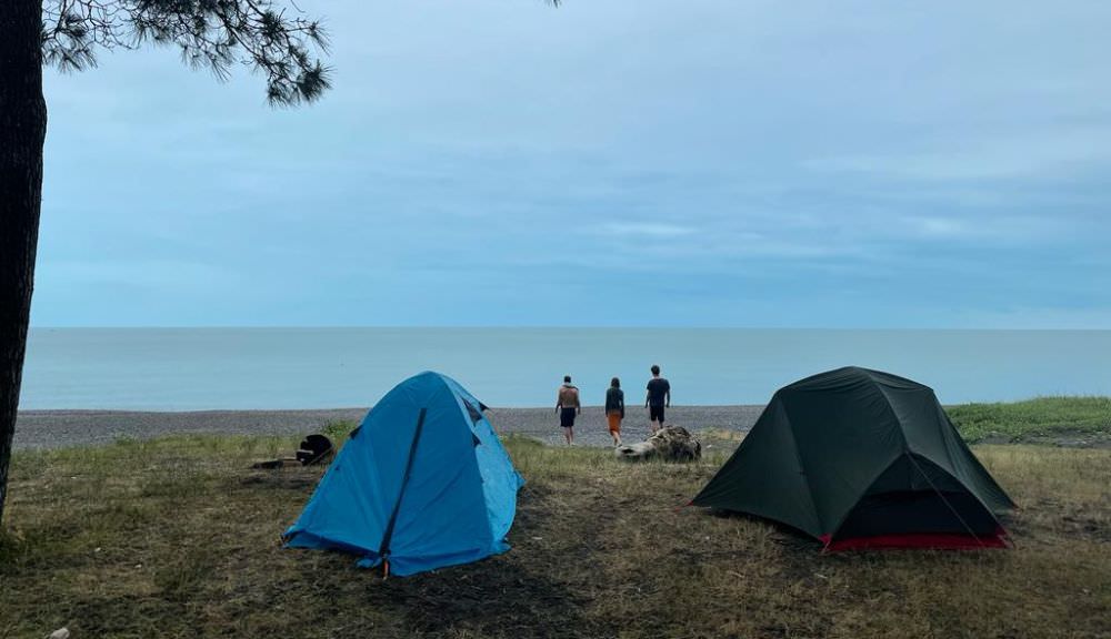
Camping at the Black Sea in Kobuleti
The trail was hiked by Chloé Tremblay and Philipp Bienek, who also provided pictures, gpx and the hike description. Also, one photo was provided by Alex Melanashvili. Thanks a lot!