An epic hike following the once popular route crossing into the Northern Caucasus.
Mazeri has been a popular base for trekking trips since the Soviet times. Many of those hikes are well-known even today - Guli Pass, Baki Pass, Ushba Glacier or Shdughra waterfall. But the most iconic of them all fell into obscurity long ago. It is the crossing of the Becho Pass,
one of the most accessible mountain passes connecting the southern and northern Caucasus. During summer, dozens of hikers crossed each day in both directions. But as the Soviet Union fell, the border was closed and adjacent areas were declared a border zone with restricted access.
Luckily, with some effort, you can experience the highlights of this hike even today. Why it is, obviously, not allowed to cross into Russia, you can still explore the Georgian side of the trail and it's well worth it - Kvish Valley is one of the most captivating areas in Svaneti. Just keep in mind that some extra effort will be needed to arrange the border zone permit.
Also, I would like to note that we didn't hike all the way to the pass, stopped one hour earlier cos it was getting late and the terrain ahead didn't look very inviting. Still, the hike ends at a really nice viewpoint which is a worthwhile destination.
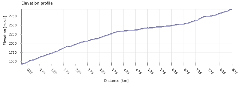
This hike is as hard as you make it to be. If you go for the 3100m viewpoint or even further, the difficulty is certainly High. Alternatively, you can settle for the upper part of the valley and turn back at 2700m, before the steep climb starts - in such case, the difficulty would be Moderate.
Again, this depends on how far you will go. The hike took us more than 10 hours, but we stopped one hour short of the pass and also took a taxi both to and from Hiker's Cafe. If you opt for a shorter variant and turn back before the steep climb at 2700m, you will save almost 3 hours. Either way, leave early.
Another option is to camp in the valley. Due to the lengthy approach to the Kvish valley, this is actually an option I would prefer - if you have a tent, go for it. This would give you a good base to explore not only Becho Pass, but also other places such as Aksu Glacier, Nak Glacier, or Hirblash Plateau.
If you plan just to hike to the end of the valley and turn back at 2700m, the trail should become accessible even in late May. But if you plan to climb to 3100 meters, you should wait till the snow melts because, at times, the terrain is steep and hard to navigate even when there is no snow. Therefore, I wouldn't attempt this route before late June.
There is no public transportation to Mazeri. The closest road served by marshrutkas lies 7 kilometers away, at the mouth of Becho valley.
So, while you can take the morning marshrutka from Zugdidi to Svaneti and tell a driver to drop you at Becho community, it's not too convenient. A preferable transport, apart from walking, is the taxi, most easily arranged at Mestia. The ride will costs you some 80-100 GEL. If you want to take a taxi to Mazeri from Zugdidi, it will easily cost 300 GEL.
There are also are two nice day walks connecting Mazeri with neighboring villages - Mestia and Etseri.
Hiking in the Upper Dolra valley
There is no public transport to Mazeri. The closest road served by marshrutkas lies 7 kilometers away, at the mouth of Becho valley. Therefore, you may have to hire a taxi, either to the main road or even to Mestia, if you want to catch marshrutka. The price of the ride to Mestia starts at 80 GEL (but can be also much higher, depending on the driver, situation and the level of your desperation).
There are also are two nice day walks connecting Mazeri with neighboring villages - Mestia and Etseri.
To enter the upper Dolra Valley, you need to arrange a trekking permit in advance. In Svaneti, this can be done at two places. The first of those is Mestia - the border office is situated right behind the airport. The other place is the border office at Ushkhvanari - this one is situated at the northern side of the village, across the main street from the football stadium.
The whole process is straightforward - you present your ID, answer some basic questions and get your permit for the designed dates (can stay there more than one night). Permit costs you nothing beyond your time - prepare at least 20 minutes.
Also, like with every other, it should be possible to arrange this particular one in Tbilisi, at the main base of Georgian Border Police situated at Simon Kandelaki Street 12, but we haven´t tried it.
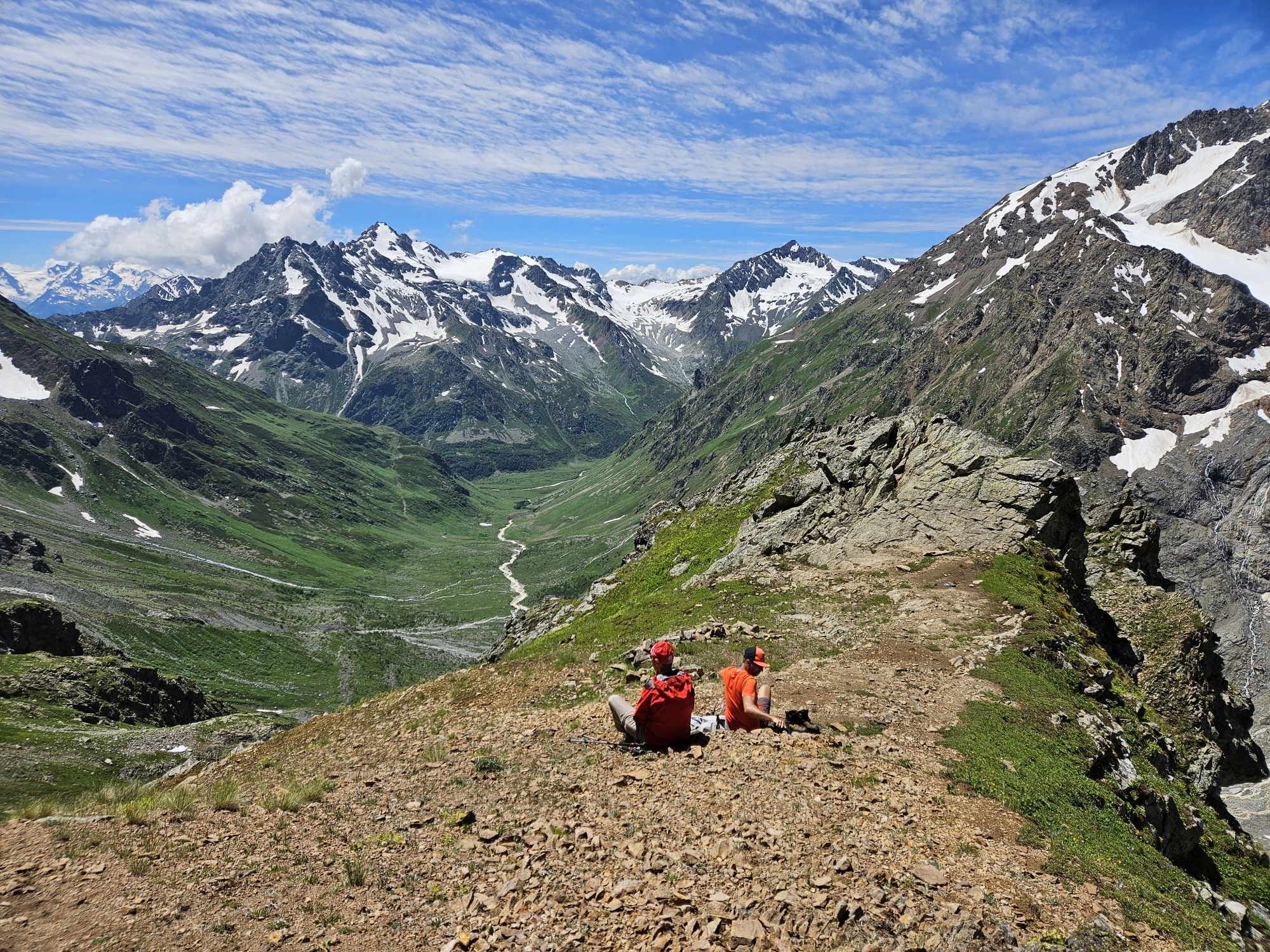
View from the final plateau at the altitude of 3100m
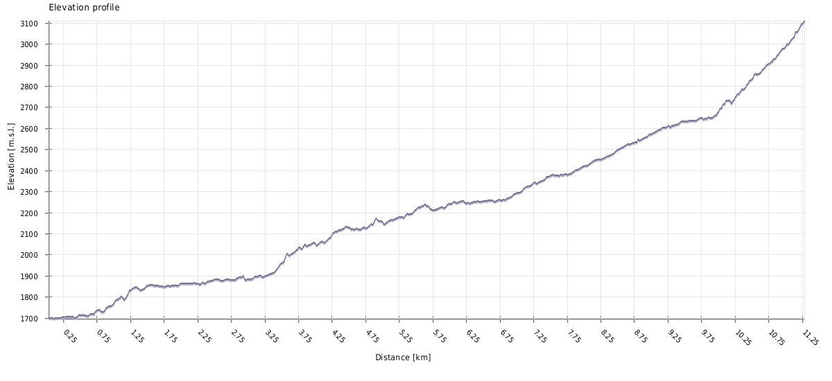
| Distance | 16 km |
| Trail type: | Roundtrip |
| Max. elevation: | 3109m |
| Min. elevation: | 1696m |
| Total climb: | 1929m |
| Total descent: | 1929m |
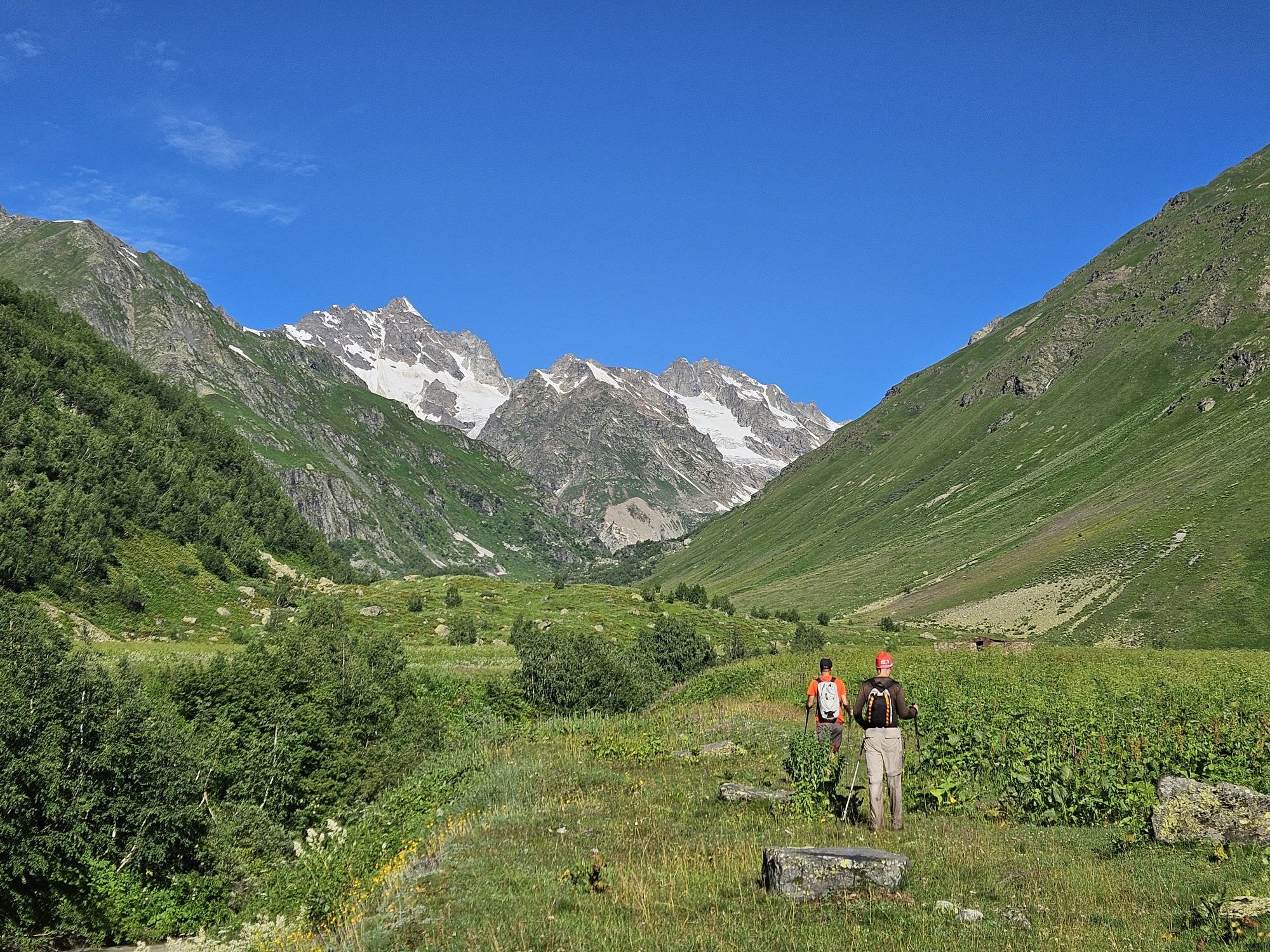
The trail starts at the bridge over Dolra, right by the Hiker's Cafe. You could walk here from Mazeri in like 40 minutes, but better conserve your strength and take a taxi - this will be a long walk. Your guesthouse should be able to assist with this - together with an afternoon pickup, this could cost about 60-80 GEL.
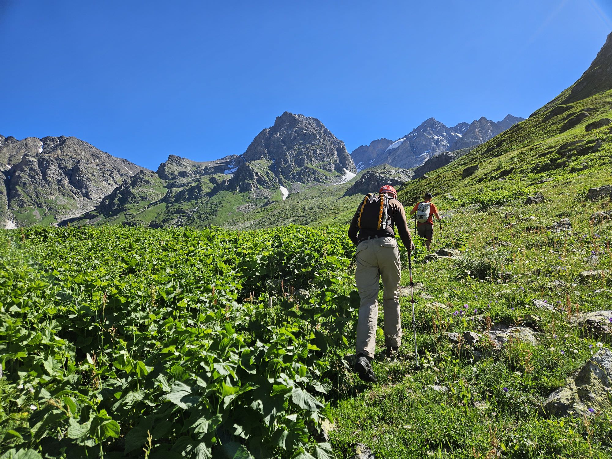
Cross the bridge and pass by the Hiker's cafe, which has grown considerably over the past years and now offers accommodation, sauna, and other services. From here, follow the trail to the north through a nice pine forest. It's a wide, busy, well-trodden track, used daily by dozens of hikers to approach Shdughra waterfall and Ushba glacier. Most of the time, it climbs smoothly, but there are also some steeper sections. You will also pass one tourist shelter - it was locked during our visit, but the adjacent gazebo could be used to hide from rain.
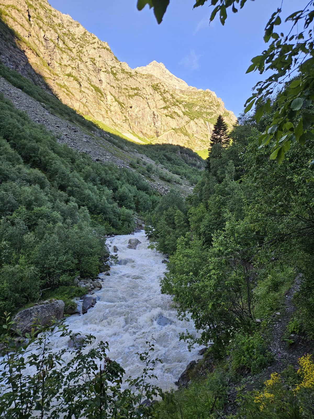
In less than an hour, the trail flattens and descends to the bridge over the Dolra river. Cross to the other side, to a place called Letsper, where you shall find a border guards camp. Present your permit.
Unlike everyone else, who heads towards the waterfall, you should cross a small wooden gate on the south-western edge of the camp and join the narrow trail that follows the river. At times, it traverses hillside uncomfortably close to the roaring river, so watch your step. Then, the trail delves a bit deeper into the forest, climbing slowly, but steadily.
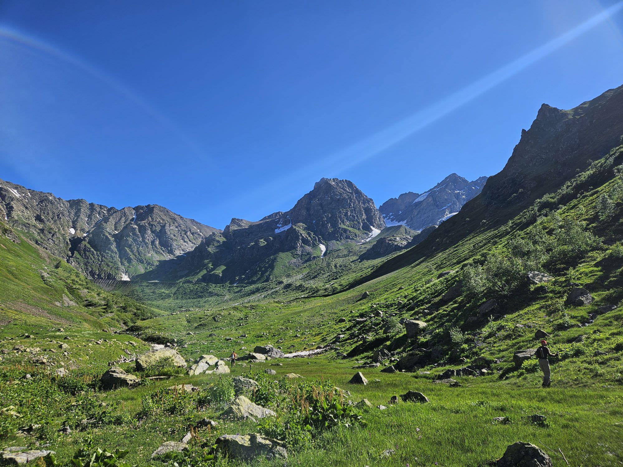
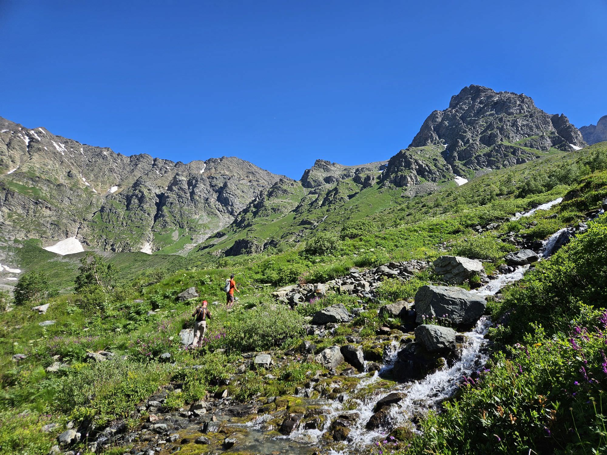
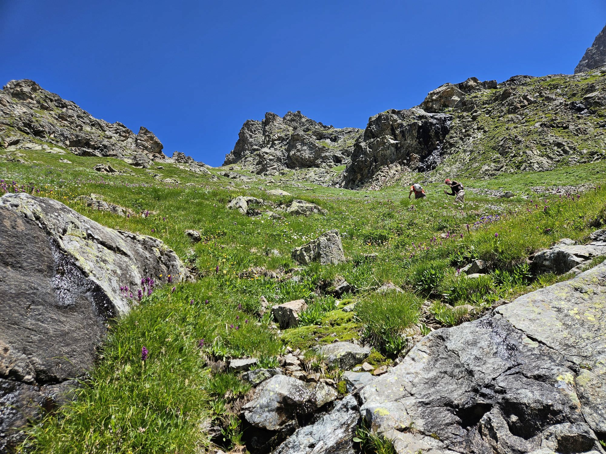
Some 30 minutes later, you shall emerge onto overgrown meadows but, luckily, the trail is still there, running in parallel with the river. Not much later, you shall see ruins of a small building ahead - during Soviet times, these served as a milk farm employing many people from the valley. These ruins sit at a rather large plateau, close to the confluence of Dolra and Kvish rivers. If you plan to spend several days in a valley, this is a good place to camp, giving you good access to several directions.
Views from the ruined farm into Kvish valley
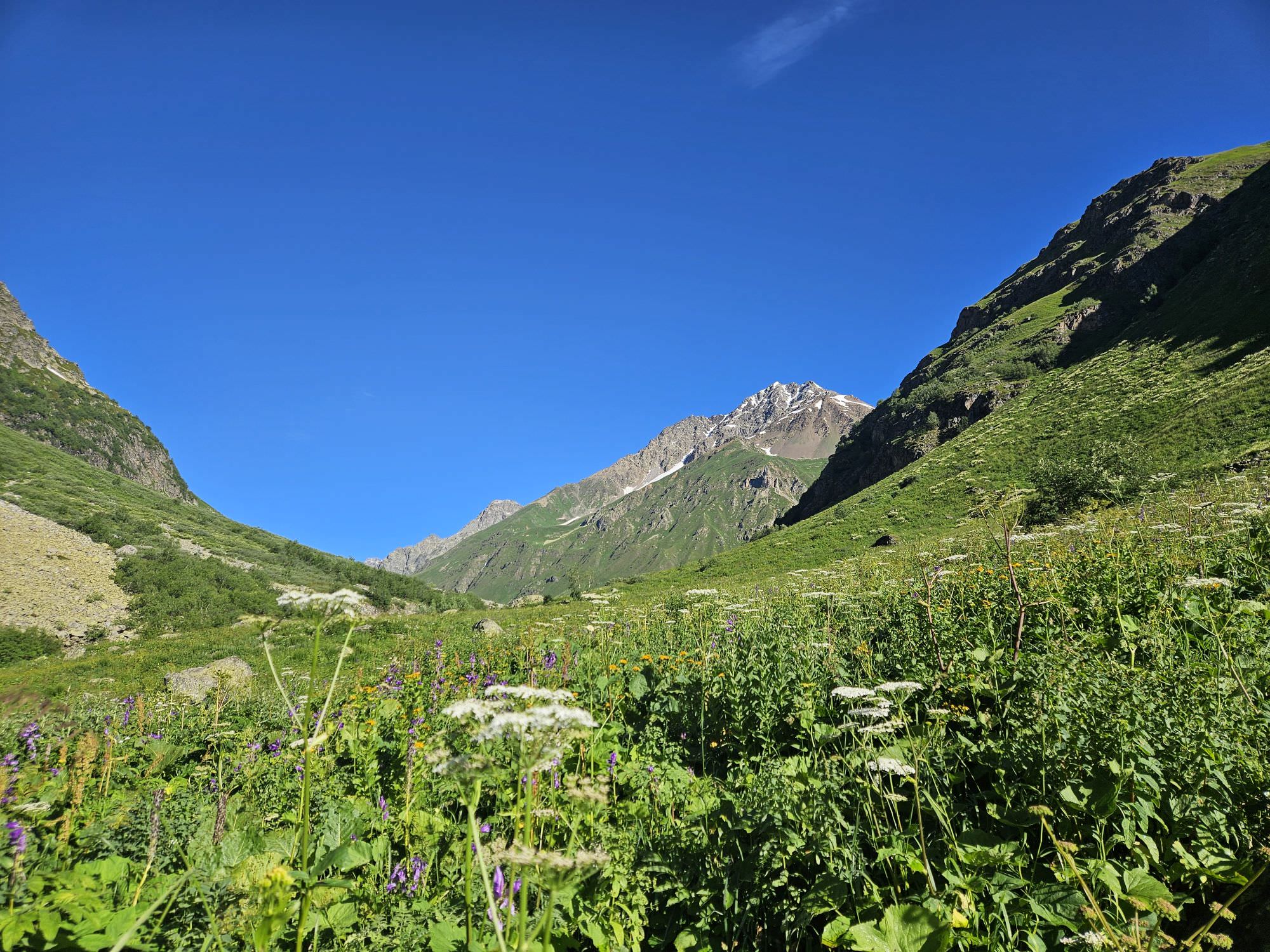
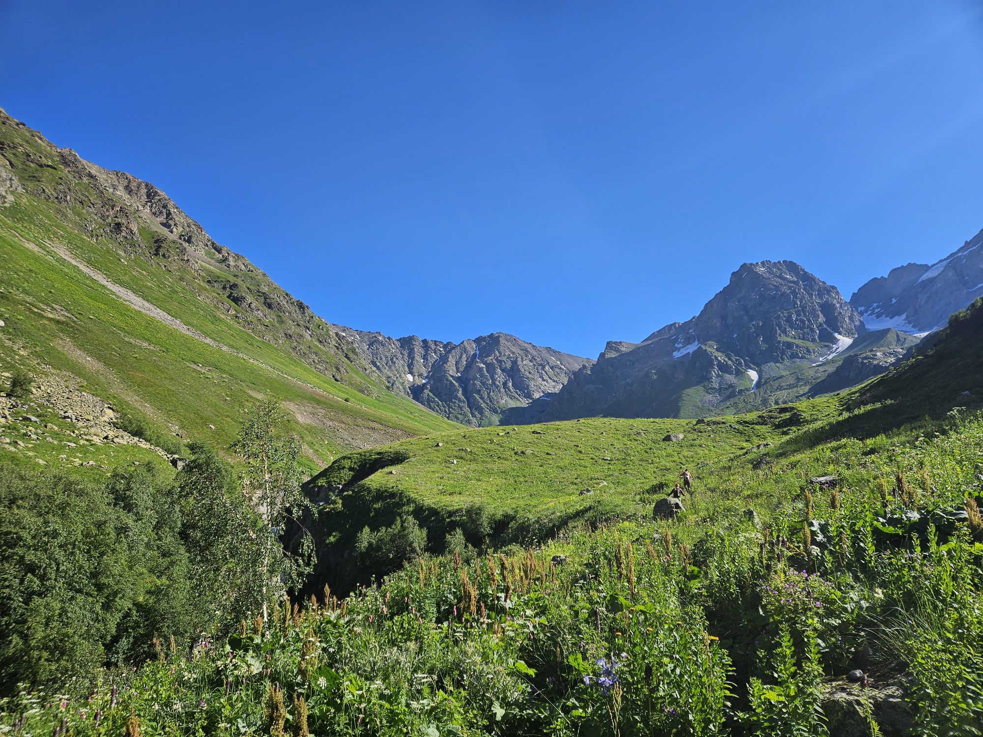
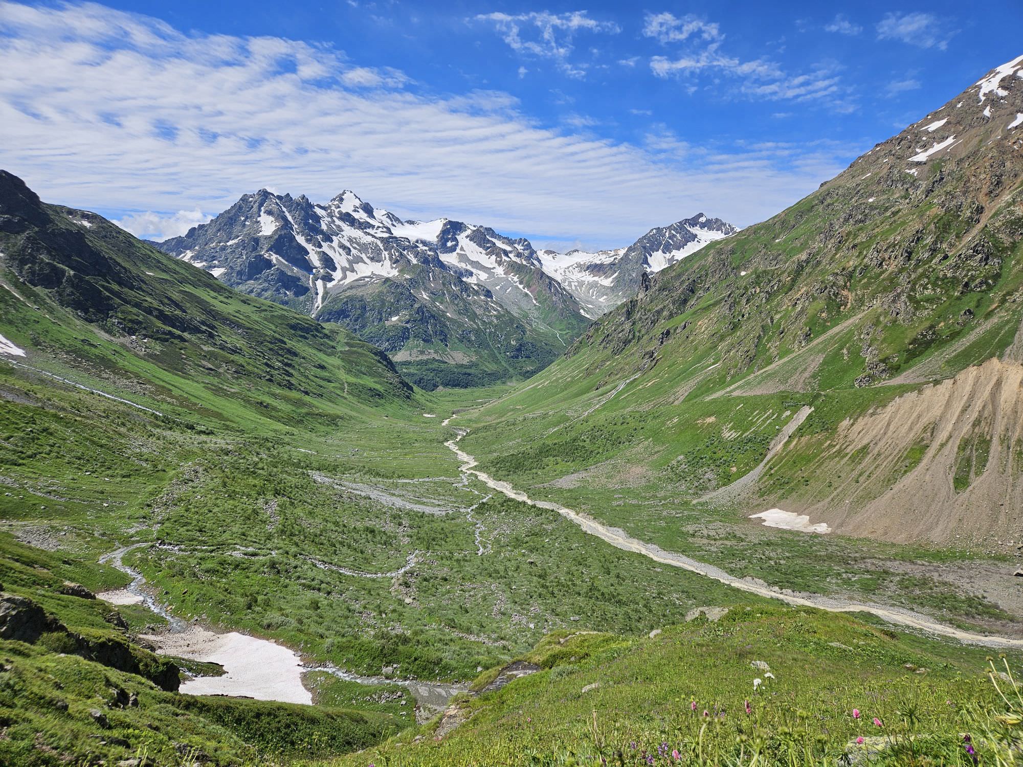
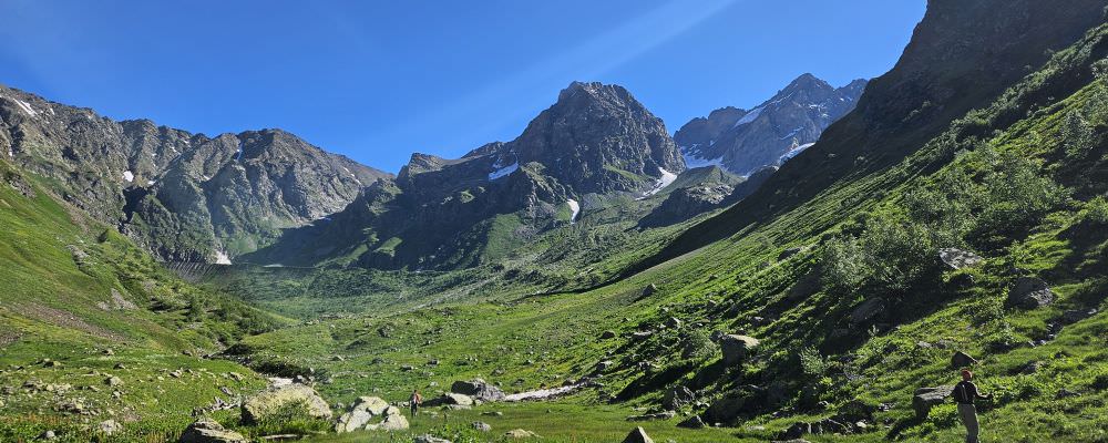
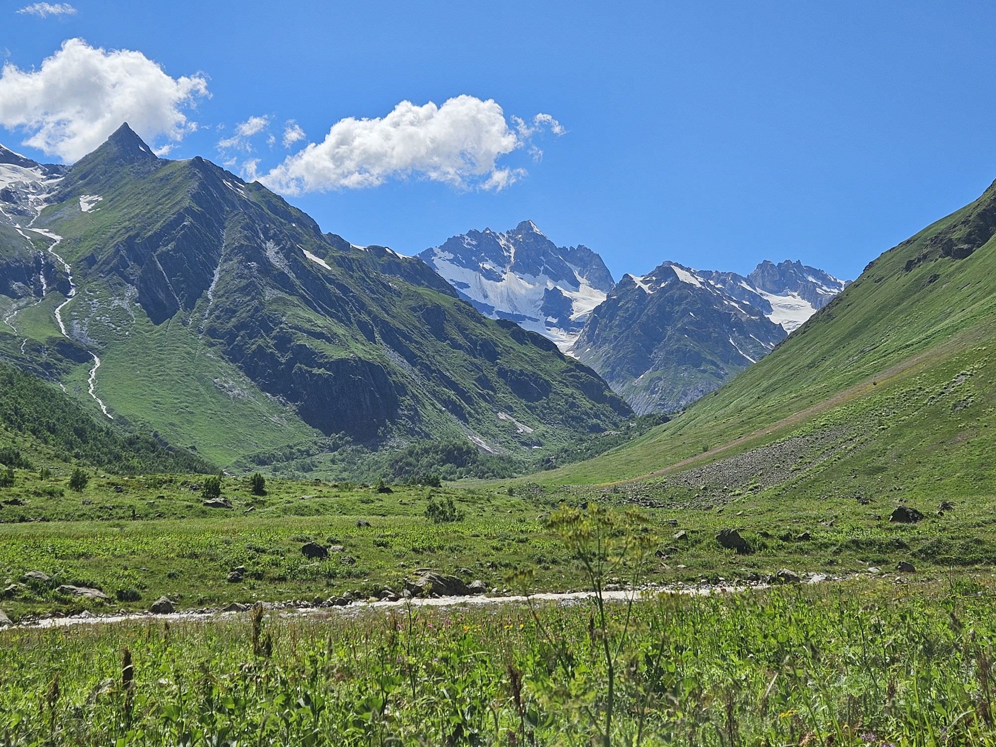
Views into the Kvish valley are terrific, but we don't go there today. Instead, we follow the Dolra river, which means that we will venture into the unassuming valley on the right, in the northern direction. A decent trail will take us through a narrow mouth of the valley and climb to the small elevation, from which, you will be finally able to admire the impressive scenery of Upper Dolra.
You will find yourself at the edge of some wetlands. Bypass them through the rocky terrain to the left and process through the meadows, still going in parallel with the river. The trail becomes harder to follow - the result of decades of neglect. You will reach the ruins of a stone hut, once used by mountaineers. Pay attention here - the trail here splits a little BEFORE the hut and passes it from the right, do not get fooled by a more prominent footpath going left and down to the river. From here, it slowly climbs while traversing the overgrown hillside. This trail is not always easy to follow, but once you are on it, it´s somewhat comfortable.
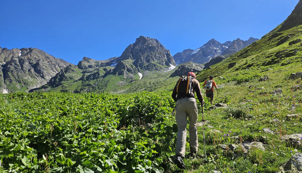
Hiking in the Dolra valley
The next obstacle you will face is a couple of creeks. Particularly the first one is rather wide, we had to take off our shoes and ford it. The second one is shallower and we were able to cross by jumping from stone to stone.
Afterwards, the terrain becomes bit more rocky and goes through a hillside sparsely covered by bushes and young trees. The trail is well-preserved and there are also some stone pyramids that help with the navigation.
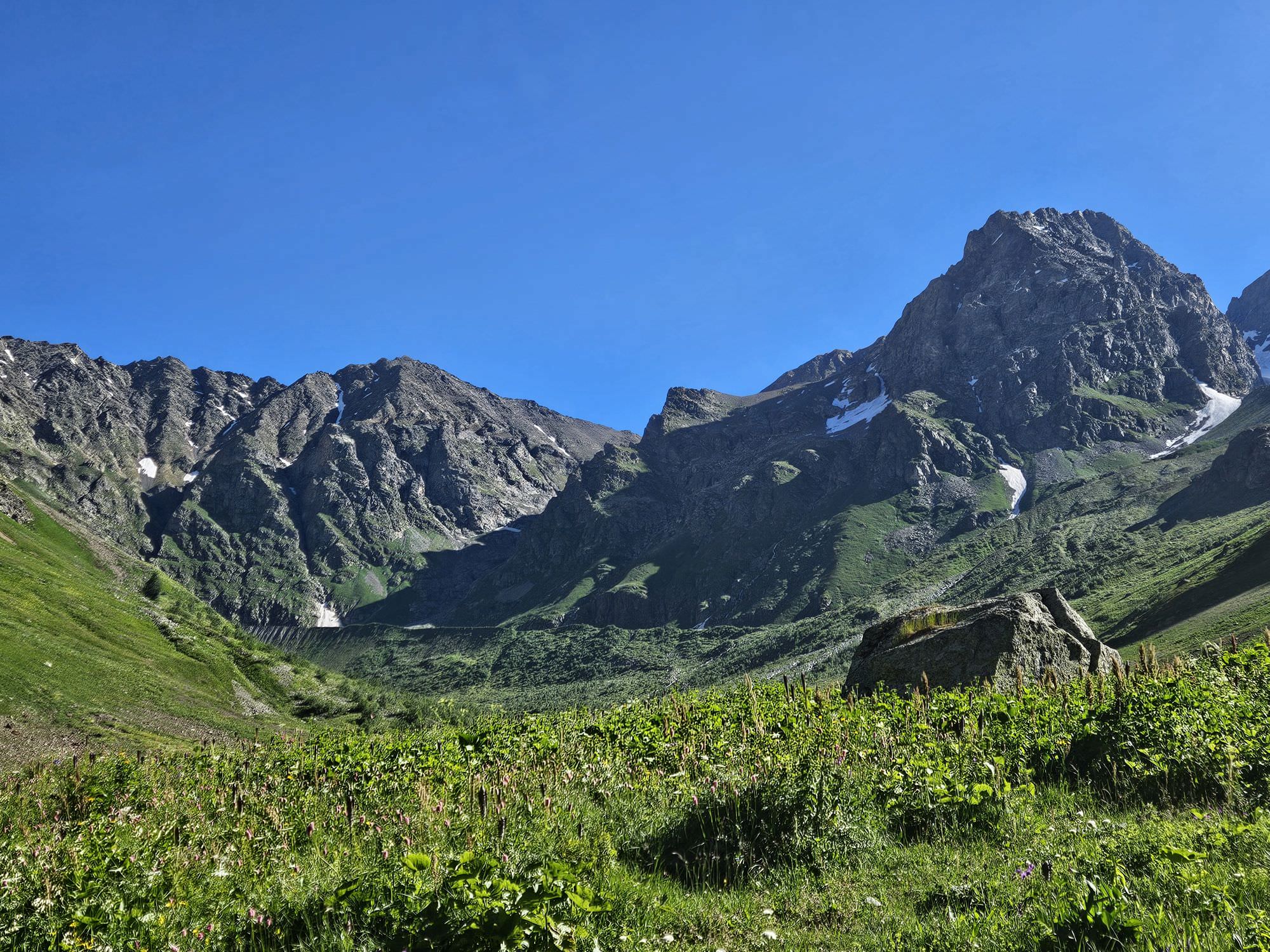
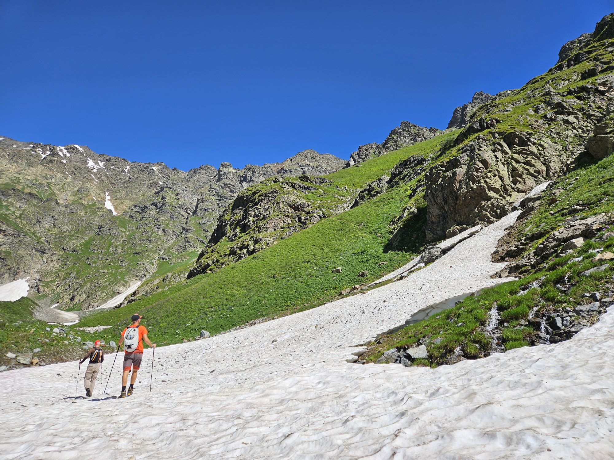
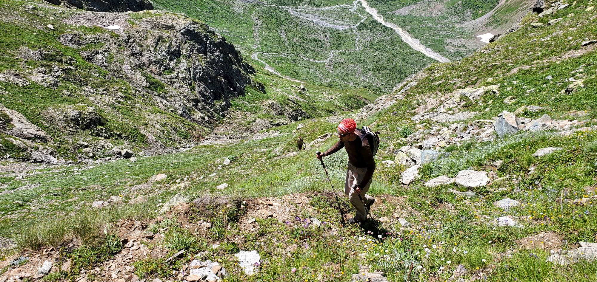
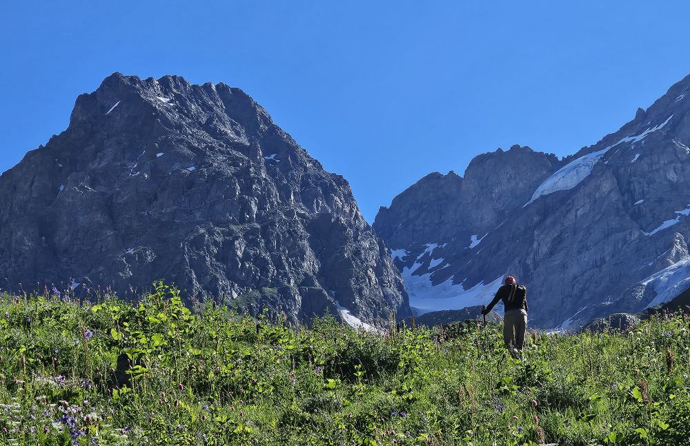
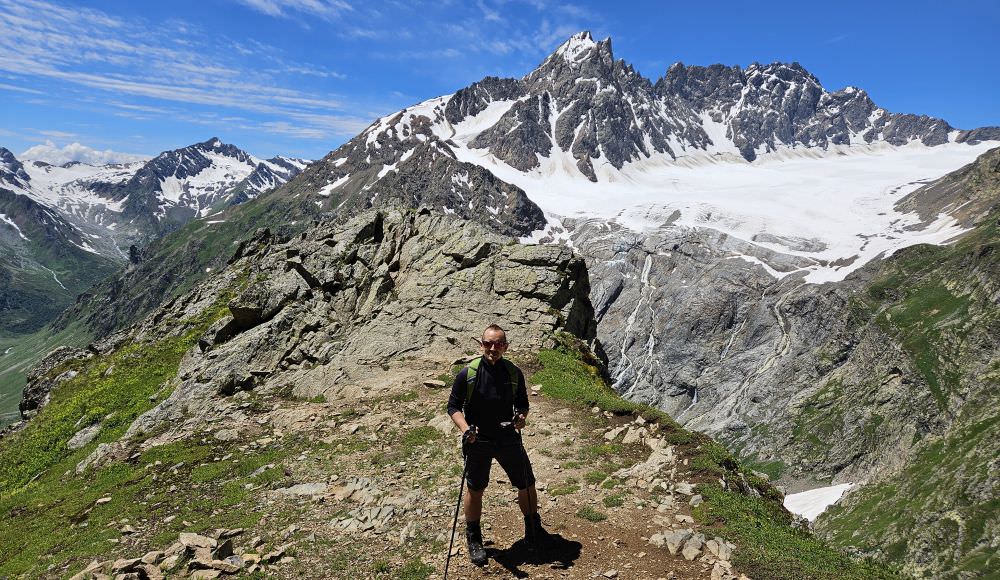
Soon, you will reach an old campsite. There is a space for one tent, protected by stones and a large pile pile of ancient, rusty cans nearby (marked in gpx log as "Tetanus campsite"). Behind the campsite, the trail joins one of the nameless subsidiaries of Dolra. Some 200 meters later, you will reach the flat upper part of the valley, you can also see some small lake ahead - a beautiful serene place beneath the Dolra glacier. If you want to go for an easier variant of the trek, this is the place where I would turn back.

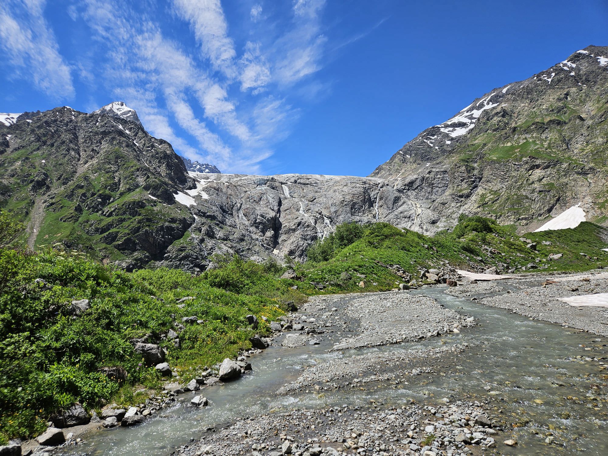
Beneath the Dolra glacier
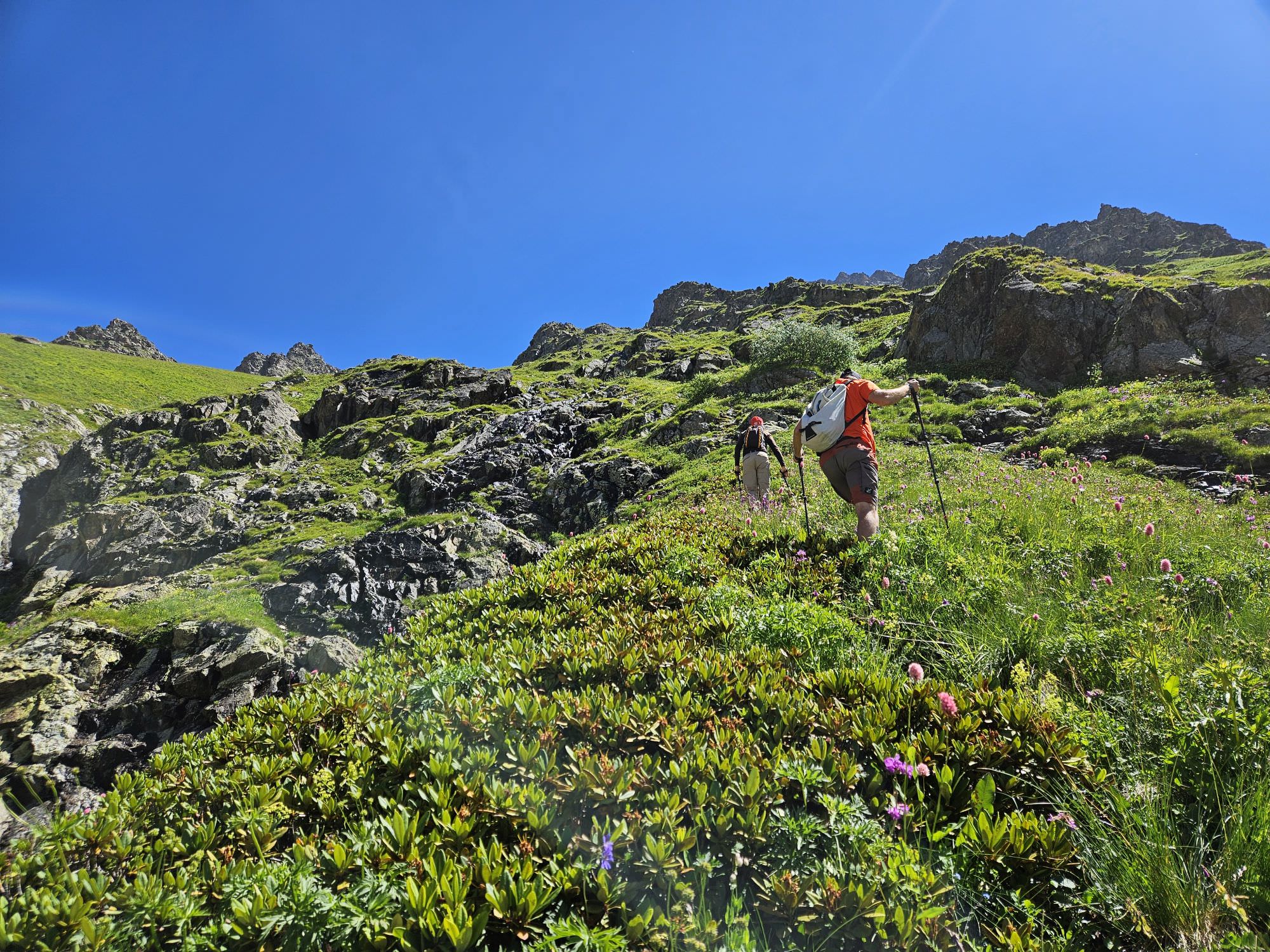
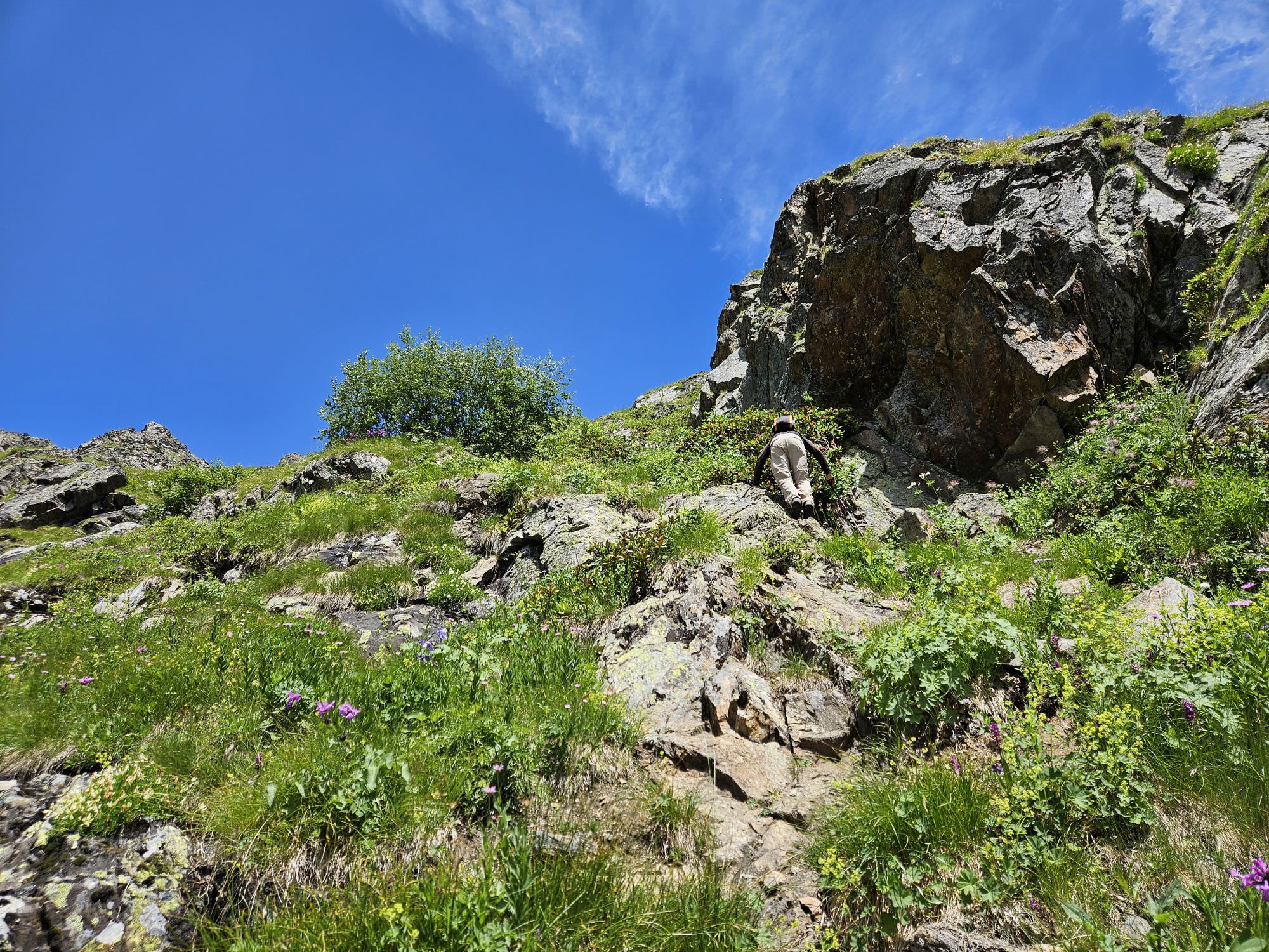
But if you want to push on: to the right, you shall see an overgrown slope - the only spot among rocky ledges that looks remotely climbable. So climb it. Begin on the right, then cross to the very left, where the rhododendron fields start. Here, you might find the remains an old trail. Keep climbing towards a solitary young tree at the very top. Once you approach it, the trail crosses to the other side again and passes the tree from the right, through a steep, narrow space between the tree and a rocky wall.
Above the tree, you need to turn left and traverse to another grassy slope you see to the northwest. Easier said than done - not much was left here of the original trail and the terrain is steep and overgrown. Be careful! Fight your way to the creek separating two slopes, then climb to the other side.
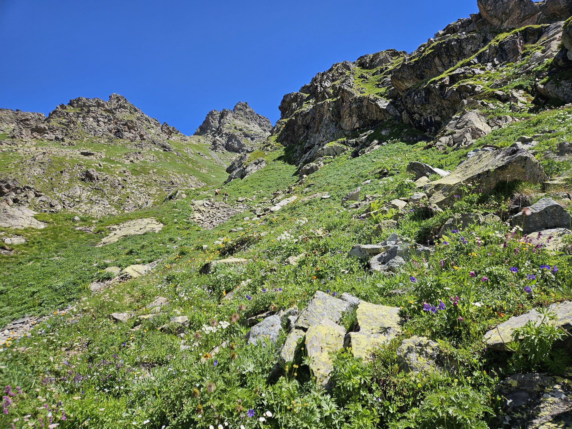
Progress here becomes easier cos the grass is lower and the old trail is easier to spot. Zig-zag up on this steep, grassy hillside some 150 altitude meters, till you reach a rocky wall. Here, turn left and climb another bit, till you reach a creek.
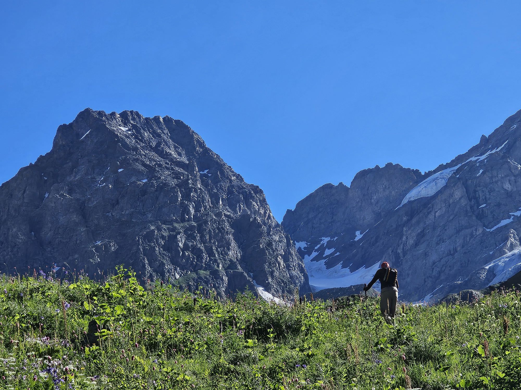
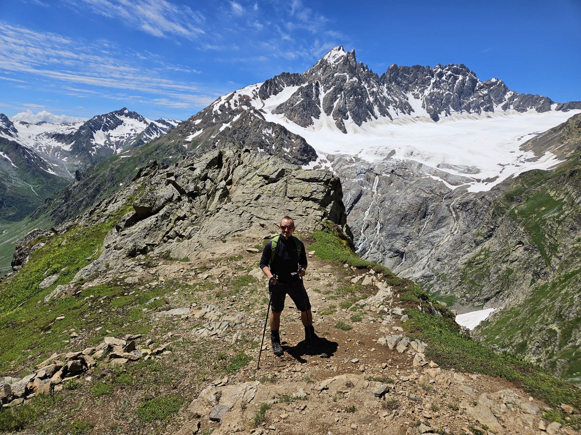
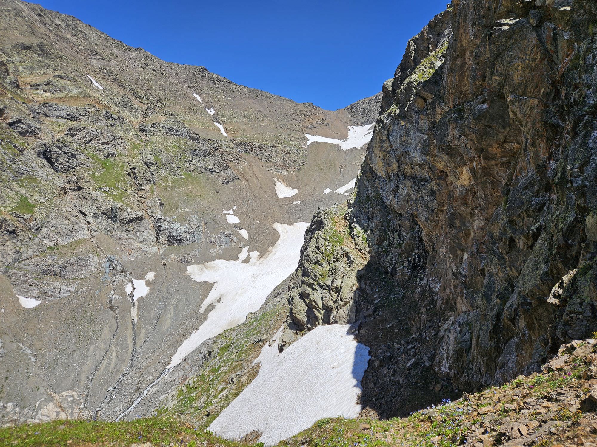
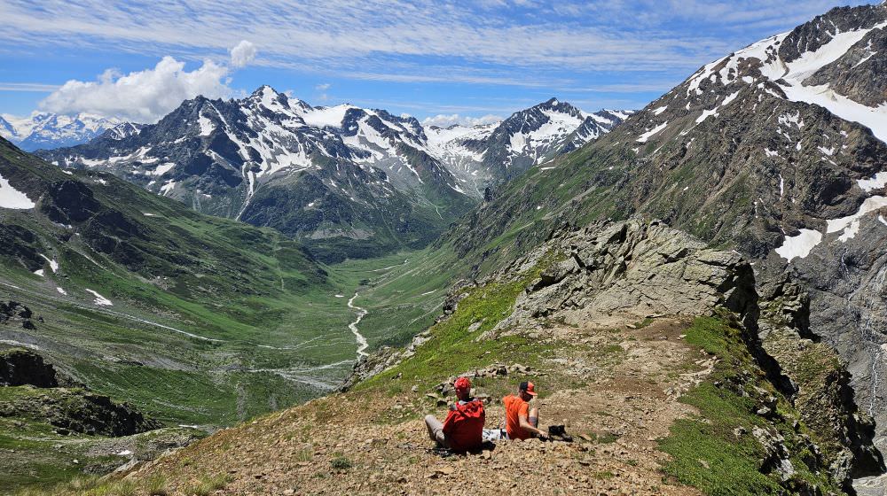
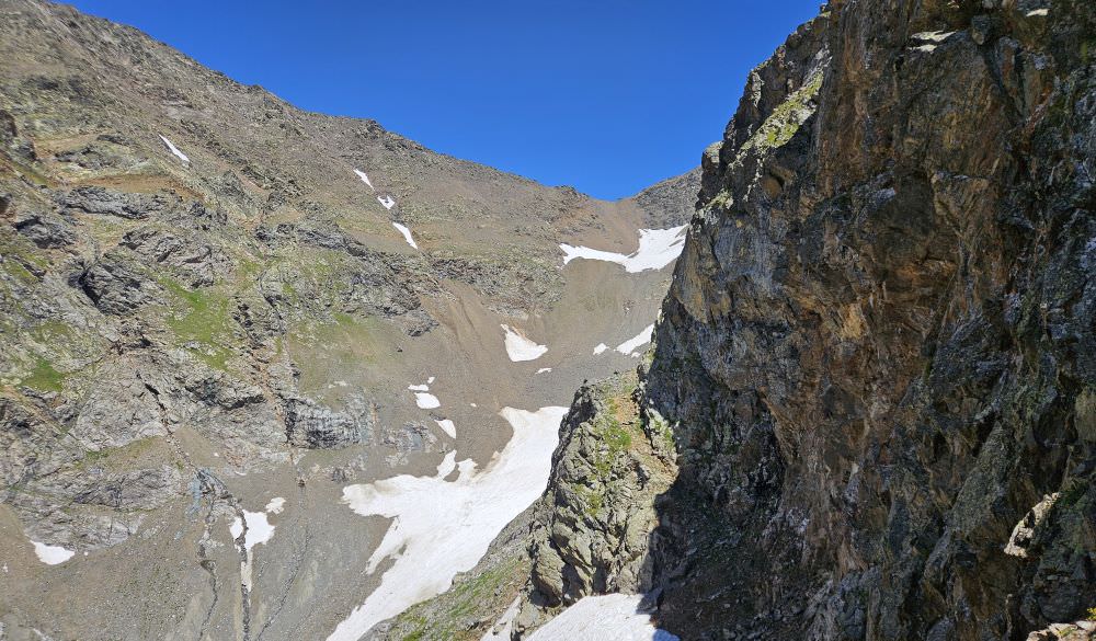
From here, you shall already see our final destination - a small pass some 200 meters above, situated between two rocks to the north. The climb is smooth, cos the trail is well-preserved here and in some 30 minutes, you should reach a small plateau at the altitude of 3100m.
This is where we turned back due to time constraints (next time, we will camp in the valley so we will be able to explore it more comfortably). The plateau is a great place for a break, offering great views in three directions - impressive Dolra glacier to the west, Cherinda to the south and main ridge to the north, with the famous Becho pass visible as well 200 meters higher. There is even a small, somewhat protected spot for a single tent.
Views of Mt. Dolra and Dolra Glacier
For now, we have to end our guide on the 3100m plateau, so return the same way - it is a long way home. There is no shame in calling the taxi pickup to the Hiker's cafe, the signal will appear somewhere halfway from Letsperi border guards camp. Or, if you think you still can and haven't seen it yet, it's worth it to make a detour from Letsperi to the Shdughra waterfall - a hiker even thinking about this after almost climbing to the Becho pass should need not much more than 30 minutes to get there and back.
The elusive Becho pass ahead