A beautiful but very demanding day hike offering superb views of (not only) Ushba mountain. The highest point of the hike is 2961m high Guli pass.
People usually do this hike in a day, but it is also possible to split it into two sections if you have camping gear (so you can do also numerous scenic detours mentioned below). The most popular place for this are Koruldi lakes above Mestia - they don´t lie directly on the trail, but offer great morning views of the surrounding mountains. Another quite popular spot is a bit south of the Guli pass.
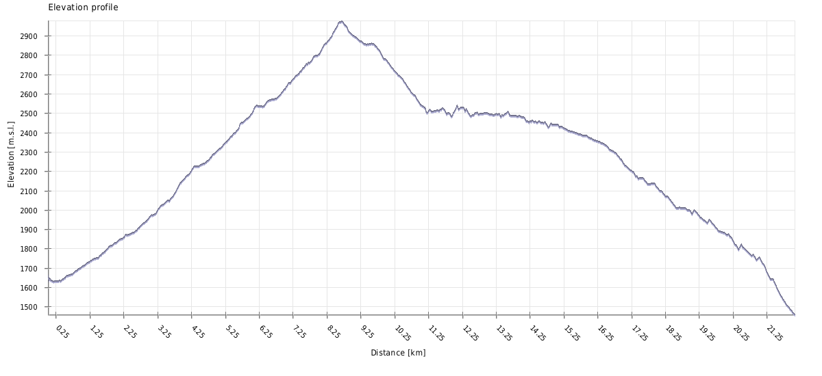
During the day, you will have to overcome considerable distance and elevation (distance 24km, 1400/1600 vertical meters up and down). If you want to do it in a day, start early!
This one is tricky. There is no specific date when Guli pass suddenly becomes "open" and "accessible" as the situation differs every year. It also depends on the hikers - one group may be able to cross in the middle of June while the other will struggle even a few weeks later.
But overall, the best period for this hike is from the beginning of July until the end of September. The trail is usually passable from mid-June (or even earlier), but at this period it could be difficult because of the leftover snow.
If you are lucky with the weather, you can have a nice hike even in first weeks of October. Later usually come first severe snowfalls which block the pass till the next season.
Looking for a place to stay in Mestia after the trek?
These are my favorite guesthouses
Doesn´t matter that much, though starting in Mazeri is a bit easier since this village lies 200 meters higher than Mestia. This direction is often used by people who do longer village-to-village treks. Another popular option is a day hike with a base in Mestia - in this case, people hike in the opposite direction and at the end of the day, they take the arranged taxi back to Mestia (the price starts at 50 GEL).
There is no public transportation to Mazeri. The closest road served by marshrutkas lies 7 kilometers away, at the mouth of Becho valley.
So, while you can take the morning marshrutka from Zugdidi to Svaneti and tell a driver to drop you at Becho community, it's not too convenient. A preferable transport, apart from walking, is the taxi, most easily arranged at Mestia. The ride will costs you some 80-100 GEL. If you want to take a taxi to Mazeri from Zugdidi, it will easily cost 300 GEL.
There are also are two nice day walks connecting Mazeri with neighboring villages - Mestia and Etseri.
The first marshrutkas to Zugdidi, Batumi and Tbilisi depart early in morning, around 7 am. every day in the morning at (these should be booked one day in advance). There are more during the day, depending on the demand. There should be also some marshrutkas departing in the afternoon to Zugdidi, just in time to catch the evening train to Tbilisi which departs at 17:25. However, since marshrutka schedules are not 100% fixed, better visit station in advance to confirm this and book tickets.
For exact timetables and booking of the tickets, visit the travel offices at the station. Just keep in mind that there are several offices and don't buy tickets too far in advance. We met tourists who entered the first office, bought there tickets for the next bus which departed in 2 hours and then had to wait even though there were several other marshrutkas (operated by another offices). If you can't find a suitable tickets and are not under a time pressure, I recommend just to grab a beer at the bar by the station, sit on the terrace and check the situation once in a while - sooner or later, some driver driver will show up.
If you prefer to have everything pre-planned, you might book a taxi in advance, especiallly if you are not travelling alone. The cost of prebookeded private transfer from Mestia to Tbilisi starts at 550 GEL. Of course, you might get an even better price if haggling with local drivers, it all depends on who you stumble upon. Svan drivers are often quite reckless - if you don't like the driving style of your driver, don't be shy and say so.
| Distance | 23,1 km |
| Trail type: | AB trip |
| Max. elevation: | 2978m |
| Min. elevation: | 1406m |
| Total climb: | 1424m |
| Total descent: | 1693m |
The hike starts at the tourist pointer lying south of Mazeri village and is marked by white/red rectangles. The trail first heads southeast, to the Bagvdanari village where it turns east and enters Gulichala valley.
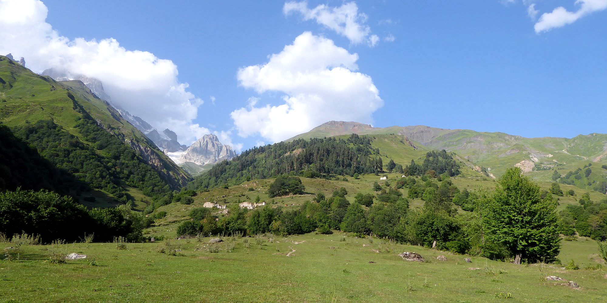
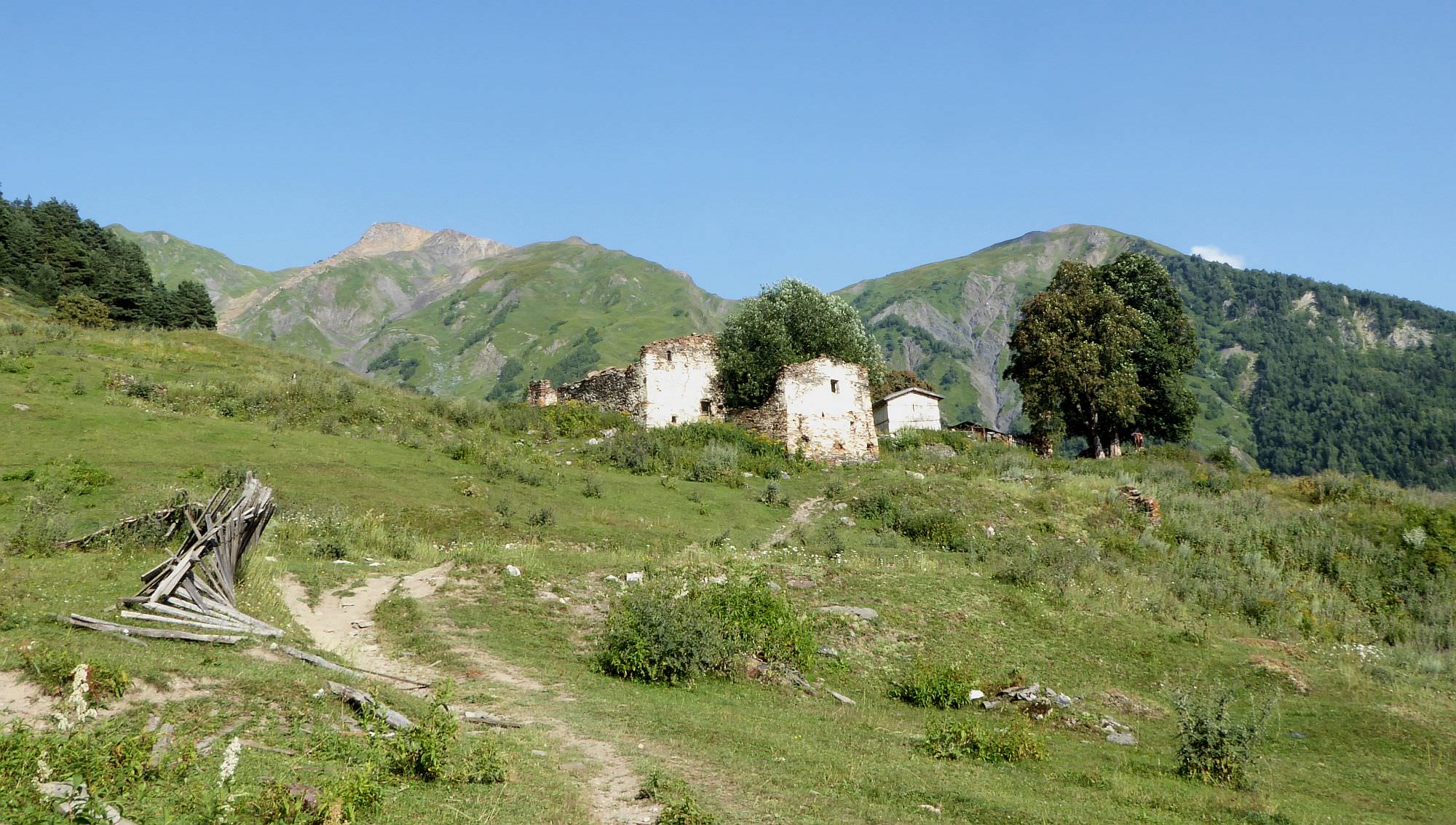
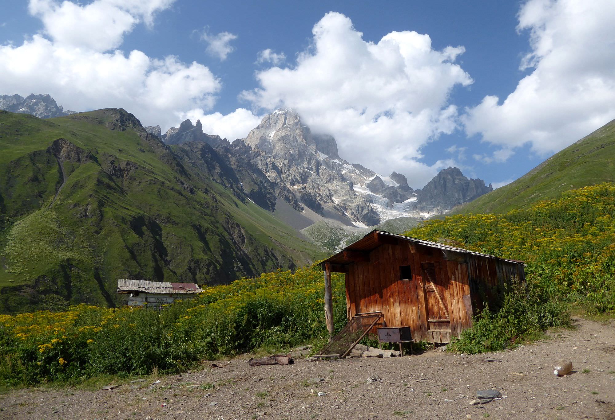
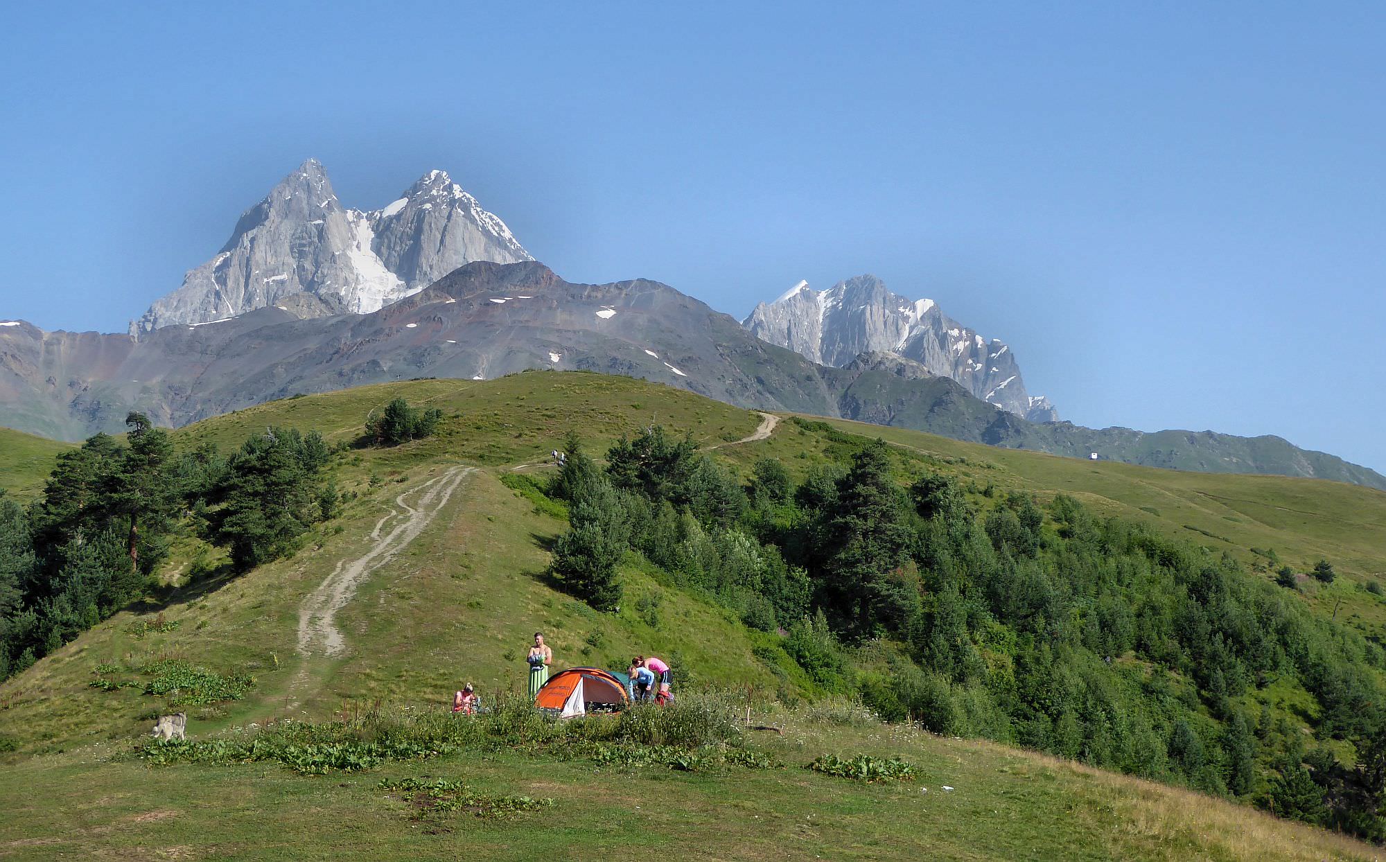
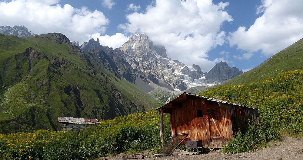
After a while, you will reach the bridge (don´t cross it). Here, the road turns into a rocky chute and climbs a bit until you find yourself on some kind of an elevation separating two riverbeds. This ridge soon turns into a large pasture from which you can see ruins of Gul village ahead (and if you look well enough, even the white pointer at the Guli pass far above). Follow the track towards the ruins. First, you will pass some completely destroyed houses, then some better-preserved church. There are several spots suitable for camping, but if you decide to put your camp in the village, expect someone who might come and collect money from you.
Also, in 2024, a small cafe-bar got opened by the trail, not far before the church. It's very handy especially for tired hikers coming from the opposite direction but if you are aiming for the pass, you might be able to rent a horse here which would help you with the baggage.
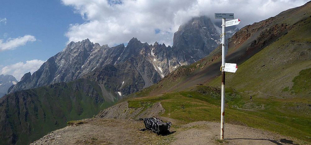
With a horse or without, keep climbing and one hour later, you will reach shepherd huts (well-known from numerous photos). If you need water, look for the white "2500" sign and arrow showing forward, towards a narrow path in the vegetation. After some 100m, you will find a small spring - keep in mind this is the last water source before the pass.
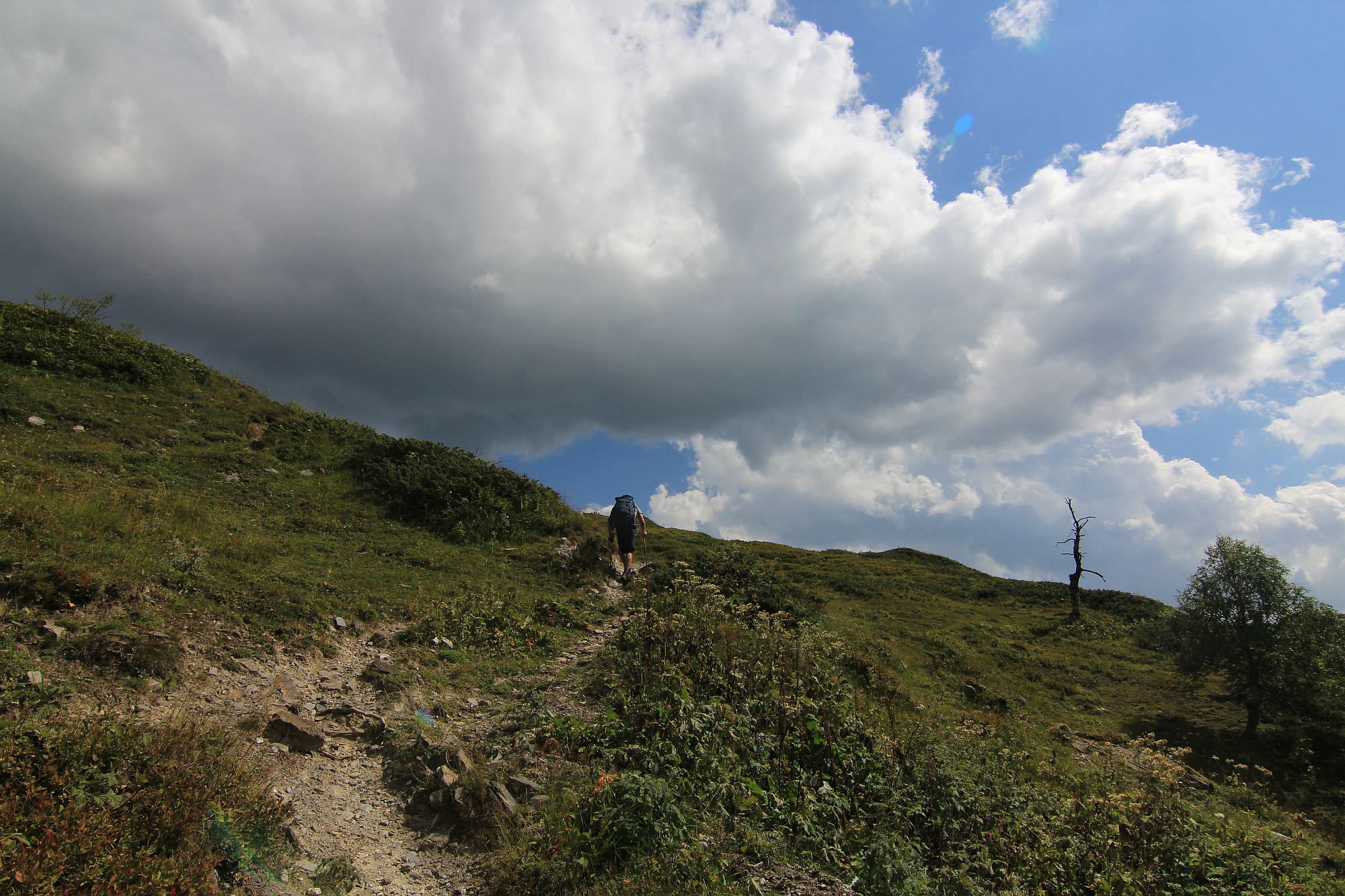
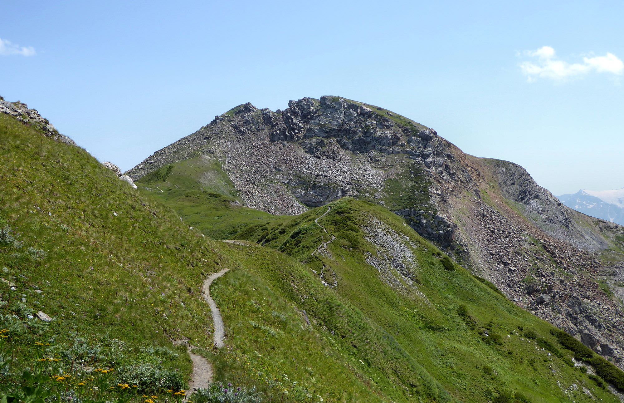
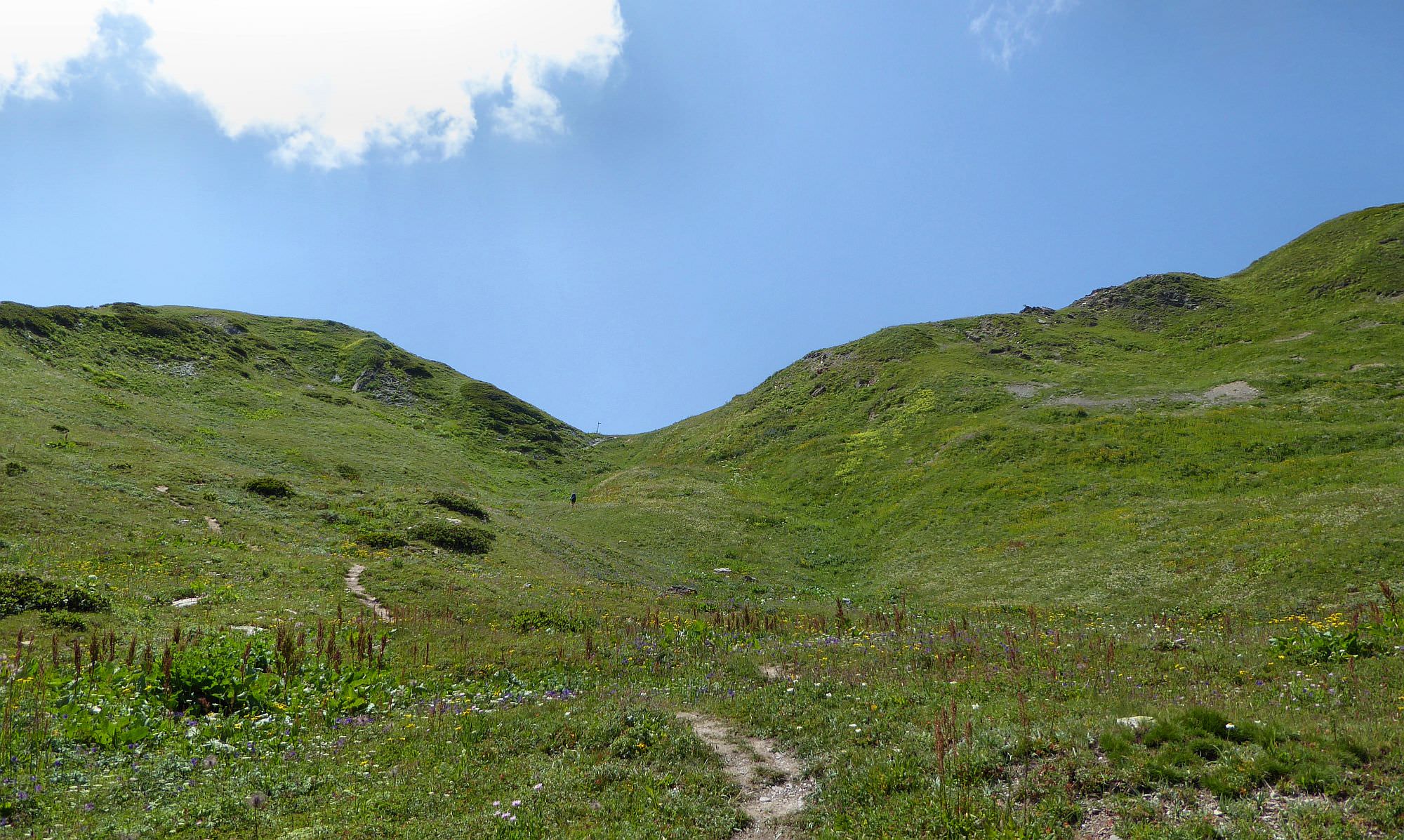
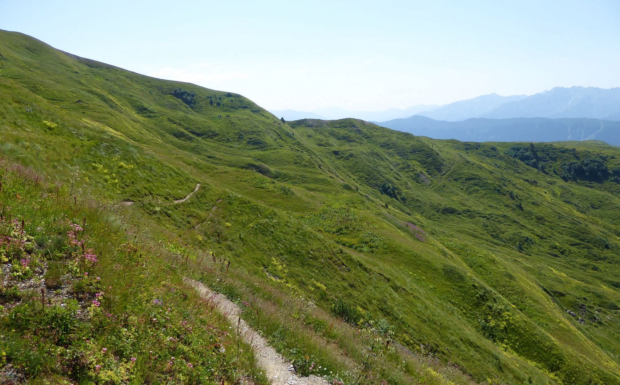
Now it's the time to climb to the actual pass. The path is basically the endless serpentine climbing to the small depression above. It´s marked, but that doesn´t mean you can´t lose direction - mainly because the slope is crossed by numerous cowpaths. And since cows prefer horizontal paths, if you focus too much on "following a trail", you may end up doing huge zig-zags while gaining only a little altitude. Still, you won´t get lost since you will see the pass all the time.
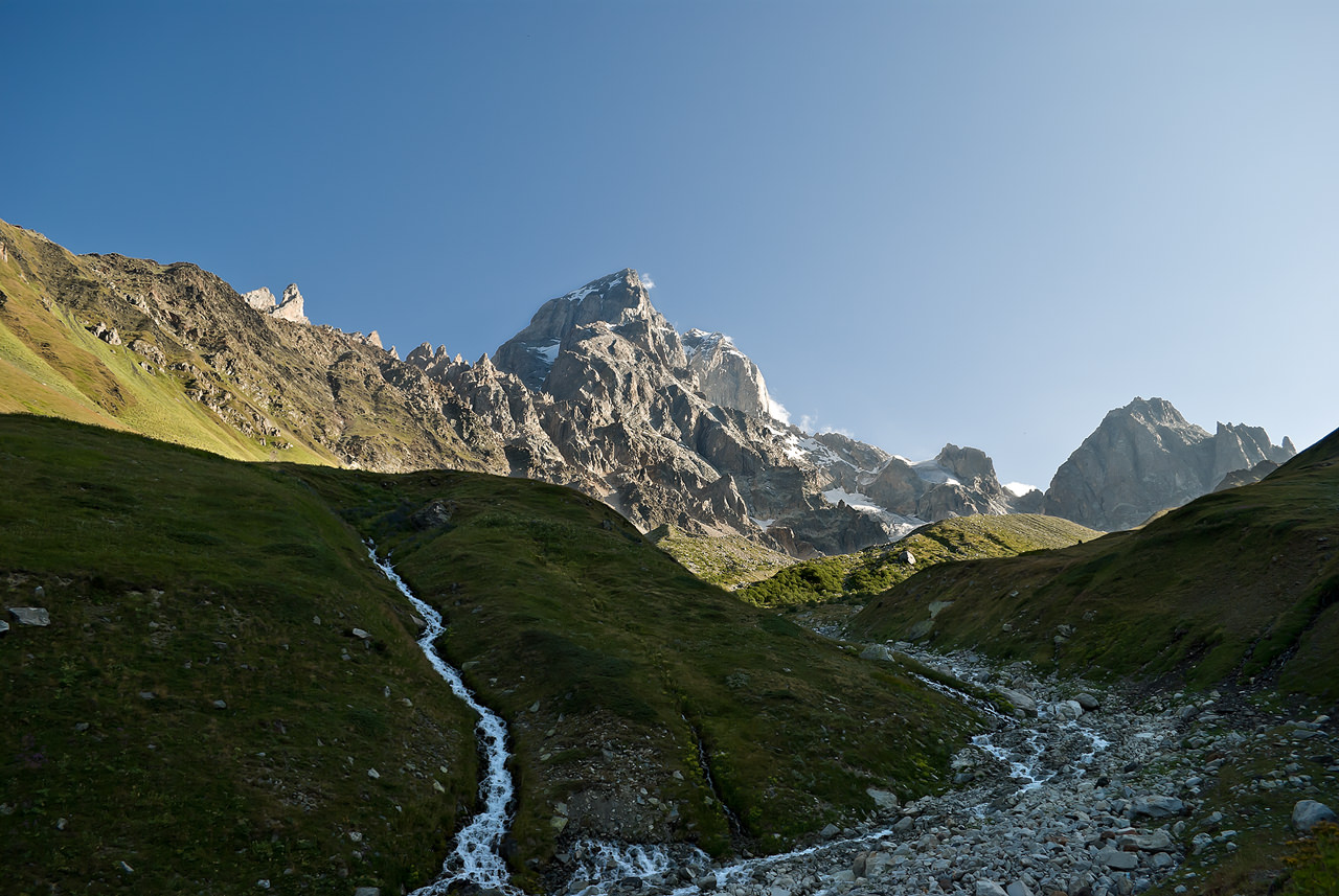
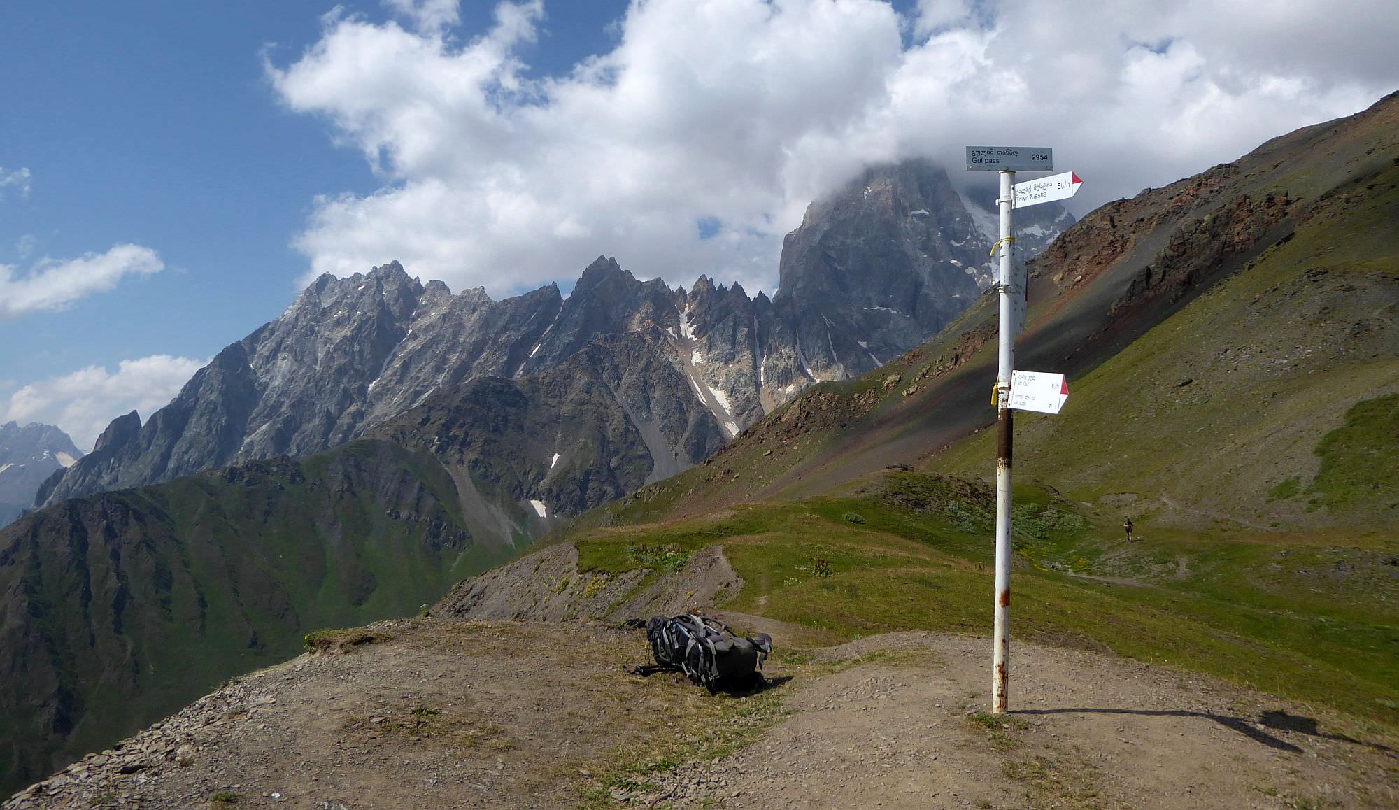
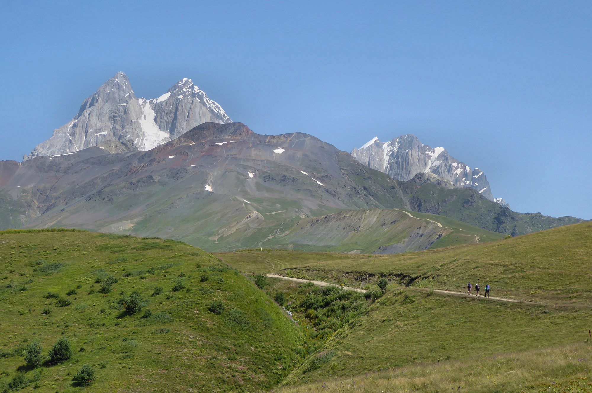
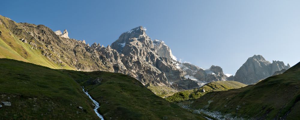
Finally, at the Guli pass (2974m). If you have time and energy (but you won´t probably have neither), you can climb further north to gain an even better view of Mt. Ushba. Ushba is one of the most prominent peaks of the whole Caucasus, its name in Georgian means "Mountain without the path" (also called "The Witch" due to its horned peak).
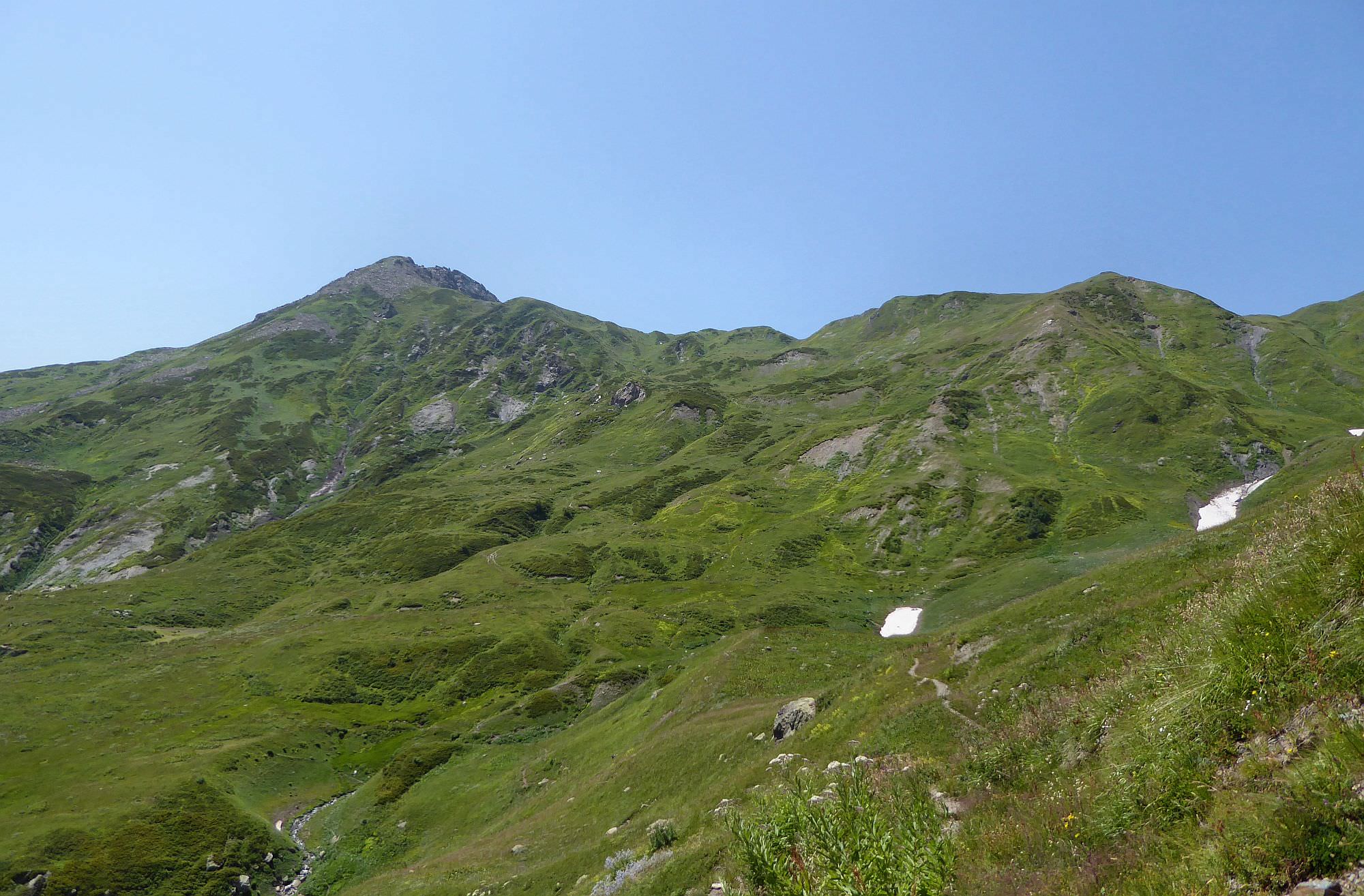
From the Guli pass, walk south on the ridge, the path slowly descends. Then, after 1 kilometer, the trail turns left, down into the valley. If you have a good tempo, you can keep walking south on the ridge and climb Mt. Guli (2925m). It takes only 40 minutes, views of Ushba are great and there are no people around (so it's an even better place for a lunch break than the actual Guli pass). But, again, unless you are a fast walker or you reserved 2 days for this trek, you probably won't have time for this detour.
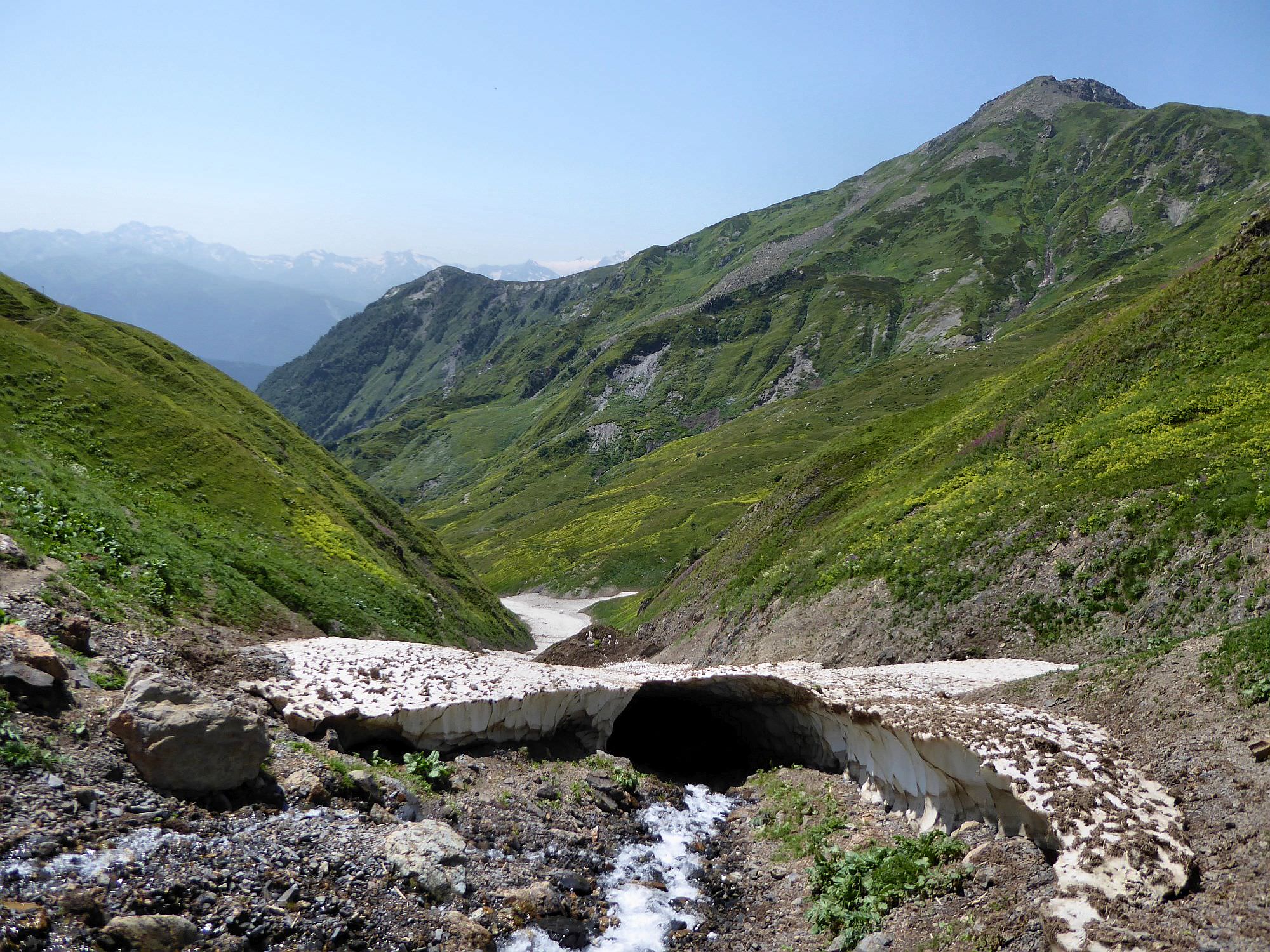
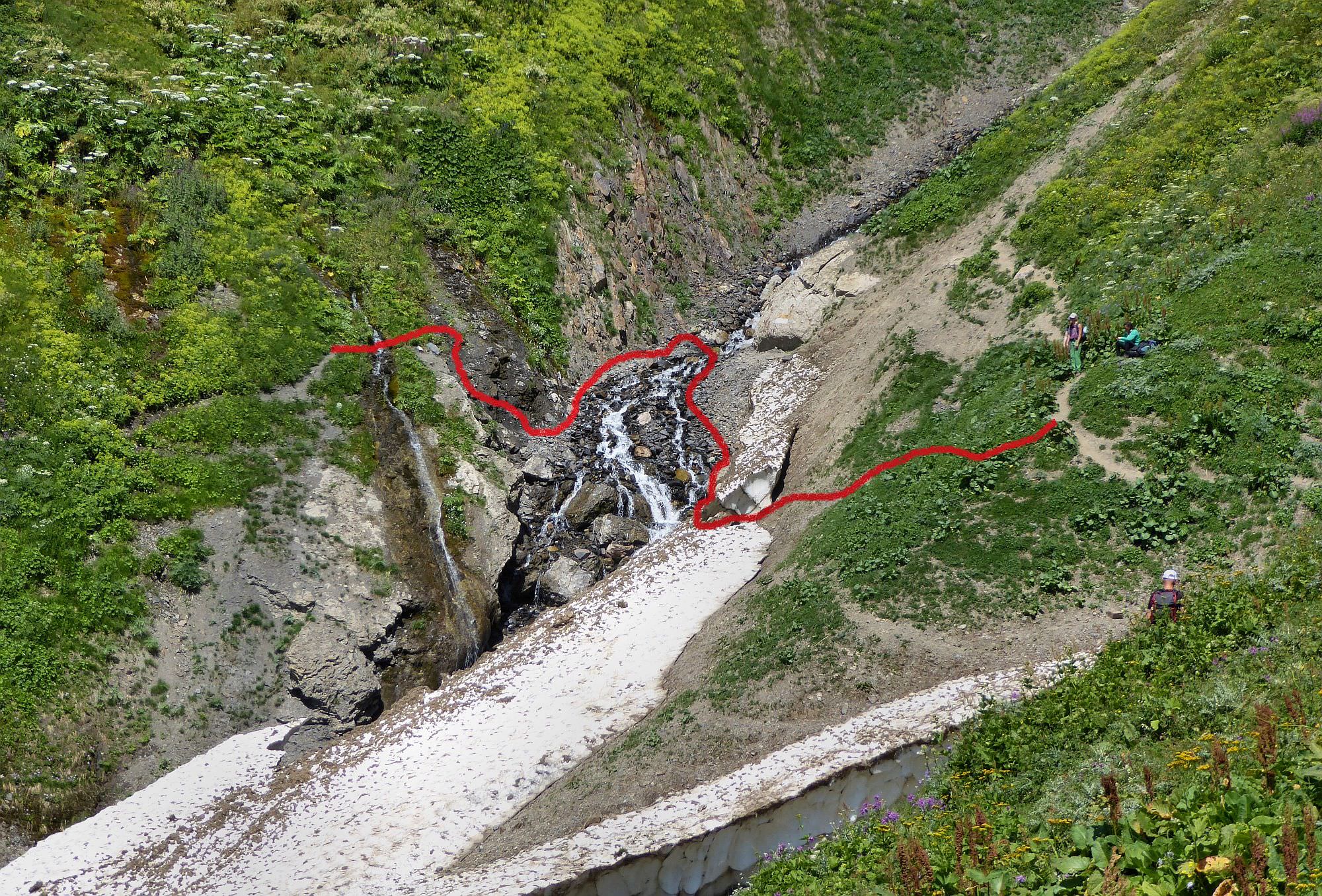
The descent into the valley is pretty steep. At the elevation of 2500m, the path turns northeast and starts traversing the hillside. Then comes technically the most difficult part of the trek - crossing of Pushkueri river. The river itself flows at the bottom of a deep gully - during the early summer, it´s filled with snow which makes the crossing easy but once it melts, thing get more complicated. Descending into the gully from the side of Guli pass is easy, needs only some simple climbing. To get out, don´t try to follow the original trail destroyed by the landslides, the terrain is too steep there. Instead, follow a riverbed for some 10 meters (or less or more, it all depends on the status of the snowfield) and then climb up onto the trail once the terrain becomes more navigable.
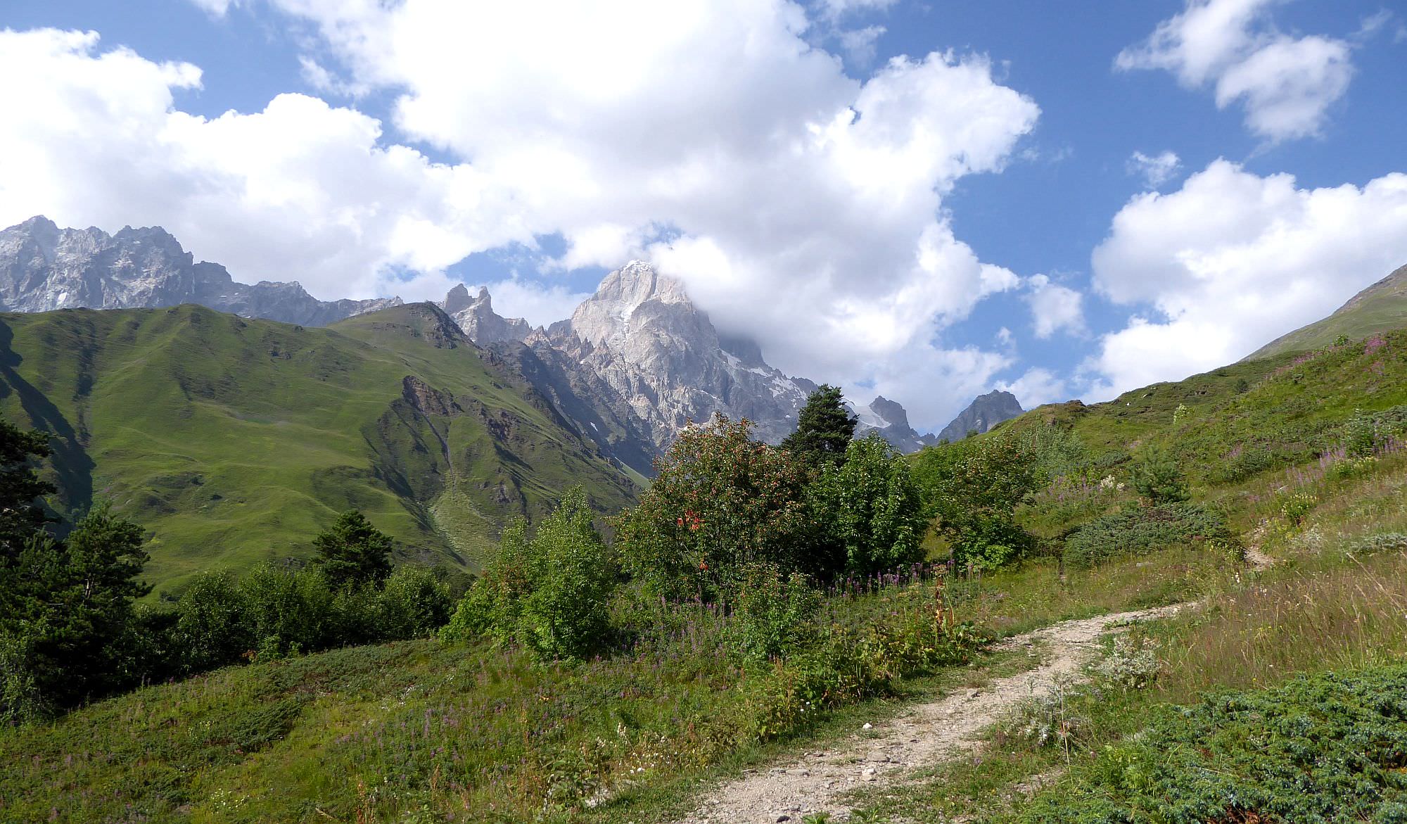
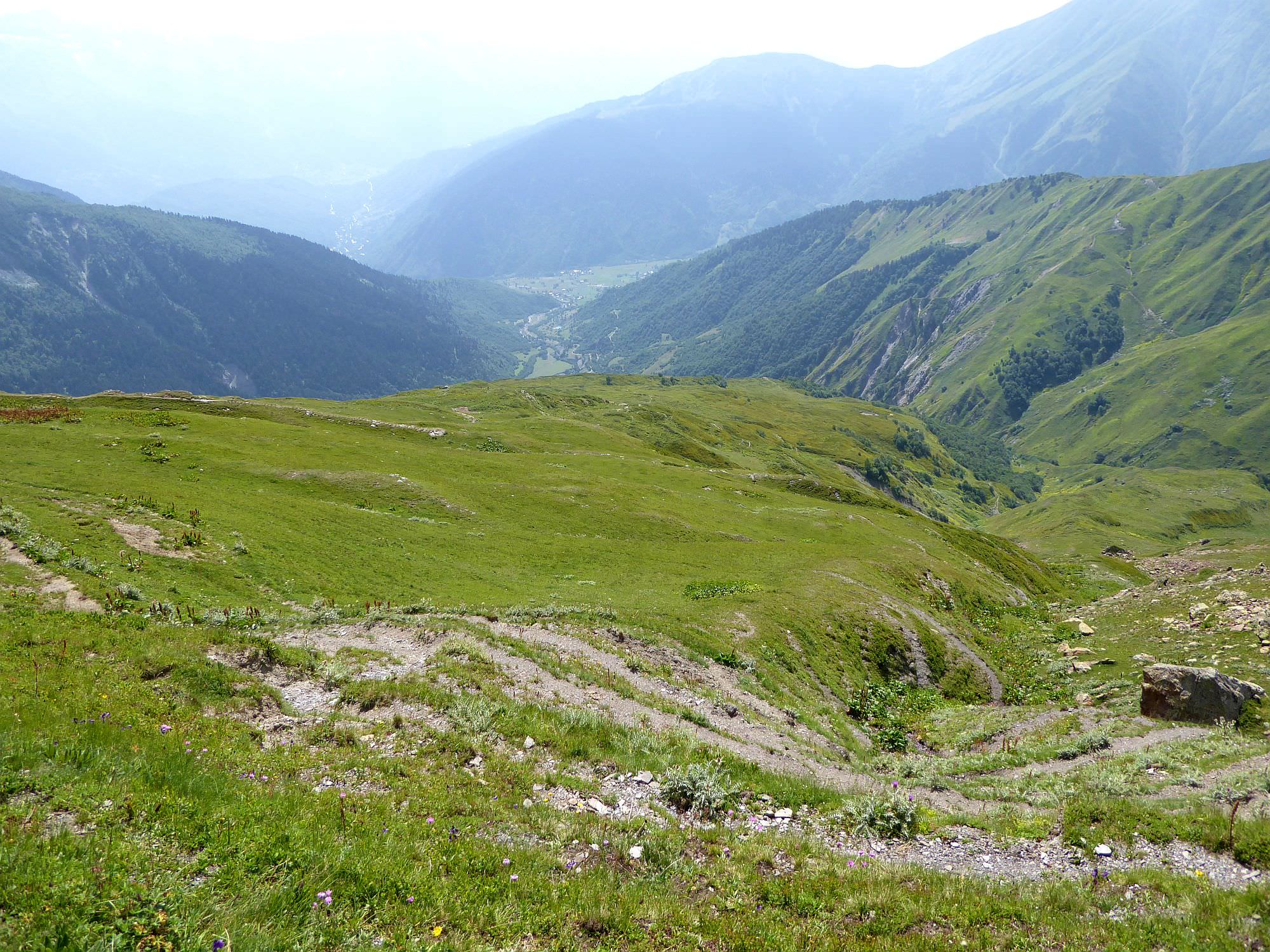
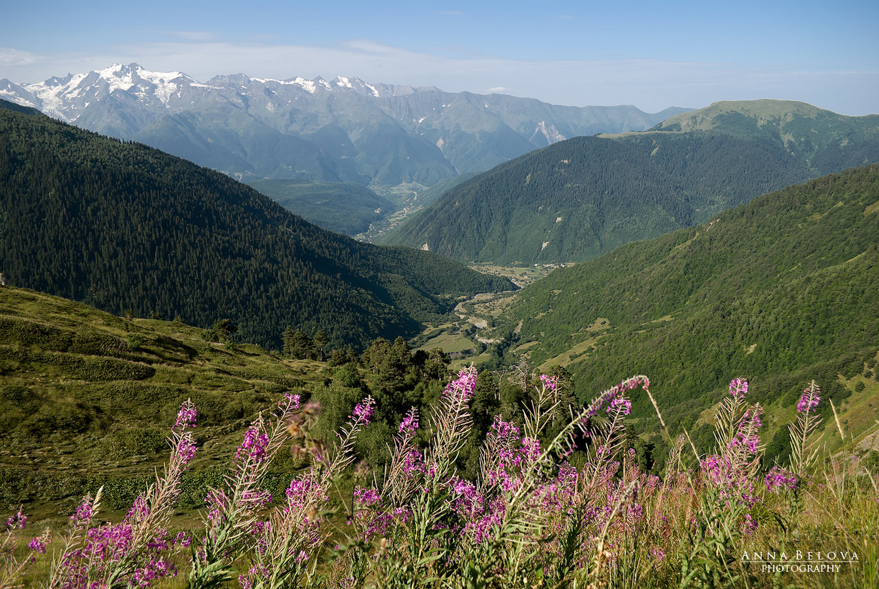
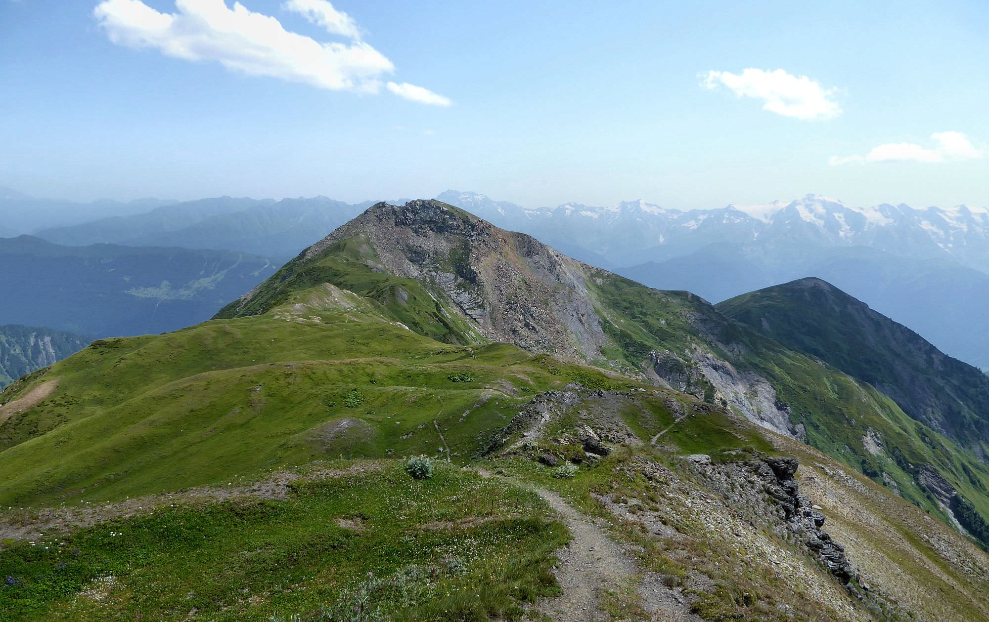
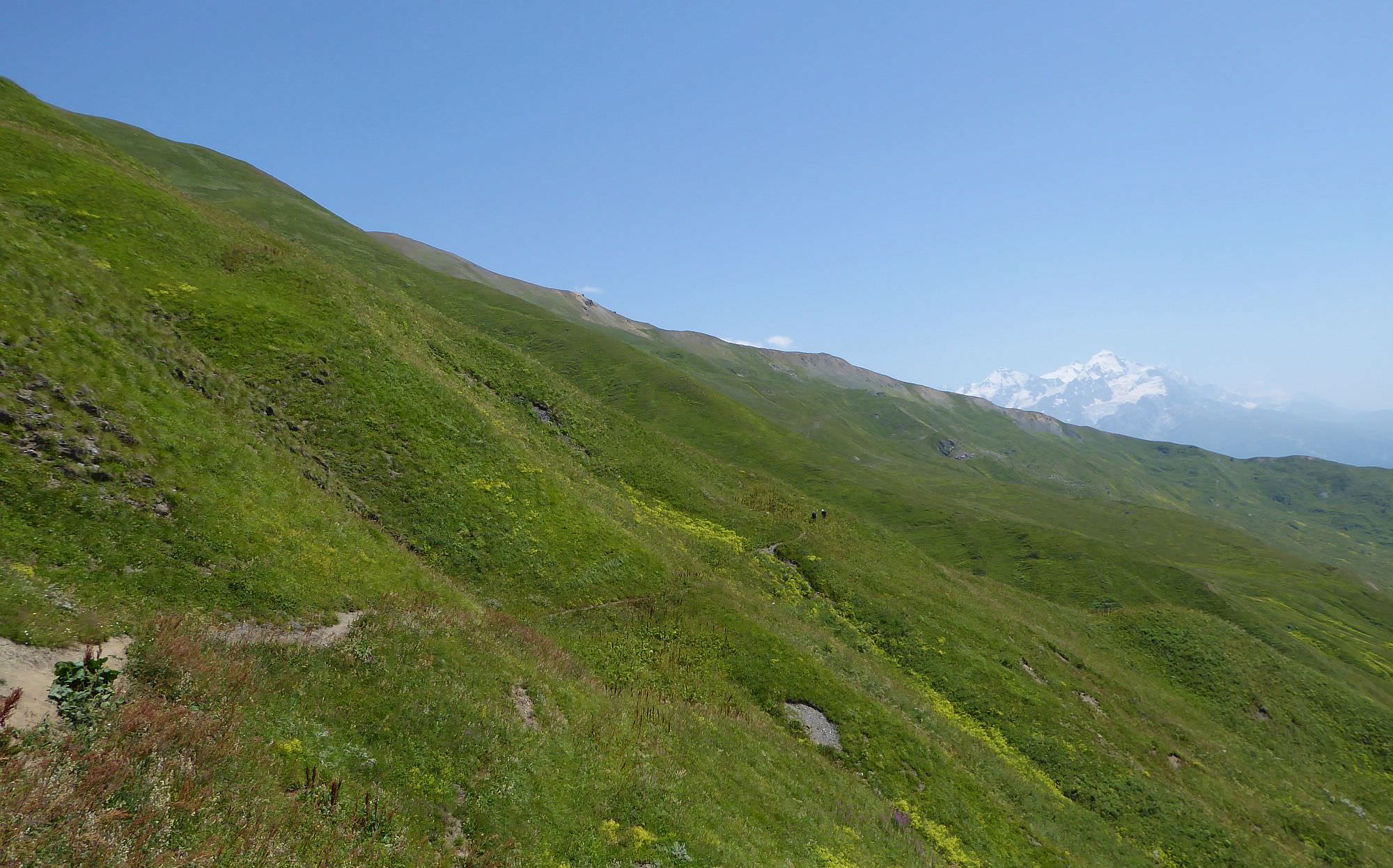
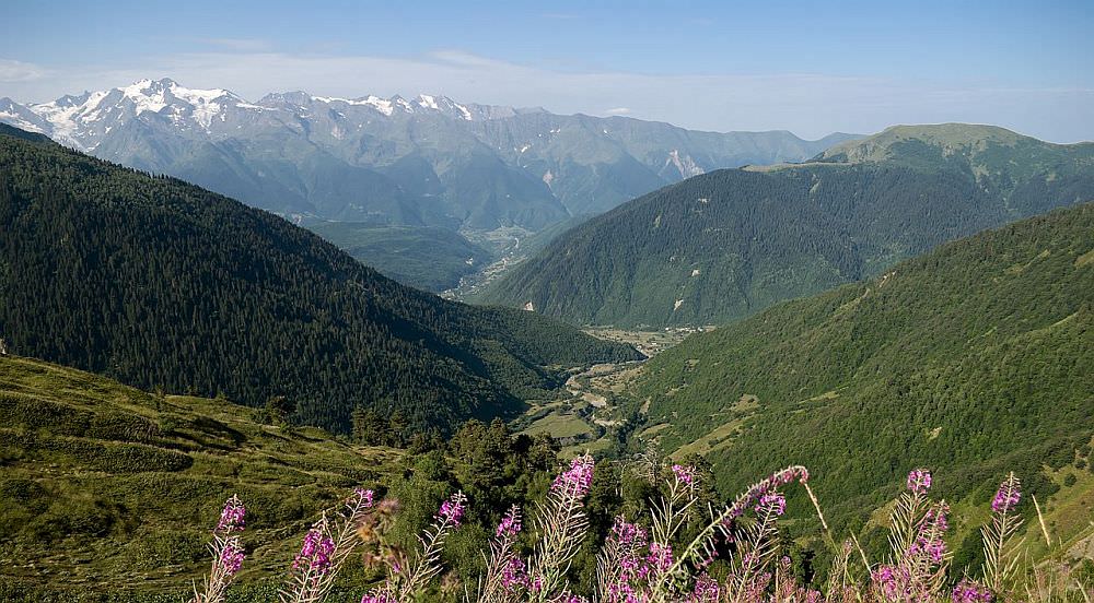
From here, follow the narrow trail traversing the hillside towards Lamaaja ridge. You will pass some smaller streams as well as numerous blueberry bushes. On the ridge, your small trail will connect the major dirt track leading to the Koruldi lakes. But you probably won´t have time to see them (unless you plan to camp there) so just turn right and continue south. You can either stay on the track all the time (this route passes a water spring) or take a shortcut through the shepherd's huts. Just don't forget to turn back from time to time, Ushba should soon become visible right behind you.
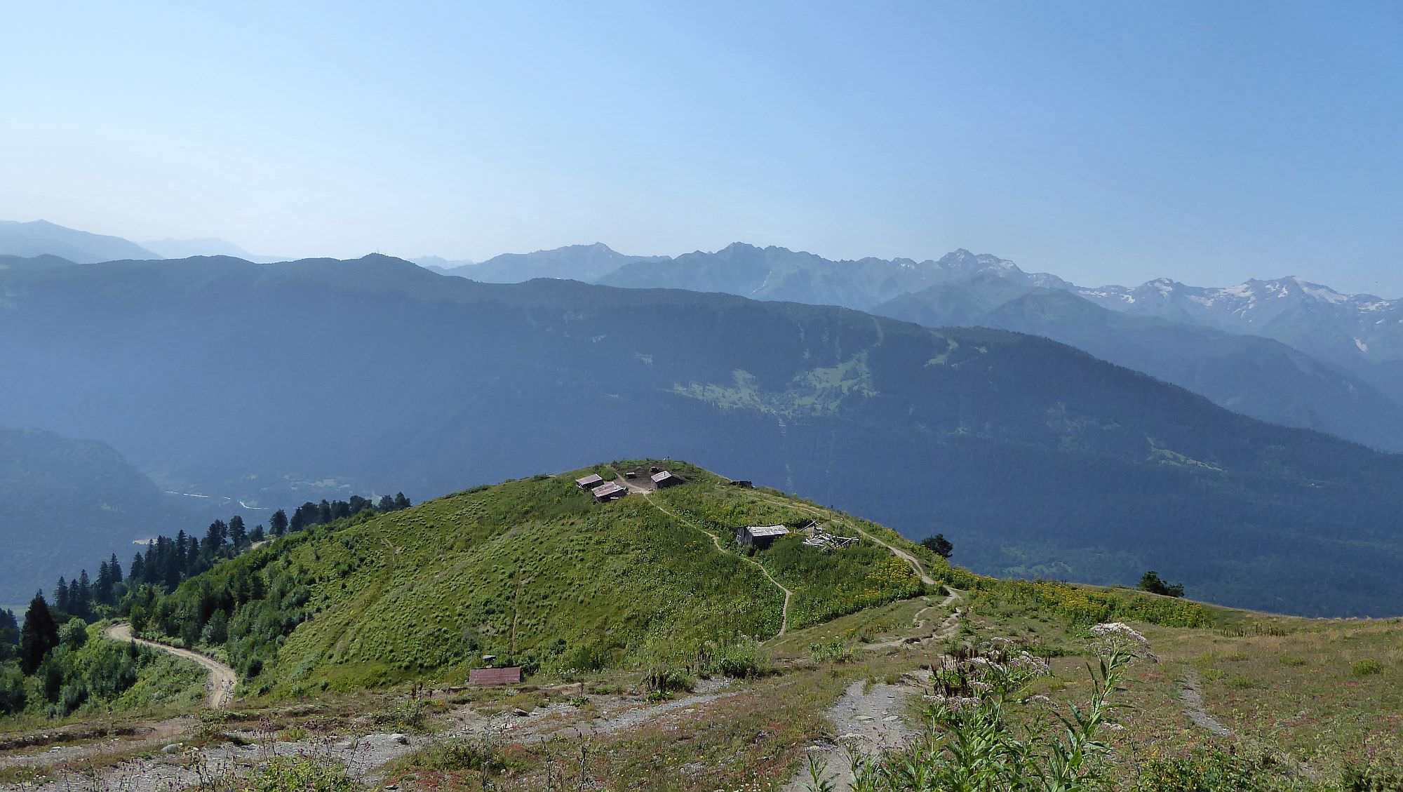
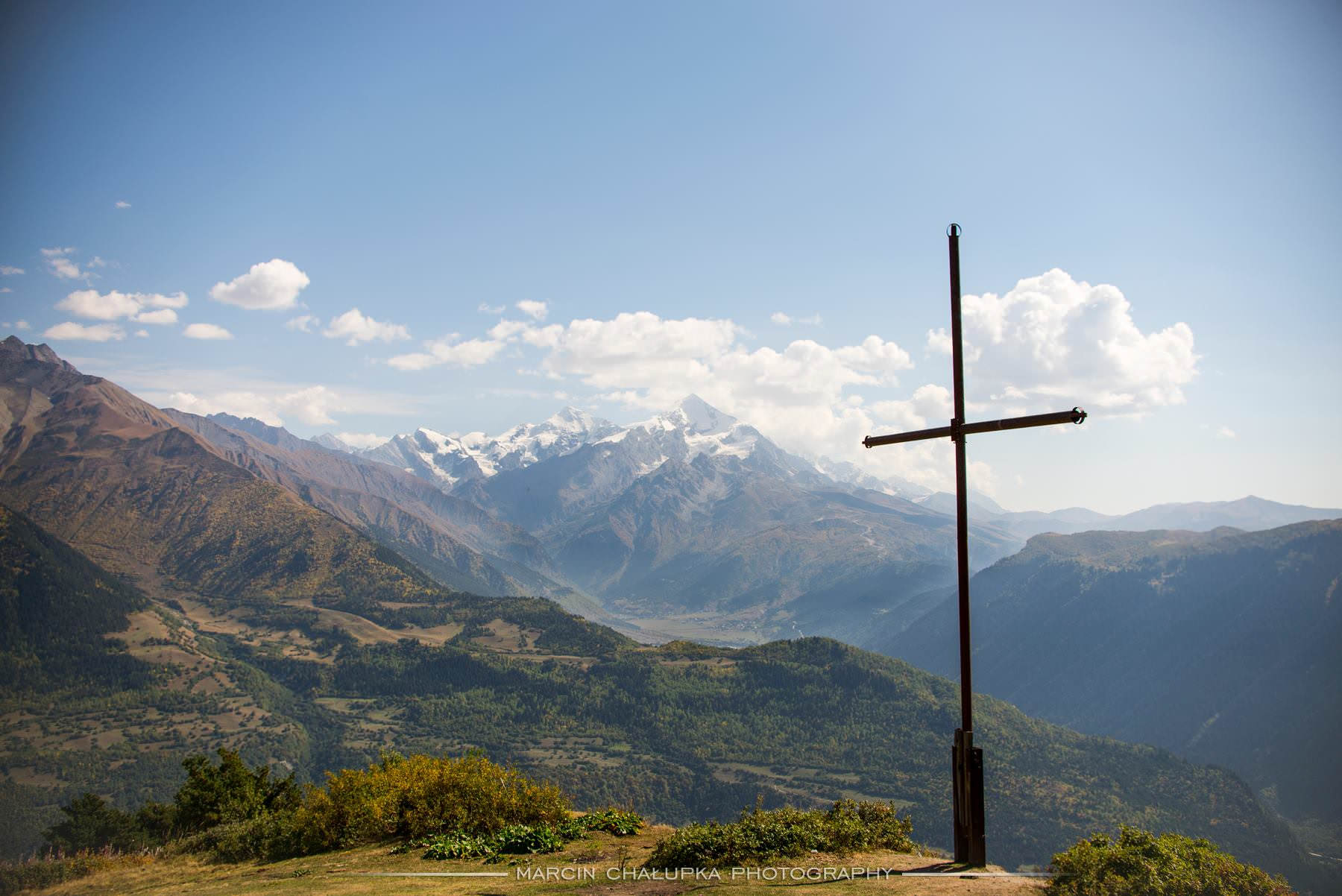
After some 30 minutes, you will come to the shelter and cross at the top of Tshakazagari hill (2200m) over Mestia. Keep following the large dirt track heading down to the town. At the elevation of 1850m, turn right from the large road onto the smaller trail going between the wooden fences (there is also a tourist pointer). This trail will lead you all the way to Mestia.
Mazeri is, from the hikers perspective, the best village to stay at since it provides the best access to the hiking trails. Of the numerous guesthouses in the village, these are some of the better ones
Lia Jamdeliani´s guesthouse - traditional homestay established in the old house at the center of Mazeri (location on Booking.com is way off). Rooms and beds are quite basic, but this place is still a very pleasant - it has a nice, laid-back atmosphere. Moreover, the food is very tasty and abundant. The house is inhabited by friendly 3-generational family. When we got there, they were fully booked but offered us at least dirty, unused room at the upper floor (with a discount) with an option to move to the normal room on the next day.
Guesthouse Shuan - modern, very pleasant guesthouse at the southern edge of Mazeri village, close to the mineral springs. Malkhaz and Rita are wonderful hosts and in spite of looking new, the place has still retained its "family atmosphere".
Grand Hotel Ushba - first just one clarification, the name is a bit misleading - this is rather an upscale guesthouse. It is located few hundred meters north from Mazeri village which adds to the sense of isolation. Overall, it provides higher quality compared to other Mazeri guesthouses, but also for a higher price. It´s main assets are good food, nice rooms and very comfortable beds. And, of course, it´s co-owner Richard. This Norwegian academic knows about Svaneti more than you will ever need to know - if he is not around, check at least his books :).
Mila guesthouse - traditional Svan guesthouse known for terrific, homely-grownd food. Ladies running the guesthouse are very kinddly and while they don't speak English, with mutual effort, there is no problem with communication.
Finished the hike and looking for more?
Here you will find all hikes around Mestia
Some photos were taken by Russian hiker and photographer Anna Belova, my compatriots Jozef Strezenec and Radovan Bieleny and Polish photographer Marcin Chalupka. Thanks to all of you!