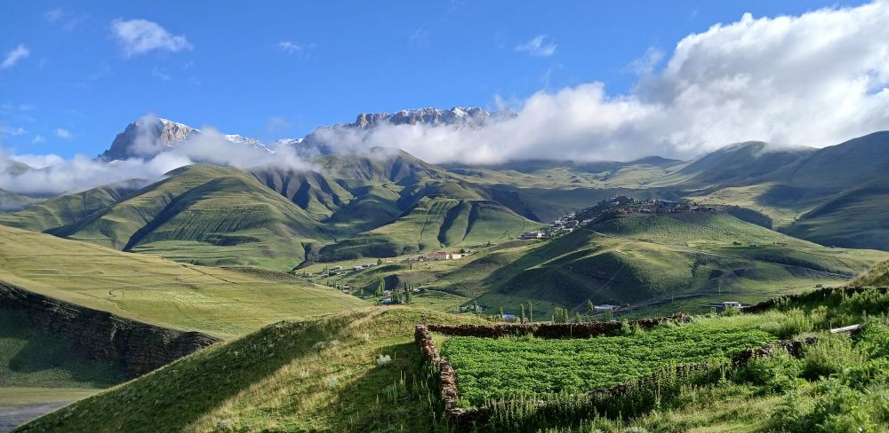
““Summit fever” is a mountaineering term that describes the drive or compulsion of a climber to reach the summit of a mountain no matter what the cost.”
The Caucasus mountains cover a wider area than just Georgia and Russia, therefore to explore them more I took a plane to Azerbaijan. This trip was nonetheless as always full of many twists and turns, ups and downs. One thing for sure there is always much more going to happen here than what you anticipate.
Due to a flight delay, I landed in Baku early in the morning, which meant that I got very little sleep. We then spent the rest of the day sightseeing and went to bed early to catch up on lost sleep. Unfortunately, I had a mosquito in my room which kept me awake again which was to have consequences later on.
The following day we travelled by jeep to the remote village of Khinalig which is on the UNESCO list. The people in this village have their own language ‘Ketish’ which is only spoken there due to the remoteness of the village. It has an incredible 49 letters which is many more than the 26 currently in the English language. It is also situated halfway along the route between the Shahdagh highlands and the Shirvan lowlands. The people here have lived in isolation to the surrounding Azerbaijan countryside as the village is very remote and inaccessible.
After arriving and getting rooms in the guesthouse, we proceeded to prepare our gear for the days ahead. Soon, we were out on our first acclimatisation walk. Khinalug sits at 2,100m and our 4 hour climb was to the peak of Kharibulbul (2,743m) . It was misty and a straightforward climb, but all acclimatization helps. A swift descent and finally, I had my first good night’s sleep in 3 days.
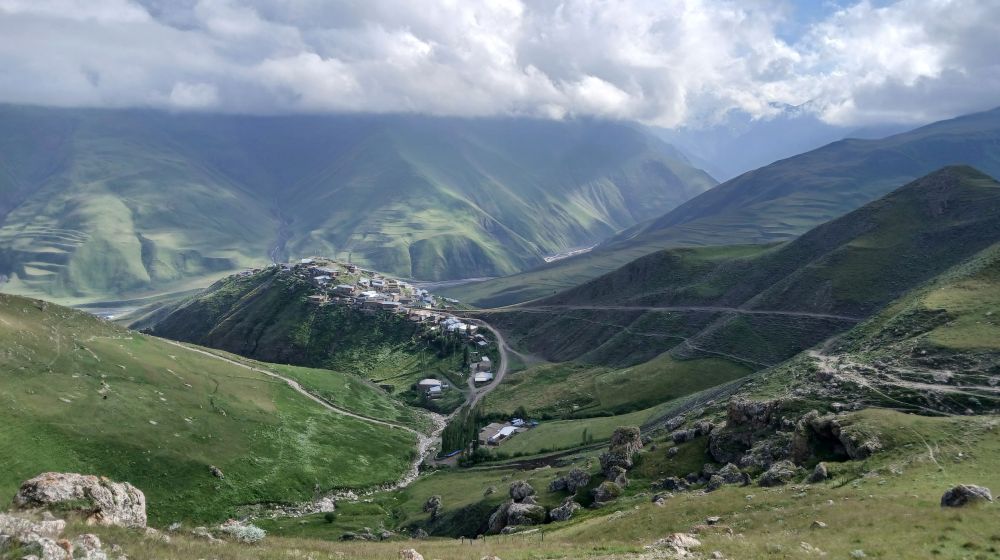
Khinalug from above
The next morning after an early breakfast we were picked up by a truck and a jeep. I declined the dust of the lorry for the bouncing around of the jeep, not much of a choice really. A brief stop at the entrance to the Shahdag National Park where we had to hand the passports over to the Kalashnikov totting soldiers.
Shahdag National Park is the largest protected area in the Caucasus. It lies on the border of Russia and Azerbaijan, so we needed a special permits - our plan was to climb both Shahdag (4,243 Metres) and Bazardüzü (4,466 Metres).
After a short while, we were allowed to proceed up the dirt track. It was lined with a steep drop, with a river raging below, which made the journey pretty interesting (to say the least). We were bounced around a lot, but at least we got numerous breaks as the driver had to put water into the radiator. But to be honest, it was more the brake fluid I was worried about and not the water in the radiator. On the positive note, views were wonderful and with blaring Azerbaijani pop music (similar to Disco Polo), the ride was certainly atmospheric.
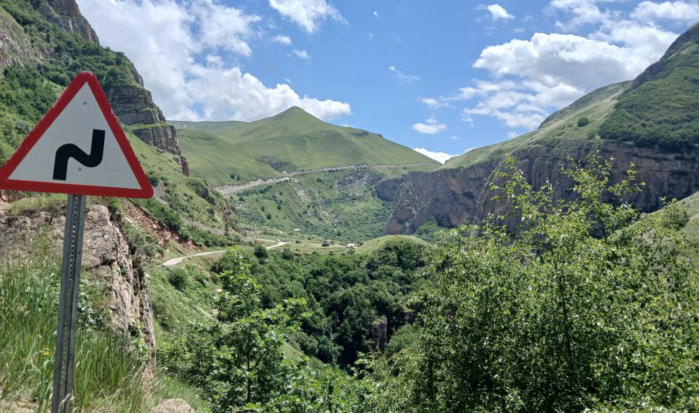
Road to Perdition
Eventually we reached the pass at around 2,800 metres and waited for the lorry to catch up and then the long descent. We descended on a narrow track until we reached the valley floor and swept onto a wide plain. We stopped briefly and got out to stretch our legs in all directions - there was a light sprinkling of snow on all the towering mountains around and the sun was shining. The green grass of the valley was covered with wildflowers of all colours and numerous butterflies fluttered around, what a perfect moment in essence really!
Back into the jeep, now for the river crossing. The lorry with a high wheel base crossed easily. We in the jeep however had the water lapping against the doors. Drove on for a few more kilometres and stopped at a corner of the valley where the horses were waiting. The bags and ourselves were transferred from the jeep onto horses.
Now the final climb up onto around 3,100 metres to the campsite. After around one hour we reached a small plateau near a waterfall. Wildflowers, the sound of roaring water, unbelievable scenery down the valley… this wide ledge was the best campsite we could ask for.
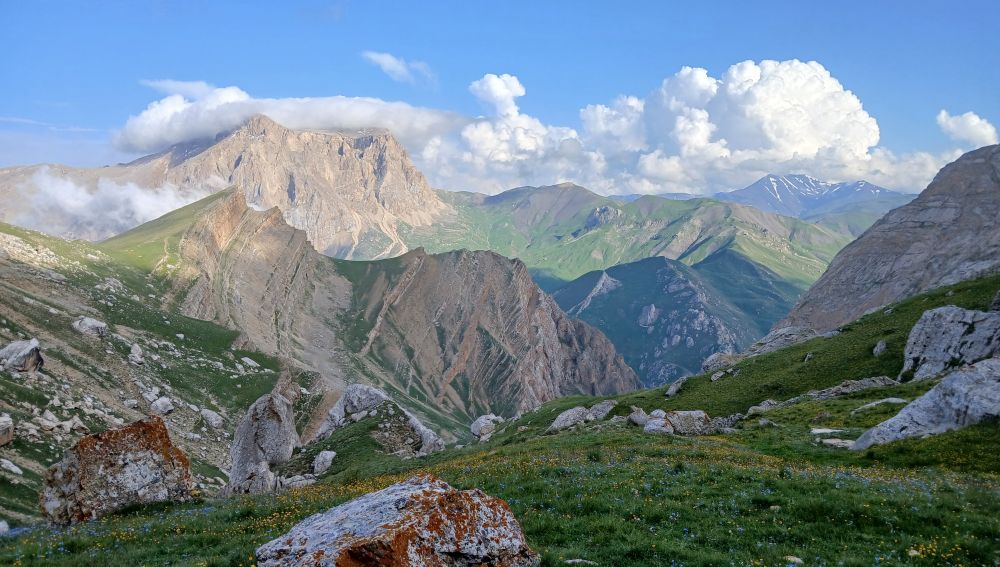
Evening view from the campsite
The horses were already there, we quickly unloaded the tents and we picked the most suitable spots. After a short while it was time to get the jetboil out and cook the evening meal, as immediately afterwards we did our next acclimatisation hike. It took three hours to hike up to around 3,400 metres and back to prepare for the following day. We were getting up at 3 am and leaving at 4 am.
It gets dark early here and everyone was in their tents and asleep by ten PM. Fortunately I had covered the bags left outside with a plastic bag, as a thunderstorm started around 11 PM and with thunder, lightning and rain it was going to be a restless night.
After a restless night in a cramped tent, I groggily woke, feeling miserable. I had one good night’s sleep in four days and was very concerned about the next day. Tea, breakfast porridge, and it was already time to put on my head torch and follow the others. At this stage the weather was clear and shortly afterwards, the sun's early morning powerful rays spread some warmth over us. After a few hours we reached Shahdag pass at around 3,600 metres and the chill had gone out of the day a little.
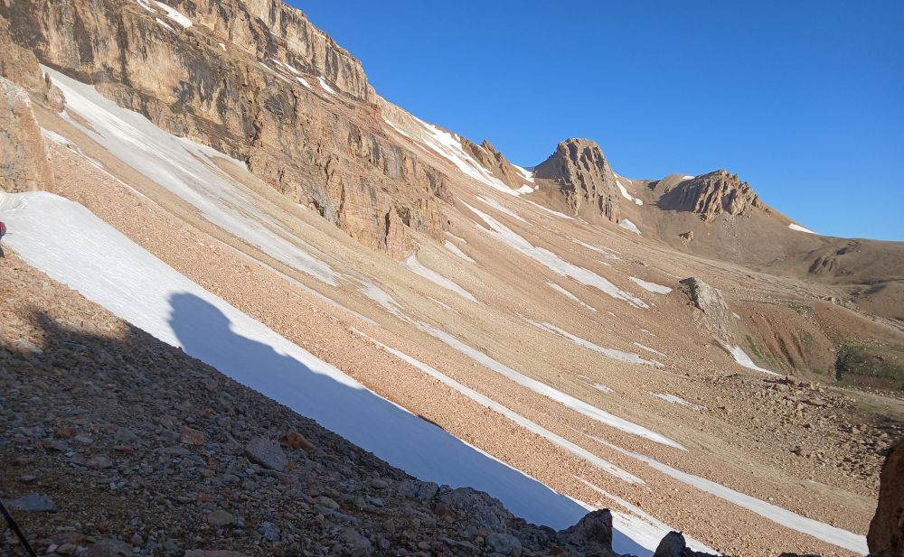
The valley ahead
We rested and took water, snacks and tea - most of us also shed extra layers as it was getting warm. The second part of the climb involved a traverse of a scree and ice field valley. We also put on helmets and prepared microspikes. This valley was around one kilometre wide and this was going to be slow and difficult. We crossed around ten or eleven ice fields and also at least ten scree fields. The slope was pretty steep, with the high potential for a serious accident, so we had to stay focused at all times.
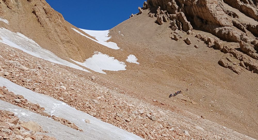
Heading up
After an hour we stopped at around 3,800 metres for some rest. I had not been feeling well earlier due to a lack of sleep and a stomach bug. Had recovered a little but now the sheer fatigue of one and half days of sleep in 4 days hit me. I was at a Key decision point (KDP). The basic 3 principles of KDP was to (1.) stop and (2.) rest which i did but the most important thing was to (3.) assess the situation. Like all the mountaineers out there reading this we have all reached this point and in common with you all, we sometimes take a bad decision but mostly a good one. I knew that even exhausted, I was still capable of reaching the summit. Then, the old adage springs to mind “to reach the summit is optional, to descend is mandatory”
However, I was also conscious of Summit Fever syndrome, we have all reached this point in which we knew we could reach the summit but getting down could be a huge problem. How many of us have thought we could get down before it gets dark, or get down before the rain, fog or snow comes in or before the exhaustion takes over completely. There are times when we may have pushed it beyond more than we should have done, but as you get more experienced in the mountains it happens less and less.
I felt exhausted but knowing the steep snow section to come and another two hours (or more) of climbing I thought it prudent to turn back rather than collapsing on the way down or delaying the others hugely by a very slow descent or even by making a big mistake on the scree or snowy sections of the climb. No matter how much you prepare for anything, sometimes on the day everything does not always fall into place. The unusual thing was at that moment, I had already crossed the two most difficult sections of the climb already.
Very disappointing, but in another way satisfying as I was proud that I made a logical choice over the emotional one. I have reflected since that yes I could have made the summit, however on the descent being exhausted and crossing ice fields would have been more than dangerous.
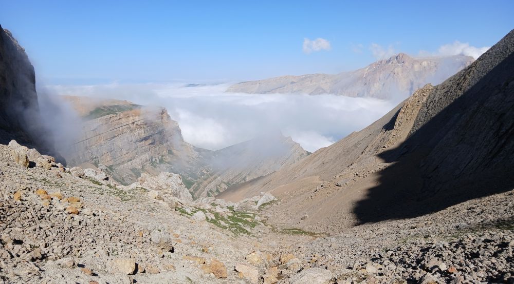
Cloudy views from the pass
Also, being exhausted could have turned my well-being much worse at higher altitudes. Funnily enough I have climbed higher and even slept in a tent at a higher altitude a few times before, so altitude is not a problem. Furthermore, I have had good luck on many big mountains, so finally a bit of bad luck had to happen at some stage.
After waiting for ten minutes myself and Abdullah (the spare guide), started to descend. However, the drama was not over yet! On the way back crossing one of the ice-fields, the ice gave way as I was kicking steps and I had a slide of 20 metres of so. As I had done a winter skills course in Scotland I knew what to do. The important thing is to slow down and not get the microspikes caught in the trousers so it was ‘lie on your stomach”’, ‘feet in the air’ and then used my elbows to slow me down. Thankfully it was one of the shorter Ice fields and not one of the steeper and longer ones. However despite being short I still broke my climbing pole and my helmet protected me apart from a minor cut when I hit the scree .
We continued down to the base camp, and the others eventually arrived. They had been surrounded by fog at the summit, so I didn't miss any views. Some of the group experienced tiredness and altitude sickness at the summit, but they improved as they descended. Our original plan was to climb Shahadag followed by Bazardüzü, but the forecast of more rain made this doubtful.
Later, we heard about a glacier burst and a 19 km mudslide that blocked the track near the entrance to the national park. We all went to sleep not knowing what the next day would bring.
The next morning, after finally getting a good night’s sleep, I left the tent during a dry spell. About 100 meters above, fresh snow had sprinkled over the cliff edges. After breakfast, I attended a campsite meeting to discuss the latest news. Due to the weather, climbing Bazardüzü was impossible, and there was a real chance the only bridge over the main river could be washed away. Therefore, we decided to trek out of the valley.
As it was raining, we waited in our tents. I dozed off but was awoken by a horse poking its head into my tent. Our horses had arrived. We loaded our extra bags and made our way down to the valley floor. Although the clouds came and went, it stayed dry for a while. We crossed several small rivers by throwing stones to create footholds and eventually reached and crossed a temporary stone bridge.
We then turned east just as heavy rain began. After a steep climb to the pass, we descended into the river valley as the rain and mist intermittently came and went.
When we had originally taken a lift in the lorry and jeep into the valley, we didn't notice how the track zigzagged across the river. Now, with the river swollen, crossing was more challenging, but after an hour of tossing stones into the river, we made it. Then we encountered the glacier mudslide. It was 10 meters tall and 500 meters wide, having flowed an incredible 18 km from the glacier burst. It contained lumps of solid ice and flowing water, making the crossing with sinking feet extremely difficult.
It quickly became clear why we could not get a Soviet-style truck back to Khinalig. Shortly after the glacier mudslide, we had to help the horse drovers hand-carry the second bags across the raging river. The combination of mud and strong currents made it impossible for the horses to cross safely. Even the drovers struggled without assistance. We went down to the river’s edge and helped pass the bags across.
Once we reached the other side, we loaded the bags onto a lorry, which then headed to the village. We continued our trek for the final few kilometers. The glacier mudslide would not be an easy mess to resolve!
Eventually we passed through the army checkpoint and headed up to Khinalig, 7 hours of a trek from the base camp. This area is so close to the Russian border that quite often some of the expedition got Russian mobile signals. Back in 1988, a local villager Babaali Babaaliyou had seen an abominable snowman when searching for goats in a cave. He was still alive in 2024 so the sight of 18 dirty and hairy mountaineers approaching his village might have seemed like his worst nightmare coming true!
In Khinaliq, houses are heated by cow dung so you can’t miss an unusual aroma wherever you enter. We were assigned to guesthouses and after a brief rest, followed by a meal, we retired to slumber.
We got in the lorry and it rattled over the wide river bed whilst simultaneously bouncing us from one end of the lorry to the other. However this was a lot easier than throwing lots and lots of stones in the fast flowing river bed and hopping from one rock to the other !
Early the next morning, after another good night's sleep, we prepared to meet the lorry arranged to take us to that day's mountain challenge. The ridge of Khinalig mountain, just over 3,000 meters high, lay ahead as an impressive challenge. We climbed into the lorry and it rattled over the wide river bed whilst bouncing us from one end to the other. Despite the rough ride, it was much easier than hopping from rock to rock in the fast-flowing river!
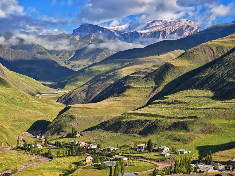
Mountain views
The climb began as we crossed a small metal bridge and then ascended the hill. Using rocks thrown from the bank, we crossed another smaller river and wound our way up the mountain. We climbed higher and higher, experiencing a mix of sun, wind, rain, and clouds. Finally, we reached the ridge at 3,004 meters, having ascended around 1,100 meters. The views from the ridge were truly breathtaking.
After a short rest to enjoy the scenery, we began our descent. At around 2,400 meters, we encountered five Caucasian mountain dogs who were not pleased to see us. Our guide's yelling and stone-throwing eventually made them back off. These dogs have their ears clipped to protect against wolf attacks, a common practice in the Caucasian mountains where they are usually left to guard sheep. With a bite pressure three times that of a Rottweiler, no wonder they give the wolves a hard time.
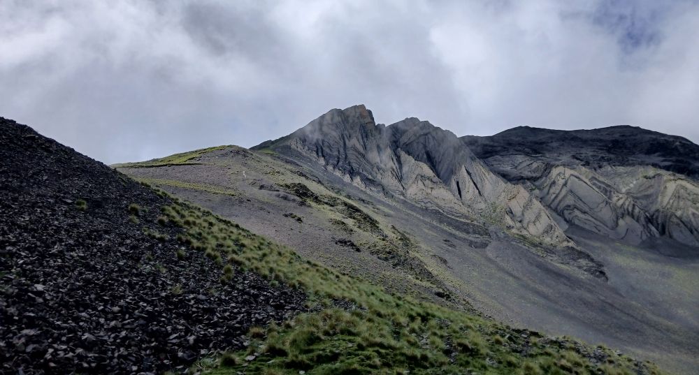
Khinalug ridge in sight
After our seven-hour hike, a lorry awaited us by the riverside. This time, there were no planks or a tailgate, so we just clung to the sides for a rough, bumpy ride back to Khinalig, with its unique aroma. Despite the strenuous journey, I had two good nights of sleep. The walk through the National Park and the next day's 1,100-meter climb up Khinalig Mountain were manageable. Unfortunately , I lacked the same energy for the big climb up Shahdag, but some you win and a few you lose. Upon arriving in the village, we visited the local museum, which detailed the unique Ketish language, spoken only here, and the village's 5,000 years of history.
The village's uneven, stoney streets and ramshackle buildings were a long way from the gleaming skyscrapers of Baku, funded by petro-dollars. Wandering sheep, ducks, geese, cattle, and horses were common sights on the streets, but thankfully, there were no aggressive Caucasian dogs. In some ways, it reminded me of Longford Town, albeit slightly more advanced. The guest house owner was proud of the village's UNESCO heritage status, but it’s clear that this alone won't generate enough jobs or income to lift them out of evident poverty. With around 2,000 residents, the village experiences extreme temperatures, ranging from -20°C to +18°C throughout the year.
With the climbing behind us, it was time for a farewell dinner at the guesthouse. Midway through the meal, the lights went out as the electricity was cut off. We were told that during storms, the authorities often turn off the power to protect the sub-station from lightning strikes. The evening was special, as it was the guesthouse owner's birthday, and we enjoyed some birthday cake. It was another night of excellent hospitality that nicely concluded our visit to the mountains. The next day, we drove back down the few stretches of tarmac on the mountain roads to the tropical, dusty heat of Baku, a stark contrast to the cold and occasional rain of the green Caucasian mountains.
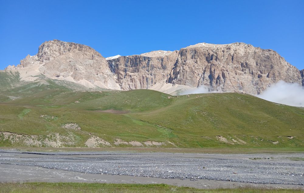
Mount Shahdag


