Virtually unknown, yet pretty spectacular 2-day trek in the Lower Svaneti.
This little-known, yet very interesting trail showcases some of the best sceneries of western Lower Svaneti and a different perspective on the main ridge of the Greater Caucasus mountains and Egrisi range. Still, since it's not that long, it's unlikely that someone will travel to Lebarde just for this walk (even if the road problem gets solved in the future). It makes much more sense to combine it with routes coming to Lebarde from the direction of Lebarde lakes, making this trek a terrific way to finish some longer trek starting in the area of Kulbaki or Askhi plateau.
The only reason I’d consider completing this hike within a day is an uncertain situation about the water. However, that would be extremely exhausting, so it's better to camp along the route.
This is not a well-trodden trail. Along the route, you will have to navigate a narrow, partially overgrown ridge which sometimes leaves you no other chance but to bypass it on a steep slope. There is also quite a steep descent just before arriving at the campsite and poor water availability.
The best period to go is from the early summer till mid October. Because of the water issues, I’d recommend going in early summer to have a better chance to find it, as well as to avoid the irritating heat.
Because of the logistics, it's much more pleasant and convenient to start this hike at Lebarde, as described below.
Not surprisingly, the ridge itself is dry. The only place where you could theoretically get water is at the campsite of Devashi ridge (or Ienashi - both names valid), near the start of the decent dirt road used by woodcutters (and it may be hard to find cause it’s hidden under a thick cover of plants). I wouldn’t name it as a spring, but rather as an underground water pooled in an approximately 50-60cm diameter shallow natural “reservoir” so it''s even a task to fill the bottle. Besides, who would give any guarantees it will be alive...
So, I recommend taking an extra 2,5l liters from the junction on the Lebarde side (not including 2 liters necessary for the junction – campsite section). Even better for you if you get the water at the campsite. But it's better not to rely on it.
For this trek, you will need a tent. Some huts can be seen in the distance during the hike, but their condition and ownership are more than questionable.
The saddest part of the whole journey. Lebarde is the worst dead-end one can imagine with a totally derelict road. The journey to get there will have at least two phases.
First, you need to reach Doberazeni village, where a dirt track to Lebarde starts. Taxi from Kutaisi would cost you at least 100 GEL. If you prefer public transport, your best bet is marshrutkas departing to Martvili. These leave from the bus station by McDonalds at 7:30, 8:00, and then in hourly intervals. Ask the driver if he continues to Didi Chkoni or even further to Kurzu, otherwise, you will need to hitchhike or take a taxi for the remaining 25km to Doberazeni or Kurzu.
Here starts the harder part. To Lebarde, it´s another 25km on a quite poor dirt track. And what´s even worse, there are several Tekhuri river crossings, one of them particularly unpleasant. For this reason, I don´t recommend hiring a taxi for the whole route at Kutaisi, you need a local driver familiar with the route. You should ask around the village and hire a taxi or truck driver, however, it could cost several hundreds of lari. Much optimal solution is trucks, which during summer, regularly bring vacationeers from Doberazeni to Lebarde, however, their schedule for the 2024 season is not known yet. Once it gets public, will try to update it here.
There are several marshrutkas a day departing in the direction of Kutaisi, with the first one leaving around 8 am. Your best bet is to head to the bus station situated at the main square or, if you are staying at the local guesthouse, to ask your landlord to procure a ticket for you.
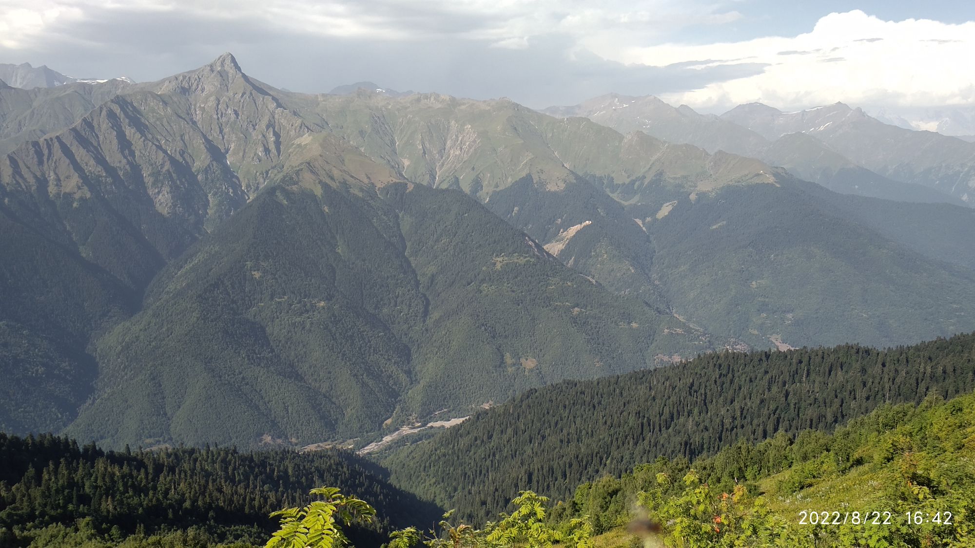
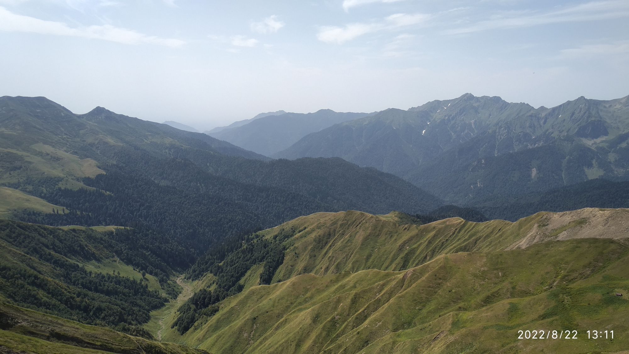
View towards Egrisi mountains
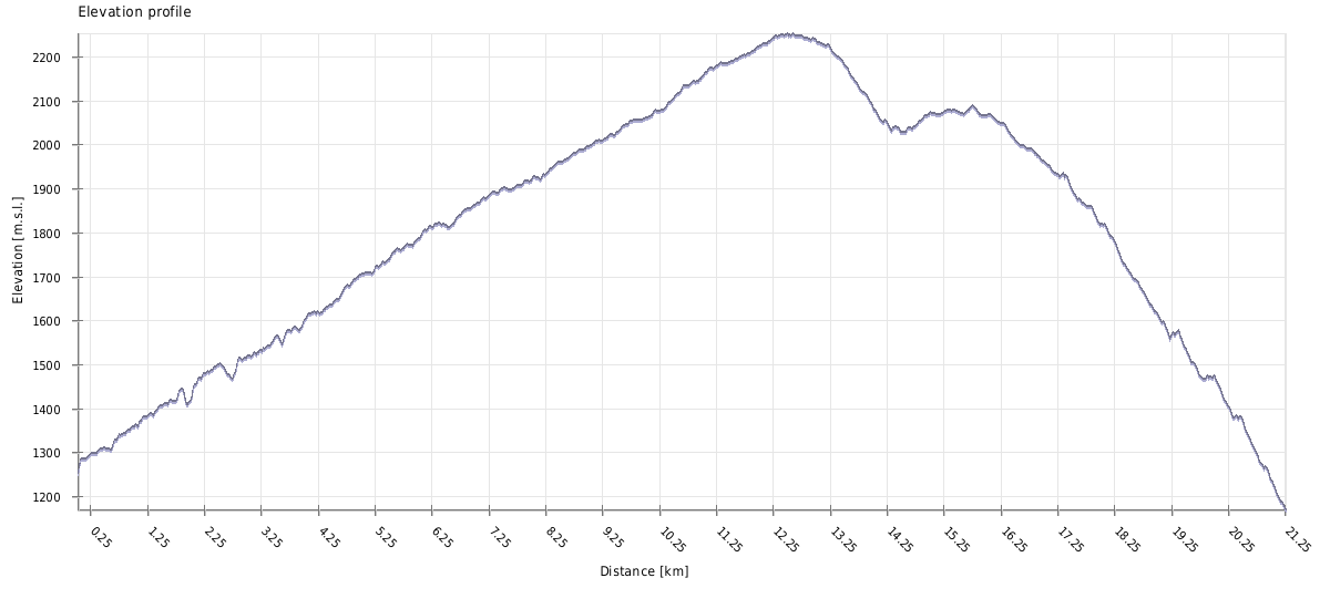
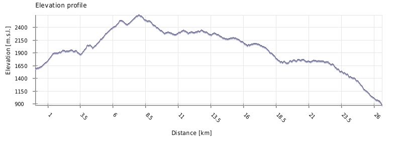
| Distance | 29 km |
| Trail type: | AB trip |
| Max. elevation: | 2638m |
| Min. elevation: | 872m |
| Total climb: | 1740m |
| Total descent: | 2465m |
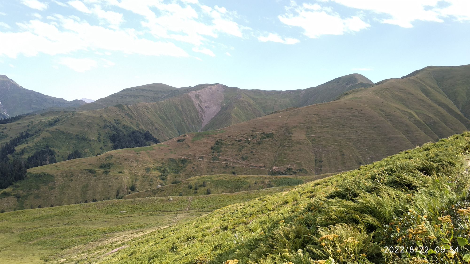
You shall start from Lebarde meadow eastwards on the broader path, cross a little stream and then into the forest. Quite soon it will turn sharply south ascending the slope with some 150m of elevation gain.
Once you reach the open area it follows a narrower trail on the hillside in the SE direction, mostly straightforward until you descend a bit and cross the stream next to the hut. Then you shall climb the opposing slope, soon bypassing another hidden hut lying atop.
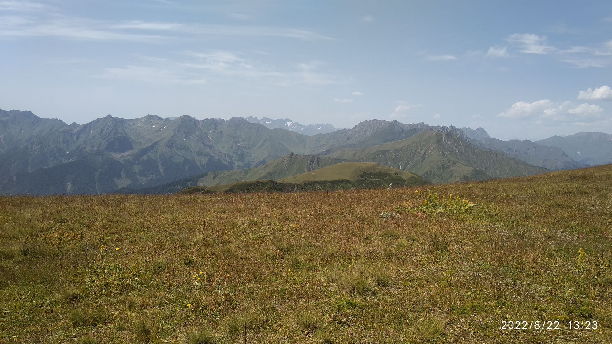
Once you make it out of the forest, and shortly afterwards climb to the top of the small ridge (altitude 2040m), you shall reach a (not too obvious) junction - time to leave the well-trodden trail to Lebarde lakes, which is going here down again. Turn left and start climbing the ridge in the northeastern direction.
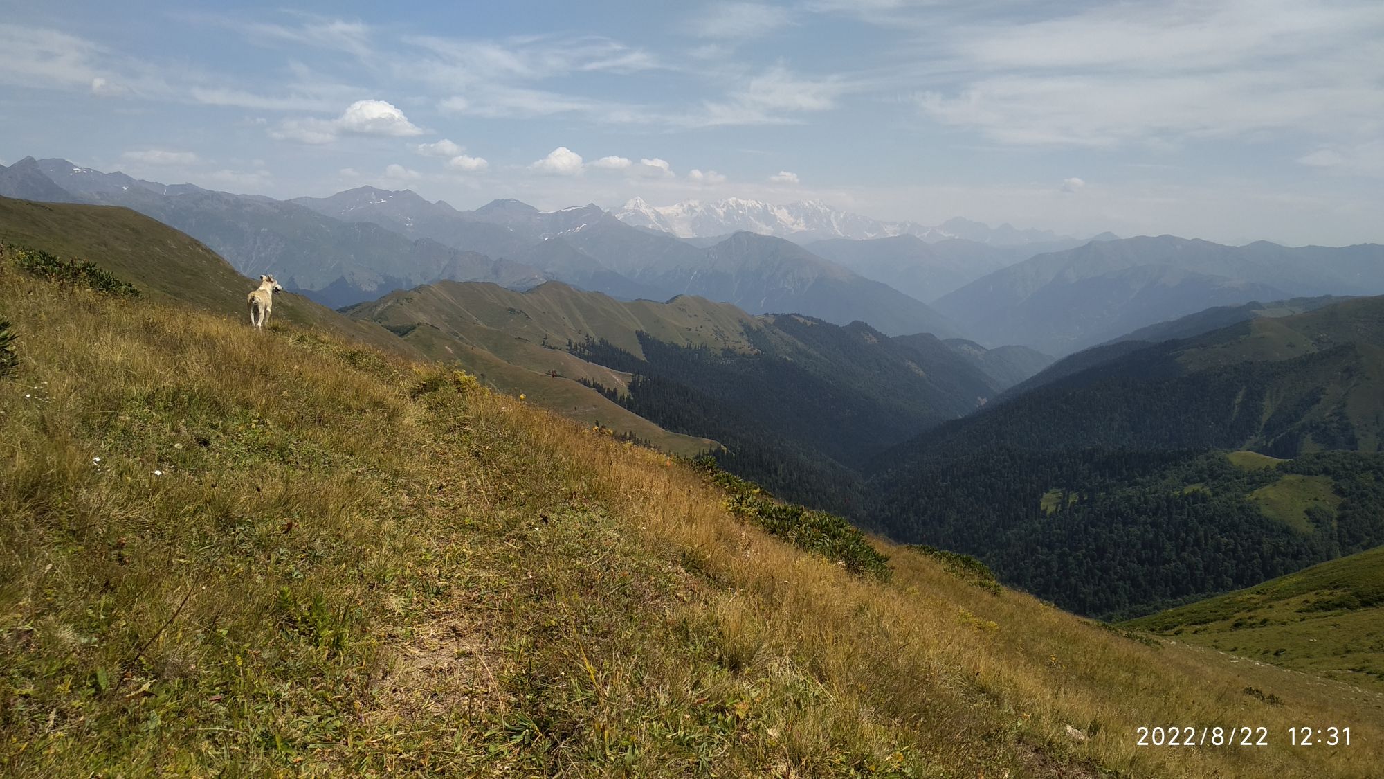
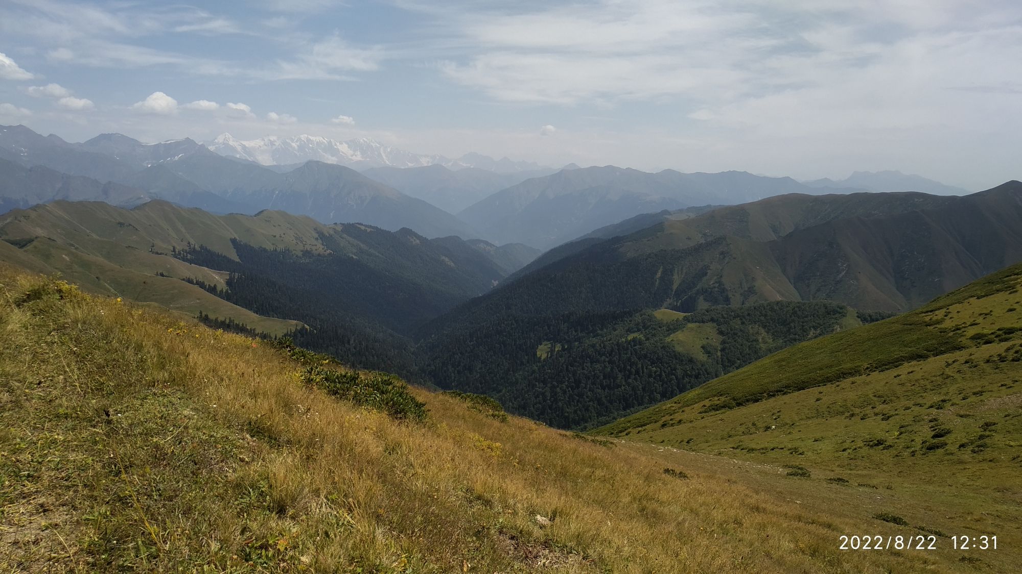
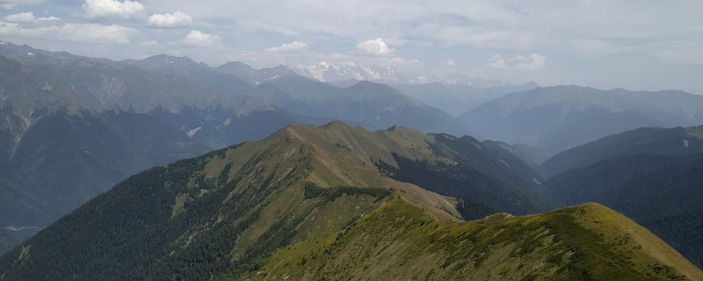
Ridge which you should climb up(treeless,flat,gradually ascending) and Mt. Diuristavi,the highest point seen behind, in the right side of the photo. Viewed from the direction of Lebarde lakes
Along the route, you shall pass at least one shepherd's huts, so beware of their dogs. 500 altitude meters later, you shall make it to the top of Devashi range and turn to the north.
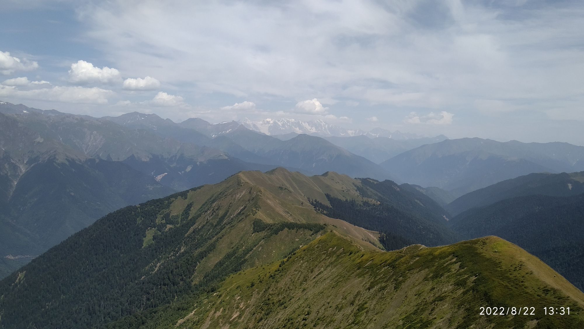
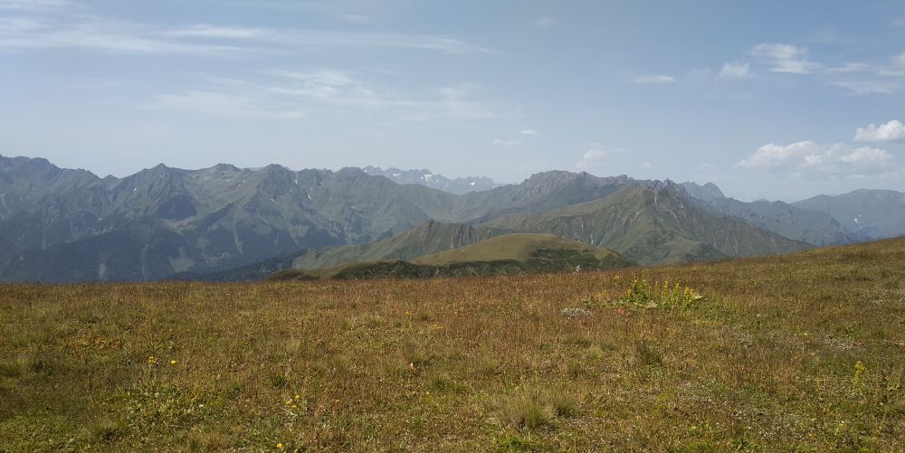
From there, it's less than 30 minutes to the Mt. Diuristavi (2667m). The views awaiting at the top are exceptional - enjoy the moment and keep going, following the top of the ridge in the northeastern direction.
The following section is spectacular, but at the same time also very demanding. Countless "ups and downs", bushwalking, high grass and occasional traverses of the overgrown slope are certainly tiresome, though I can’t say there’s something dangerous. Just be careful when climbing down the quite steep final drop towards the Devashi campsite.
On the ridge, you will gradually lose the altitude. At around 2000m, you shall notice an old dirt track some 200 meters to the left. Skip to it through high grass, pass the small swamp and here you are! Road contours are sometimes a bit distorted by grass but still recognizable, direction is clear. Approximately 1km until a decent road! You will pass another swamp, much bigger this time. Places for camping are more than plentiful, choose by your preferences.
Once you see a decent road, it means the water is near (approximately 20-30 meters before arriving at the wide road), some 5 meters from it to the right (southern) side, the path to it should be trodden a bit.
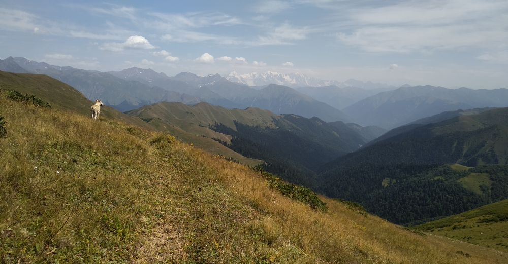
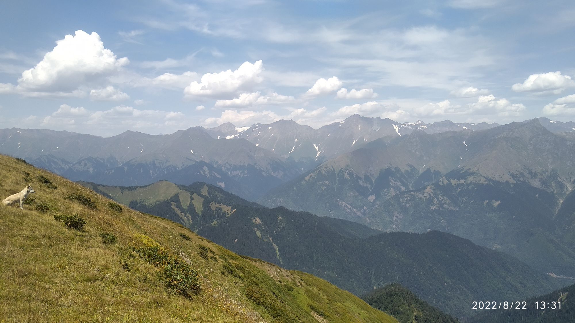
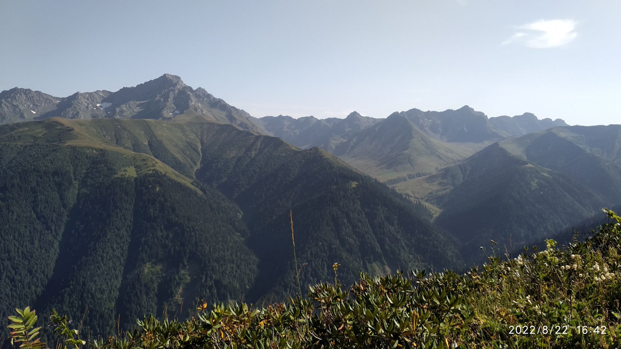
Devashi ridge, sweet doggo and Shkhara in front.
Pack up and return to the start of the road. At the beginning, it goes southwards into the forest and descends through southern slope of Devashi ridge for quite some time but then treks up again to cross towards Lentekhi. Don’t get frustrated if you come across a few turns which are nothing more but short dead-ends. If you have a general sense of orienteering and can distinguish between the main road and the one made to extract the wood you won’t have any problems. However, keep in mind that I lost gpx signal during this descent (at places where waypoints are much more spread out as before). Please, do not follow this last part blindly and if you finish this trek, I would be very glad if you sent me your gpx log.
Also, with some luck, you may hitch a ride with some local woodcutters because the walk on the dirt road is really not that interesting. If not, you just keep following the switchbacks till you reach the village Tsanashi and the real road. Lentekhi lies less than 3 km to walk to reach Lentekhi.
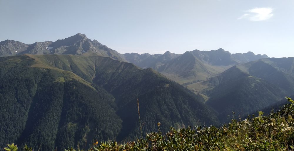
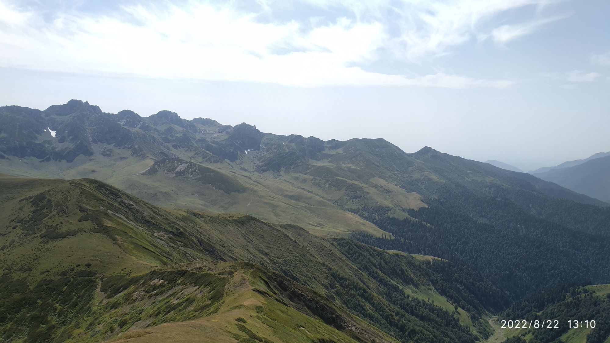
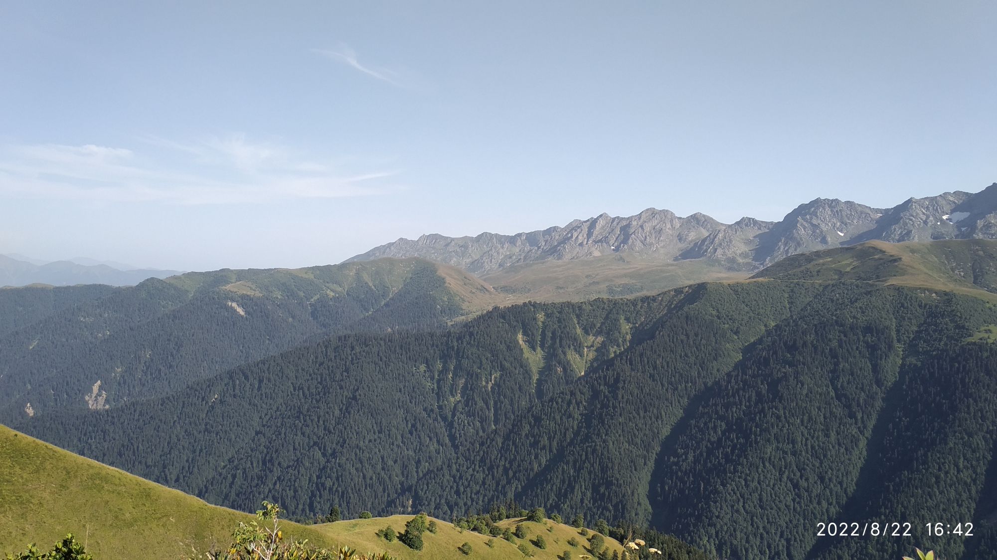
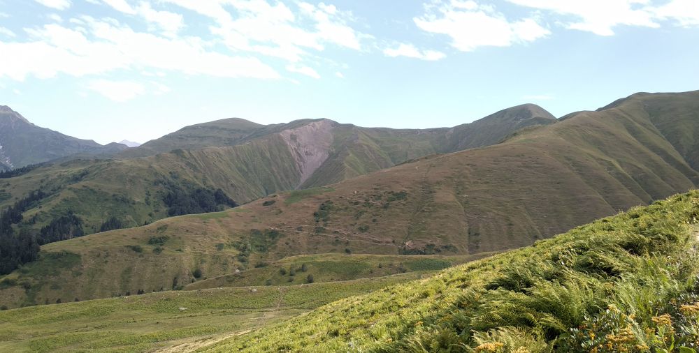
Egrisi range and Mt.Tsekuri south of Devashi ridge. Not to be confused with Egrisi mountains fuirther to the west.
The trail was hiked by Alex, local backpacker and trekking guide, who also provided pictures, gpx and the hike description. Thanks a lot!