Demanding hike aiming for some of the most impressive views around Mazeri.
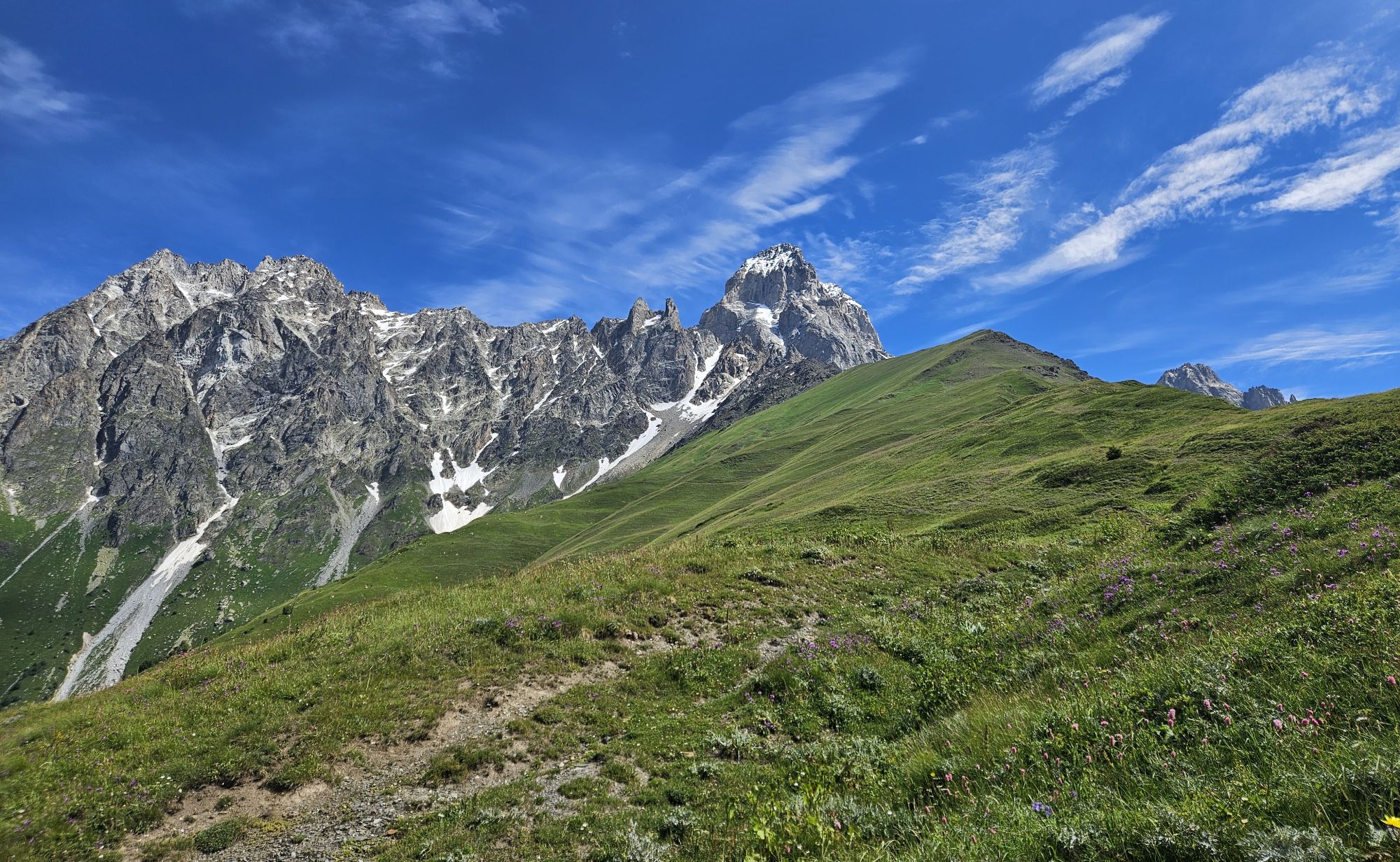
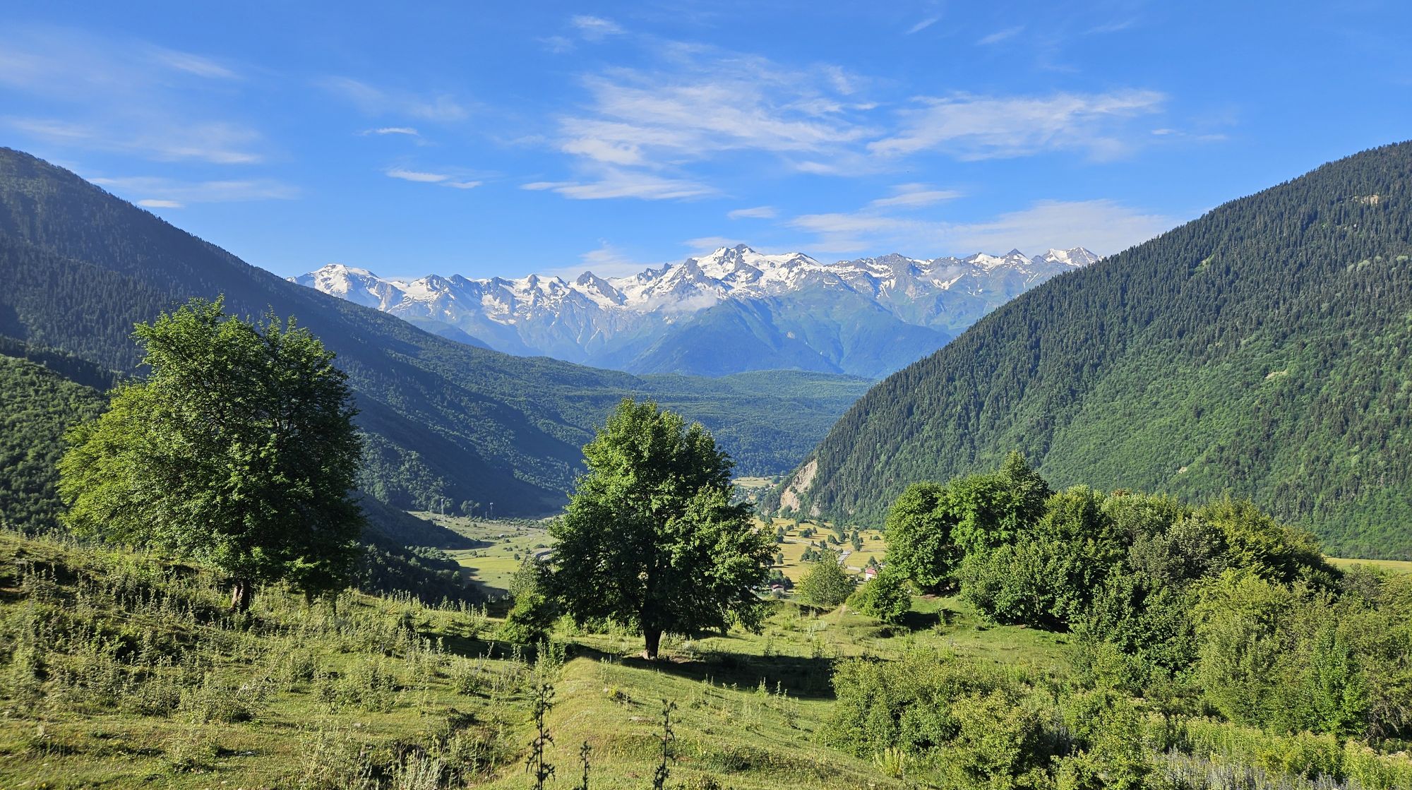
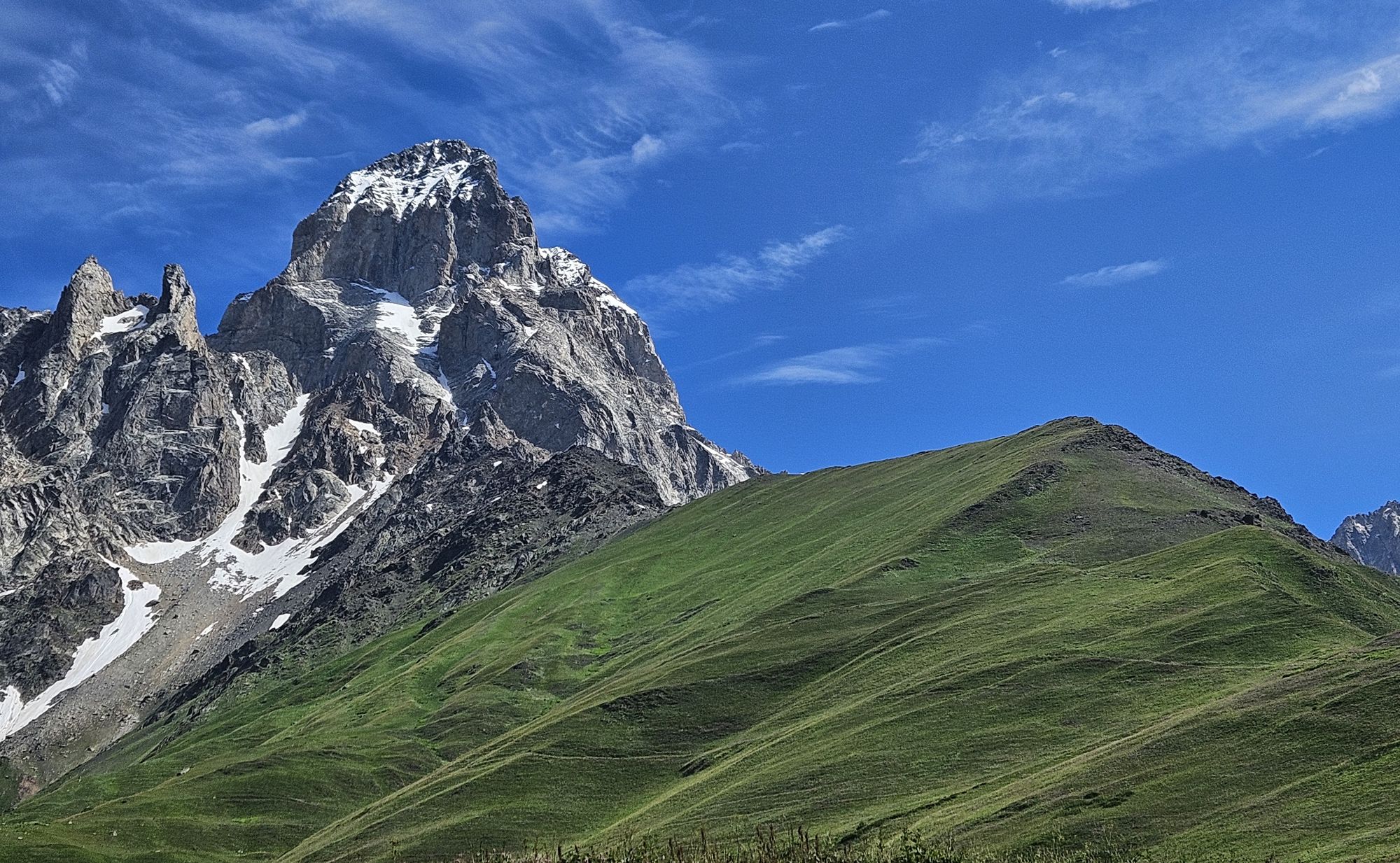
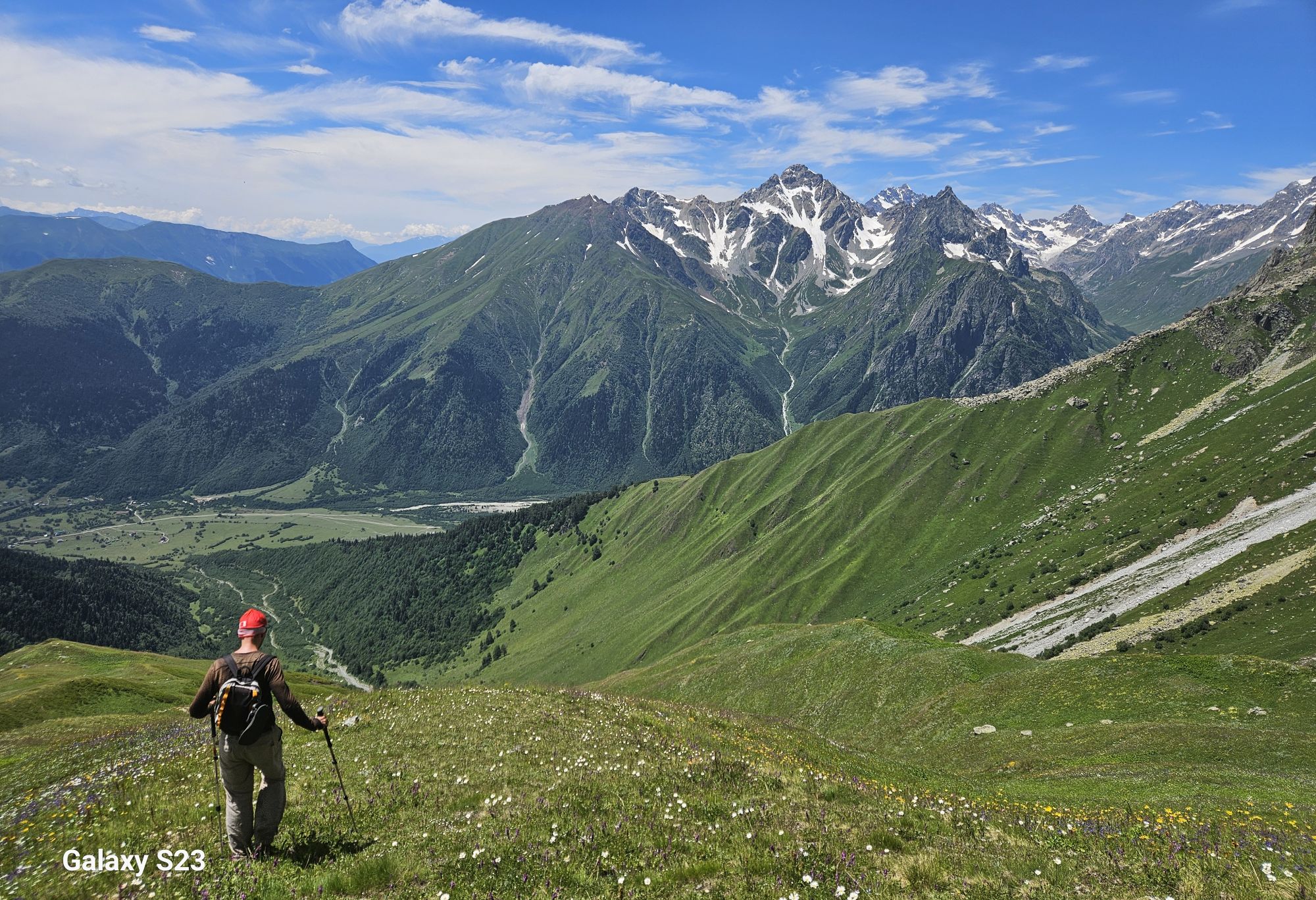
While admiring Ushba from the Mestia - Mazeri trail, I can imagine that many hikers wonder - how could I get closer to that horny mountain? There is one way, but it is not an easy undertaking and requires a whole extra day. Still, those willing to spend the effort to reach the black rock of Meshkhol (and to check the weather forecast for clouds) will be rewarded by terrific views, one of the best in the area.
Another advantage of this hike is that you don't have to climb all the way to the top, which lies at 3100m. Many people turn back at the meadows of Lemel at 2500m, which are also pretty scenical.
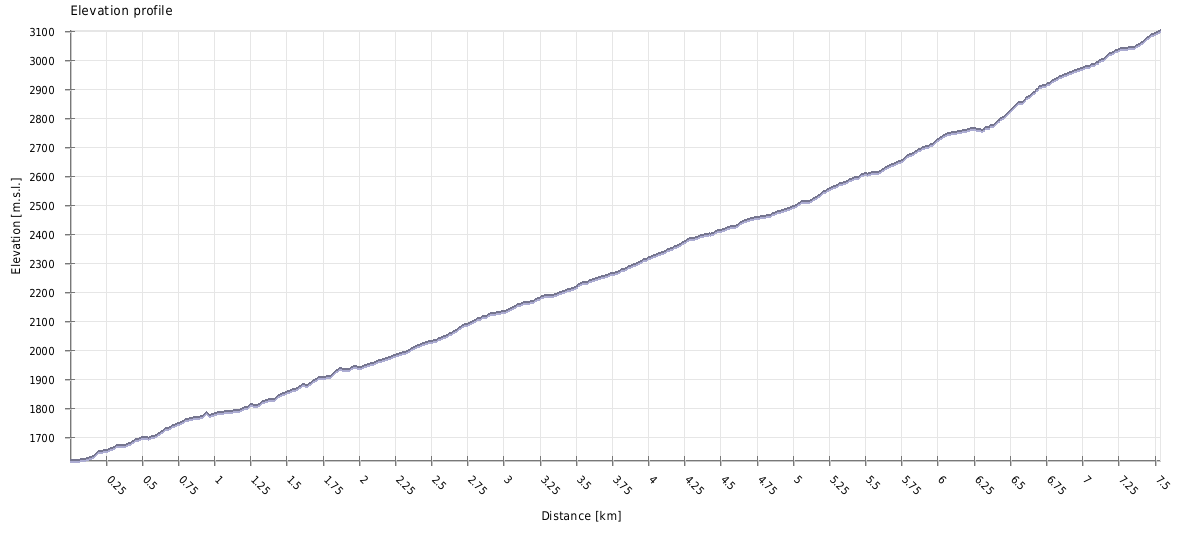
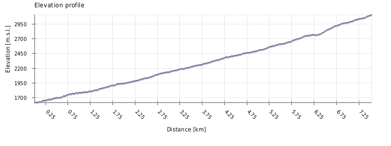
Since you can turn back anytime, this hike is as long as you make it to be. There are two logical places to turn back. The first one is at the meadows of Lemel at 2500m, after you leave the forest and views of Ushba open up above you. The climb from Mazeri to Lemel and back should take about 6 hours.
If you want to reach the black rocks of Meshkhol at 3100m, expect to spend about 9 hours on the trail.
Again, it depends on when you will turn back. If you go only as far as Lemel, the difficulty is Moderate. But if you plan to climb all the way to 3100, this hike is closer to Hard.
The trail can be attempted all year long, in fact, the route through the forest looks like an ideal ski-touring trip (at least till Lemel, then terrain then becomes steeper and avalanche-prone).
For a hiker, time to try this one would be from May till October for the Lemel hike and late June till late September if you want to climb all the way to 3100m.
There is no public transportation to Mazeri. The closest road served by marshrutkas lies 7 kilometers away, at the mouth of Becho valley.
So, while you can take the morning marshrutka from Zugdidi to Svaneti and tell a driver to drop you at Becho community, it's not too convenient. A preferable transport, apart from walking, is the taxi, most easily arranged at Mestia. The ride will costs you some 80-100 GEL. If you want to take a taxi to Mazeri from Zugdidi, it will easily cost 300 GEL.
There are also are two nice day walks connecting Mazeri with neighboring villages - Mestia and Etseri.
There is no public transport to Mazeri. The closest road served by marshrutkas lies 7 kilometers away, at the mouth of Becho valley. Therefore, you may have to hire a taxi, either to the main road or even to Mestia, if you want to catch marshrutka. The price of the ride to Mestia starts at 80 GEL (but can be also much higher, depending on the driver, situation and the level of your desperation).
There are also are two nice day walks connecting Mazeri with neighboring villages - Mestia and Etseri.
On the Bagvdanari ridge
| Distance | 15.6 km |
| Trail type: | Roundtrip |
| Max. elevation: | 3100m |
| Min. elevation: | 1610m |
| Total climb: | 1851m |
| Total descent: | 1851m |
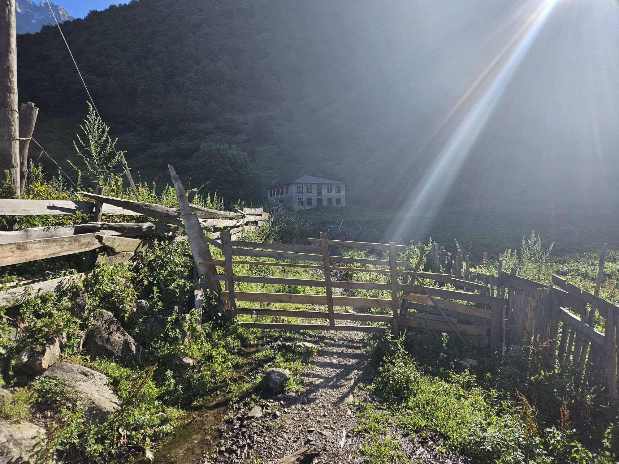
The trail starts at the northeastern edge of the village, at the main road that skirts it from the east. On the eastern side of the road, there is a small wooden gate. This place could really use a hiking pointer, but at least in 2024, there was none.
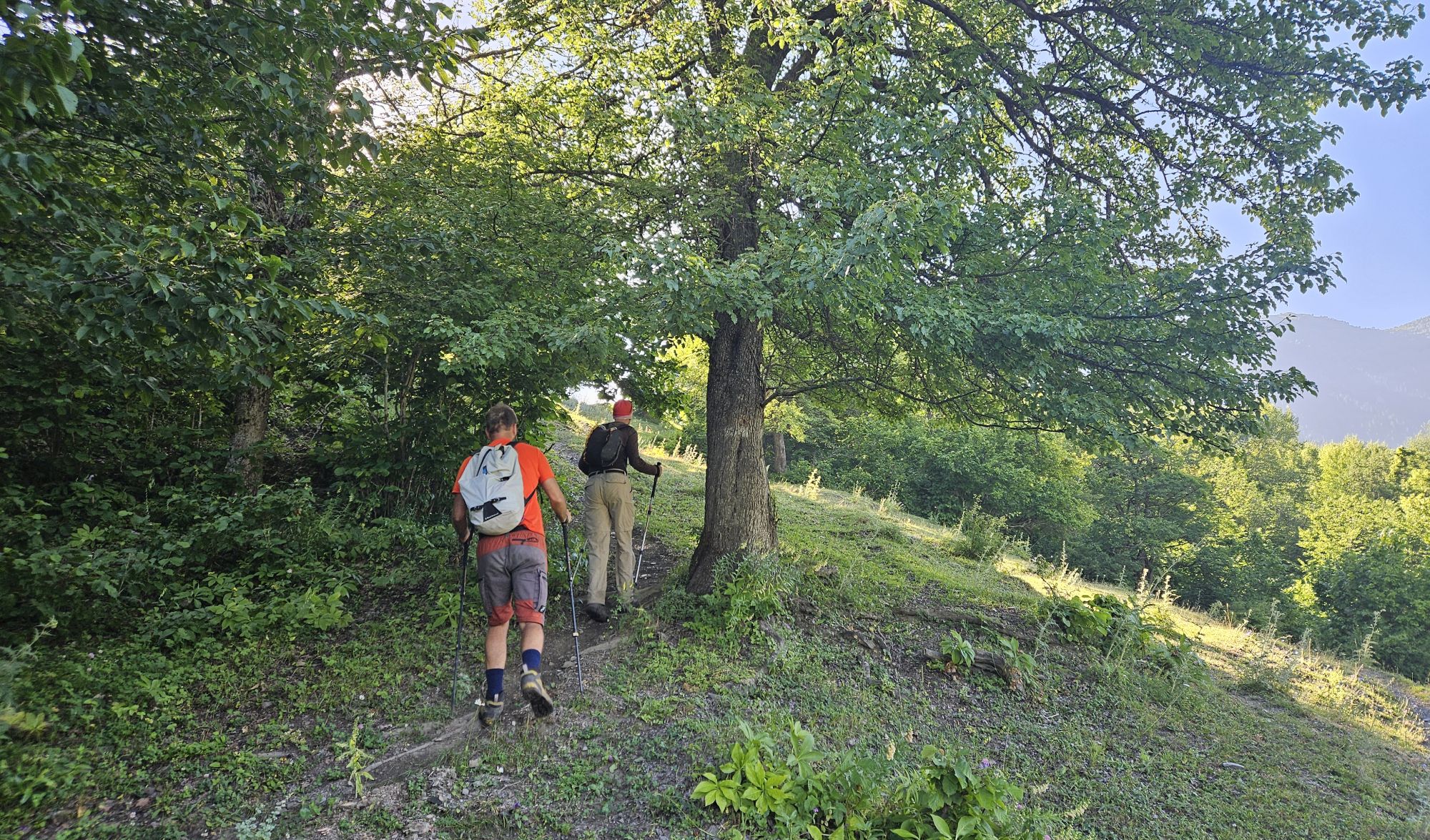
Pass the gate and follow the track between two fences for about 100 meters, past the large house on your right. Here, it splits - turn left and cross a small meadow, till you reach a more narrow space with the fence on your left and a rising hillside on your right. Here, make a 150° turn and look for a trail that diagonally climbs the hillside. Follow it for a while through the forest - the climb is smooth and soon, you will find also some worn-out white-red markings.
After you gain 100 altitude meters, the trail emerges onto an upper part of the meadows. Traverse the first one, pass the lonely tree with a marking and soon you will reach another one, criss-crossed by cow paths. You shall also see a larger path on your right coming up from Bagvdanari village, so keep your altitude and you will join it soon enough as it re-enters the forest. After 300 meters, it shall emerge onto a rather large dirt track coming from the east. To the right, you shall see a nice, flat grove (known among locals as Labok), suitable for picknicks.
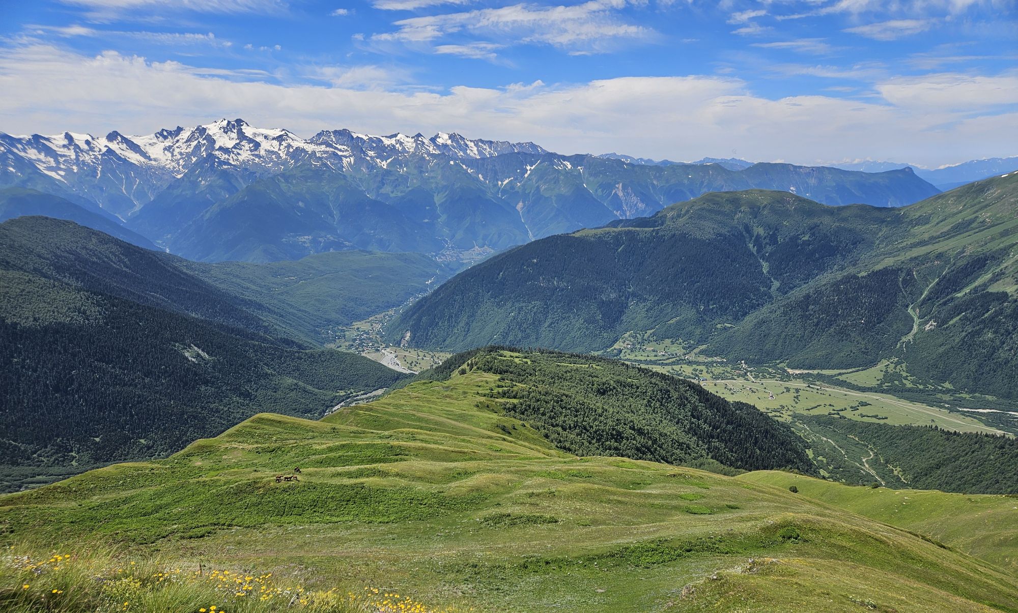
Now comes the dullest part of the hike - almost two hours on the dirt track (tho I imagine it would be a terrific route for a ski-touring trip). Over the first hours, there are some views at Mt. Bak and Mt. Simzagar across the Dolra Valley, later, also Ushba starts showing up. The track is also straightforward - there is only one junction at the altitude of 2100m, with the right branch heading to a couple of abandoned shepherd's huts and a small lake. Not much later, there is a small water reservoir to the right of the road, tho I would use it only in an emergency (or on the way back) since this is not 100% running water.
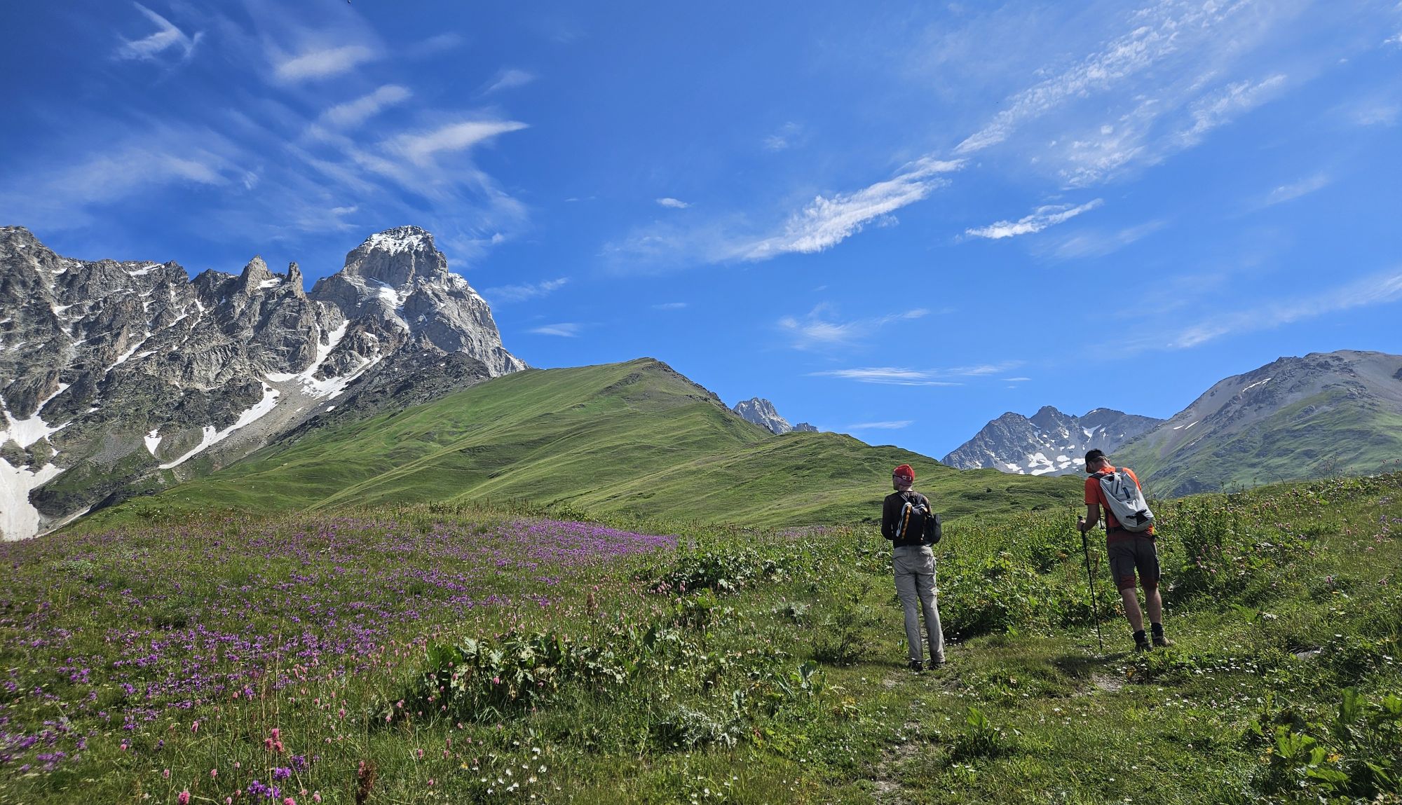
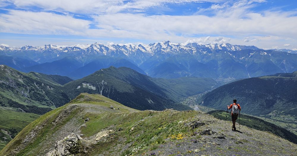
At higher altitudes, views slowly open up
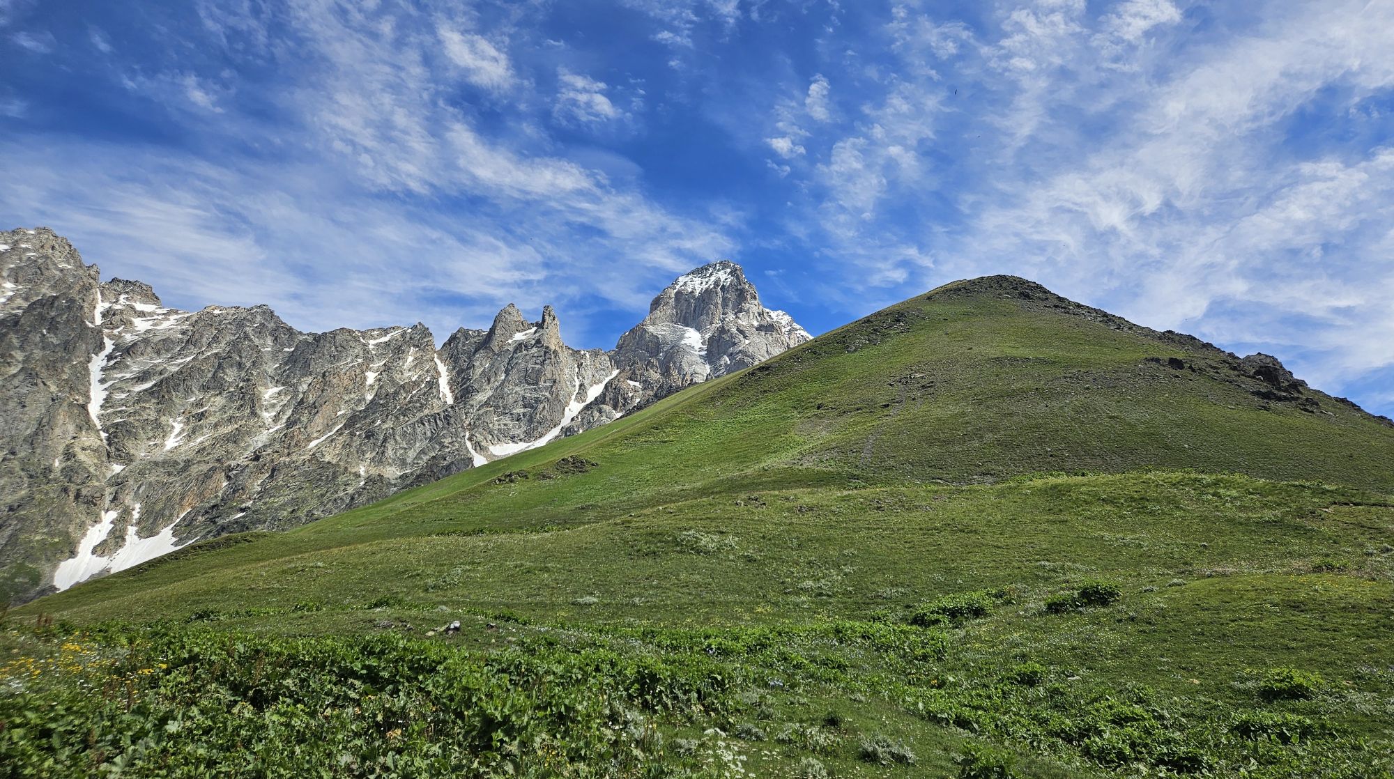
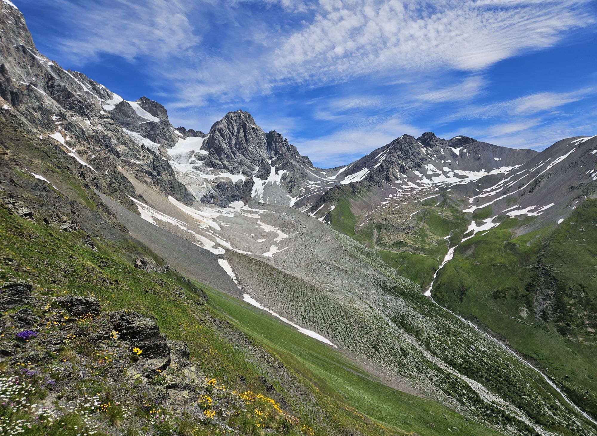
The road gets in and out of the forest until it finally leaves it at the altitude of 2450m. This area is called Lemel and offers the first clear views of your final destination - a rather large Bagvdanari ridge ahead. You shall pass a small, dirty lake and finally reach the junction where the dirt track turns right, over the hill, and down into the Gulischala valley. Here, stick to the trail going in the original direction, towards the ridge.
From the junction, you should follow a trail, steadily climbing towards the ridge in front of you. Ignore several tempting cowpaths which follow the contour lines to the north, just keep climbing on a mildly zig-zagging main trail. Eventually, you will reach the plateau at the altitude of 2750m, where the trail ends. With some water, it would be a premium camping spot. But we didn´t find any signs of camping there, just a herd of semi-wild horses.
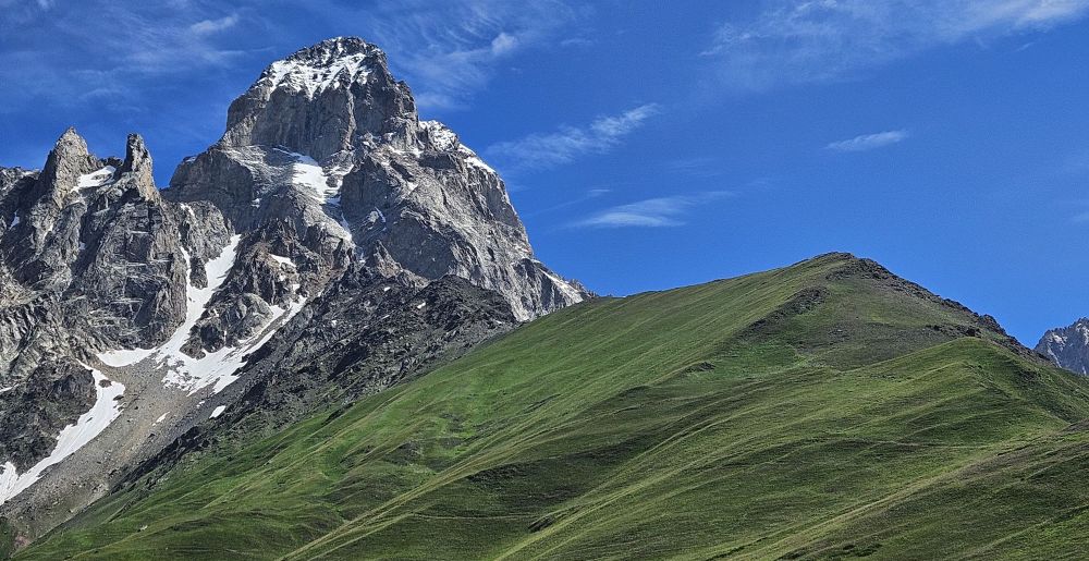
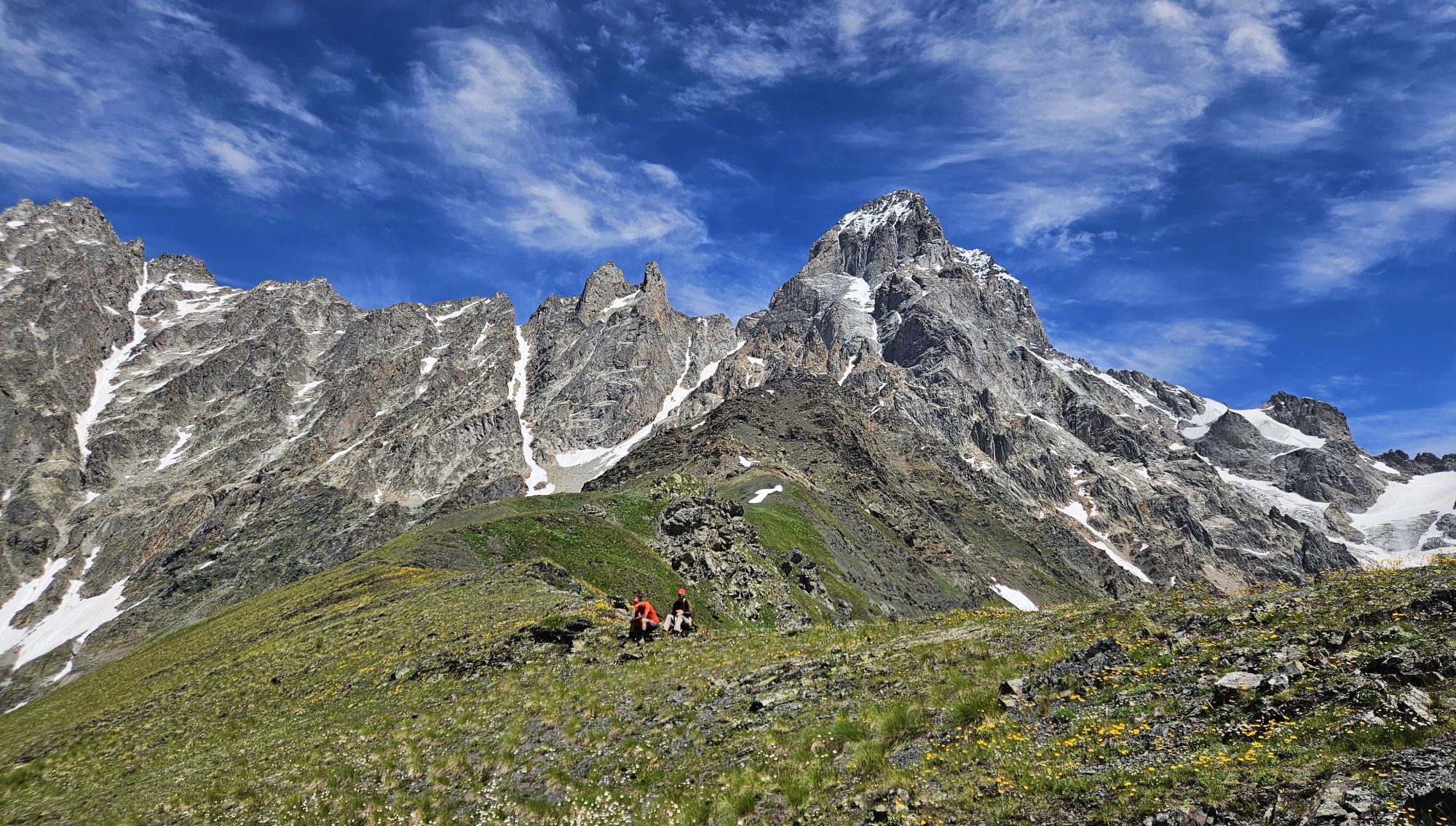
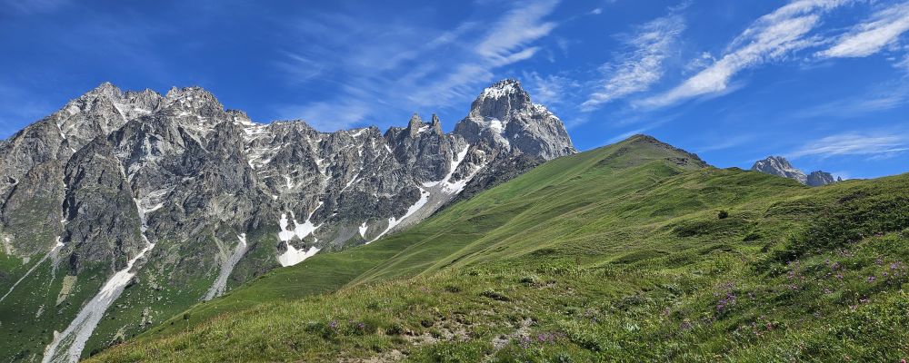
Close-up of the ridge, as observed from the plateau
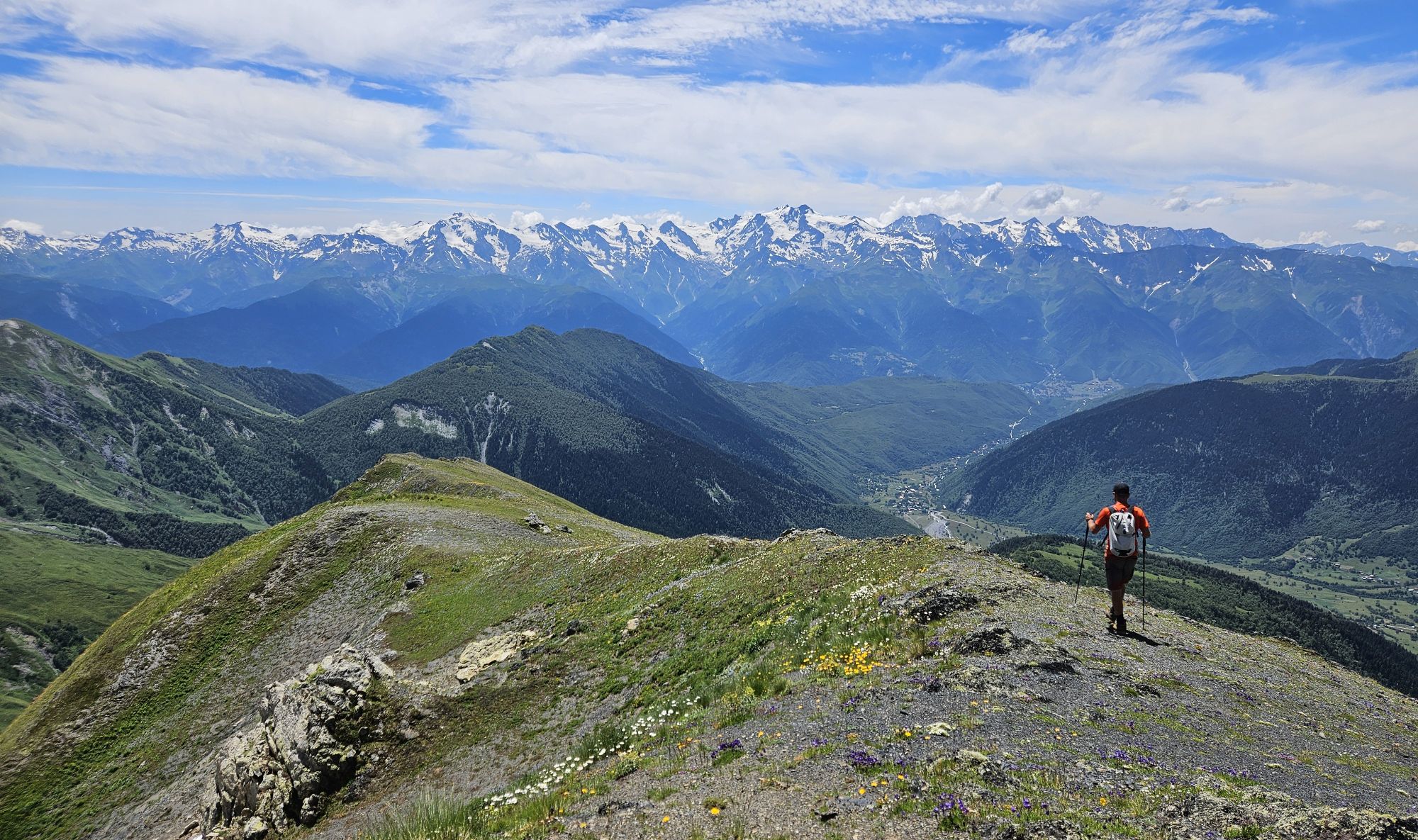
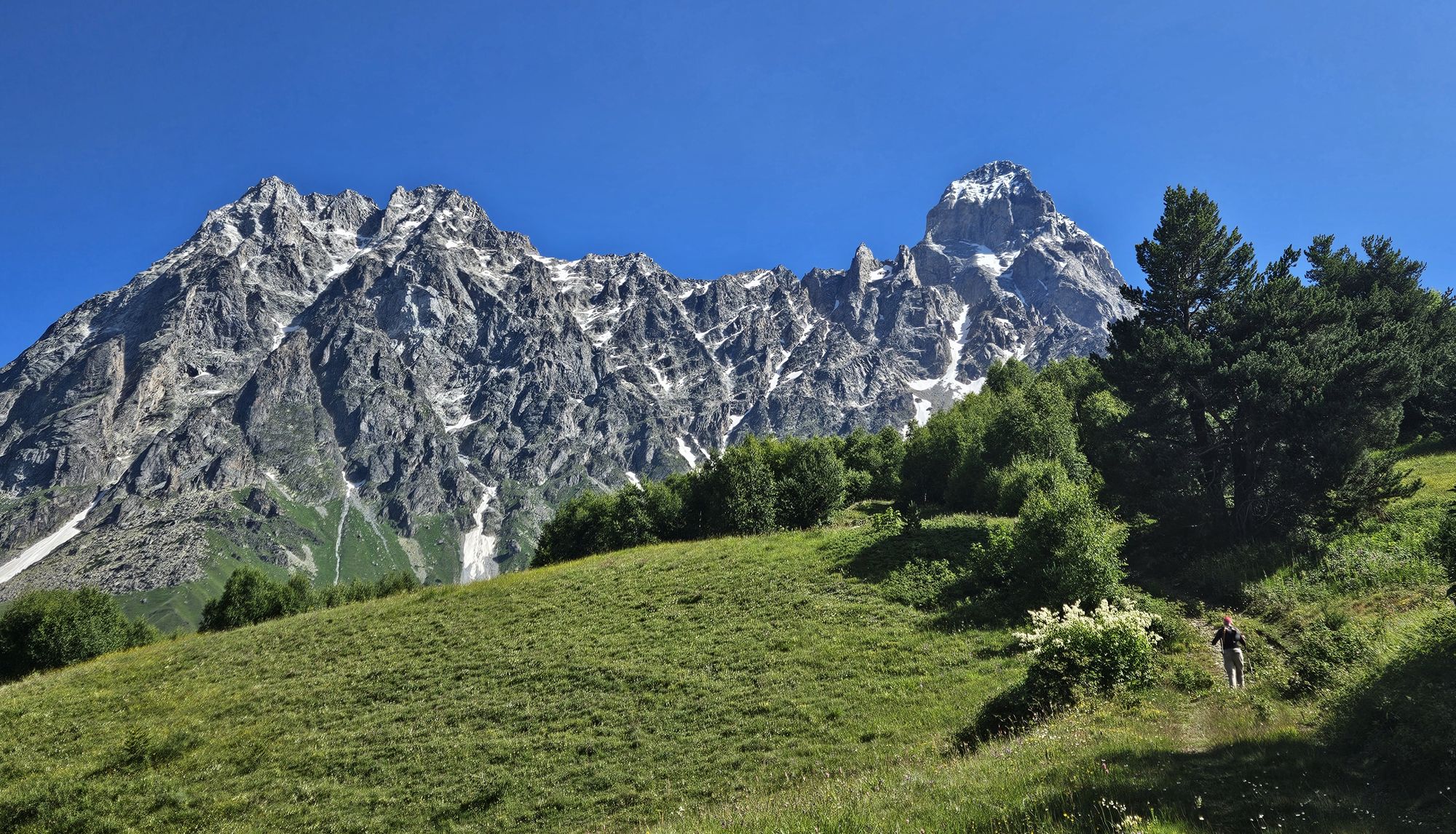
Standing at the plateau, you see Bagvdanari Ridge towering above you. The direct climb through the southern side would be pretty steep. However, further to the left, you can clearly see the the rim on the ridge, with the western side promising a much smoother climb. You need to walk some 200 meters to the north, then, once you make it to the rim, start a direct climb to the top. With a gradient of over 30°, it´s not easy, but manageable. During the climb, you can admire a wide variety of local flowers - a great excuse for a brief break once you run out of gas.
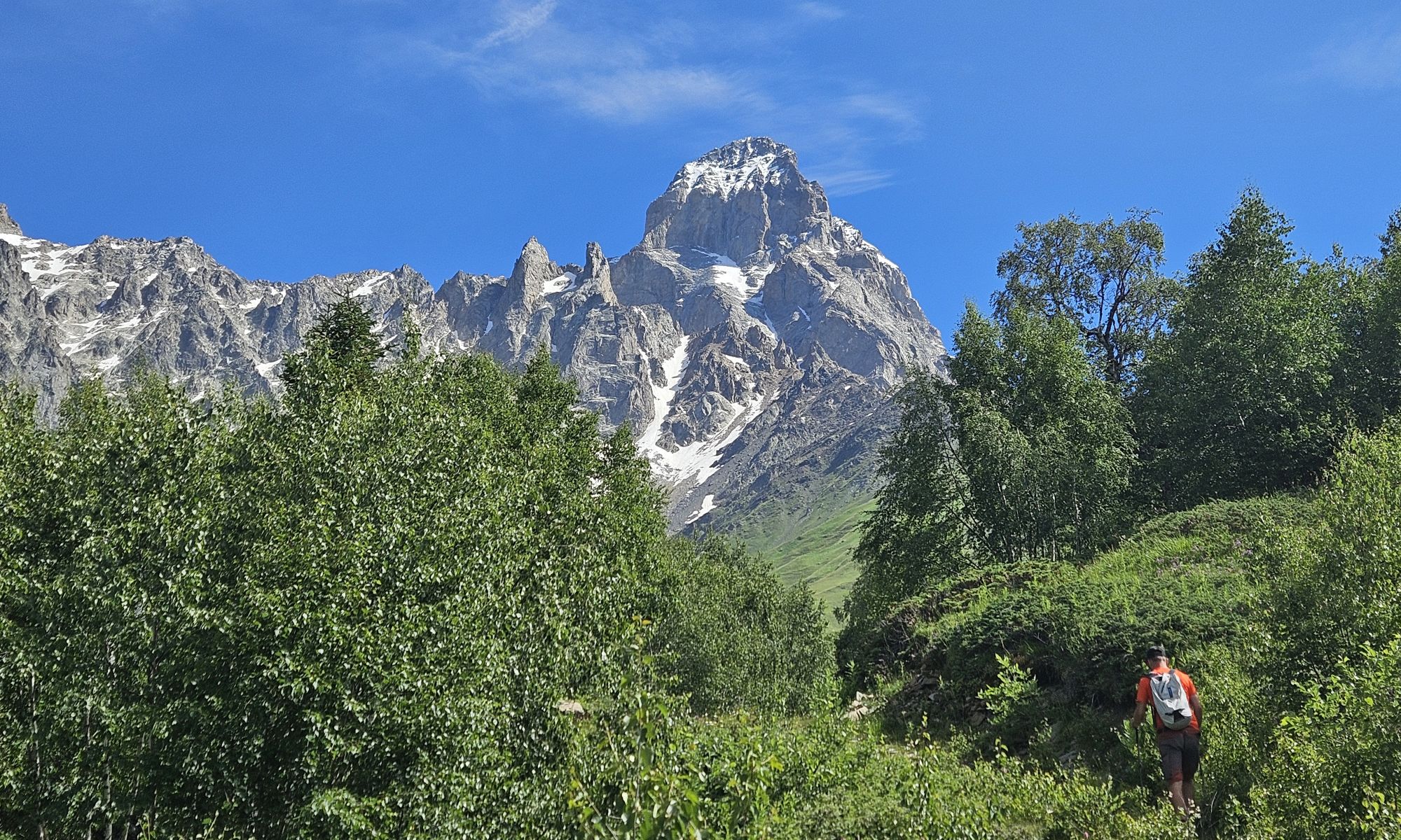
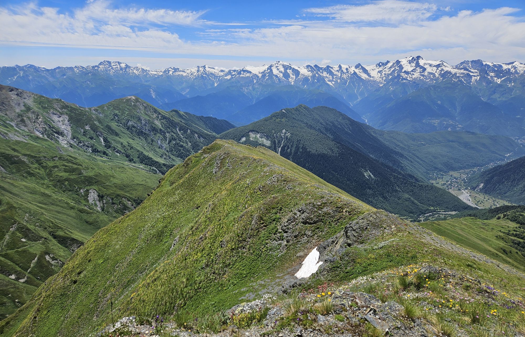
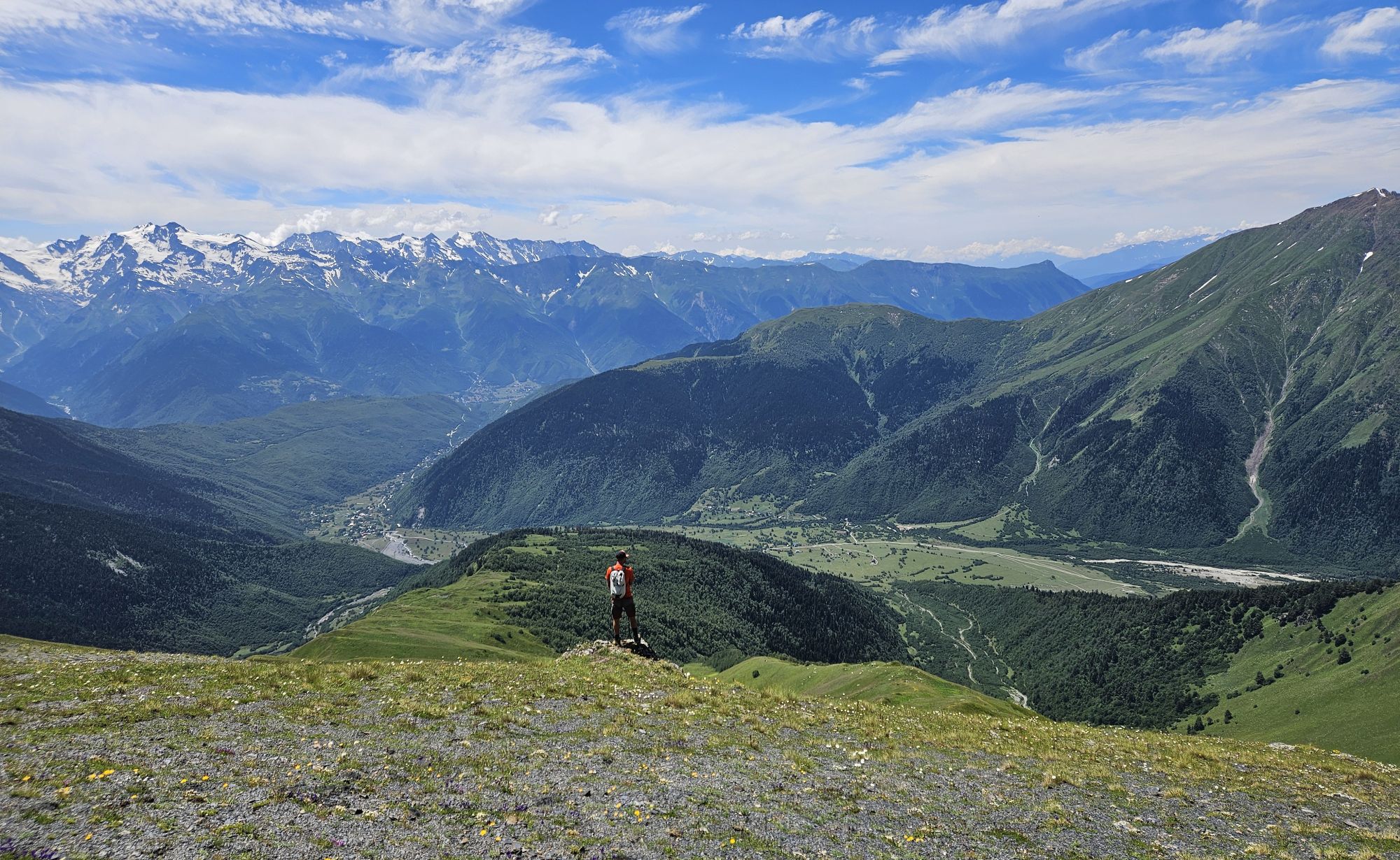
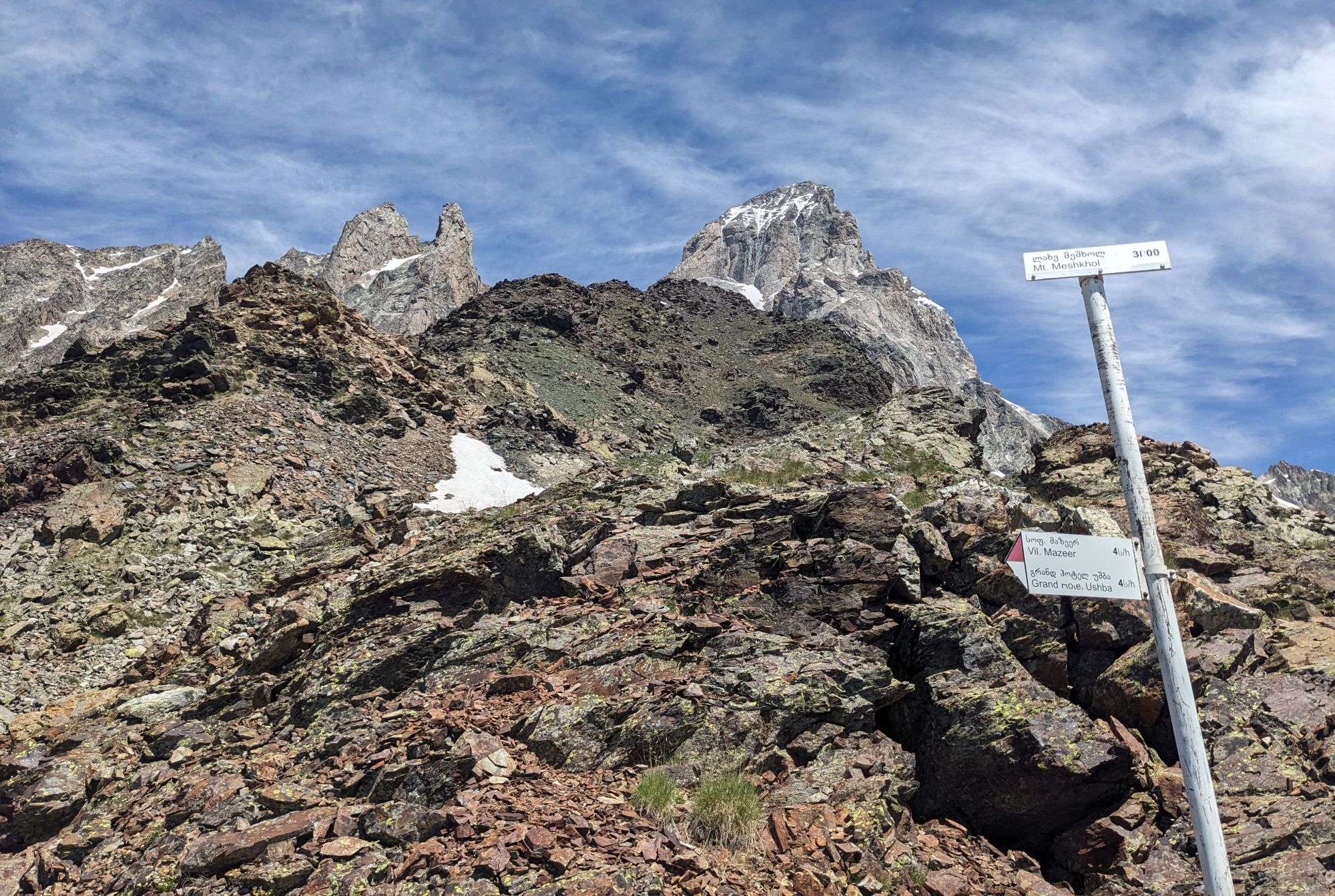
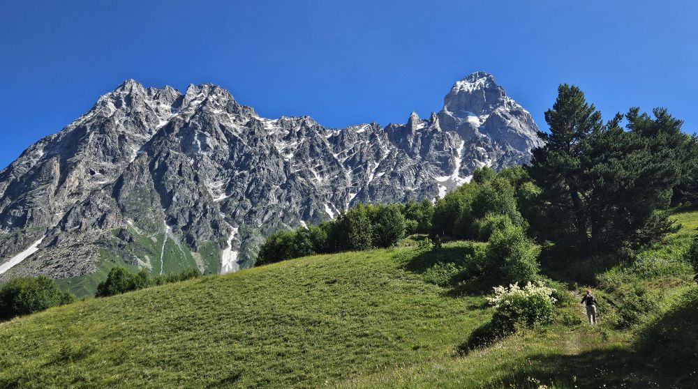
Once you make it to the top of the ridge at 2950m, full views to the other side open in front of you. The whole Gulischala valley, Guli glacier, Chalaadi glacier, Guli pass to the southeast - these are the views you came for. The only downside is that you see only one of Ushba´s horns since the Northern Ushba is obscured by the Southern one. But you are still not at the end. Follow the top of the ridge to the north - it rises, but compared to the previous section, this is like a walk in the park. Finally, you shall reach the hill formed by visibly darker rocks - Meshkhol ("meshke" meaning black in Svan). At its foot, there is a hiking pointer saying "3100m. Grand Hotel Ushba - 4 hours". I wonder who placed it there ;)
You might want to climb even higher, but it won't be easy. So, it's better just to relax at the top and once you soaked in the views, return the same way you made it to the top.
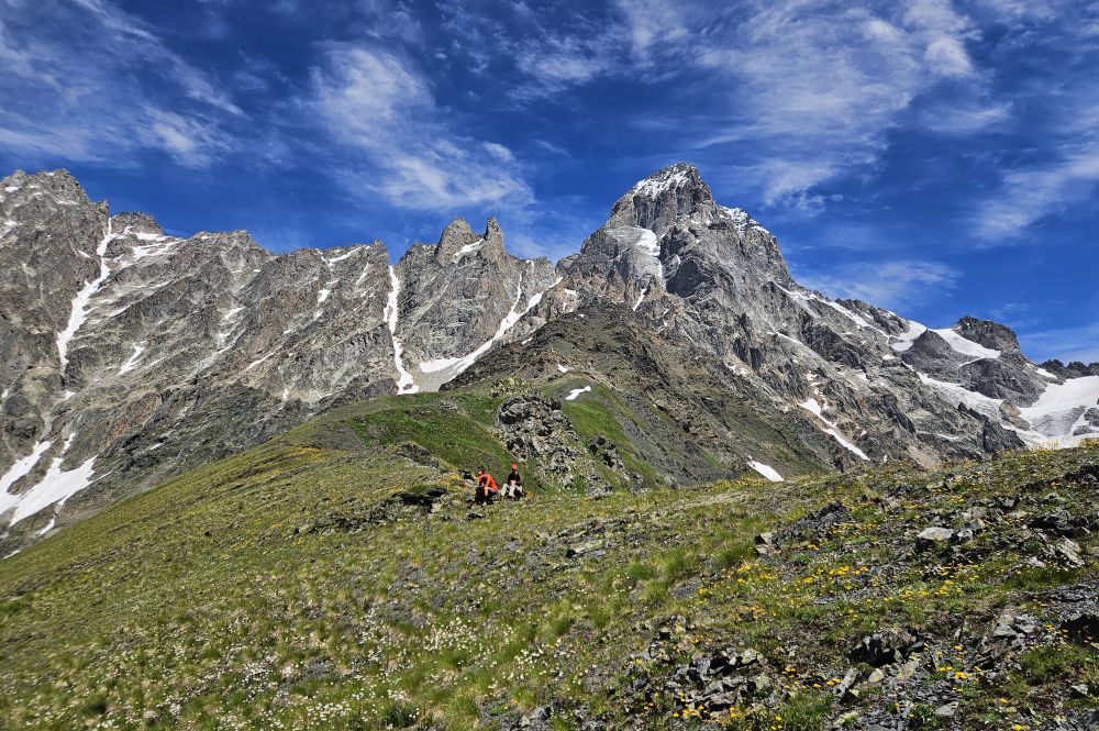
Resting below Meshkhol