A difficult and very impressive alternative for the second half of Mestia - Ushguli trek.
This great trek connects some of the most beautiful valleys of Svaneti while staying as close as possible to the main range of the Greater Caucasus. Or, to be specific, you will basically hug the imposing Khalde wall that is formed by the very same mountains as the more famous Bezengi wall, but is situated from the other side, in Russia.
It should be noted that this walk doesn't work that well as a standalone hike - it's rather a great alternative to the last half of Mestia - Ushguli trek for trekkers with camping gear who don´t mind a challenge and occasional bushwhacking.
Certainly a hard trek. You need to cross two mountain passes in two days (while carrying the camping gear), the trail often disappears and some sections are pretty steep.
For this trek, you will need a tent. It's probably the only variant of Mestia - Ushguli trek where you can utilize your camping gear, so if you brought it to Georgia for some other reason, it's one more reason to try this route.
Best on foot, like everybody else. If you want to undertake this trek, you are probably doing also the first half of the
Mestia - Ushguli trek, either by classic route or via the Tsvirmi variant.
But if you, for some reason need to get to Adishi by car, that´s also possible. There is a dirt track heading all the way to the village that starts at Bogreshi village on Mestia - Ushguli road. The cost of the taxi from Mestia to Adishi should be about 150 - 200 GEL.
If you need to return to Mestia, your best bet used to be minivans making day trips from Mestia to Ushguli. They usually had a few empty seats on the return trip which occured around 3 pm. . However, in the past years, drivers became reluctant to bring hikers back since the Ushguli drivers try to claim all hikers that reached village on foot and other drivers don't want to have problems with locals. So don't rely on these buses too much. So what to do? You can either take a taxi from locals (costs as much as 40 GEL per person) or walk on the road towards Iprali and once the village is out out sight, try to stop some minivan with daytrippers, that should be a bit cheaper.
It's like cab mafia there, we managed to get in a bus for 20 GEL but the cab guys saw it, followed by car, stopped the bus and made us leave it. We kept walking since we didn't want to support this behavior and they even followed us half an hour by car. Later on the gave up and we manged to get another bus.
If you want to prolong your trek, you can cross into Lower Svaneti on foot via Latpari pass or Zagar pass.
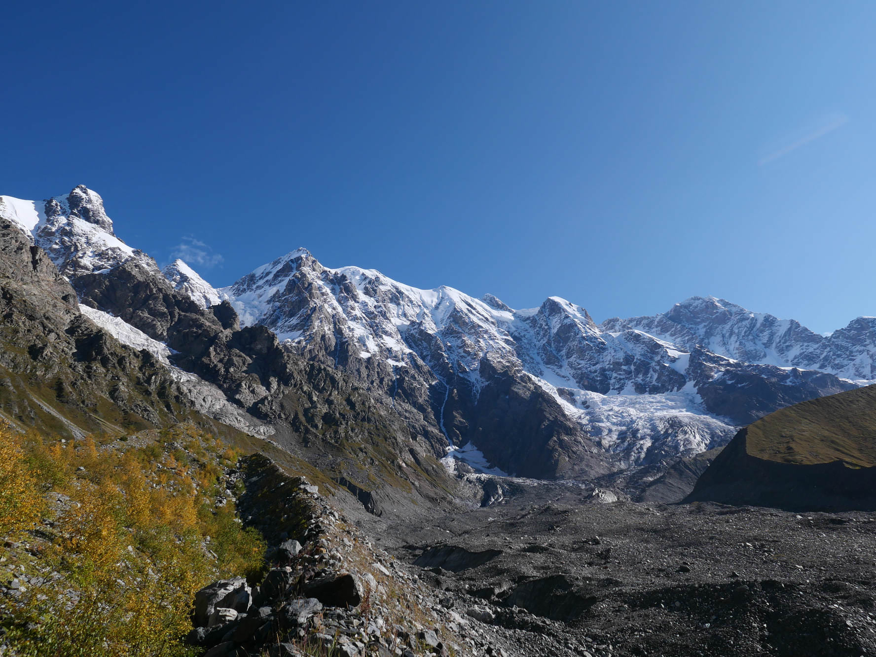
Khalde wall & Khalde glacier
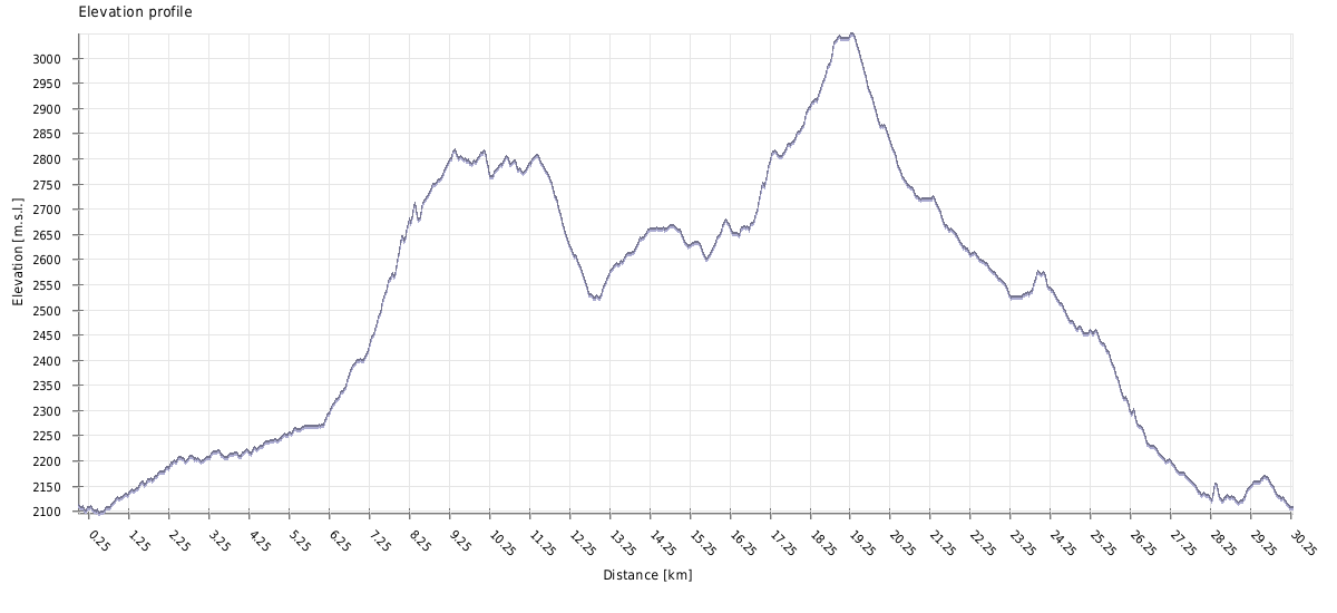
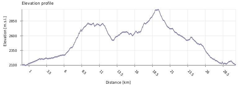
| Distance | 27 km |
| Trail type: | AB trip |
| Max. elevation: | 3048m |
| Min. elevation: | 2097m |
| Total climb: | 1920m |
| Total descent: | 1915m |
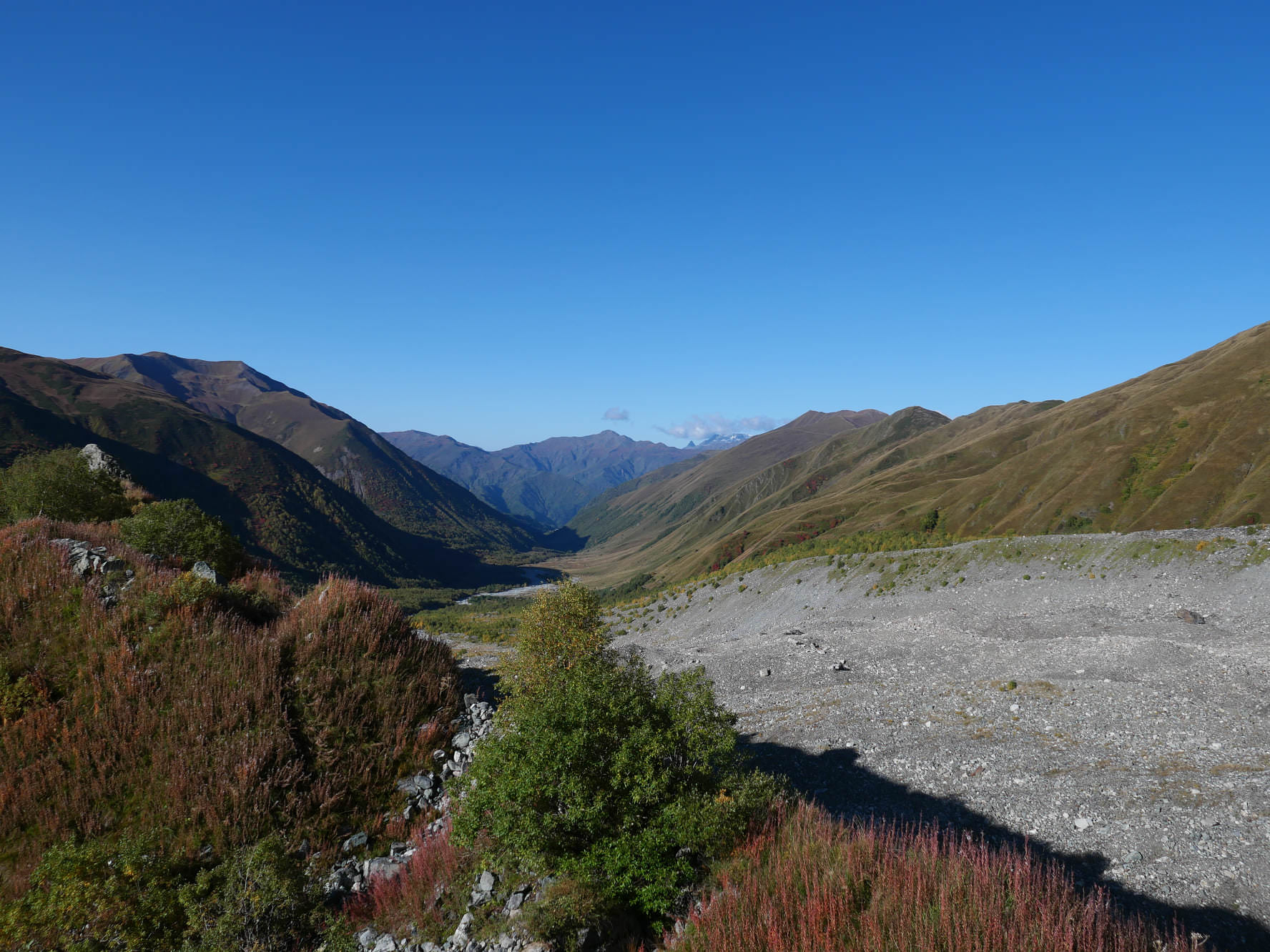
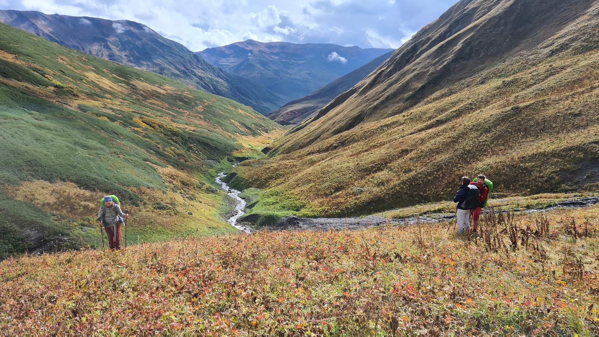
A major part of this day overlaps with the route of the Mestia - Ushguli trek. Leave the village by a path heading by the river to the east, to the foot of Adishi glacier. After one hour, the path ends in a river - you will have to ford it. During the season, there are usually several locals from Adishi with horses which offer transport, However, they charge 25 GEL or even more per person which is, considering the duration of the ride, usually quite a ripoff (unless the water level is high, then it´s worth every penny). Before you pay, I recommend walkin some 50 meters upstream where the river branches a bit more and check if you can cross on your own - that doesn´t mean it´s always possible, but it´s worth checking out. The water is freezing so you won't be able to spend too much time in the river. Wear hiking sandals and use hiking sticks. But don't take any unnecessary risk and use a horse if you don't feel confident.
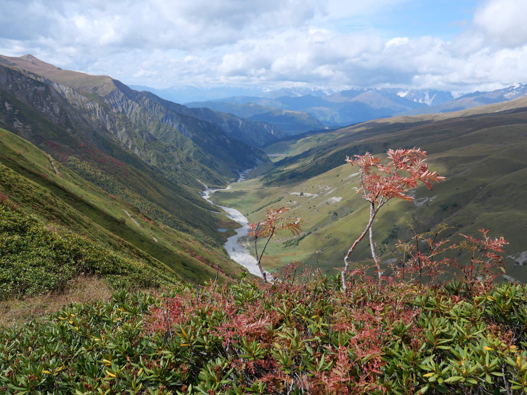
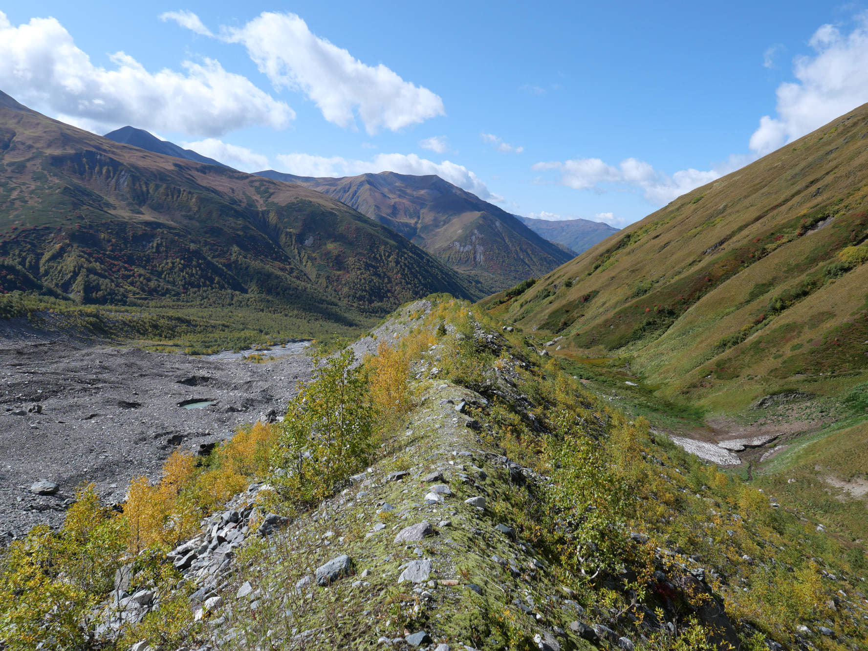
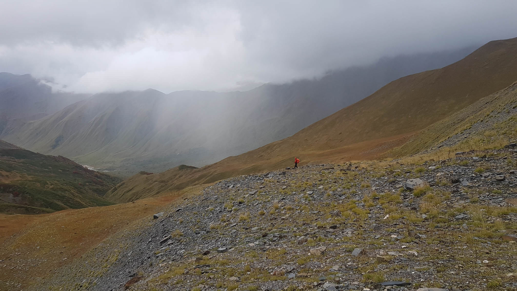
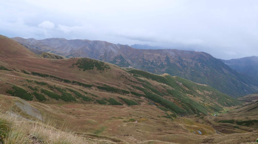
Behind the river, the path appears again. After 2 hours of climbing through the fields of rhododendrons, you should make it to the Chkhunderi pass (2655m) - it offers great views of surrounding mountains and the Adishi glacier. This is where our route leaves the classic trail - we don´t head straight down like other hikers but follow the top of the ridge to the northeast. We climb about 100 altitude meters to a viewpoint, which offers even better views of the Adishi glacier. From here, follow the ridge for another two kilometers till we reach a Rhododendron pass. This saddle is quite wide and consists of two depressions with a small spike in-between. Follow the ridge to the very end of the pass, till the spot where the terrain starts rising steeply.
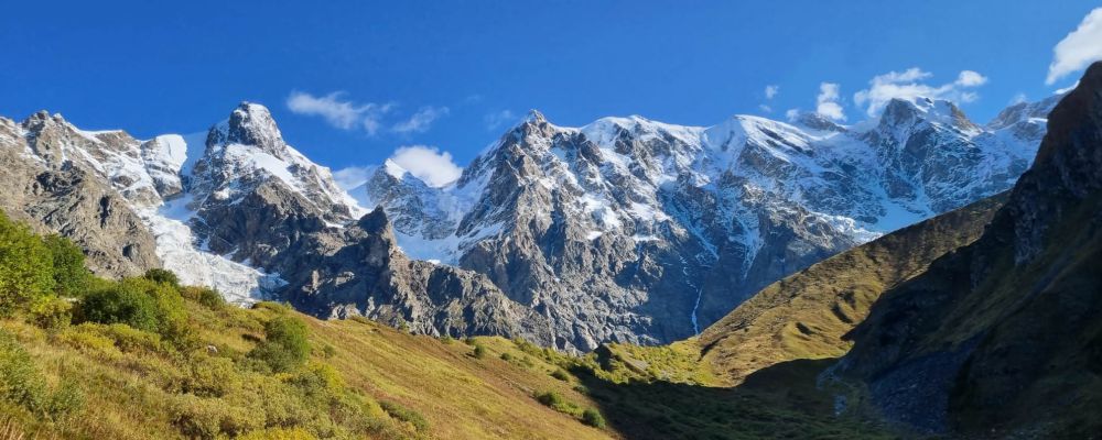
At the Rhododendron pass (with trail to Chkhunderi pass visible in the distance)
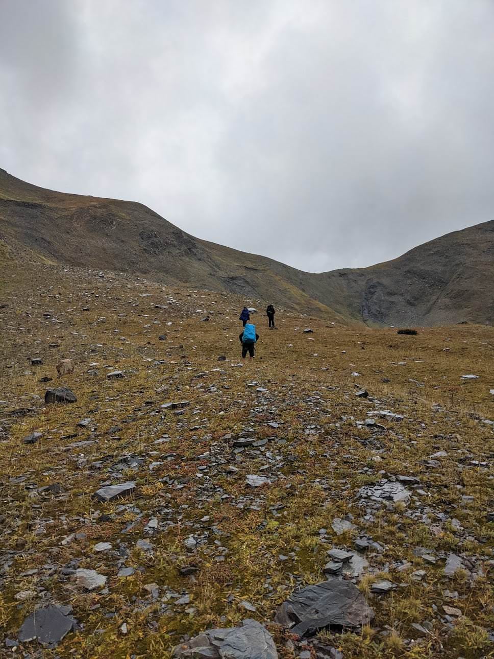
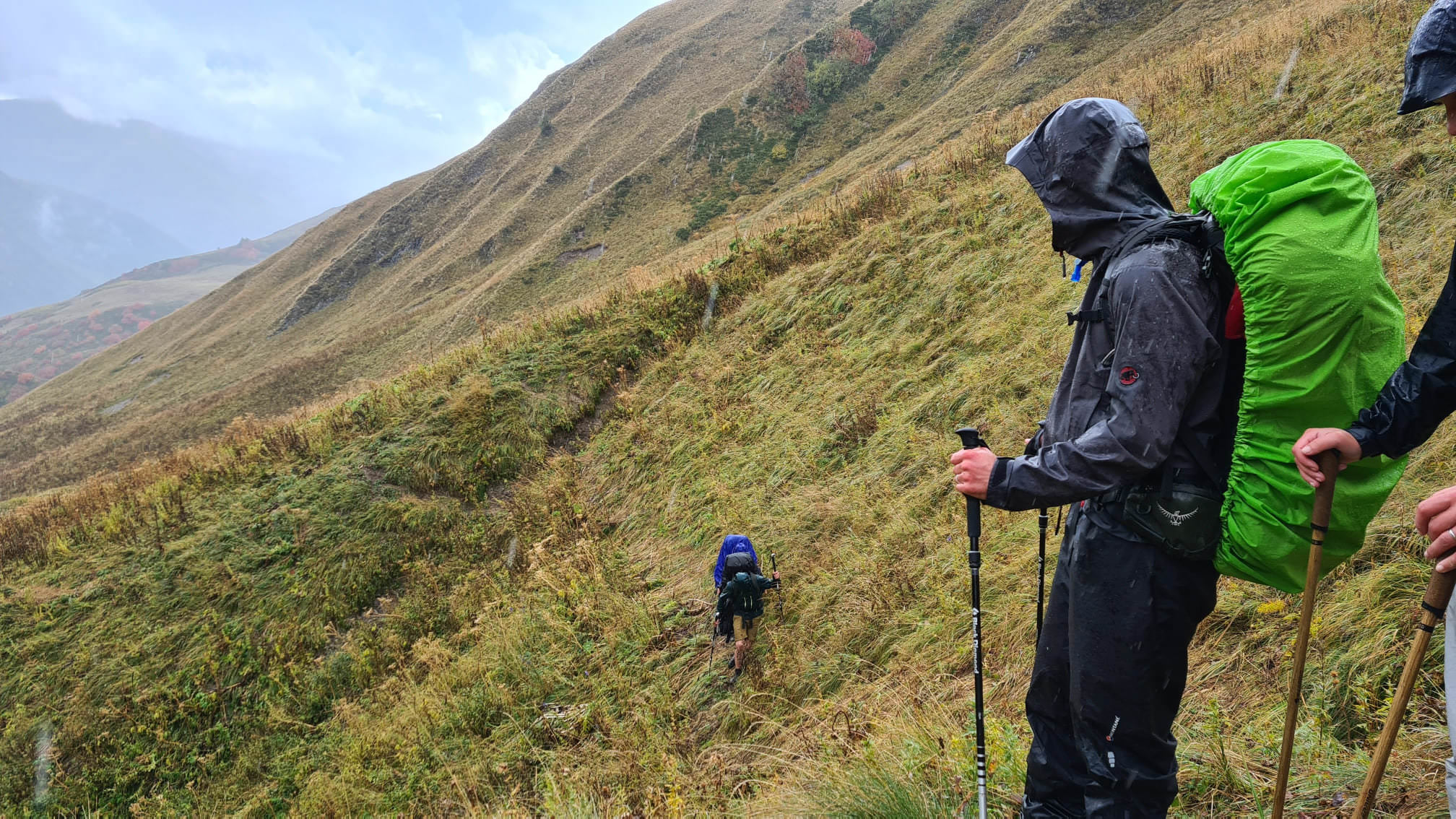
From here, things get interesting. You need to get to the bottom of the valley, but there is no trail to follow. Moreover, the terrain slopes down in the southern direction, but you need to get to the southeast. So, at some passages, you will need to traverse small side ridges, at others, head straight down, depending on the situation or "as the mountain lets you". On a positive note, there are no rhododendrons on this side of the pass🙂 . If not sure, check the GPS log, but I am not saying it´s the best possible trail since there is no trail - it´s simply the route we took.
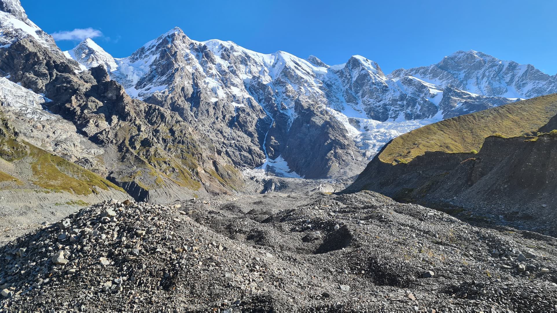
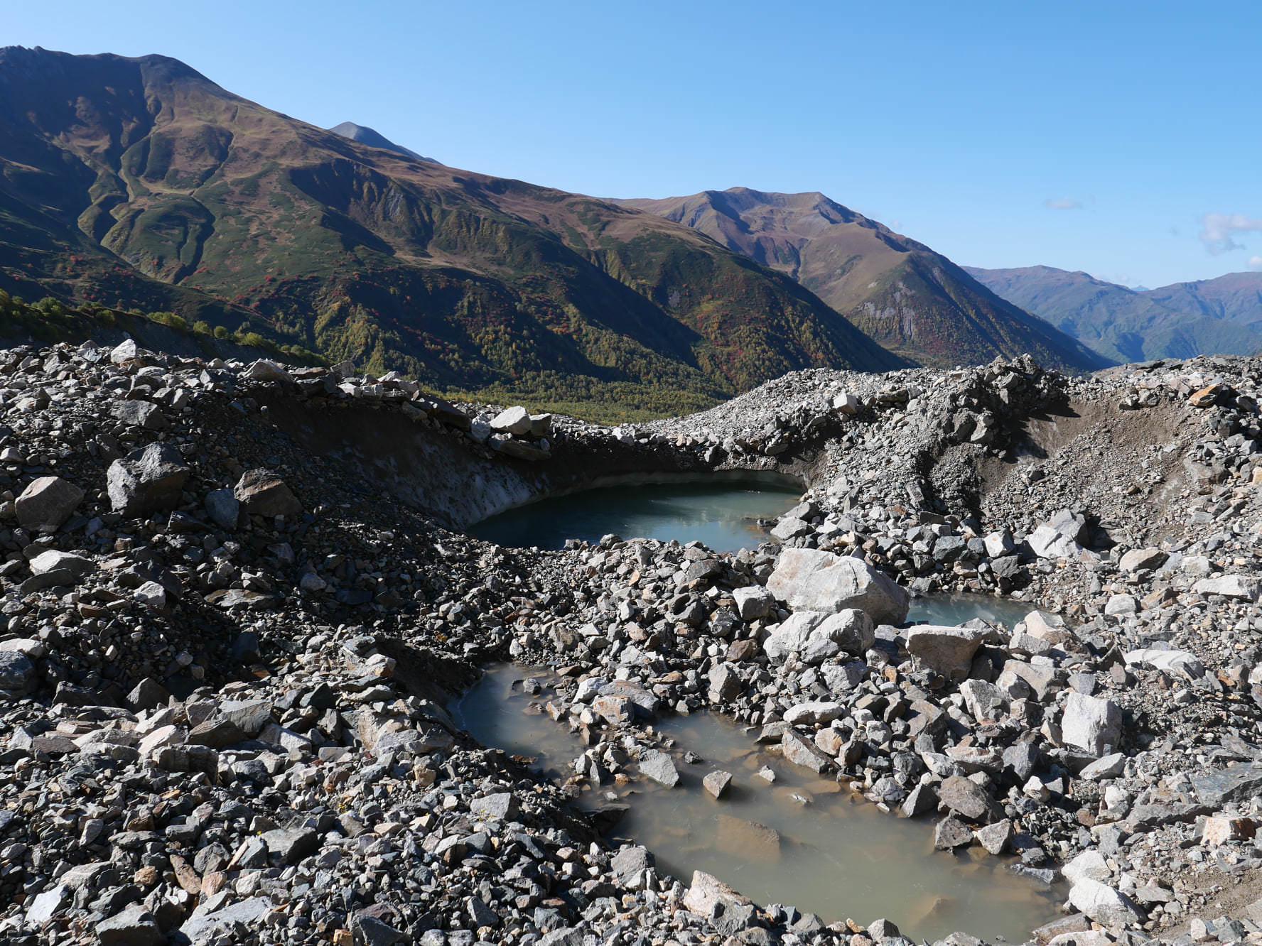
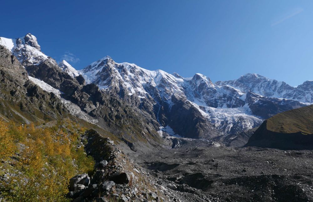
Eventually, you will make it to the bottom and connect the path heading to the north. Along the trail runs a small creek where you can replenish your water, there are also several "narzans" - sources of mineral water nearby. Soon, on your right side rises a small ridge lining the moraine of the Khalde glacier from the western side and you will need to climb it. Now, you see the Khalde glacier you need to cross - or at least stones covering it.
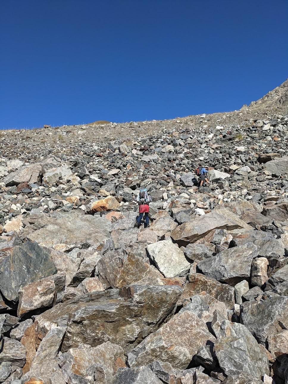
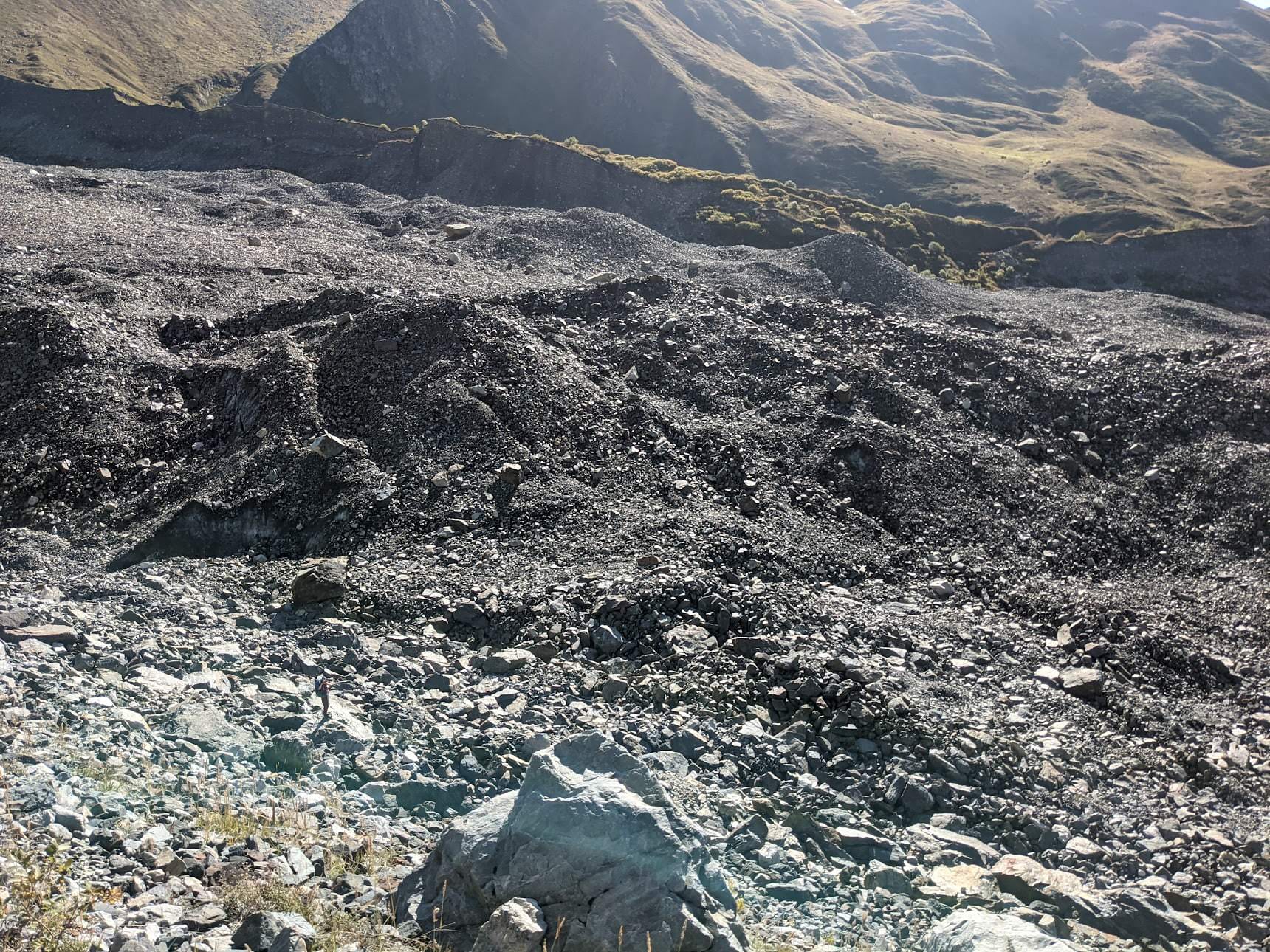
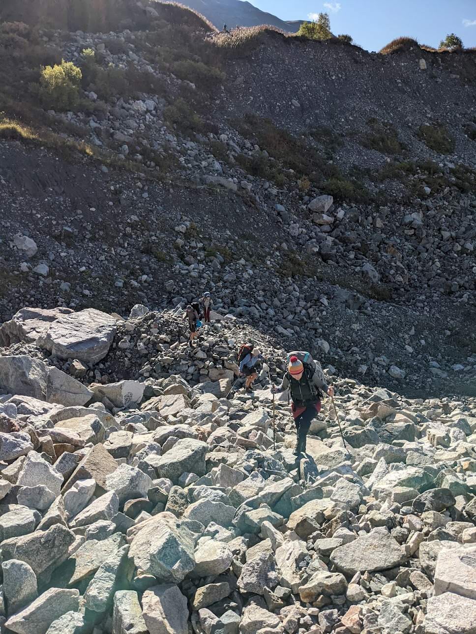
Follow the ridge till you reach an altitude of about 2650m, where you shall find a faint trail going down to the glacier, marked by several stone pyramids. Descent via a steep boulder field is quite unpleasant. Once at the bottom, cross the glacier by a most direct way. It´s completely covered with stones and there are even some small bushes, so you wouldn't even notice you are standing on the glacier if there weren´t places where stones collapsed into pools of icy water.
The exit spot at the other side of the glacier is obvious - the eastern side of the moraine is very steep, apart from one section, maybe a hundred meters wide, where the moraine wall collapsed and formed a serpentine route going to the top. Still, climbing it is as difficult as going down. Luckily, there is a faint trail that, once you make it to the top, turns into a proper hiking path.
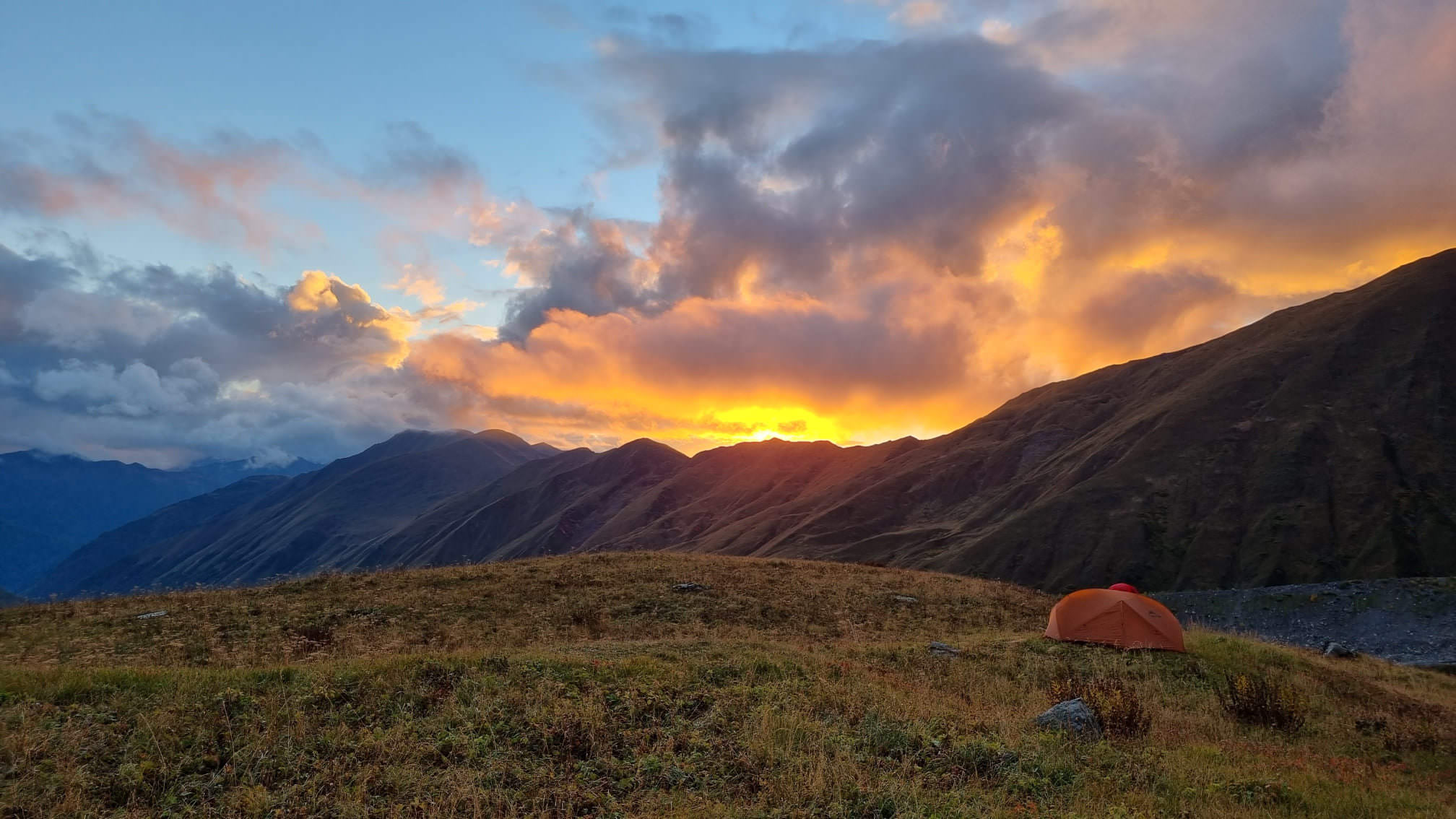
Once at the top, you will find yourself at the edge of the side moraine, a rather large depression with a small creek running at the bottom - an ideal place to refill your bottles. Not much further ahead, you will also find a plateau suitable for camping.

Campsite above the Khalde glacier
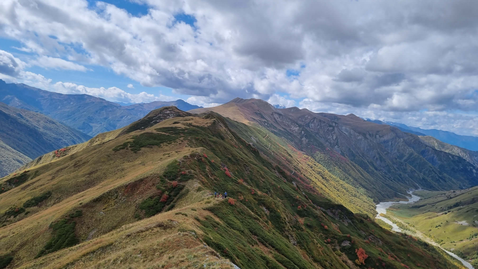
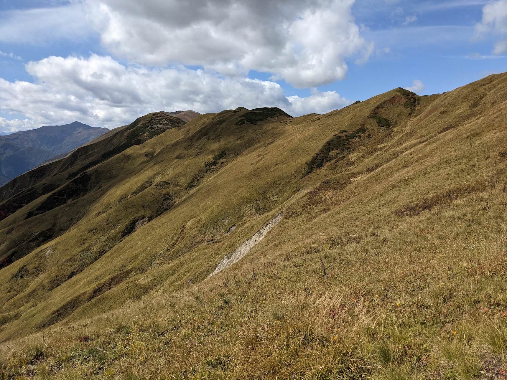
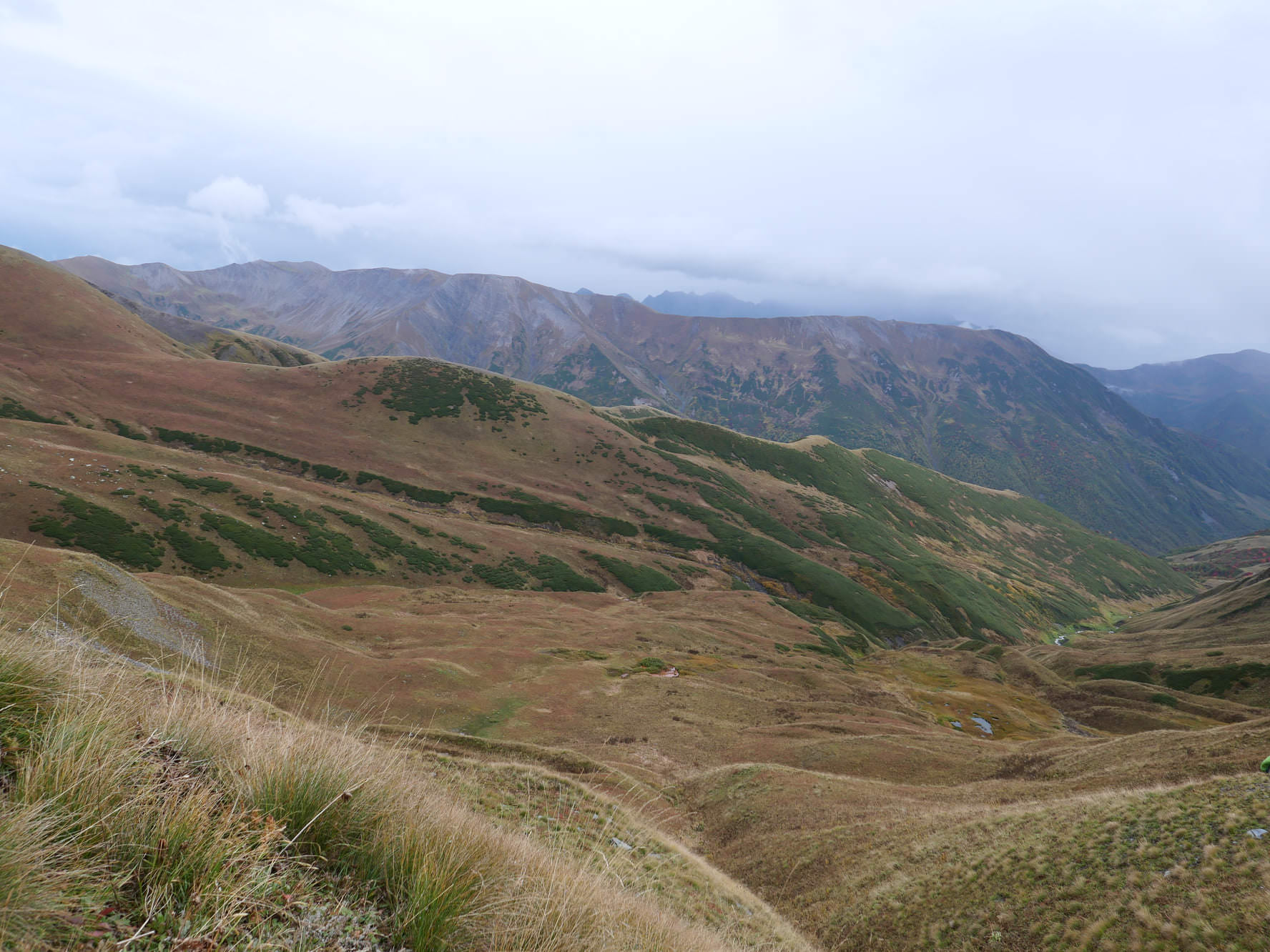
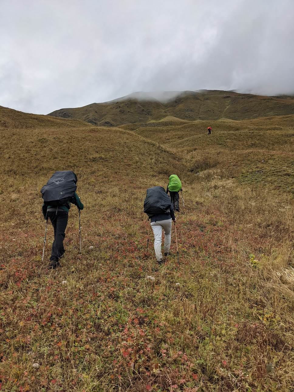
The easier day of the two. First, traverse the hillside to the south, slowly gaining height. You are still on the trail, which branches from time to time, so pay attention to the route and stick to the left. The terrain is rolling, quite overgrown and many hikers passing through here complained of midges. Luckily, this doesn't last long. About 1 km later, you will cross a major side ridge and the Karetta pass comes into view to the left, mere 250 altitude meters above.
The final climb is straightforward and quite pleasant. The route is not too steep, max 20 degrees and you are already too high for midges or some dense vegetation. Don´t aim for the lowest part of the ridge, but rather some 30 meters to the north of it. Once at the top, enjoy views, make some nice photos and sent them to me - we had fog :P
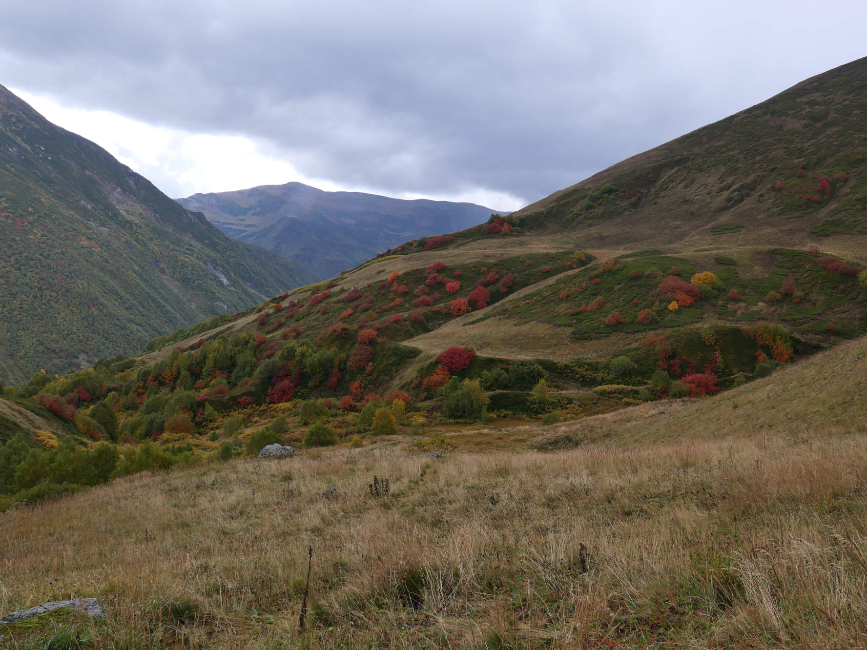
To get down, you need to get straight down for about 300 altitude meters - unlike the other side, the terrain here is steep. Below, you will see a major ravine formed by Pakvlashi river but before reaching it, turn right and head towards some wetlands. From here, head straight a few hundred meters to the south, to the place, where Pakvlashi river is joined by a right-side tributary (you won't see creeks, but you certainly won't miss their gullies).
Further progress is somewhat disputable. On many hiking maps, there is a trail marked on the right bank of the Pakvlashi river, but we found the terrain too steep and there was no trail anyway. So we recommend to cross the stream and stay on the left bank. You can then return to the right bank after some 1,5 kilometers. This section is a bit tricky since the river is mostly running in a ravine, so we had to cross it, climb a steep, overgrown hillside and then traverse it for a while. Not sure if it is the optimal approach, if you have more success here, please let me know so I can update the log (know that some groups didn´t even try to cross Pakvlashi, but stayed on the left bank and followed it straight down to the valley road).
Luckily, a proper trail soon appears. Then we cross another right-side tributary of Pakvlashi and our trail joins a more popular one going down from the Lagem pass.
The route from here is straightforward since you already see Ushguli ahead. Just follow the trail while slowly losing altitude and getting closer to the larger track below which leads to the Shkhara glacier. Both routes eventually merge before the village. All you have to do then is walk another mile, cross the bridge over the Enguri river and pass the Lamaria monastery. Welcome to Ushguli!
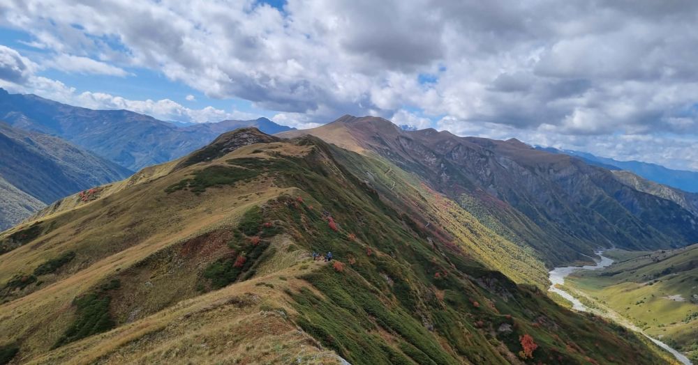
View from Karetta pass
Most information needed to write this trail description as well as photos were provided by Stefan Dobrev. Thanks a lot!