The wonderful trek which would be way more popular if it didn’t lie at the end of Racha.
The wonderful trek which would be way more popular if it didn’t lie at the very end of Racha. It climbs to the small alpine lake lying at the elevation of 2800m - in good weather,
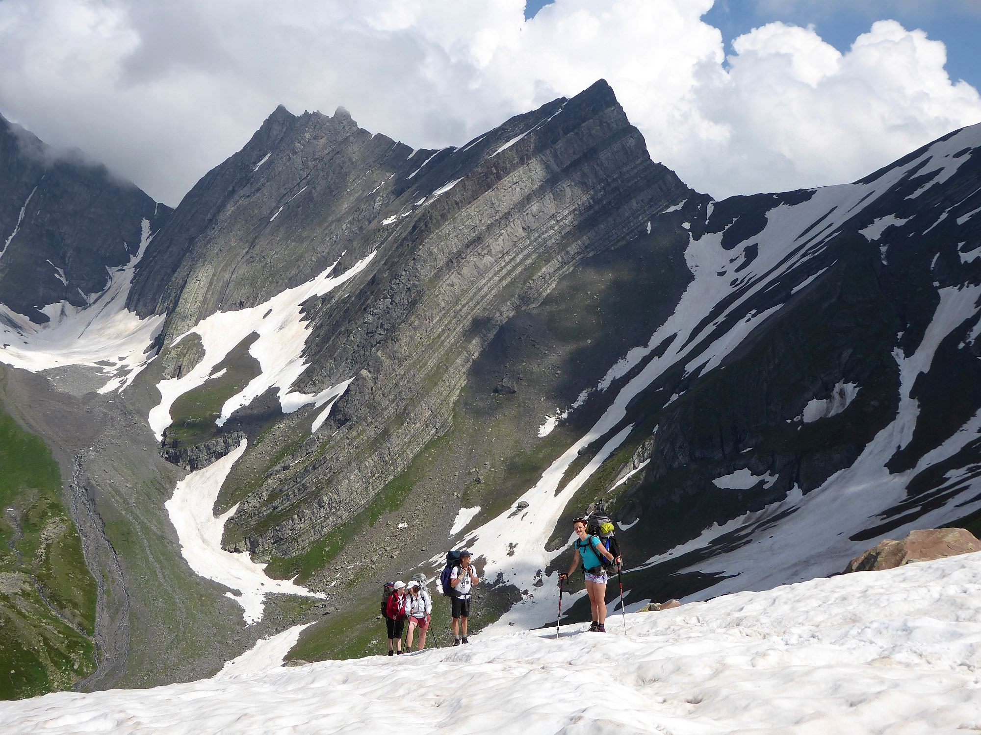
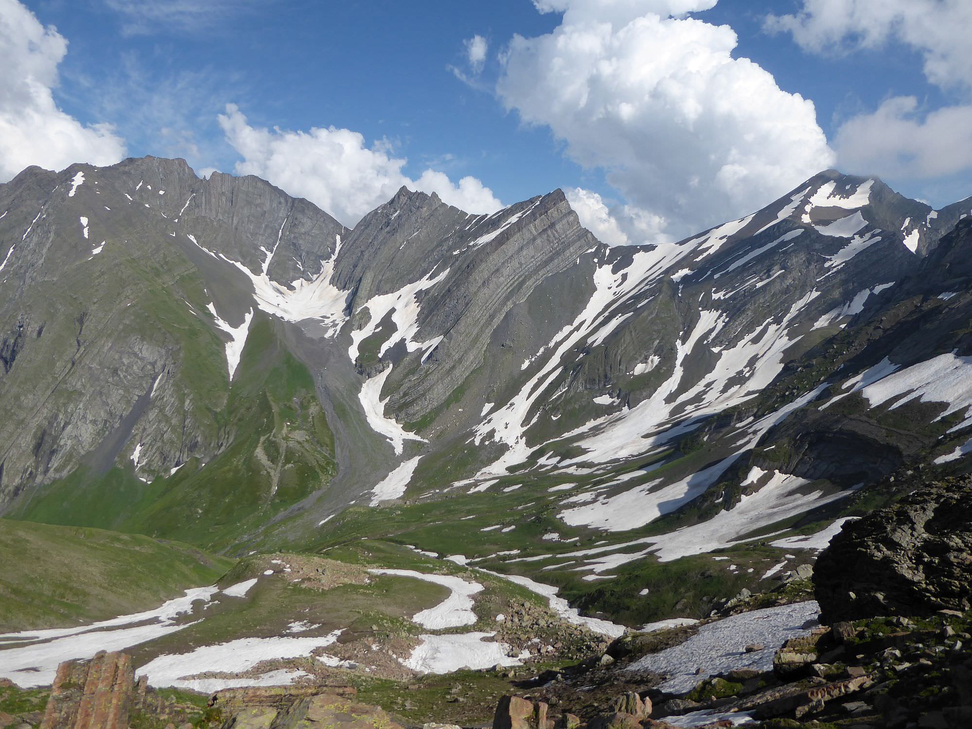
there is a great view of Caucasus panorama. Another highlight of the trek is the mountains around. They look strangely “bent” - I haven´t seen similar rocks anywhere else in the Caucasus.
Trek starts in the Shovi village and forms a small loop. After two days, you will end up in Glola village, not far down the road from a place where you started.
In theory, this trek can be finished even in a single day, but for that, you would have to take easier way from Glola in both directions. So you will miss highlights of the trek such as twisted mountains of Chkauri valley and Geske pass. Not worth it in my opinion - if you´ve travelled all the way to the very end of Racha, you should be able to assign this trek time it deserves.
The distance is not that great but the elevation gain/loss is significant and the terrain not always easy to navigate. Therefore, hard difficulty is well-deserved here.
Due to a large amount of snow at the western side of the Geske pass, trek usually becomes accessible only in the late June and stays open until late September or early October.
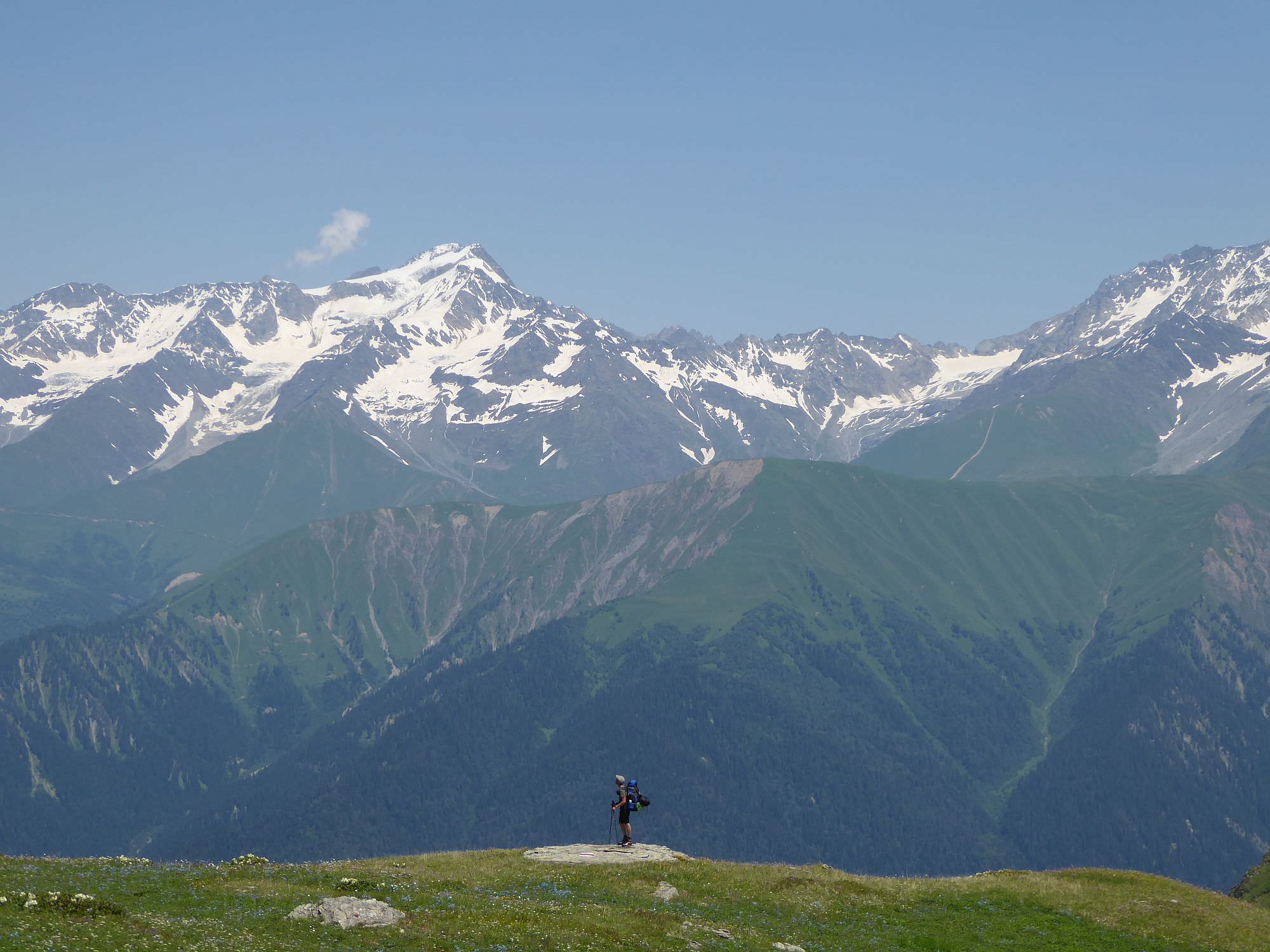
Shovi as a starting point seems to be a bit more popular, maybe because of the stunning panorama of Greater Caucasus, you will be facing during the descent from the lake. Otherwise, I think the direction doesn´t matter that much, starting in Glola may be even a bit easier due to the more even distribution of difficulty on both days.
How to get to Shovi by public transport? Honestly, I don´t have a clue. I asked several villagers about the public transport but their answers were so chaotic that I can´t use them here. If someone can shed light on this, pls contact me.
Still, to get to Shovi, you have to pass Oni which lies nearby and the situation is much clearer here. Daily minibus leaves Didube station in Tbilisi at 8 am. The ticket costs 20 GEL and the ride takes 6,5 hours - as usual, it's better to come at least 30 minutes earlier to have a guaranteed spot.
If you need to reach the city from Kutaisi, there are two buses a day leaving from the bus station by the chain bridge below Bagrati cathedral (not the Central bus station by the McDonalds). One departs at 9:00 (ride takes 5 hours as it follows the bad road through Rioni valley) and second, much faster departs at 2 pm (this one takes the direct road through Tkibuli). These buses sometimes continue further to Shovi - ask the driver.
Another option is to take marshrutka to Ambrolauri since the city is only some 20km from Oni - marshrutkas depart daily from the Central bus station at 10:00 and 14:00. However, both take the longer route through Rioni valley. From here, you can take a taxi, hitchhike or hope to catch some local bus.
Again, hard to tell. You will have to ask around, hitchhike or even pay a taxi back to Oni.
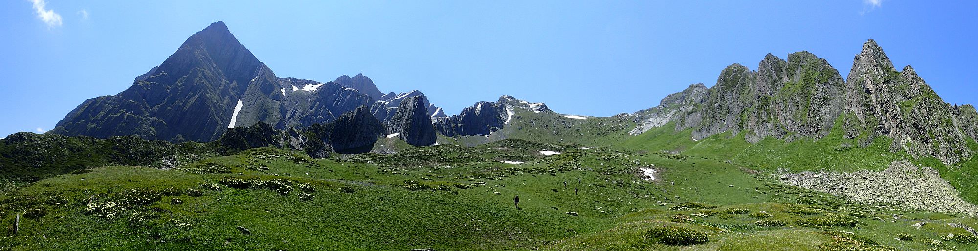
"Twisted mountains" of Chkauri valley
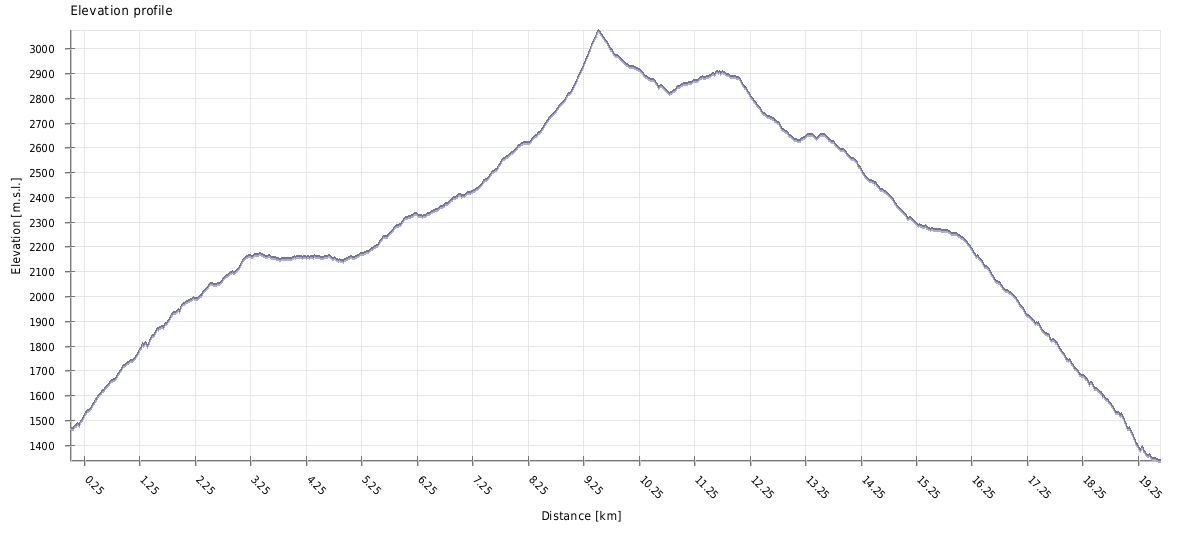
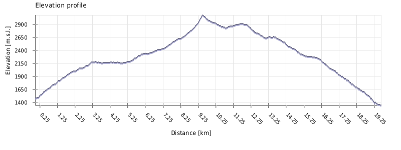
| Distance | 19 km |
| Trail type: | AB trip |
| Max. elevation: | 3075m |
| Min. elevation: | 1338m |
| Total climb: | 1769m |
| Total descent: | 1899m |
The trail starts at the hiking marker 500m before the entrance to the Shovi resort (elevation 1470m). It says that it takes only 6 hours to walk to Udziro lake but I am not a fan of this kind of humor. More important is the red mark beneath - the trail is marked, and in my opinion pretty well.
Leave the main road, walk by the small spring and after few meters turn left, onto the grassy road. Follow it for about 100 meters and then turn right, into the forest. Here starts the first climb, a taste of the things to come. After some 250 elevation meters, you will make it onto the small ridge and stay on it for a while.
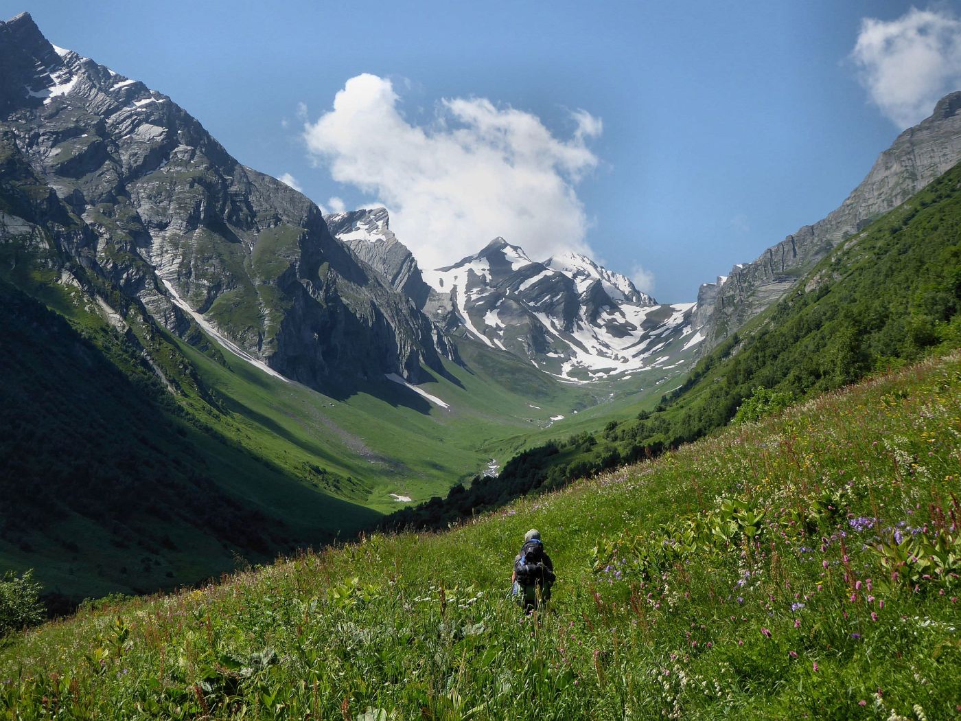
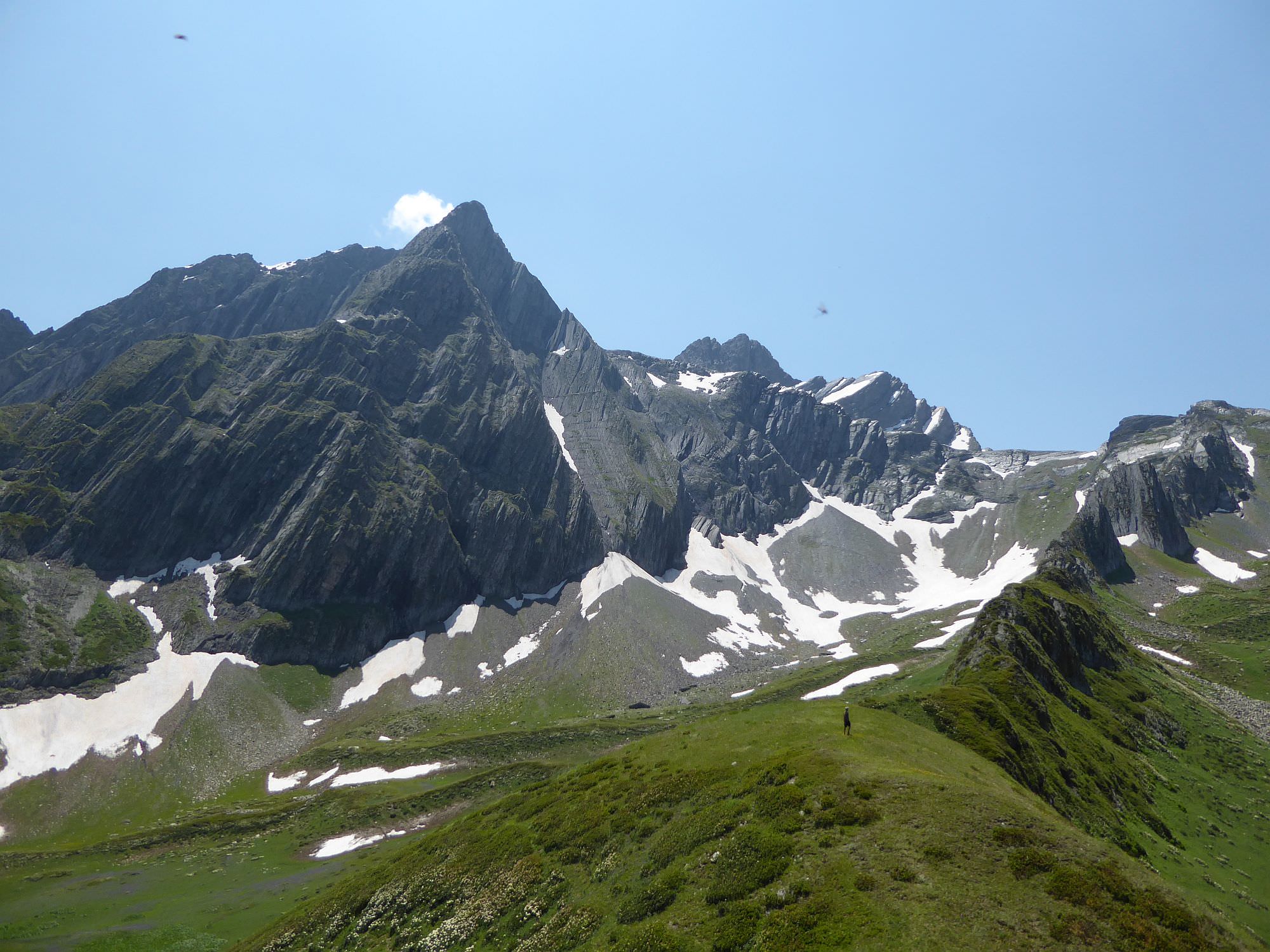
Keep walking through the forest till the trail emerges from it at the elevation of 2130m. Then, after the short, steep climb through the overgrown meadows, the impressive Chkauri valley appears in front of you.
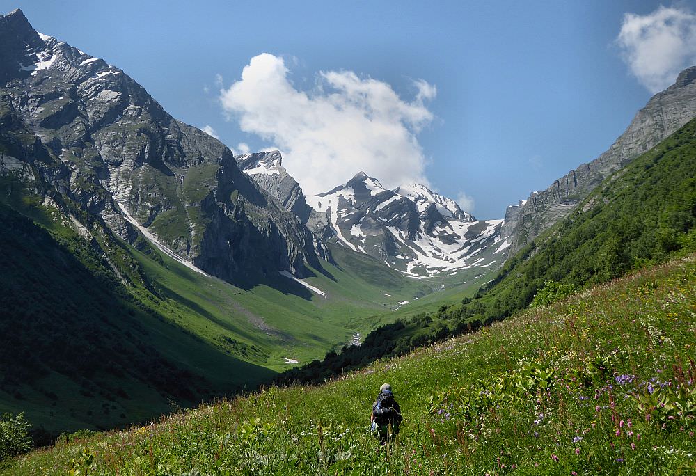
First views of Chkauri valley once you make it out of the forest
You are now quite high on the right side of the valley. During the next hour, you will keep your elevation but the river will get closer and closer. Finally, the trail reaches the river and from here, follows it. At some sections, it disappears - luckily, the marking is dense enough and from the one mark, you usually can see the another.
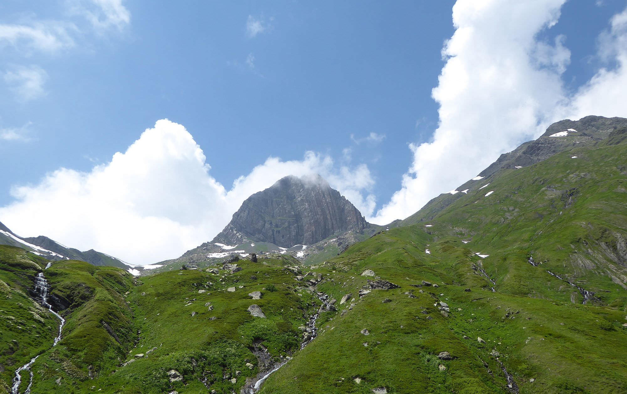
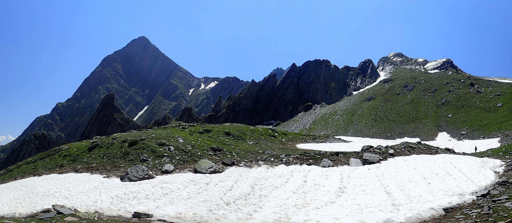
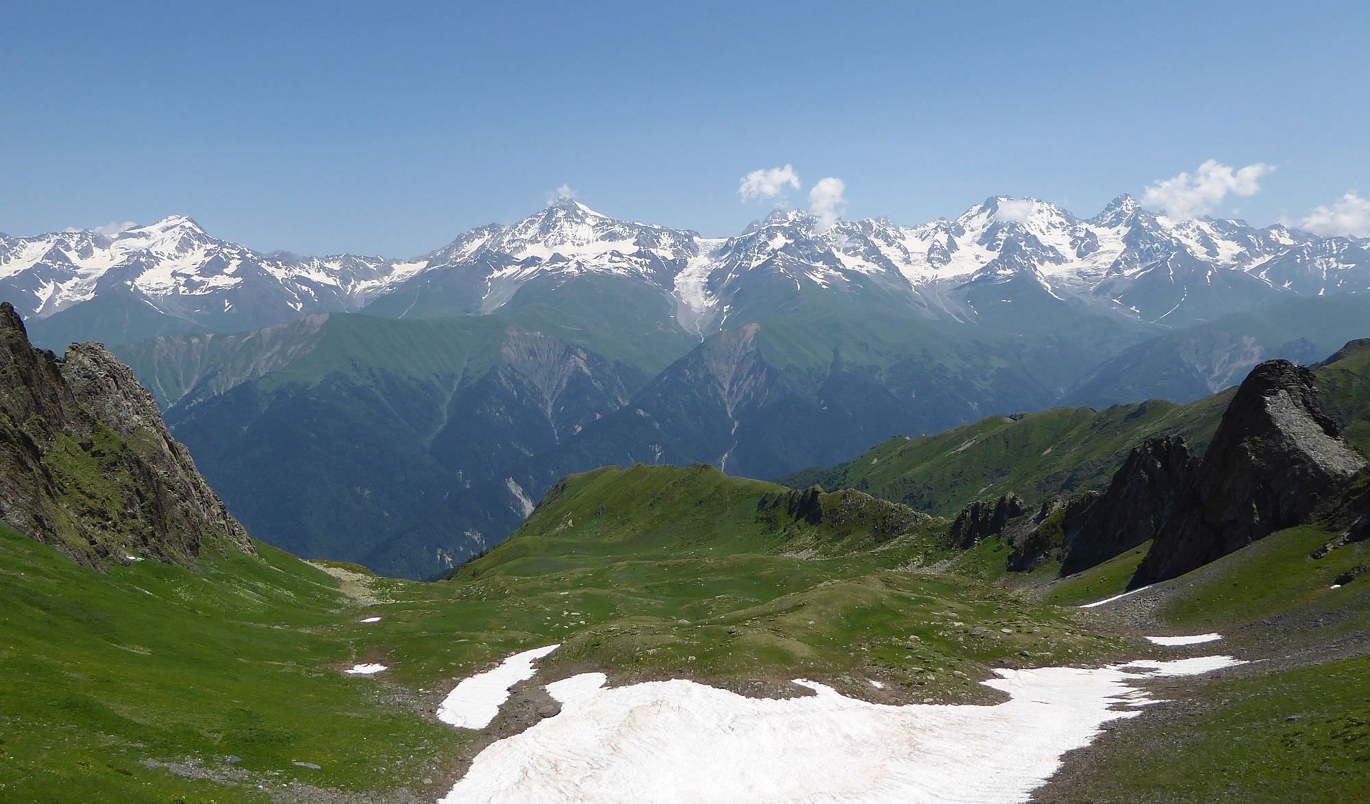
You follow the river till the point where it bends to the west. At the elevation of 2500, there is a small flat hill between the streams, good place for lunch or camp. Also, from here you can finally see the Geske pass you need to cross. It is located to the right of imposing Katitsvera mountain and it looks pretty steep.
How to reach it? It makes no sense to head directly towards the pass, the terrain is really difficult. Instead, it´s better to climb a bit onto the southern side of the valley and traverse towards the pass from there.
Still, no matter which path you take, there comes the moment when the climb becomes steep - like very steep, almost 40 degrees. Most of the people follow a small couloir at the right side of the valley which is a bit less steep than the surrounding slopes. We didn’t - we climbed all the way to the foot of Katitsvera mountain and traversed from there, but that isn’t a route I would recommend.
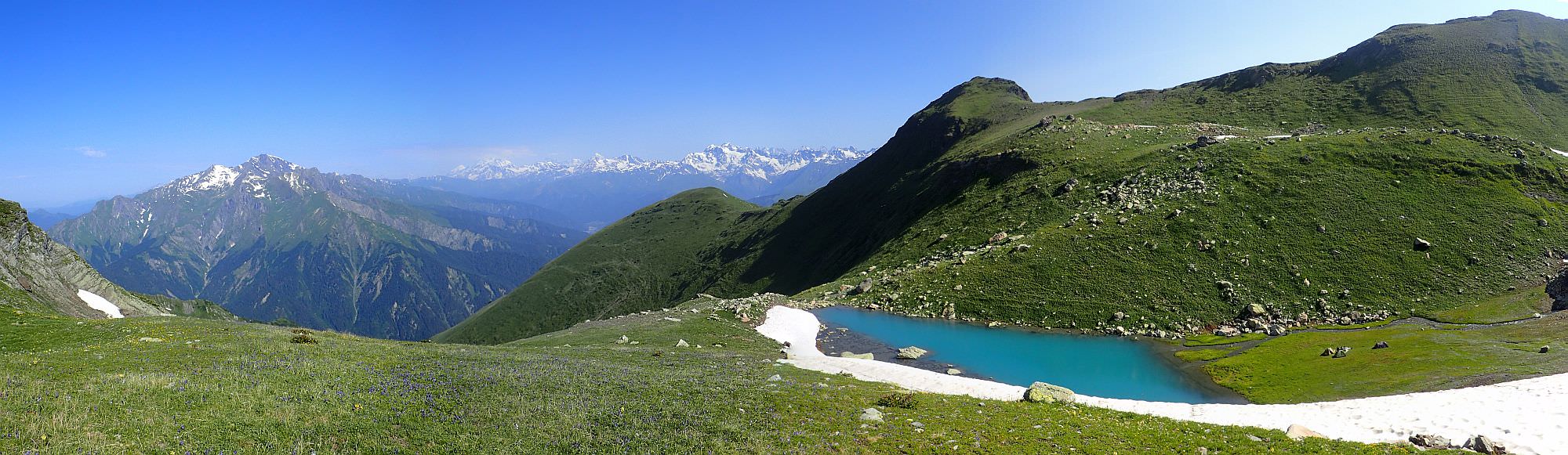
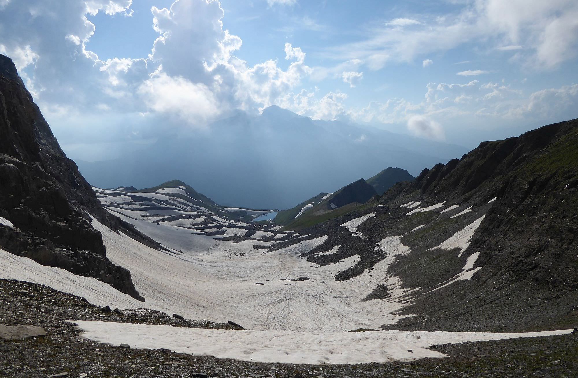
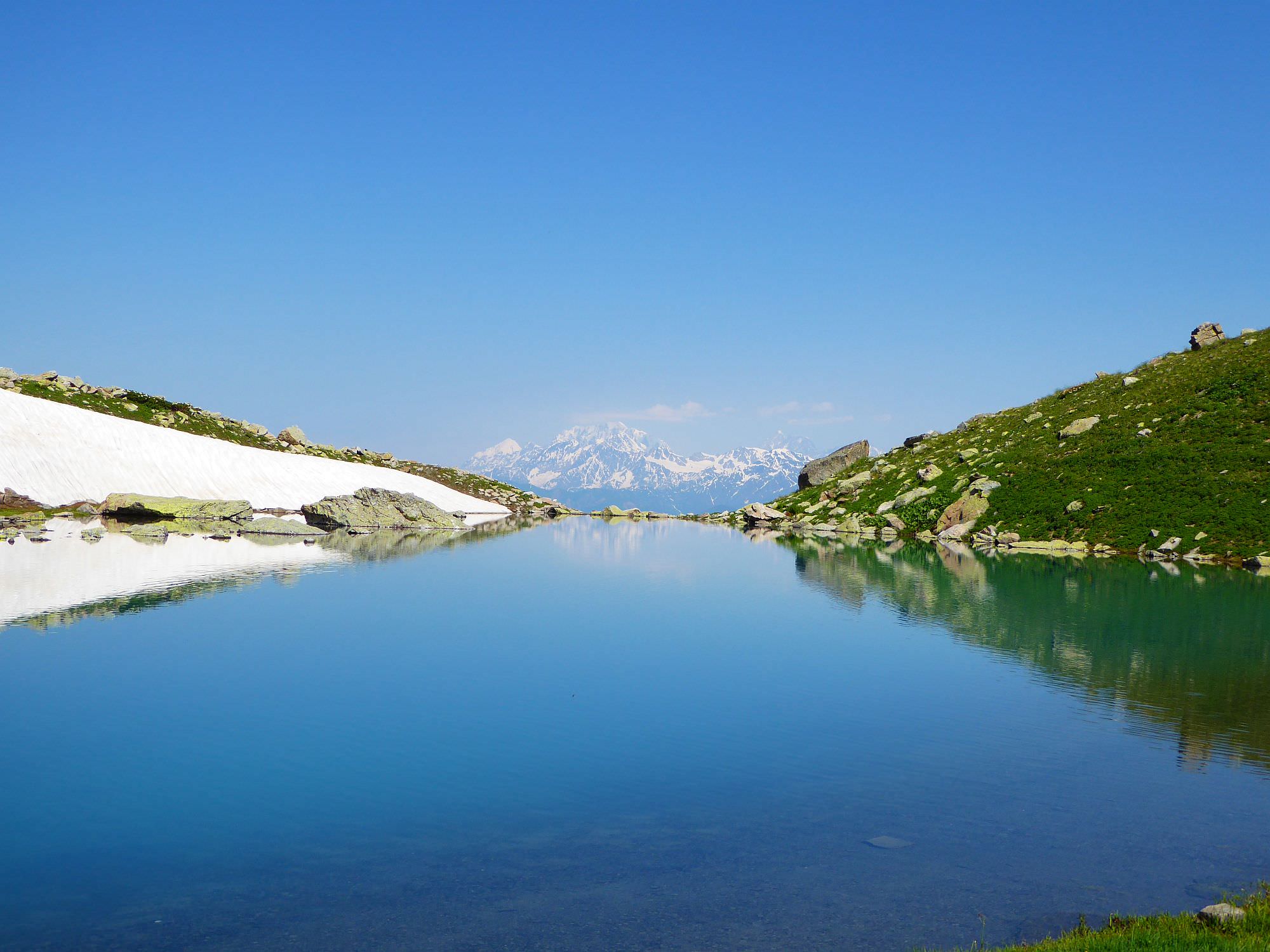
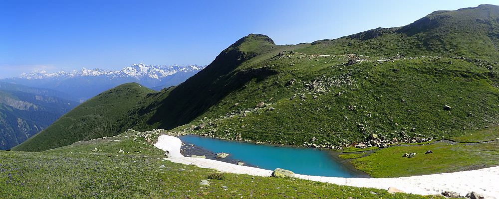
From the Geske pass (3074m), you can finally see the Udziro lake in the distance. Descent is at first steep and you will have to zig-zag a bit, then becomes pretty straightforward - just walk towards the lake. I can’t elaborate on the terrain too much as even in the mid-July, most of this route was covered with snowfields. Still, the walk shouldn’t take more than one hour.
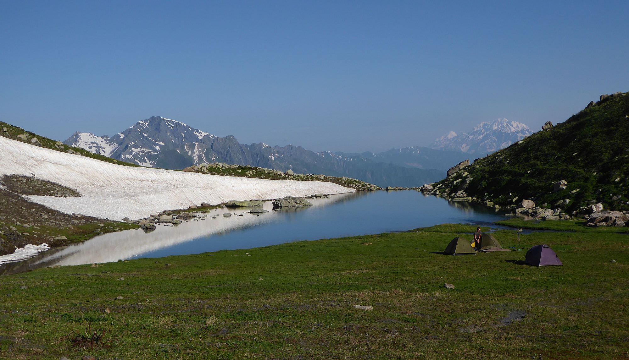
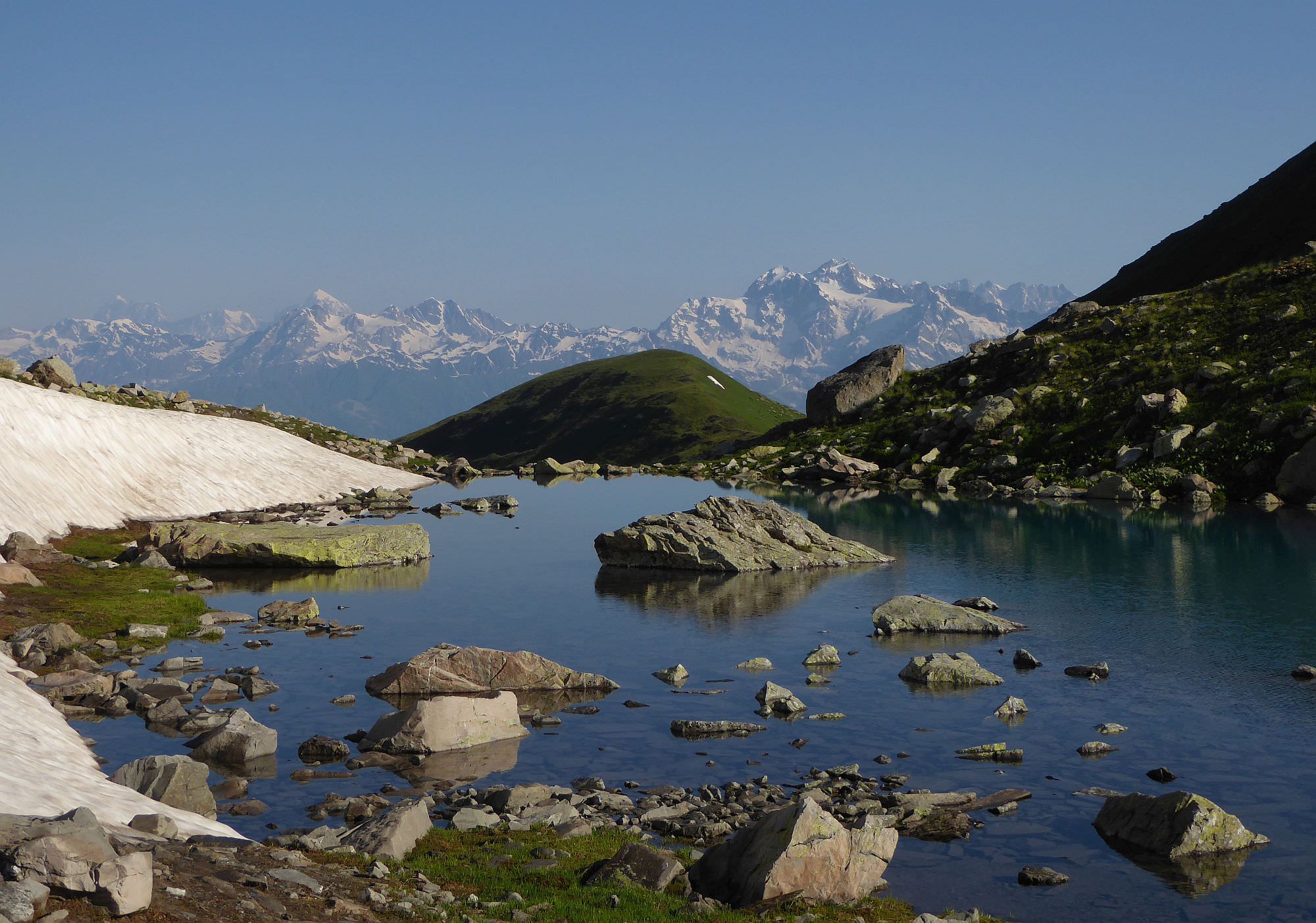
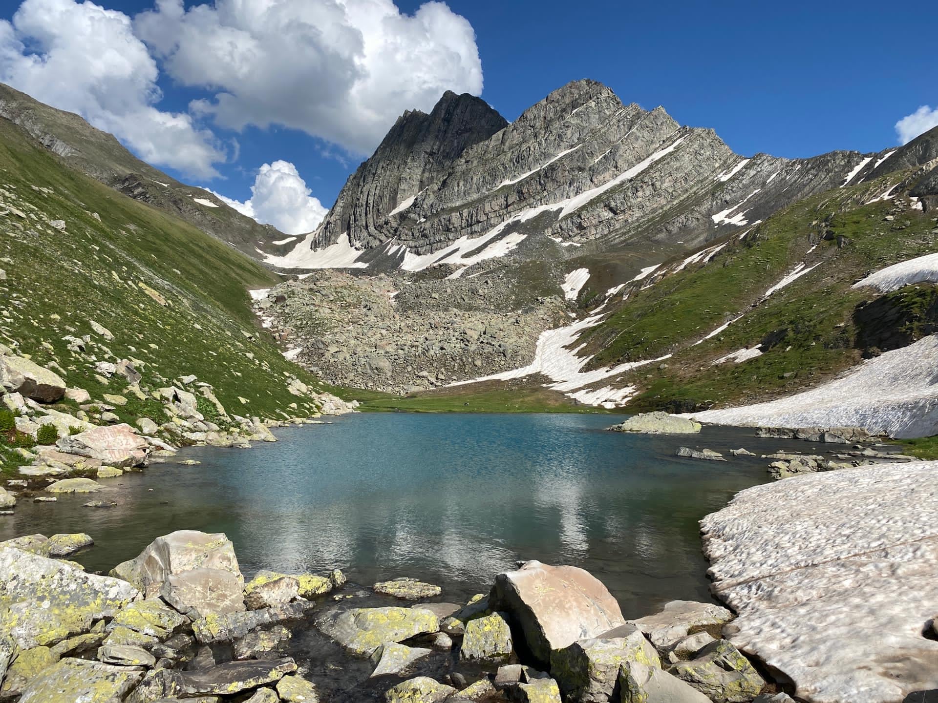
There is a lot of place for tents at the bank of the lake. Water can be taken from several springs supplying the lake.
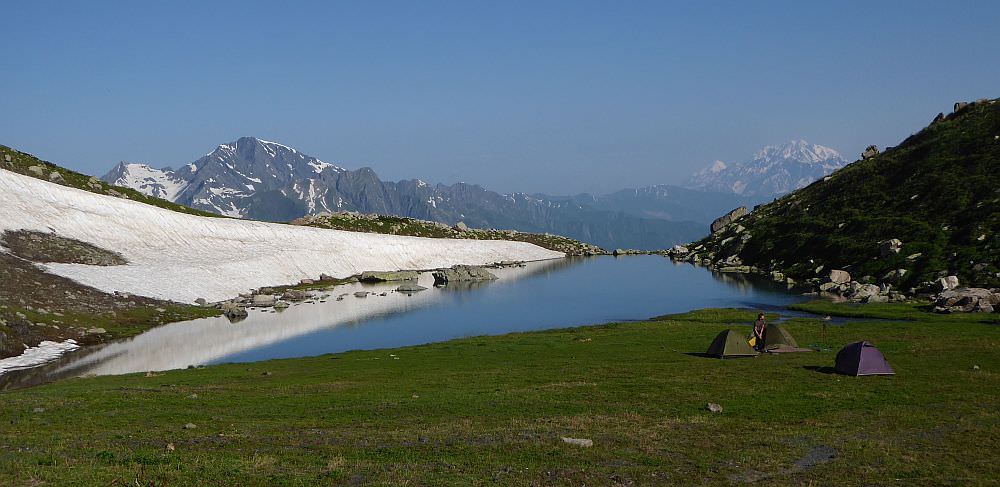
Camping by the Udziro lake
From the lake, return about 100 meters the way you came and climb the small ridge to the north. Soon, you should arrive at the Udziro pass. There is a hiking pointer showing the way to Glola (3,5 hours, this is at least doable). Few meters beneath the pass, there is a small flat spot, suitable for a campsite.
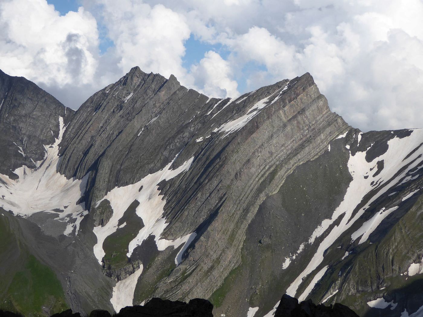
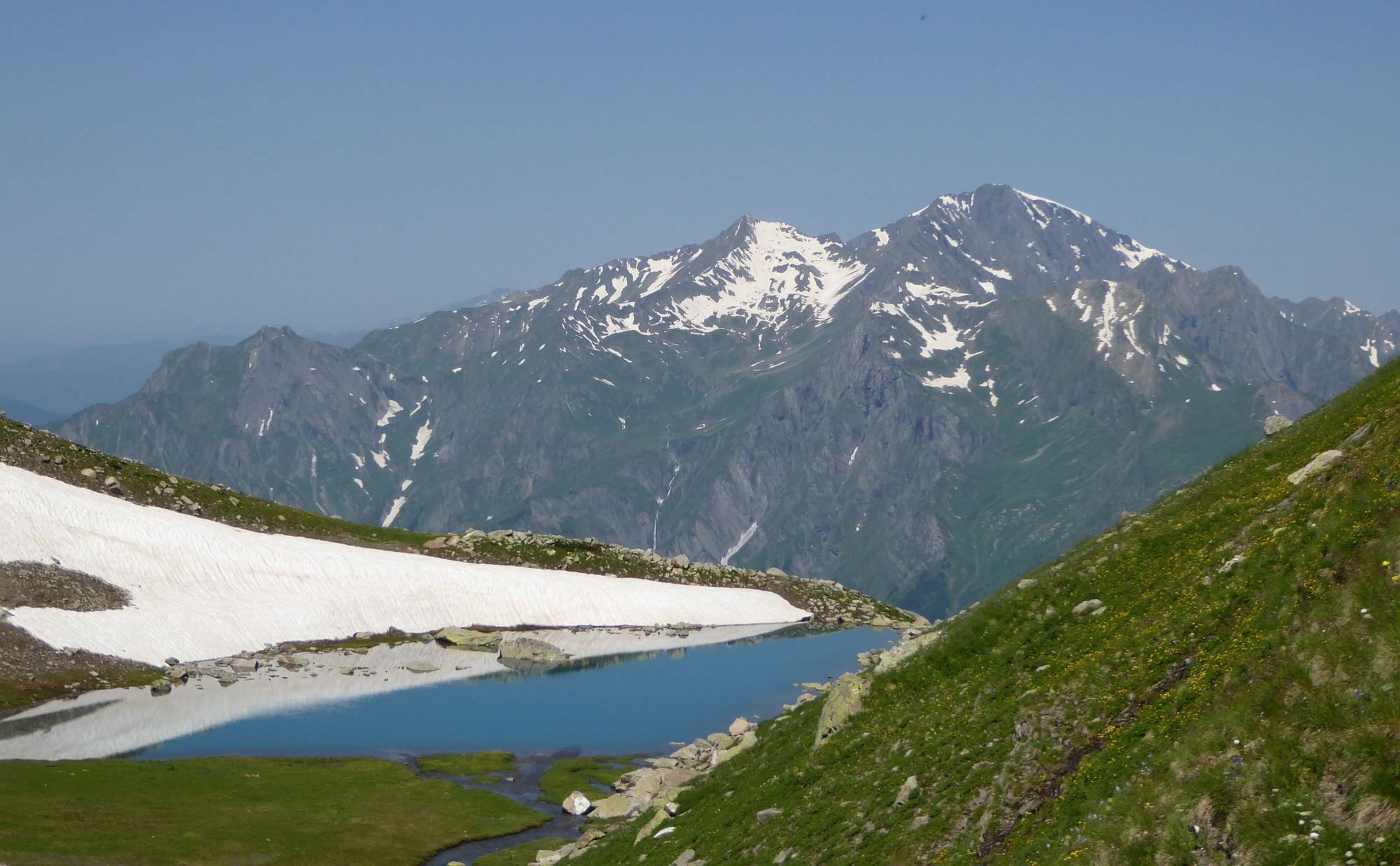
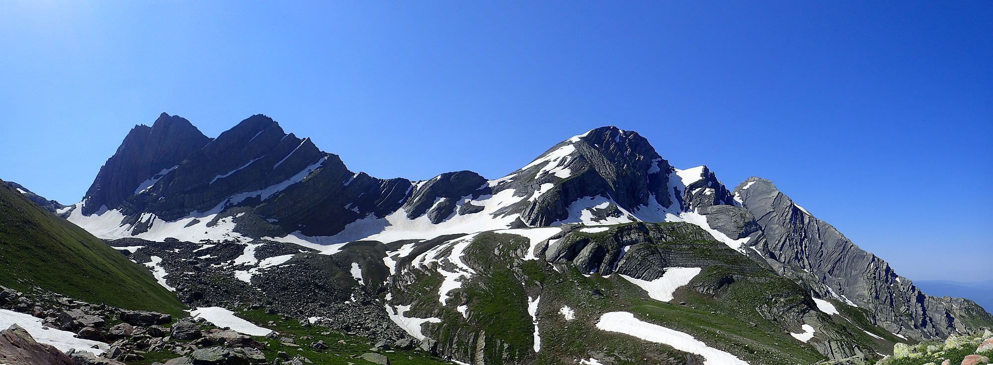
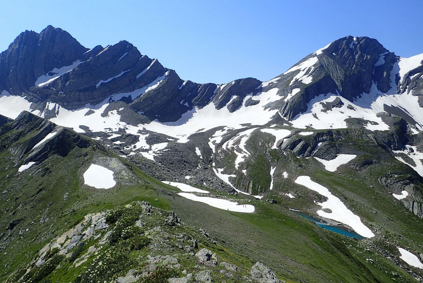
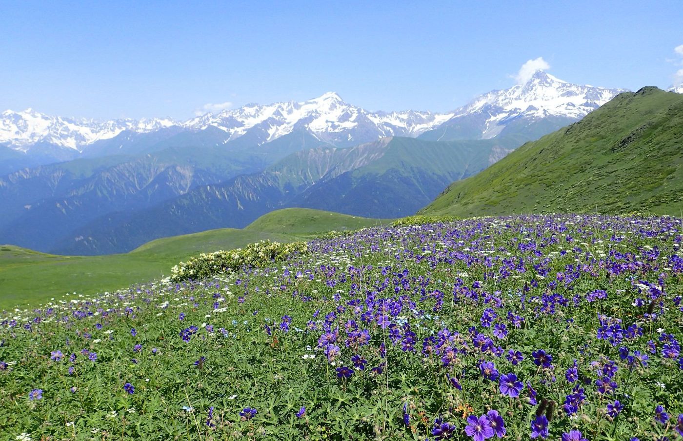
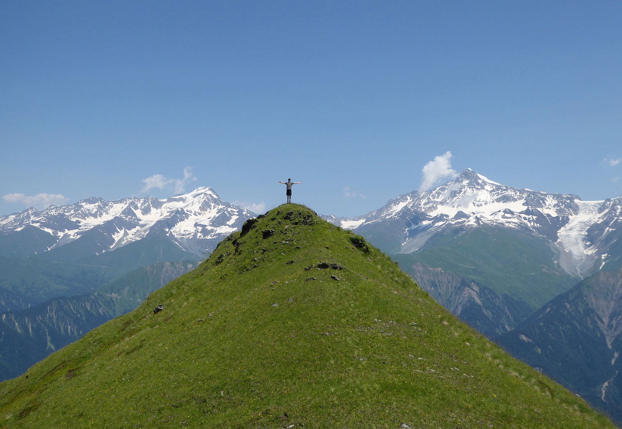
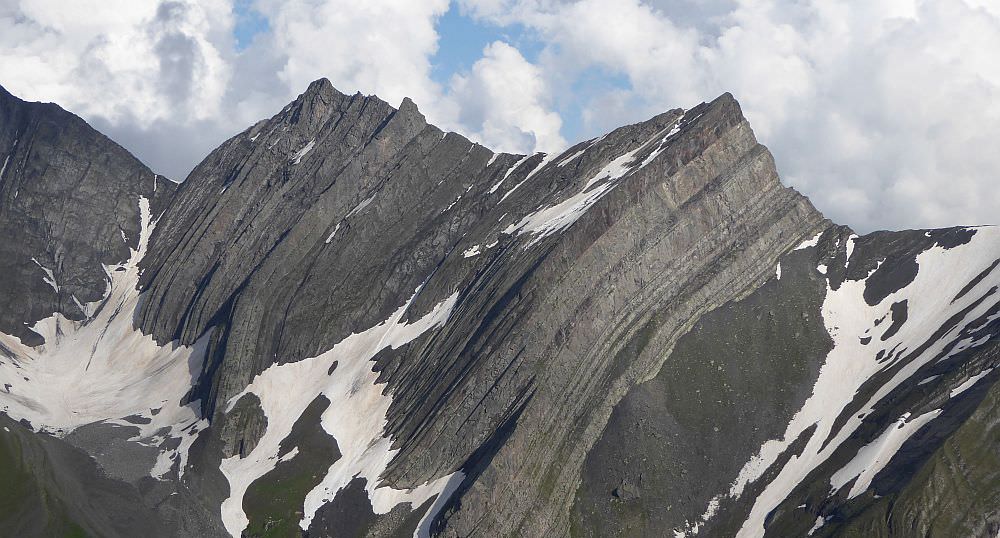
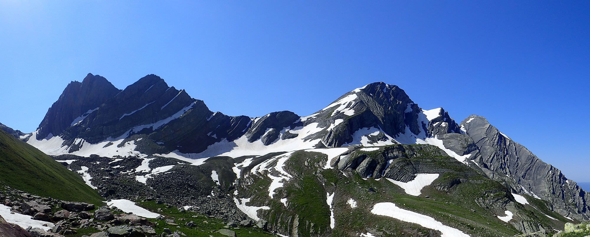
If the weather is good, I strongly recommend climbing the small elevation to the northwest of the pass. It takes only 10 minutes, but the views are unbeatable. To the north, you see the panorama of Greater Caucasus with peaks such as Chanchakhi, Burjula, Kharaugomi or Edena. In good weather, even peaks of Svaneti such as Shkhara, Tetnuldi, and Ushba are visible. To the south, you see interesting layered rock formations. To the west, you see mountains Shoda and Lagora. And, finally, to the east, you see a triangular Dolomisistsveri mountain and also Katitsvera, which got it´s name since the bent rock reminds "cat´s whiskers".
Layered rocks above the Udziro lake
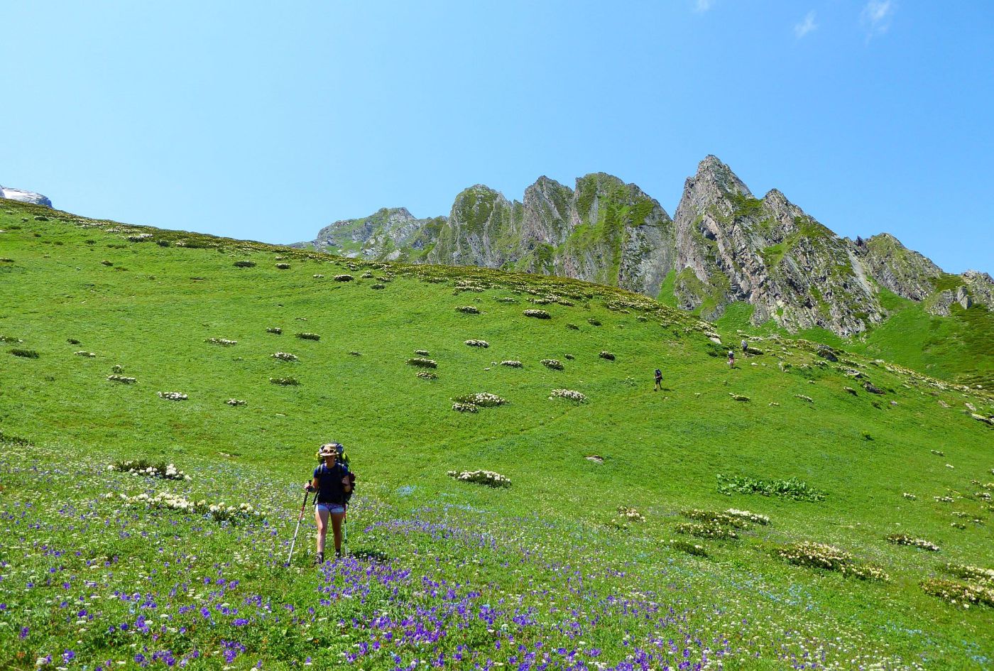
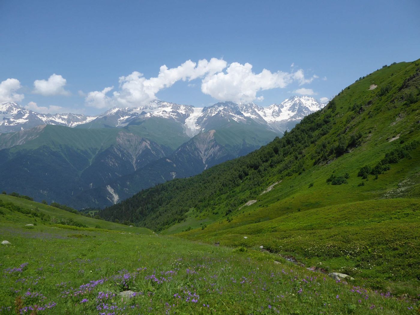
Once you soak in the views, return to the Udziro pass and start the actual descent. The trail is apparent - it navigates through beautiful alpine meadows and rhododendron fields. Ahead, at the right side of the valley, you will see a small ridge with like six small elevations. You need to cross it (another viewpoint nearby) to get into the adjacent valley. There, the descent continues.
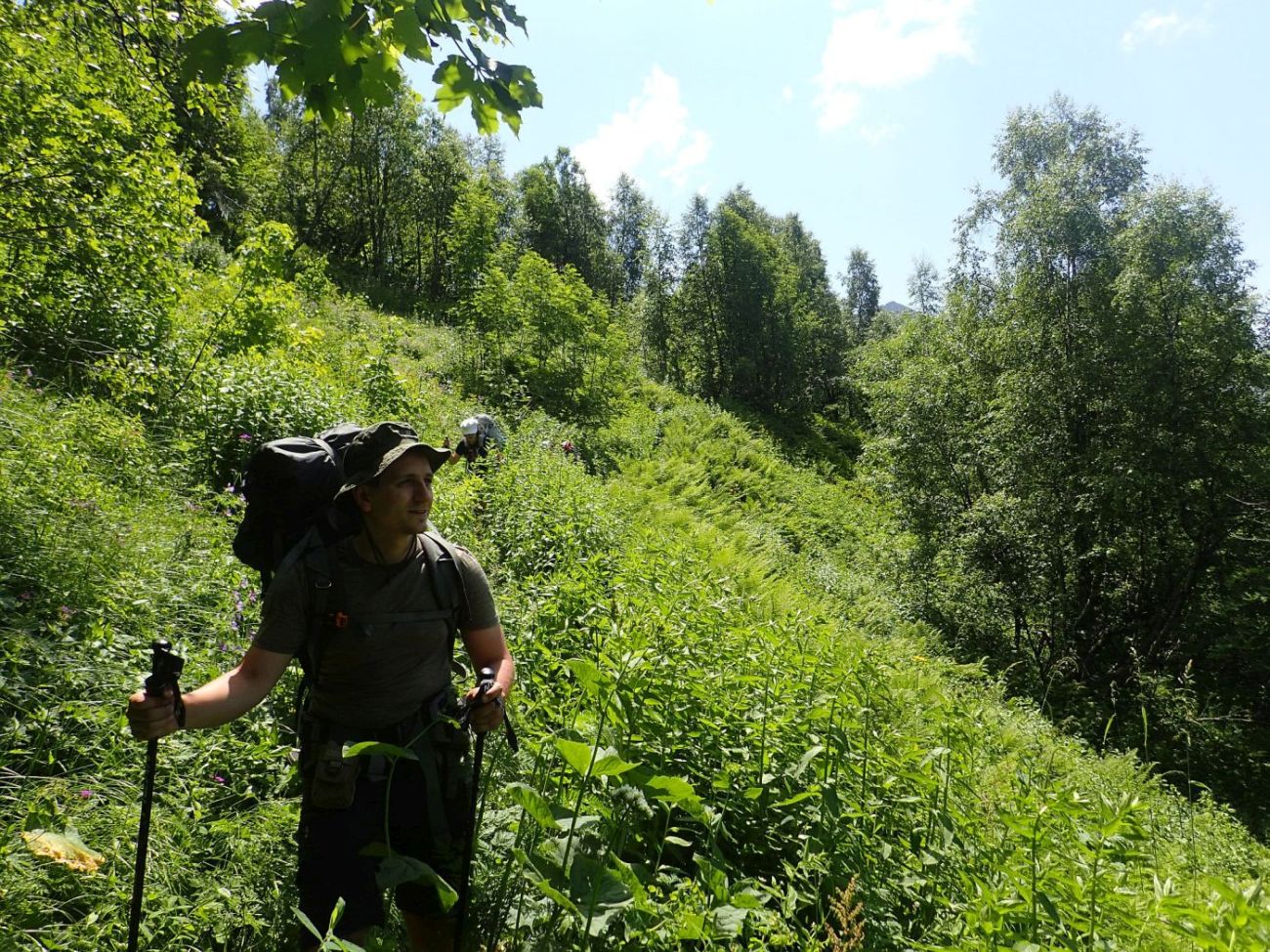
Trail gets closer to the stream called Chibisru and finally crosses it (the place is marked by a large stone cairn). This crossing is crucial as the trail enters the birch forest here. It traverses the terrain for a while until it emerges again on the large, overgrown meadows. After a short, steep descent, the trail dives into a beautiful pine forest.
From here, the route is pretty straightforward. But that doesn´t mean easy - you will have to lose another 700 meters of elevation till you reach the Glola village.
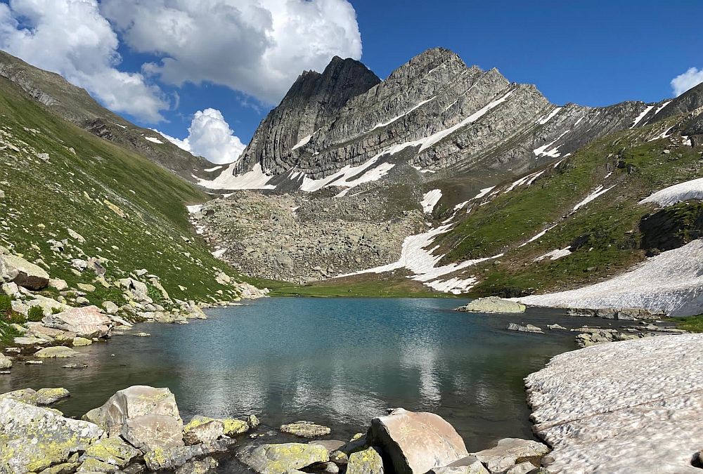
Udziro lake with Mt. Katitsvera in the background (by Chloé Tremblay)