A little-known, yet very scenic climb in the vicinity of Mestia.
An interesting, yet almost unknown alternative to the popular Guli pass hike. It climbs 2926 meters high Gul mountain south of the pass, which offers even better views of magnificent Mt. Ushba than the pass itself. To reach it, you will cross scenic high pastures of Lashkvid - a place very few tourists ever heard of. Also, since it forms a loop, it´s particularly suitable for hikers based in Mestia - they can explore the area without the need to pay for a taxi to bring them back from Mazeri.
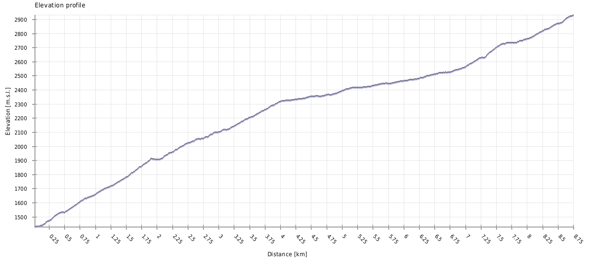
With over 1600 meters of going up and down, this hike is certainly hard - and here we are talking about roundtrip from Lenjeri. If you decide to push on and join the classic Guli pass route ending in Mestia, it is a whole 5 km longer. Of course, it is also possible to continue to Mazeri, this variant is about as long as return to Lenjeri. At least finding the route itself is easy, apart from days when visibility is limited.
Lenjeri is a small village lying along the main road some 2 km west of Mestia. Getting there from Mestia is therefore easy. You can walk, it takes less than 30 minutes. You can hitchhike, the road is busy enough so there is a chance you won't wait long. Or you can hire a taxi, 10 - 15 GEL should be about right for such a short ride.
Again, reaching Mestia from Lenjeri should be easy. You can walk, it takes less than 30 minutes, or you can hitchhike. Only getting a taxi might be harder.
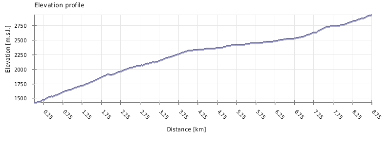
| Distance | 17,6 km |
| Trail type: | Roundtrip |
| Max. elevation: | 2931m |
| Min. elevation: | 1415m |
| Total climb: | 1680m |
| Total descent: | 1680m |
The hike starts at Nesguni village of the Lenjeri community. Svan tower closest to the main road marks a right turn into a narrow lane leading to a courtyard with a water tap. Keep right passing by another tower and walk straight by a wooden fence along the meadow with yet another tower in the distance. Steep cow track climbs (taking a bit to the right) above the village toward the group of pine trees where it splits. Turn left and follow the path to the church (its white cube is visible from the main road). Passing above it. walk into a clearing surrounded by shrubs and low trees.
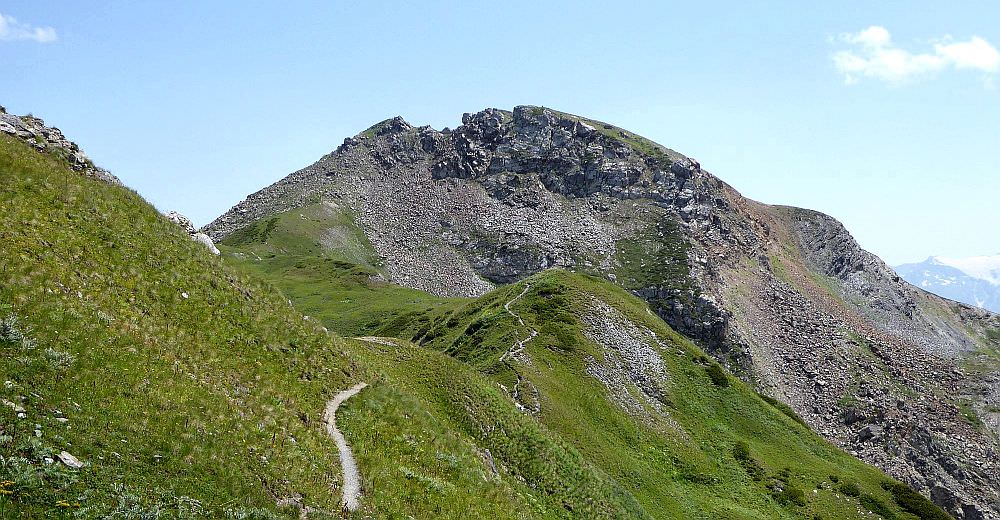
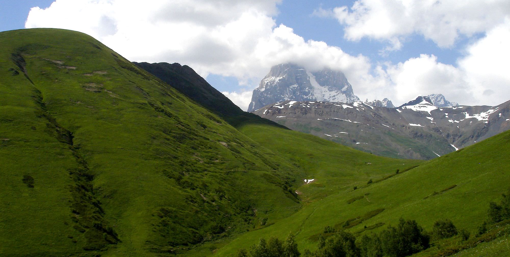
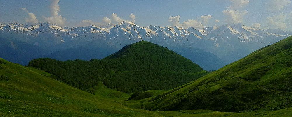
The next section is steep and off-trail and it is imperative while climbing straight up to keep slightly to the left until reaching the dirt road. Walk on this road as it turns to the left (right fork leads to Pushkveri valley). It gets rougher and rockier with ditch cutting it in the middle. One hour later, above the tree line (2098m) it makes a similar turn to the left and curves around the grassy slopes of Mt.Lashkvid (features as 2533m on the maps) to finally reach summer huts. At this spot towers of Ushba come into view making a striking contrast to surrounding rolling hills.

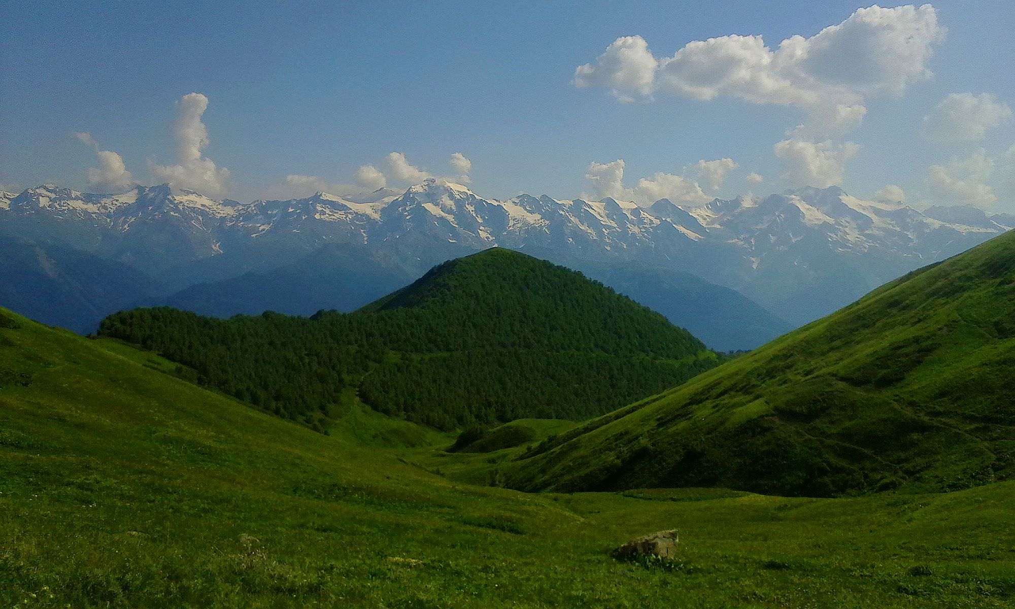
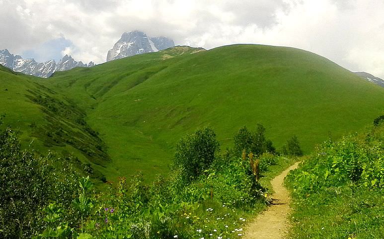
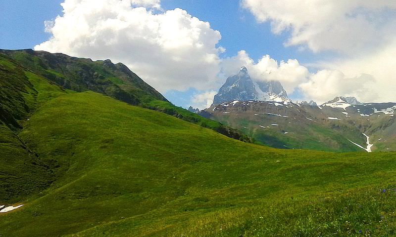
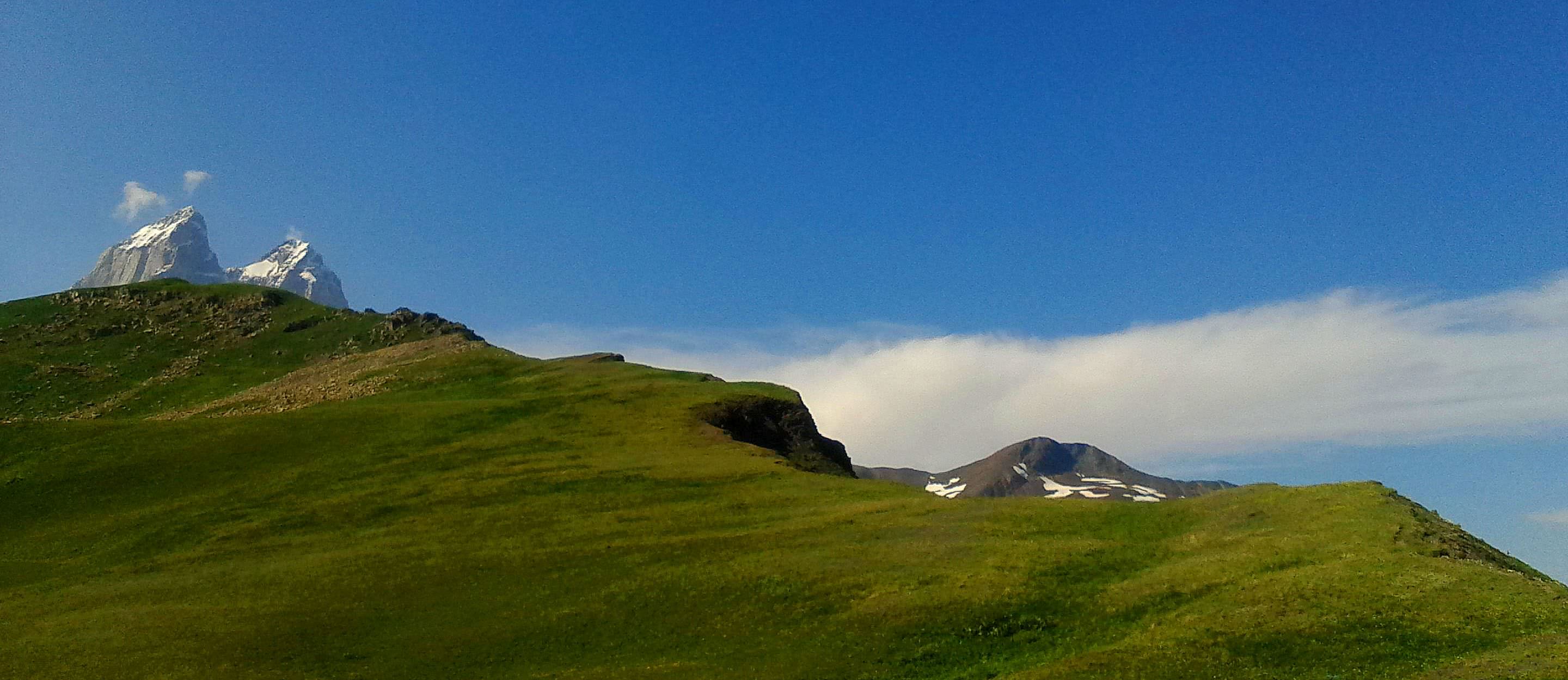
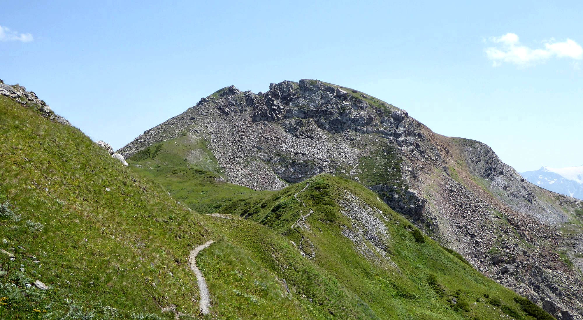
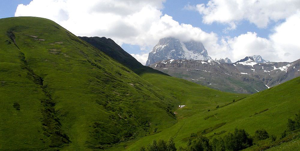
Don't descend to the stream but take a well-beaten track which completes the loop around Mt.Lashkvid and terminates at the ridge above a spacious meadow (2450m). Turn left following a faint trail (a while later it fades away amid rhododendron shrubs) and proceed along the ridge reaching the point where it changes direction and runs north toward Mt.Gul. When getting closer keep to the left and climb grassy slopes with rock outcrops just below the summit. The highest point (2930m) is marked by a small wooden cross. Summit panorama is dominated by peaks of Ushba of which south peak with its walls of frightening steepness is more impressive of the two. In the south is far less forbidding glacier-covered massif of Mt.Layla.
If you want, you can turn back here, the views won't get much better. But if you want to return by a different route, you need to continue north to join the Mazeri - Mestia trail and continue in either direction. Steep rocks make direct descent impossible. Move east onto the subsidiary summit and climb down (watch for loose rocks) to the hiking marker. From here, you can either head to Mestia (turn right, down into the Pushkueri valley) or Mazeri (keep walking straight on the ridge, towards the Guli pass).