Famous, but still a pretty remote trail visiting some of the most beautiful Georgian lakes.
This stunning trek crosses Egrisi mountains which separate Svaneti from Samegrelo lowlands.
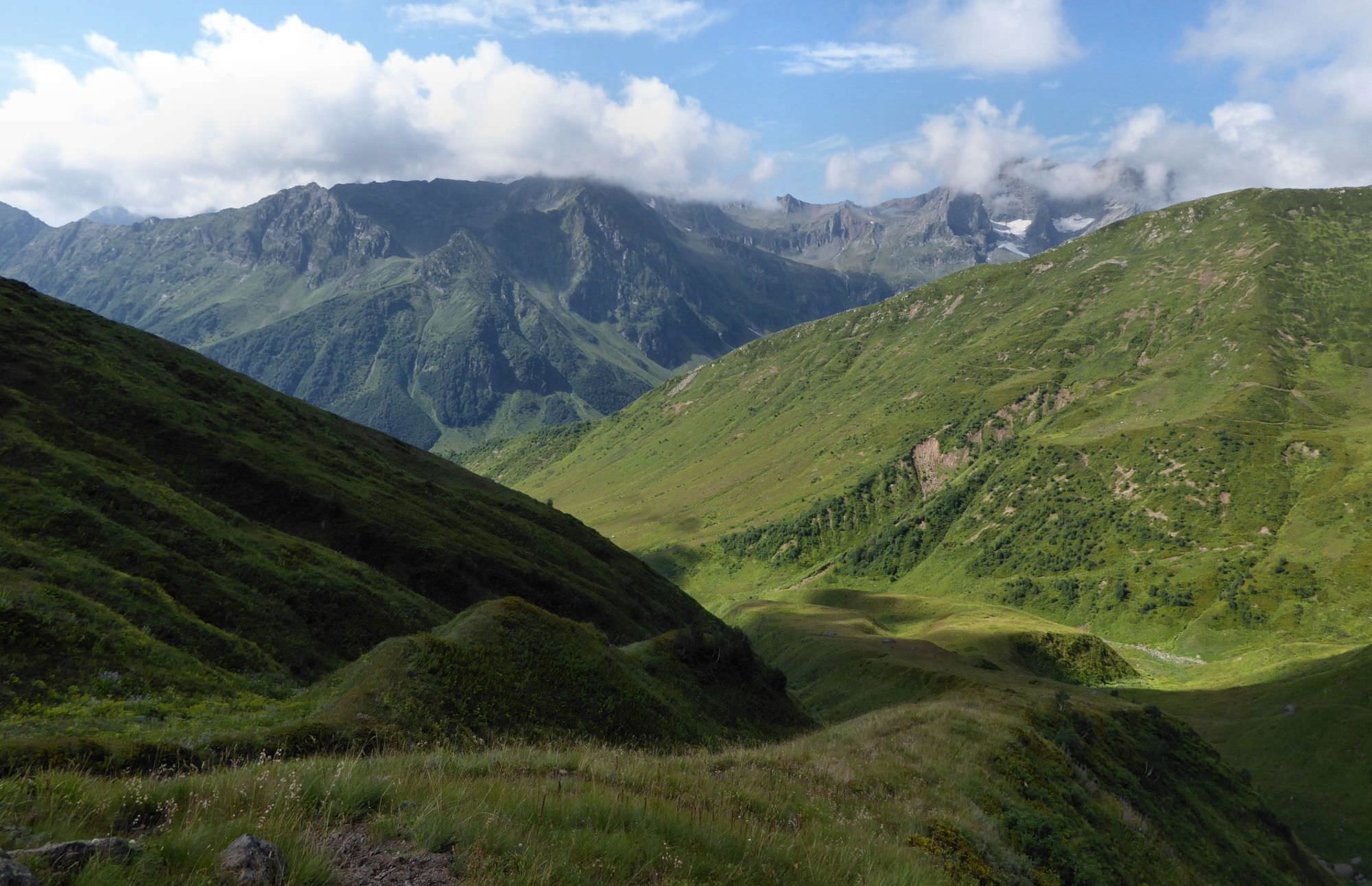
You will not come close to the highest mountains of Caucasus, but this small drawback is fully compensated by a very diverse environment.
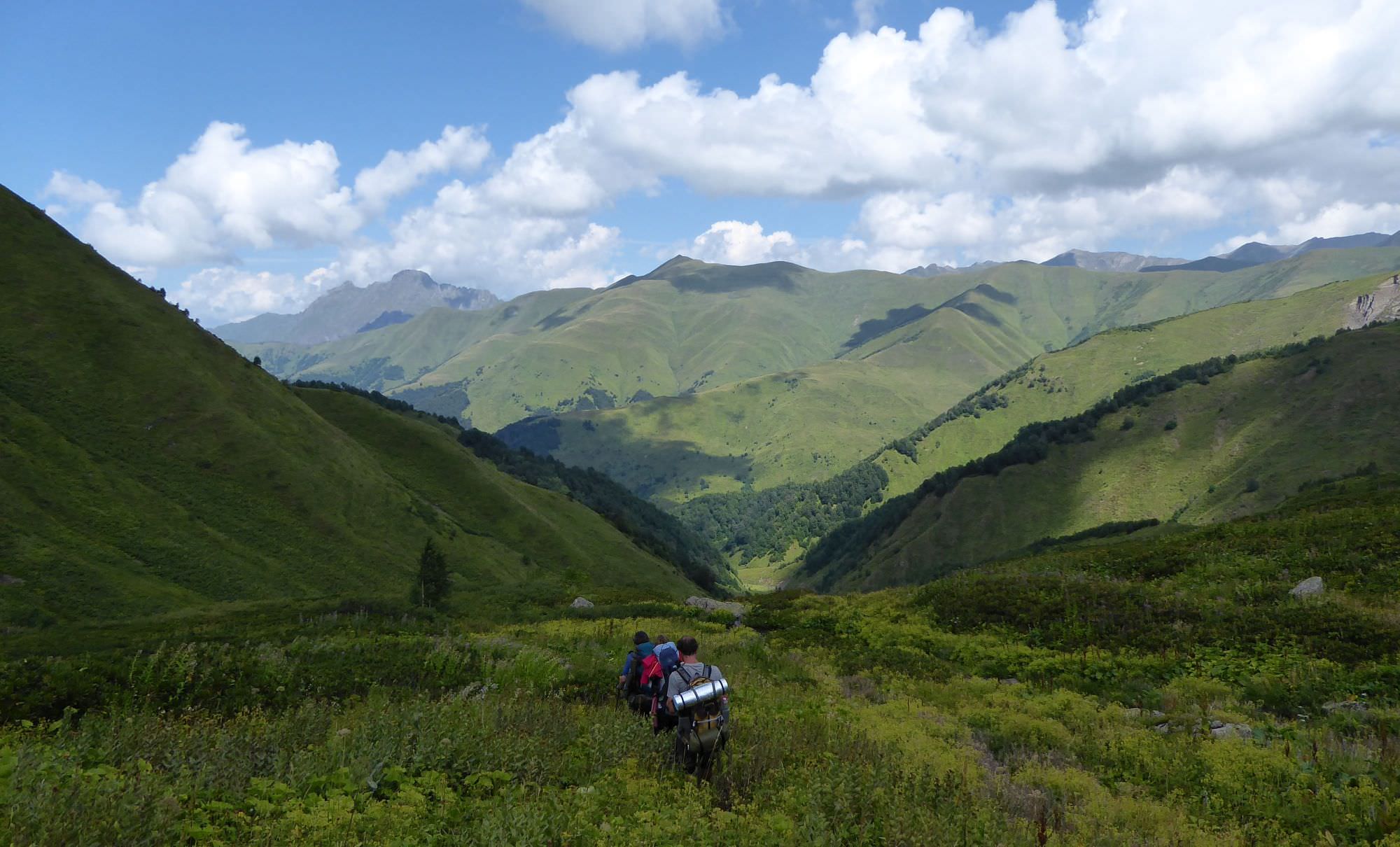
High passes with great views, magical lakes, rocky gorges, waterfalls, shepherds huts, remote valleys - this trek has everything.
Or almost everything. There are no medieval stone villages, so typical for many Georgian regions. So, if you are coming for your first visit and have time for only one trek, this might not be the best pick. It´s more suitable for people who have already seen the "highlights".
Duration of the trek greatly depends on the route and approach you choose. For example, currently there is a pretty decent dirt road built to the Natipuru mountain (2000m). Therefore, I see no point in walking it, if you can take a jeep and save whole day of time for some 300 GEL (definitely a good deal for larger groups), solo trekkers and couples might see it differently. So, if you take a jeep to Natipuru and do trek as a roundtrip, with return the same way (and jeep ride again), you can complete this trek in 3 days, an absolute minimum by my opinion.
Of course, it usually takes more. Natipuru road occasionally gets blocked by landslides, so you can't take jeep even if you wanted. You might choose some different route from the lake, either up to Khaishi in Svaneti (as described in this guide) or down to Skuri in Samegrelo. Also, the westher might not cooperate so you should have at least one day as a buffer. Egrisi mountains are quite rainy because of the proximity of the Black Sea and it would be a pity if you walked so far and saw nothing because of the mist. In such a case, it's better to spend more time at the lake to get the best possible views.
So, summed up, I would assing no less than 5 days if I was planning to do this trek.
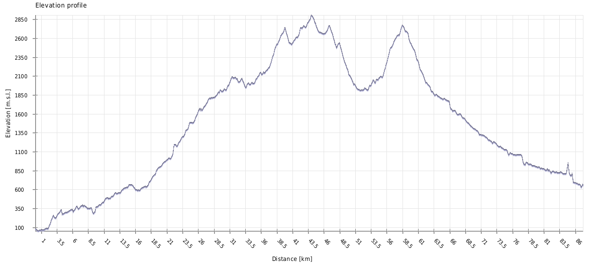
The trail is almost 80 km long from start to the end (60km if you take a jeep to Natipuru), crosses four mountain passes and several potentially risky water bodies. Especially the crossing to Khaishi is quite remote and in case of any problems, it won't be easy to get any help.
The best time is from the late July till the mid of September because of the most pleasant weather and lowest rainfall.
I would like to stress that my description is relevant to this "ideal" period. Overall, lakes are usually accessible from late June (when they are still frozen) till late September. I really don't recommend to try to visit them earlier or later - I am not saying it's impossible (nothing is "impossible"), but high passes will be covered by snow and crossing them could be tough and possibly life-threatening. I know several people who went there in late June and all, even though they are active climbers, admitted that it was just too risky and probably not a good idea. Also, during the late spring, lakes get quite a lot of rainfall.

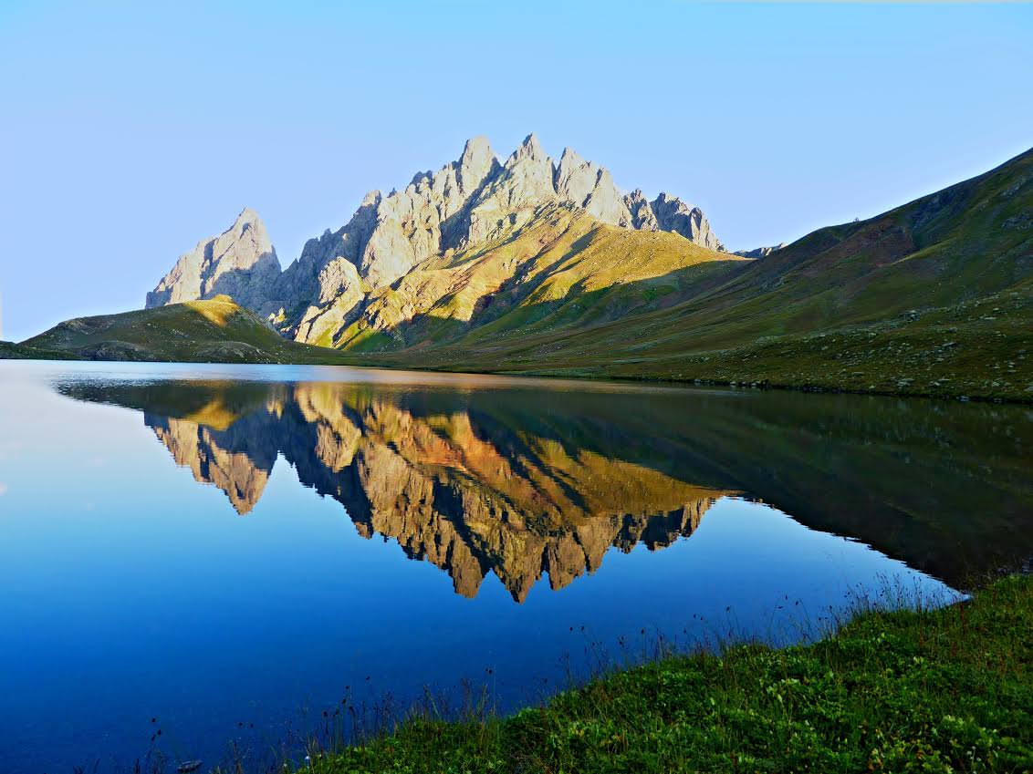
Tobavarchkhili lake in late June
There are no villages or guesthouses where you could spend a night, you will have to pack everything necessary for a prolonged camping trip.
There are several alternative routes to the lakes. This post describes Mukhuri and Khaishi variants which are, in my opinion, the most scenic ones. The third, shorter route starts in Skuri.
The best place to start your trip is Zugdidi. Marshrutka to Mukhuri departs at 9 am. from the local bus station -
it's the one by the bridge (42°30'31.9"N 41°52'09.0"E), not the one by the train station. The ride costs 3 GEL and takes more than two hours.
Another option is to take a taxi. Price for the ride to Mukhuri should be some 40-50 GEL (it's 40km) and the trip takes less than an hour. Trip all the way to Lugela spring could cost about 60-70 GEL.
Several marshrutkas heading either to Mestia or Zugdidi pass through Khaishi every day. However, they are often full so there is still a change that you will have to hitchhike or take a taxi.
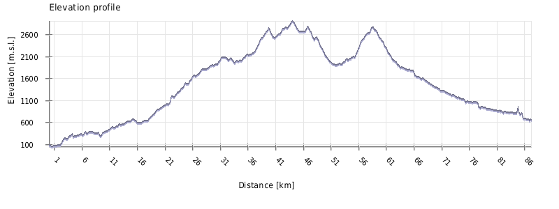
| Distance | 77,7 km |
| Trail type: | AB trip |
| Max. elevation: | 2905m |
| Min. elevation: | 262m |
| Total climb: | 5306m |
| Total descent: | 4916m |
First, just a side note - since the reconstruction of the road, I don't see much point in walking this, did it once and never again - it's an arduous and not particularly rewarding walk. But there are scenarios when it makes sense, especially if you have more time than money. Also, it's a pretty long section and might take you even two days, especially if you started late (getting to Mukhuri takes time). To make things a bit easier, if you came by taxi, ask your driver if he could take you at least to the Lugela spring so you skip the first 7km of the boring, but still quite decent road.
OK, now to the trail description. It starts at the bridge over Khobistskali river at the elevation of 300 meters - it's big dirt road following the right bank of the river. For the first few kilometers, it snakes between some houses, then leaves them behind.
More than an hour later, you will reach Lugela mineral spring. It's a meadow to the right of the road - seems to be a popular camping spot. Lugela water flows out of the metal pipe and is extremely salty. Nearby, you can also take a dip in the river (but if you try to reach the lake in 2 days, you won't have time for that).
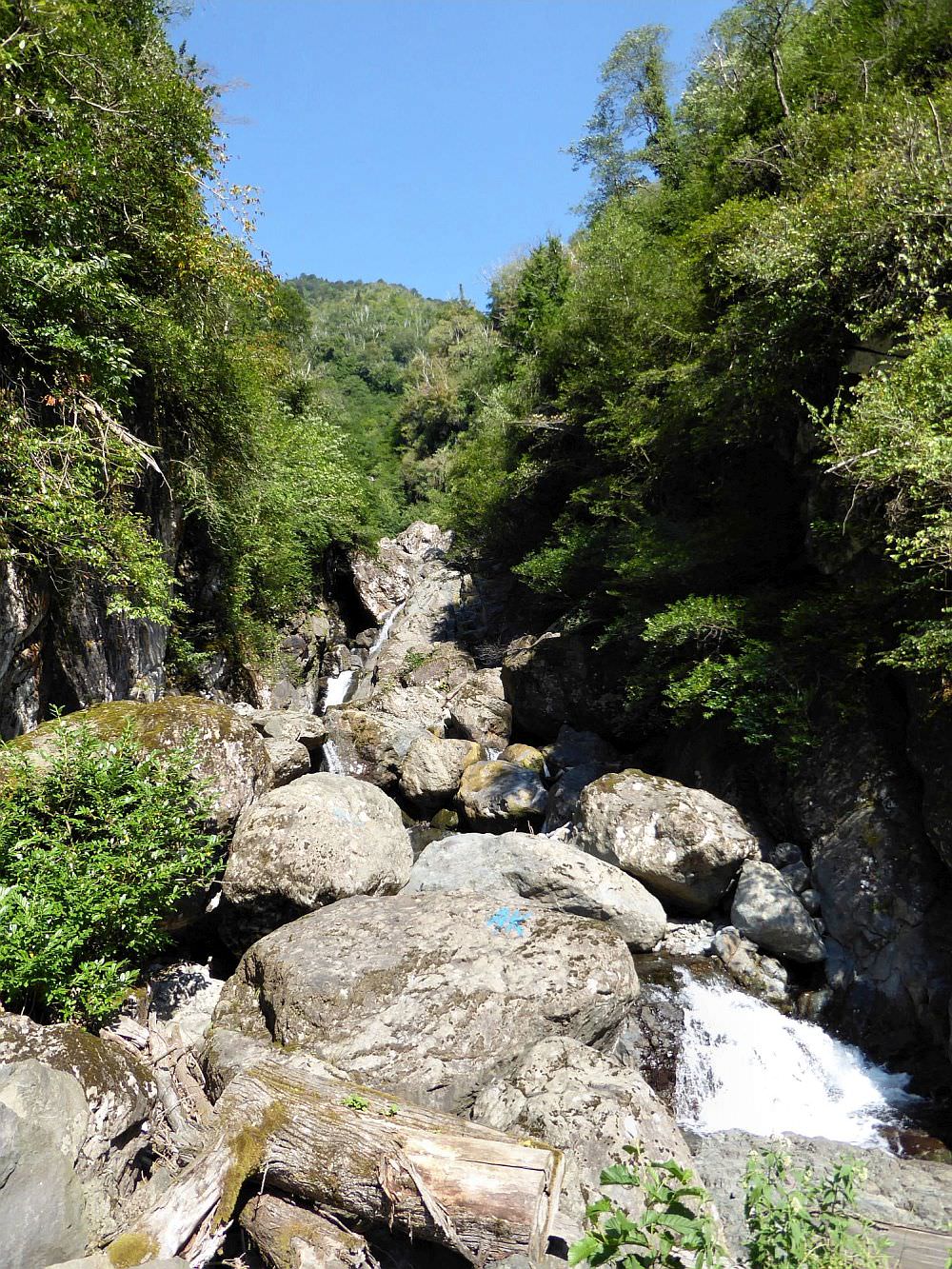
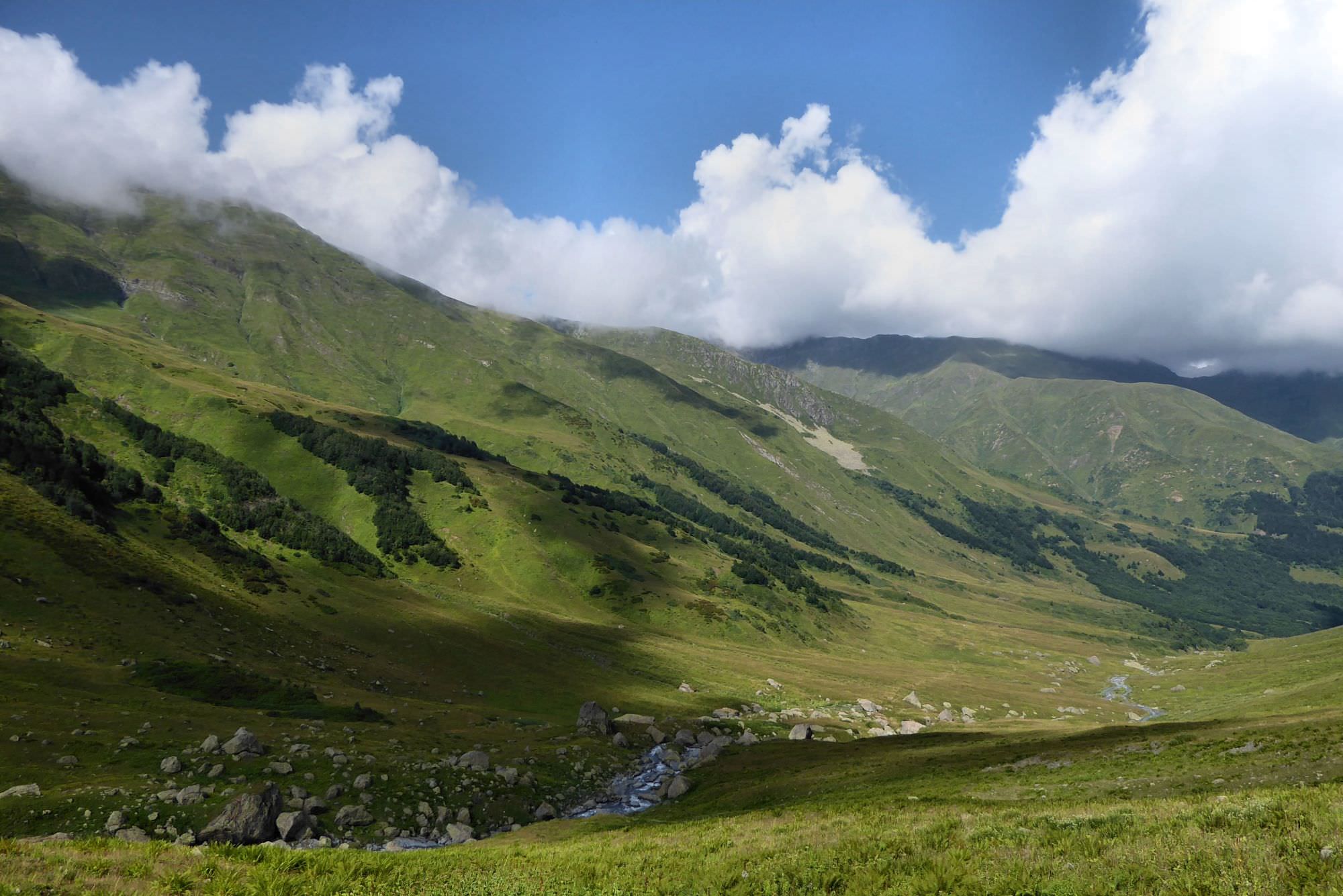
Follow the main road, it's slowly climbing. There are several water springs on the way - take enough water since in the next few hours, there will be none. After another 10 kilometers and 300m ascent you will come to impressive Gunzha gorge, there is a wooden bridge over the river. Overall, there are very places to camp, but few hundred meters behind the gorge, there are a few suitable ones.
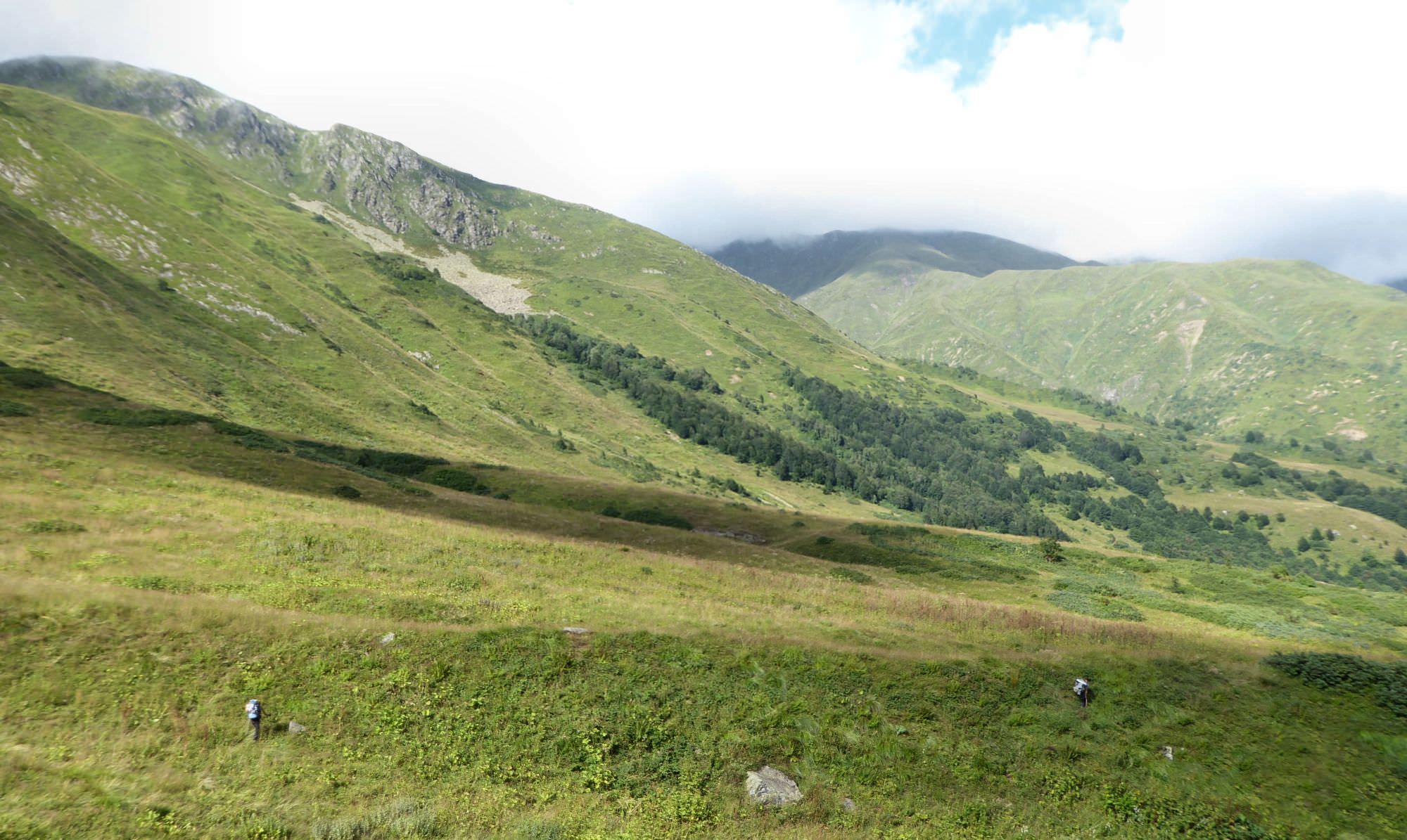
Follow the main road. Soon you will come to the intersection - right path stays by the river, but you need to turn left, onto the branch which heads uphill. The aubsequent climb is long, arduous and not too interesting . You will be just walking on a dirt road in a forest with very limited views and no sources of water. During the next 5 hours, you will have to climb 1300 meters from elevation 600 to 1900m. Your climb will be occasionally sweetened by blackberries/raspberries.
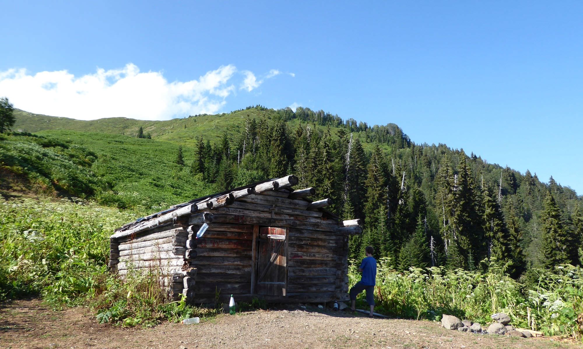
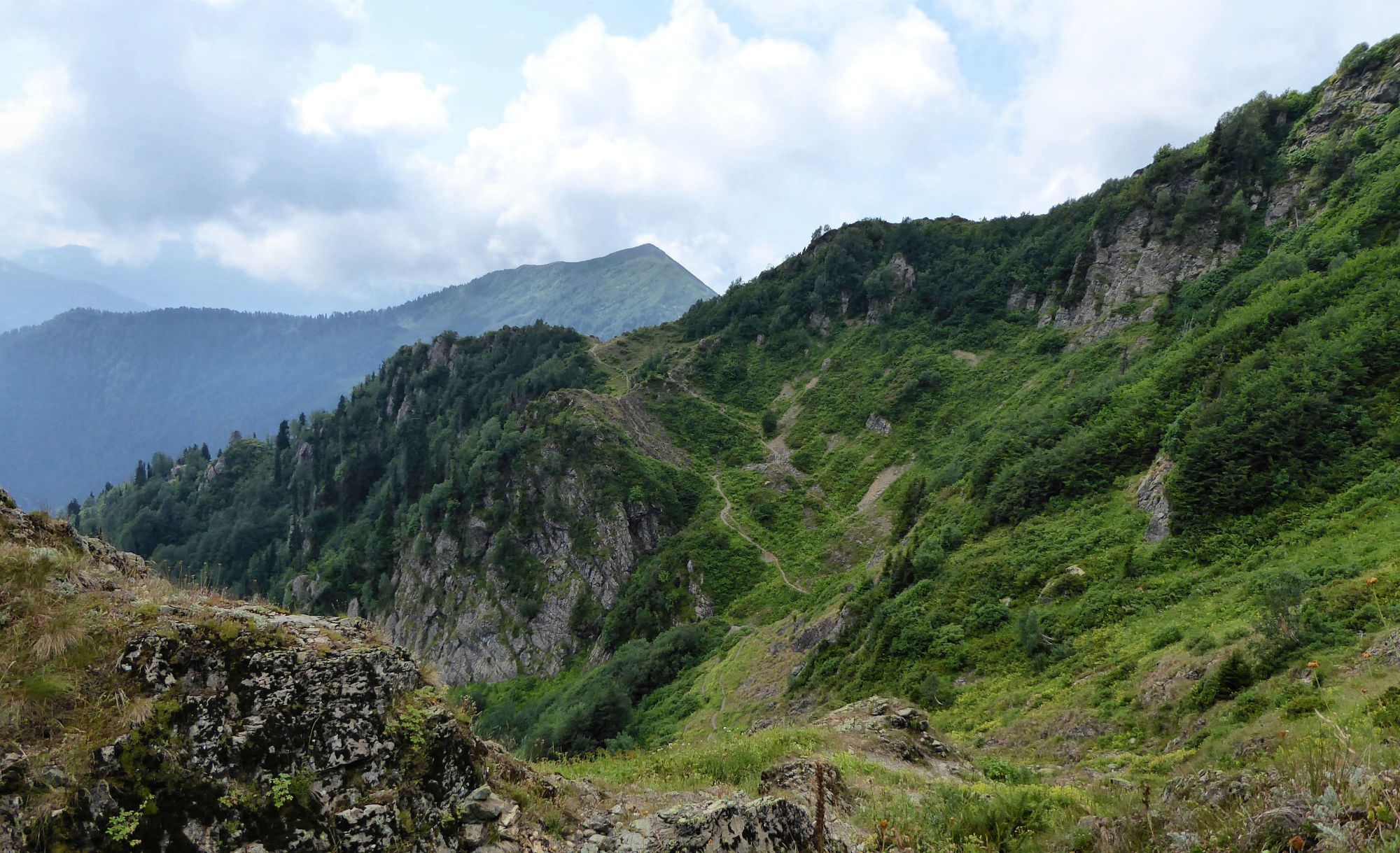
At the elevation of 1760m, you will come to the junction - a newly built forest road branches from the main road to the right. This road leads directly to the Natipuru hut, but I recommend to turn left to stay on the original road. If you turned right, you would miss the water spring which lies one mile later, at the elevation of 1860m.
From the water spring, a small trail snakes across the forest - to find it, you need to turn sharply right and backward, using the clock position terminology, "this route is on 4 o'clock". After some 10 minutes you should come to the hut below Natipuru mountain, where you will find a nice campsite and finally get some great views. And from now it will get only better.
From the hut, follow the new dirt road which bypasses the Natipuru mountain from the left side. After you pass the mountain, you will reach small crossroads with the tourist marker. It points to the right and this is also the direction I took (left branch bypasses the ridge you are standing on from the left side, then crosses it to the right and eventually joins the trail above the hut with a blue roof. It is longer, but looks more scenic - if someone walks it, pls send me a gpx log. Thanks a lot :)
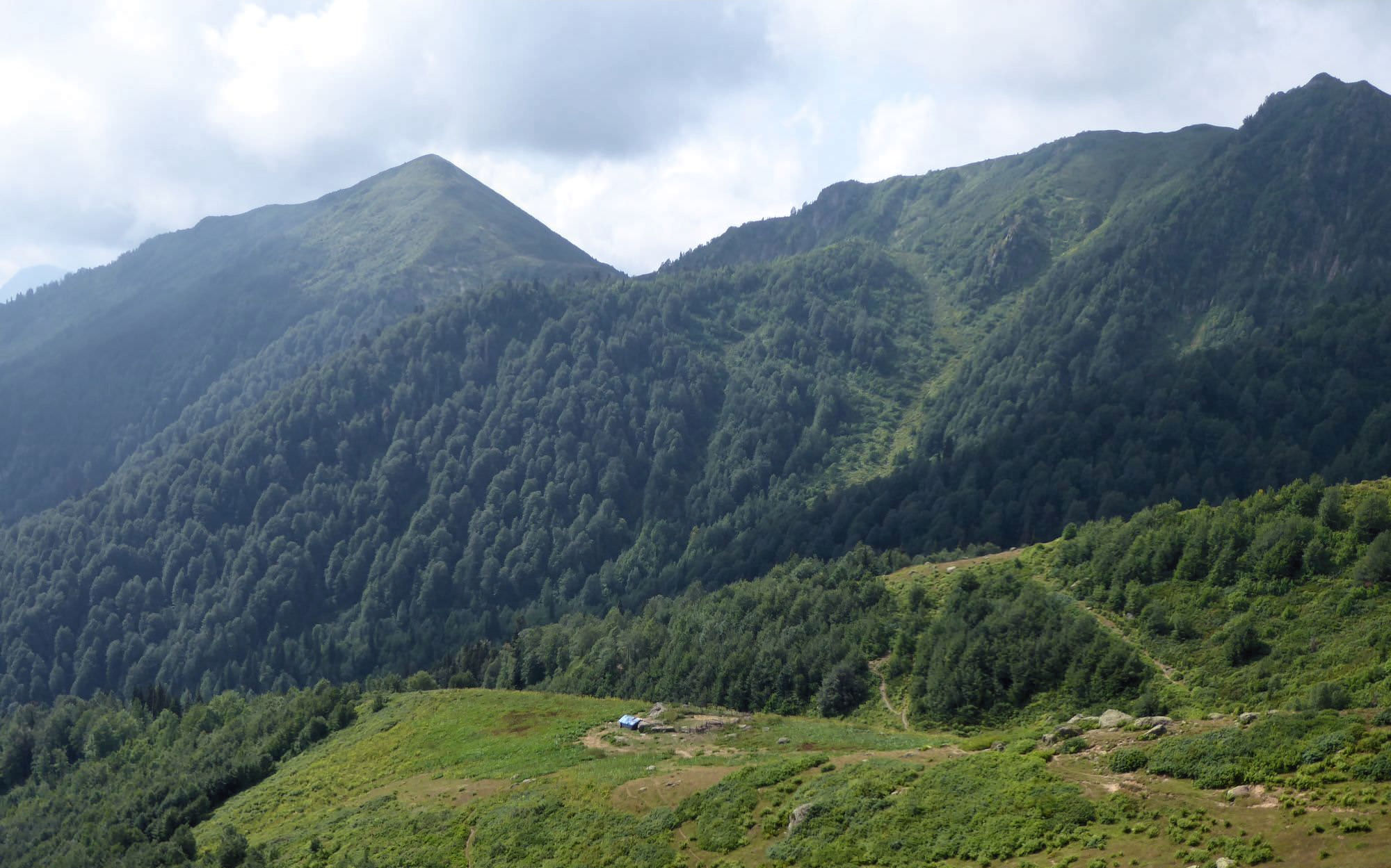
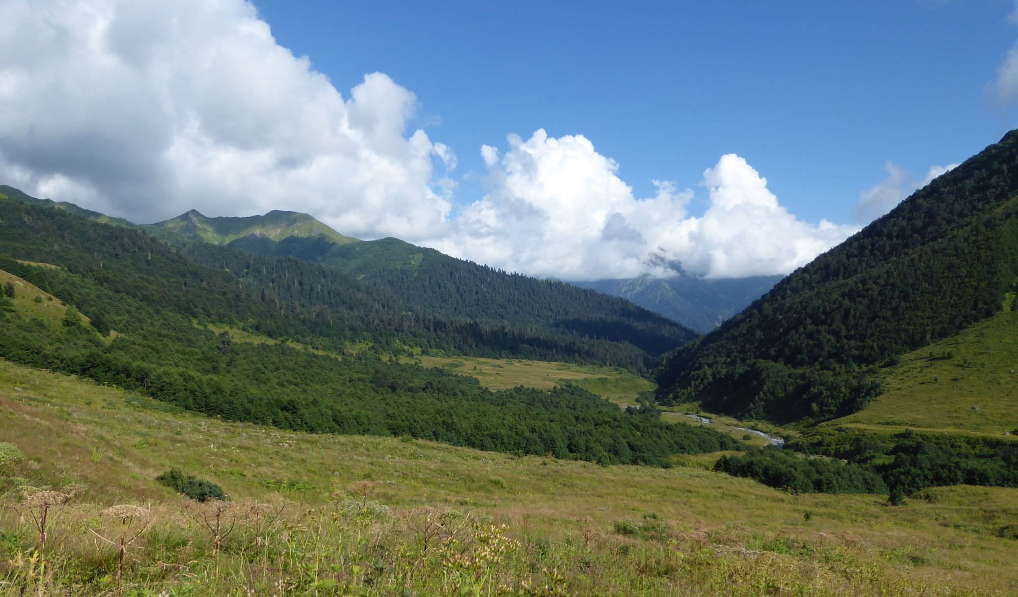
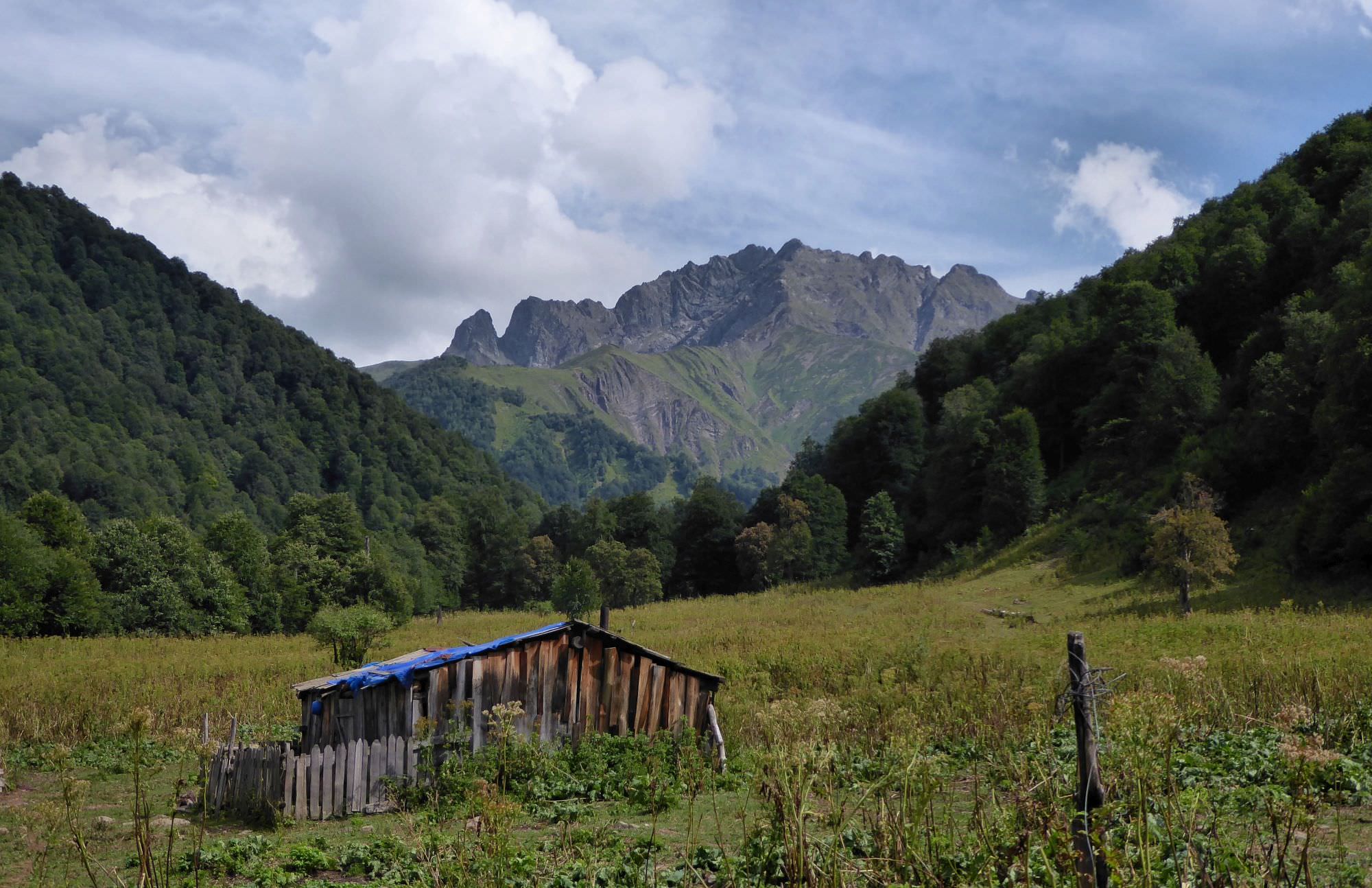
The road then dives into the forest again. Here, shortly after it turns right, down into the valley, watch out for a small trail to the left, it's very easy to miss (this exit got probably damaged during the construction of the forest road). This trail will lead you through the forest, cross four smaller streams and after few kilometers comes to the big flat meadow with a shepherds hut with the roof made of blue plastic bags.
The surrounding of this hut, abandoned during our visit, would make a great camping place. However, during 2018, a couple of shepherds lived in the hut and I heard several warnings about them. I even spoke with a couple which they invited for a drink and then one of the shepherds stole some things from their backpacks. Therefore, I wouldn't spend around more time than necessary.
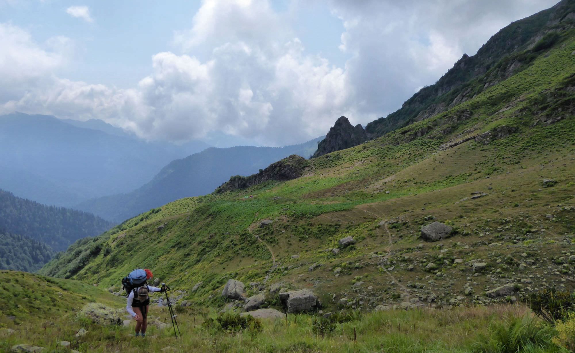
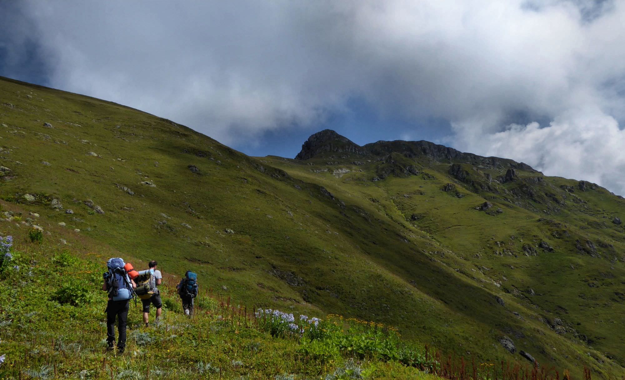
From the hut start climbing directly uphill until you find a footpath traversing the slope. Here you need to turn right and head towards small saddle to the east, close above the treeline.
The path then turns to the north and starts traversing the steep slope, crossing several rocky ledges. After some 30 minutes, you will come to a big square stone, quite a good place for camping if needed. Here you need to turn left and start climbing up the valley to the depression some 400m above you, which most closely resembles a pass. It was quite tiring, especially since we lost a path for an hour (I marked in gpx log where we found it again).
When you make it to the depression, you find out that this is not Okhoje pass yet - to reach it you will have to climb another 200 meters in the northern direction. But good thing is that you can't get lost here.
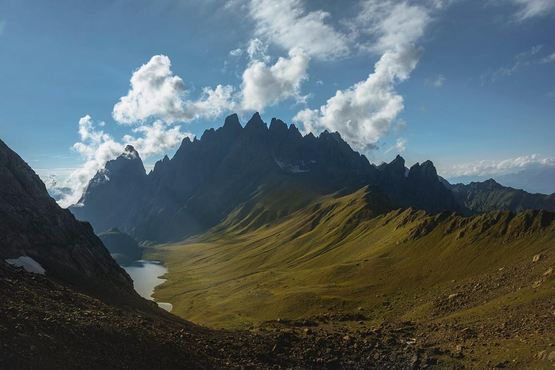
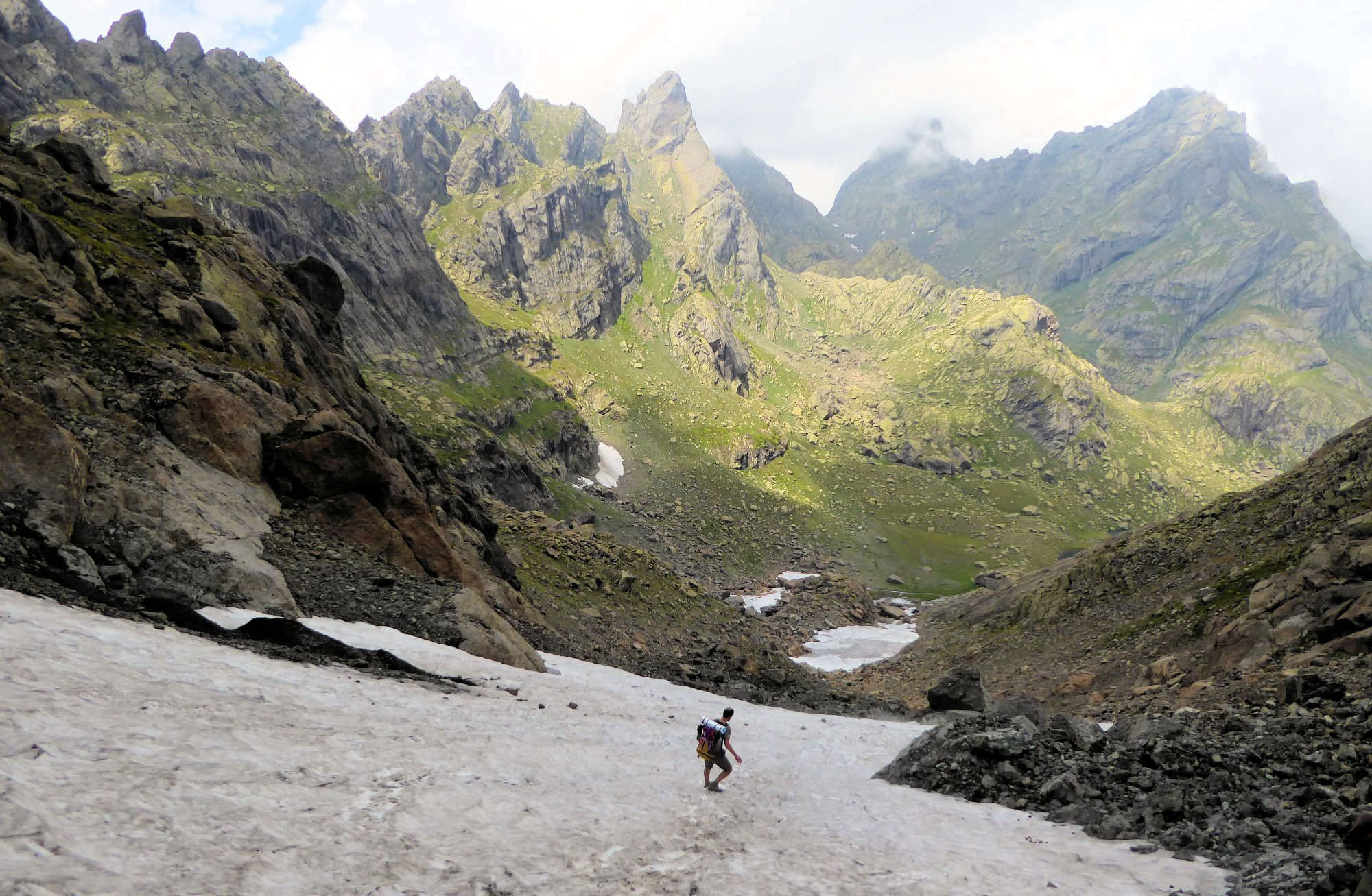
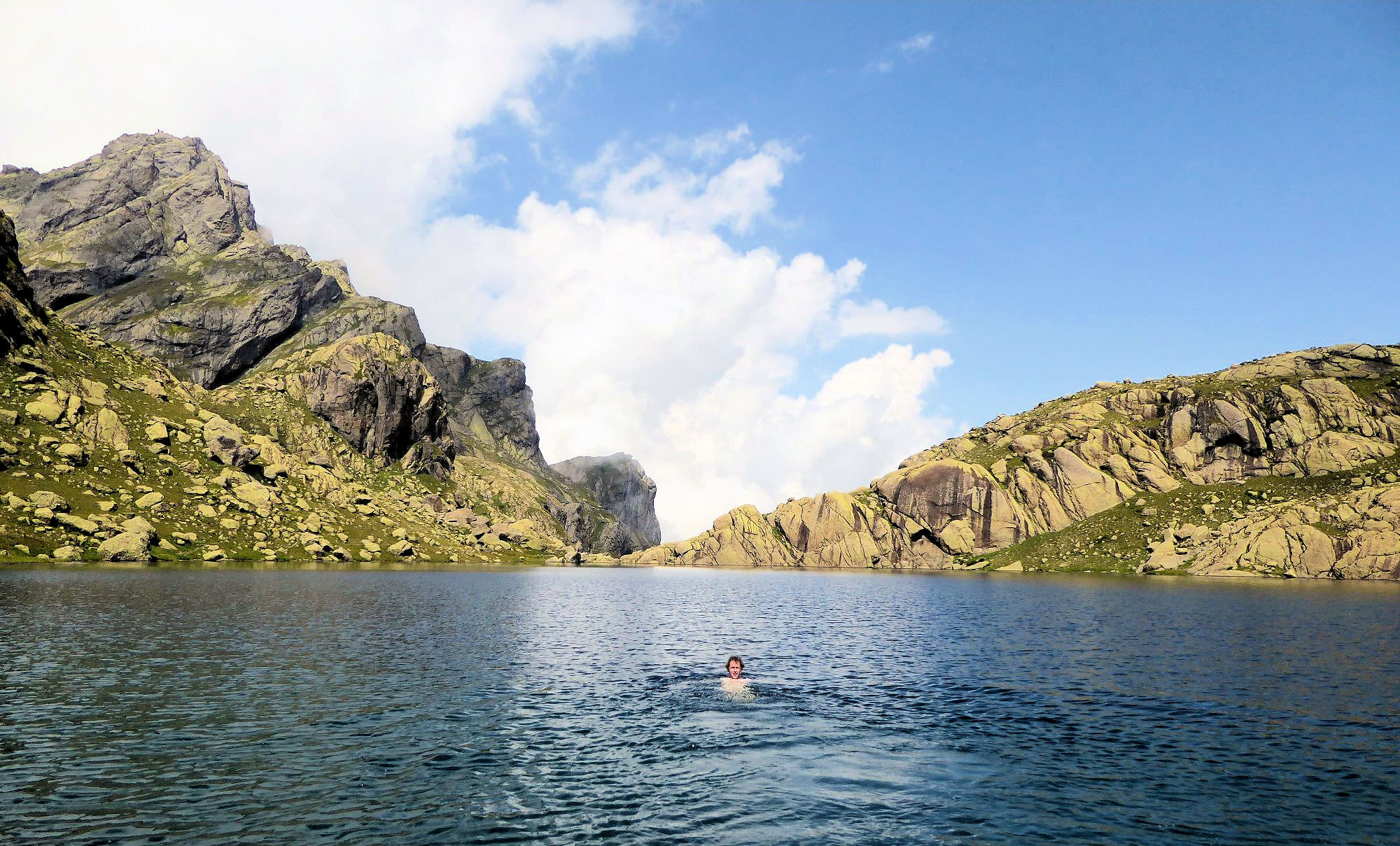
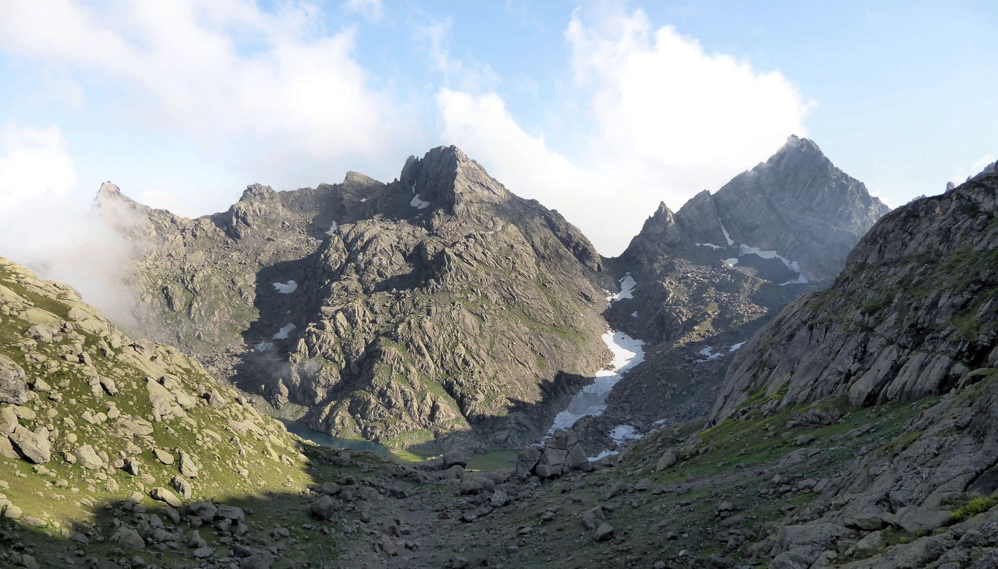
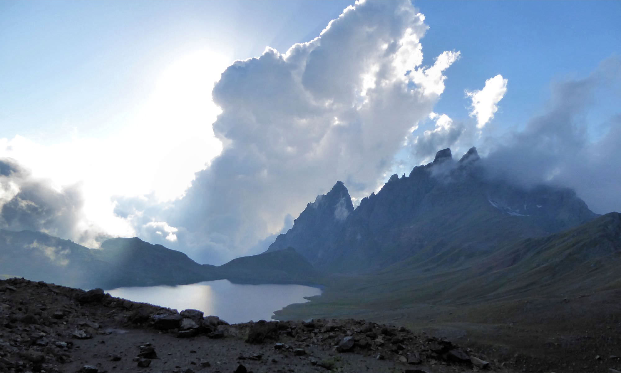
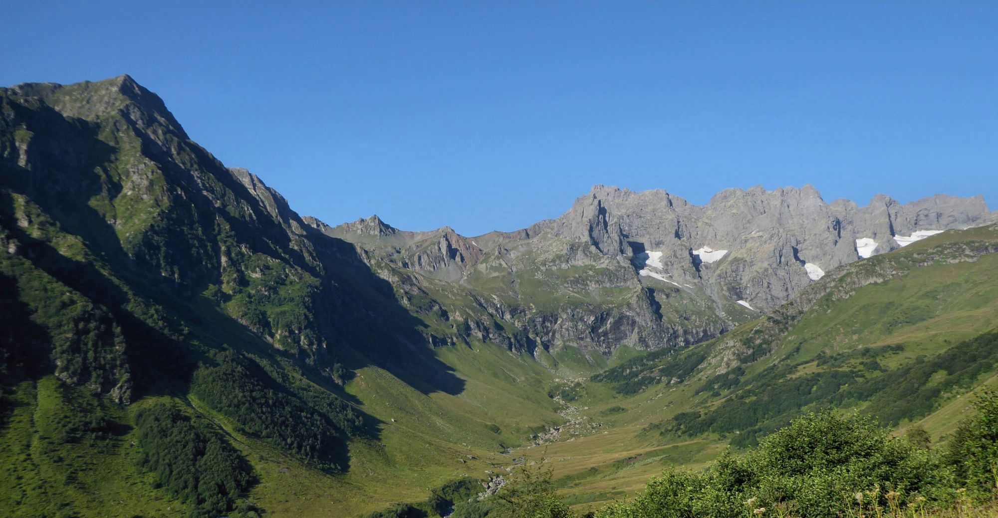
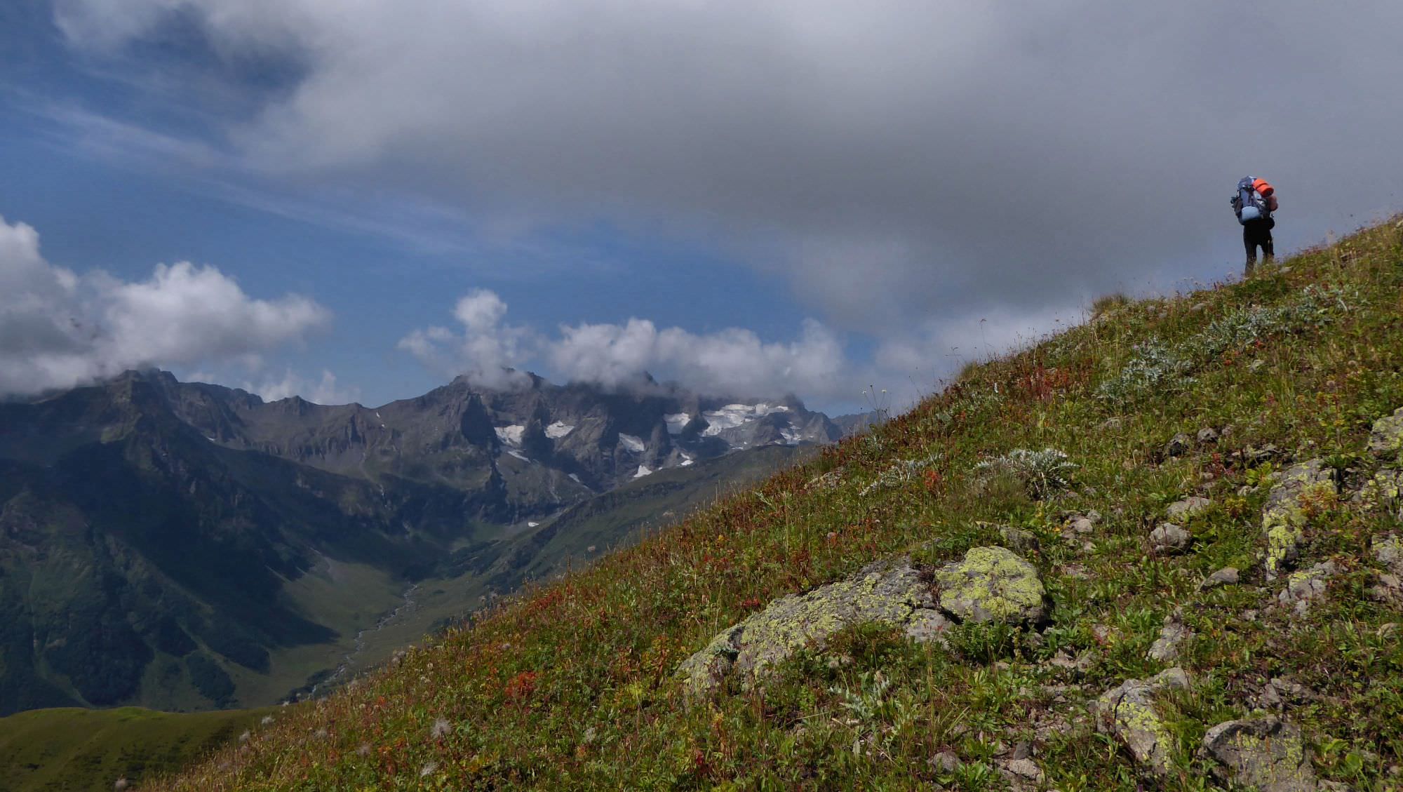
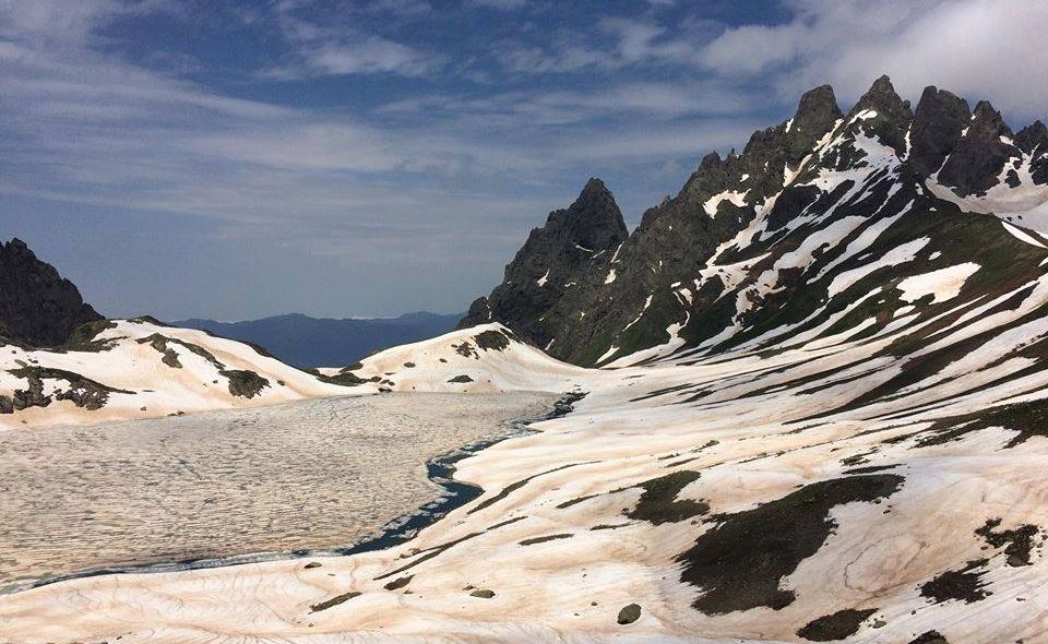
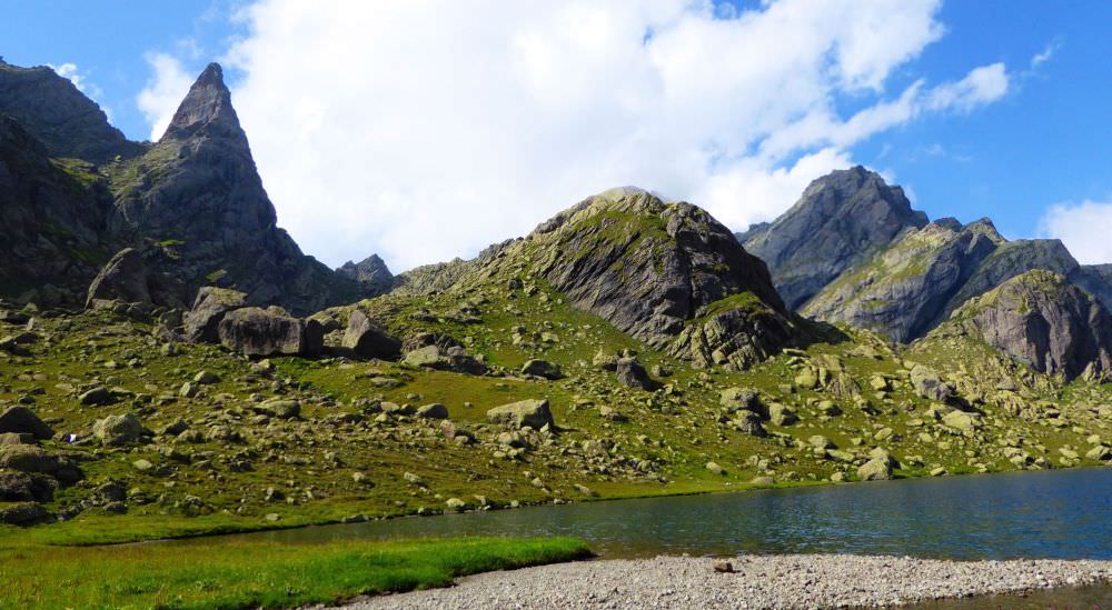
Finally at Okhoje pass, elevation 2750 m. Enjoy the views and slide down to the Okhoje lake - in late August there were still snowfields at the north side of the pass.
Okhoje lake is ideal for a break and a dip. You can camp here or continue to Tobavarchkhili lake - just take into consideration that this walk takes another three hours.
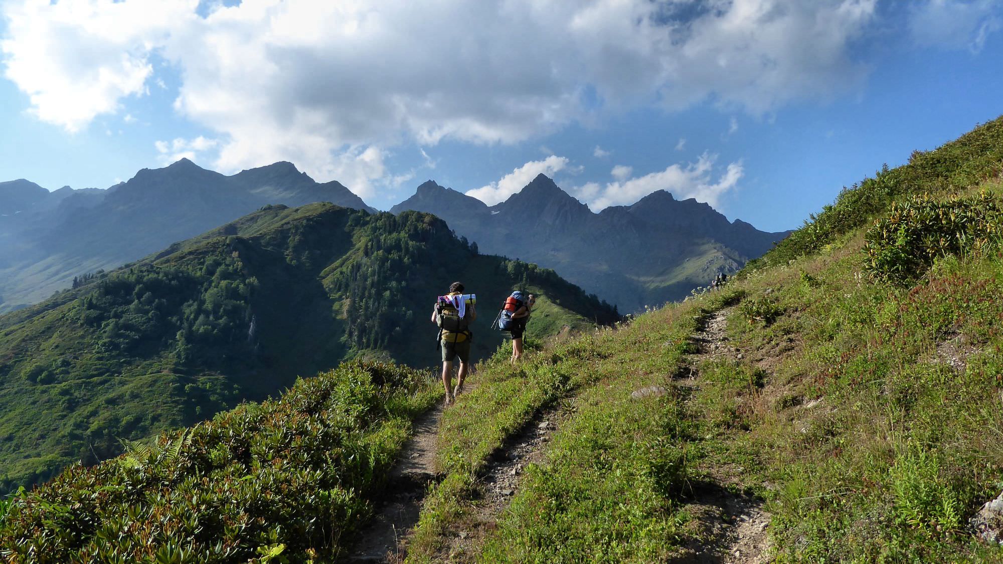
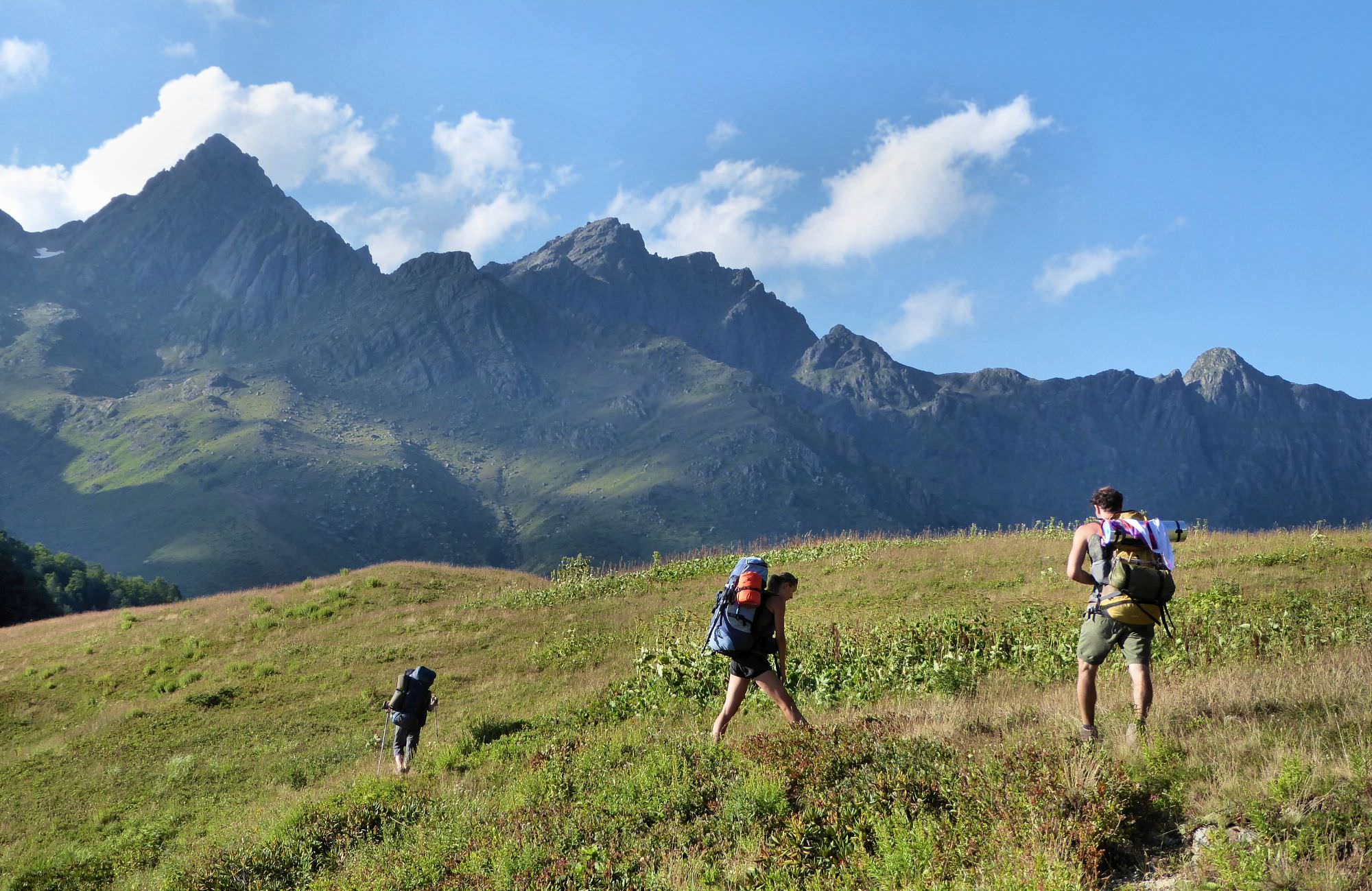
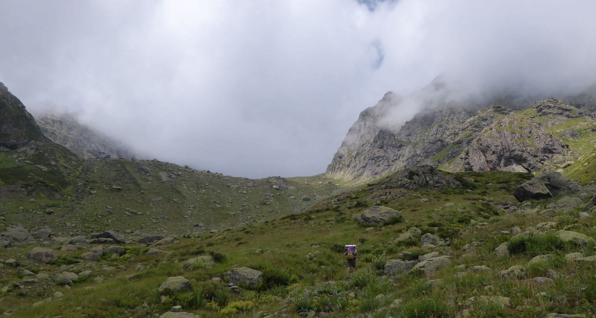
Let's push on. Follow the bank of the lake to its northernmost point and from there, start climbing between huge rocks towards a pass to the north. There is a hiking pointer showing the direction and some kind of a rough trail between the stones.
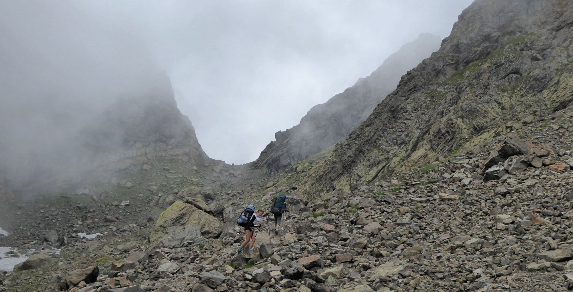
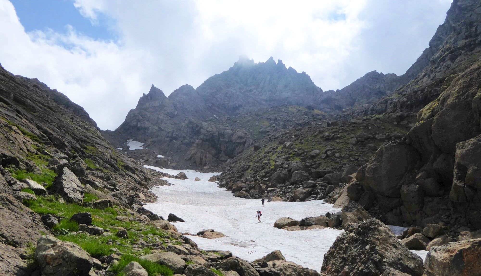
You need to overcome some 200 meters of elevation to make it to some kind of a large mountain plateau. When at the top you will find yourself on a rocky meadow. There is a hill in front of you. Walk around it from the right side and after some 30 minutes, you should see Eastern Toba pass (2902m) in the distance. It's pretty steep and you should expect snowfields close to the top,
but not that high, you will have to climb just another 200 meters.
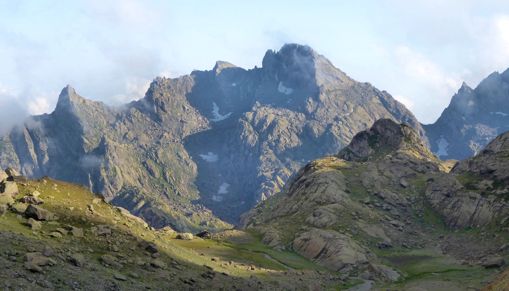
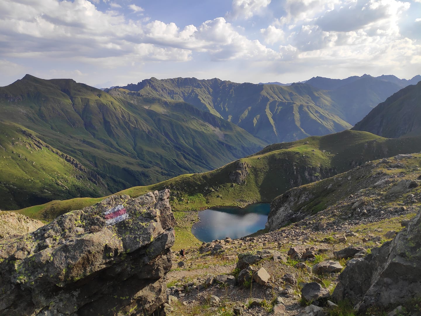
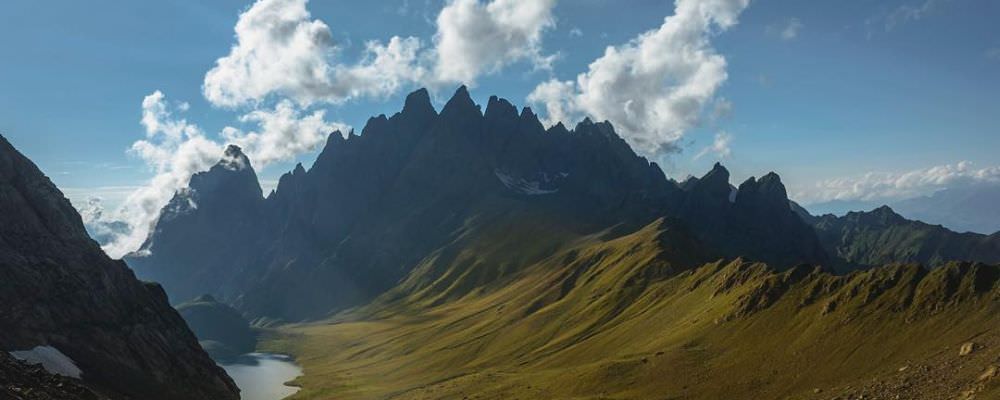
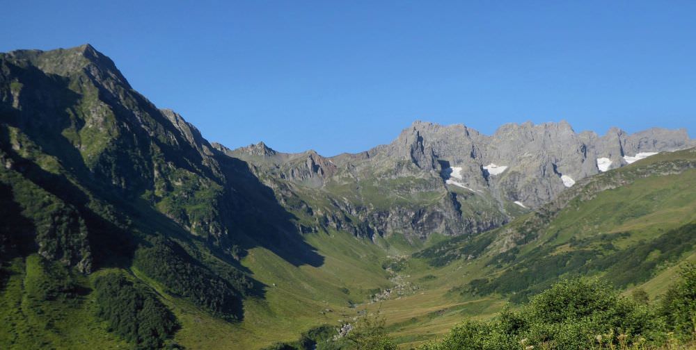
The pass offers fantastic views on the peaks of Chitaghvala massif (3226m), but the lake is not yet visible, it's hidden behind rocks to the left. Start descending, the path goes on the right side of the valley. It will take some time as you will have to descend 250 meters. Its better to camp at the farther side of the lake because of nearby water source (marked in the gpx log).
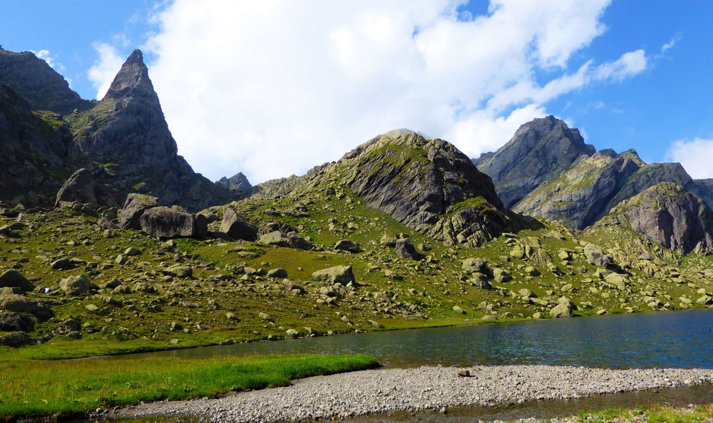
Start early and climb to the pass to the north of the lake. It should be quite fast as its only 100 meters of elevation and path to the pass is clearly visible from the lake - first, you climb the ridge to the right from the pass and from there, follow an obvious, only slowly rising trail. Then descend on the other side. On your right, you will see small Didi Ghele lake, usually covered with ice. Not much later you will descend to the Kailashi lake - it has a shape of a heart.
Here is the tricky part. Cross the small stream at the spot where it flows out of the Kailashi, but don´t follow it to the left - instead of that turn right
and start climbing onto a ridge behind a lake. There is also a path, if you look for it, you should find it pretty quickly. Follow the path,
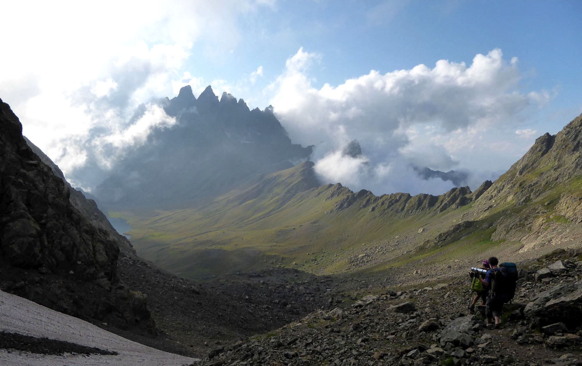
it slowly climbs above the lake and then circumvents nameless hill from the right side. Finally, you will reach a tourist pointer showing the detour to the Tshakatskali lake. To reach it, you would have to cross the small pass you see to the south-east. However, the route is difficult and involves a lots of scrambling.
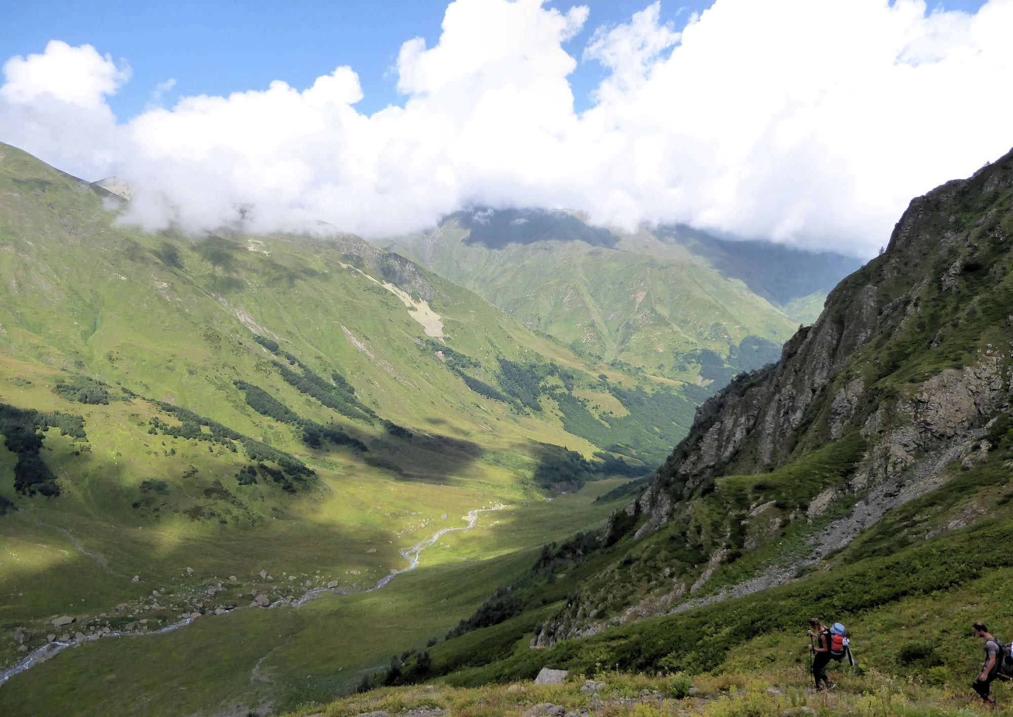
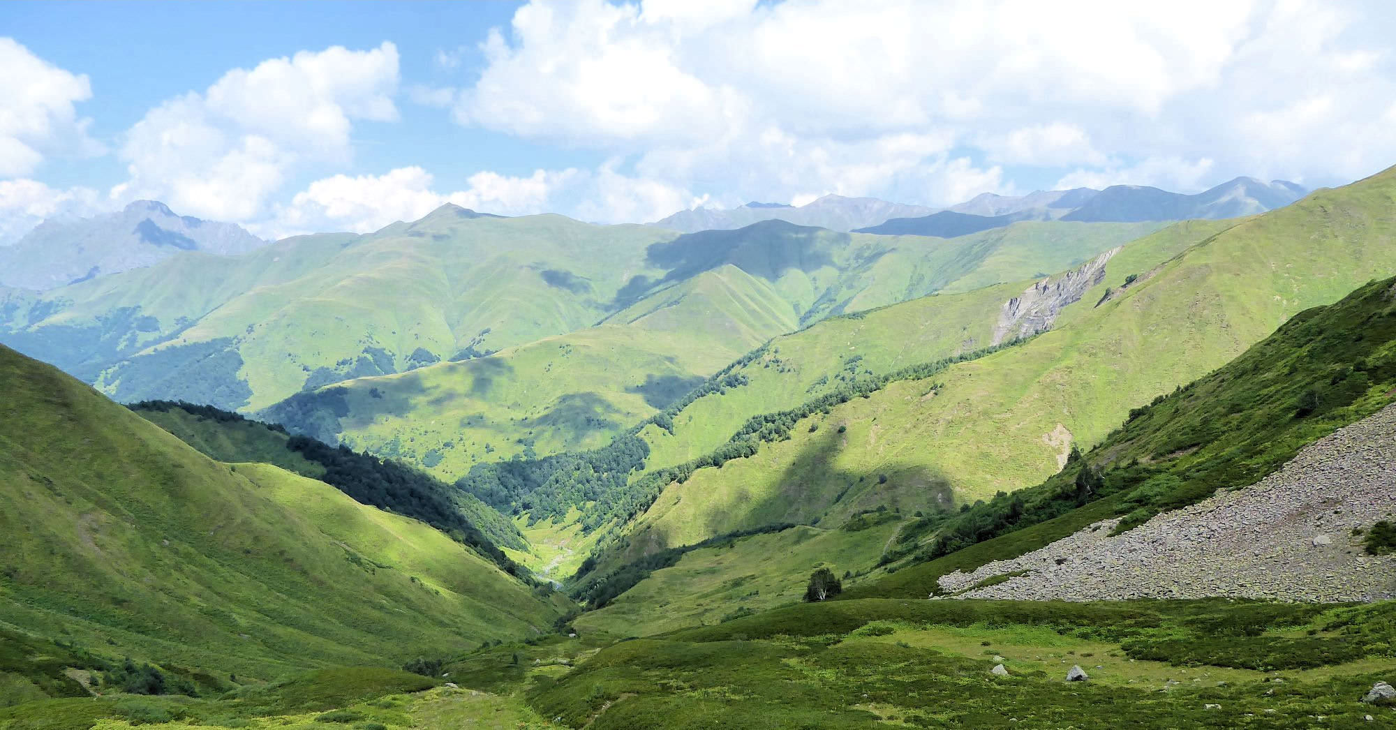
If you don´t have few extra hours, follow the classic trail and turn left. Before you, an amazing view into Khobistskali valley opens up - this way you will descend. The trail here consists of a series of endless serpentines which will bring you some 400 meters lower to the river. When you come to the bottom of the valley, path becomes hard to follow. Walk down the valley, more or less in parallel with the river, but keeping a distance from it. Some 700 meters later, you will see a huge square boulder right by the river and if you look better, also a write/red hiking marker. Descend to the river and cross it at this spot. At the other side, you will find another hiking pointer.
From here, follow the left bank, keeping some distance from the river. The trail here is heavily overgrown, but noticeable and soon becomes pretty obvious and easy to follow. Your advance will be slowed down by several gullies formed by smaller streams joining the river.
Another obstacle here will be two patches of young, but very dense forest. The rule here is "if you don't see the trail, don't fight your way through them, instead, climb a bit" - in both cases, there was a well-trodden trail some 10-15 meters above the point where we reached those groves.
Not far behind the second grove, you will find a spot somewhat suitable for camping. Not particularly flat, but few tents could fit here and there is a small stream among the trees uphill. Depending on the time you will have to decide whether to stay here or continue -
but if you want to make in the next day to Khaishi, you will have to press on (or walk 12 hours on the next day as we did, but I wouldn't recommend it to anyone).
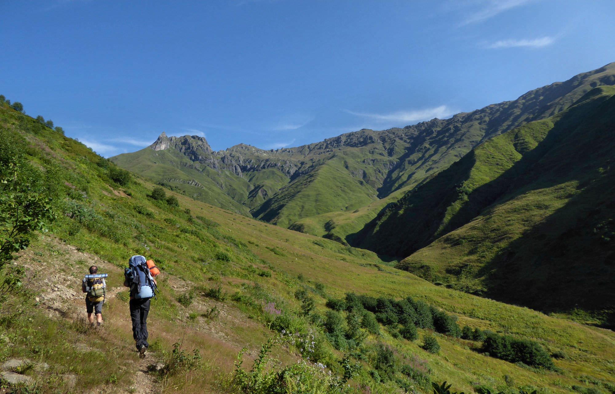
From here, you will need to walk for 4 hours to get to another suitable campsite behind Natakhtish-Dudi pass.
Some 100 meters behind a campsite path turns to the north and dives into a major side valley, at this section, it's already well visible.
It crosses two small streams and begins climbing to the pass. You need to climb on a big, wide side ridge in front of you that eventually narrows and bends to the right.
In lower parts, the path is hard to follow, then reappears again. Your advance will be slowed down by fields of big, tasty blueberries.
After you make it to the top of the side ridge, the path turns right and starts traversing the ridge.
Ahead, you will see a small, round elevation. Once you will reach it, you will finally see a pass more than 100 meters above you. This is the last but worst part - first, you will have to climb steep side ridge (no trail), then traverse to the Natakhtish-Dudi pass (2770m), which lies on a "not-so-rocky" part of the ridge. From the pass, you can admire the panorama of Greater Caucasus ridge as well as Mt. Elbrus lying behind (at least on the sunny days). Descent a bit from the pass and you will come to green meadow suitable for camping. However, you will probably have to descent 100-200 elevation meters more to get some water (therefore, I recommend to bring enough water from the other side of the pass).
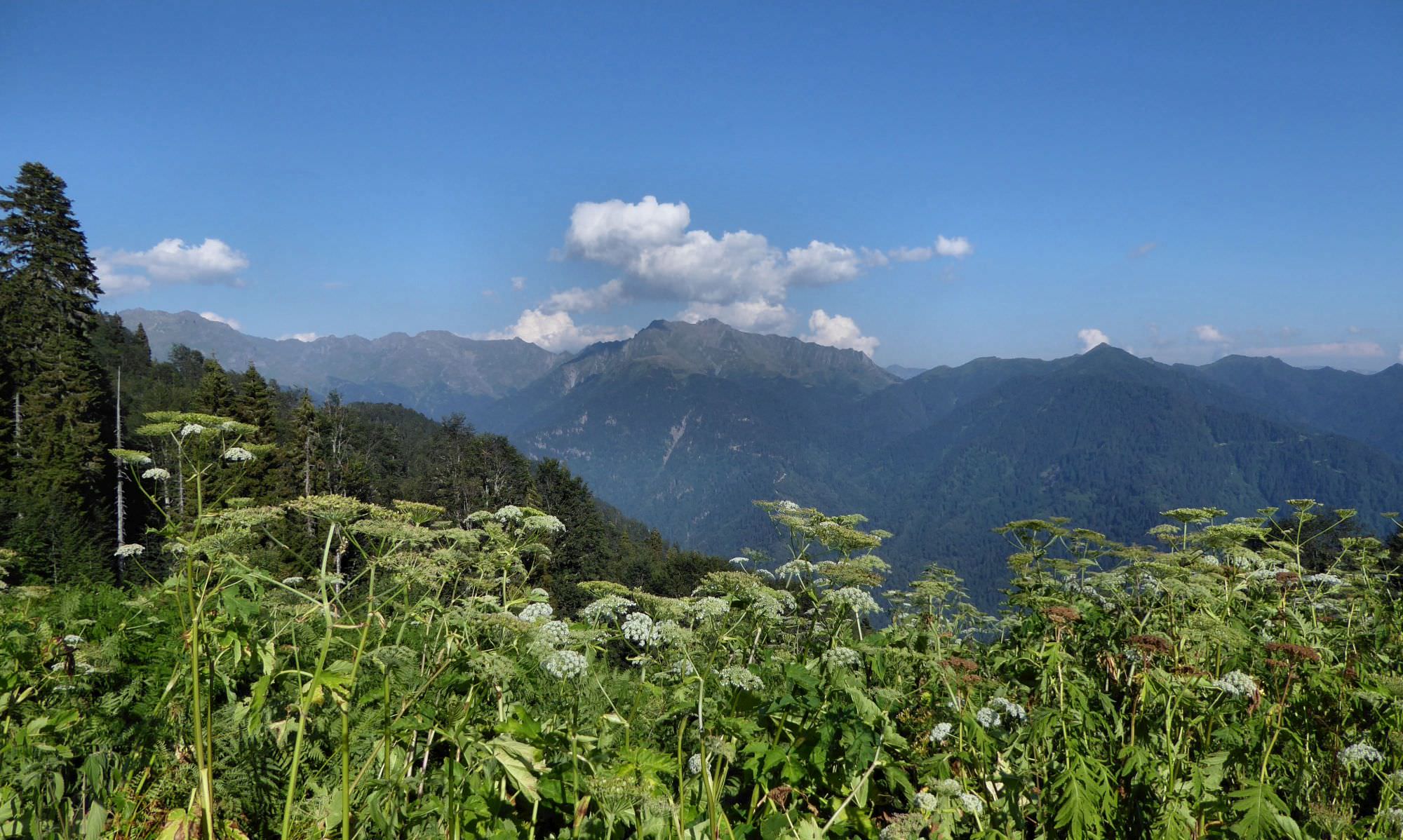
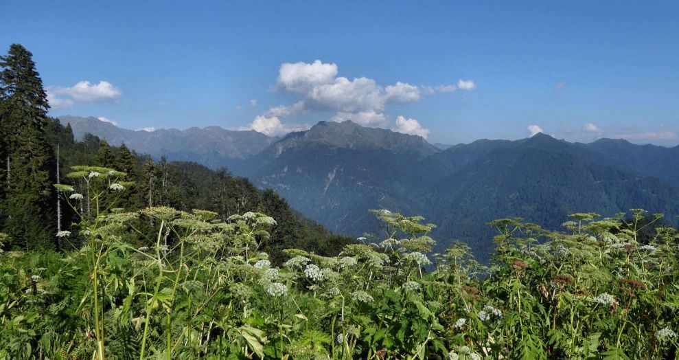
Another tough day. Continue descending to the bottom of the valley, you will cross rhododendron fields, hogweeds and eventually dive into the small forest.
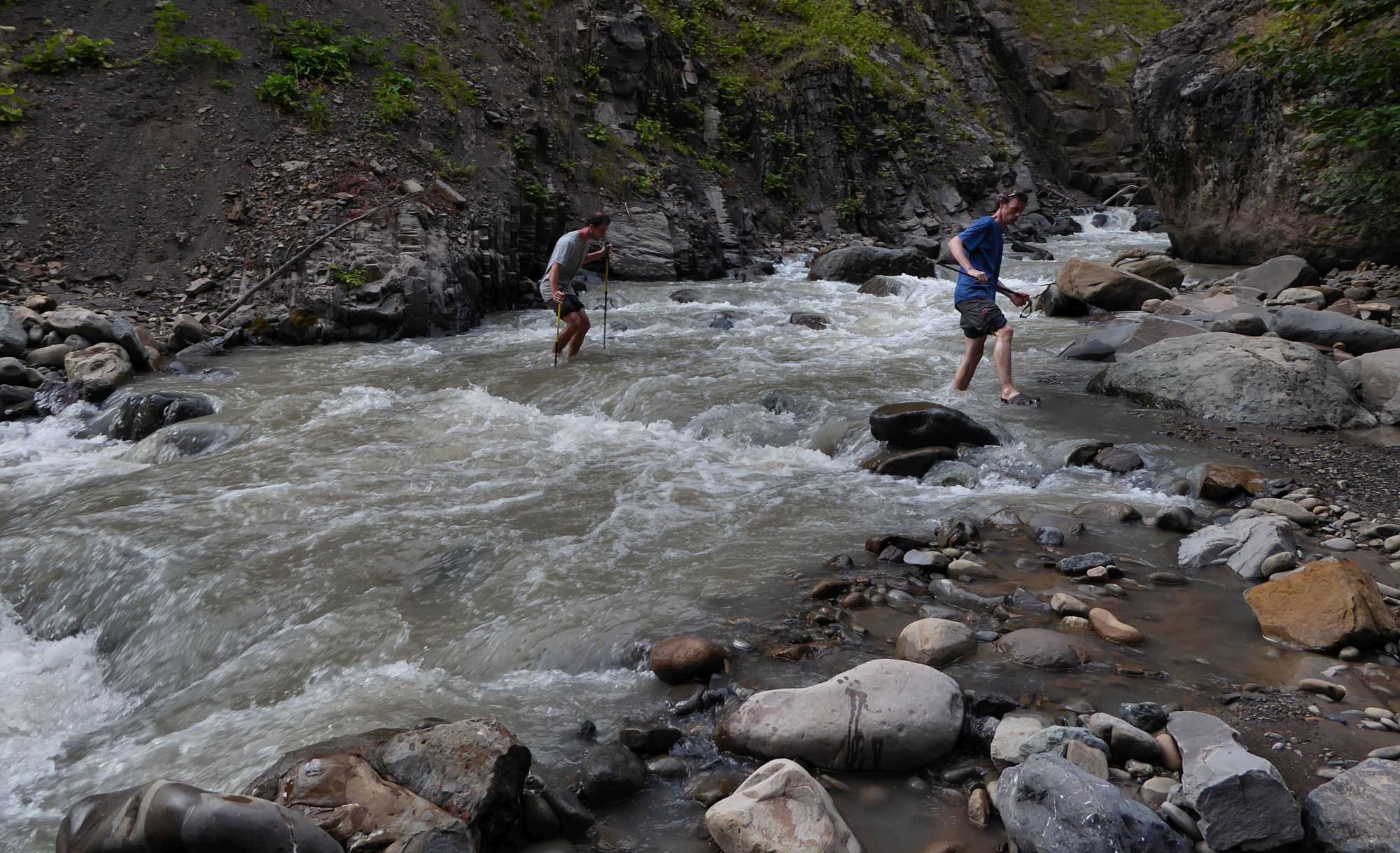
Then you will have to ford a river and appear amongst hogweeds again. Path at this section is always more or less visible, just look carefully. Basically, it just follows the river. However, it's very swampy and at several occasions, we sunk ankle-deep into the mud.
After some time you will have to ford a river and after 100 meters do it for the last, third time. Here appears decent path and first signs of civilization such as cows.
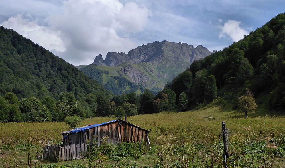
Some 30 minutes after last fording you should come to shepherds hut called Gvandra - the owner, Tariel/Misha is friendly, but with passing years starts to forget that women hikers are for watching, not touching. Be careful around him. But you haven't won yet, from here to Khaishi its another 5 hours of brisk walking.
Path later turns into a dirt road, after some 4 km you should see Zeda Vedi settlement on the opposite bank of the river.
Stay on the left bank, it's a long walk. But apart from that, there is not much to talk about, just follow the road.
The road crosses the river two more times, luckily, there are solid bridges. Then it climbs a bit and soon, Kveda Vedi village gets into the view far into a distance.
It's quite a walk. Some one kilometer before the village, you should pay attention. The road turns a bit left and then crosses the river - this crossing is meant for cars, but also hikers should be able to pass. However, there is a better option if you don't want to wet your feet (or risk if the water level is high). Not far before the river crossing, where the road turns left, look out for a tree with the yellow marking and some wooden mark in the shape of diamond, pointing straight into the forest. If shows you a small forest trail which leads to the footbridge over the river and soon merghes with the main road again.
This was the last obstacle before Kveda Vedi village - it mostly lies at the eastern bank of the river, but you need to stay at the western one. Behind the village, the road dives into beautiful canyon and after another two miles of walking you should finally arrive at Khaishi.
During the work days, there is also a chance that you will be passed by woodcuters trucks returning from the forest. Workers are generally nice and willing to offer you a ride (in our case, they also refused any money). It's much more comfortable than the endless walk on the quite boring road, however, it has its downsides. When their Kamaz entered the canyon and started manoeuvering on the narrow road high above the river, I wished we just kept walking...
The cover photo of the lake (or at least a part of it) is published here with kind consent of Max Richter. Thank you, Max!