I consider myself old school. I wear heavy hiking boots, don’t count every gram of my equipment and used to carry Garmin device for trail recording and navigation. However, it broke last summer and I am not buying a new one. There is no need to. Current smartphones are more than adequate for the job. They are almost as precise as designated units and shorter battery life can be solved by power banks. Also, modern GPS apps are much more user-friendly.
In this series of posts, I will describe in detail how to turn your smartphone into an indispensable assistant for your hikes in Georgia. I will cover the apps which are the most popular or useful. And start with the one I actually use - Locus Map.
Locus map is the app made by Czech company Assam software. I´ve been using it for years, mostly because of their superb coverage of Slovakia. But it can be as much useful for hiking in Georgia. Here I will show you how.
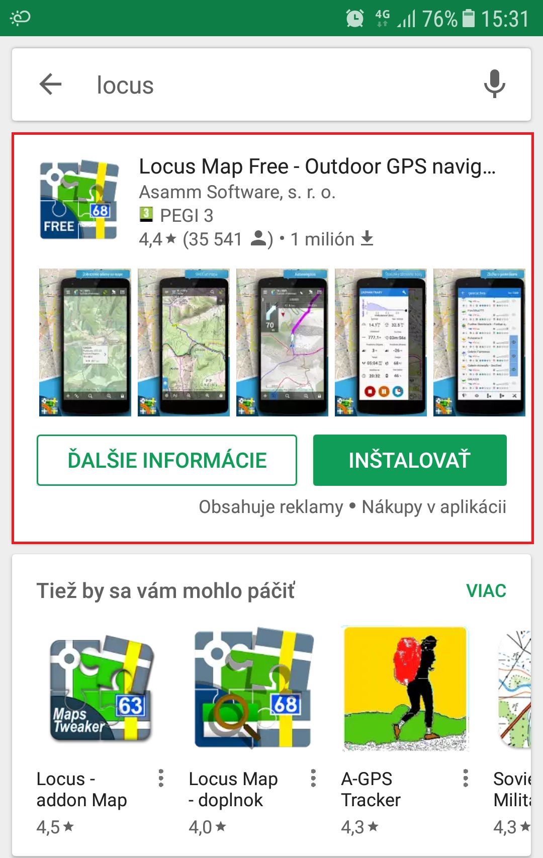
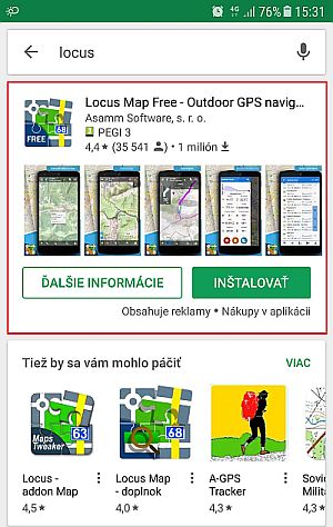
Installation is pretty straightforward. In the Google Play store, just search for "locus". The first app returned is Locus Map Free - Outdoor GPS Navigation - this is the one you need to install.
Locus map has also a paid variant. Locus Map Pro costs 7,50 EUR and has a few more bells and whistles (no advertisements, weather forecast, calories spent, better support for geocaching and so on). I will buy "Pro" since I want to support the company but fro the user perspective, I think also the free version is more than sufficient.
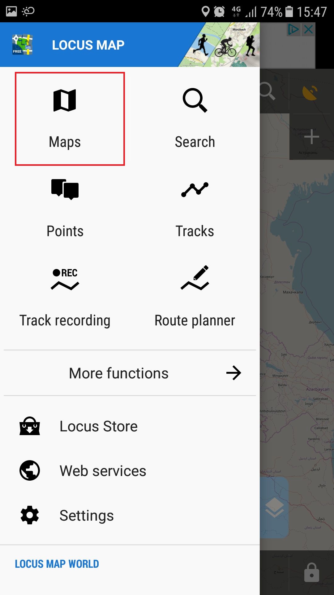
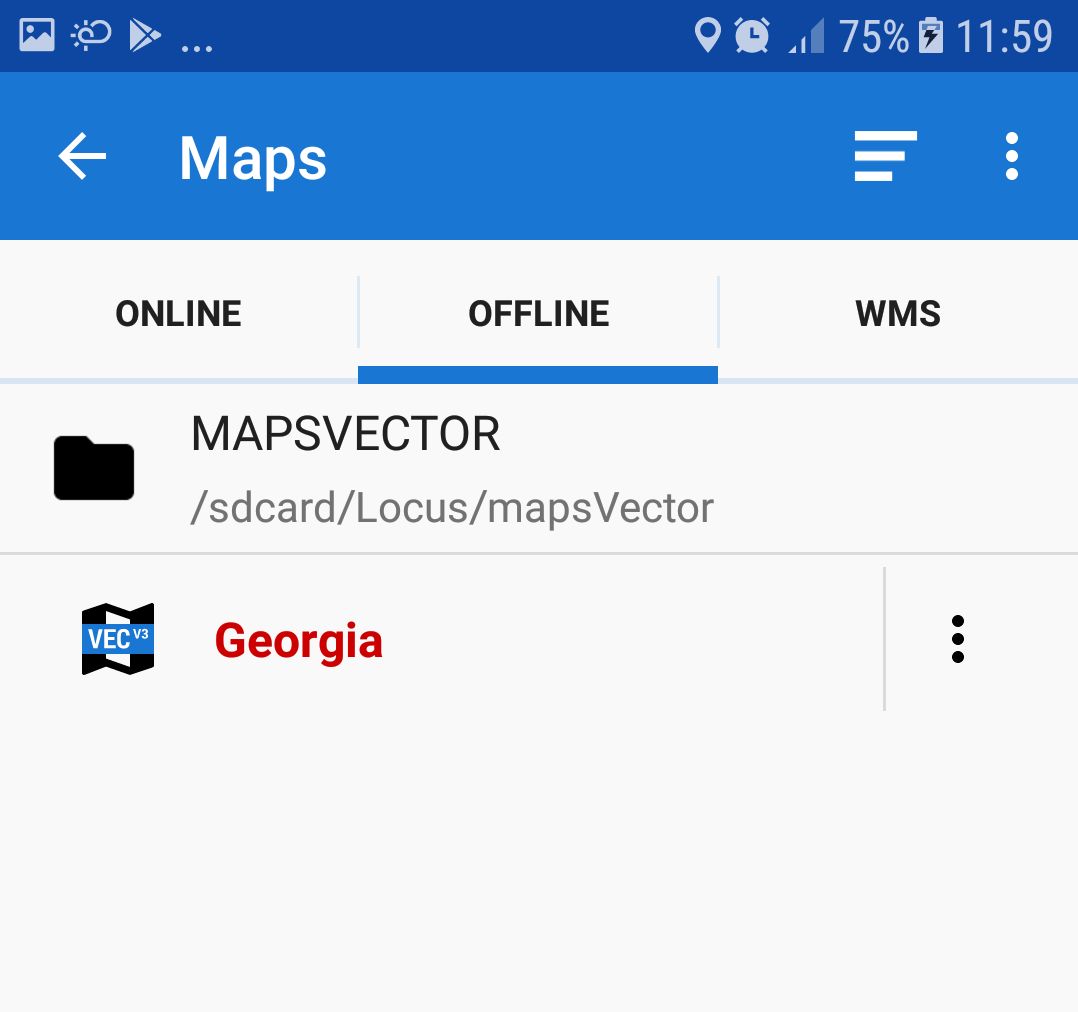
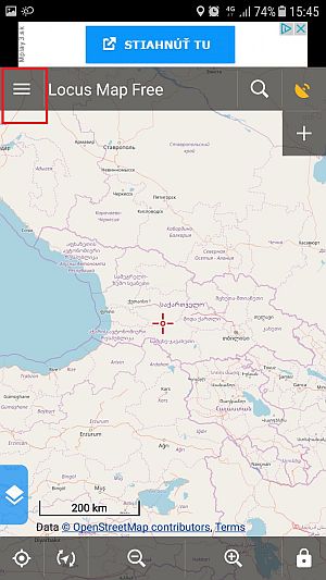
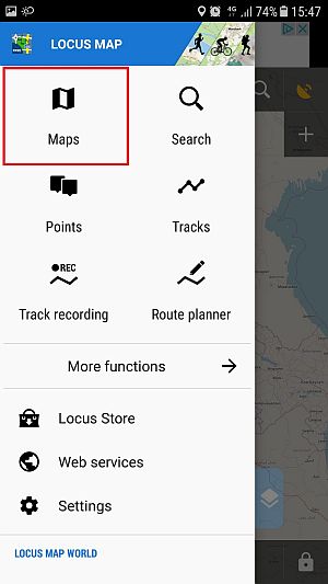
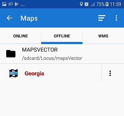
OK, the app is ready, now we need some maps. By two clicks, you can open the “Maps” menu. Here, you can see three options - online maps, offline maps, and WMS.
WMS (web map service) is basically another layer with additional information (weather forecast, protected areas, house numbers) which enhances your basic map. I don´t use it at all.
Online maps contain a wide assortment of maps to choose from, but they cover mostly Europe. Also, you need a mobile data coverage to be able to use them. Some of those maps can be cached but since none of them is particularly useful for Georgia, let´s not bother with them and move to Offline maps, where lies the true strength of Locus maps.
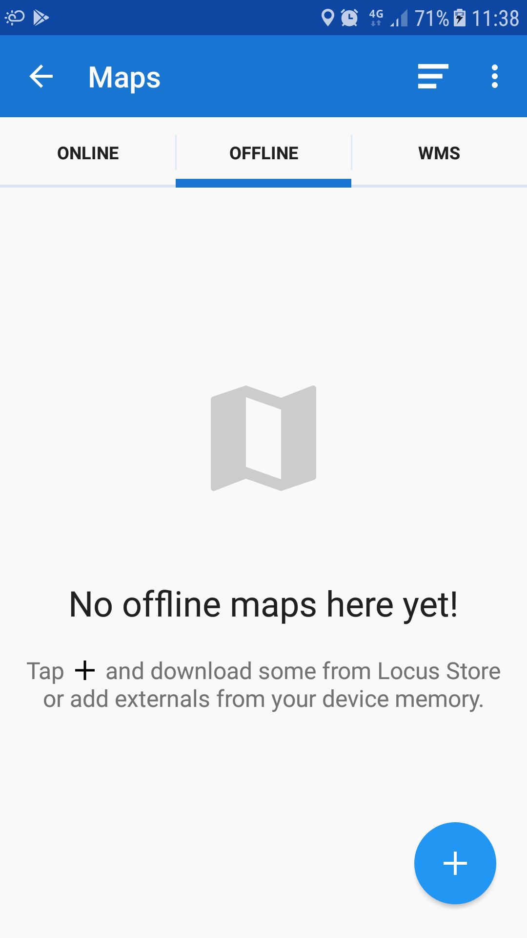
Offline map is the map which you completely download to your phone. Each phone has its own GPS chip which works even without mobile coverage, so combined with an offline map, you have all info necessary to hike.
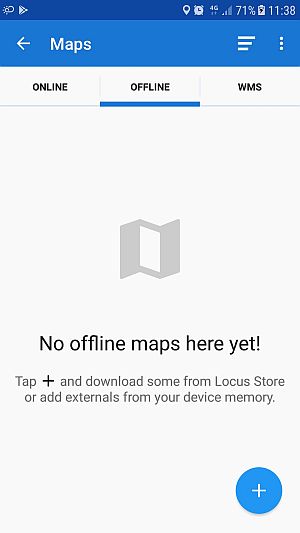
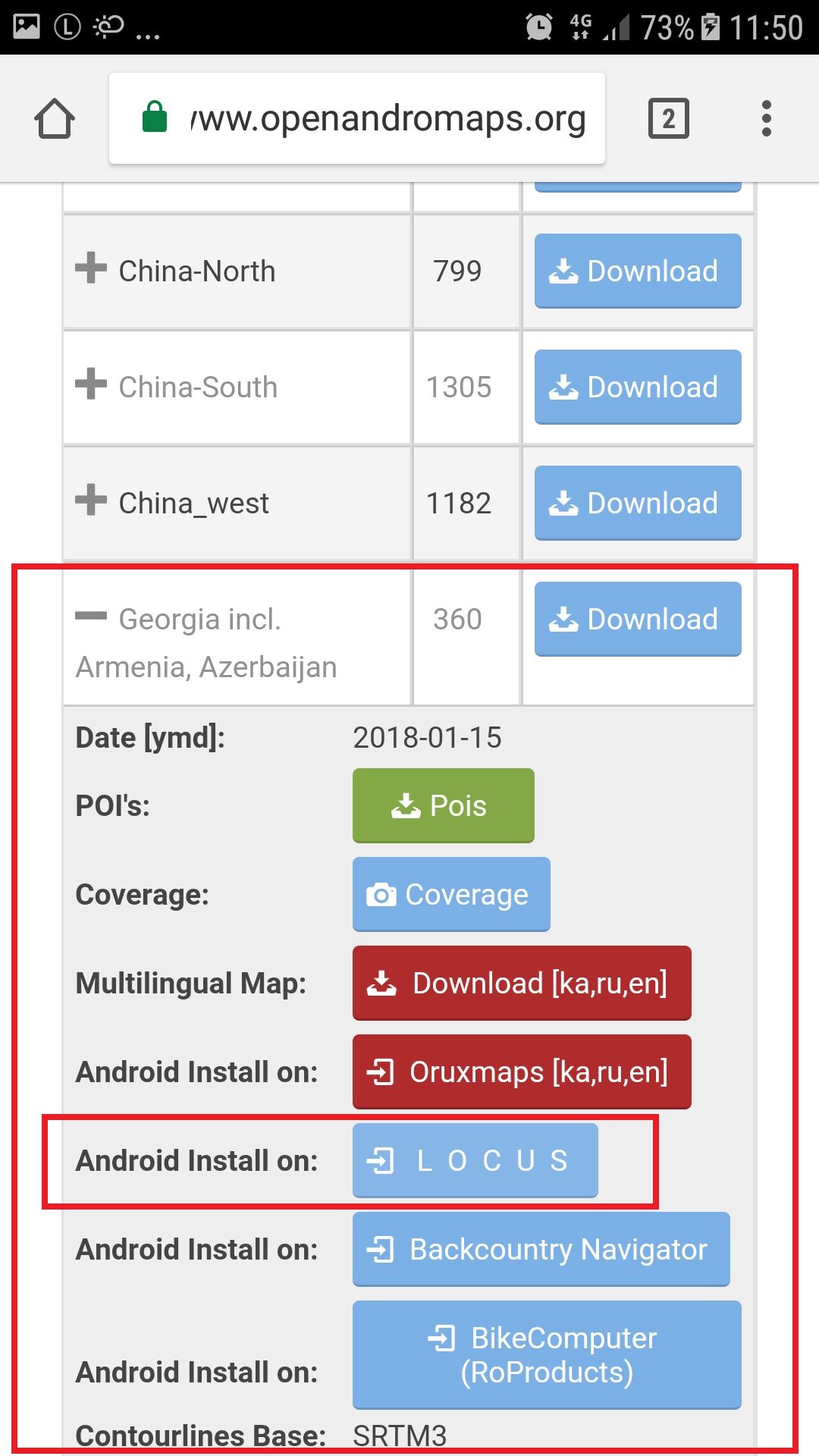
Where to find offline maps? Personally, I use maps from https://www.openandromaps.org/en/downloads/asia-middle-east. The easiest way to install them is to open the link above from your smartphone, expand the "Georgia incl. Armenia, Azerbaijan" by clicking on the icon and select Android Install on Locus option. This opens Locus maps and starts the installation - you can check its progress by clicking on the icon in the upper left corner. Once the installation is finished, you can open the "Offline maps" section and select Georgia from the list. Of course, you can use this process also to download the map of any region of the world.
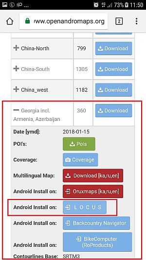
The process above has one disadvantage - you need to download 460 MB of data which may turn costly with some mobile phone tariffs. To avoid it, you can download the map file to your computer - to do it, do not expand the Georgia section via icon on the OpenAndroMaps page and only click the Download button. Then extract the zipped Georgia.map file you downloaded into Locus/mapsVector folder on your smartphone. If you restart the Locus app, the map will be detected automatically and will appear in the list of External maps.
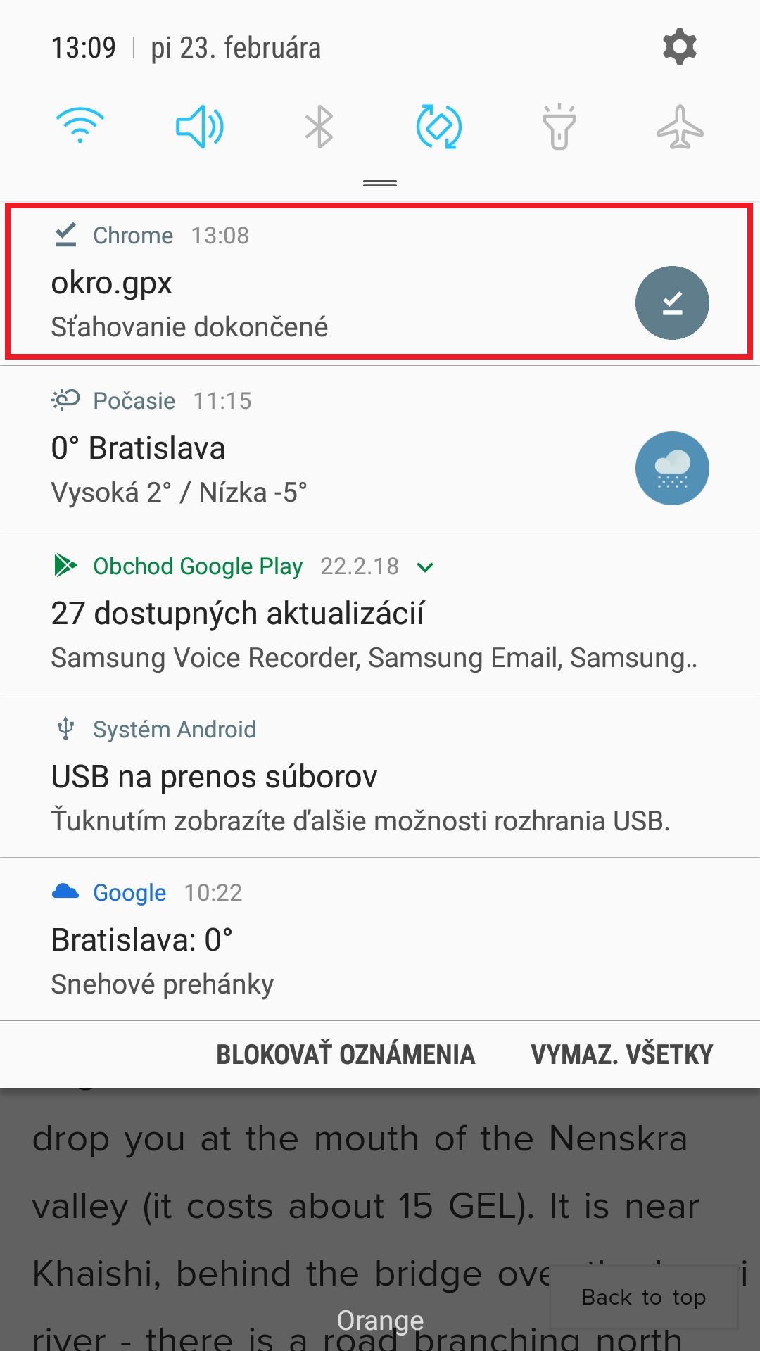
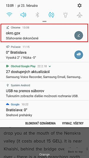
To import tracks, first download them - the easiest approach is to open my web from your phone and download the tracks directly (Locus supports both GPX and KML formats). Then unroll the upper notification menu of your phone which informs you about the downloaded file and click on it. This launches Import feature of Locus maps, so you just click Import button, the track is added to your catalog and displayed on the map.
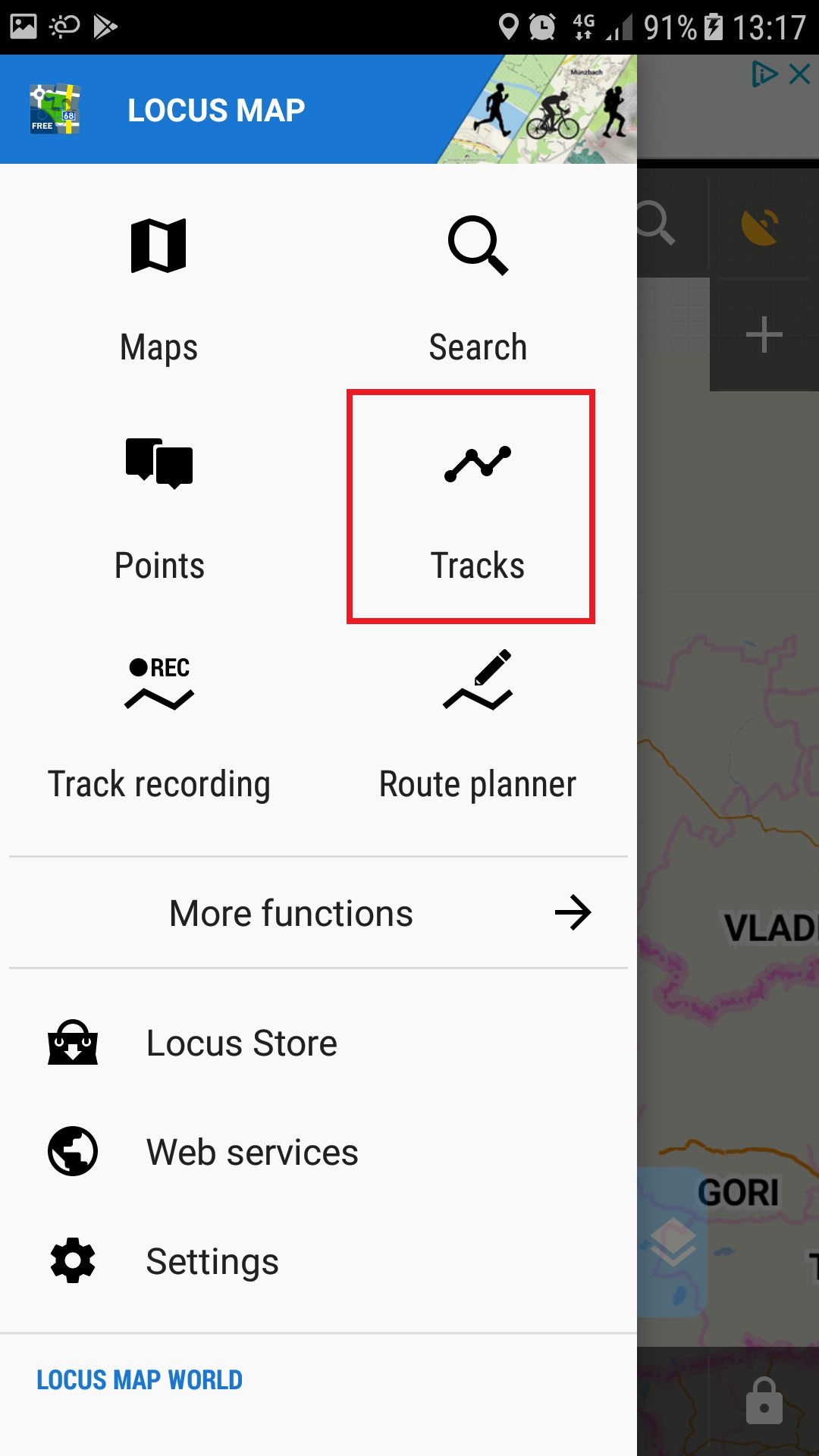
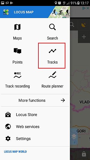
If you prefer more systematic approach, download all files to your computer and then copy them to the new folder in your Locus directory on your phone. Then, open the Tracks menu, press icon and use the Import feature to add the tracks one by one.
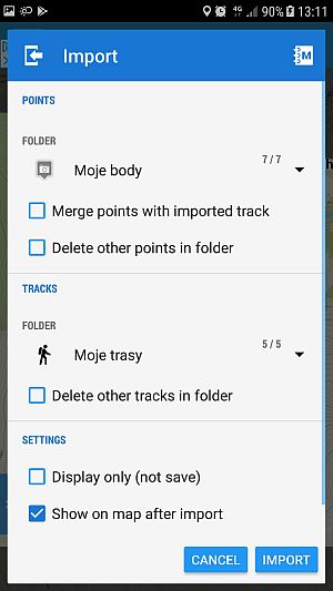
Once the trails are imported, you can browse through them, modify them or hide/unhide them using the "eye" icon. But I will not get into details here - my ambition is to write a simple how-to guide my granma would understand, not a complete user manual. If you want to familiarize with Locus maps more, here is the link to their complete user guide where you will find much more information.
Still, I hope that even this simple guide will help some of you. And if there is something unclear, please let me know :)