Little-known panoramic route connecting Tusheti highlands with Kakheti.
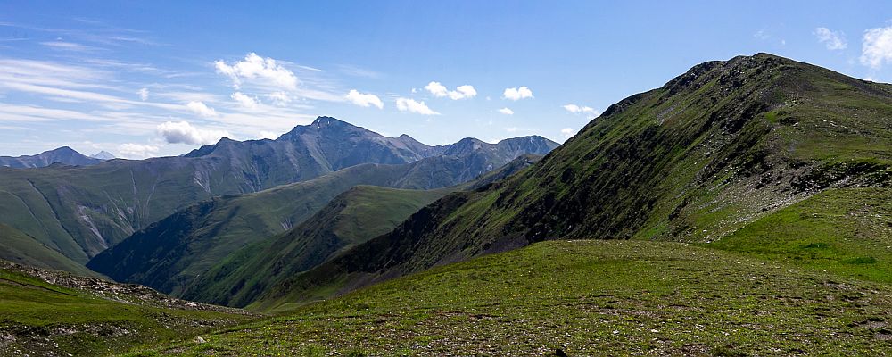
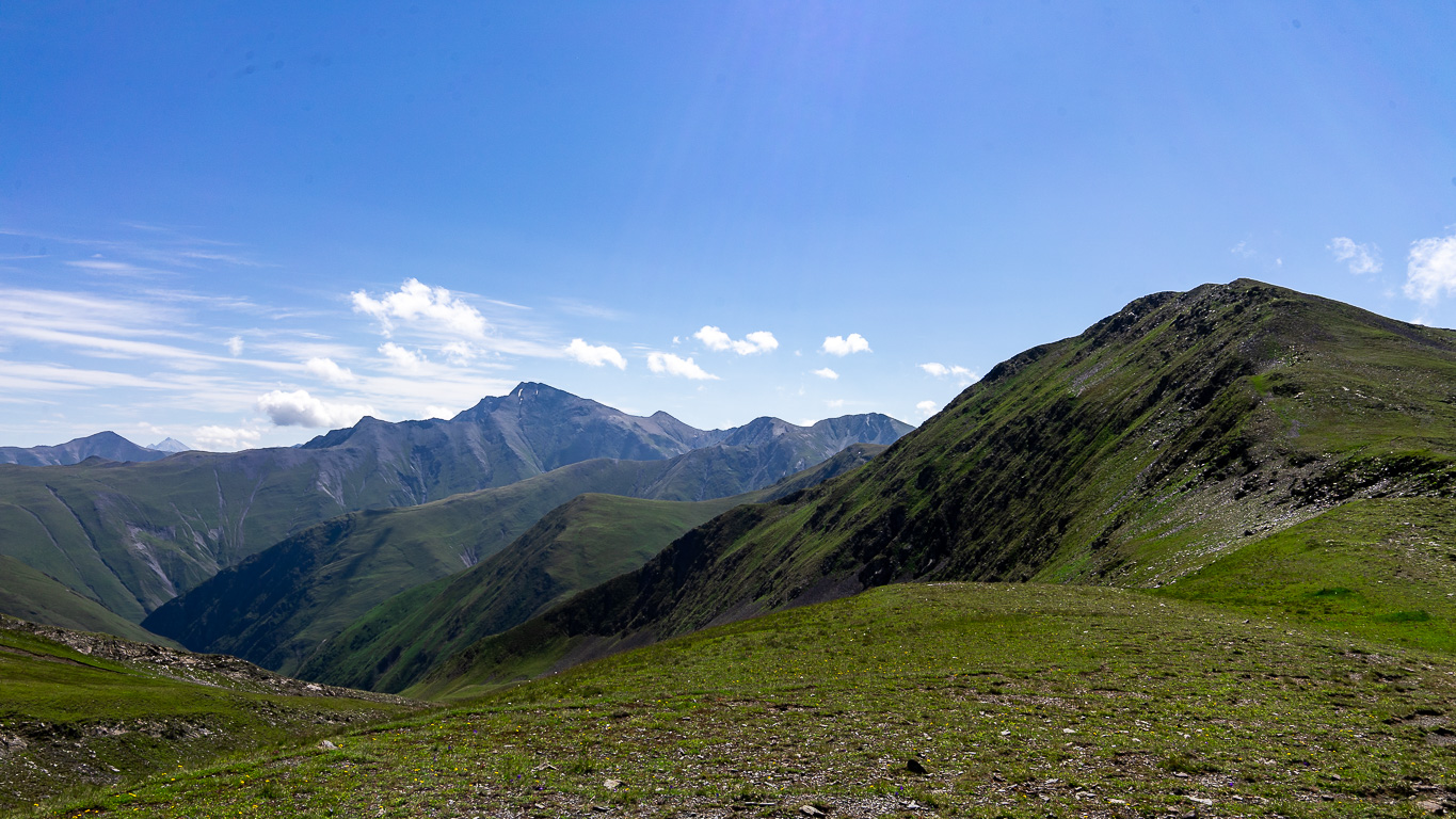
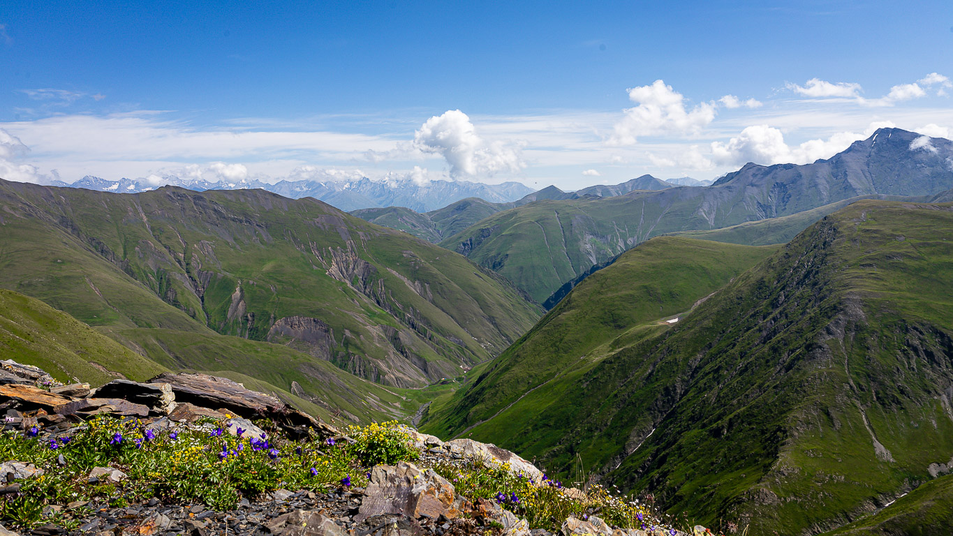
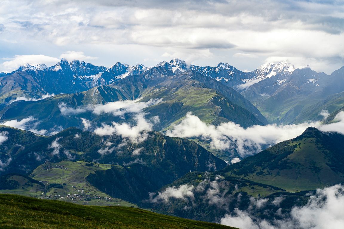
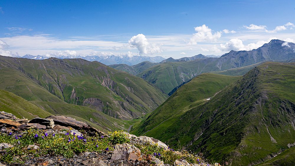
When thinking about gettings from Kakheti to Tusheti (or vice versa), most people just use a car. Apart from a few shepherds, very few people know that there exists longer, more demanding and infinitely more interesting route through the mountains. It passes along some of the most panoramic ridges in the region. In good weather, you will be rewarded with great views of Tusheti, Dagestan, and Chechnya in the distance. Large parts of the route follow a ridgeline above 3000m, so be prepared for sudden bad weather, even in summer. It is unlikely you will encounter anybody else along the ridge, although there are a few shepherd’s huts nearer Artana.
The route is almost 70km long and includes several long climbs and descents. Four days should be enough for a fit hiker and good conditions, but allow an extra day in case of bad weather as thunderstorms are common high on the ridge.
The trail is generally easy to follow and not overgrown. Some of the route has no clear path, so good navigation skills are necessary. Still, the difficulty is fully deserved - this is a long, remote trek with limited escape routes once you cross the main ridge.
Since not whole trail is recorded (see below) and info comes from limited amount of sources, I will mark is as Very Hard and hope that only skilled and determined trekkers will attempt it. Once I get more feedback, might put it down to Hard.
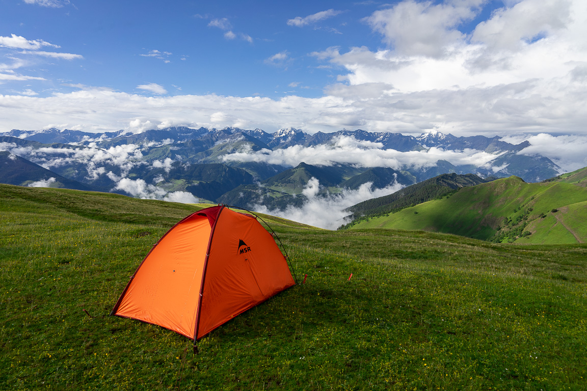
No places to sleep inside or restock along the route - you will need to carry all supplies and bring a tent.
Both directions work well. From the Tusheti side, this trail is an ideal extension of Shatili to Omalo. From Kakheti, the trail begins with a steep climb but provides a very panoramic way into Tusheti - and in my opinion, this experience makes the region even more special. But, of course, trekking in this direction is even harder due to the altitude difference.
Some sections of the attached GPS log were drawn, not recorded. The trail is easy to follow most of the time since it follows either shepherd trails or the top of the ridge (apart from one place when one has to bypass two rocky spires), but somewhere, trail finding might be harder, notably on the section between Eshmakisghele and Natsidrskhevi creeks on day 4. So, pls, be aware of where you need to get, pay attention to your surroundings, and follow an existing trail where it exists rather than following your GPS device blindly.
I tend to publish routes only with recorded trails, but decided to make an exception cos it would be a huge pity to ditch such a special trail just because of a few missing pieces of the puzzle. But if you even finish this trek and record it, please let me know so I can improve the log. Thank you.
By jeep:
There is no public transport to Tusheti. To get to Omalo, you will need to hire a driver with 4WD. If you are traveling from Tbilisi, you will first need to get to Kvemo Alvani village - this can be done by marshrutka or a taxi.
The marshrutka departs from Ortachala bus station in Tbilisi at 9.am and arrives at Alvani two hours later (price 20 GEL). Drivers are used to tourists and often arrange them further transport to Tusheti. Just confirm with the driver that he is going all the way to Alvani, they sometimes try to drop passengers in Telavi in order to make them hire another taxi to Alvani. Or they simply want to hook you up with the jeep driver from Telavi but that is OK if the price is right.
If you want to take a taxi from Tbilisi to Alvani instead of a bus, the price can be anywhere 100 and 150 GEL (it grows with your distance from the Ortachala station :))
In Kvemo Alvani, the bus or taxi will drop you at the main (and the only) junction. This is the place from which depart jeeps to Tusheti so if you get here before noon, you should be easily able to hire a driver.
The ride to Omalo takes about 4-5 hours and costs about 100 GEL per passenger (or about 350-400 GEL for the whole jeep). BBC once placed it among the "10 Most Dangerous Roads in the World", but with a good driver, it definitely doesn´t feel like that. In navigates pretty steep mountainside but the road is usually wide enough and unless you are passing another car and need to navigate to the very edge of the road, there is no reason to feel nervous. Still, the accidents happen here and the road claims a few lives every year. Therefore, even if you have your own car, for this stretch of the road, it may be better to use the service of the local driver.
By hitchhiking:
Hitchhiking can be "hit or miss" since jeeps traveling to Omalo are usually booked by tourists and full. And even when they are not, tourists might be reluctant to pick someone who just walked a few hundred meters beyond the departure point and raised a thumb (especially if he is dressed up in Arc´teryx gear like a couple of "travel hackers" we saw there the last time :)). Professional drivers will rarely pick you up for free. Therefore, your best bet will be locals heading to Omalo for a visit - but it may take a while until some show up.
Another option is the Kamaz truck which brings supplies from the lowlands to Omalo. These drivers usually pick up passengers for a symbolic price but the truck has no fixed schedule. It departs like each other day in the morning, so it can´t be relied upon.
The easiest way to leave Artana is to catch a marshrutka or hitchhike to Telavi. From Telavi, there are numerous marshrutkas to Tbilisi daily. Alternatively, you can continue hiking eastwards towards Lagodekhi.
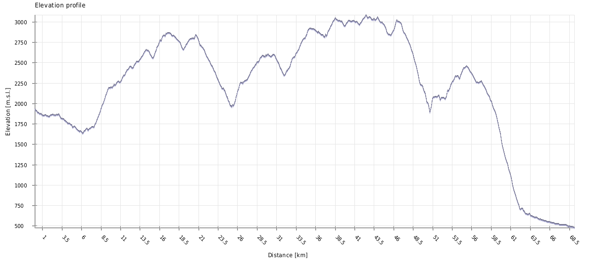
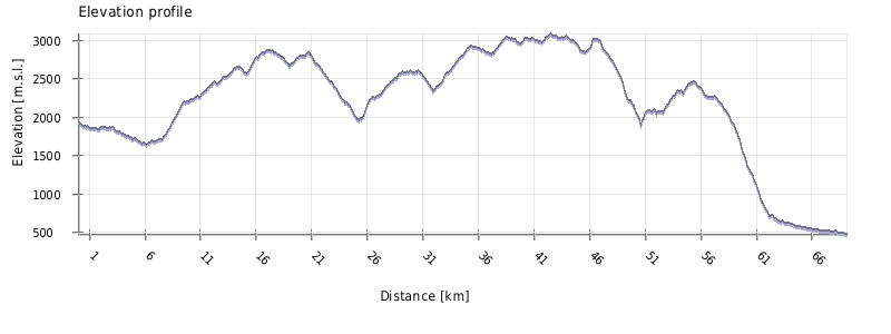
| Distance | 69 km |
| Trail type: | AB trip |
| Max. elevation: | 3085m |
| Min. elevation: | 478m |
| Total climb: | 5018m |
| Total descent: | 6487m |
Trek starts in Lower Omalo. Follow the car road in the southern direction for a few kilometers while it descends to the Alazani river. Finally, you will come to the bridge. Cross the river and turn left, in the direction of Kumelaurta village.
Follow a dirt road - after a while, it takes almost 180° turn and a meadow appears to the left. Leave the road, turn left, and hike up, towards the forest. There is no path on the pasture, but it starts once you reach the trees.
Then comes the most difficult path of the hike - climbing onto the ridge. Valleys of Tusheti are often steepest at the bottom and this one is no exception. On a short section, you need to overcome quite a big elevation, about 400 meters. You are climbing in a nice pine forest with very limited views.
Everything gets much easier once you make it to the top. Follow now almost flat trail and soon you will come to a shepherd's hut. From here, continue to the south. The trail is now slowly rising through a forest, interrupted by a series of beautiful meadows. You also have a great view of the surrounding mountains.
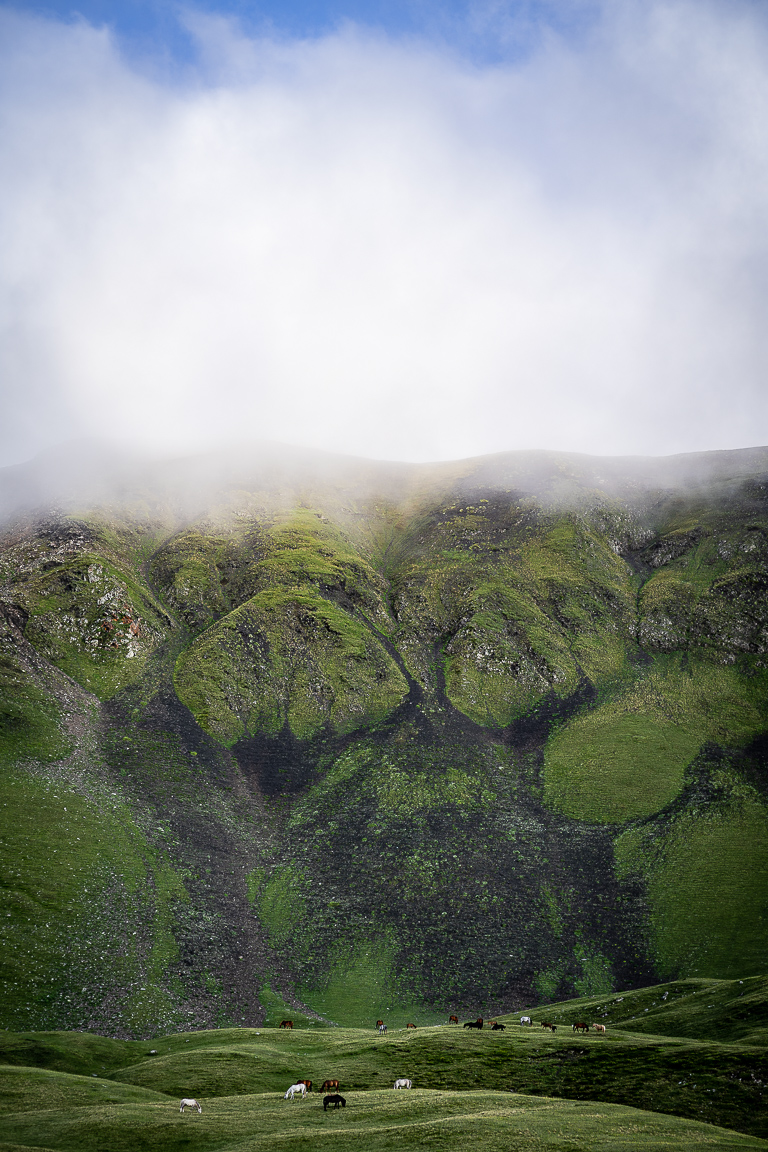
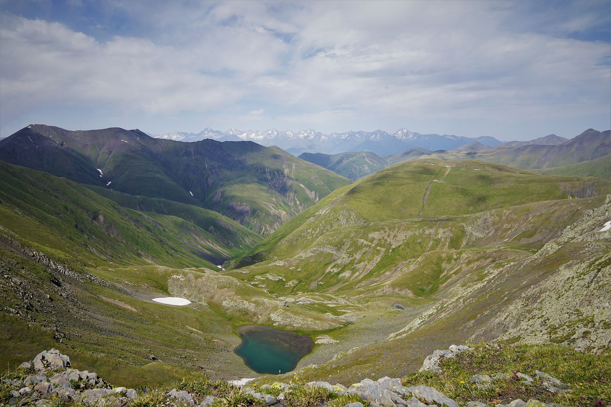
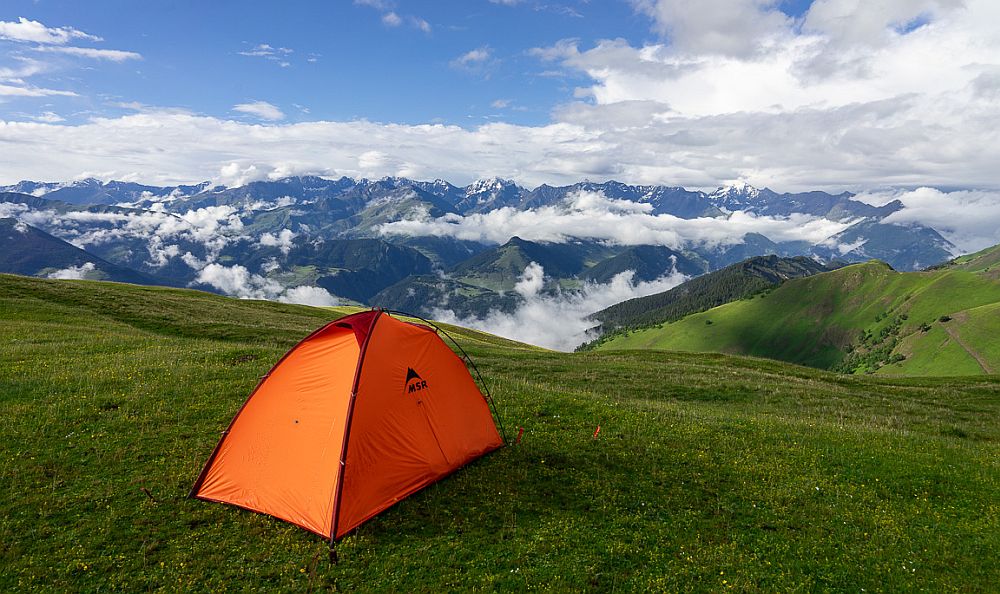
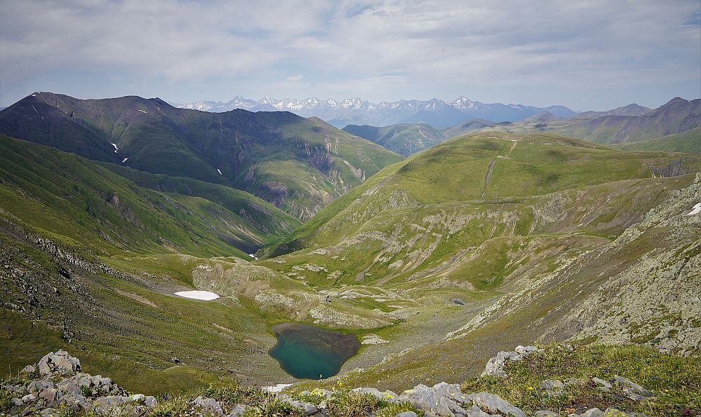
When you finally leave trees behind, the ridge ahead starts rising too steeply and you have to pick a side. Turn left and enter fields of rhododendrons (there is also an info panel, visible from a great distance). The trail passes these fields and is very easy to follow. Finally, you will cross a small stream, walk a bit uphill, and voila - the lake is right ahead of you! Streams around it provide water and there are also several flat, grassy spots suitable for camping.
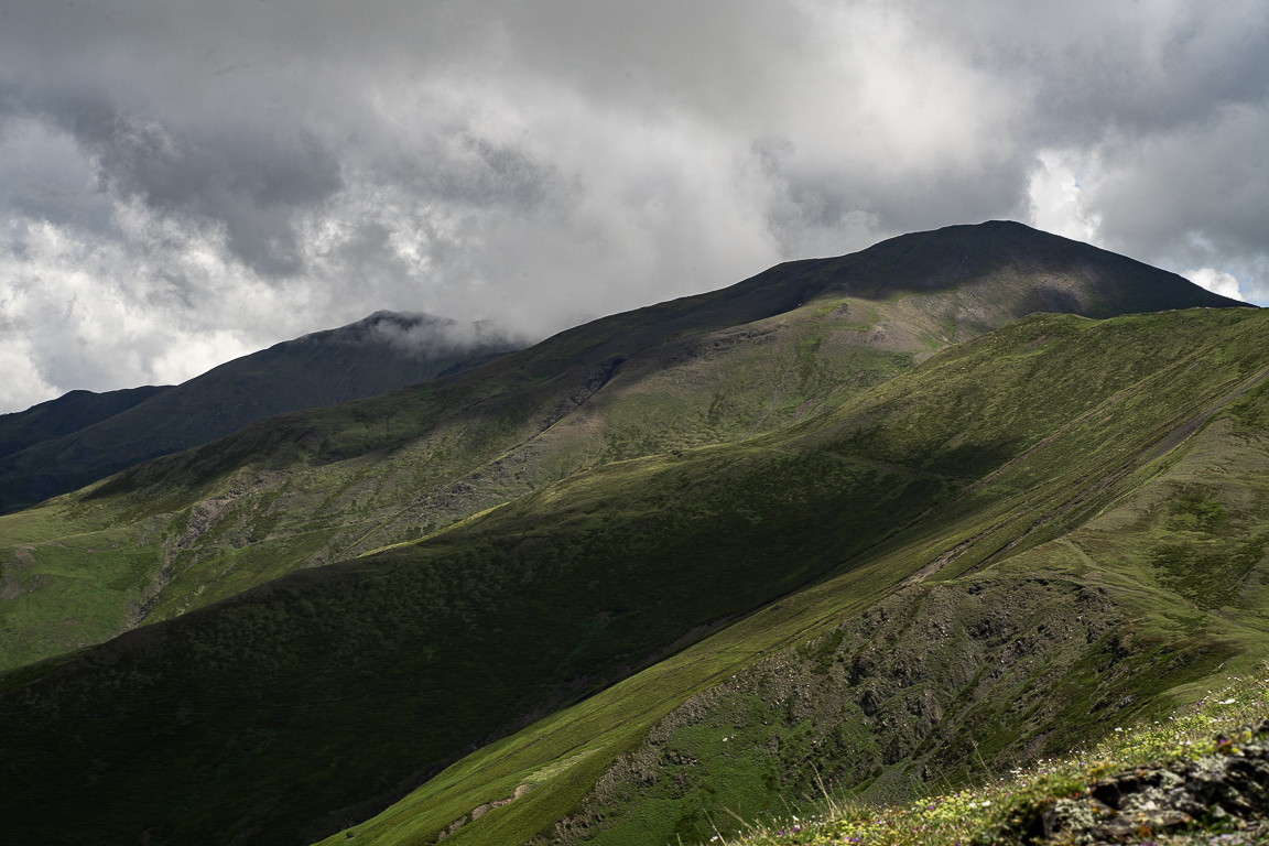
From the lake head back along the trail towards Omalo. After about 700 meters, just as the ridge to your left recedes, you will reach a small intersection - turn up and left (thus leaving the classic Oreti route). Follow the shepherd’s path as it curves right beneath the line of the ridge above. Continue along this line for a few kilometers before climbing to the ridgeline. Follow it till you reach Mt. Sadzrokhe (2847m), the last prominent hill of this ridge - the trail traverses below it from the left side.
From here, you can go only down, to the Khiso Alazani river, but you can choose the route. The ridge to the west sharply drops towards the valley where runs the main road to Omalo. For this reason, we take the southern ridge - it drops straight to the confluence of Khiso Alazani and Tsokhvi river. Cross a little above, since it´s always easier to cross two smaller rivers than one larger one. On the other side, you will find an old shepherd trail that steeply climbs the hill in a series of switchbacks. Once you gain about 250 elevation meters, it turns right and starts traversing the hillside.
The trail then passes a series of forest belts and 15 minutes later emerges by a shepherd's hut. From here, it continues in the western direction, occasionally going up, but mostly staying on the contour line. You will pass traverse two smaller side ridges, then comes a slight descent to the valley of Chalabakhi river, just a few hundred meters from the main road. Cross the creek and continue up the valley - there may be a large amount of snow here even in summer as the sun does not reach this junction. Once you find some spot you like, break a camp.
Follow a vague shepherd's path besides the stream until the valley opens up with a wide pass ahead. Climb steeply towards the wooden post marking the pass. From the post, drop down a few meters to reach a shepherd's path. If coming from Artana, this path can be followed NW to reach the Abano pass and avoid the steep descent to the Chalabakhi valley. Follow the path to traverse the flank of the large peak to your left towards a side ridge you see to the south.
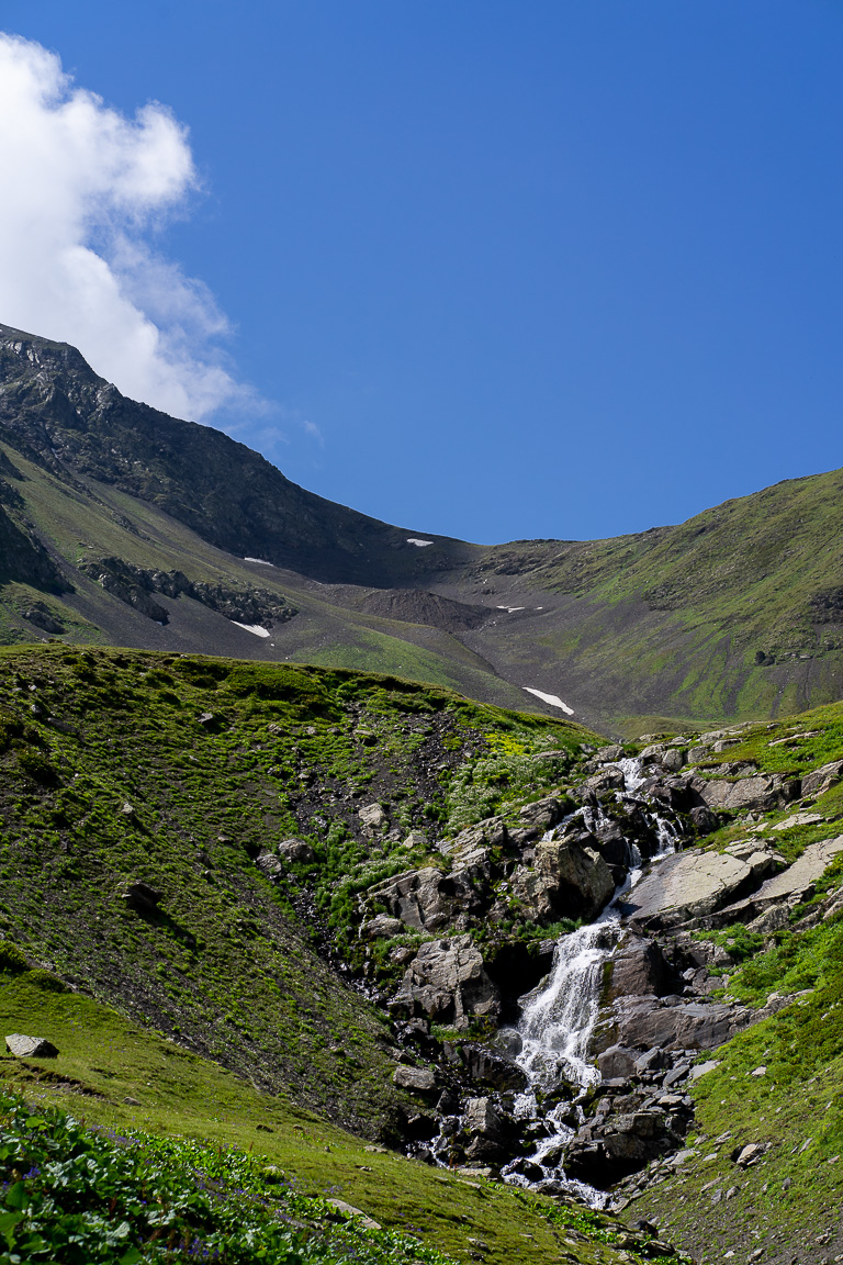
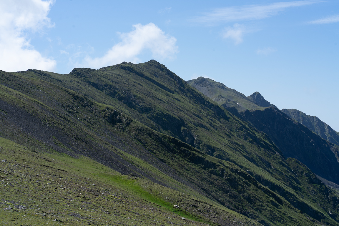
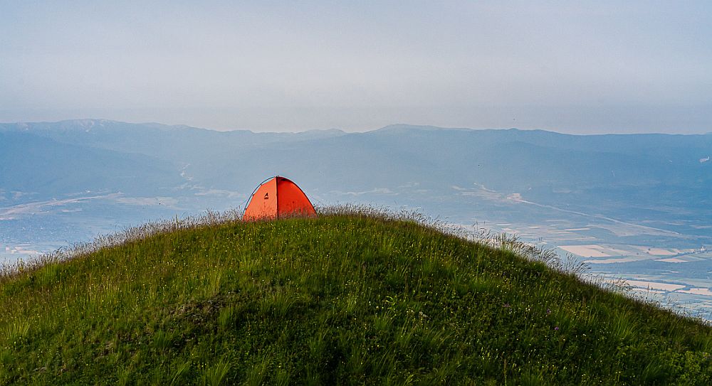
Little below the top of the ridge, you will see an old shepherd’s hut below. Pass above this, then turn east and climb along the flank of a second rocky peak towards a second pass to reconnect with the main Greater Caucasus ridge (altitude 3000m). There is another metal post at the pass. Once reaching this pass, the route follows the line of the ridge for around 10km. There are vague shepherd’s paths to follow and some flat areas for camping if bad weather comes in. Follow the ridge, dropping down to your right to avoid any rocky obstacles. Water is available along the ridge at the small lakes that are visible from the path (one such lake located north of Mt. Zetavi, which can be reached from the "flat campsite" waypoint - lets call it Zetavi lake).
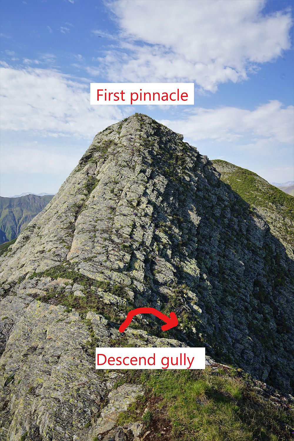
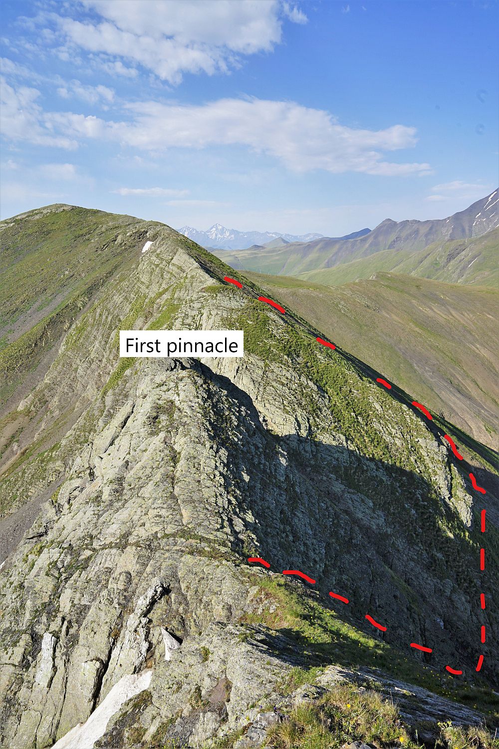
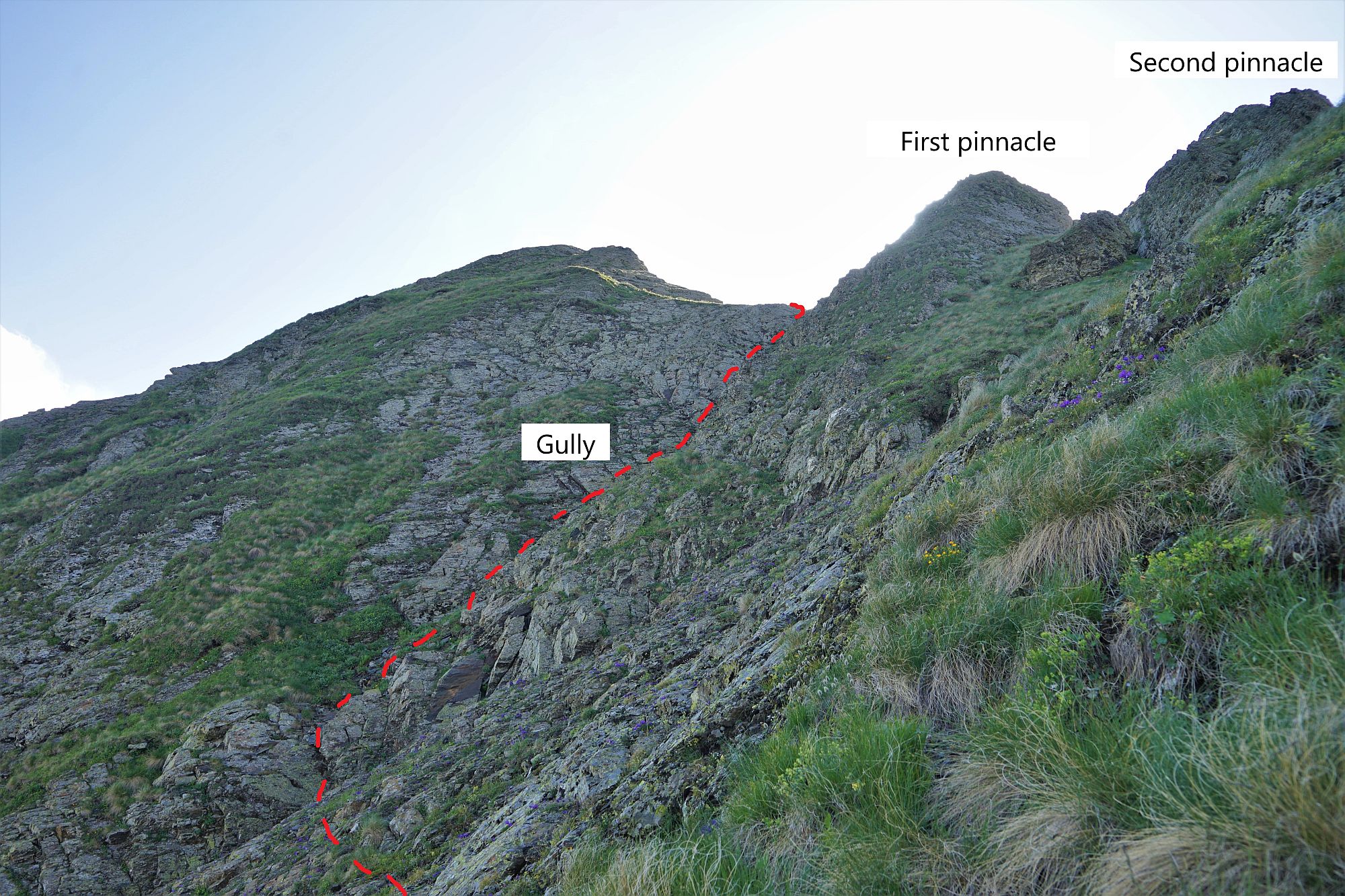
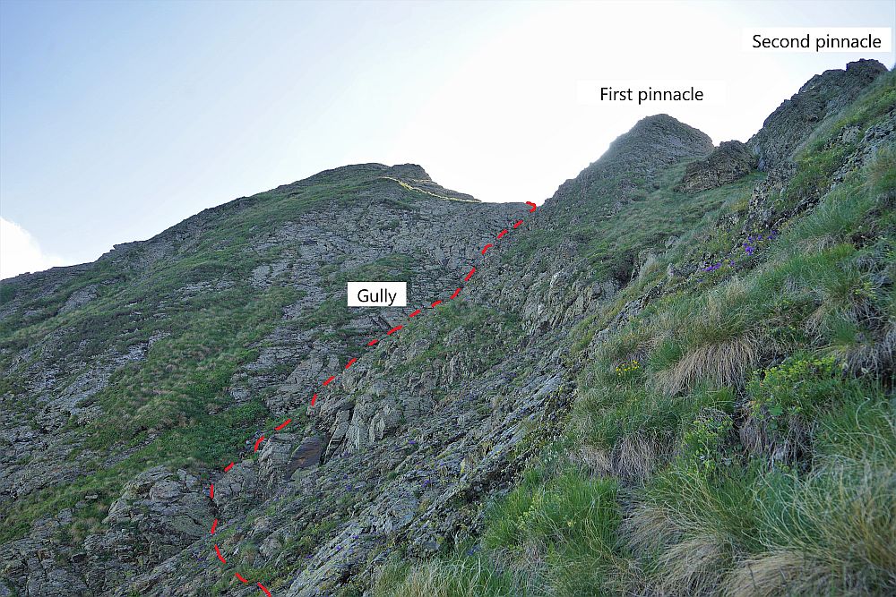
At Mt. Zetavi turn NE and follow the ridge, again dropping down to your right to avoid any obstacles. Avoid the steep north-facing side of the ridge. Some 1km behind Mt. Zetavi, the ridge is broken by several steep rocky spires. Descend a narrow gully to the right and traverse over steep grass, avoiding the three pinnacles before heading back up to rejoin the ridge (for better idea, see photos). Alternative, you can bypass this whole, quite rocky section of the ridge, it you descend to Zetavi lake before climbing Mt. Zetavi and then continue east to climb the main ridge again behind "Two rocky spires" waypoint.
Not far after this last obstacle, the ridge splits. The main branch continues in the northern direction, towards the Russian border. If the border regime ever gets eased it will be a great trek, but for now, we have to turn south, onto the Samamlisgori range.
Follow the top of the ridge, while rapidly losing altitude. On the right side, below, you will see a shepherd's hut which you may want to check. At the altitude of 2150m, when the trail approaches trees, it sharply turns left and drops another 200 elevation meters through the forest to the Eshmakisghele creek. There is a small wooden bridge. On the other side, climb steeply up to regain those 200 lost meters. Once you get out, you will see another hut nearby. The area is suitable for a camp, provided you got water down at the creek.
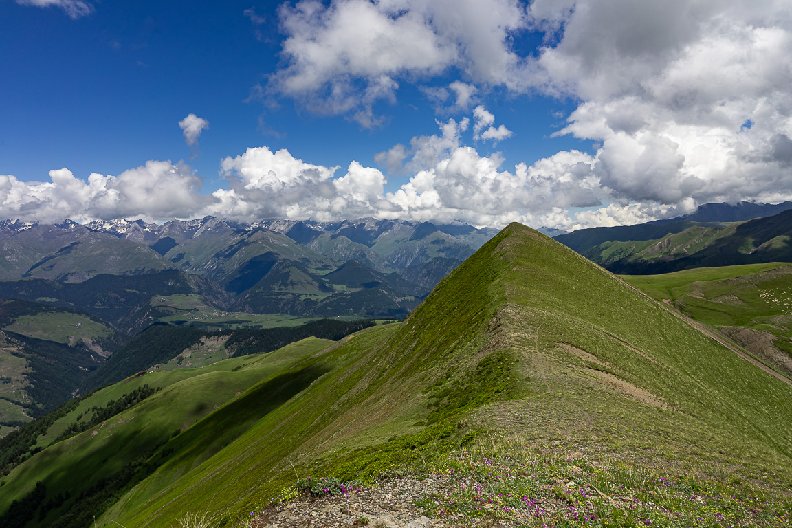
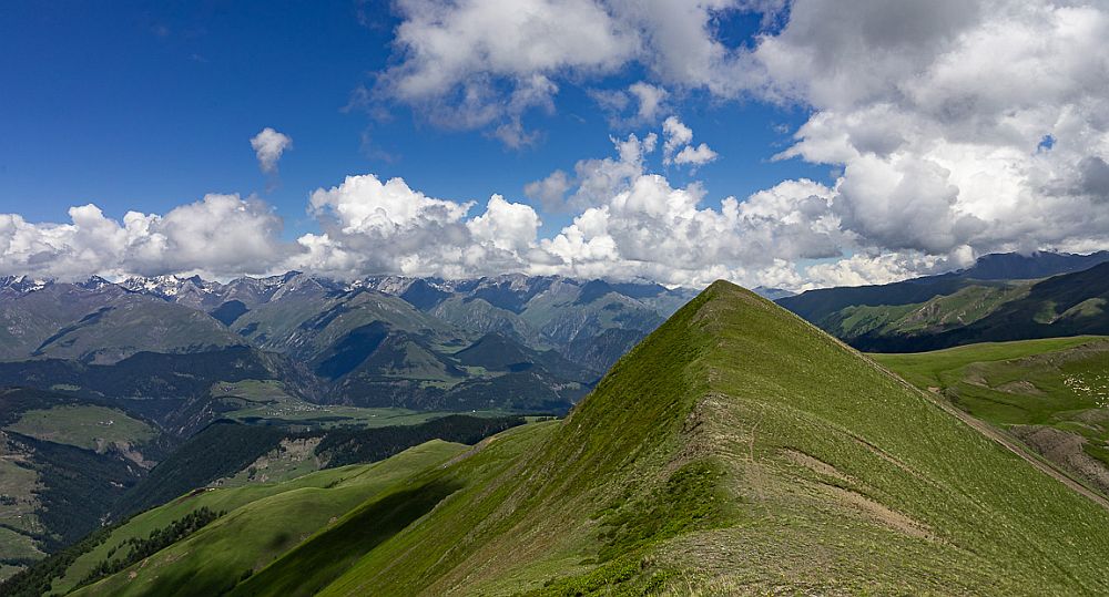
From the hut, the trail going up the valley, gradually getting close to the Natsidrskhevi river. Finally, cross the river and climb an opposing ridge - on the top, you will find several large stone cairns. Turns to the west - follow the ridge for around 6km on a clear path and enjoy the incredible panoramas until you reach Mt. Kokhta, the last prominent hill of the ridge. From here, it´s just one long descent - follow a clear shepherd's path through the woods with many switchbacks till you reach a confluence of Siphistskali and Okhotistskali creeks. Cross this stream then follow the path beside the river for about 1,5 hours until you reach the village of Artana - you will need to cross about five smaller subsidiaries along the route. If starting from Artana, ensure you fill up on water at the stream, as there is none available again until reaching the Natsidrskhevi river.
This trail was submitten by James Stearn, who in 2019 crossed Georgia west to east and plans to finish his Caucasus traverse once borders are reopened. Some photos from his trip can be found at his website. Thanks a lot!
Gps log for one section part of the trail was provided by James Dean.