Classic hike climbing from Shovi resort which provides nice views of Buba glacier.
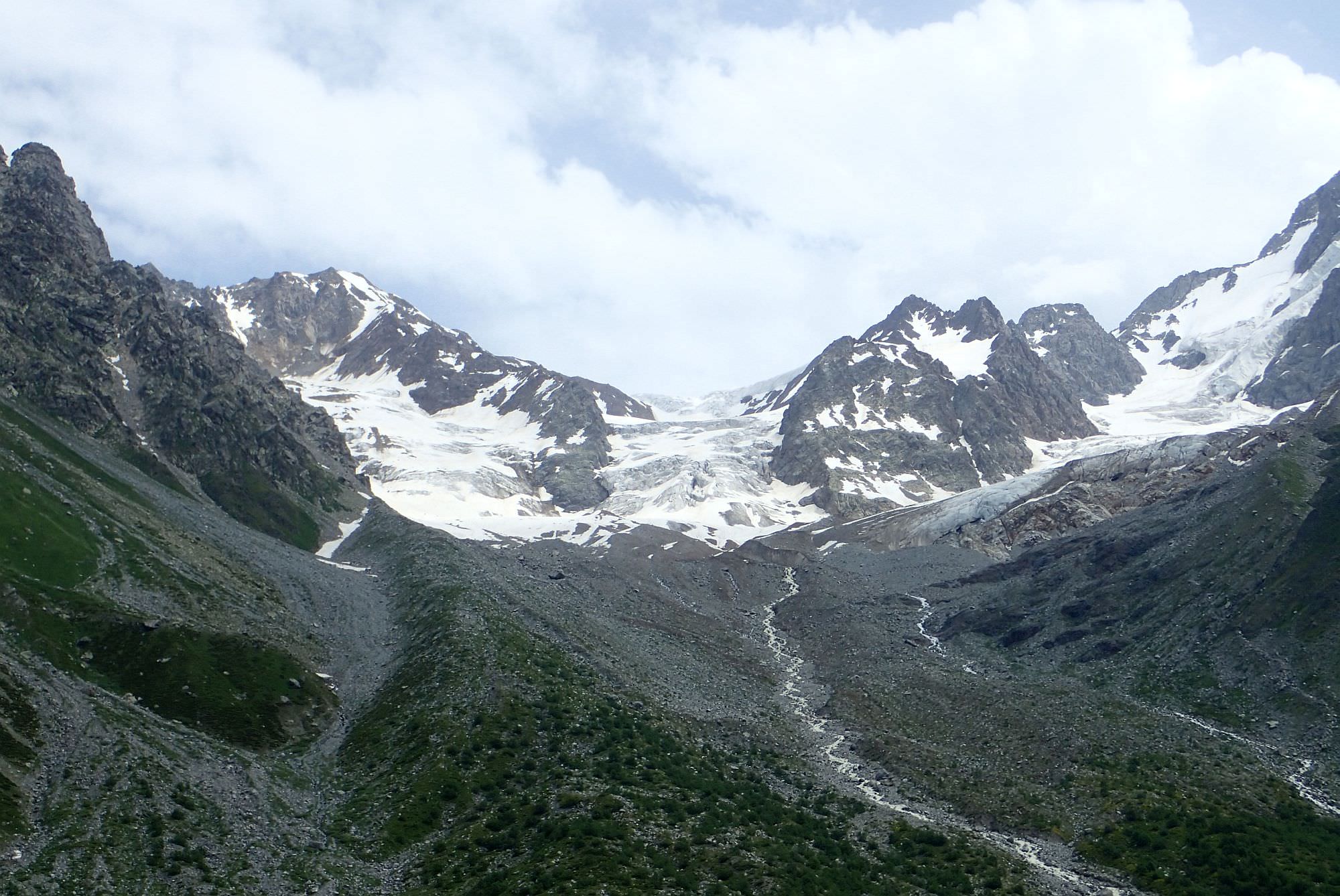
Classic hike climbing from Shovi resort onto the small ridge which provides nice views of Buba glacier. Actually, the actual glacier is a bit of a letdown since you are just kinda observing it from a distance, but the surrounding mountains are really impressive. Can be prolonged into 3-day trek which covers also Tbilisa glacier and the route to the Mamisoni pass.
2023 landslide: On 3th August of 2023, Shovi resort was hit by a massive landslide which caused considerable damage on human lives and property. Lower part of the trail was taken as well. Due to it, as well as continuing rescue and repair works, trail might be off-limits for the rest of year 2023.
Basically, it takes one whole day to hike to the glacier and back.
There is a considerable elevation difference but the path is well-trodden and any fit hiker should be easily able to hike to the glacier and back in a day.
How to get to Shovi by public transport? Honestly, I don´t have a clue. I asked several villagers about the public transport but their answers were so chaotic that I can´t use them here. If someone can shed light on this, pls contact me.
Still, to get to Shovi, you have to pass Oni which lies nearby and the situation is much clearer here. Daily minibus leaves Didube station in Tbilisi at 8 am. The ticket costs 20 GEL and the ride takes 6,5 hours - as usual, it's better to come at least 30 minutes earlier to have a guaranteed spot.
If you need to reach the city from Kutaisi, there are two buses a day leaving from the bus station by the chain bridge below Bagrati cathedral (not the Central bus station by the McDonalds). One departs at 9:00 (ride takes 5 hours as it follows the bad road through Rioni valley) and second, much faster departs at 2 pm (this one takes the direct road through Tkibuli). These buses sometimes continue further to Shovi - ask the driver.
Another option is to take marshrutka to Ambrolauri since the city is only some 20km from Oni - marshrutkas depart daily from the Central bus station at 10:00 and 14:00. However, both take the longer route through Rioni valley. From here, you can take a taxi, hitchhike or hope to catch some local bus.
Again, hard to tell. You will have to ask around, hitchhike or even pay a taxi back to Oni.
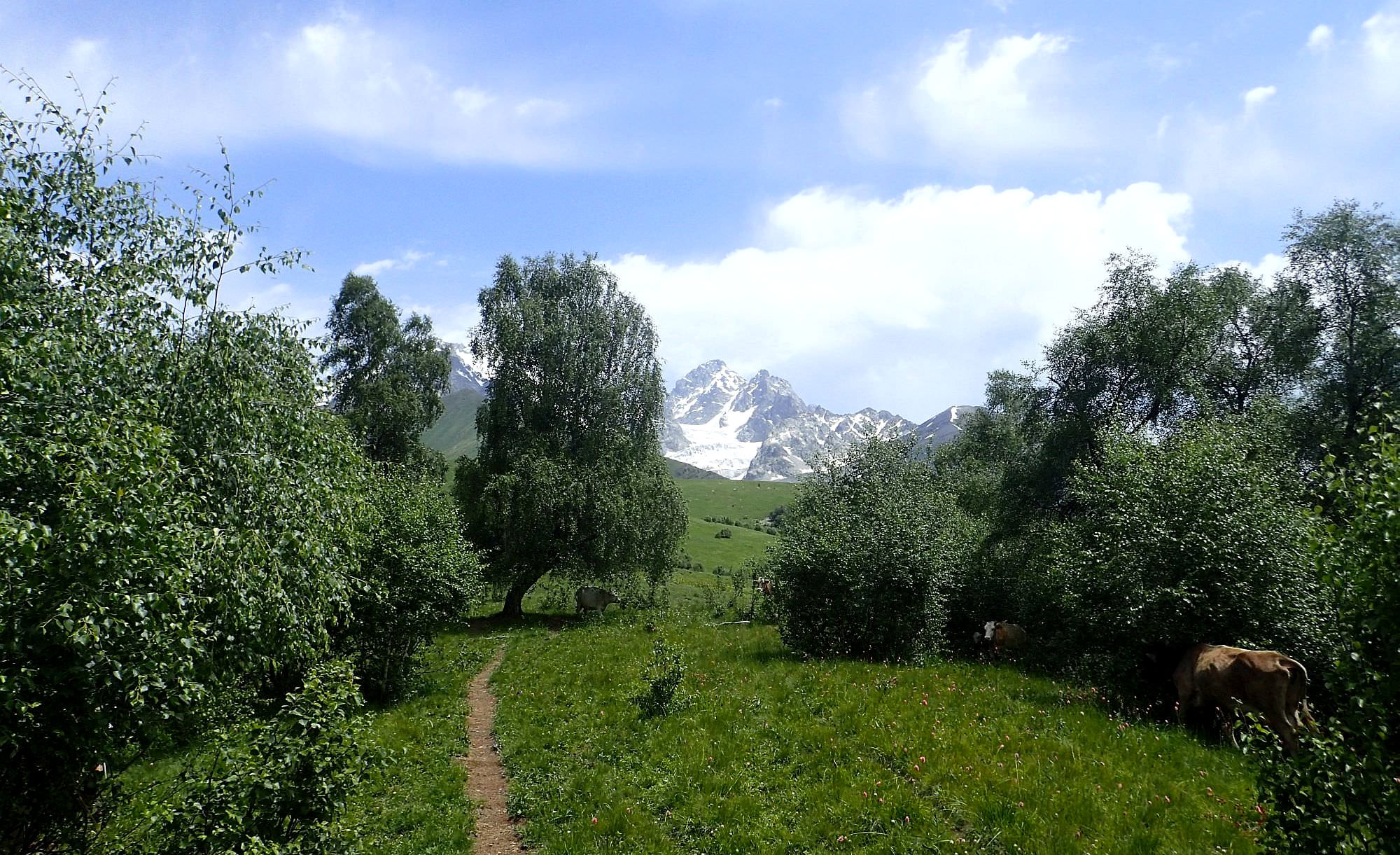
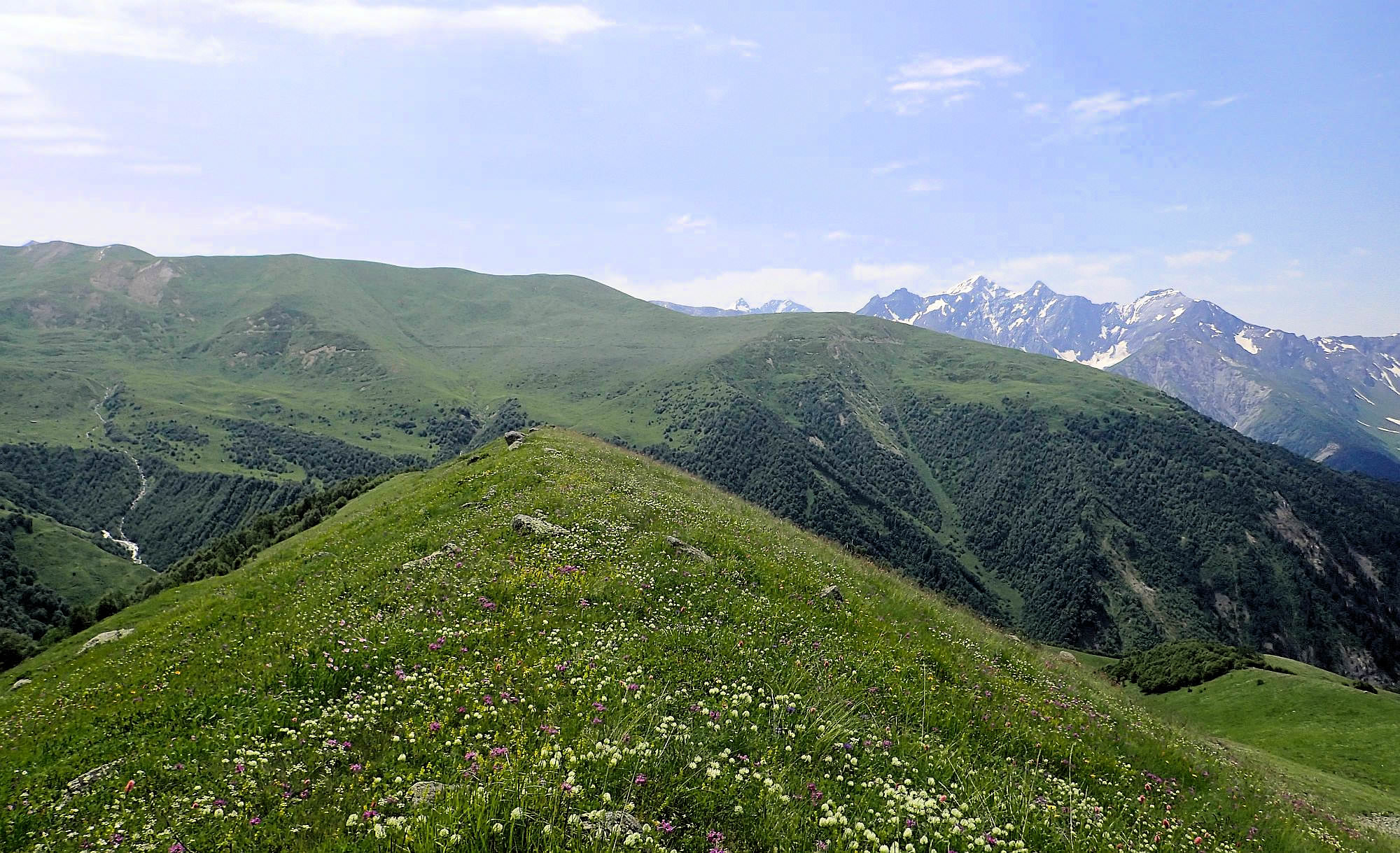
Once above the treeline, nice views open up in southern direction
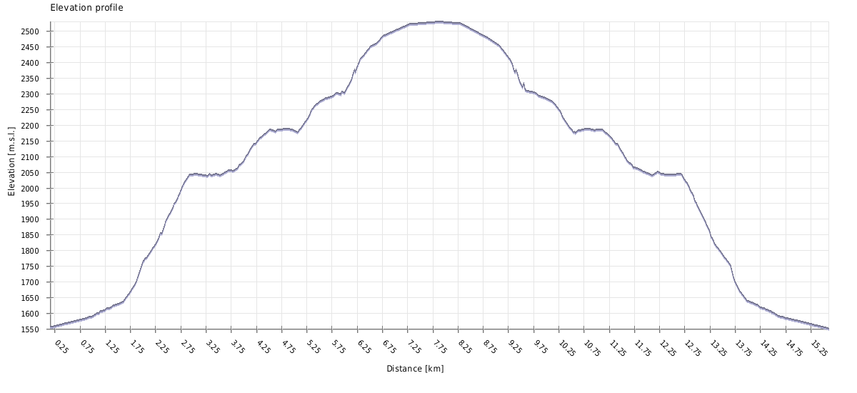
| Distance | 17,7 km |
| Trail type: | Roundtrip |
| Max. elevation: | 2534m |
| Min. elevation: | 1550m |
| Total climb: | 1095m |
| Total descent: | 1095m |
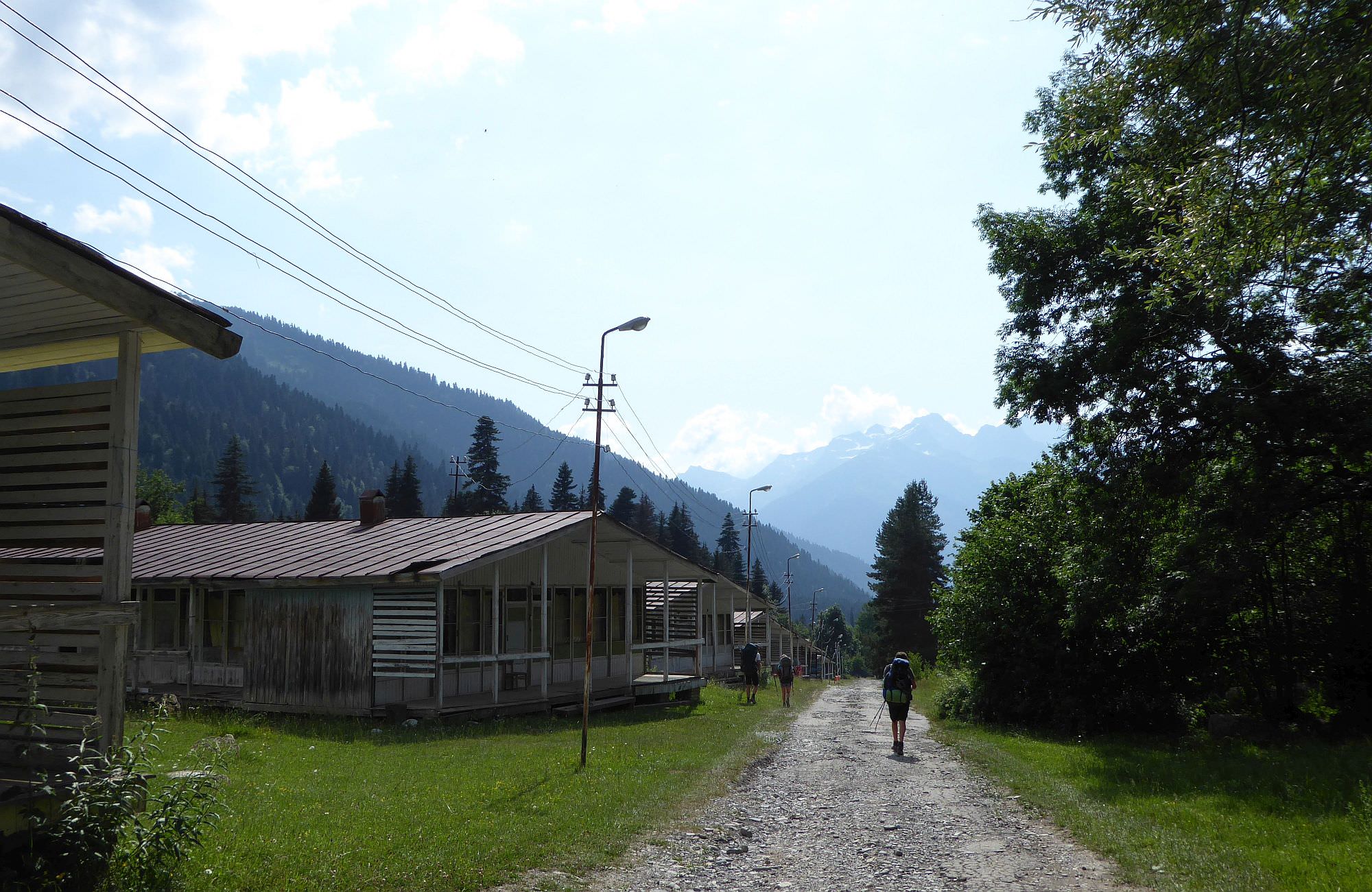
The trail starts at the entrance to the Shovi resort, by the large info panel. Walk across the resort, there will be numerous mostly abandoned chalets and one decent restaurant on your right side. After 1km, you will reach the ruined hotel and turn right in front of it. Here, you will find the first hiking pointer - the almost whole trail is marked by red markings.
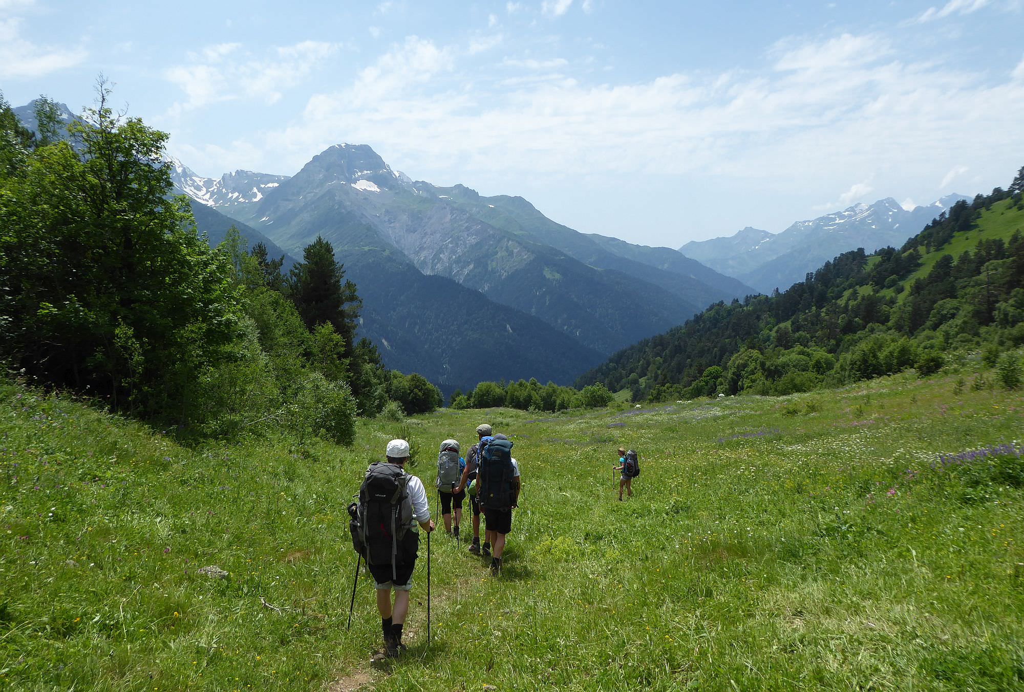
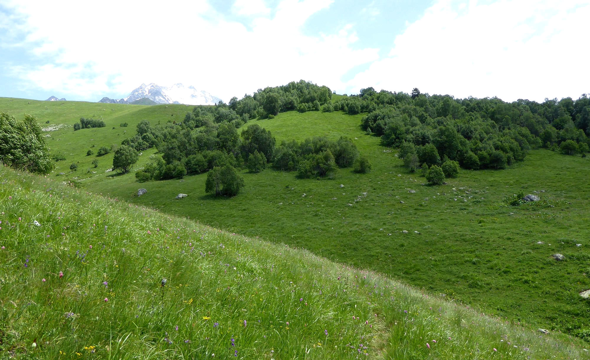
After a while, you will reach a nameless tributary of Bubastskali river and the previously wide road turns into a footpath. The next section is the most difficult part - a pretty steep climb through the spruce forest (spruces are later replaced by maples and beeches). Eventually, you will leave the forest and follow a small trail through completely overgrown alpine meadows.
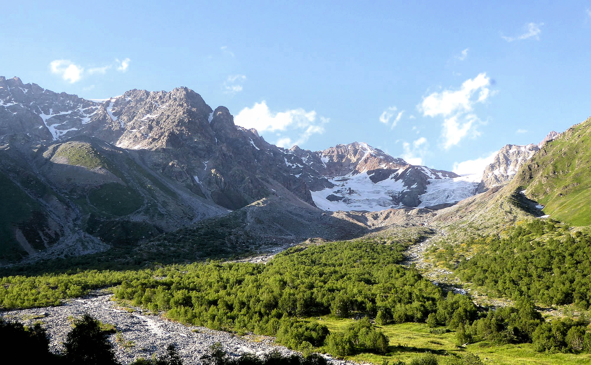
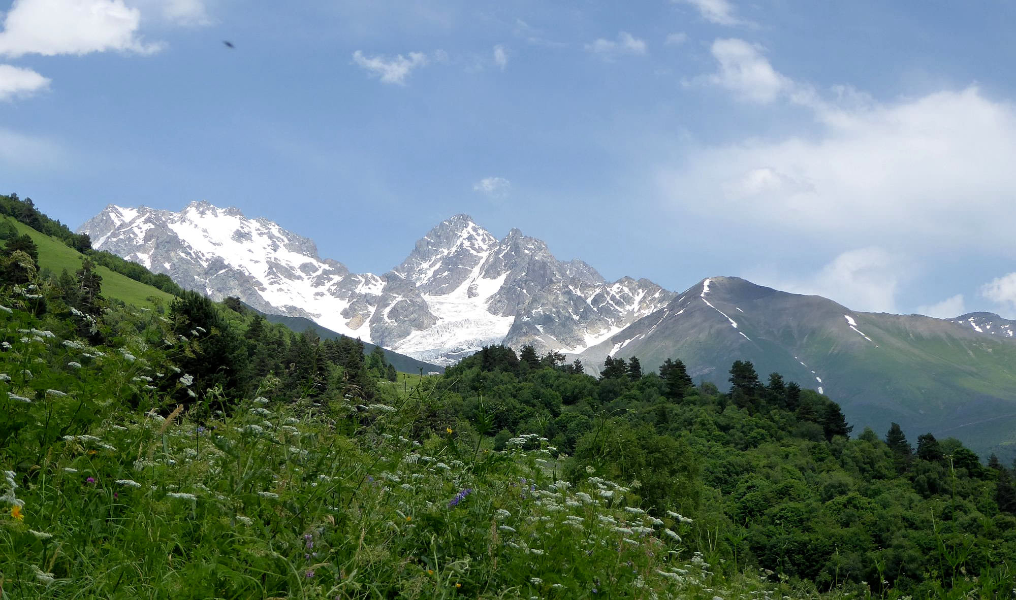
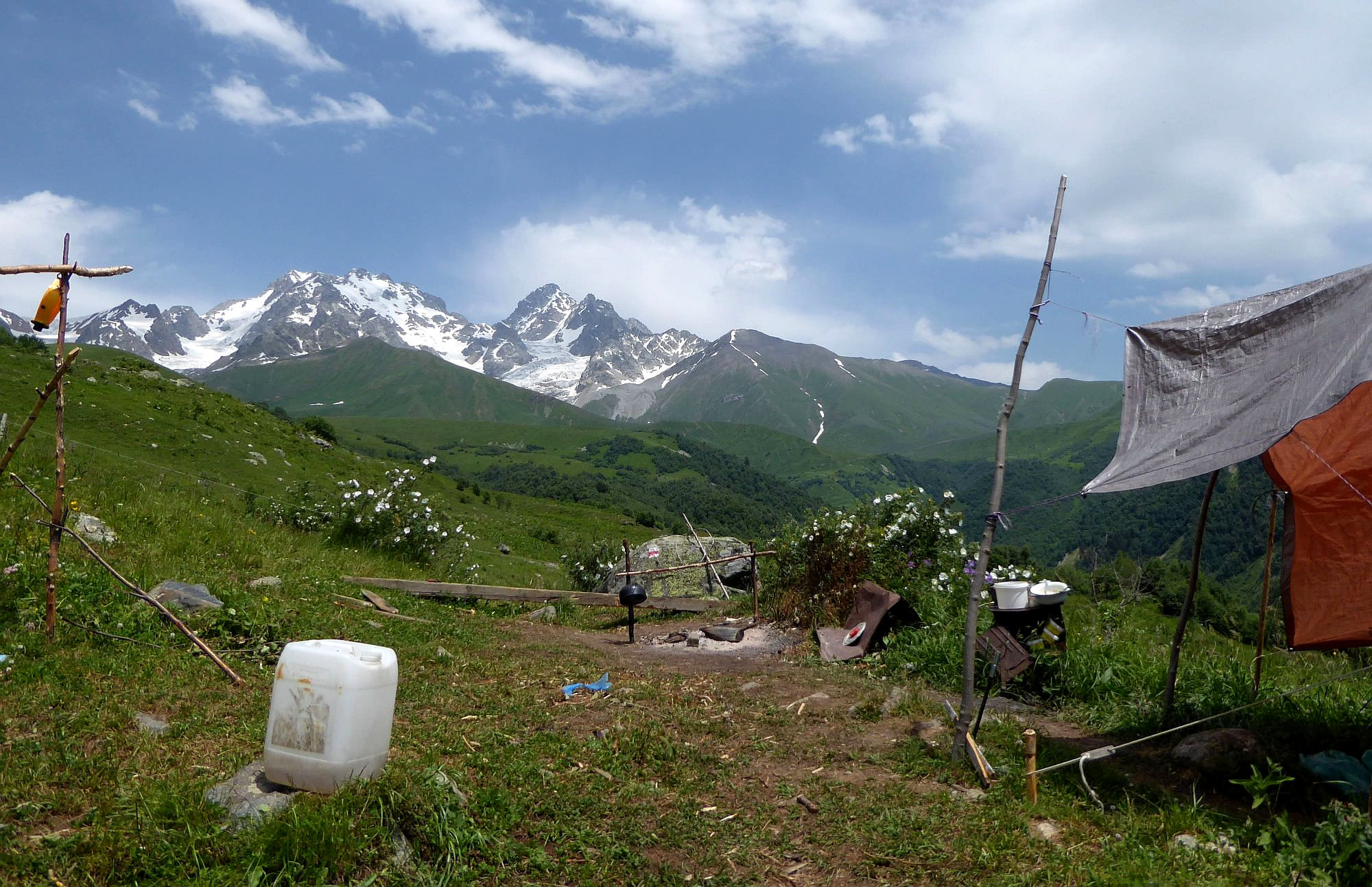
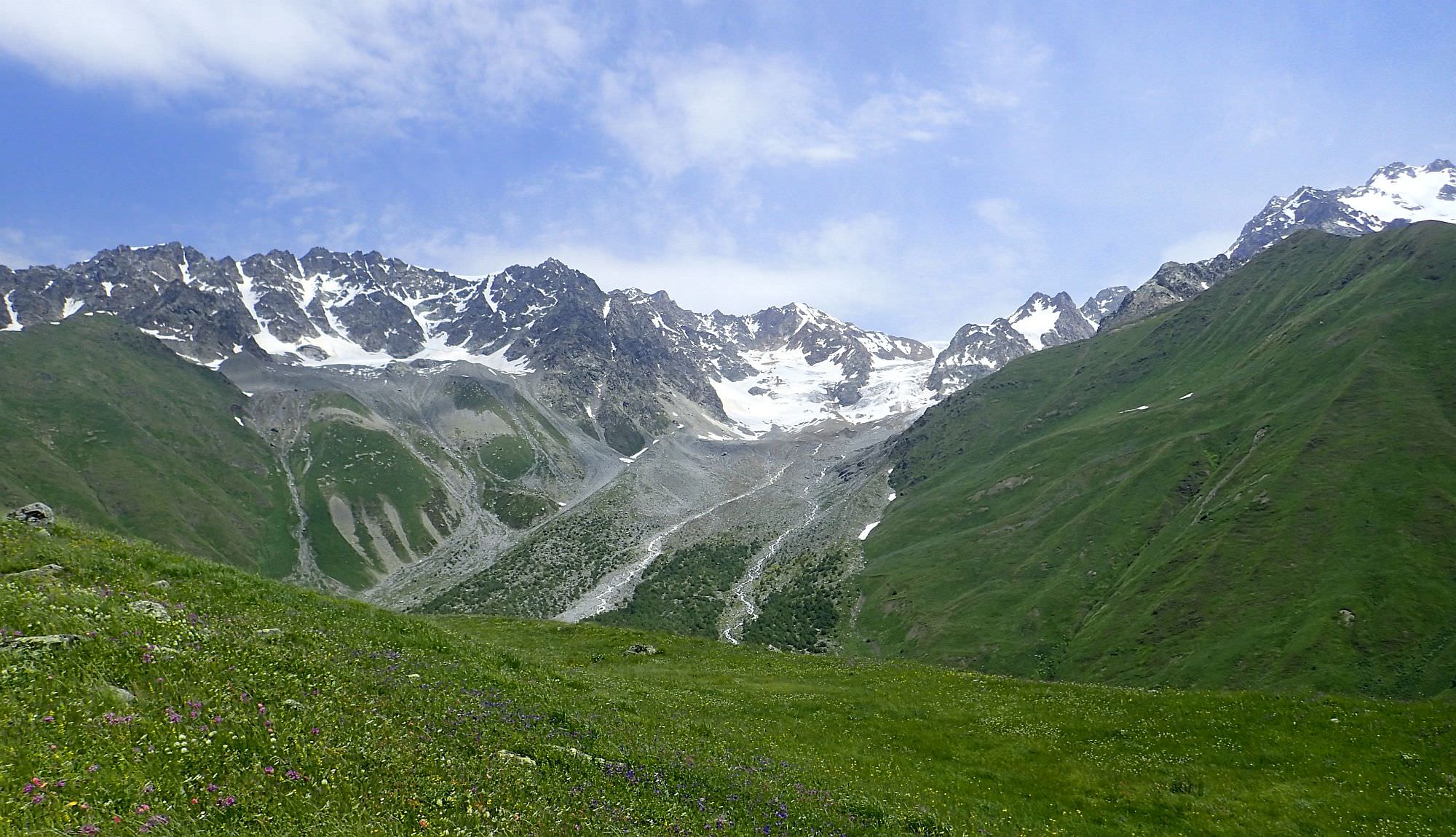
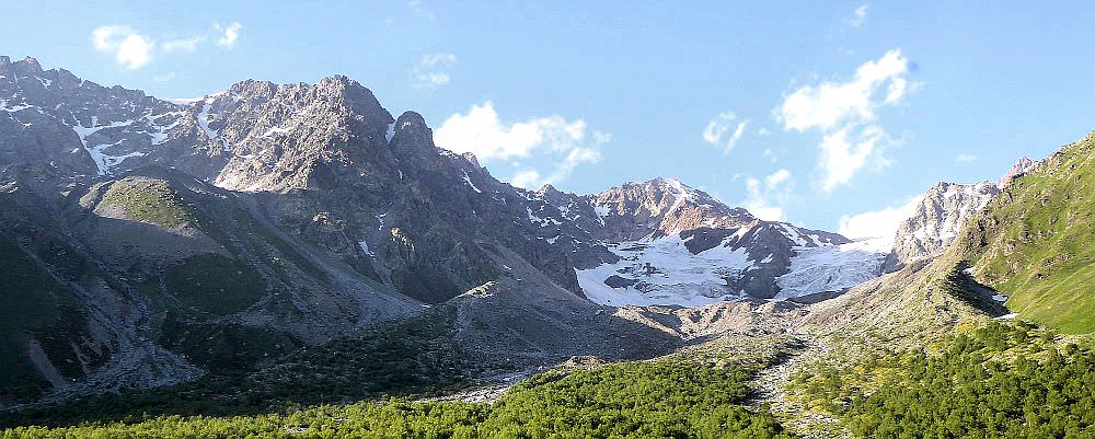
At the elevation of 2180m, you will reach a shepherd’s hut and the imposing Buba mountain with its glacier appears right in front of you. Keep walking towards it and cross another two streams not far above their confluence (be careful, though, as the area is a bit swampy). Behind the streams, you will find the final pointer - the rest of the trail is not marked.
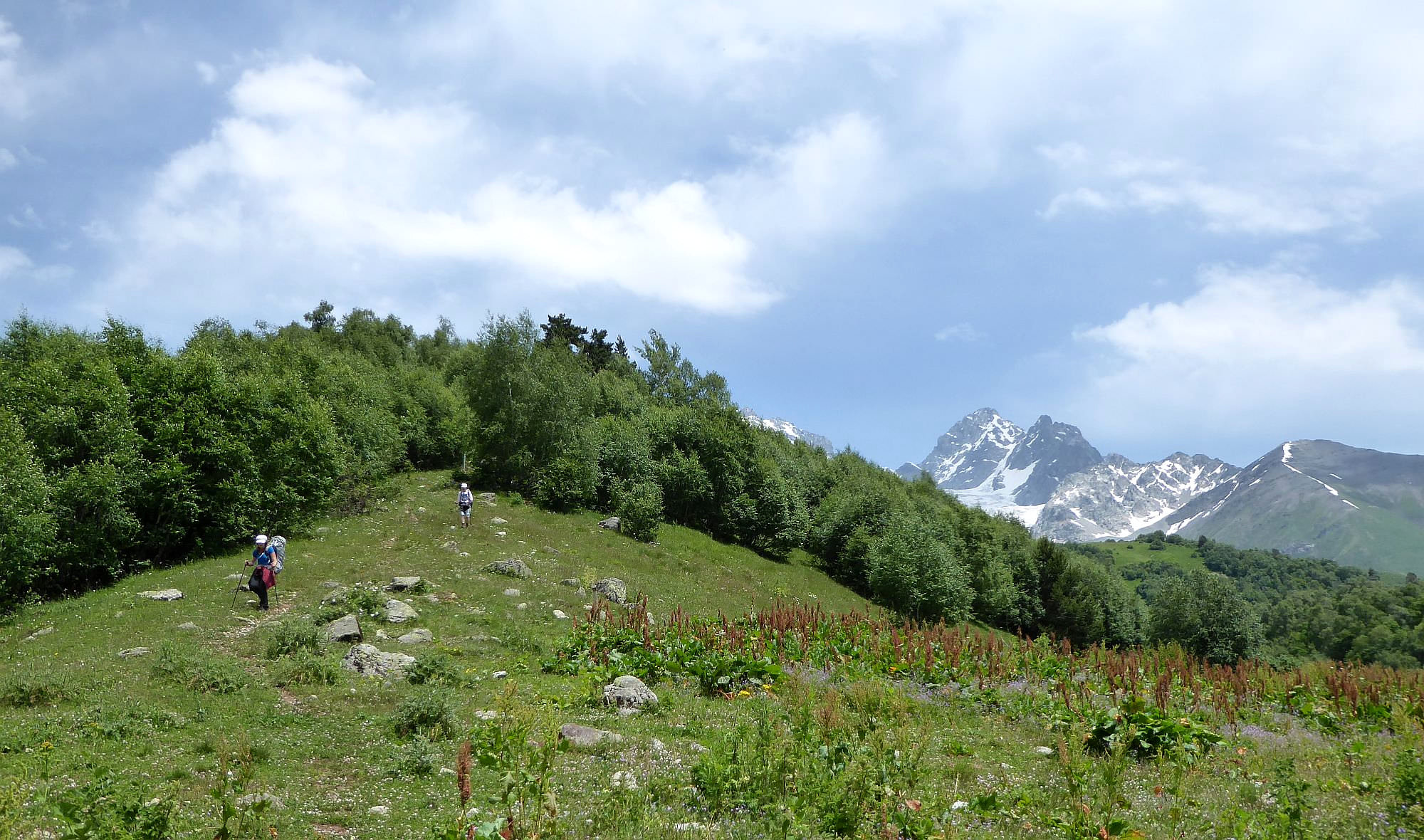
The next section of the trail crosses through several small meadows and groves of young birches. The whole area is criss-crossed by cowpaths, but the direction is obvious. When you leave trees behind, you will see Buba mountain to the left and in-between one last small ridge you will have to climb. The trail here disappears, so we just climbed up the meadows between the groves.
Once you are at the top, follow the ridge to the north, this section is simple, pleasant and offers great panoramic views. The hike ends one kilometer later by the tourist pointer. You can see the Buba glacier, but it’s still pretty far. If you want to actually "touch" it, you will have to hike another 1-2 hours in a quite difficult terrain.
To return, use the same route you arrived.
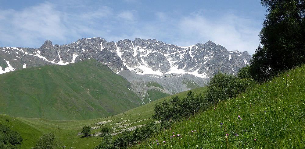
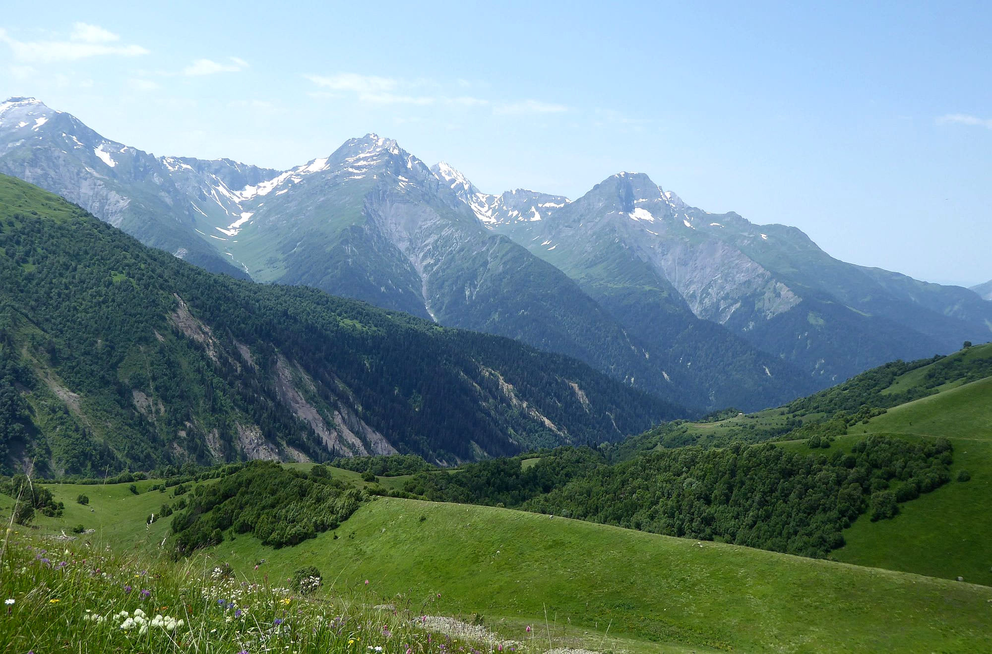
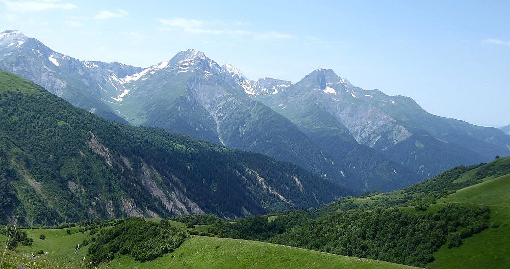
Mountains west of Buba glacier