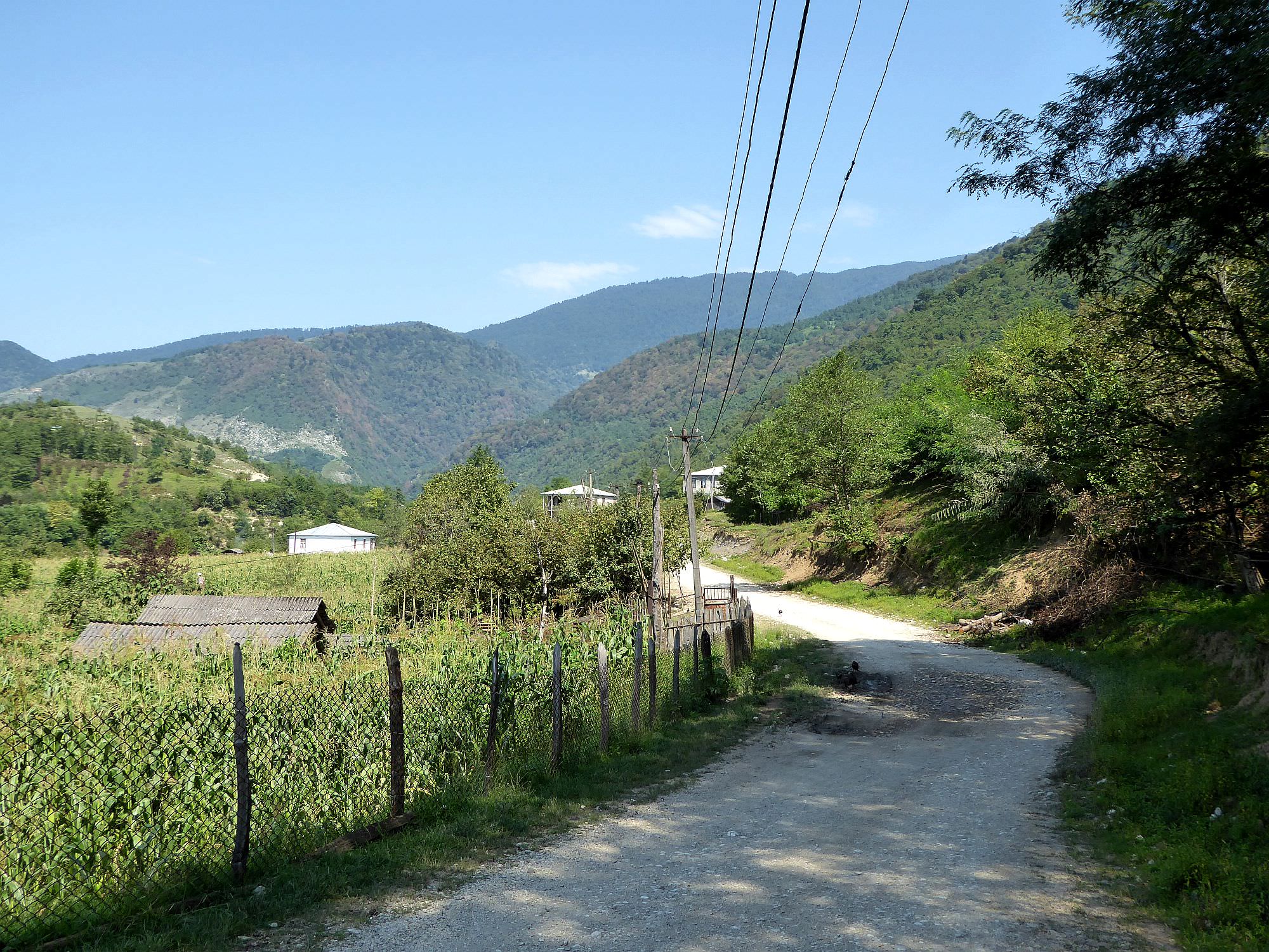
Short but demanding walk from Chkvaleri village to the nice waterfall.
This little-known walk takes you through the valley of Intsra river to a pretty nice waterfall. It doesn’t belong to top sights of Georgia, but if you happen to be in Zugdidi with some extra time and desire to get away from crowds, it is an interesting option.
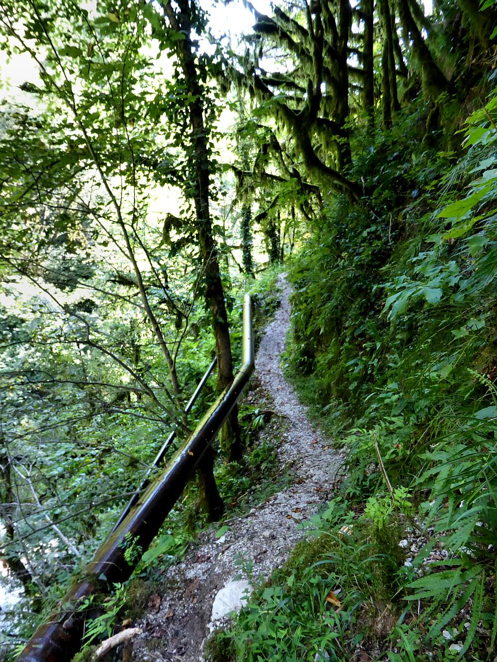
The trail is short but towards the end, there are some narrow exposed sections above the river. Bring good shoes and be prepared for some scrambling.
Since there is no direct bus between Zugdidi and Chkvaleri, I would just take a taxi - the price should be up to 40-50 GEL. You could also take a marshrutka to Jvari (all buses going through Mestia are going through there) and take a taxi from there for some 20 GEL - could save you a few lari if you are traveling alone or as a couple.
The last, cheapest option is to take a marshrutka to Jvari and walk to Chkvaleri from there, but I can´t recommend it. It doesn't look far on the map but the road is narrow, surprisingly busy and constantly goes up and down.
Also very problematic - if you came by taxi, just ask the driver to wait for you. Otherwise, you will probably have to walk to the Jvari village and try to hitchhike. But, of course, it never hurts to have a number of some local taxi driver, as a backup.
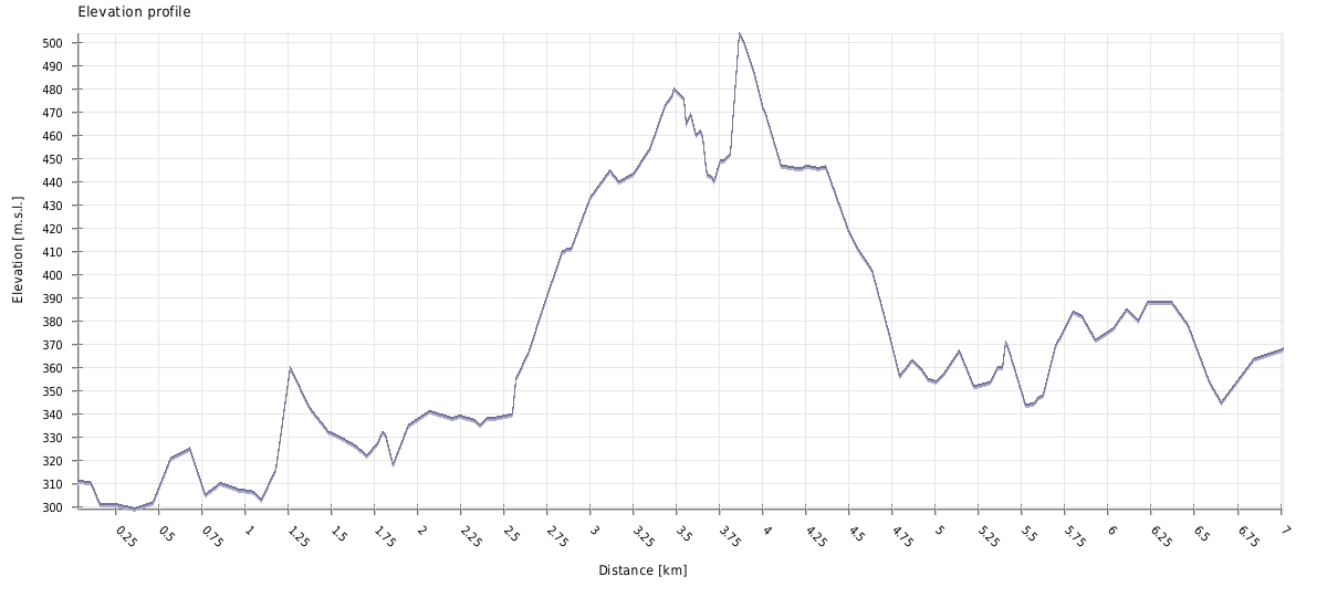
| Distance | 7km |
| Trail type: | Roundtrip |
| Max. elevation: | 504m |
| Min. elevation: | 299m |
| Total climb: | 401m |
| Total descent: | 371m |
The trail starts at the intersection by the Chkvaleri village. There is also a hiking pointer - the trail is marked by white/red rectangles.
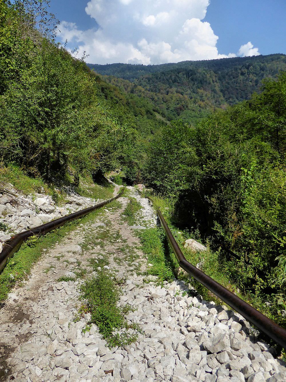
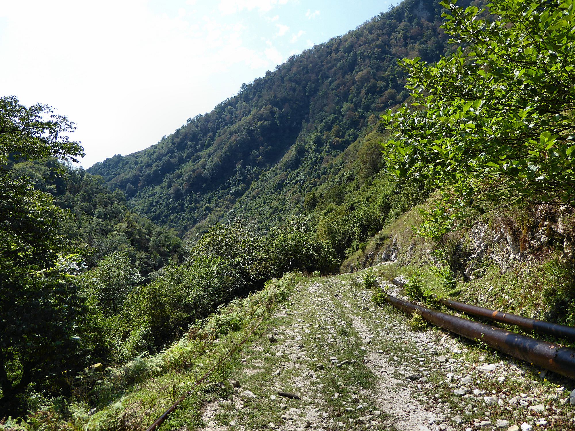
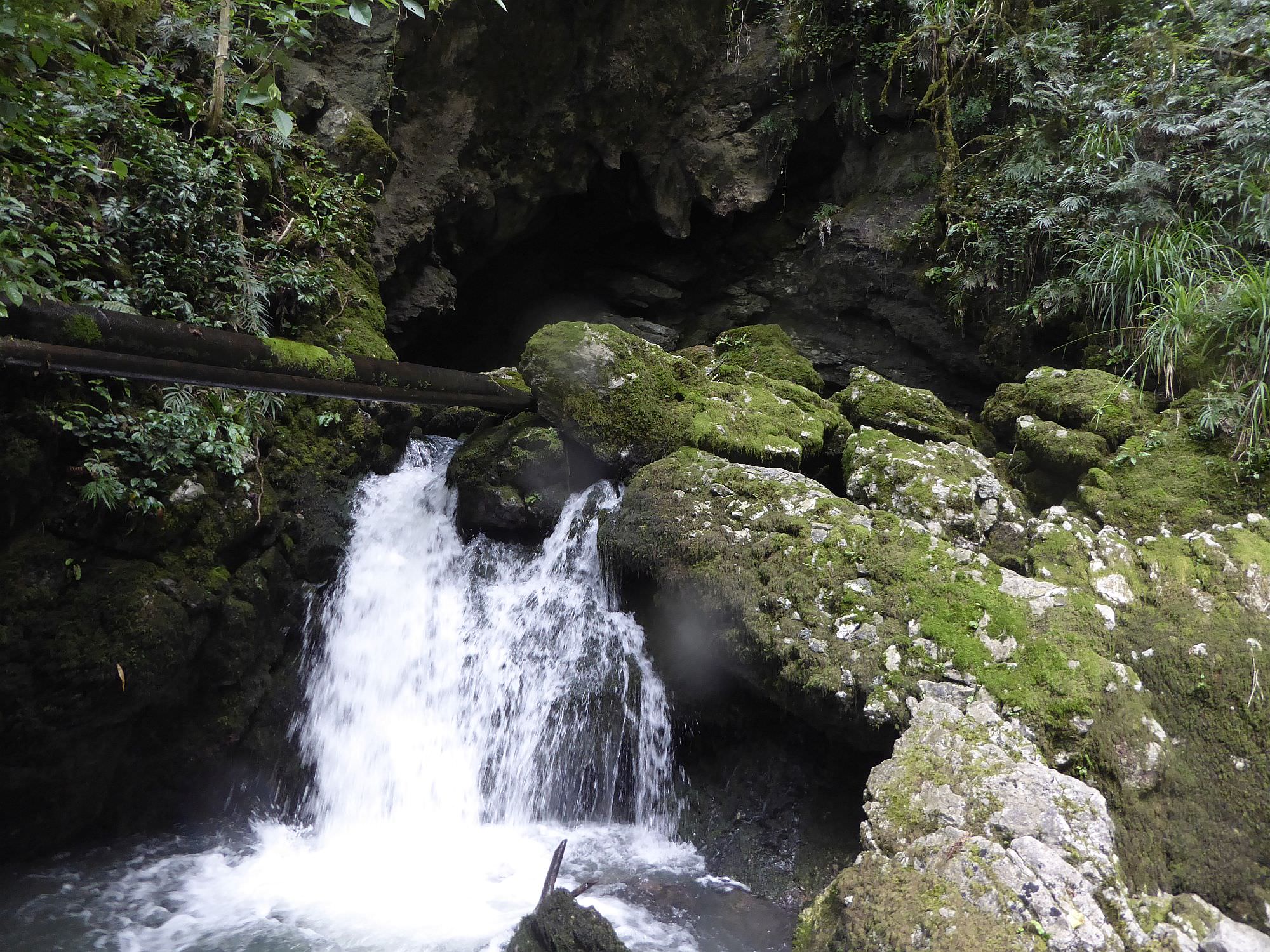
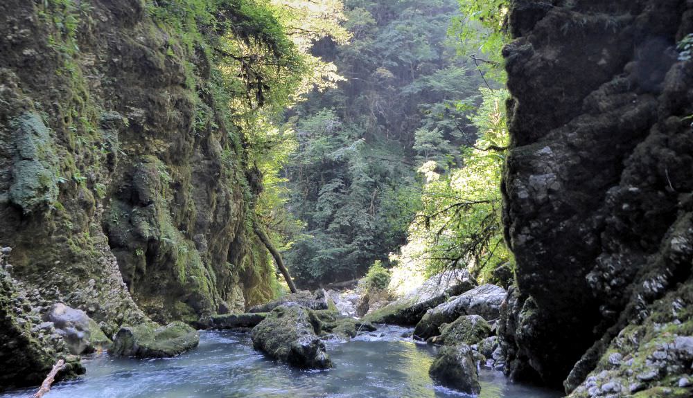
The initial part of the trail is pretty straightforward, you just follow the dirt road delving deeper into the valley. It's lined with steel water pipes - they will lead you all the way to the waterfall.
About 3km from the first pointer, the road emerges onto the small clearing. There is also a pointer showing the path climbing to the left, towards the Kvira mountain. But you keep going ahead, where the road turns into a footpath and enters the forest. Be careful here as the slope is steep and trail very narrow. Also, there is a water pipe running at the level of your ankles - if you slip, you can easily stumble upon it and fall headlong into the gorge.
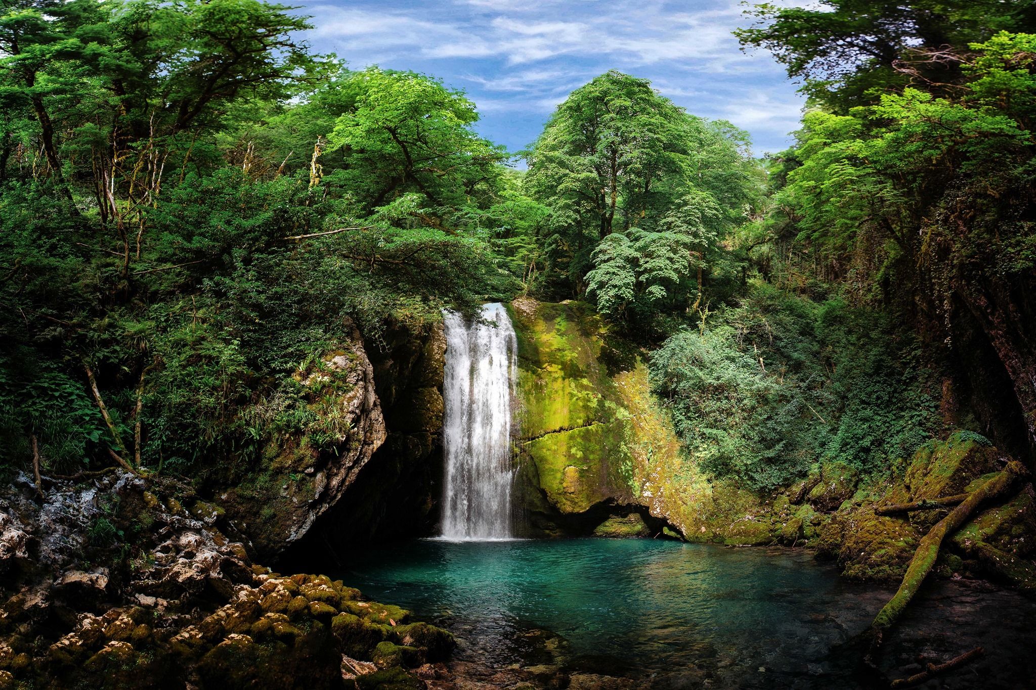
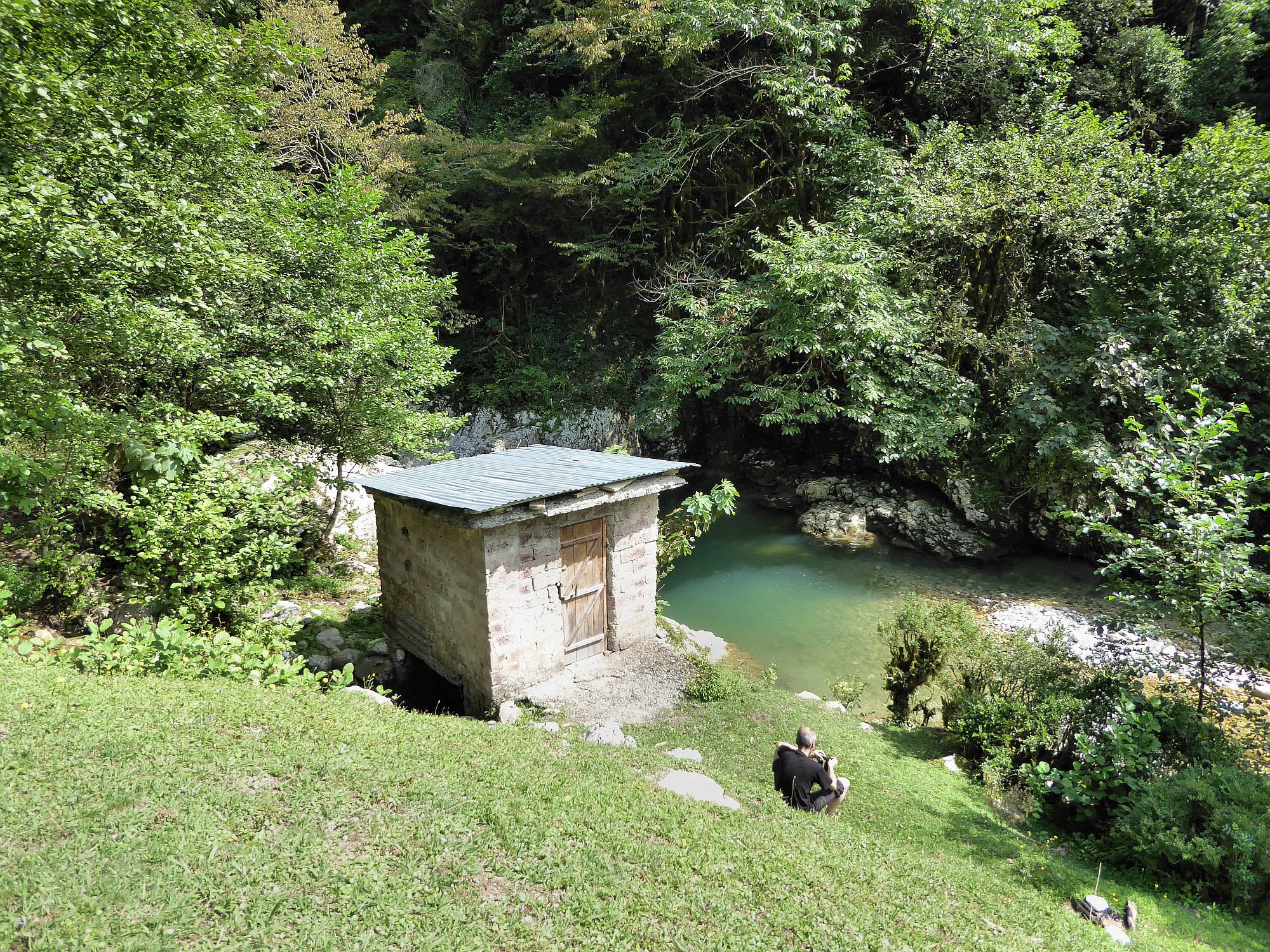
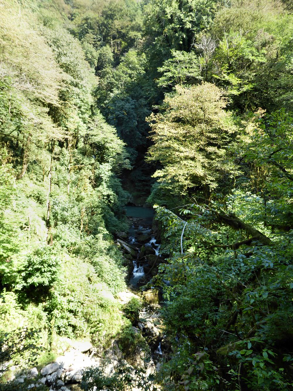
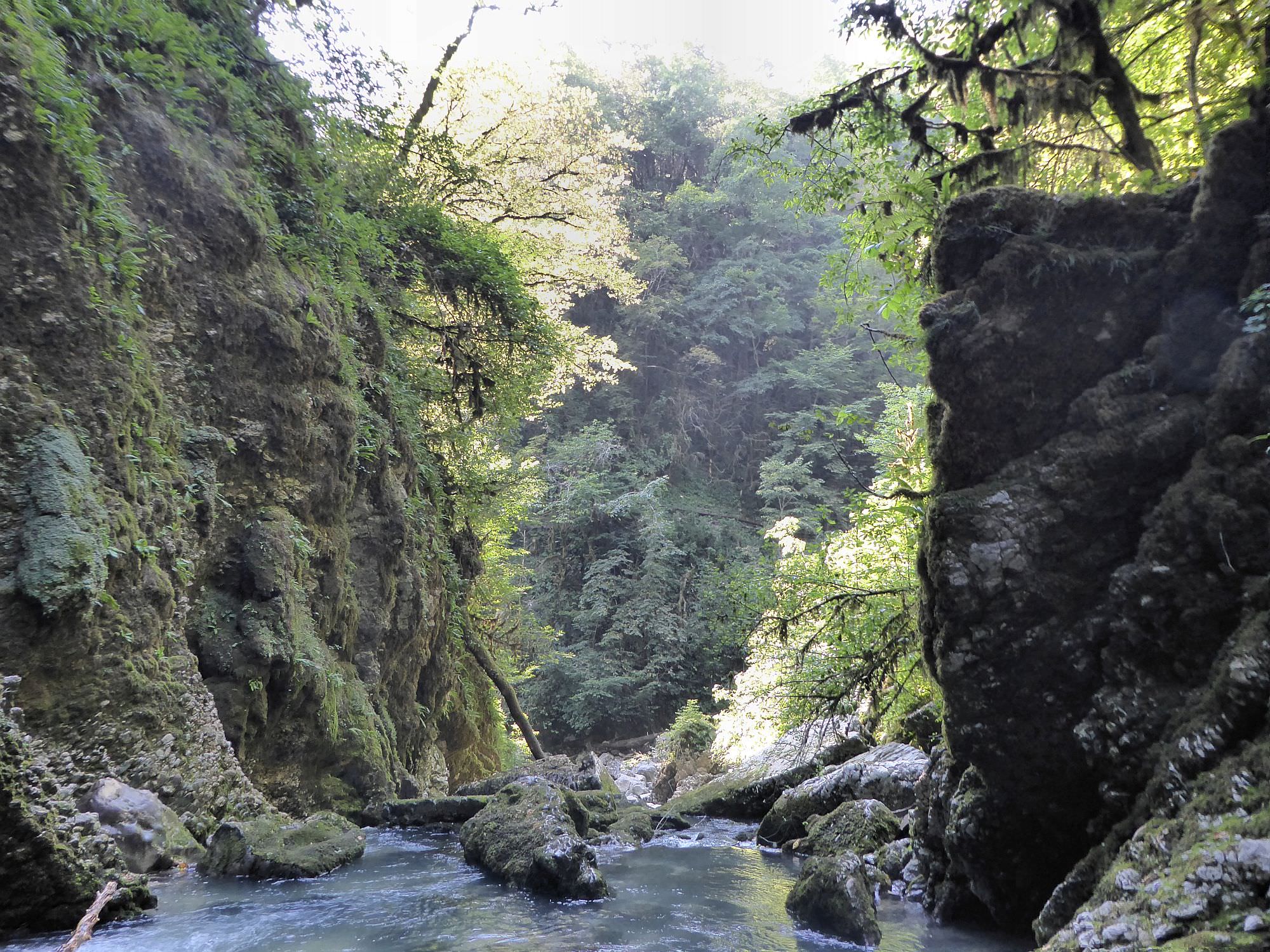
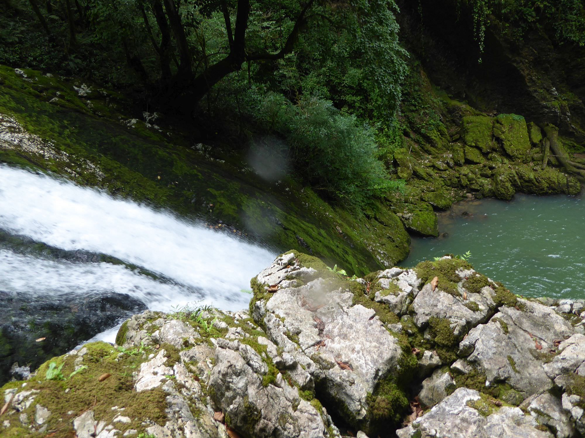
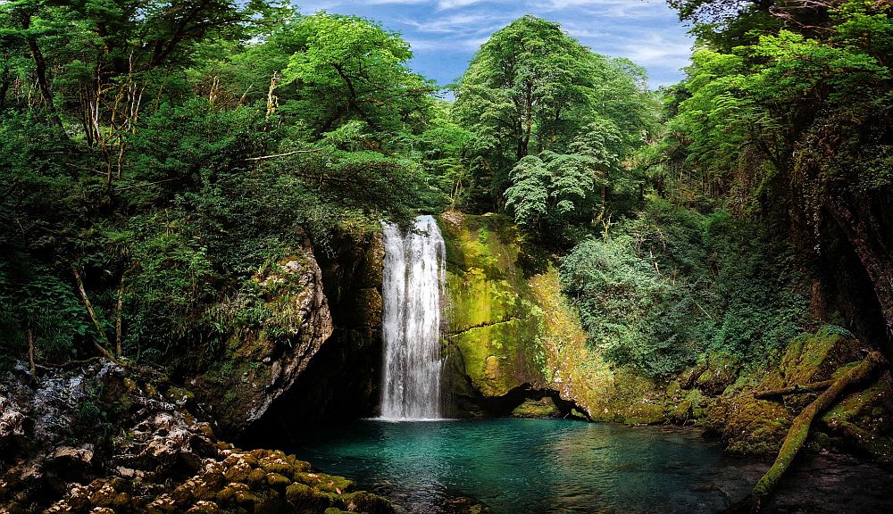
Keep looking over the river until you see a pond of beautiful green water. That's where the waterfall is. Only some 30 meters later trail drops into the riverbed (don't worry, usually there is very little water). Cross the river, climb down some boulders and find a trail on the opposing bank - it's not hard as it is lined by two smaller water pipes. This trail goes a bit up, at one section you will even walk in a narrow space between both water pipes. Then you will reach another pointer - if you turn right here, you can climb down to the pond at the bottom of the waterfall.
If you go ahead instead, the trail will take you to the top of the waterfall (the water flows out of two caves). However, this section is even harder than the previous ones. It´s technically not the difficult, but not for the faint-hearted - if you slip here, you can fall into the waterfall and get seriously hurt.
To get back you can return the same way you arrived.
Title photo (that one hundred times better than any other in this post) was provided by Gio Mefarishvili. Thanks a lot!