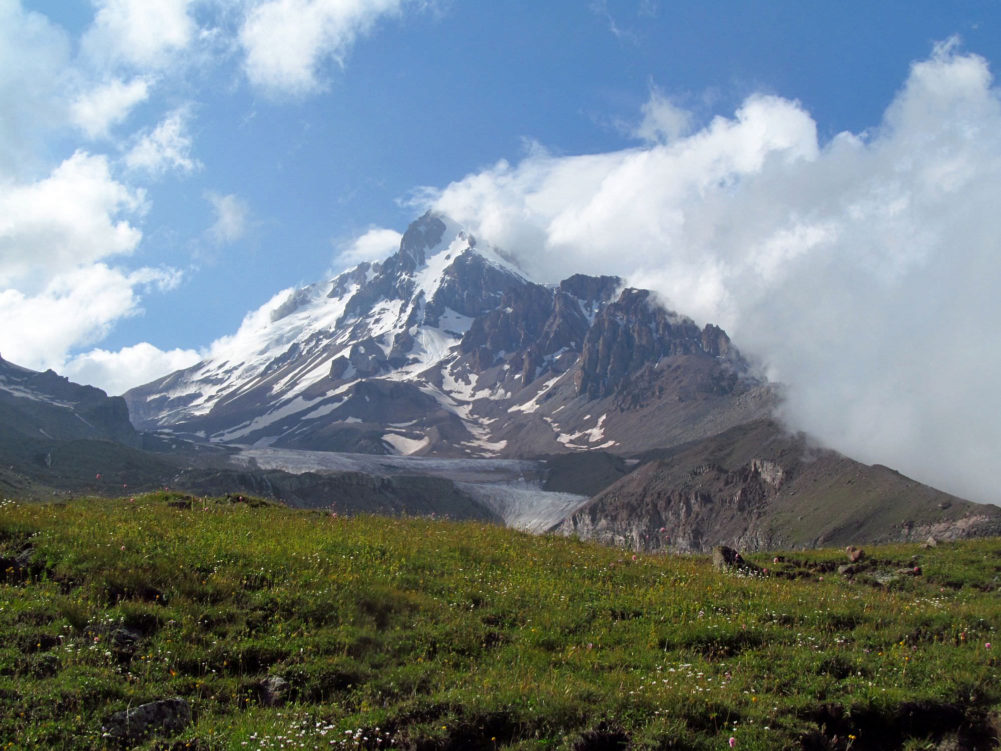
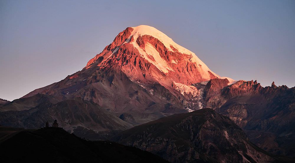
Classic day hike from Stepantsminda village to the foot of glacier covering Mt. Kazbek.

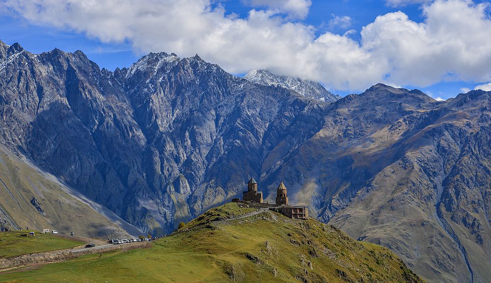
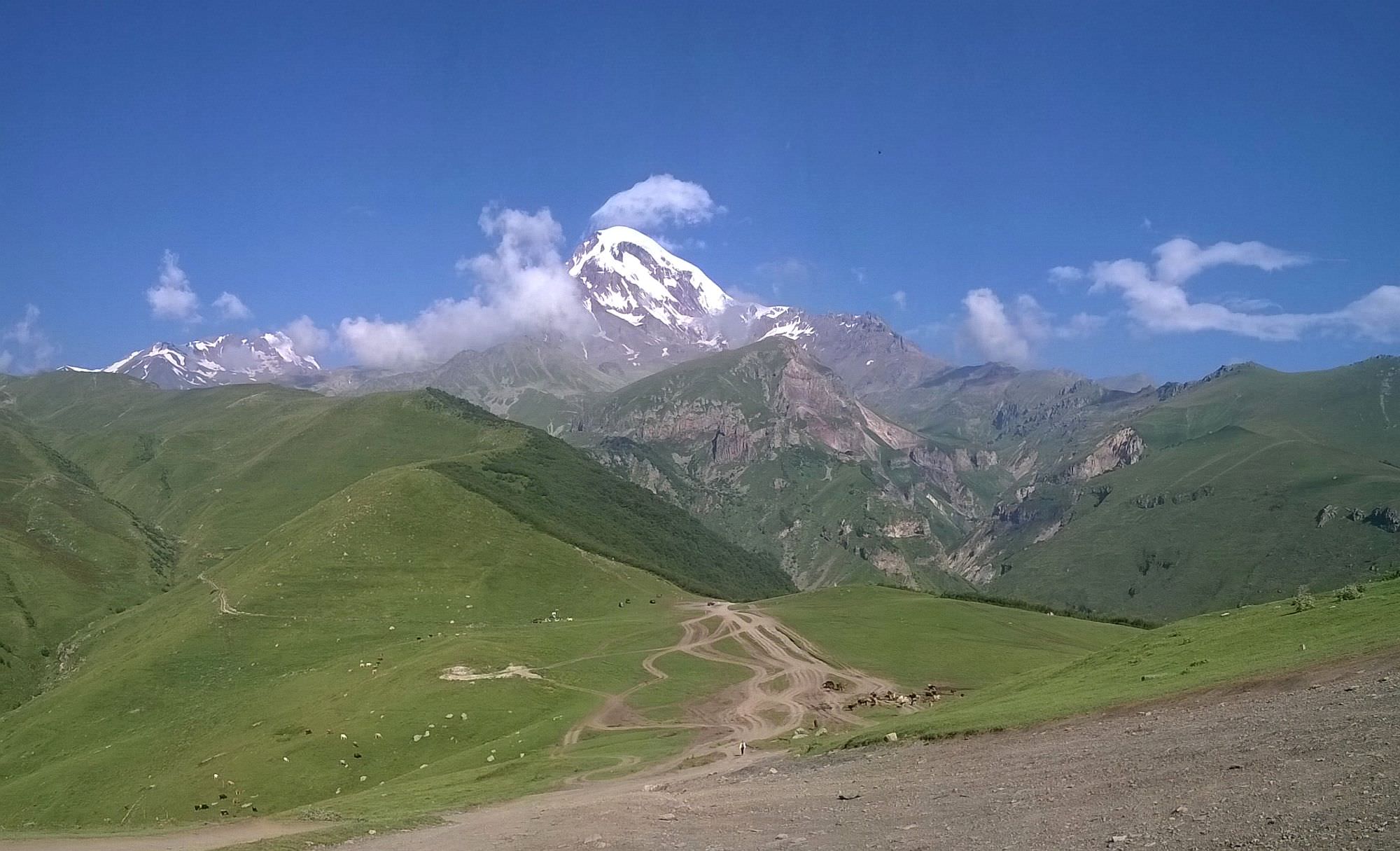
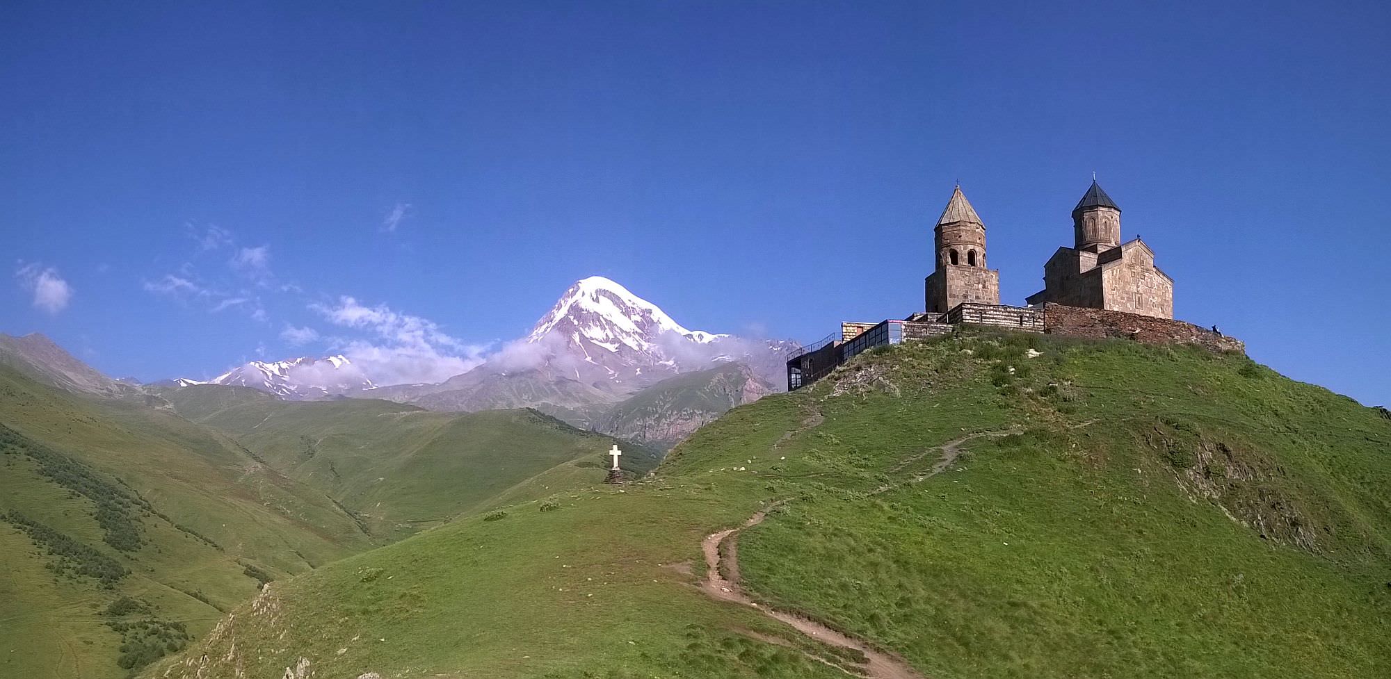
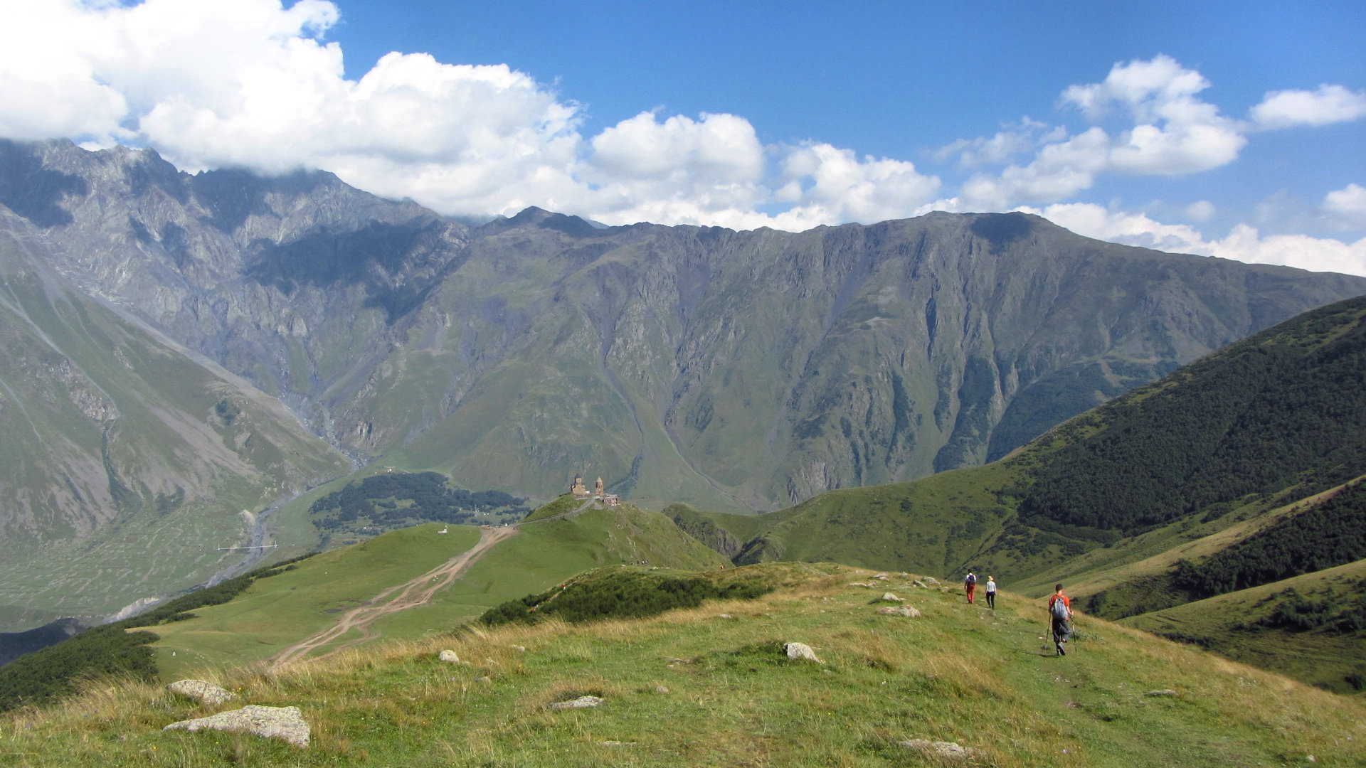
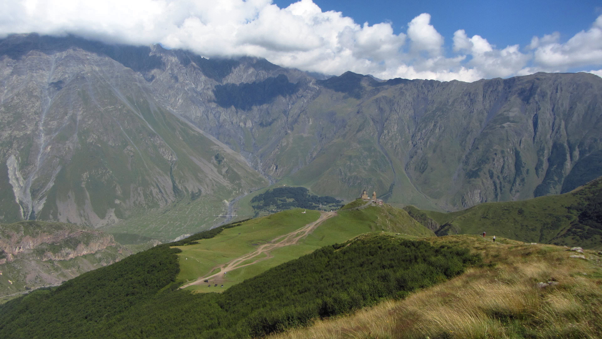
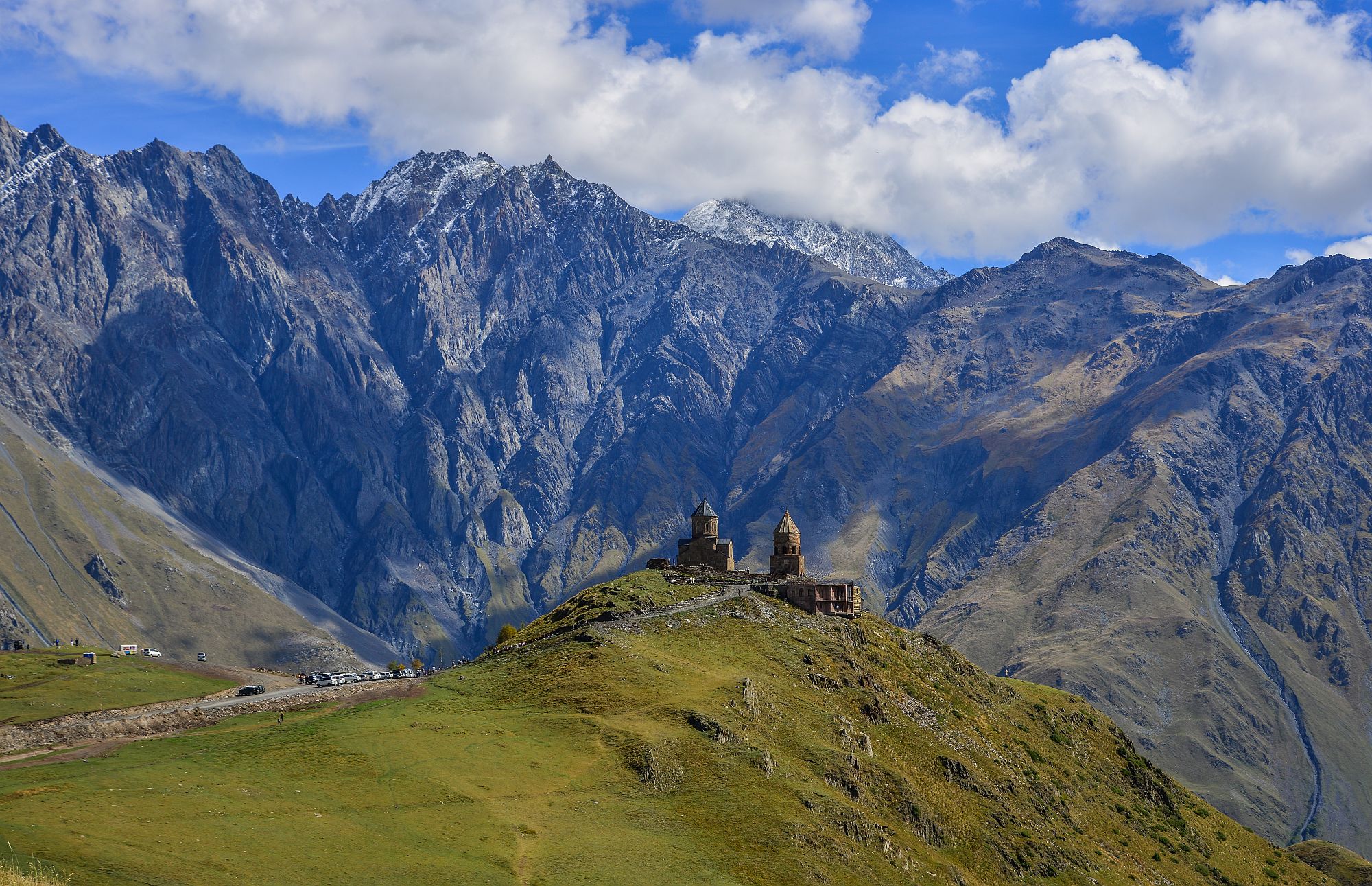
A classic one-day hike from Stepantsminda (Kazbegi) village to the foot of Gergeti glacier covering Mt. Kazbek. On the way, you will pass beautifully situated Gergeti Trinity church, probably the most famous Georgian landmark.
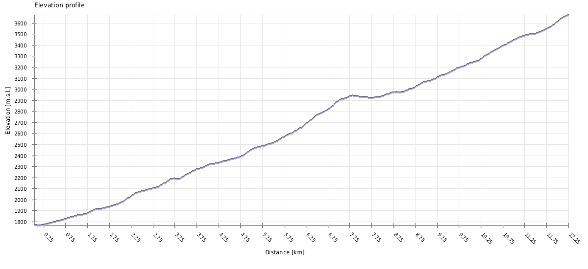
On average, moderately fit hikers needs about to five hours to climb to the glacier and another three hours to return. Of course, it all depends on your walking speed, number of breaks and so on, so you might need even more time. Therefore, it's important to leave early (more on that below).
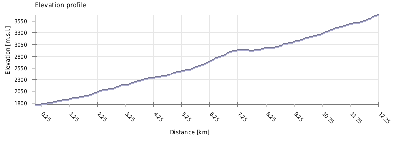
In a single day, you will have to hike 1600 meters up and down - while the trail is well-trodden and easy to follow, this is certainly not an easy feat. If this looks like too much of a challenge, you can also take a taxi to the church - in such a scenario, the difficulty is moderate.
Marshrutkas to Tbilisi leave hourly from the bus stop at the main square. The first one departs at 7:00 am., the last one at 5 pm. and the trip also costs 15 GEL.
The best place to start your trip to Kazbegi is the Didube bus station (located by the metro station of the same name). Here, you will need to decide if you want to take a marshrutka or a taxi.
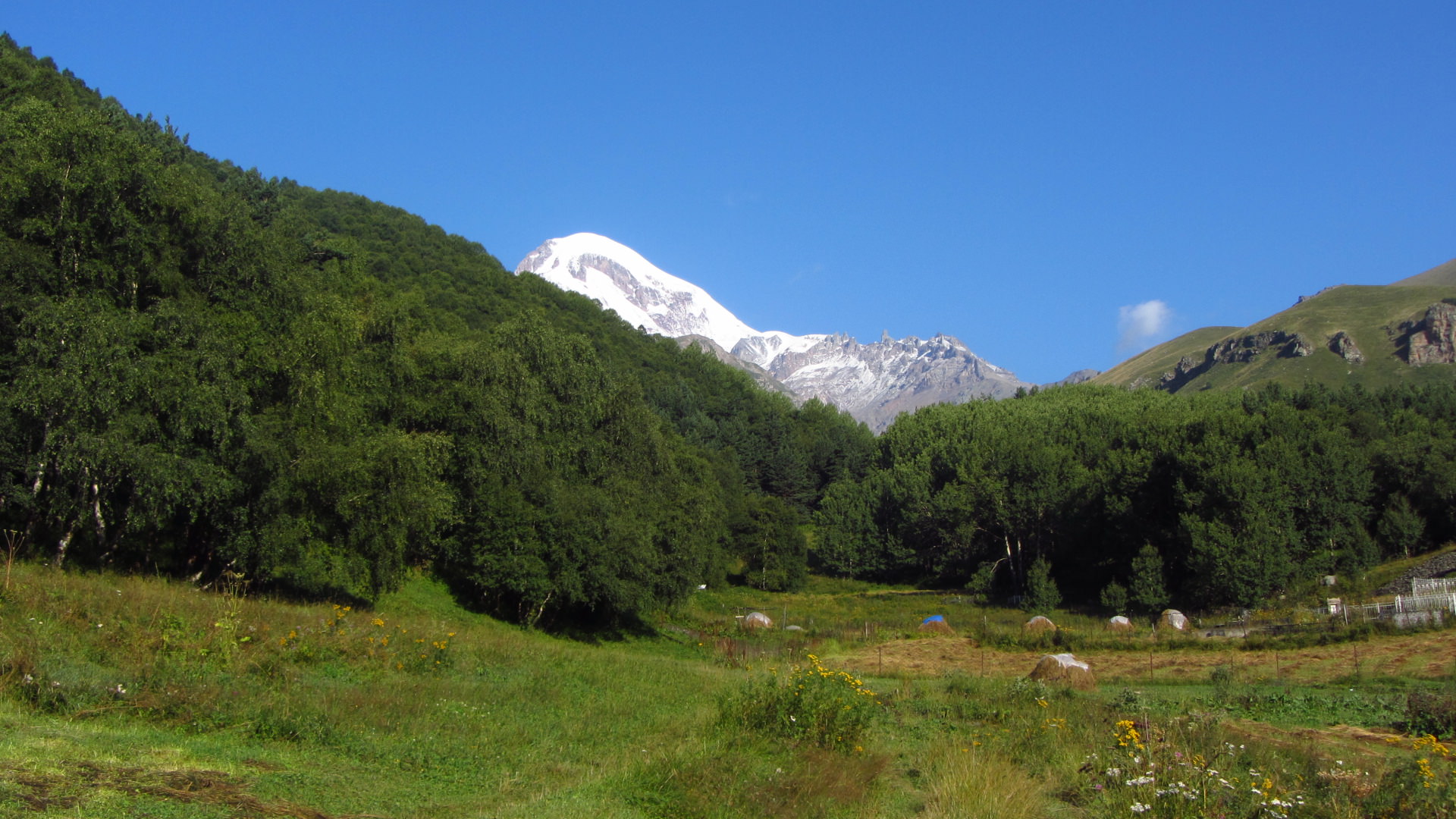
Glacier is usually accessible to hikers from early June till October. During winter, a hiker can climb (with some effort) to Gergeti Trinity church but I don't recommend going any further.
Looking for a place to stay in Stepantsminda before the hike?
These are my favorite guesthouses.
| Distance | 20,4 km |
| Trail type: | Roundtrip |
| Max. elevation: | 3265m |
| Min. elevation: | 1770m |
| Total climb: | 1552m |
| Total descent: | 1552m |
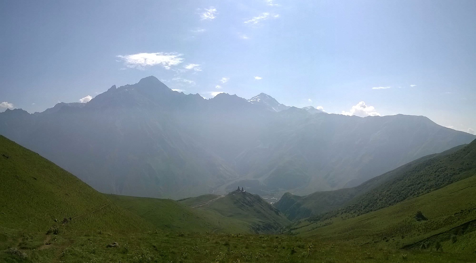
The trail starts at the main square of Stepantsminda. Follow the main road north and once it crosses the Tergi river, turn left onto the road towards Gergeti village. Follow the road for some 15 minutes until you reach a T-junction at the center of the village.
From the junction, several routes climb to the Gergeti Trinity (Tsminda Sameba) church. From hiker´s perspective, the best one is the one to the left which climbs to the church through the Bashi valley. It offers the best views and while a bit longer, it´s also not as steep and therefore not that hard to walk. As a bonus, it keeps you away from the road and traffic.
How to find it? At the T-junction, turn left. After 100 meters, you will pass the Gergeti summer cafe and adjacent parking lot. The track then leads you past a ruined tower and follows Bashi creek for a while. To the right branches trail climbing directly to the church but its extremely steep so it´s better to follow the route to the left.
Soon the trail splits again. The left branch closely follows the creek - it eventually also reaches the church but the final climb will be much more difficult. So it´s better to stick to the right and start gaining some altitude right away. At these moments, you can already see the church on the hill above you. Finally, the trail turns to the right and after a short but steep climb, you will reach a new concrete road close to Gergeti Trinity church.
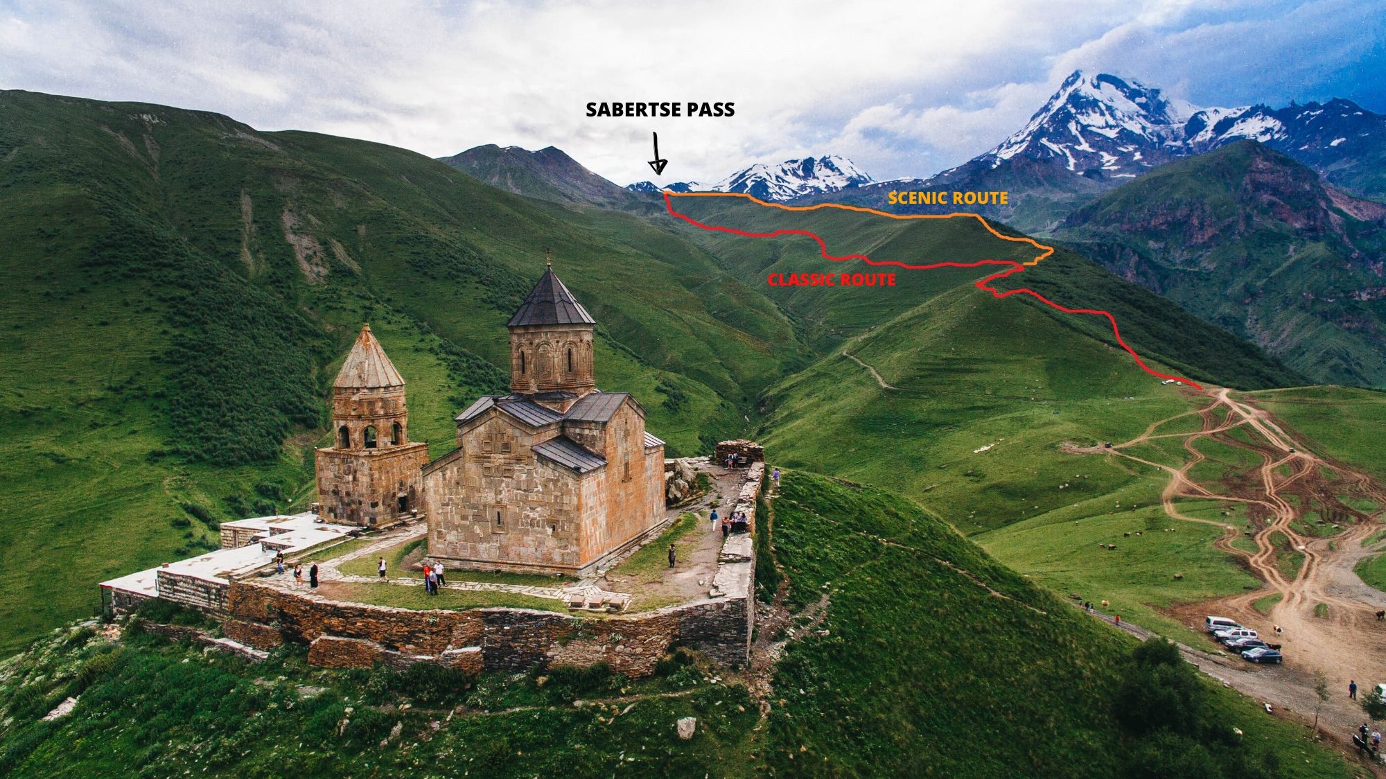
After the visit to the church, follow the new road back. The trail further up starts at the first junction, close to the new parking lot. After a short climb through the birch forest, you will make it to the top of a ridge rising to the west. Follow it for 200 meters. Far ahead, you see a flat pass to the right of a prominent, 3200m tall hill. That place is called Sabertse pass and is your next destination. And now is the time to decide which of two routes leading to it you will take.
The classic route, used by mountaineers and the majority of hikers turns left and traverses the hillside some 100 elevation meters beneath the top of the ridge. It is well-trodden and straightforward. However. it offers only limited views.
From a perspective of a hiker who doesn't plan to climb Mt. Kazbek, more interesting might be the scenic route that follows the top of the ridge all the way to Sabertse pass. Elevation-wise, I don´t think it´s harder but it´s longer by 300 meters (3 vs. 3,3 km).

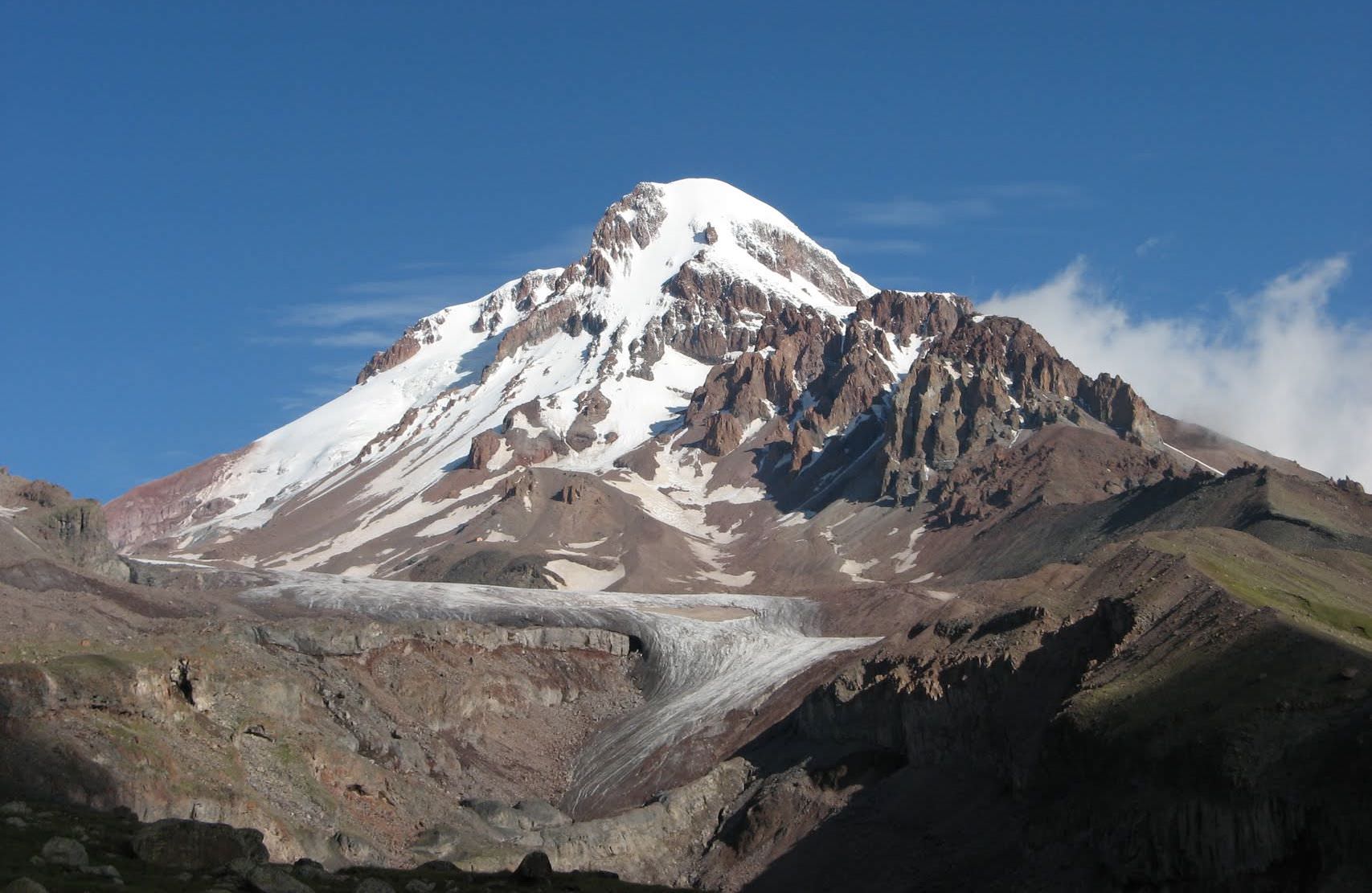
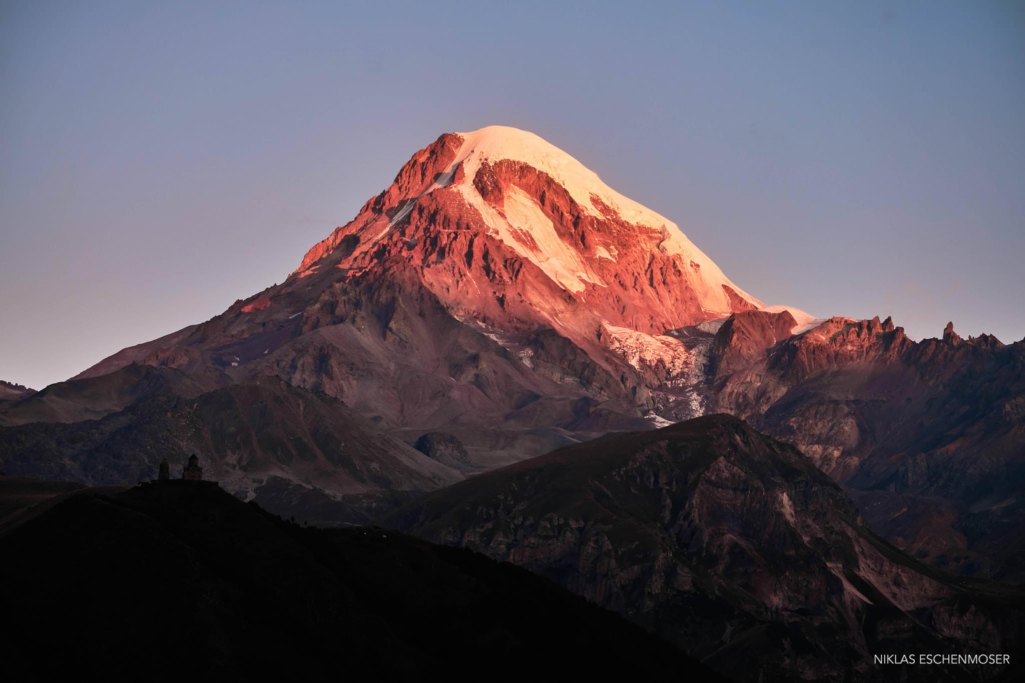
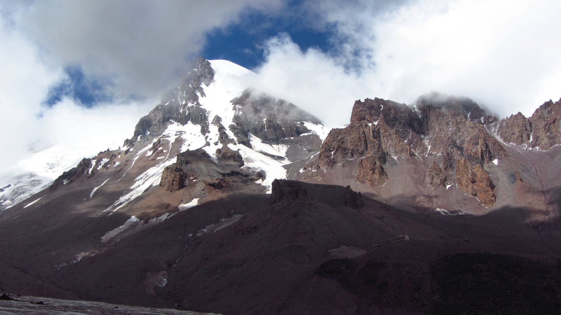
At Sabertse pass (2900m), you will find a small shrine and enjoy first views of Gergeti glacier (if you took the classic route). From here, you need to traverse the hillside and eventually cross a subsidiary of Chkheri river (no need to soak your feet, there is a small metal bridge). Right ahead, you can see a campsite, often used by mountaineers planning to scale Mt. Kazbek, and not far to the right, you see newly-built Altihut.
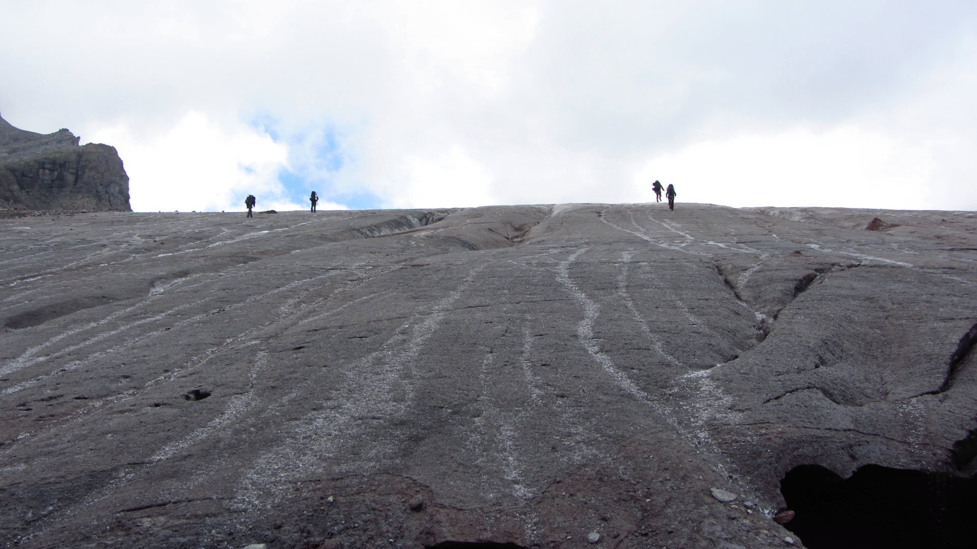
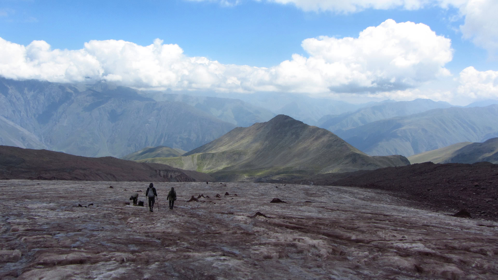
Behind the river, the trail becomes steeper and climbs directly towards the foot of the glacier - this last section takes about half an hour. At the glacier, you can try a small walk, take a few pictures and its time to go back the way you came.
Some trekkers also cross the glacier and reach meteostation Bethlemi, equipped only with trekking poles. Under some circumstances, it is not too risky, sometimes it´s irresponsible. I don´t want to encourage anyone to try it (cos I don´t know who is reading this) but if you have experience and you are ready to evaluate the risk, it´s also an option. The hut at elevation 3600 meters (route also included in the gpx log, but may change, it´s a glacier, after all). Just keep in mind that to walk from Stepantsminda to Betlemi hut and back is very exhausting (11+ hours of walking). At the station, you can sleep (booking recommended) or camp nearby for 10 GEL.
Would you like to do some more hiking in the region?
Check this list of best day hikes around Stepantsminda