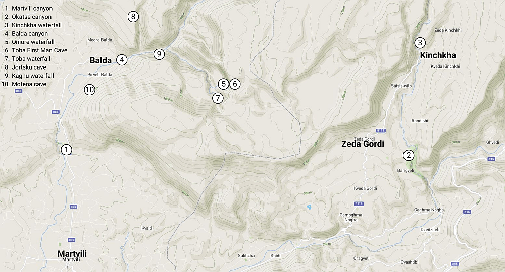
Discover one of the most diverse regions of Georgia on foot.
For lovers of canyons, caves, and waterfalls, probably no other area in Georgia is as interesting as foothills of eastern Samegrelo. The number of geomorphological formations tucked in the southern reaches of the Askhi massif is truly staggering. Some of these places such as Martvili and Okatse canyons have been already developed and turned into popular tourist attractions. Others are still hidden in the mountains, visited only by a handful of enthusiasts.
While most people visit these canyons by car, there are several routes that cross the mountains and can be used to connect many famous and not-so-famous sights. They give you an option to admire pretty nice mountain scenery (it's no Svaneti though) or visit one of several cheese farms that dot the Askhi massif. There are three main routes, greatly differing in distance and terrain covered - from rocky mountain tracks to routes passing wet, humid forest.
There are four possible variants to take. If you choose the longest one and decide to explore all caves and waterfalls nearby, you may need four days to finish. In case of the shortest route, one day might be enough if you don't spend too much time at all those waterfalls.
Whichever option you pick, most of the route follows various unmarked forestry roads, but there are also some off-trail sections such as the top of Askhi Massif or route branch passing the Oniore Waterfall. Still, there is no serious bush whacking or any other technical challenges.
The trails can be walked all year around. As there are more exciting regions in summer and autumn, a focus on the off-season is recommendable: late autumn or spring for instance for the longer Askhi-loop and the snowy winter season for the shorter version to enjoy frozen waterfalls and forestry roads in an appealing white.
Both directions are possible and both villages, Balda as well as Zeda Gordi, are rather well connected thanks to the nearby canyons and waterfalls. The described routes go from Martvili / Balda towards Okatse / Zeda Gordi but the opposite direction is possible as well.
The best place to start is Kutaisi. Marshrutkas to Martvili depart from
Central Bus Station (by McDonalds) at 7:30, 8:00, 9:00 and then each whole hour till 18:00. The price of the ride is 3 GEL. At Martvili, you will need to take a taxi for the final stretch to the Martvili canyon. Alternatively, you can ask the bus driver if he ends in Martvili or continues further to Dido Chkoni. If that is the case, you can then, depending on your plans, leave the bus at Martvili canyon or 800 meters later at turn-off towards Balda.
If you would like to take a taxi, from Kutaisi, you should be able to find a driver willing to take you there for some 60 GEL. If you are not a fan of haggling and would like to arrange your trip in advance, you can also use services such as GoTrip.ge - but in such case, it will cost you 100 GEL or more.
While there are some two daily marshrutkas from Zeda Gordi, in order to get to Kutaisi, you would have to change bus in Khoni. Because of that, it´s much more convenient to take a taxi - the drive back to Kutaisi should cost no more than 50-60 GEL for a car.
At the Askhi massif
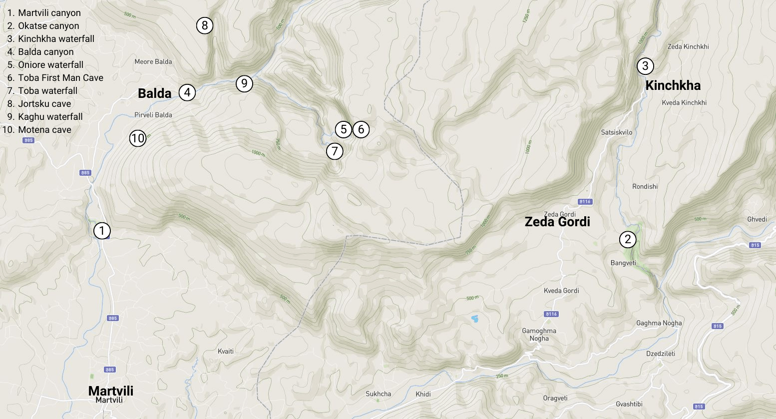
There are plenty of natural attractions on the southern side of the Askhi massif. If I were to write about them in the trail descriptions, it would completely break its structure, so I decided to cover them separately.
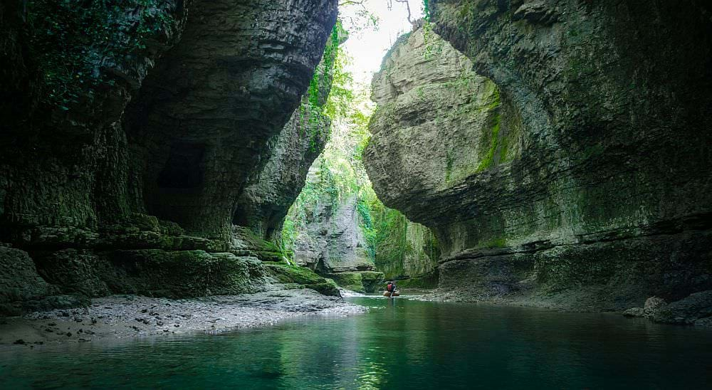
Martvili canyon is a charming, but pretty touristy gorge with a small blue/green colored river at the bottom, situated north of the Martvili town. There are also several waterfalls and small grottos, formed by the Abasha river.
In 2016, a new visitor’s centre was built here. Nowadays, there is an entry fee 17 GEL for foreigners / 10,35 GEL for residents; for another 15 GEL, you can take a surprisingly short, but still nice boat ride. There are several picnic spots at the edge of the canyon. However, swimming in the canyon is forbidden - for that, you should visit the spot some 1 km upstream, by the Gachedili bridge.
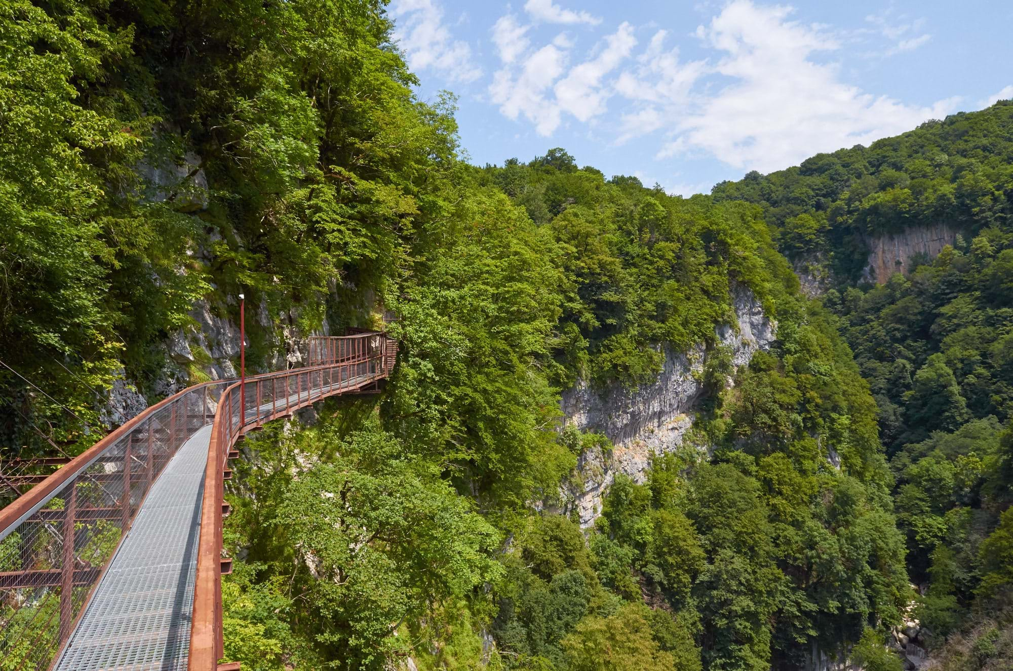
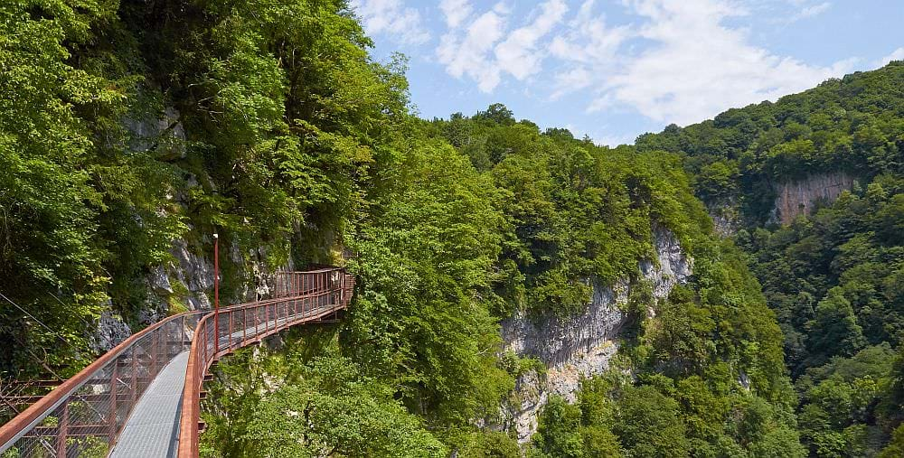
Okatse Canyon is an up to one-hundred-meter-deep gorge located close to the Gordi village. In 2013, the government modernized the whole area and turned it into a regular "attraction". Which means that there is an entry fee - in 2021, it was 17.25 GEL for foreigners, Georgians pay half price.
The walk starts in the Dadiani Gardens in Gordi, which once served as a summer residence of the Dadiani dynasty. From here, you have to walk 2 kilometers through the park to the main attraction of the area, a 700m long hanging walkway, built right into the side of the canyon. The walk ends at the viewing platform ejected over the chasm.
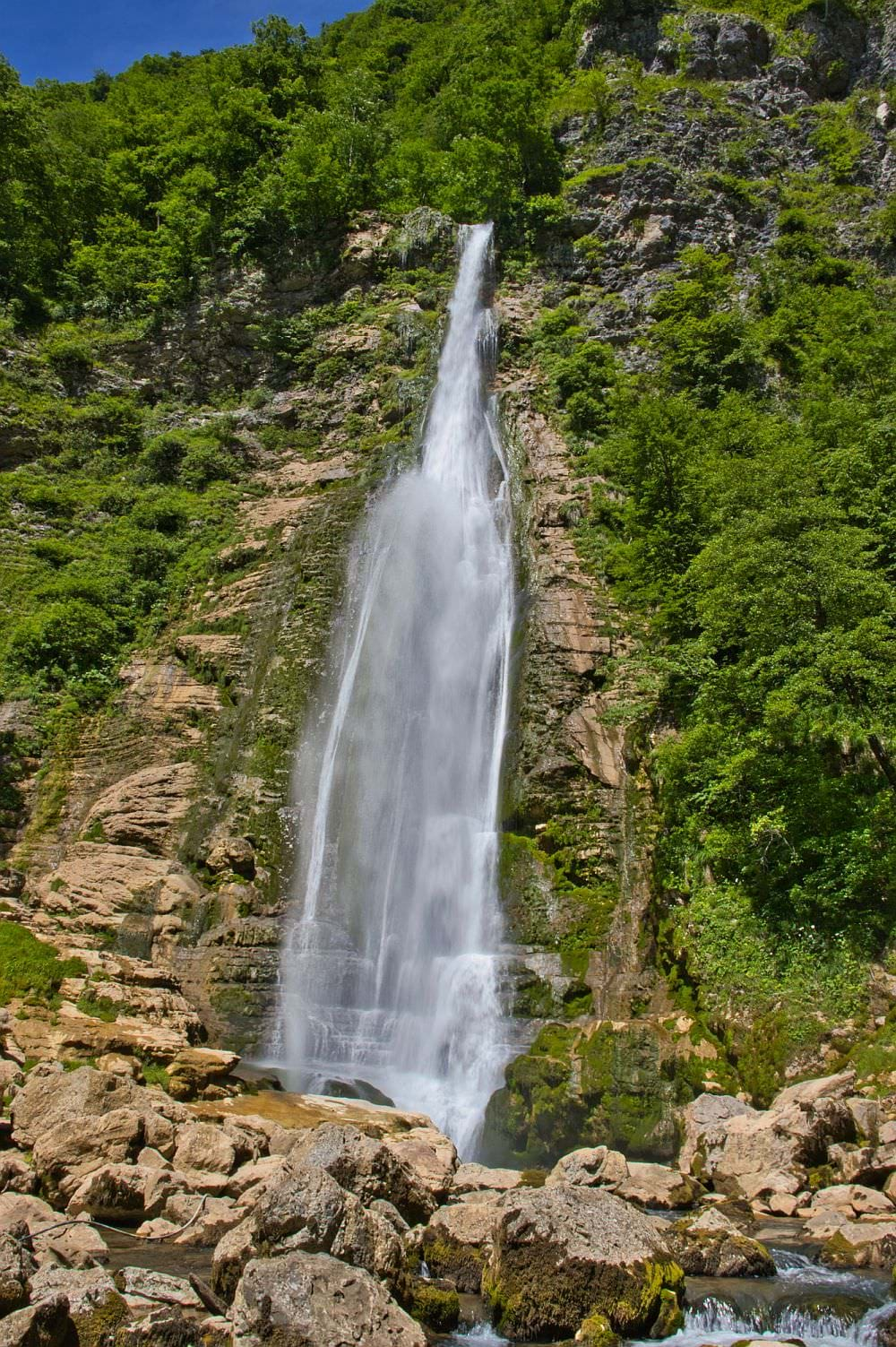
Kinchkha waterfall is an impressive waterfall cascade situated close to the Kinchkhaperdi village. The cascade consists of three steps - smaller ones are about 25 meters tall, but the middle one has over 70 meters, making it one of the highest waterfalls in Georgia.
The place is currently accessed by a newly built pathway that ends with a viewing platform. That, of course, has a price - in 2021, foreigners paid 17.25 GEL for a visit, residents 10.35 GEL.
Balda canyon is a less touristy alternative to the Martvili canyon, lying only few kilometers upstream on the Abasha river. As the name suggests, it´s situated at the Balda village, close to the Balda Monastery of St. Mary´s Assumption. The canyon is about 1,5km long and 5 meters wide.
It has several advantages over it´s more famous cousin - with entry fee of mere 2.5 GEL, it´s considerably cheaper (in the off-season it may even be free of charge) and swimming is allowed here, too. As for the downsides, it´s harder to reach and also a bit less impressive.
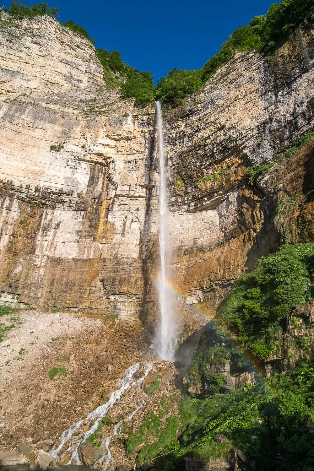
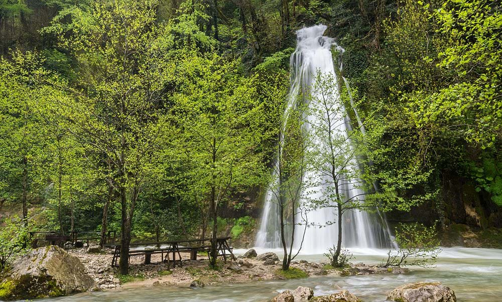
Oniore is an impressive, 70 meters tall waterfall located in the lush forest some 5 km east of the Balda village. Though it might not be the most beautiful waterfall in Georgia, it is definitely in the top 5 and worth the visit.

Kinchkha waterfall

Oniore waterfall
Toba first cave is the source of the river forming the Oniore waterfall, situated only some 70 meters from it. Getting there isn't easy, it's quite a detour since the vicinity of waterfall is very steep - actually, I am not sure if it's worth trying to get there without a guide.
The cave is quite spacey, 70 meters deep and ends with an underground waterfall, this one over 20 meters tall.
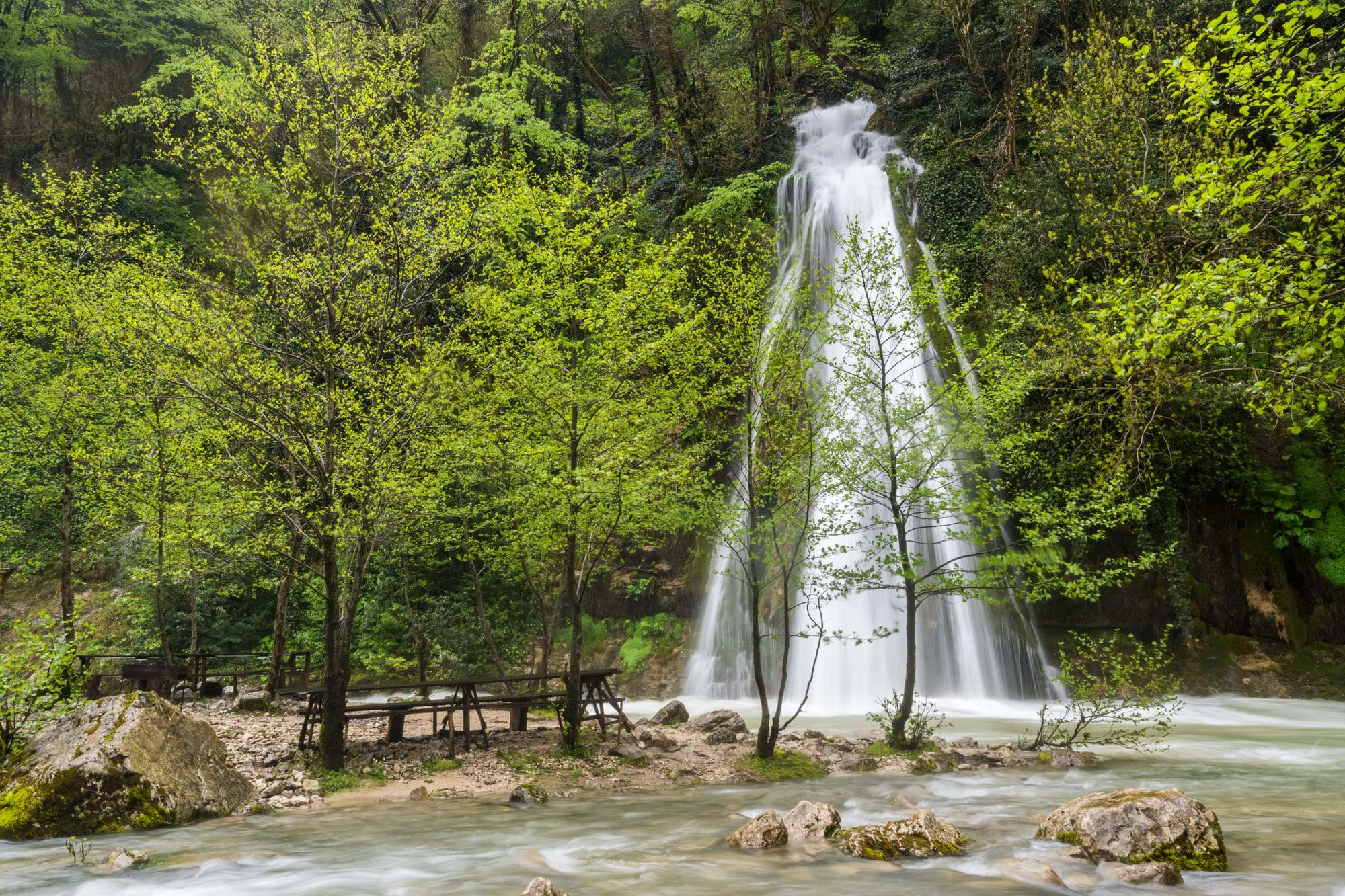
Toba waterfall is situated in close vicinity of Oniore waterfall, just a little south along the hiking trail. It consists of several cascades which sum up to 234 meters, making it the highest waterfall in Georgia. And even without this accumulation, its highest step is quite high and definitely worth a visit.Close by a picknick area and a birdwatching tower can be found.
The river forming the waterfall comes from the Arsen Okrojanashvili Cave (also known as Toba Second Cave), which is even harder to reach than the Toba First Cave. To move around and to explore the four underground lakes you would need an inflatable boat and not many hikers carry those.
Only most interpid explorers reach Jortsku cave, situated some 4 km north from the Balda village. It´s position at several online sources such as mapy.cz is incorrect, the cave lies at 42°30′37.2″N, 42°25′09.3″E. To reach it, you will need to leave the main Balda-Gordi dirt track and follow a path leading south through a meadow, marked occasionally by wooden pointers. Eventually, you will need to descend a forest slope and cross of a small brook.
The cave, home to a small quantity of bats, is not large and can be explored in an hour, exhibiting fascinating formations such as stalactites. However, it should be noted that strong headlamps are a necessity for the exploration of the cave, and waterproofed shoes are highly recommended, due to the existence of several centimeters of standing water in parts of the cave.
A smaller waterfall situated east of Balda village, along the hiking trail to Oniore, which is marked on maps either as Kaghu or as Zhuzhghi waterfall. It's pretty accessible, mere half an hour long walk from the village. Apart from that, it's not that special compared to its larger cousins deeper in the forest.
Motena is a small cave situated in the hillside south of the Balda village. If you cross Abasha river to its southern bank at Pirveli Balda and turn right at the church, towards Martvili, in less than 10 minutes a junction with a rather large, grassy road heading up the hill. It ends by some house pretty soon, but you can continue on a smaller track. But that one turns into a footpath pretty soon - a partially overgrown and a pretty steep footpath. There are some pipes with drinking water for the village which lead you the way. If you see some smaller tracks along the route, always choose the one that goes straight uphill. And if you want to be sure, here is the gpx log to download.
The entrance is partially blocked by wall as the cave was an integral part of a now lost fortress in medieval times. Motena cave is about 80 meters deep and relatively easy to explore by following the water pipes. There is a number of bats, snakes and spiders living in the dark.
| Distance | 65 km |
| Trail type: | AB trip |
| Max. elevation: | 2311m |
| Min. elevation: | 300m |
| Total climb: | 3240m |
| Total descent: | 2560m |
This day, you won='t walk too much but rather will visit several natural sights. The route starts at the main parking lot of the Martvili canyon, which can be visited upfront to the actual hike. In case you are not interested, you can skip the National Park and start right away from the Balda village. Don't be confused, Balda officially consists of four settlements (Pirveli/First, Meore/Second, Mesame/Third, and Meotkhe/Fourth) and many maps indicate this information – Pirveli and Meore are the ones in the north-east and relevant for this hike.
From the Martvili parking lot, follow the main road to the north for about 700 meters, till you come to a dirt track branching off to the right - a shortcut to the Balda village. After some 15 minutes on a nice wide road along the Abasha River, you should reach a marker pointing uphill towards the Motena cave - the first one of two caves you can visit during this trek.
Not much further, you will reach a junction by a church in Pirveli Balda. Turn left and cross the bridge towards Meore Balda. Depending on your available time you can start a small exploration of some of the caves and waterfalls in the Balda – Kaghu - Oniore loop (description further down). In case of the detour and earlier visits to Martvili and Motena it may have turned late by now already. But that’s not a problem as there are several inviting and pleasant guesthouses in the village. No need to push it and then camp by a forest track some few kilometers beyond the village.
In case you skip all the sights and the detour you can combine Day 1 and 2, which makes it some sporty but possible up to 20 kilometers.
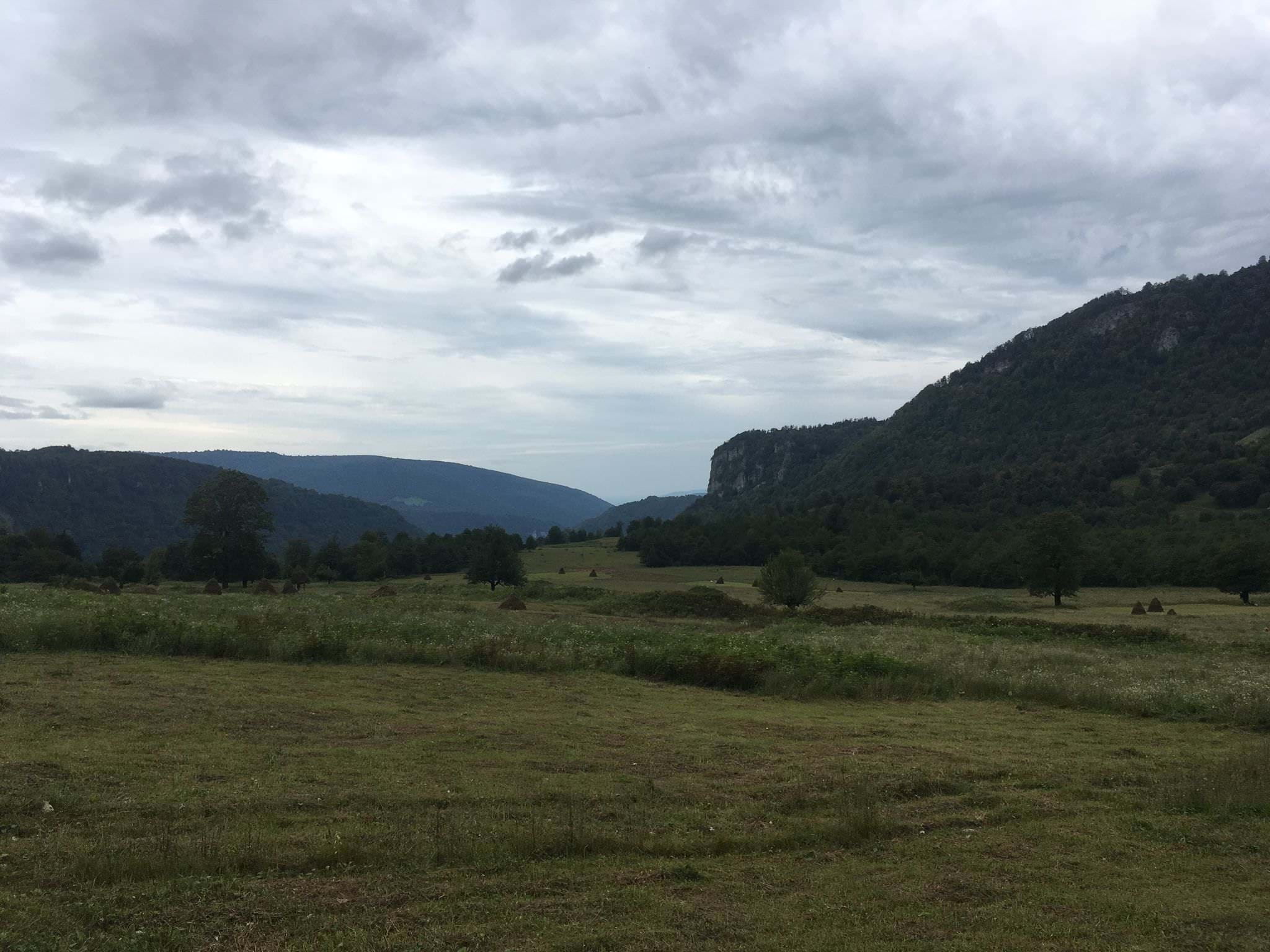
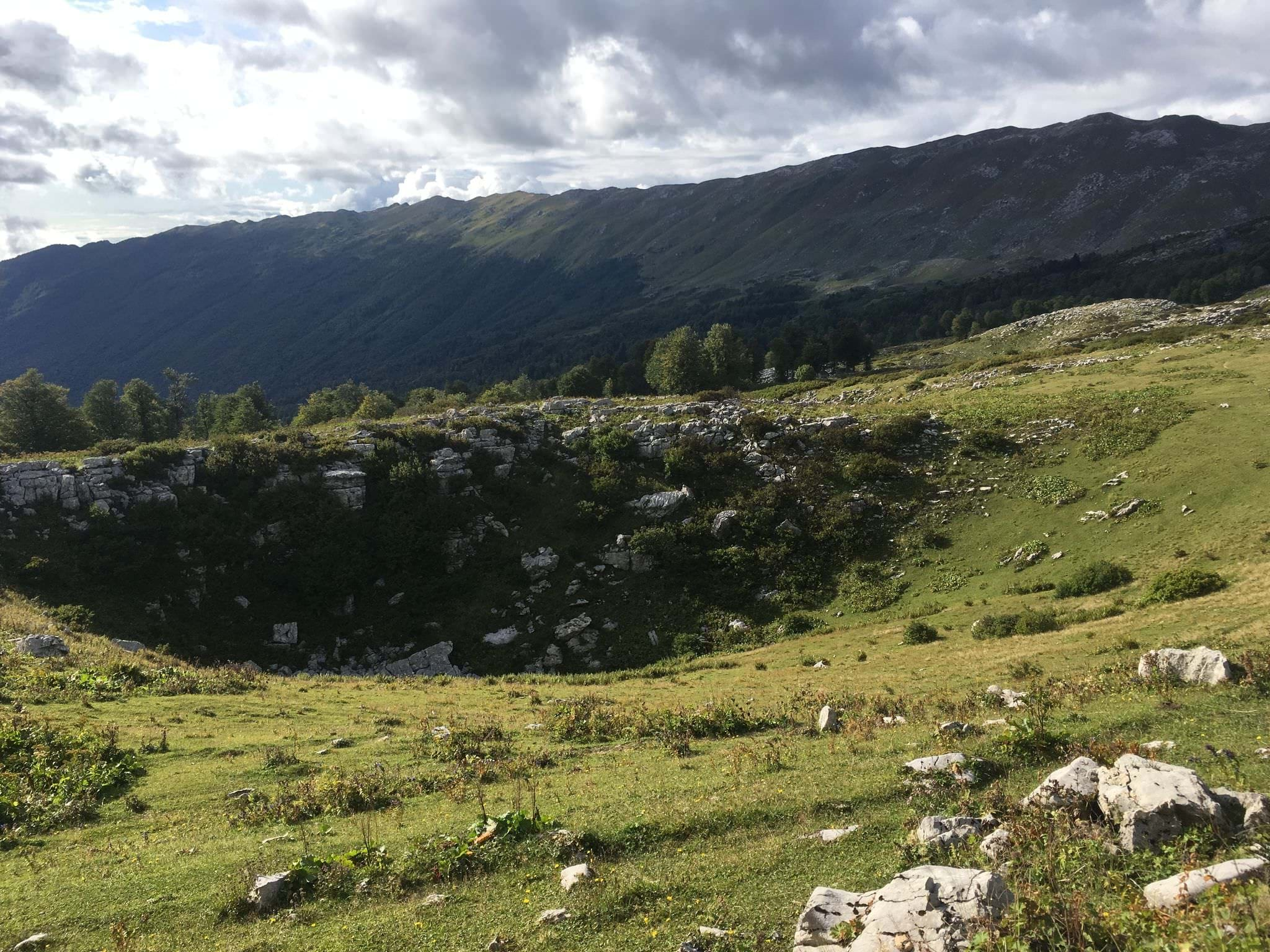
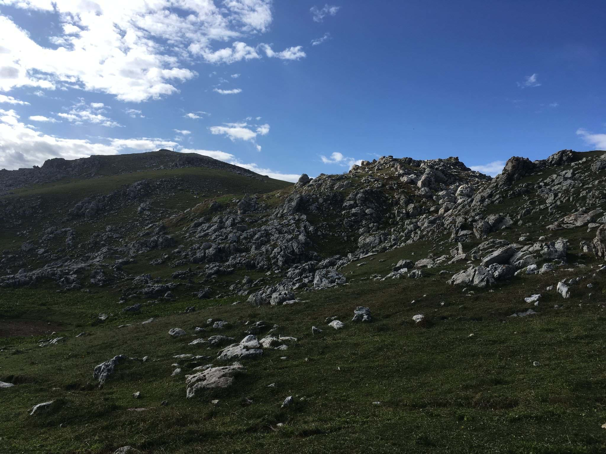
Vicinity of Balda village
Leaving Meore Balda, the path ascends on a ridge to the north and enters an expansive forestry and grazing area. Ensure to follow the GPS as there are many diverging pathes. Four kilometers from the village, the forestry road passes close by the Jortsku Cave, the second cave that can be visited during this trek. Anyhow, it may turn out to be tricky to find it, so don’t spend too much time with looking for the right way.
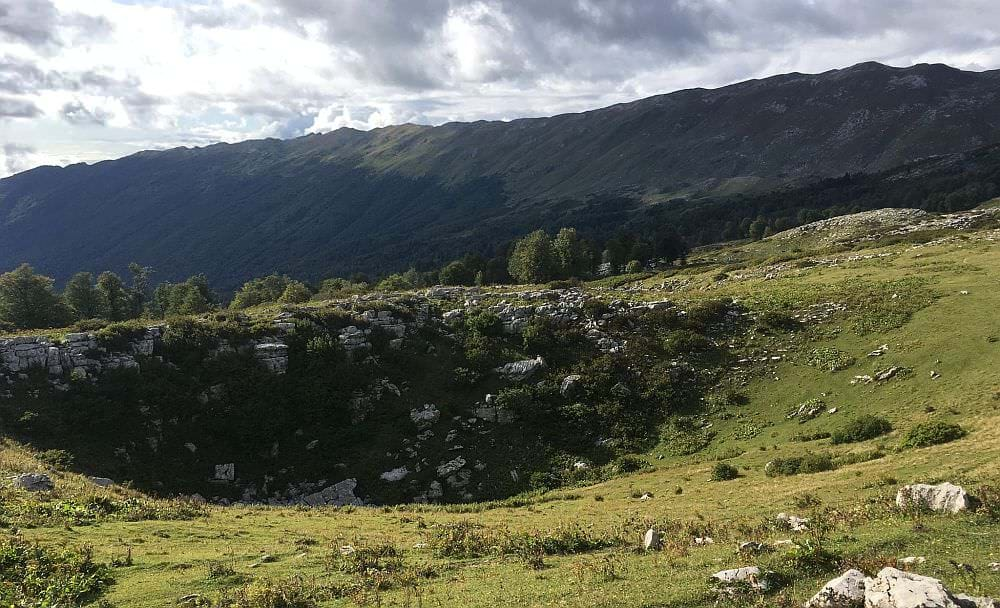
Continue up through the forest where the trail splits soon. Follow the path to the right, eventually crossing the Abasha River at 850 meters. In case of a late start in Balda or a combination of Day 1 and 2, you can use an abandoned close-by cheesemaker's hut or the surrounding grazing land for your night camp. From here it is still another 17 km to the Askhi plateau. Follow the wide dirt road and choose the left path at the crossroads, which will lead you up a small mountain. The trail passes through a pasture area and crosses a small river at around 1.700 meters. Besides the ponds on top of Askhi, this is the last spot to fill up your water reserves before leaving for the massif. So, it might be about time to set up your camp here.
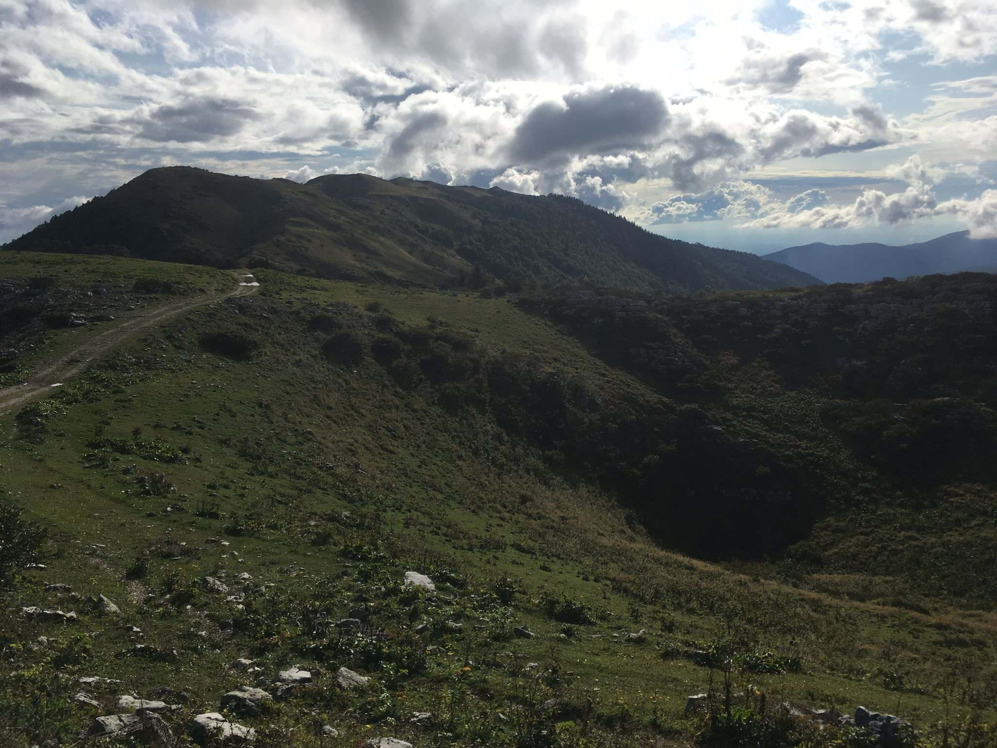
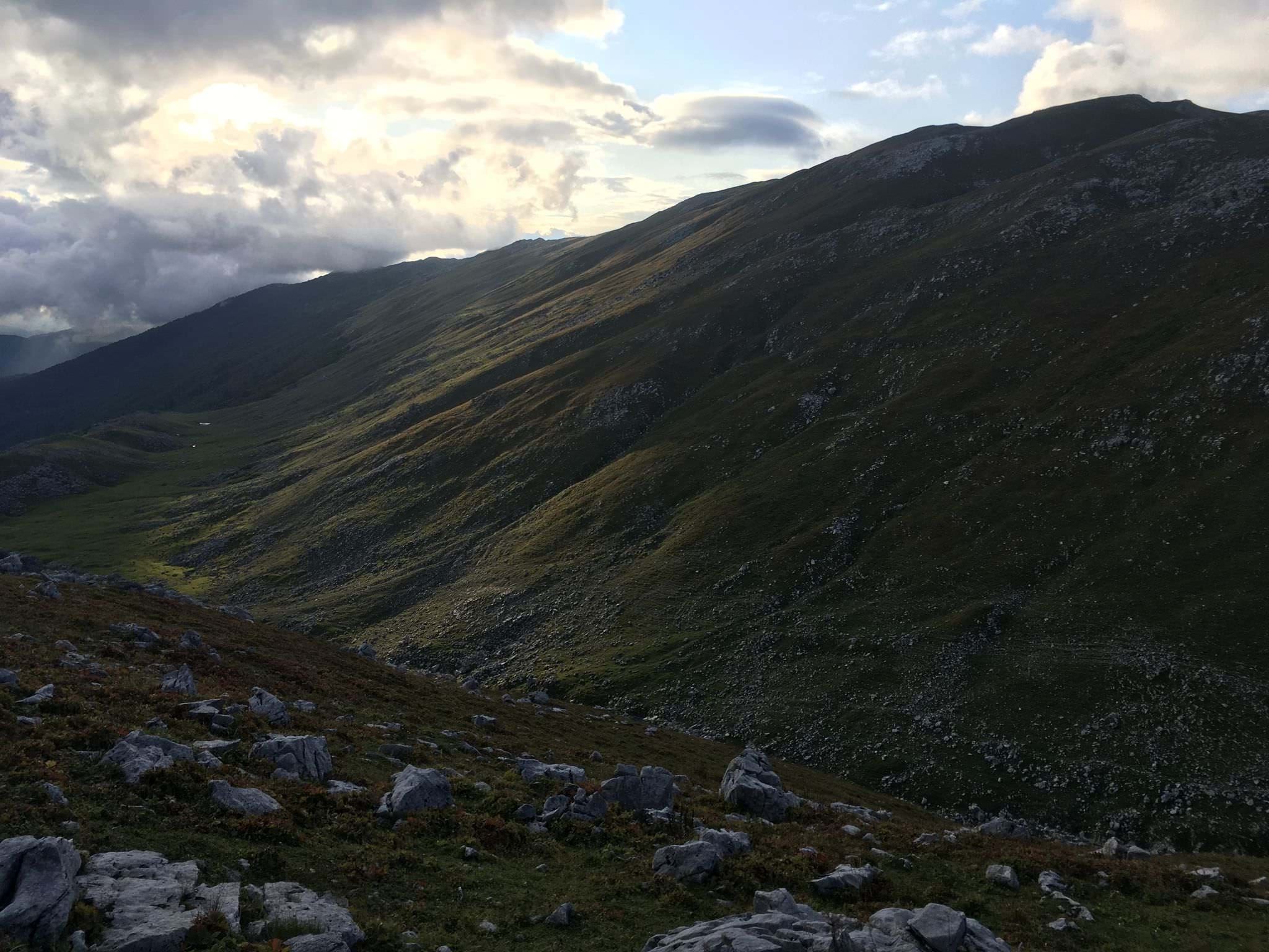
Scenery around the tracks climbing towards the Askhi massif
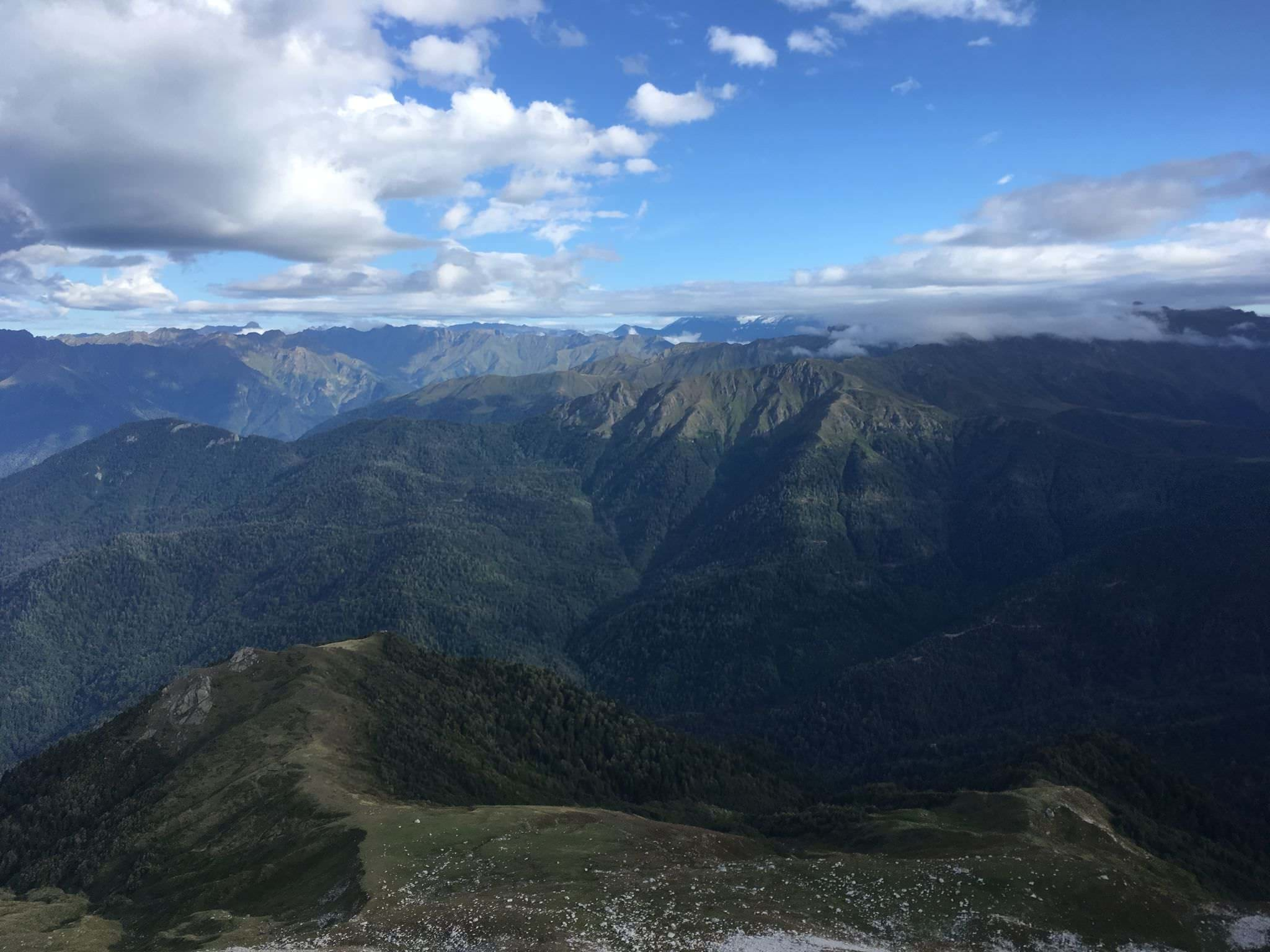
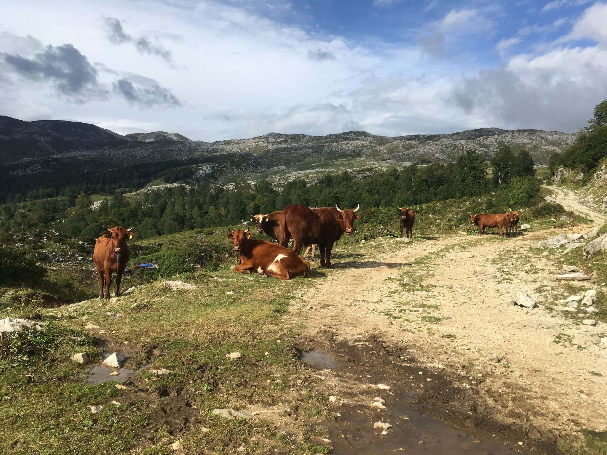
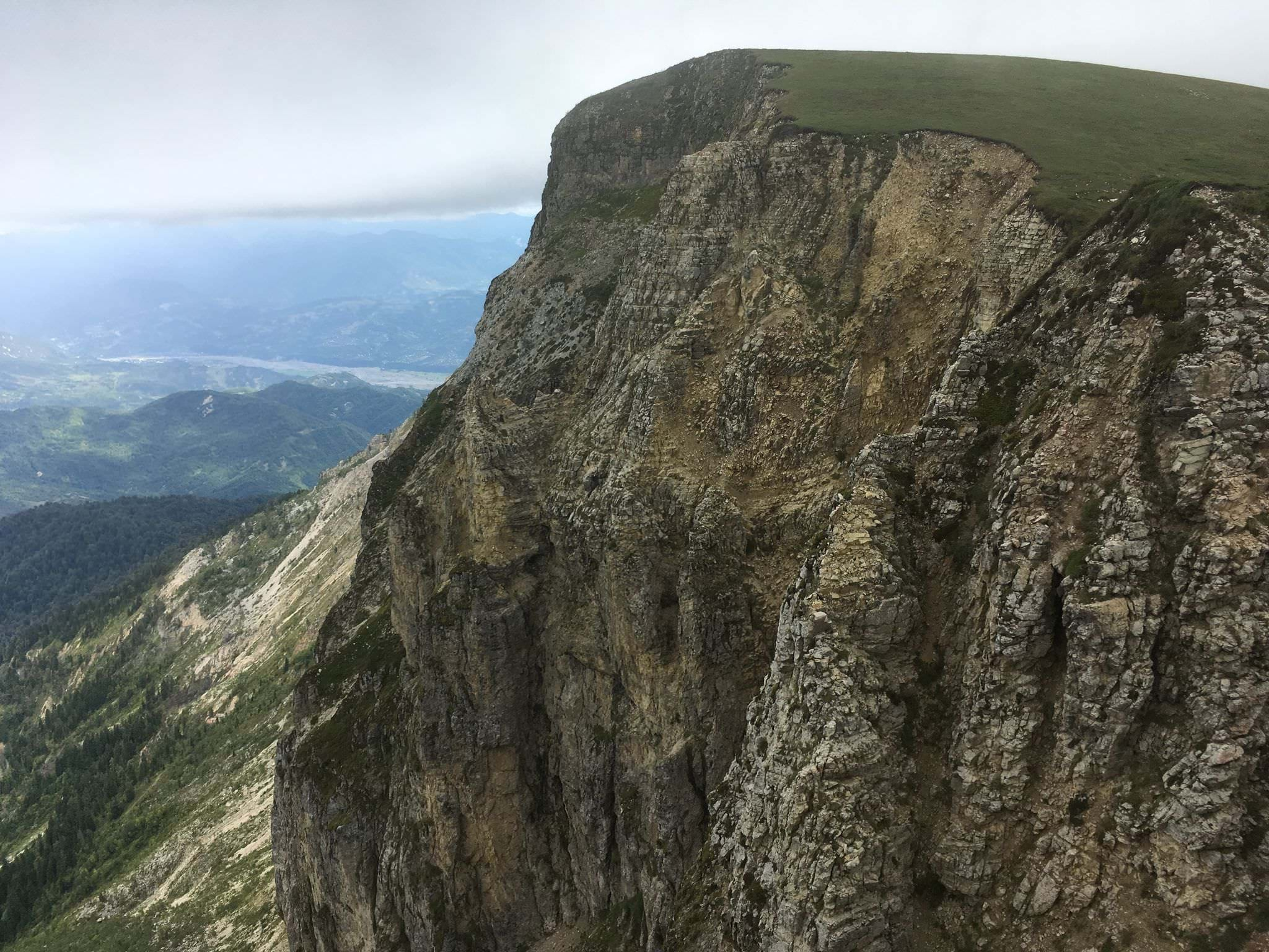
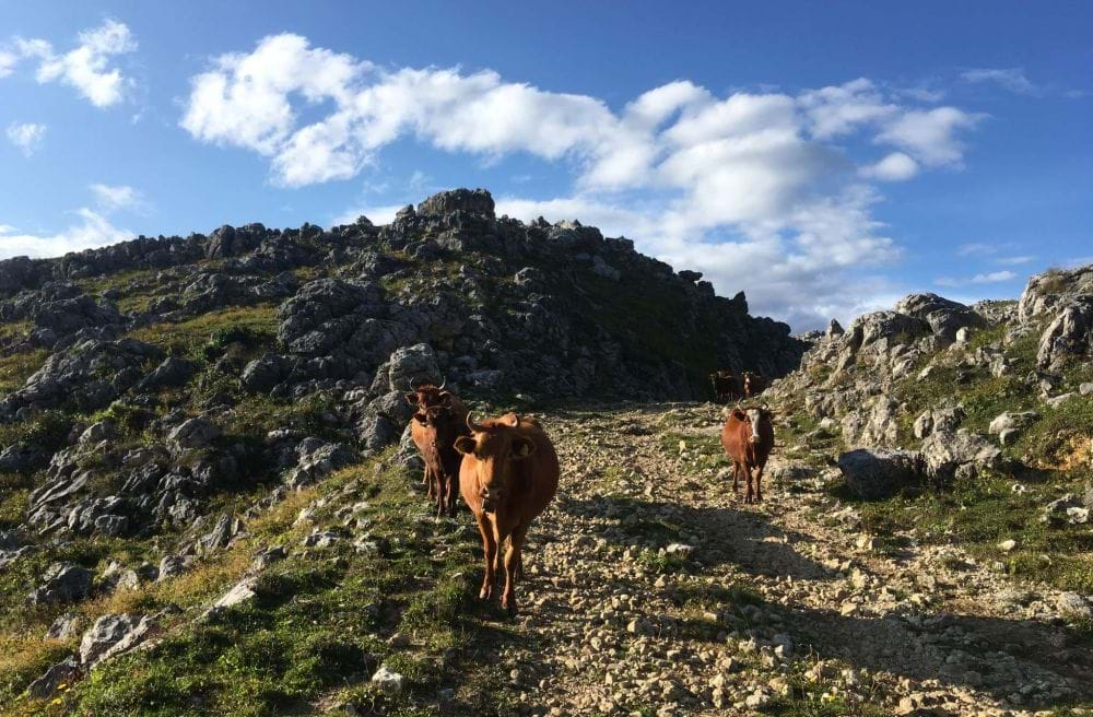
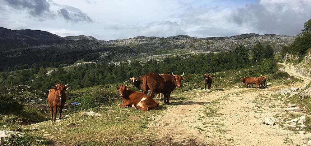
The trail ascends steeply through a final stretch of forest and finally ascends onto a dramatic, rocky ridge at 1800 meters. From here you will enjoy an excellent scenery while trudging up towards the plateau. There are a number of active cheesemakers along the way which can offer hospitality, as well as some abandoned huts whose beds can still be made use of. In contrast to the cliffs of the north and east faces of Ashki, the west and south are guarded by the peaks of Mt. Goderakili (2520m) and Mt. Lekhi (2442m). The path finally passes through a narrow canyon between these peaks at 2100 meters and enters the plateau. Again, you will find several abandoned huts which can provide night shelter.
It is feasible to ascend Mount Goderakili and achieve a phenomenal panorama of the entire Askhi plateau, the Akhalchala Reserve, and the environs of Lebarde. On a clear day, the Black Sea and the Lower Caucasus are clearly visible to the west and south, while the Lechkhumi, Egrisi and Svaneti Range blend together in the north. From the huts on the west side of the plateau it is a climb of 400 meters over steep but non-technical terrain which can be done in a few hours.
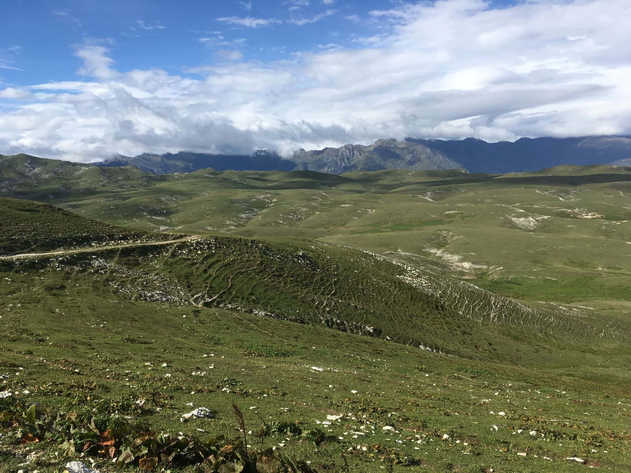
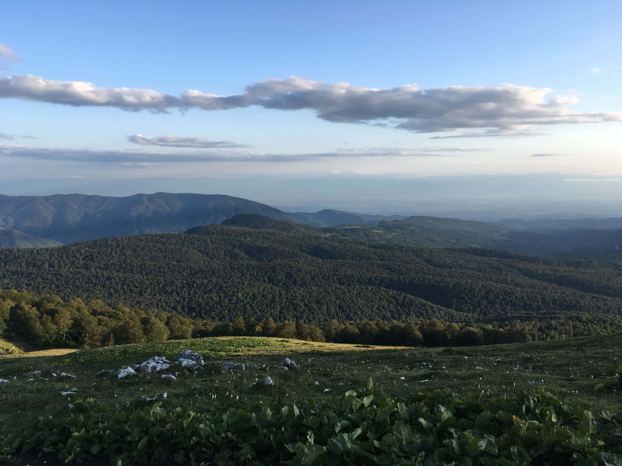
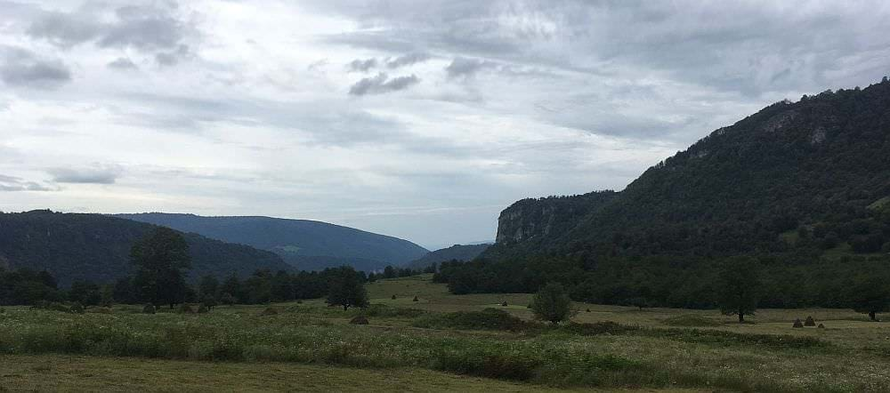
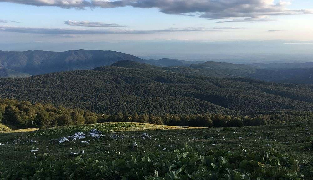
The path continues east through the plateau, which is composed of rolling hills and is full of livestock and cheesemakers. The trail is sometimes not especially evident, but the gentle terrain of the plateau will let you choose your own path with little difficulty. Diversions may also be made to observe the cliffs on the north and east side of the plateau or even to connect with the Askhi massif trek further to the north. Near the east side, the path ascends from the plateau to the ridge of Lekhi mountain, offering a final panorama of the Askhi plateau before it descends in a long and tiresome, though beautiful, series of switchbacks towards Imereti.
At the bottom of these serpentines, you will find the first stream (or the last if ascending from Okatse side) at 1820 meters. Nearby can be found a final array of (abandoned) cheesemaker huts, a good spot to camp and leave the last 18km to Kinchkhi for the next day.
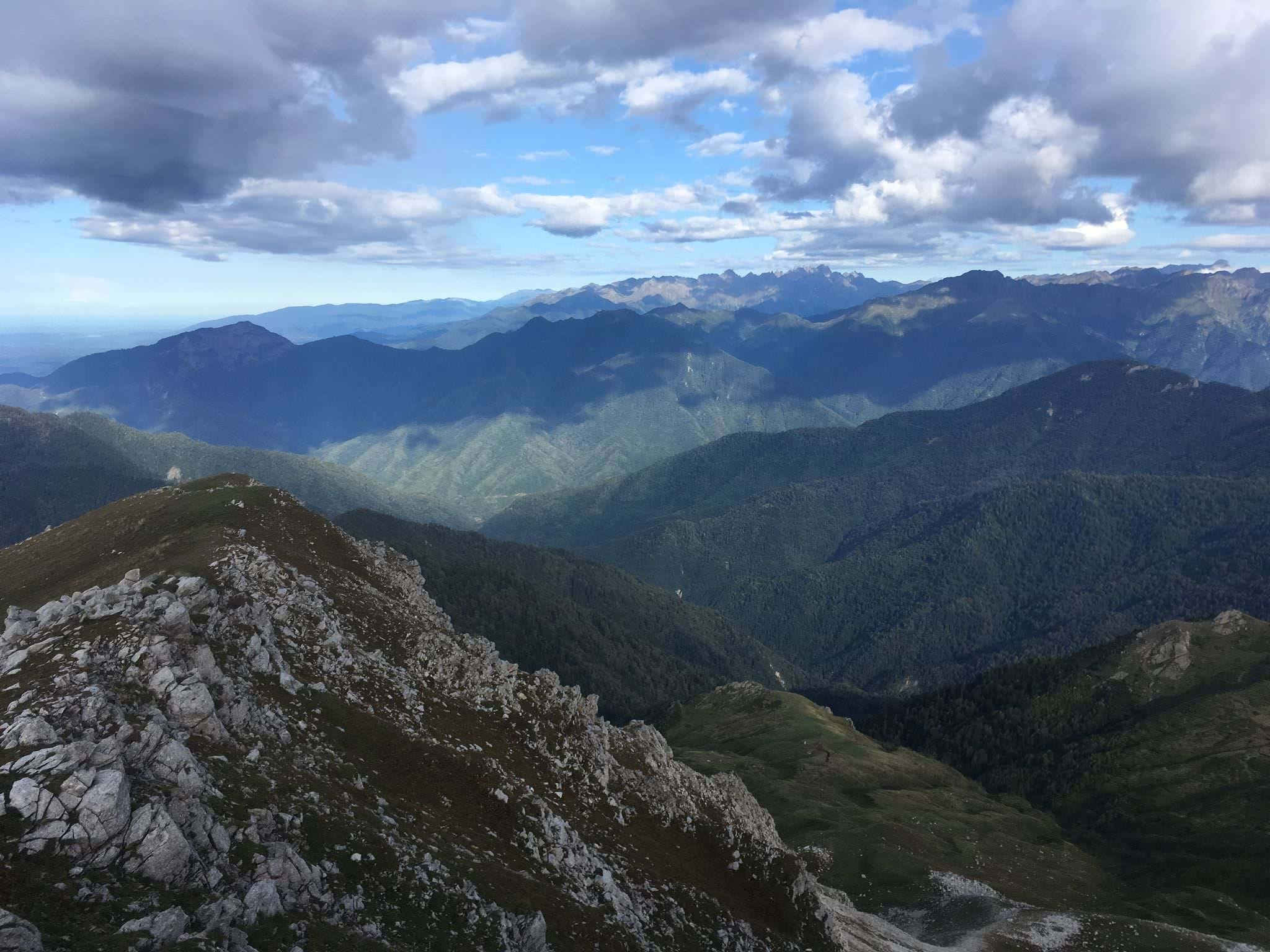
At the Askhi massif, with Lekhi mountain visible to the south
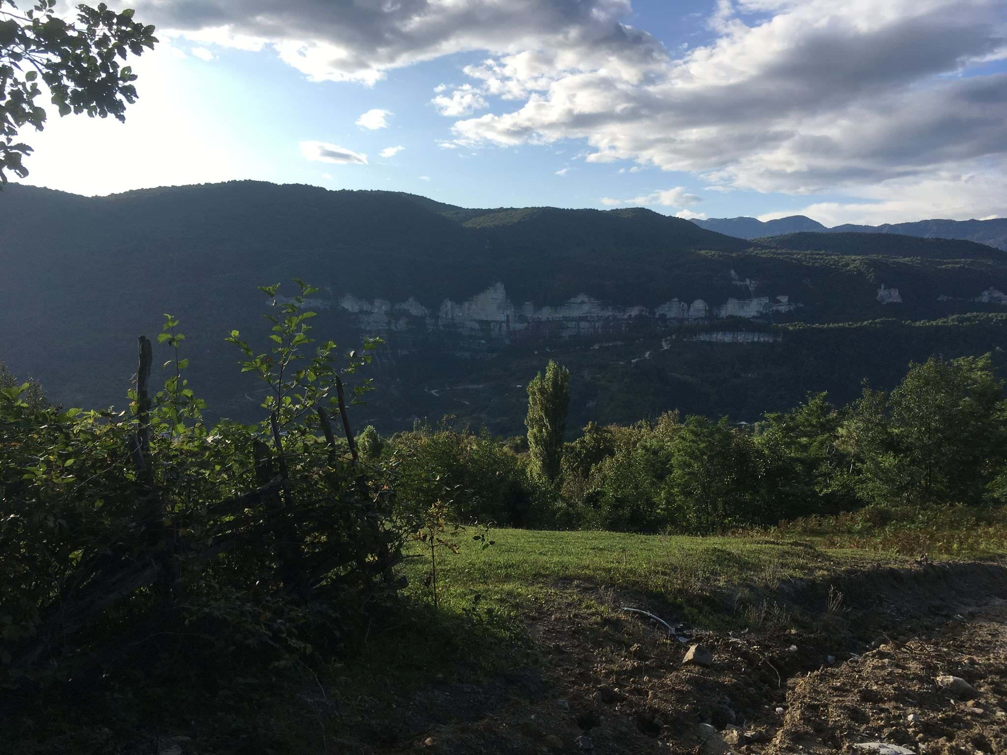
Today, you will enter the woodcutter's territory. The trail descends at first steeply and then more gradually, occasionally becoming annoyingly muddy due to the traffic of logging trucks. At 1300 meters, the trail enters a series of pleasant meadows, which will carry you all the way down to the Kinchkhi village. In Kinchkhi, it's possible to see the impressive Kinchkha waterfalls; although you have to pay for the official entrance to the national park, it's still possible to explore the area around for free. Climb down the road to the river at 42.4926240N, 42.551845E, some 200 meters after the bridge, and clamber up the rocks to a small beach at the bottom of the large waterfall. In the village, there are a number of comfortable, homely, and affordable guesthouses; and some cafes and restaurants also operate in the tourist season.
Views during descent from the Askhi massif
| Distance | 32.5 km |
| Trail type: | AB trip |
| Max. elevation: | 1303m |
| Min. elevation: | 343m |
| Total climb: | 1282m |
| Total descent: | 989m |
The hike starts in Meore Balda and follows all time a forestry road called 'Balda-Gordi' on apps like maps.me or Gaia GPS; additional five kilometers and various natural sights can be added when heading off already at Martvili Canyon. Note, that this trail was walked under winter conditions with snow of up to half a meter; the mentioned times may vary accordingly in warmer seasons of the year.
The unmarked trail, the same like in the northern route, quickly leaves the village and constantly leads up the hill side. The main path is constantly accompanied by smaller ones on the left and right which sometimes turn out to be a shortcut while others lead completely elsewhere. Accordingly, the biggest challenge is to be not too attracted by those but to remain on the main road. On the way up you will have the option for a small side exploration of the Jortsku Cave; therefore, you need to leave the main trail though after about 4km rather downhill in north-eastern direction.
Back on track and after a total of nearly 12 km (without detour) the Abasha River will cross your path. Soon after, (abandoned) huts will be visible and a wide, open space will offer you a variety of camping possibilities. Instead of staying down on the meadow, you can continue for another hour and find a spot close to a more remote single hut
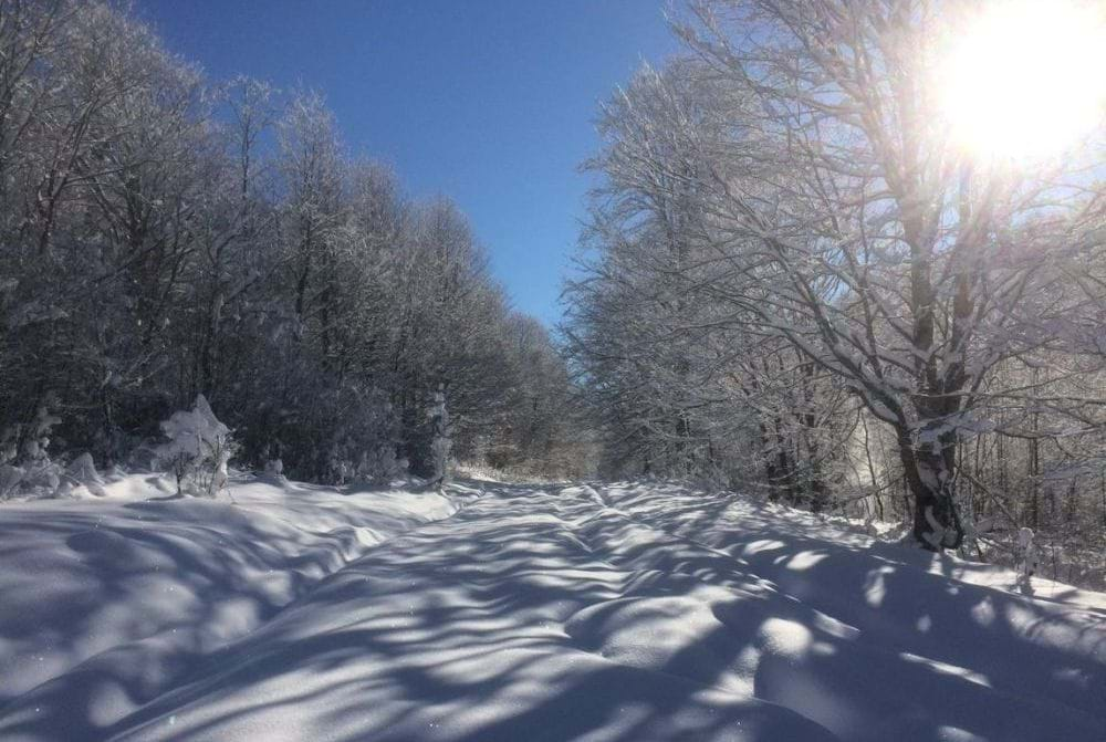
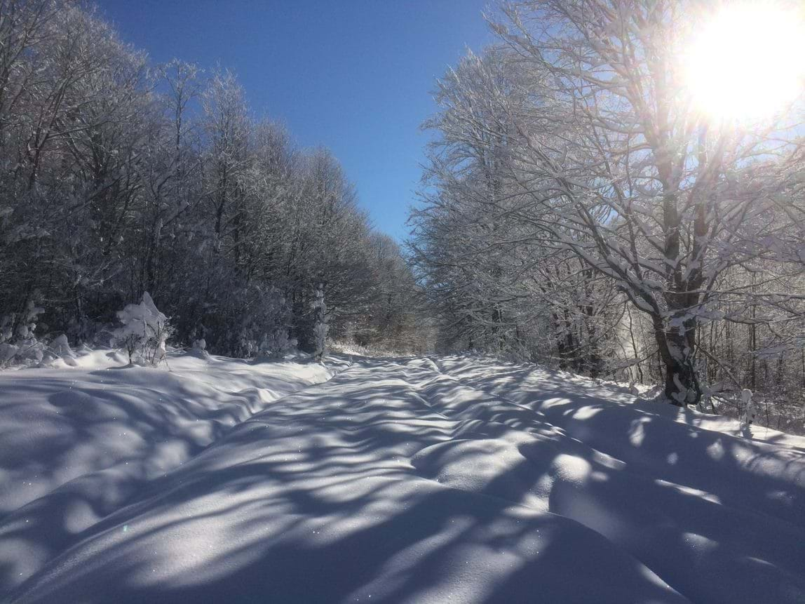
Forestry roads in deep snow
The next nine kilometers will be a slow but steady increase of height from about 1.000 to nearly 1.300 meters, which may take you up to five hours in case of snow. The path itself is straight forward with barely any risk to take the wrong track. On your way you will pass by a rather unobtrusive path leading south to Oniore Waterfall and a more obvious road leading north to the Askhi Plateau (3km; see Northern Route). Here, you are right on the border of Imereti and Samegrelo. Soon after the junction to the plateau you will take a long-stretched curve for about 4,5 kilometers finally heading to the south
From here on you will descend about 400 meters in less than 1,5 hours into a meadow with various huts and even simple houses – in theory also a spot for camping. You will cross a shallow but maybe three- to four-meter-wide river and soon head upwards again. On the next two kilometers you will have to ascend before you will enjoy your view on Zeda Gordi and the wide, hilly Imeretian countryside behind. The remaining path will lead you straight forward into the village and to the entrance of the Okatse Canyon.
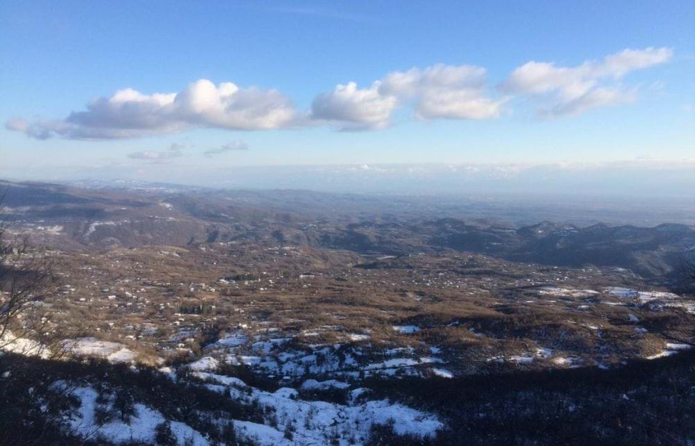
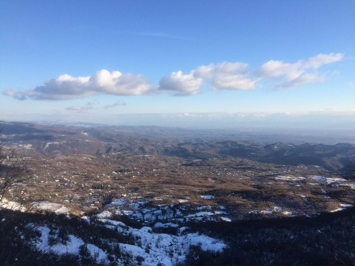
View on Zeda Gordi
| Distance | 20.1 km |
| Trail type: | AB trip |
| Max. elevation: | 993m |
| Min. elevation: | 320m |
| Total climb: | 1660m |
| Total descent: | 1280m |
The shortest of routes connecting Meore Balda with Zeda Gordi village that can be, under ideal circumstances, finished in a single day. Just keep in mind that while there are two official trails to Oniore waterfall, the one following the river valley is very overgrown (or at least it was in April 2021). So, in order to spare yourself from unpleasant suprises, take the route further to the south.
The trail starts at the Monastery of St. Mary’s Assumption in Pirveli Balda. From here, follow the flat village road westwards and leave at a junction in roughly one kilometer distance. From here, the mud road will lead you within the next hour from 300 meters up to approximately 700 meters. Soon after, the track slowly descends again into a small valley. The path itself is wide, marked, and easy-to-follow; anyhow, there are some junctions here and there, so simply check the map at times and look out for respective signs.
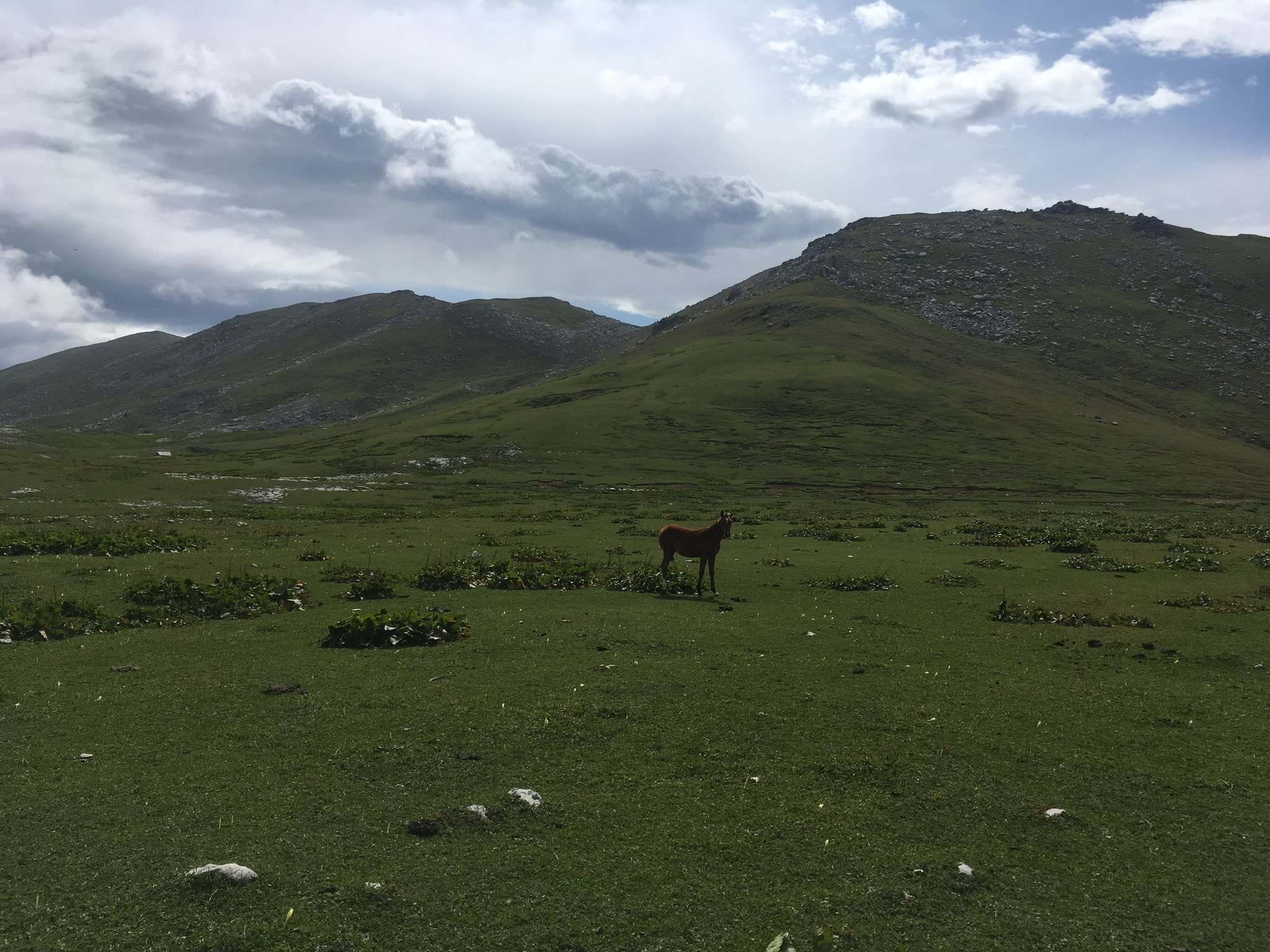
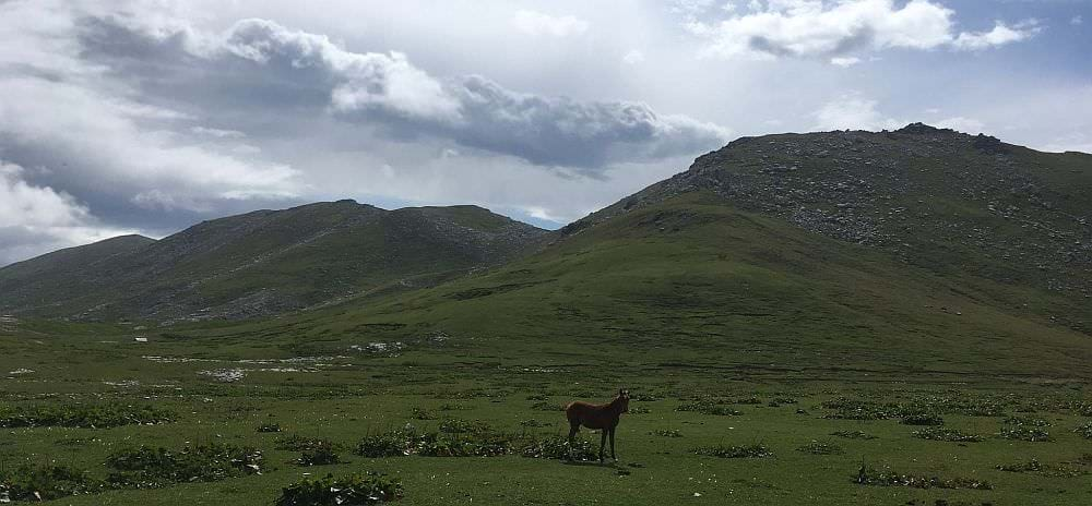
After a total of 1,5 km down, you will reach a small meadow with some free-running horses, soon followed by a basketball hoop (why not playing a round of ball out here!?) and finally Vako's Hut, a small gastronomic facility which offers foods and events in the main season. The area is quite appealing for camping or a small picknick – the hut also has some covered eating area in case of rain. While passing the meadow look up to the opposing rock face where you might be able to identify some caves (one of them the Arsen Okrojanashvili Cave) and smaller waterfalls.
From the hut onwards, the road turns into a small forest trail and leads some more meters down. The vegetation is constantly increasing, and the surrounding environment turns greener and greener. After some minutes you will already hear Toba waterfall; turn right from the main trail and you will soon discover the lower cascades. Feel free to climb a bit around and explore the higher levels as well.
Once you had enough, return to the main trail and cross several smaller wooden 'bridges' (some are not more than two or three tree trunks put together). It’s less than a kilometer from Toba to Oniore. Nevertheless, you need to gain roughly 100 meter in height before you can enter the small valley of the second waterfall. About halfway, on a small mountain ledge, take note of a small trail climbing to the right. We won't take it yet, unless you for some reason want to skip the visit of the waterfall.
Follow the trail towards Oniore and once at the top, go down for a few minutes along the Toba River until you encounter an impressive 70m-high water wall. On the way there, you will locate some bonfire spots and maybe enough space for a tent or two, in case you want to split the hike into two days. Anyhow, be careful with the surrounding trash, including broken glass and metal, of irresponsible visitors.
Once you admired Oniore waterfall, return to the junction you passed earlier and turn southeast - you are basically climbing the ridge separating Toba waterfall from Oniore. Once you gain some 200 altitude meters, the terrain flattens up for a while and the track turns south. Soon, you will reach a small clearing with the ruined hut, the path (or rather a forest track) goes right behind it into the forest.
From here on, you will follow various forest roads carved through the beech forest. There is some red/white tourist marking, but it's very sporadic so better pay attention to your GPS device (you won't find these forest roads on any paper/online map). For the most of the time, roads follow contour lines, without major climbs or drops. First, they head south, then, after few kilometers turn east and keep this direction till they rejoin with the "Central route" before the final descent to Zeda Gordi village.
| Distance | 20 km |
| Trail type: | Roundtrip |
| Max. elevation: | 719m |
| Min. elevation: | 297m |
| Total climb: | 1236m |
| Total descent: | 1236m |
The trail combining Balda Canyon, as well as the Kaghu, Oniore and Toba waterfalls is supposed to be a very appealing roughly 15-kilometer-long loop, which can be done perfectly in one day. As of April 2021, the part between Kaghu and Oniore waterfalls was unfortunately completely overgrown which made even bushwhacking impossible. Hopefully, maintenance has been picked up in the meanwhile again which would allow to avoid a big back-and-forth on the southern path. The given trail parameters and description is based on exactly this back-and-forth.
It is easiest to start the trail at Balda canyon or the Monastery of St. Mary’s Assumption in Pirveli Balda which are just some meters apart from each other. Here, you can easily be dropped-off or park your car, and from here it is possible to walk off in both directions: By heading first to the Kaghu / Zhuzhghi waterfall in the northeast, you can not only see the first waterfall already after some 20 minutes but also check the level and current of the Abasha River, as well as if passable the vegetation on the northern side of the loop. By doing so, you only risk a detour of less than four kilometers; realising the impassability of this part at the very end of your hike might mean additional up to fourteen kilometers as you need to walk all the way back.
Kaghu waterfall
In the best case all is fine, you simply follow the marked trail and will reach Oniore waterfall after some six kilometers along the Toba River and through the forest. You will then just walk the below described route in the opposite direction to make it a roundtrip. We were unfortunately not lucky and had to turn around to the starting point.
From the monastery, follow the flat village road westwards and leave at a junction in roughly one kilometer distance. From here, the mud road will lead you within the next hour from 300 meters up to approximately 700 meters. Soon after, the track slowly descends again into a small valley. The path itself is wide, marked, and easy-to-follow; anyhow, there are some junctions here and there, so simply check the map at times and look out for respective signs.
After a total of 1,5 km down, you will reach a small meadow with some free-running horses, soon followed by a basketball hoop (why not playing a round of ball out here!?) and finally Vako's Hut, a small gastronomic facility which offers foods and events in the main season. The area is quite appealing for camping or a small picknick – the hut also has some covered eating area in case of rain. While passing the meadow look up to the opposing rock face where you might be able to identify some caves (one of them the Arsen Okrojanashvili Cave) and smaller waterfalls.
From the hut onwards, the road turns into a small forest trail and leads some more meters down. The vegetation is constantly increasing, and the surrounding environment turns greener and greener. After some minutes you will already hear Toba waterfall; turn right from the main trail and you will soon discover the lower cascades. Feel free to climb a bit around and explore the higher levels as well.
Once you had enough, return to the main trail and cross several smaller wooden 'bridges' (some are not more than two or three tree trunks put together). It’s less than a kilometer from Toba to Oniore; nevertheless, you need to gain roughly 100 meter in height before you can enter the small valley of the second waterfall. From the top, follow down the path for some minutes along the Toba River and you will encounter an impressive 70m-high water wall. On the way there, you will locate some bonfire spots and maybe enough space for a tent or two – in case you want to split the day or make it a longer trip to Balda, Gordi or Askhi. Anyhow, be careful with the surrounding trash, including broken glass and metal, of irresponsible visitors; staying around Vako’s hut might be the safer option.
After checking out the Oniore waterfall you have the options to cross the small wooden bridge and finish the loop via the Kaghu waterfall at the monastery (about 7km; this was impossible in April 2021), to return on the same way you just came here (about 8km), or to continue your journey towards the Balda-Gordi-road (about 13km + x).
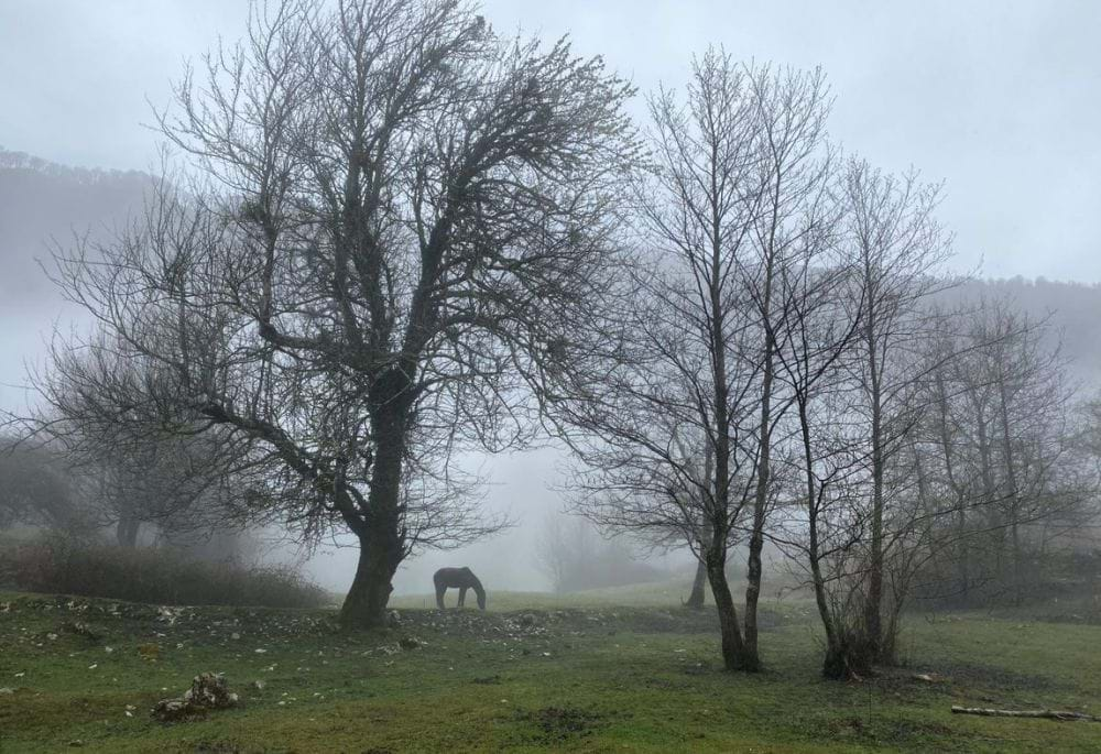
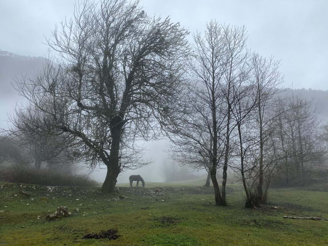
Horse grazing in the fog by Vako's Hut
Trail descriptions were written by Philipp Bienek and Timothy, most photos were also provided by them.