Challenging but rewarding off-season hike when Greater Caucasus is no longer accessible.
Askhi massif is the largest and most complex massif of Georgia. It has a complex morphological look with locked cavities and high ranges, plateaus and canyons.
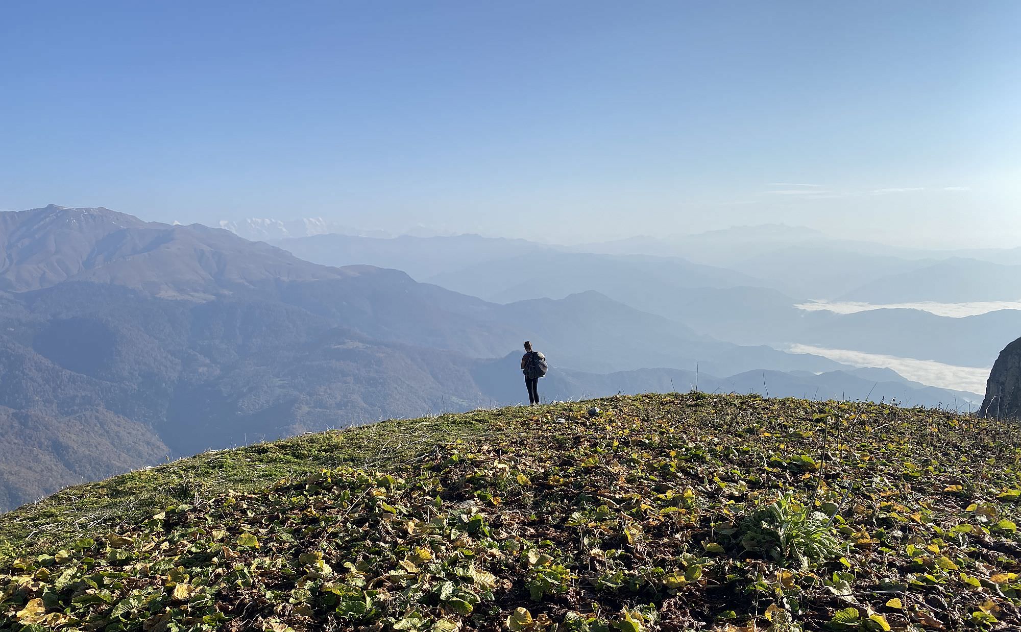
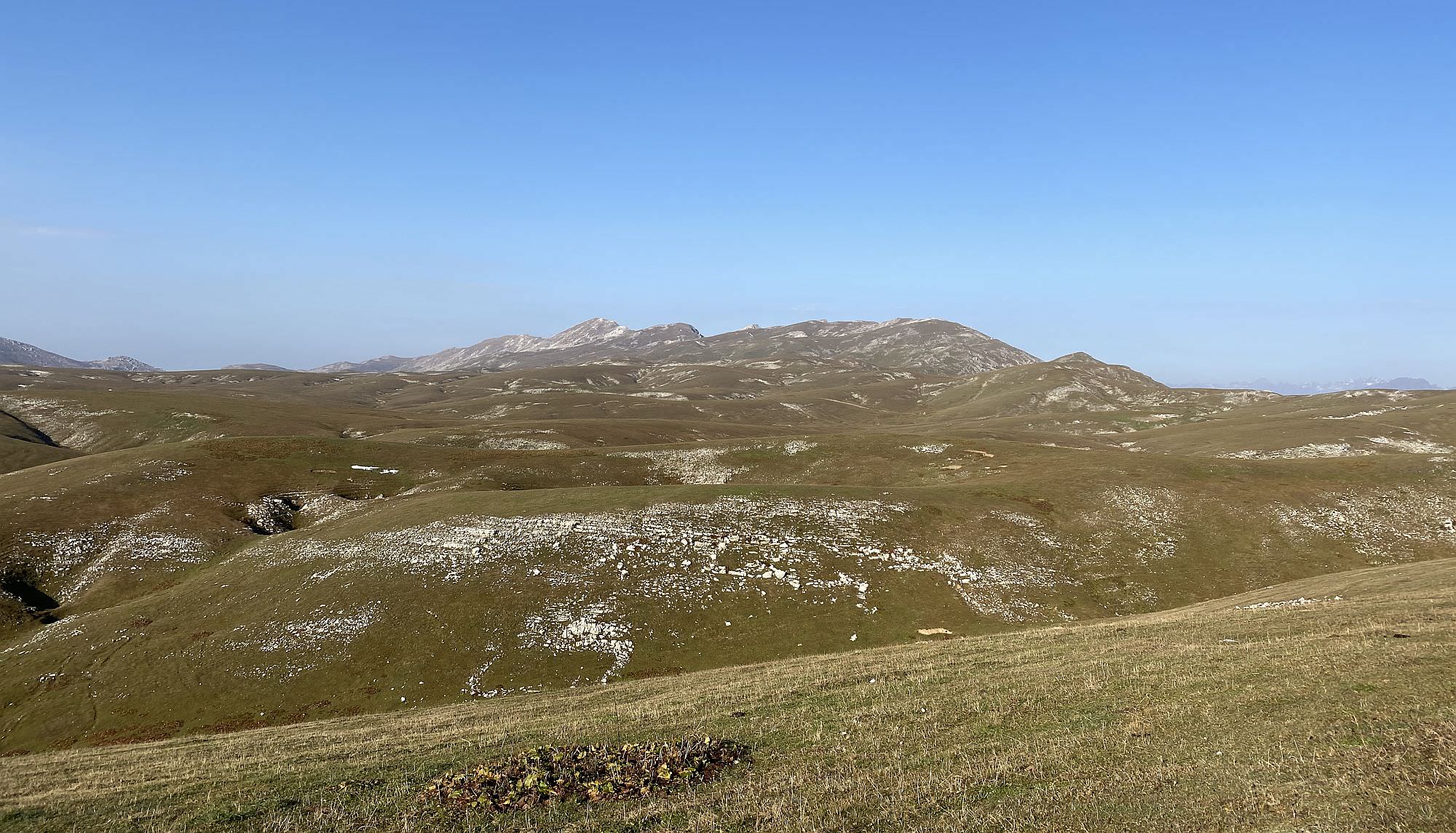
Askhi Massif is an outstanding rock formation (about 2.300m) with breath-taking cliffs, a seemingly endless open range on the plateau, and great views of the surrounding ridges. Due to its challenging ascents on all sides, the area is quite unfrequented which allows an inspiring feeling of freedom and remoteness. Located on the borders of Imereti, Samegrelo, and Lechkhumi, Askhi is moreover a great starting or ending point for longer explorations.
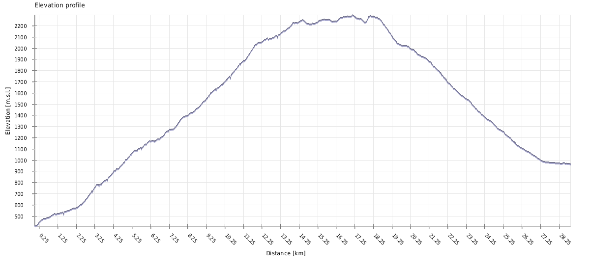
A fit person can easily manage this trek in 1,5 to two days. While day one is rather short in distance (about 11km) but challenging in terms of elevation gain (1.600m), day two is longer in distance (15-20 km depending on where you want to finish) but less demanding. Starting early on day one may even allow you to get further on the Askhi plateau, which can shorten the second day.
In terms of elevation, capturing Askhi means basically the same as hiking from Stepansminda to Gergeti Glacier: you will have to ascend more than 1.600 meters on the first day and descend roughly the same on the second day. The path is mainly easy to follow and often leads to wide-open spaces or proper forest tracks; nevertheless, there is also a short steep and rocky passage along the ridge, as well as some bushwalking which might be unpleasant.
As it is not too high, Askhi Massif is a perfect pick for an off-season hike. In autumn, the way should be sprinkled with berries, mushrooms and/or chestnuts which might also be a nice add-on. Anyhow, due to the clay soil on the Zubi side (which quickly turns into deep mud) and the slippery slopes towards Kulbaki, rainy days and fresh snow should be avoided to stay safe and keep the mood up. In the case of combining Askhi with one of the surrounding alpine routes (especially Lebarde or Akhalchala), the summer season should be considered first.
Both directions are possible. In case you want to do this as a stand-alone hike, going from Zubi to Kulbaki might be easier due to logistics (see “How to get to …” section); you would also have the chance to reward yourself with a visit to the fish restaurant at Green Lake at the end. In case you want to combine this hike with exploring the Akhalchala Reserve or the Lebarde Lakes, for instance, it is completely up to you – by starting in Zubi you will have the chance to get some great views on the reserve and see already where you will head to in the upcoming days.
Water is sporadically available on the Zubi side and in abundance towards Kulbaki; unfortunately, not too much on the Askhi plateau itself. Although the area is quite green, it does not really offer freshwater resources: there are a water basin and a small, disconnected lake with rather clear water close to the two shepherd huts, but in both cases, the water should be at least boiled or, even better, filtered. Although it is close to the water, the camping spot officially marked by the Georgian authorities is rather muddy and probably not the best place to put up a tent. There are nicer camping spots alongside the way, but you might encounter them a bit too early or too late on your journey. In the worst case, the huts should be accessible as well.
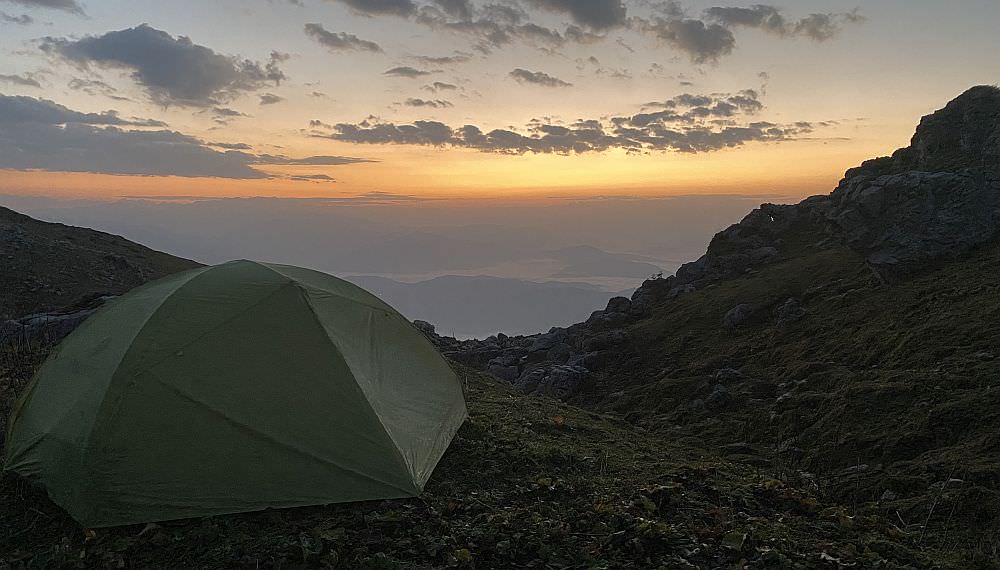
Camping on the Askhi massif
Zubi is a village with two entrances directly at the Kutaisi-Tsageri-Lentekhi road and hence easy to reach; the trail starts at the second entrance which is about a kilometer behind the junction to Mount Khvamli. To get there, you can take a minibus from Kutaisi to Tsageri (6 GEL) at 11:00, 14:00 and 16:00 o’clock, or to Lentekhi (7 GEL) at 9:00, 12:00, 16:00 and 16:30 o’clock – they all depart from the Central Bus Station next to McDonald’s on Chavchavadze Avenue. Based on the chosen provider, a taxi from Kutaisi might cost you around 80 to 100 GEL – Maxim for instance shows about 40 GEL, but remember that the driver also has to get back and hence may drive you only if you agree to pay for both directions.
The recording of this hike ends at the Green Lake, but the original marked trail goes through Kulbaki (3km) until the small village of Chkumi (6km). Nevertheless, as of October 2021, all the way up from the main road to Kulbaki is asphalted already and the last part to the Green Lake will probably follow at some point as well; hence it is not too much fun to walk it these days.
Therefore, your best bet is to get a ride with one of the numerous visitors of the fish farm at the lake. As most people go there for lunch or dinner, it is much easier to hitchhike from the lake down in the afternoon or in the evening instead of getting a lift from the main road in the morning. Most probably you will be dropped off at the bus stop down on the main road from where you should be able to get another ride in one or the other direction.
Eastern end of the Askhi massif
| Distance | 28.9 km |
| Trail type: | AB trip |
| Max. elevation: | 2296m |
| Min. elevation: | 411m |
| Total climb: | 2291m |
| Total descent: | 1746m |
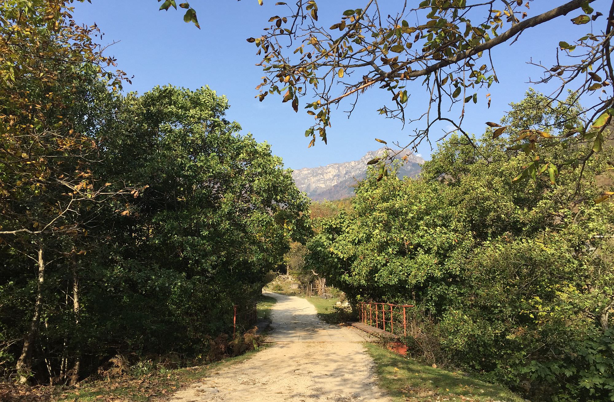
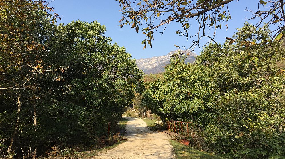
The trail starts down at the Zubi-junction of the main road – here, behind a rock ledge, you can also park your car if necessary. Follow the road for about 600m into the village and then turn right when the asphalt ends. Looking up, you will have already the first nice sight on today’s goal: Askhi Massif.
Askhi massif seen from Zubi village
Continue on the village road for the next two kilometers alongside the Kvereshuli river. A poster promoting horse riding tours to the plateau – actually, a nice offer based on what’s awaiting you –, marks the end of the smooth walk and the start of the steep ascent towards Askhi. Be aware that the path will be more and more of clay soil: it might be dry like dust in some sections and soaked with water like a swamp in others. To be honest, the next four to five kilometers are not too pleasant.
Anyhow, enough self-pity. Follow the zigzagging road and pass by a small, improvised fountain; this will be the last reliable water source until the camping spot, so ensure you are sufficiently supplied. Some quite steep hundred meters later, you will again have a smoothly ascending and simple-to-follow mud road with chestnut trees all around. After a total of 3,5 hours and the first 800 meters of altitude, you will reach a fenced field, directly followed by a small meadow. Here you can catch a quick look on the rectangular-shaped Mount Khvamli (2.002m) in your back, before you enter the forest again on the left-hand side – the old path goes on the right, but both will meet again in about 500 metres at a yellow marker. Here, follow the indication to the left, while the big mud road continues straight.
The next few meters after the marker are of high importance in order to find the correct path because the more tempting way is actually the wrong one. Remember, you should gain elevation. Don’t pass by the isolated big white beech tree on your right side but stop before and look for a small barely visible trail through some bushes and small trees on the left. You should be able to find the next red-and-white mark on a tree in maybe ten meter distance. From here onwards, the atmosphere of the hike changes drastically for the better: the surrounding is more appealing, the narrow trail more inviting, the ascent easier, and at times you can already sneak through the trees and get a nice view of the nearby mountains.
Although there are still 850 meters more to climb, you will feel it less due to a smoother and more consistent increase of elevation. Continue your hike through the mixed deciduous and conifer forest for another three kilometers. You will pass by a bigger meadow marked as "Askhi Ridge" and a smaller nameless one – both are suitable for camping if needed. Soon after, you will reach the tree line where you can enjoy your first proper panorama including the cliffs in front of you, the opposing Akhalchala Reserve and the valley down to your feet. Follow the well-trodden trail up for the last meters. When on top, don’t forget to turn around and to catch a perfect view of today’s ascent and nearby Mt. Khvamli.
Mt. Khvamli seen behind
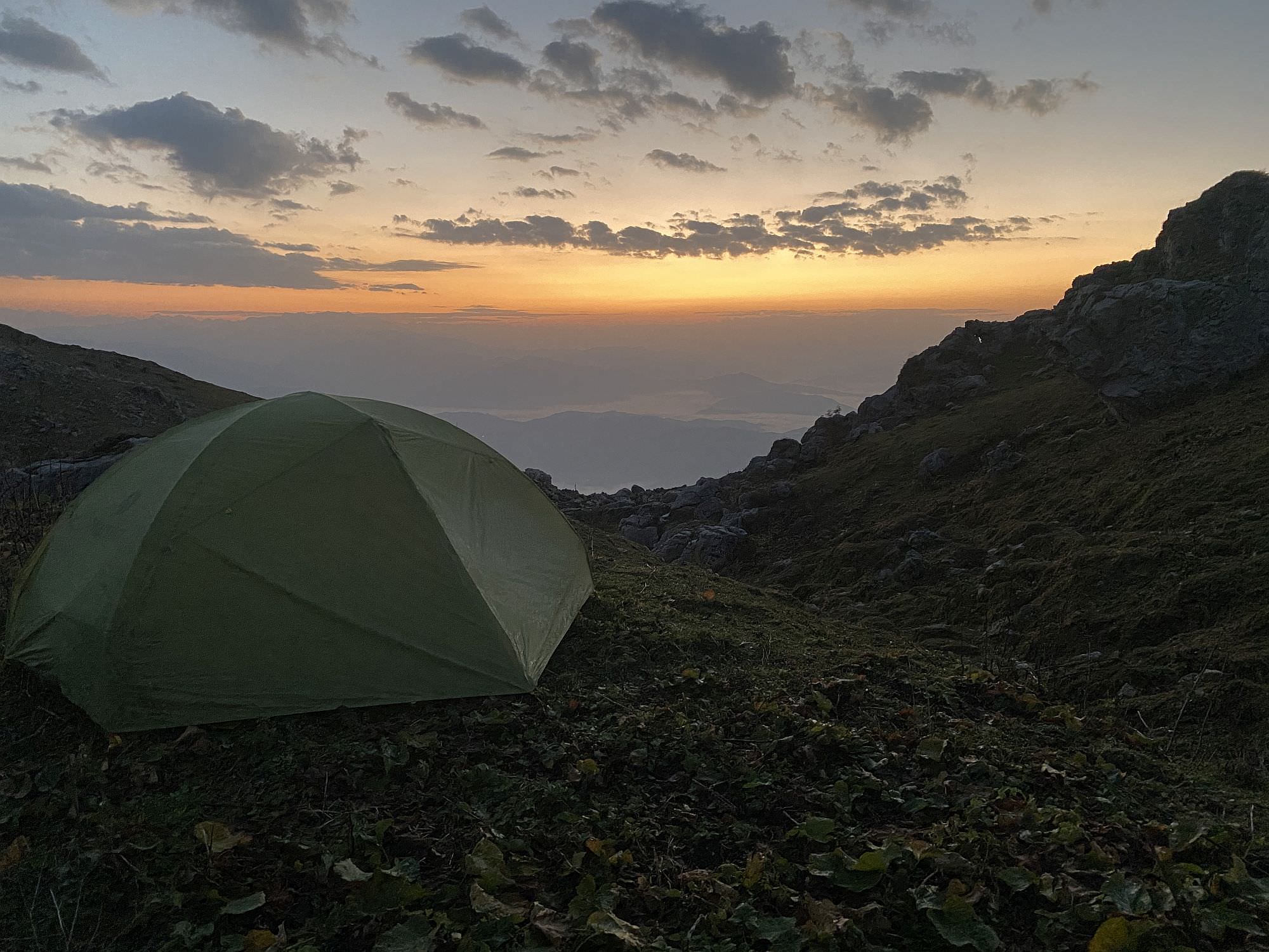
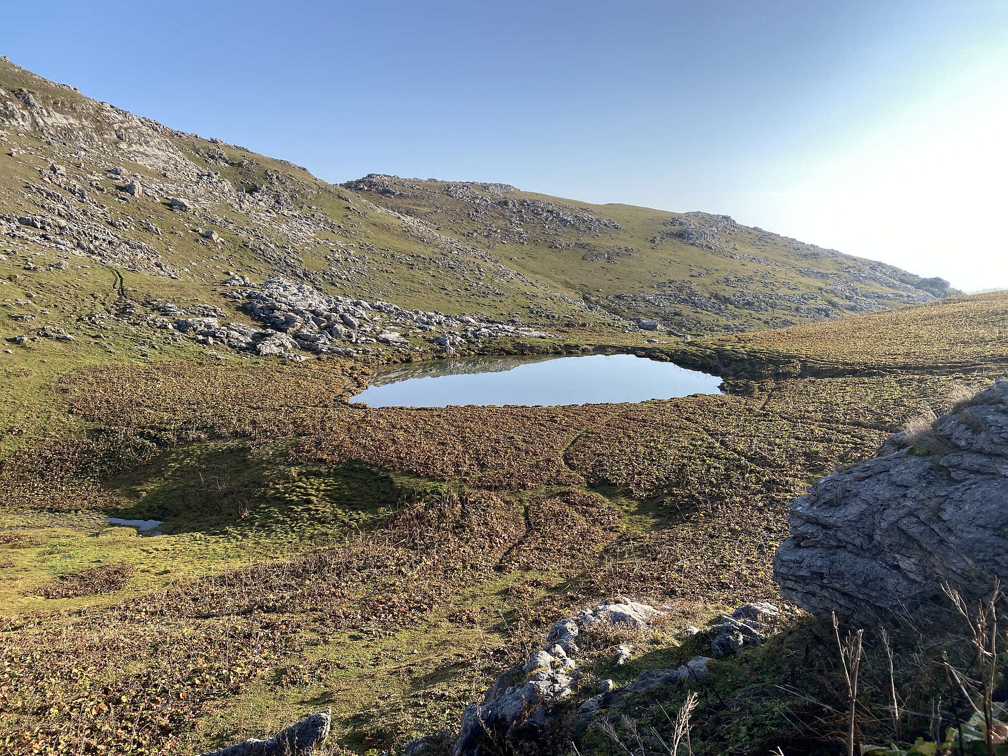
Another ten minutes later you will already reach the two shepherd huts. Although it is officially marked for camping, the area around the first hut is not too appealing for putting up a tent. If you still have some energy left, you can check for a spot closer to the second hut or explore the surrounding hills for a nicer alternative. In case you have at least another hour of sunlight, you can also head for the Askhi Plateau already (see description for Day 2), where you’ll find for sure something nicer with a great panorama. Whatever you do, ensure that you fill up your water (at the basin at hut one or at the small lake next to hut two), as there will be no other source for the first half of the second day.
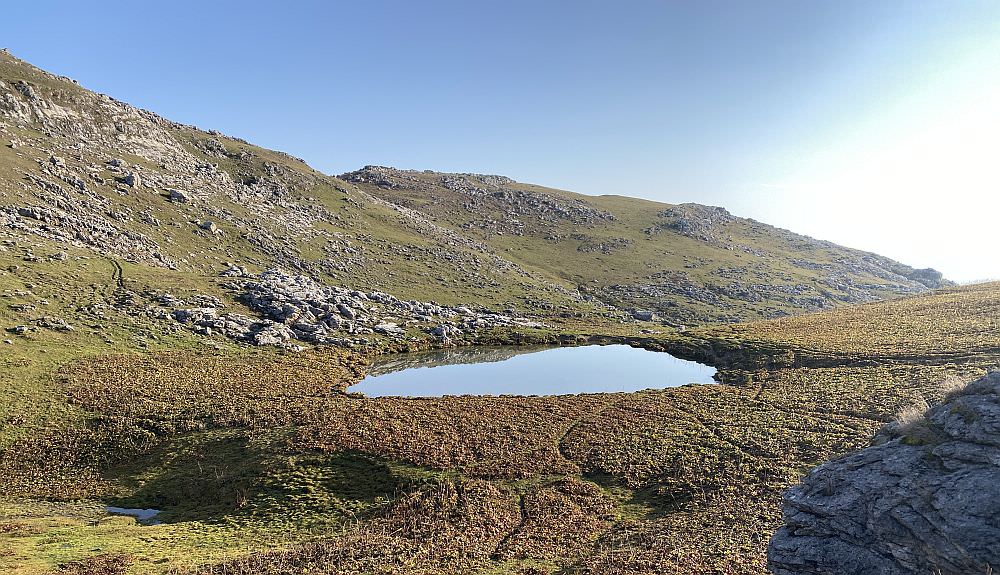
Tiny lake by the second shepherd's hut
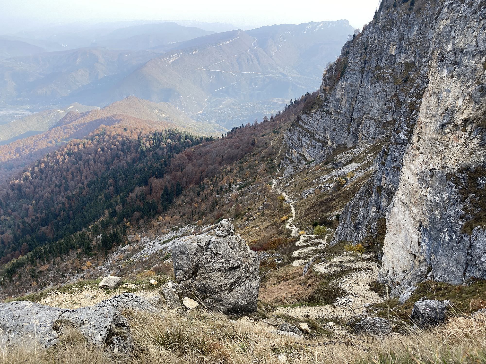
Even though it is still early, you have to pay high attention already in the morning to make the most out of your day and get the best possible views. Start from the campsite and walk to the small lake behind the second hut. The marked trail goes rather straight and leads you to a path that is marked as “Askhi Plateau Tour” in various apps. Going there is not wrong but robs you of a great scenic hike along the cliffs – the actual highlight of this entire trail. So, instead of following the marks, turn right behind the lake and climb up the ridge.
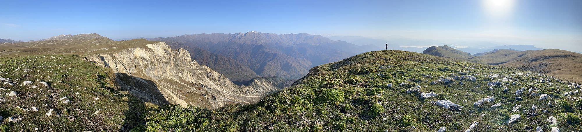
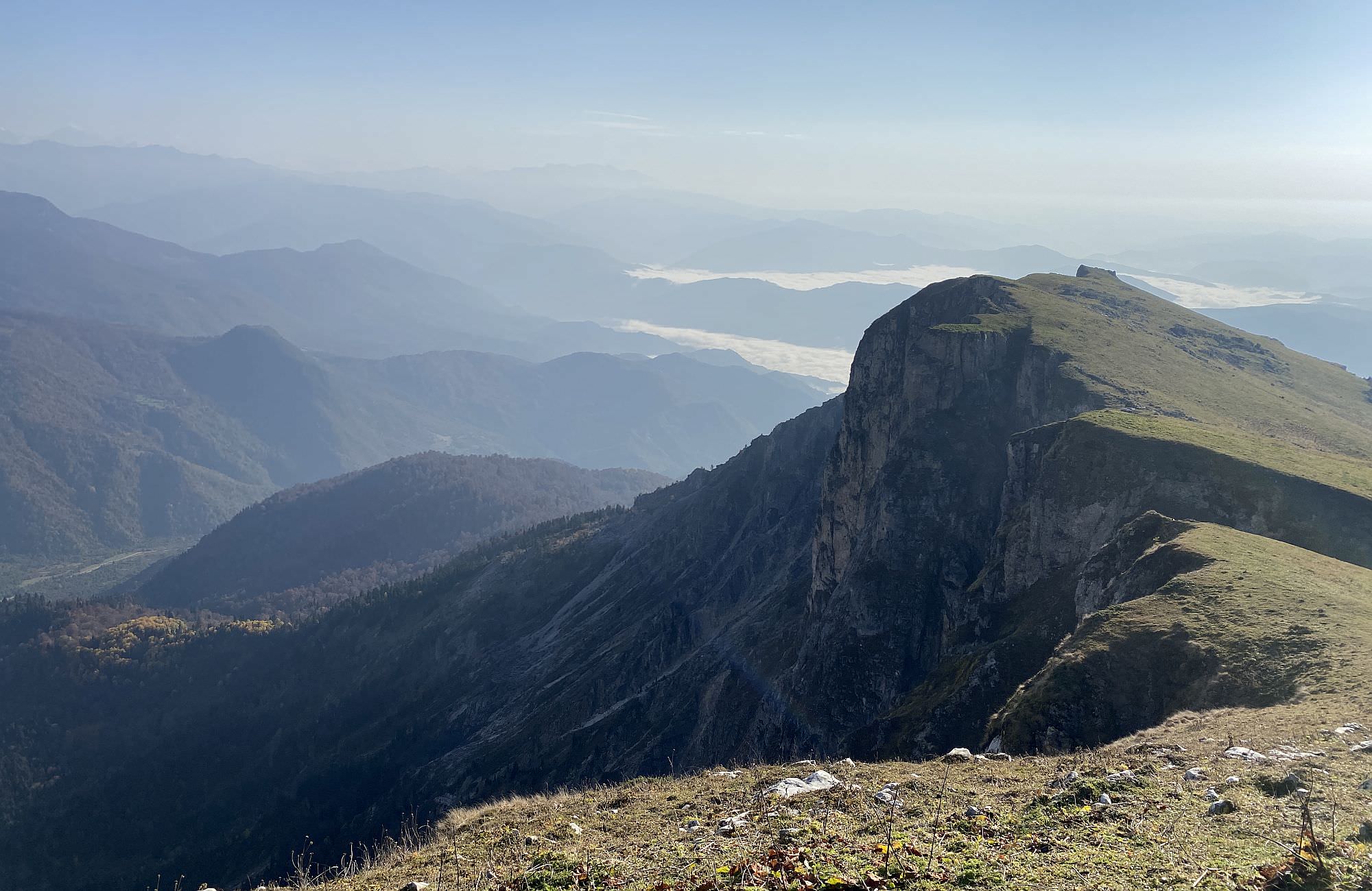
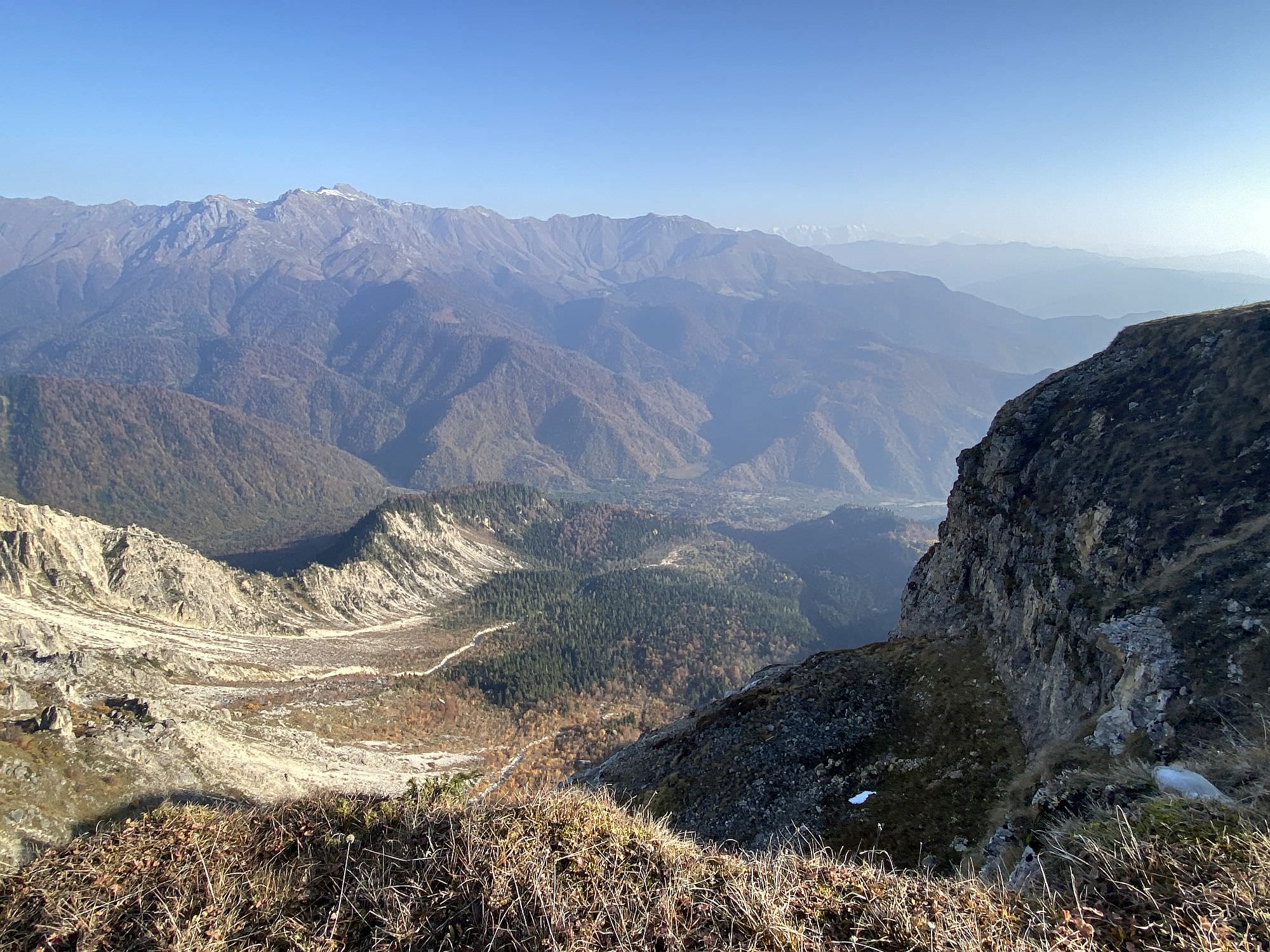
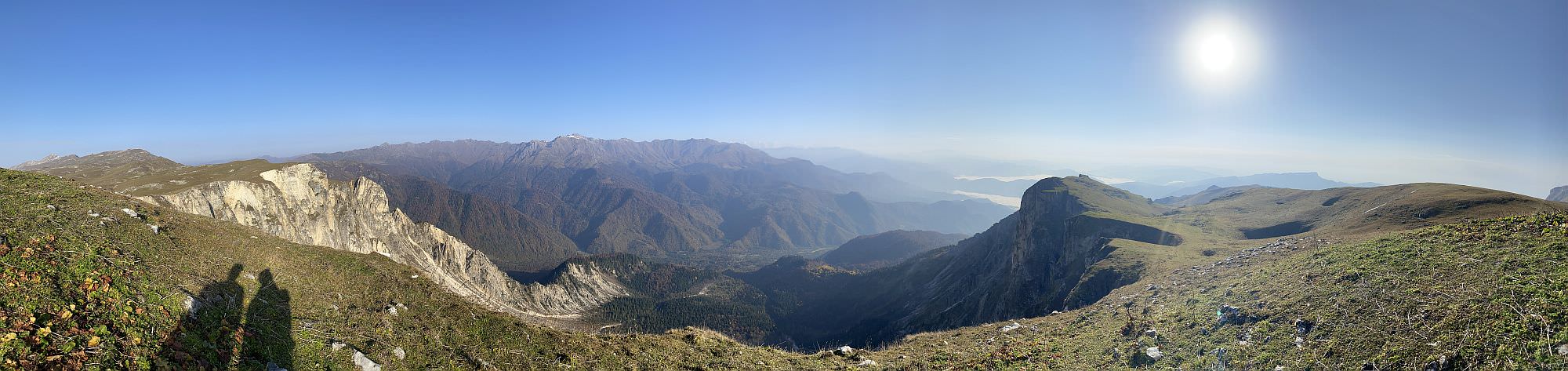
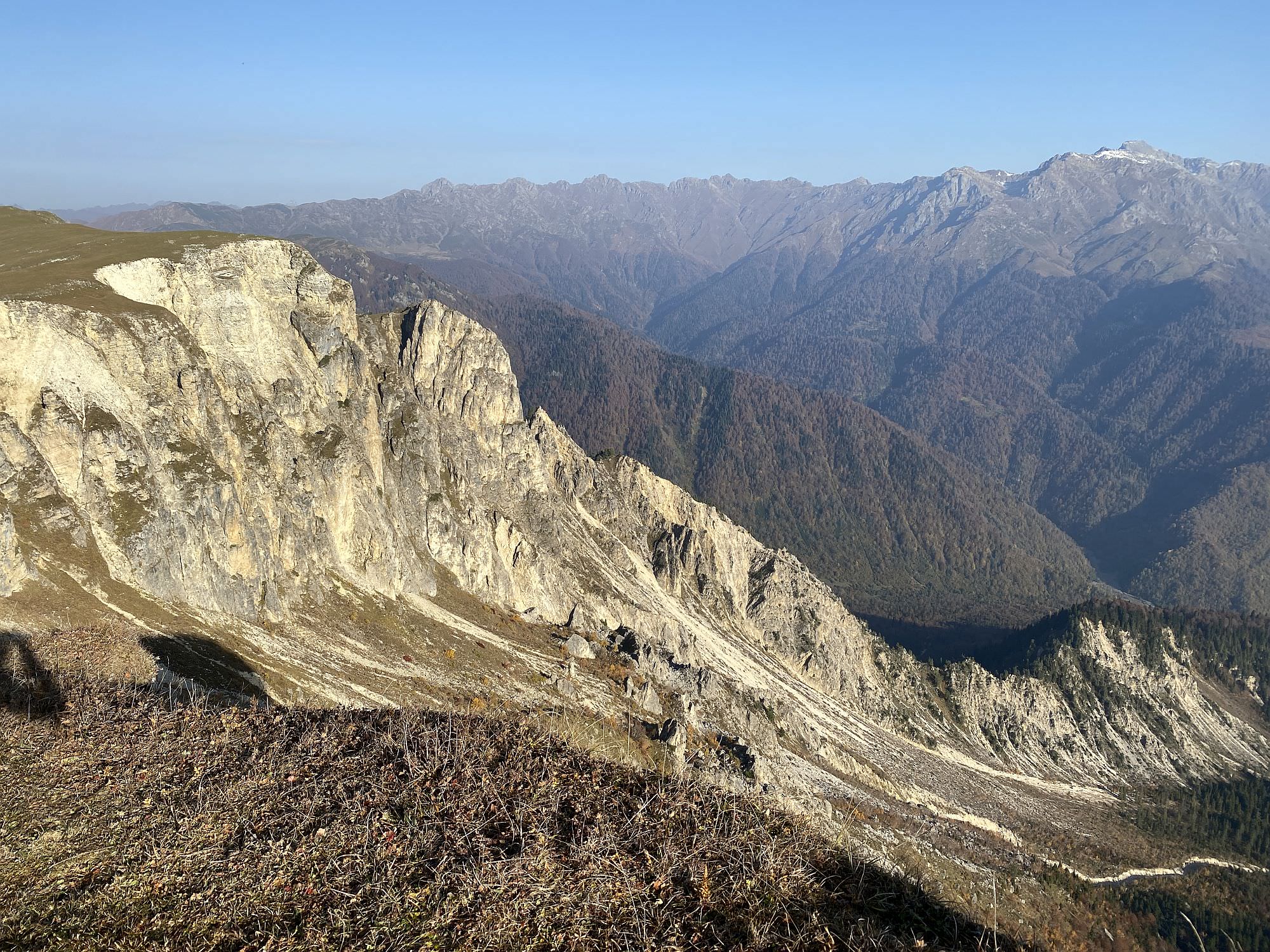
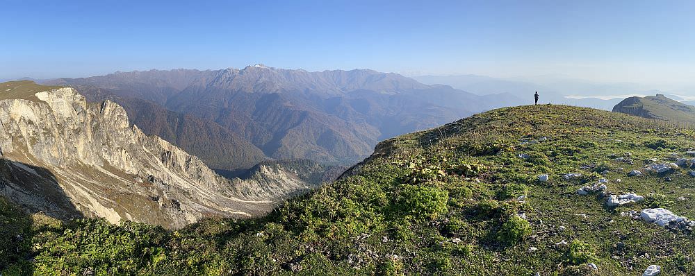
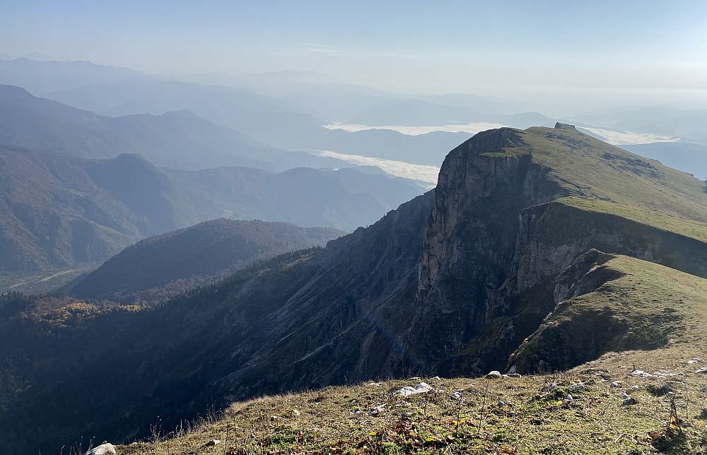
Though off-track, there is not really a chance to get lost: walk until the edge in the wide-open space and then follow it until you re-join the official path at a yellow marker labeled “Askhi Mountain” (2.208m) – also a nice spot for camping. The entire surrounding resembles somehow the Seven Sisters in Brighton or the White Cliffs of Dover (both in England), simply without sea and way higher; therefore, always bear in mind that it goes some 300 to 400 meters straight down next to you. From the edge, you can also identify the opposing Akhalchala Reserve, as well as the Green Lake (today’s destination) and behind it the drained Babushkino Lake (“Grandmother Lake”).
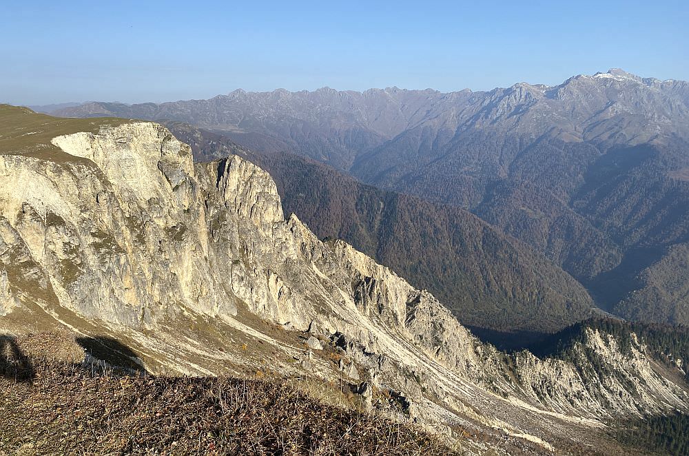
Impressive cliffs lining the northern edge of the Askhi massif
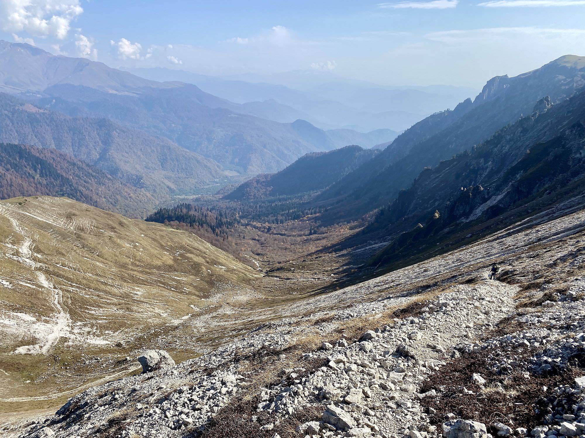
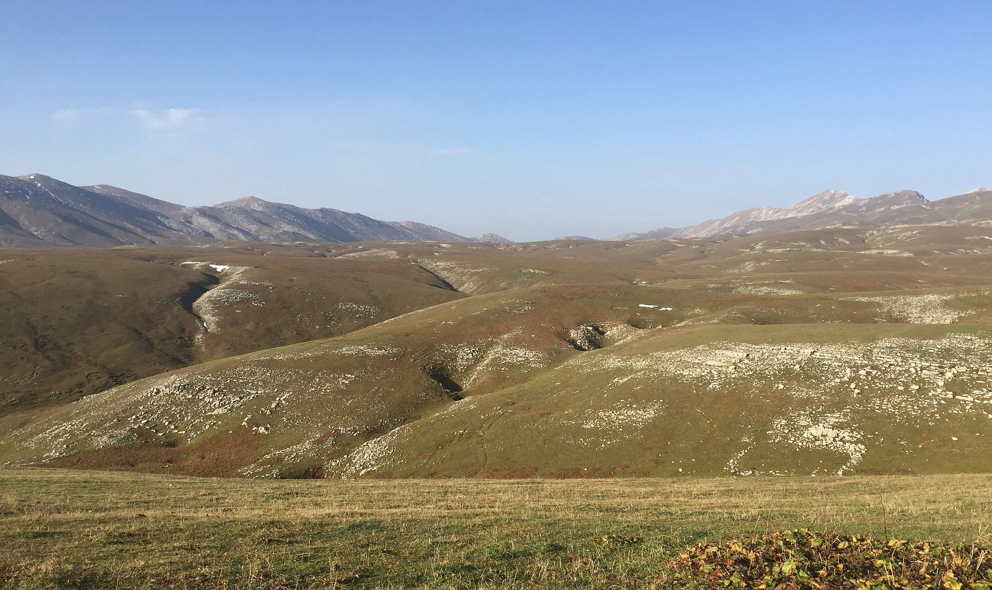
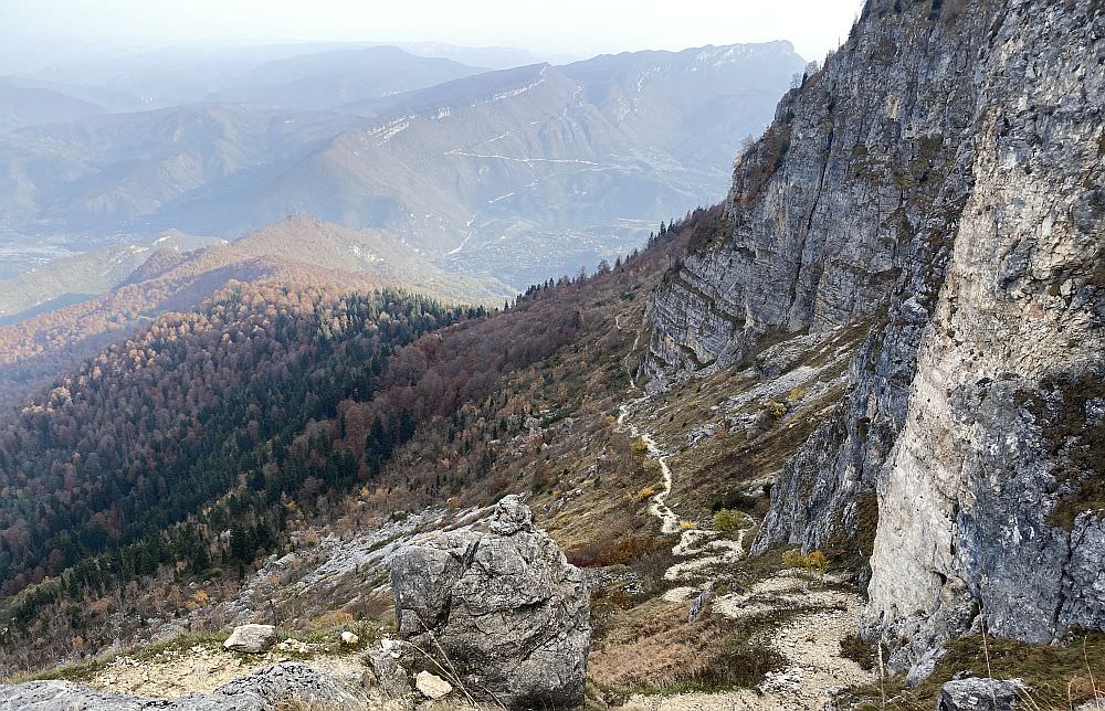
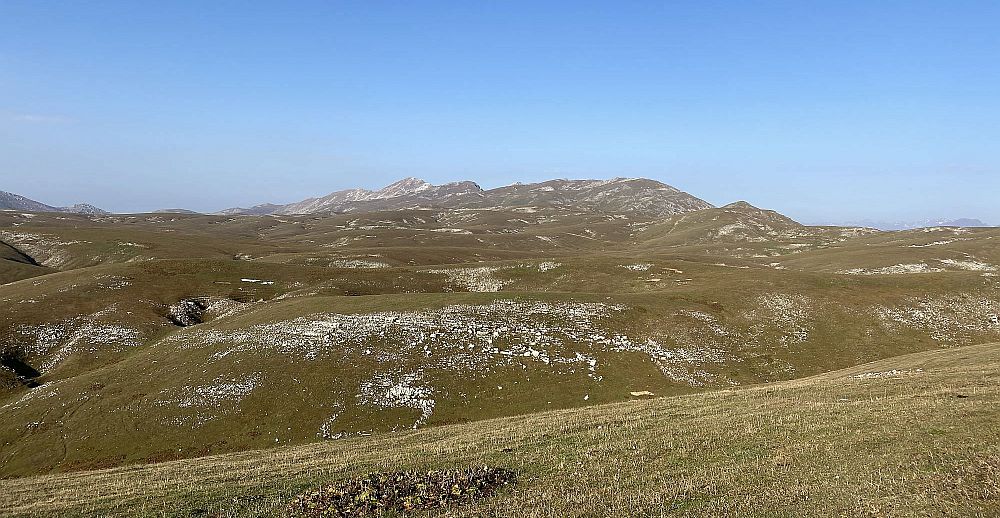
Once at the trail marker, you have the seemingly endless green Askhi plateau in front of you. In about one kilometer distance you can catch sight already on the next yellow sign; again, the official trail goes inland but the nicer route is for sure alongside the ridge. From here onwards, you first walk on a quite steep and slippery grass slope, before you traverse for about one kilometer on narrow trails in parallel to the rocky north side of a nameless peak (2.450 m); don’t be tempted to descend too early before the rock fields to avoid unnecessary climbing later. Soon after, the path will widen and zigzag down rapidly from nearly 2.300m to 1.932m at the Askhi Crossroad.
At the crossroad, the trail to Lebarde (24km) ascents, while you head down through the forest towards the Green Lake, which should take about two hours. Starting wide and inviting, you will soon realise how less frequented this trail is and how quick nature takes back what’s hers: although you may have to bushwalk a little, the path is in general easy to follow. Turn sharp right when you reached the stream (about one hour) and cross it twice within the next hour (even in summer it should be no big deal). Then you will pass through a wide meadow and find yourself some minutes later already on the solid grid street to the Green Lake – instead of following the road to the right, you can also walk the last meters straight, which might be more appealing by surrounding but also includes at least two bigger river crossings in a short period of time.
On the Askhi plateau
The trail was hiked by Chloé Tremblay and Philipp Bienek, who also provided pictures, gpx and the hike description.