Explore one of last great secrets of Georgian mountains.
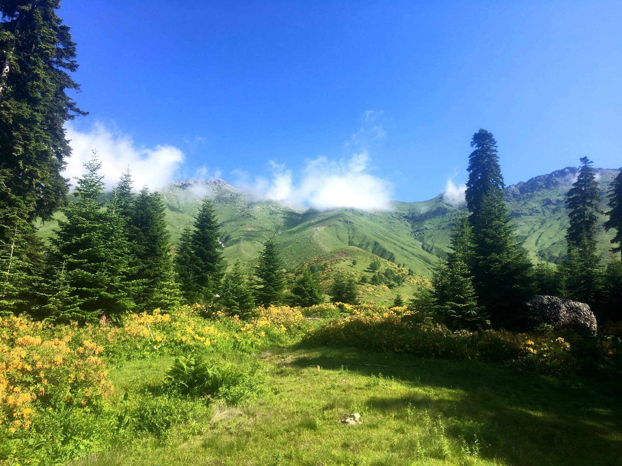
The Akhalchala Reserve is one of the last great secrets of the Georgian mountains. Once a thriving summer pasture area for the Lechkhumians of the Tskhenistskali valley, it is frequented only by a handful of local herdsmen, vacationers, foragers, and hunters. However, its great natural beauty coupled with its relative ease of accessibility makes it an attractive destination for trekkers. Probably the most interesting trek in the area is the loop between villages Kulbaki and Kvema Lukhvano. It visits Akhalchala climatic resort, Green lake and in-between climbs to almost 3000m, providing fantastic views of surrounding mountains.
Trek can be comfortably finished in three days, but if you like to take your time and take some nice detours (such as climb of Mt. Tsikuri), you can easily spend also four days.
The trek difficulty is somewhere between moderate and hard. Altitude differences and distances are not that bad, you also probably won´t get lost, but once you reach the upper treeline, you have to walk off-trail most of the time which is not always comfortable.
Mid June to early October should be considered safe limits for ordinary trekkers, with optimum season July-September.
Several other routes can be considered for a visit to Akhalchala. The classic route described below does a loop between villages of Kulbaki and Lukhvano. However, it is also possible to close the loop at either one of these villages (which is often more comfortable from the perspective of logistics), or to simply do half the loop from Lukhvano to Akhalchala and turn back (the easiest variant with limited views). More adventurous trekkers can extend their journey by heading up Askhi massif, offering the possibility to trek to Balda in Samegrelo, Gordi in Imereti, or Zubi in Lechkhumi, or by striking out towards the pasture-resort Lebarde and the "Small Tobavarchkhili" lakes in Samegrelo (not the famous Tobavarchkhili Lake, but some others with the same name) – from which paths extend to Doberazeni in Samegrelo and Kheledi in Lower Svaneti. The Askhi massif crossing and Lebarde lakes routes both branch off from the Akhalchala route in the forest above Kulbaki.
Doesn´t really matter, both variants are quite similar in terms of difficulty. The advantage of starting from Lukhvano is that there is a nice relax area with fish restaurant towards the end, but can end up there also if you do the full loop and both start and finish in Kulbaki (see later). So I would decide based on what would be for me eaasier to arrange logistically (see "How to get to.... section").
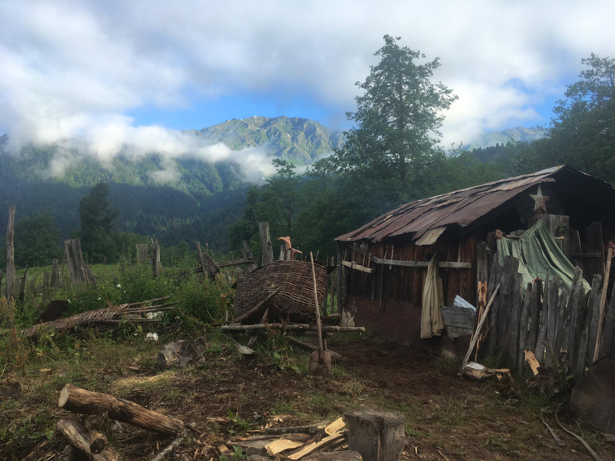
Water is readily available at almost every point. There is a large number of huts in the Akhalchala settlement and a few on the Kulbaki side of Sazamtra Mountain. Some of these are in use by herdsmen, who may invite you for hospitality. However, the law of the mountain also dictates that huts not in use are left open for the courtesy of any passerby. If you choose to use one of these huts for shelter, please respect their builders and main occupants by putting everything back as you found it when you leave.
To get to Kulbaki or Lukhvano, it is probably best to take public transport from Kutaisi to Tsageri. Your best bet are several daily marshrutkas passing Kutaisi (station behind McDonald´s) at 2 a 4 pm (these start from Tbilisi Didibe station after 9am). From Kutaisi, you can also use marshrutkas heading to Lentekhi (11 am and 5 pm) and disembark in Tsageri. There, you might be lucky enough to catch an irregular marshrutka to either of the villages, but your most efficient method of transport will be by taxi.
It is also possible to ask the driver to stop the marshrutka before Tsageri, at the junction and walk to villages; this will add distance to your route, but as Georgian villages go they are quite beautiful and exotic looking and it could be worth it. Also, once to leave the main road and turn towards Kulbaki, at the bank of Jonouli river, there are
nice public beaches with crystal-clear water, a popular picnic spot for locals, suitable also for camping. So, you can take afternoon bus from Kutaisi, leave it at the crossroads, camp by the river and start hiking in the morning.
If you have stayed overnight in Tsageri and wish to start from Lukhvano without the aid of transport, it is possible to follow a path leading above Gveso village towards the west, which will bring you to the top of Lukhvano village. Finally, many visitors head beyond Kulbaki village in the summertime, to have a picnic at the "Green Lake" fish farm. It may be possible to hitchhike through Kulbaki in this way.
Just like getting to Akhalchala, just in reverse. To leave Kulbaki or Zeda Lukhvano, one can't rely on public transport, it's too sparse. To you will need to walk to the main road and hitchhike there. If you end up in Kulbaki, you might have some luck stopping cars returning from the Green Lake. And if you end in Lukhvano, you can follow the dirt track east to Gveso village that lies in close vicinity of Tsageri.
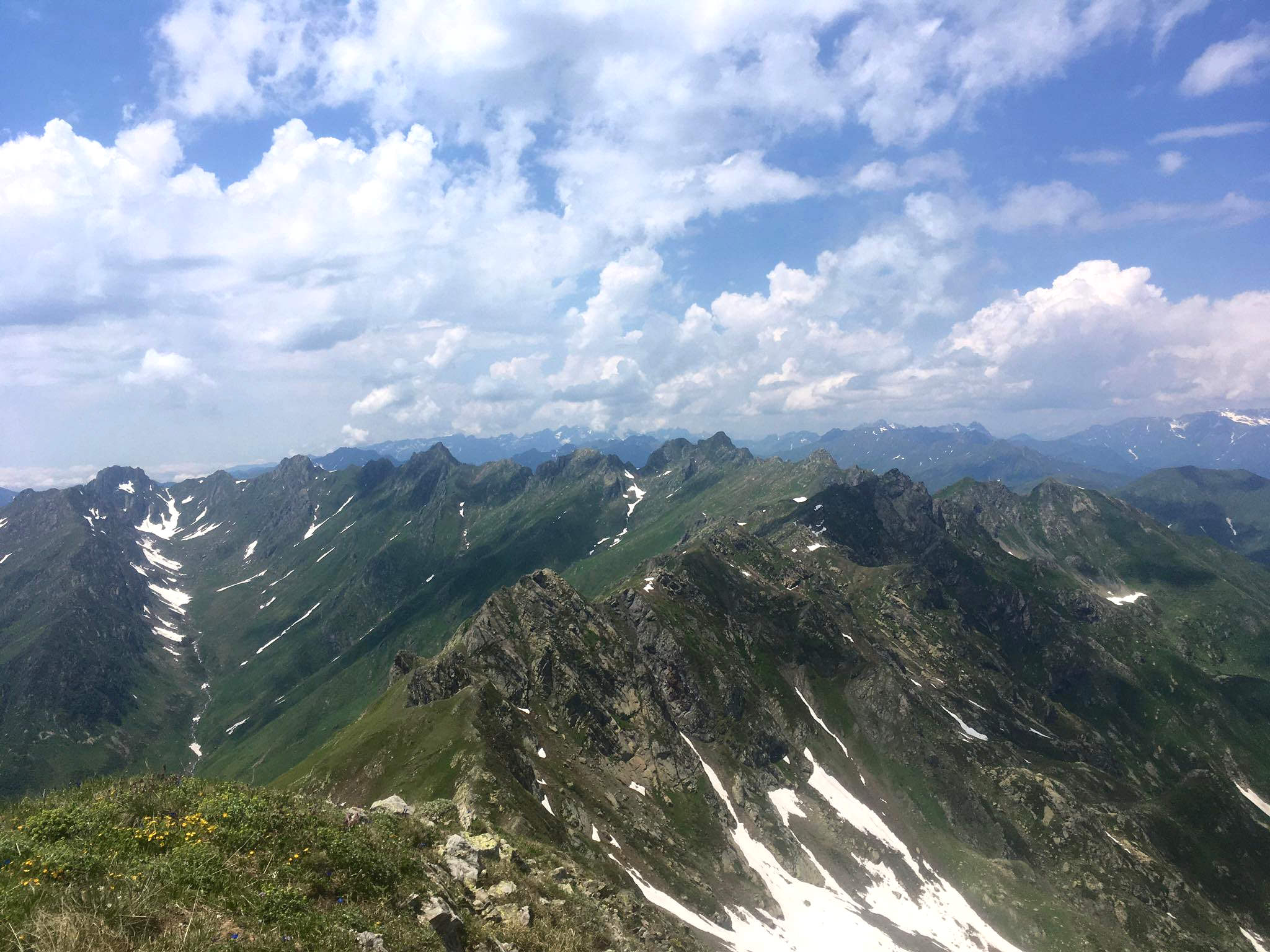
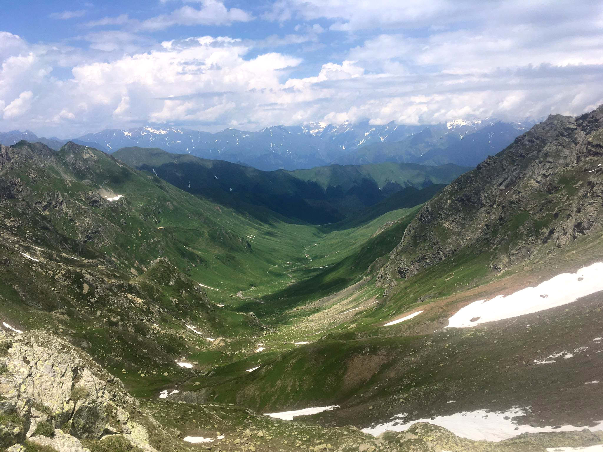
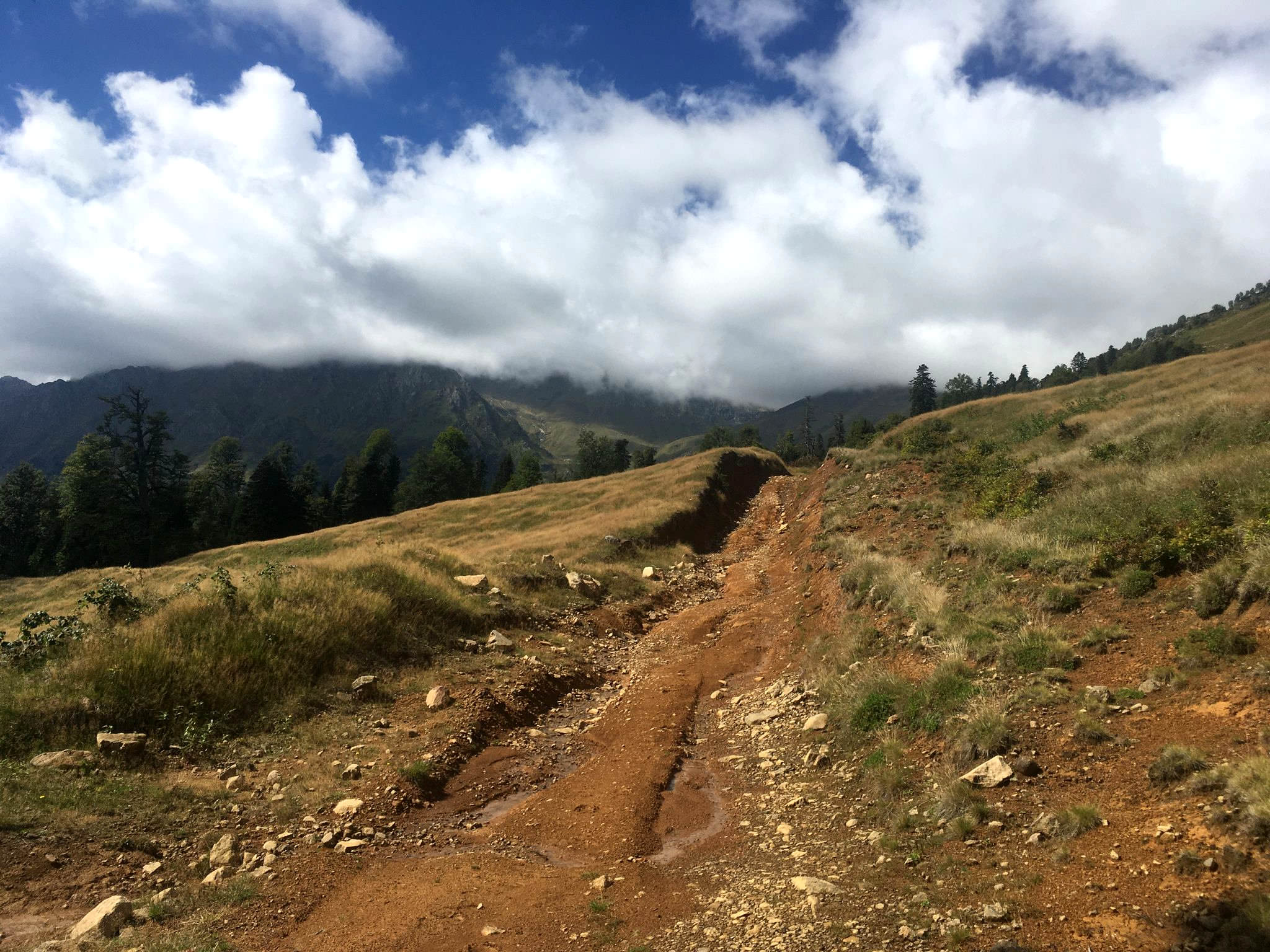
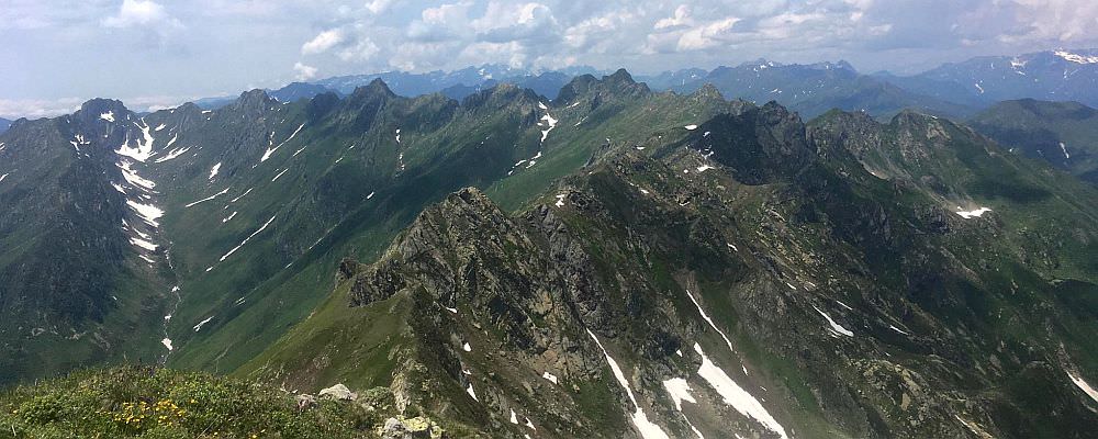
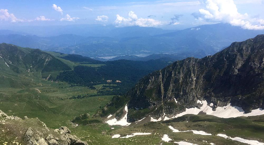
Views south towards the Askhi massif
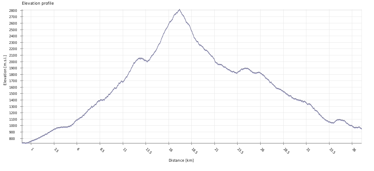
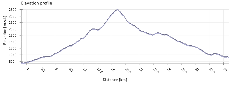
| Distance | 37 km |
| Trail type: | AB trip |
| Max. elevation: | 2814m |
| Min. elevation: | 725m |
| Total climb: | 2450m |
| Total descent: | 2320m |
Starting from Kulbaki, follow the main road for about 30 minutes till you reach the Green Lake. It´s a popular area for picnics, but swimming in lake is not recommended since it´s shallow and serves as a trout farm. There is a small restaurant, where they sell fried fish - it´s even cheaper if you catch one and let them prepare it for you. They also tend to have basic refreshments (bread, beer, lemonade).
At the lake starts also the actual trail (pointer to Lebarde), sending you along one of the streams of the Jonouli. Soon, the trail for Akhalchala will turn right, while the trail for Askhi continues straight ahead. Follow trail markings for around 2 km, at which point the Lebarde trail turns off to the left and the Akhalchala trail continues to the right. There will be no more markings to follow. If you are following the GPX, pay close attention in next five or so km, as there is a number of logging trails which may prove confusing. By keeping left at junctions, you will ensure that you continue to head uphill towards the first alpine ridge.
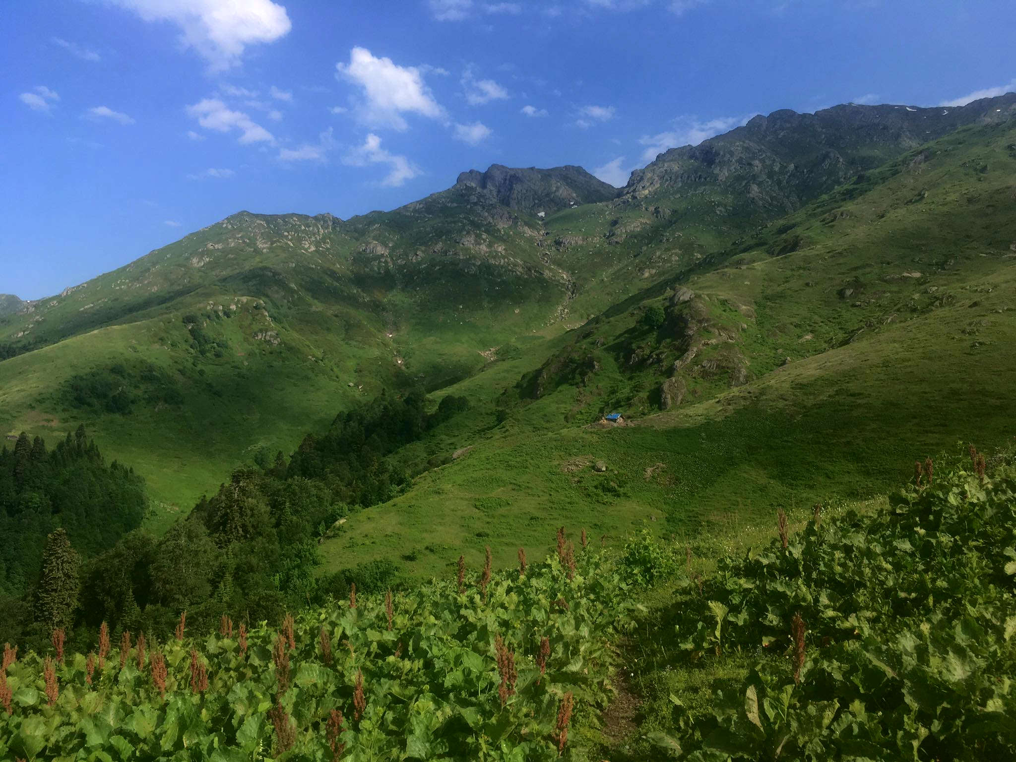
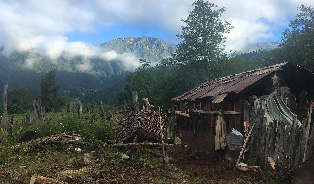
Arriving in the alpine zone, you will soon see a herdsman’s hut. The occupant may try to invite you for rest and refreshment. This, indeed, may be an excellent place to spend the night, depending on what time you have started and what pace you have made.
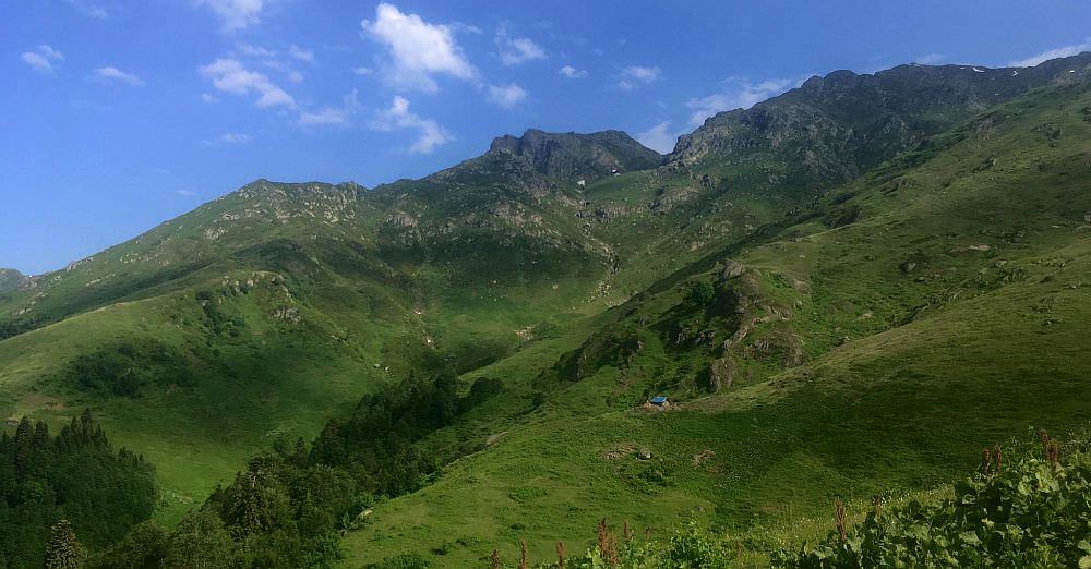
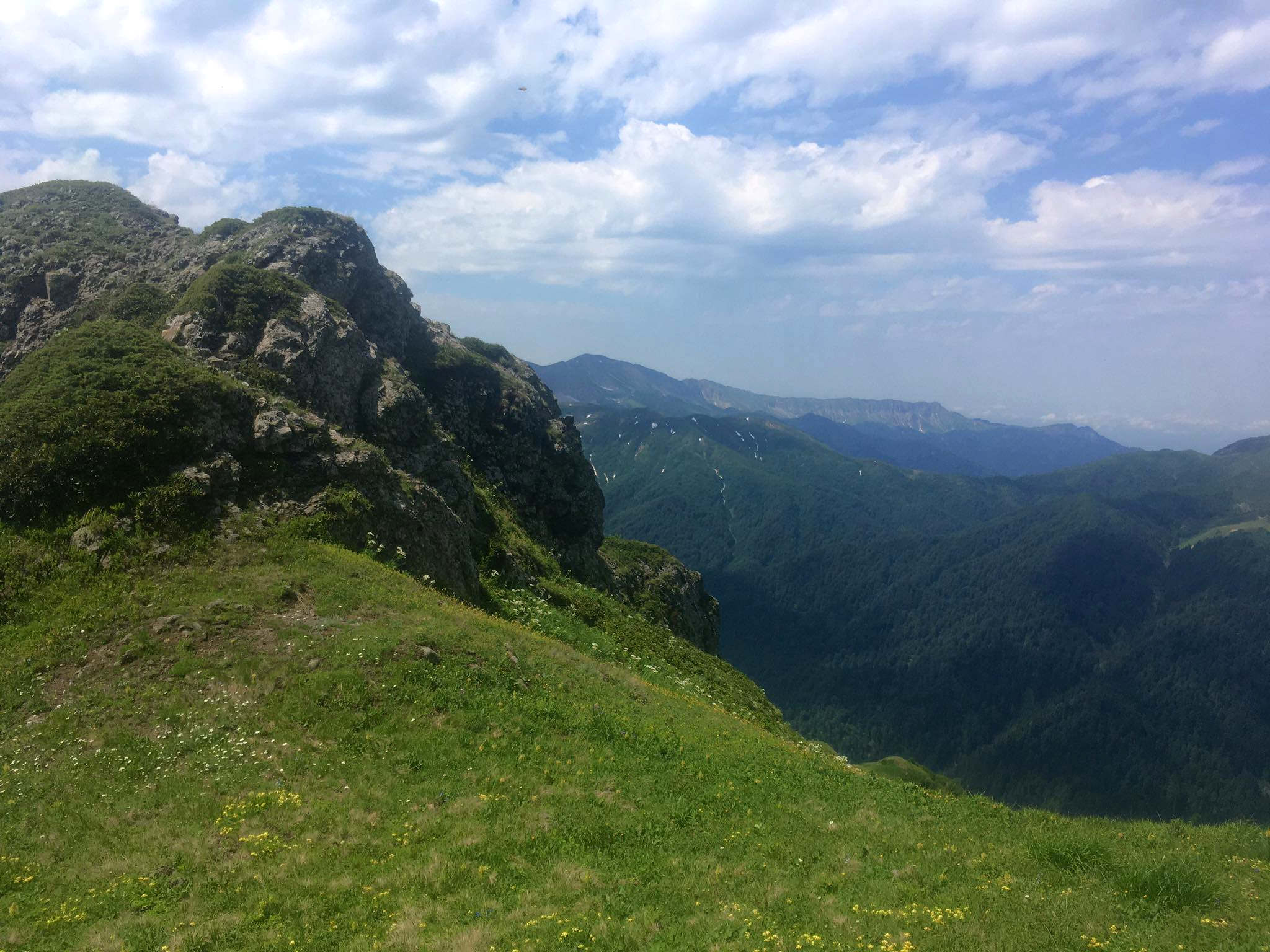
Shepherd's hut, place of 1st campsite. Above can be seen gully - the route further up
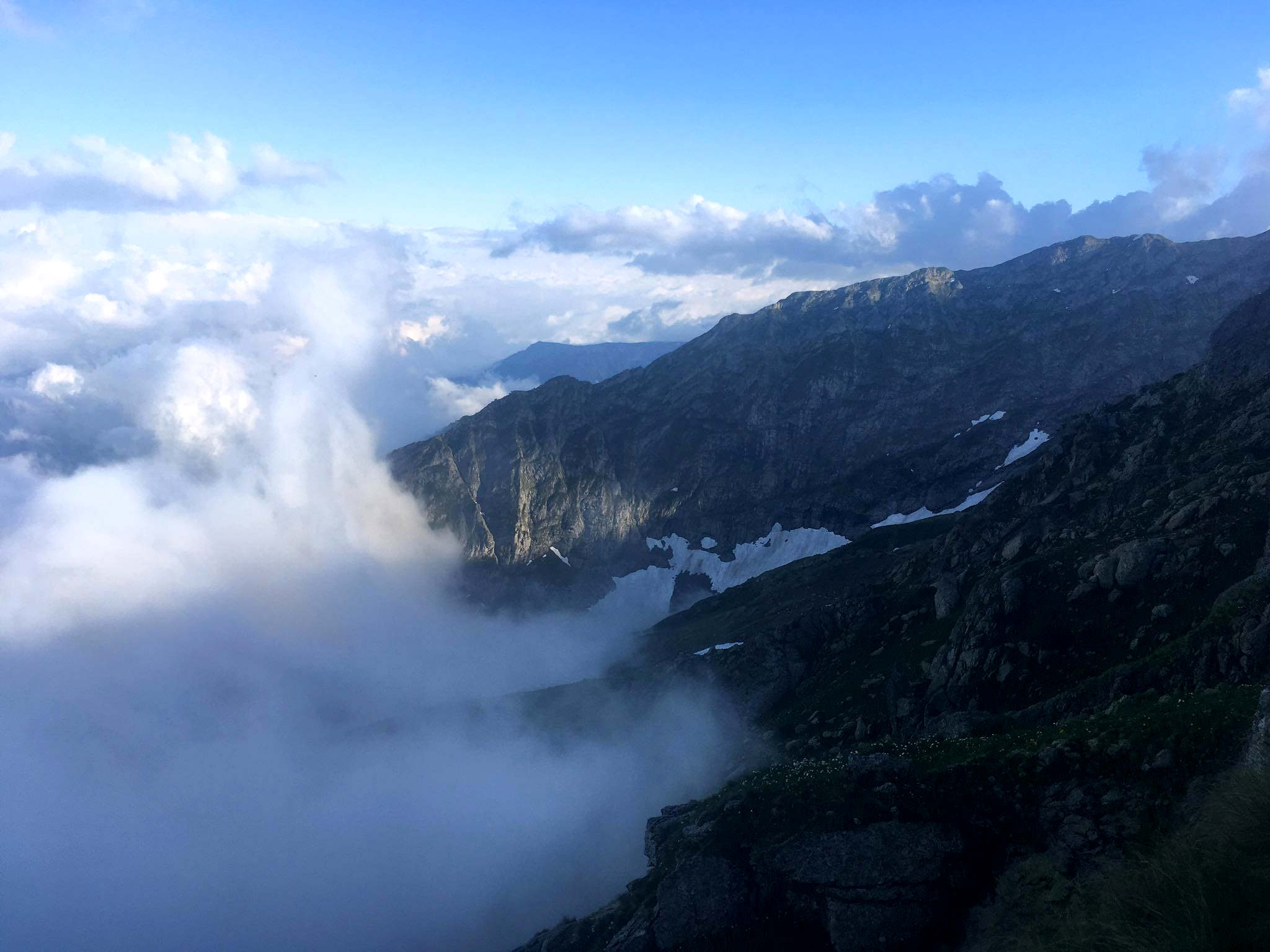
Continuing past the hut, the path becomes increasingly faint and eventually disappears. This is a sign that you need to start climbing in earnest. The easiest way will be to head west and once you cross a large dry ravine, walk past it to the north and eventually end up in it. At around 2300 meters, it splits - you need to choose a ravine to the left, the one heading in a more northwesterly direction and follow it to a small meadow at around 2500 meters, at which point you will continue to the north again. At the top of this climb, you will finally reach the pass (2765m), just east of Sazamtra mountain - it has no official name, but in the log is marked as Sazamtra pass. Turn east to head in the direction of Akhalchala.
As you reach the lip of the pass, you will observe the Akhalchala pasture-resort below and to the right. There is no path down; simply descend along the gully towards the east until you reach the stream which is coming down from Tsikuri mountain to your north. Crossing this stream, keep your eyes out for a path; rather than heading downstream, you will head up a small ridge on the other side and take a sharp left turn to come back down. Crossing another small stream, you will reach Akhalchala on the near side of a hill of maple trees.
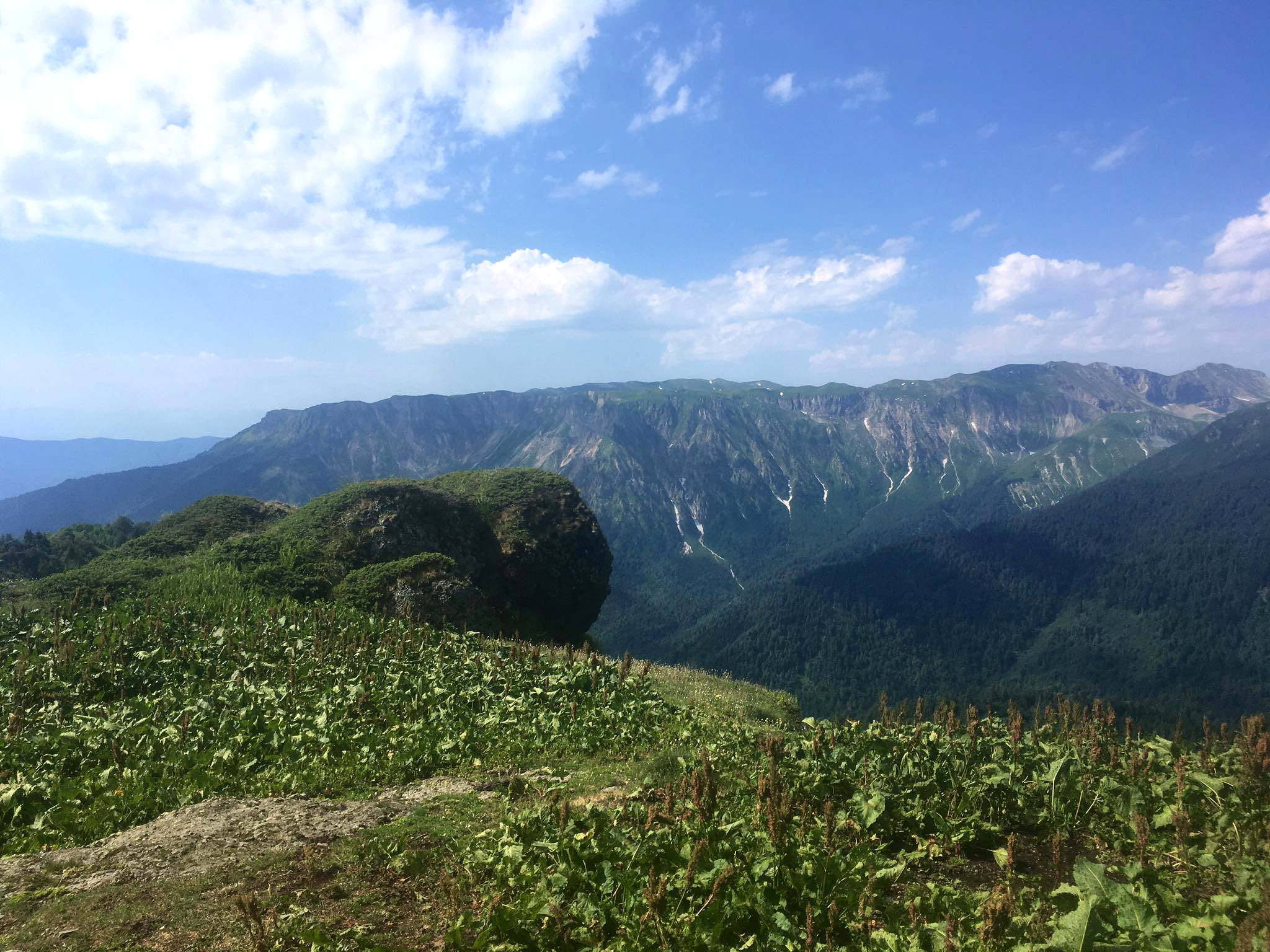
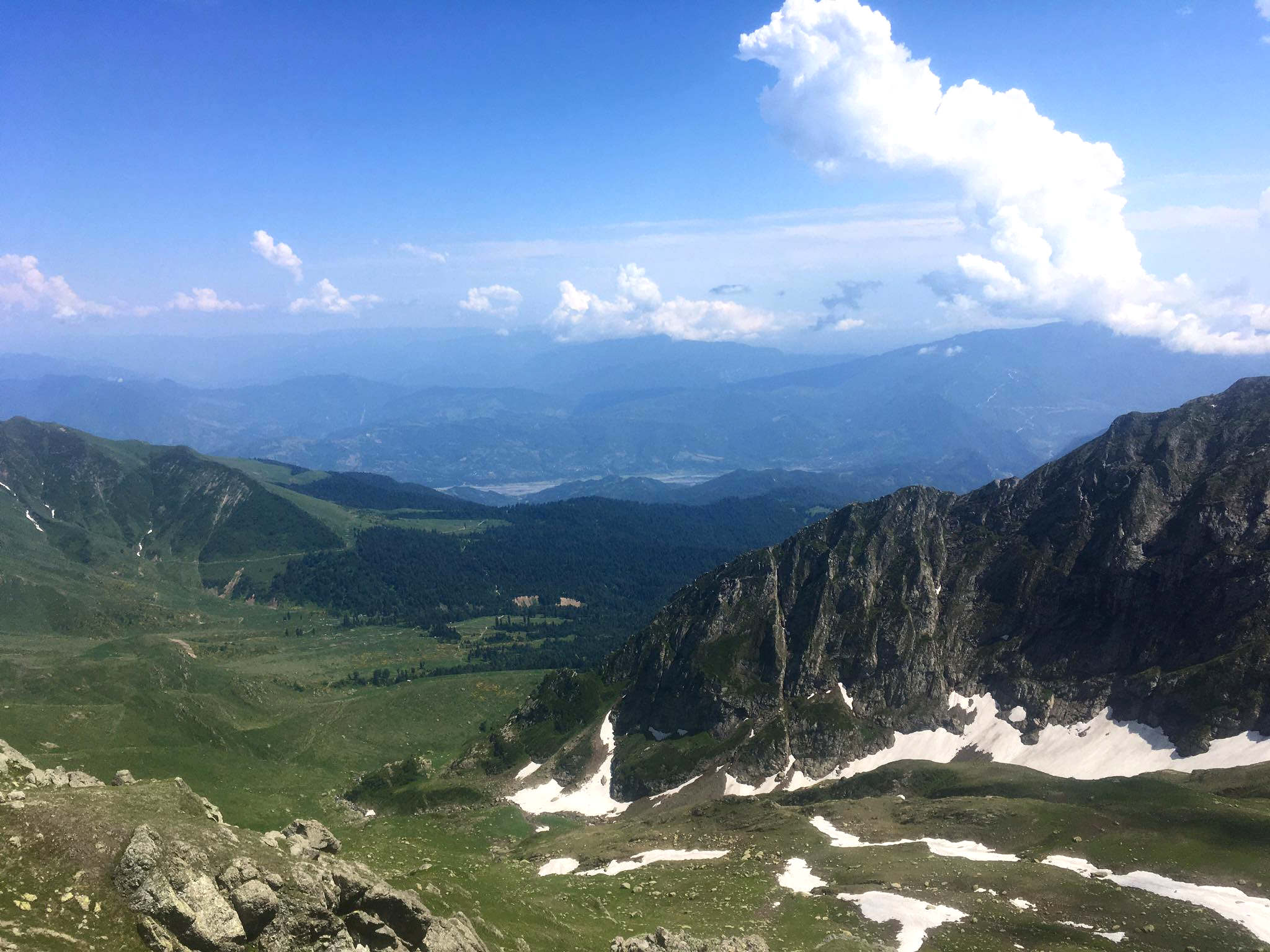
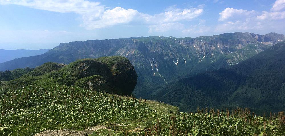
Akhalchala resort visible in the distance
Akhalchala and Lukhvano are connected by a jeep road. Therefore, to come down to Lukhvano, simply follow the jeep road at all junctions. If you are considering to take your own jeep up, bear in mind that it is a very bad road, but manageable by a confident driver in a good vehicle. However, it is worth noting that one junction on this road is possible to be considered as a path to return to Kulbaki (see below).
The route does not pose any particular difficulties by being taken in the opposite direction. In fact, the forest above Kulbaki is probably more easily navigated heading down than going up. The important bit will be to cross the small ridge on the west of Akhalchala and head up the stream valley until you see the ravine which will lead you to the pass on the north side of Sazamtra.
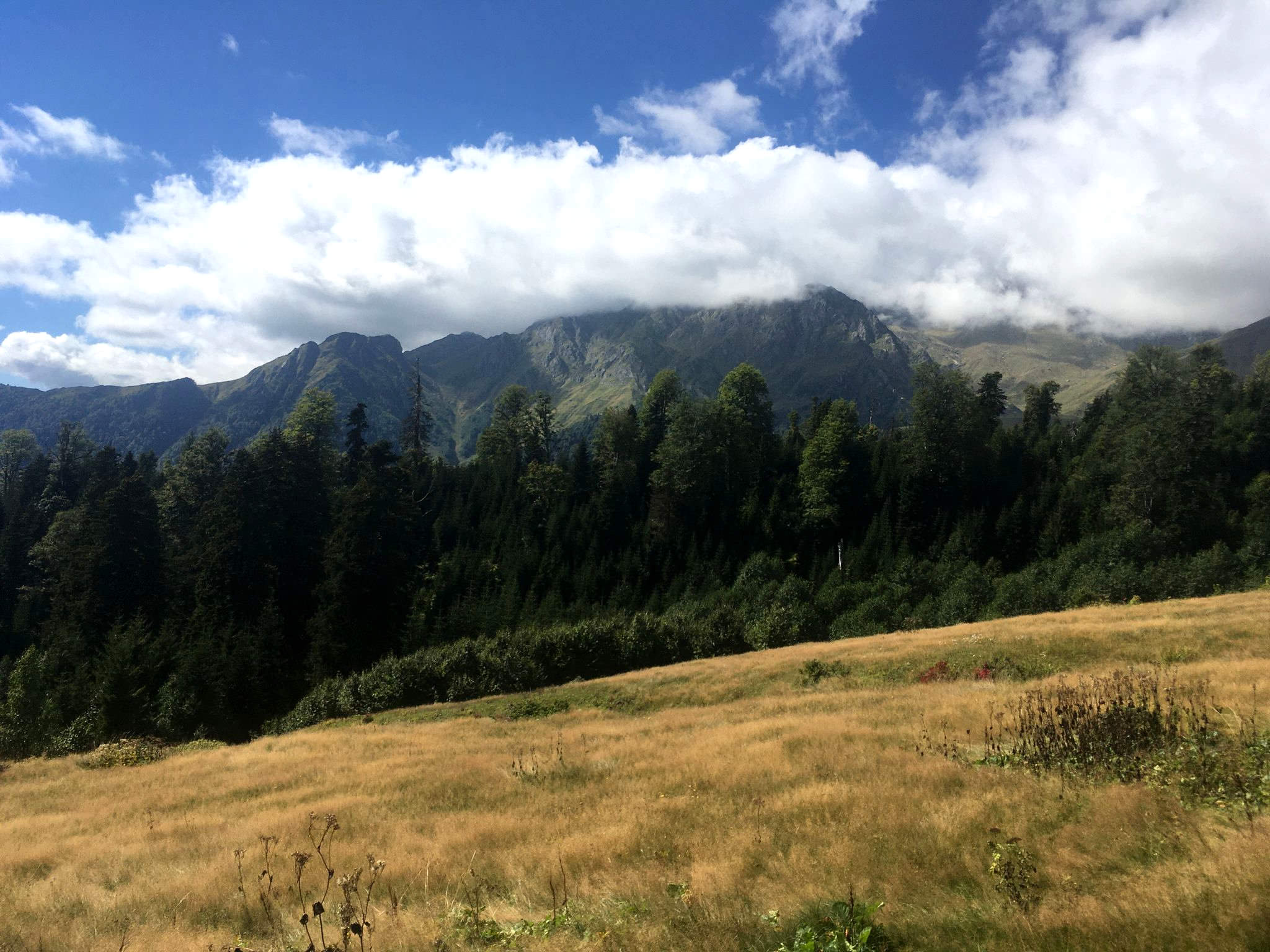
Hut below Akhalchala
This trail was submitten by Timothy, Georgian hiker who visits this area on a regular basis. Gpx log and trail description for the return route to Kulbaki was provided by Philipp and Chloé. Thanks a lot to both!