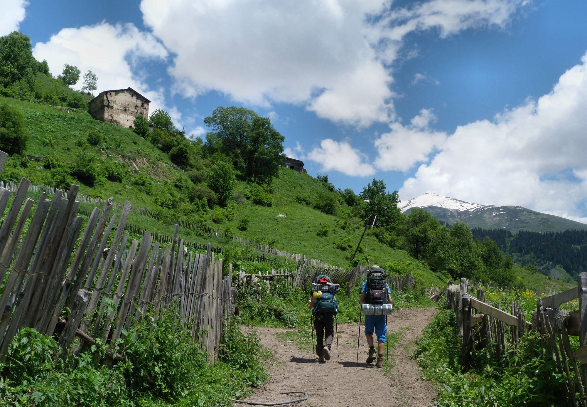
This hiking route explores the overlooked, non-touristy corners of the western Svaneti.
This hiking route explores the overlooked, non-touristy corners of the western Svaneti. It passes numerous villages and hamlets which flourished hundreds of years ago, but since then fell into a state of disrepair and now stand abandoned and forgotten. The equal fate befell the dense network of trails which once connected them - many were reclaimed by the forest. Only in past few years, trails are being rehabilitated and marked both by Transcaucasian Trail and Georgian National Tourist Associations.
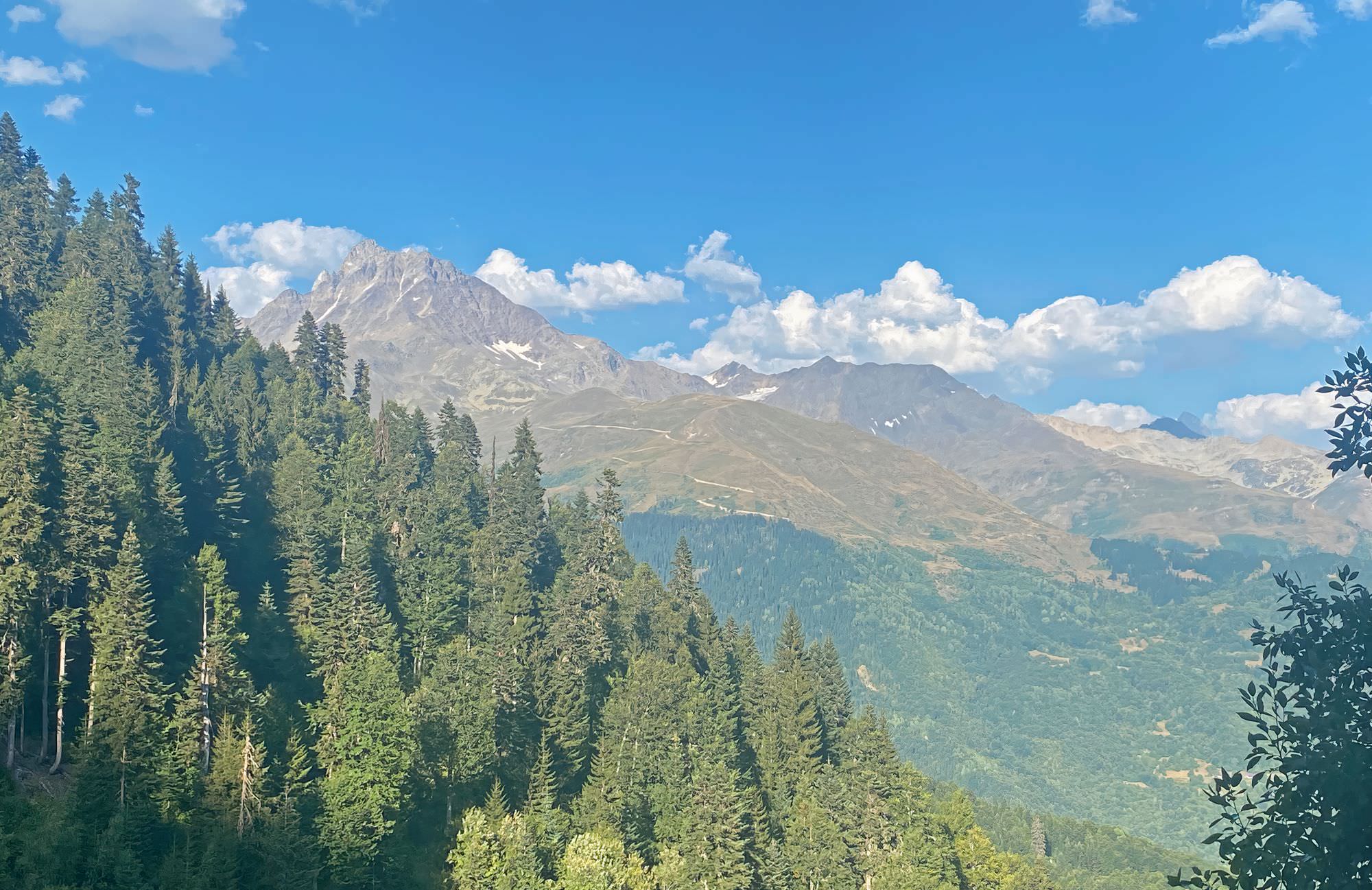
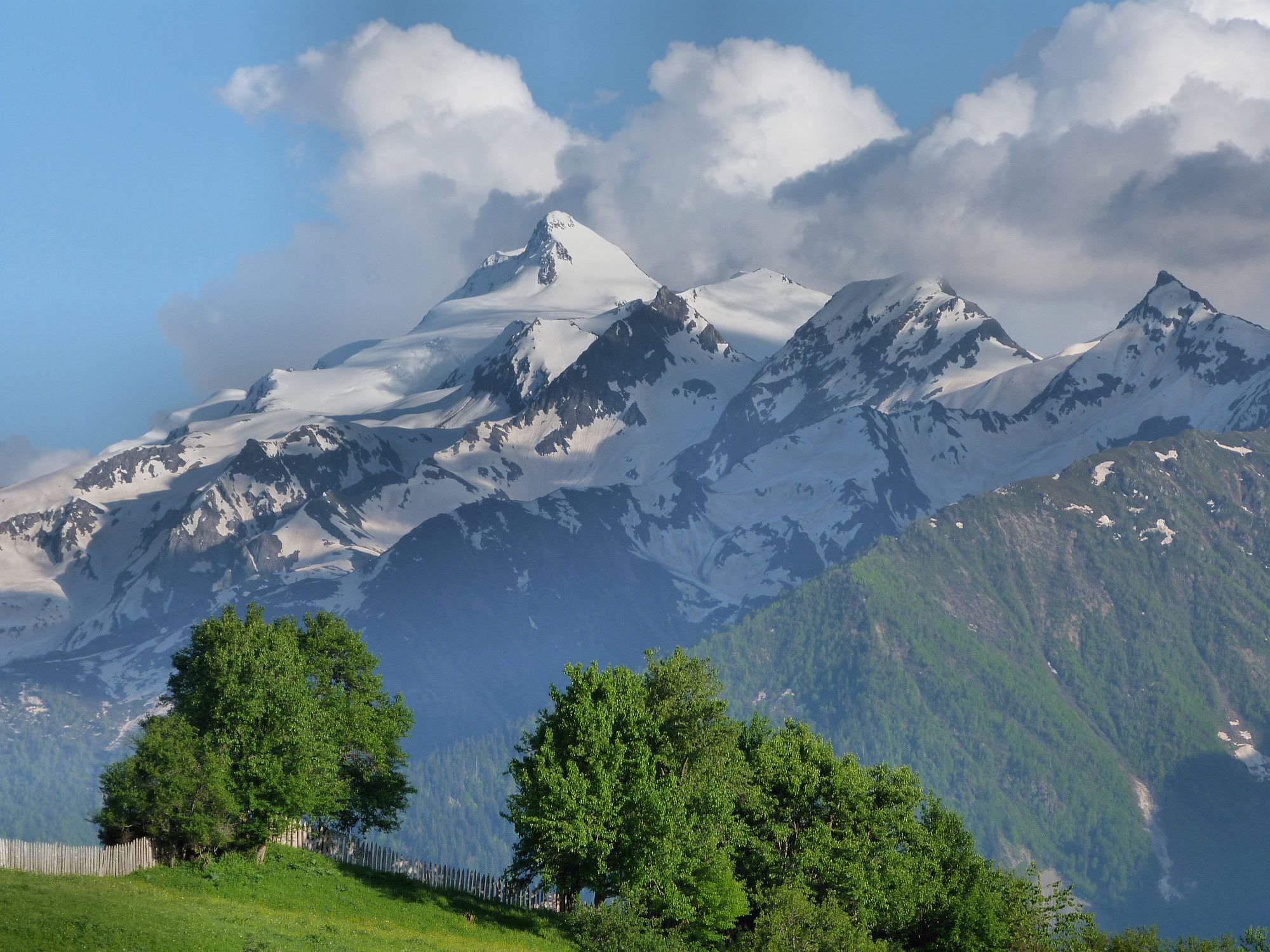
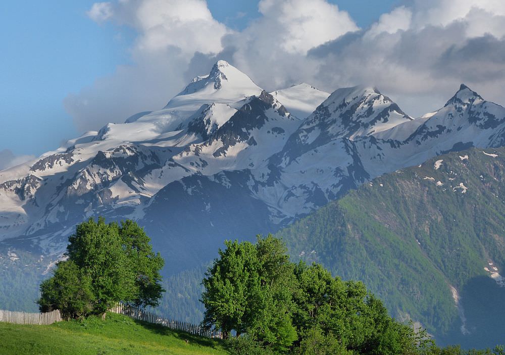
The trail itself snakes along the hillside above the Enguri valley. It doesn´t climb too high, the highest altitude reached is only 1866m. Still, it offers nice views of the valley below as well as of the surrounding mountains. Motivated hikers can add one more day and include detour to Mt. Kva (2.655m) to get a great sight of Mt. Elbrus.
Optionally, you can add one more day and climb Mt. Kva (2655m, more on that below)
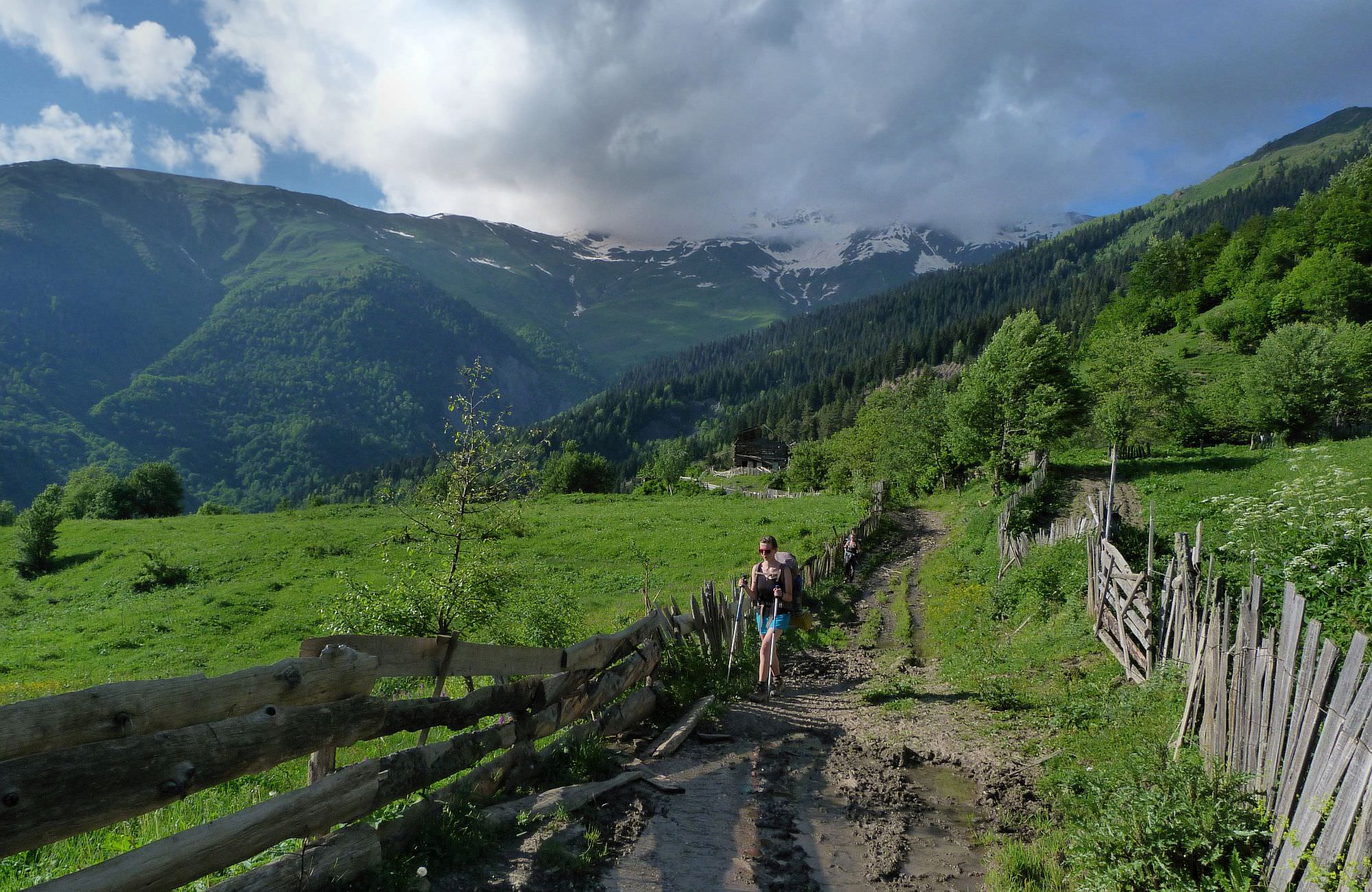
While the trail is most of the time well-trodden and easy to follow, the distance to cover is substantial and there are many up and down parts. Most of creeks on the trail have bridges, but there is also one major river fording.
There is no public transportation to Nakra village. To get there from Zugdidi, wait for the marshrutka to Mestia and ask the driver to drop you at the mouth of Nakra valley. From there, you will have to walk (or hitchhike) for more than an hour till you reach the village.
Another option is to start trekking further to the west and arrive at Nakra by foot from Chuberi, using the 2-day route across the Ugviri pass.
Leaving Etseri is easy since there is a main road not far south from the village. All you have to do is to stand by the road and thanks to the relatively heavy traffic, it should be easy to hitch a ride in the desired direction.
Of course, you can also walk. There are two nice day walks connecting Etseri with the neighboring villages - Mazeri and Nakra.
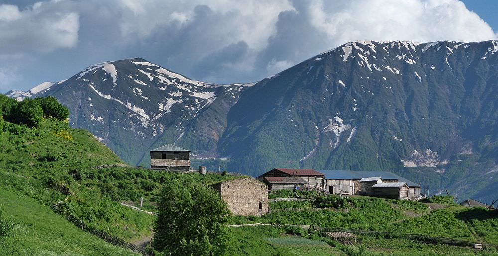
Kichkhuldashi village
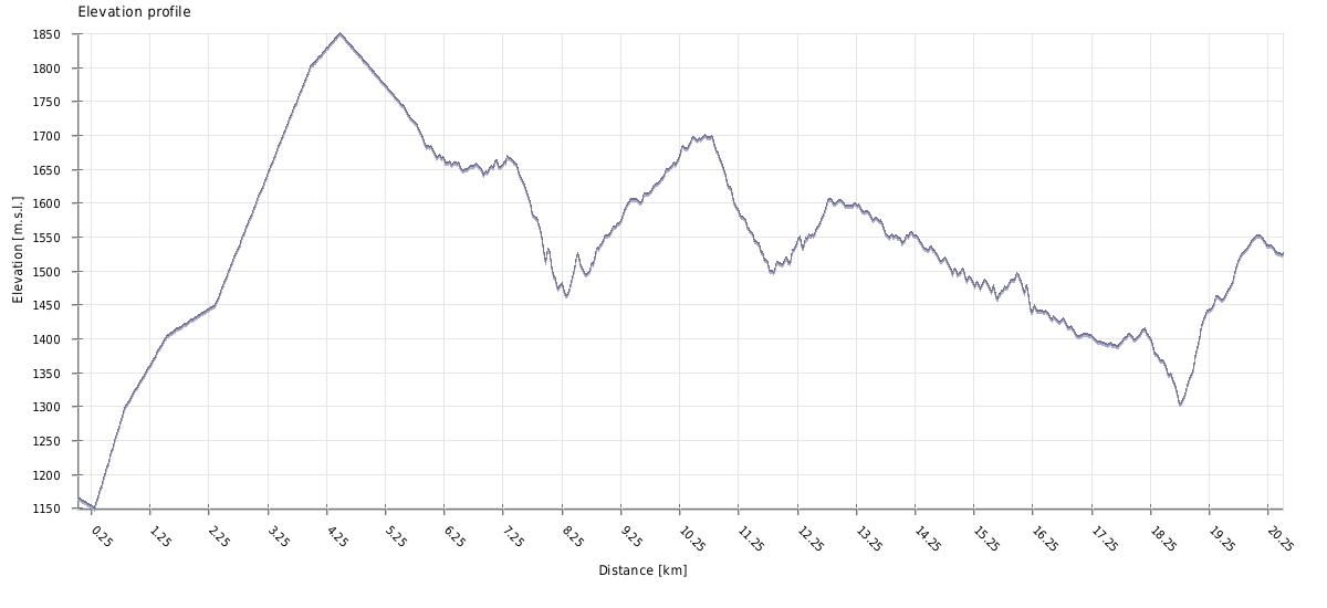
| Distance | 20,5km |
| Trail type: | AB trip |
| Max. elevation: | 1855m |
| Min. elevation: | 1149m |
| Total climb: | 1560m |
| Total descent: | 1202m |
From the Nakra mineral spring, follow the river downstream for a hundred meters till you reach a wooden bridge. Cross the river. The path then climbs steeply through the forest, eventually reaching the Latsumba community. Once you reach the second cluster of houses, you will see a gate to the right. Pass this gate and immediately turn right again, onto a small trail leading into the forest. The trail then leads across the forest and pastures in the western eastern direction, slowly gaining the altitude. Then it turns south and climbs onto a small forested ridge. Once at the top, the views of Svaneti range rising to the south will open up. The view of the mountains will follow you for the rest of the day.
Also, once at the top of the ridge, you will notice a small trail to the right which leads you to a small church. The church lies at the top of the ridge some 300 meters to the west and offers great views over the Enguri valley - so you can make a small detour if you feel like it.
While this trail is clearly marked by GNTA on the OpenStreet map, it is not usable and potentially very dangerous! The high route markers and trail completely disappears after reaching the two abandoned huts. We were crawling on our bellies under tree limbs, plowing through waist high nettles and undergrowth, on an extremely a steep and slippery descent until we reached the bottom of the ravine and were faced with a half melted glacier and no possibility of going further without risking our lives. This trail should be removed or marked as useable until further work is done on it.
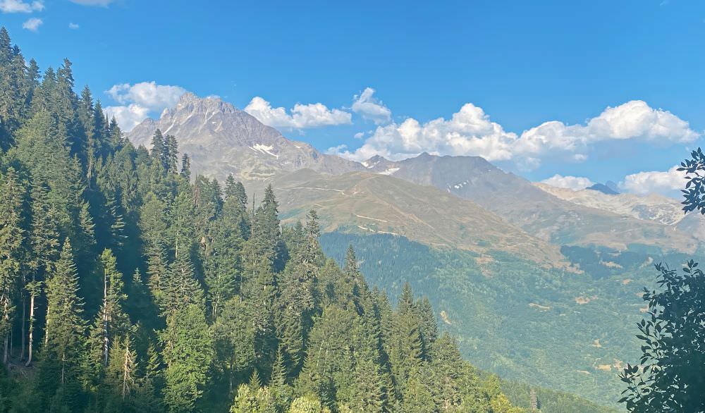
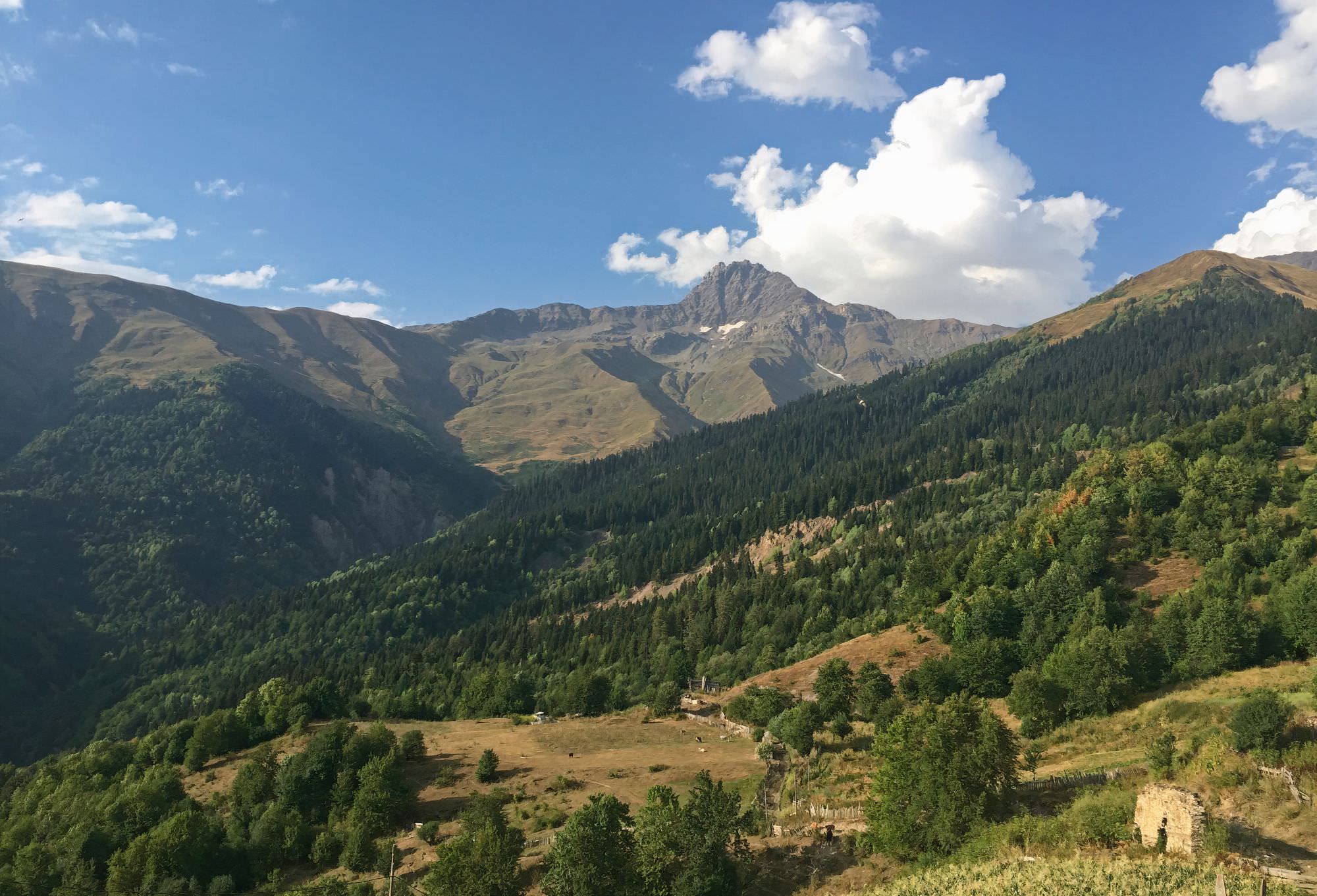
Mt. Kva in front of Mt. Tsalgmil
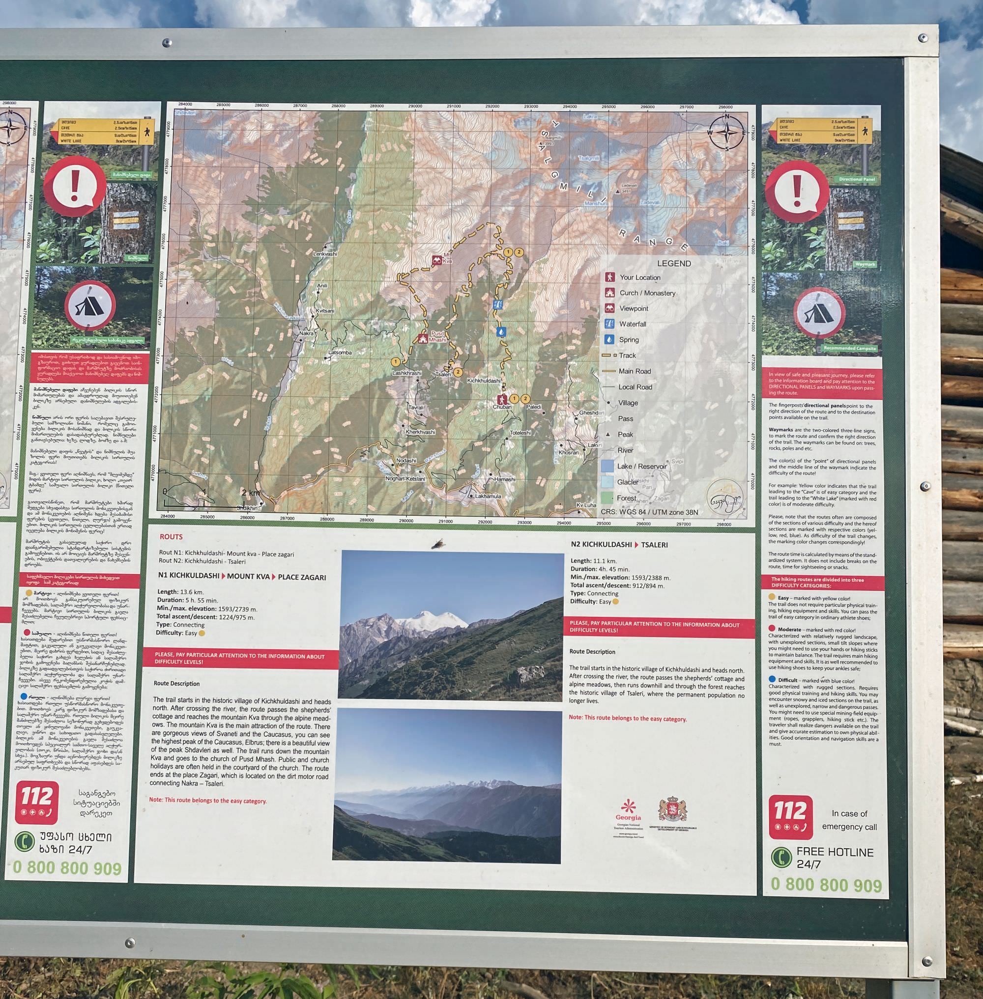
From the pass, the trail leads in the eastern direction towards the bunch of ruined houses - remains of Lashkrashi village. Here it joins the jeep road - turn right and at the very next junction 250m later, turn sharply to the left, towards Tsaleri village. You will reach the village after some 20 minutes of gradual descending. It seemed empty with just some cattle standing around. Most houses are ruins as well. There is an information panel that describes the history of the village as well as a map for reaching Mt. Kva. There is also a water spring by the road.
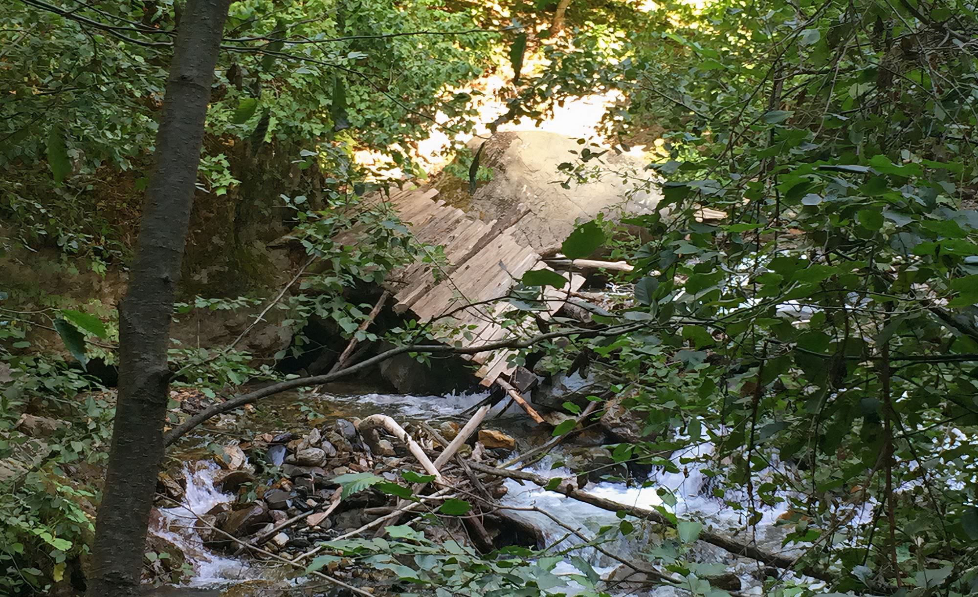
Once you leave the village, after the rightward turn, make sure to look around for the signs to turn right down to the forest on a footpath which will lead you down to cross the Manshura river and its subsidiary. Unfortunately, both former bridges have been destroyed. While the first one has been replaced a bit further up the river’s arm, the main river has to be walked up for some 30, 40 meters – which should be rather fine most of the year. Anyhow, especially when hiking in the opposing direction from Etseri to Nakra, walking in the riverbed feels kind of wrong until you finally re-connect with the original path. In both directions, crossing the rivers will force you to lose the altitude, which you will have to climb back straight after you cross the rivers. This is why the trail takes so much time to finish.
In addition, due to a landslide (probably 2020/21), the original route which is also marked in most hiking apps is not walkable anymore these days. A roughly 300-meter-long diversion surrounds the disappeared slope. Small red ribbons on trees and bushes indicated the way in summer 2022.
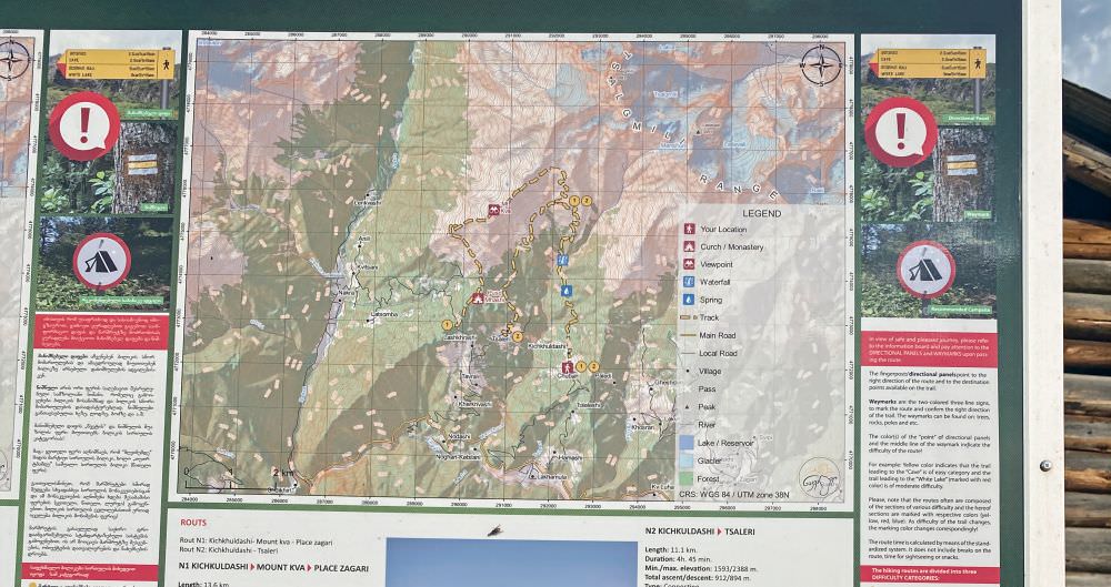
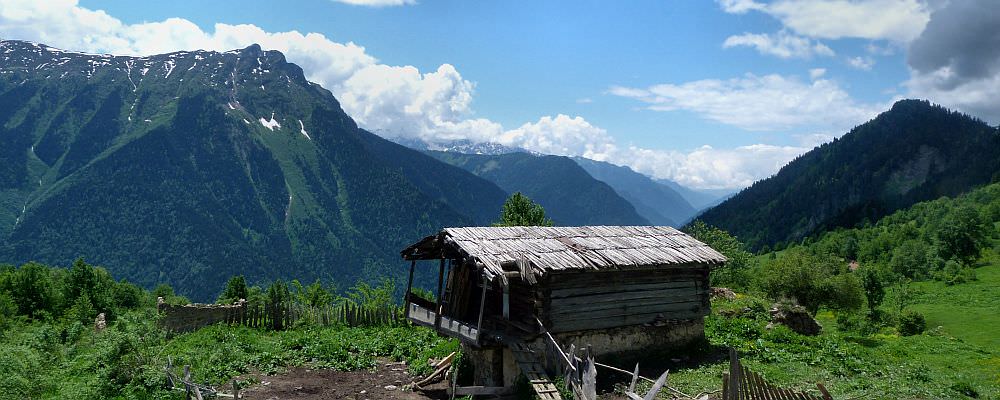
Hiking map in Kichkhuldashi
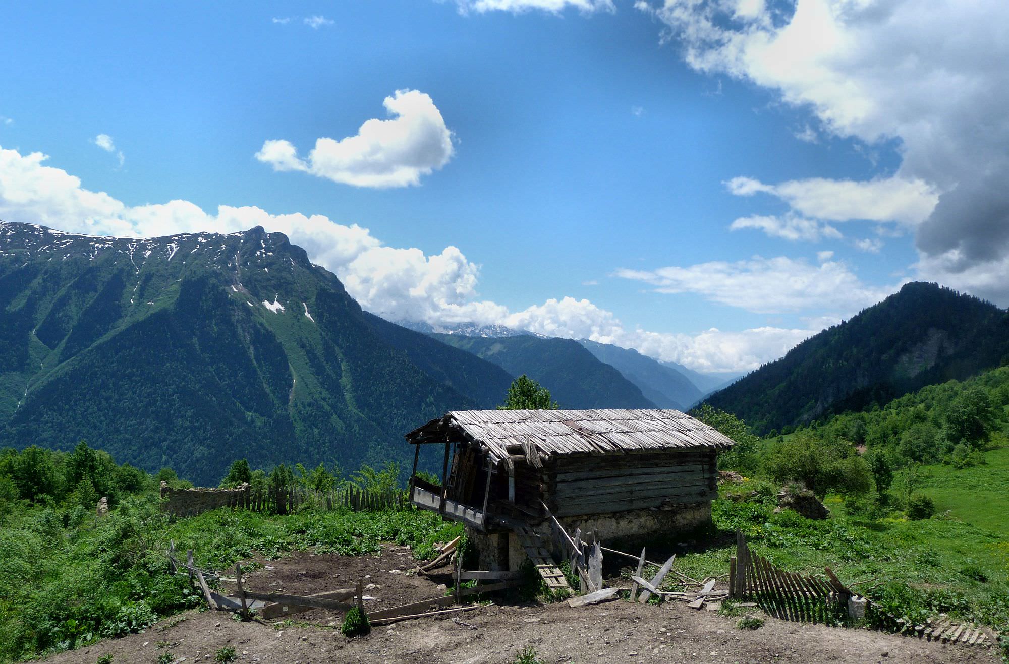
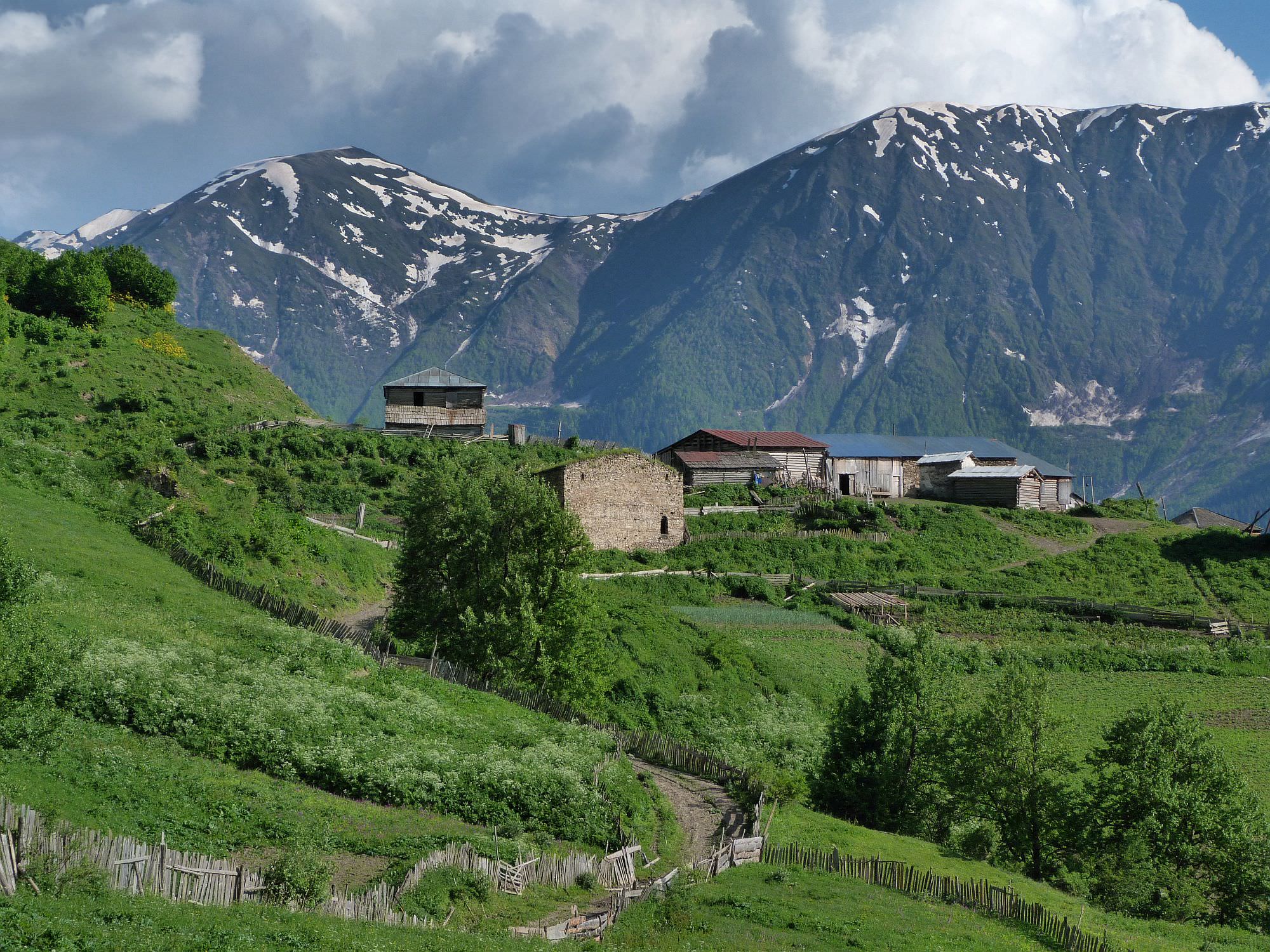
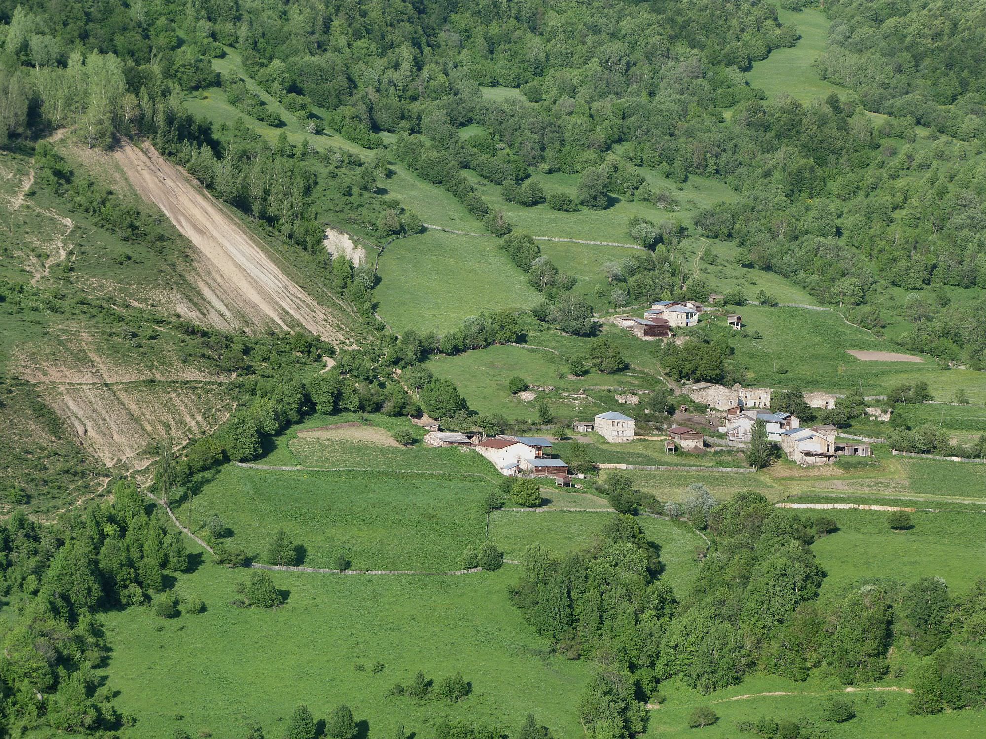
Once past the landslide, the trail passes by a small meadow, where you also find a spot for one or two tents, and leads you up to the Kichkhuldashi settlement; at the T-junction the Mt.-Kva-detour also joins again the main route. There is a small group of houses with a tiny chapel in the middle. The whole settlement is inhabited only by two people, Valeri Vibliani and his wife. They put up a huge sign "guesthouse" on a farmhouse, offering rooms and meals to the trekkers. If you plan your trip to reach Kichkhuldashi in the late afternoon or evening, I would really recommend staying over, both of the owners were very friendly and extremely happy to have someone to talk to.
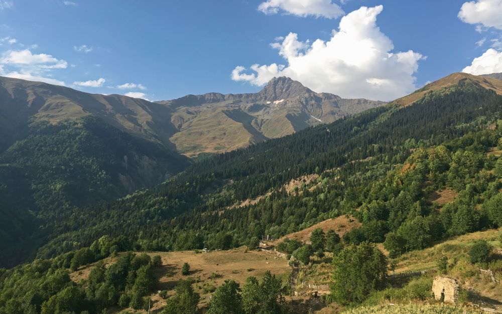
Mt. Tsalgmil and its ridge from Kichkhuldashi
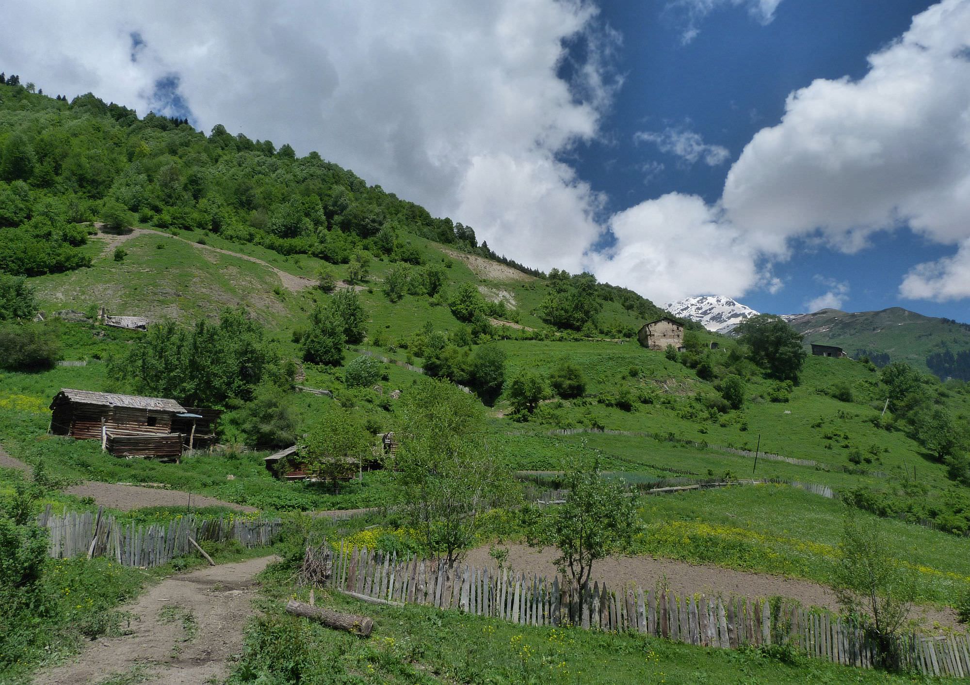
Behind Kichkhuldashi, the trail enters the forest again. At several places, it's blocked by fallen trees - a sign that it's not used too often. Once again, you will have to descend to cross the river Ladlina, passing the Paledi ruins. On the opposite side of the valley, you can already see Gheshderi village where you are heading. Before, you still have to climb down and up to cross a river stream (there is a bridge and also a small camping spot before). The trail then turns into a dirt road, slowly descending, with amazing views around, including the Laila peak of 4008 meters.
Once you reach the crossing of the river Parischala before the Pari village, there is a natural mineral spring of water rich in iron which is smelly and delicious. Pari was quite a lively village with some newly built houses and a few water pipes along the trail. After Pari, you will reach the T-junction - its left branch climbs to the Katskhi village, its right branch descends south to the main road. You take neither of these roads - instead, follow a smaller trail to the left of the right branch which climbs to the Zagari hamlet (a bunch of houses on small hill 100m away). Before you reach the hamlet, turn left and follow the trail across the meadow. Then there is yet another descent to cross the Kinni river (there is a small bridge), with a subsequent ascent to the original altitude.
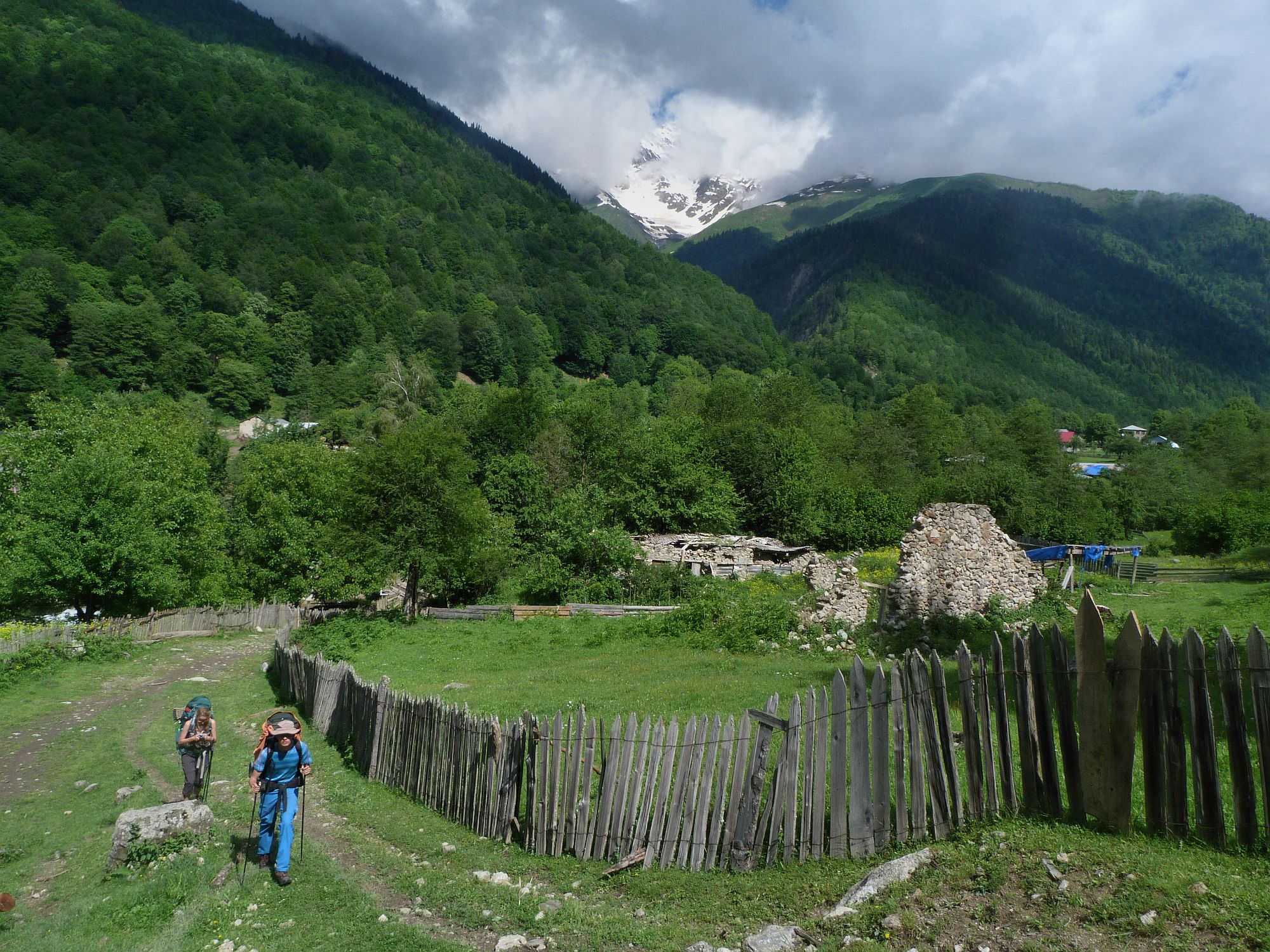
From the bridge, follow the trail through the meadows to the southeast until you reach the Pkhutreri village. Here, turn left and hike to the Etseri village 500 meters further. As in 2018, there was only a single guesthouse in the village, owned by Tony Hanmer and his wife Lali, a perfect place to have a cola, beer, tea or a cooked meal (since they also run a shop).
Mt. Laila at the other side of the valley
The major part of this trail description was written by Czech hiker Miloš Hejný who finished the trail in the early summer of 2018. He also provided me with photos. Chloé Tremblay and Philipp Bienek hiked the other way around in August 2022 and provided their remarks and further pictures. Thanks a lot!