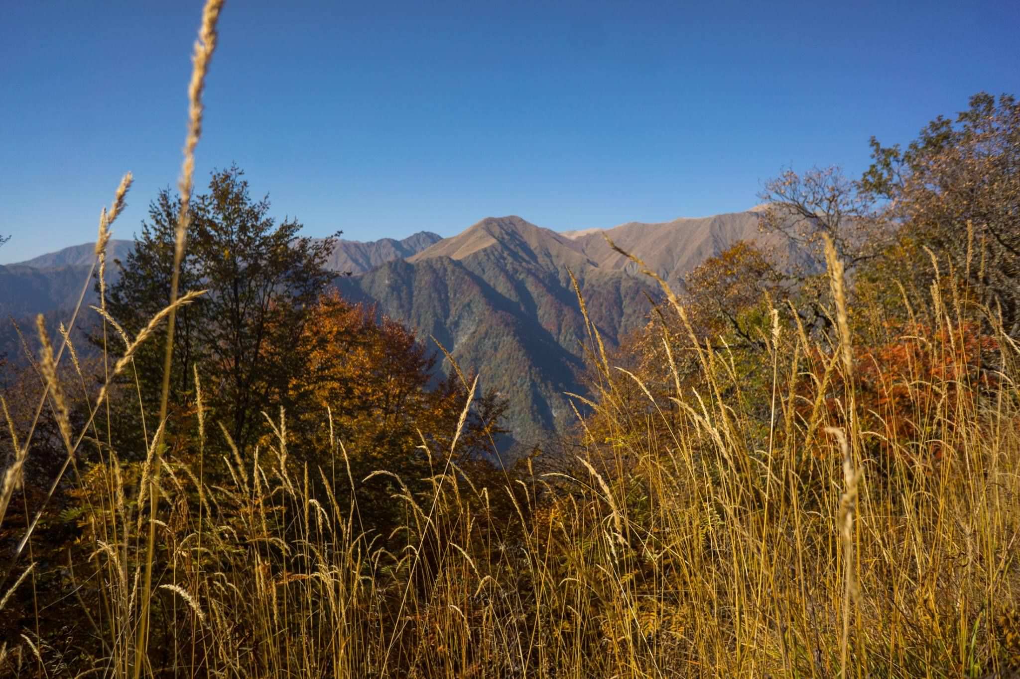
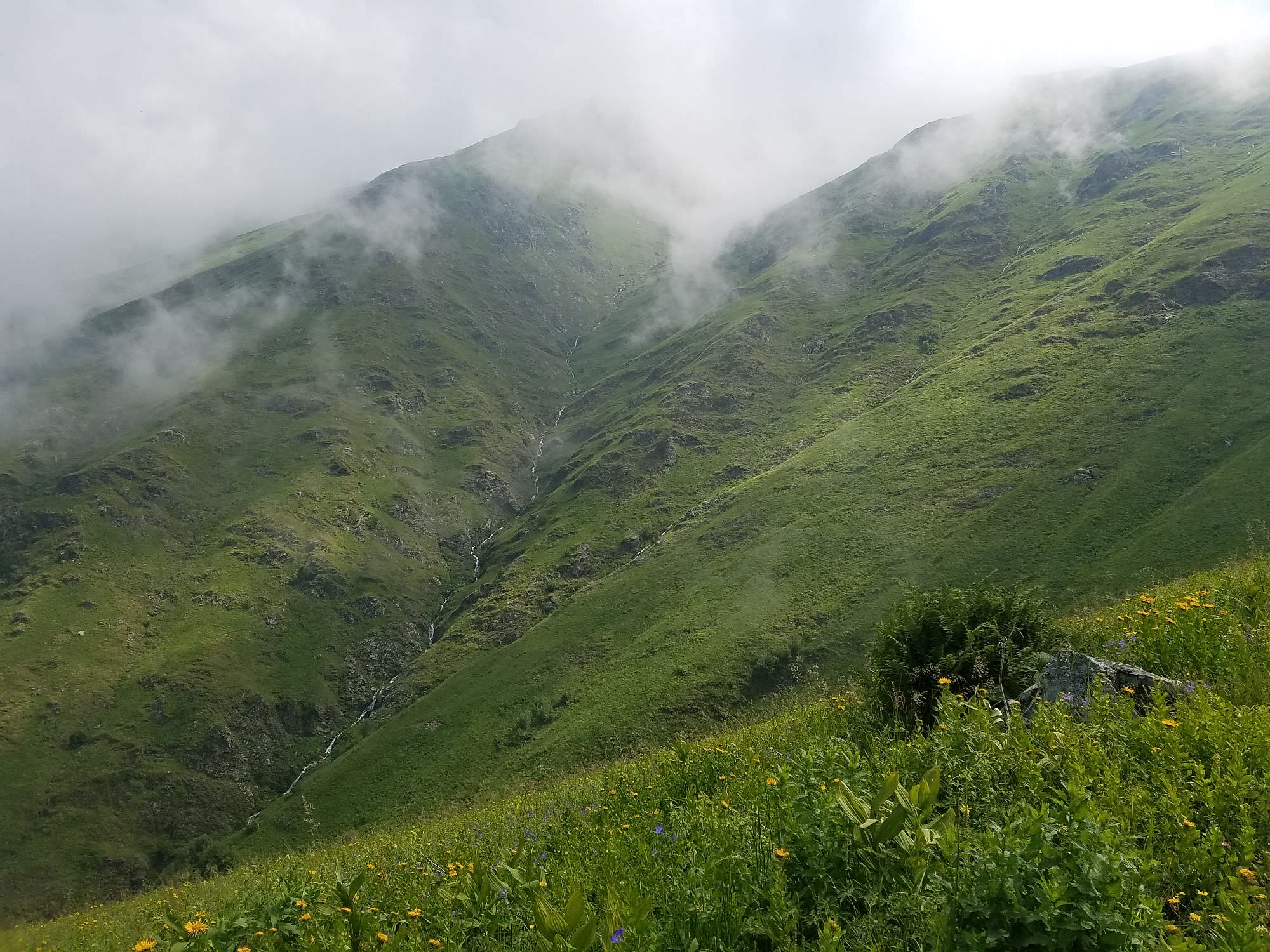
Wild flora and fauna in Georgia’s oldest nature reserve.
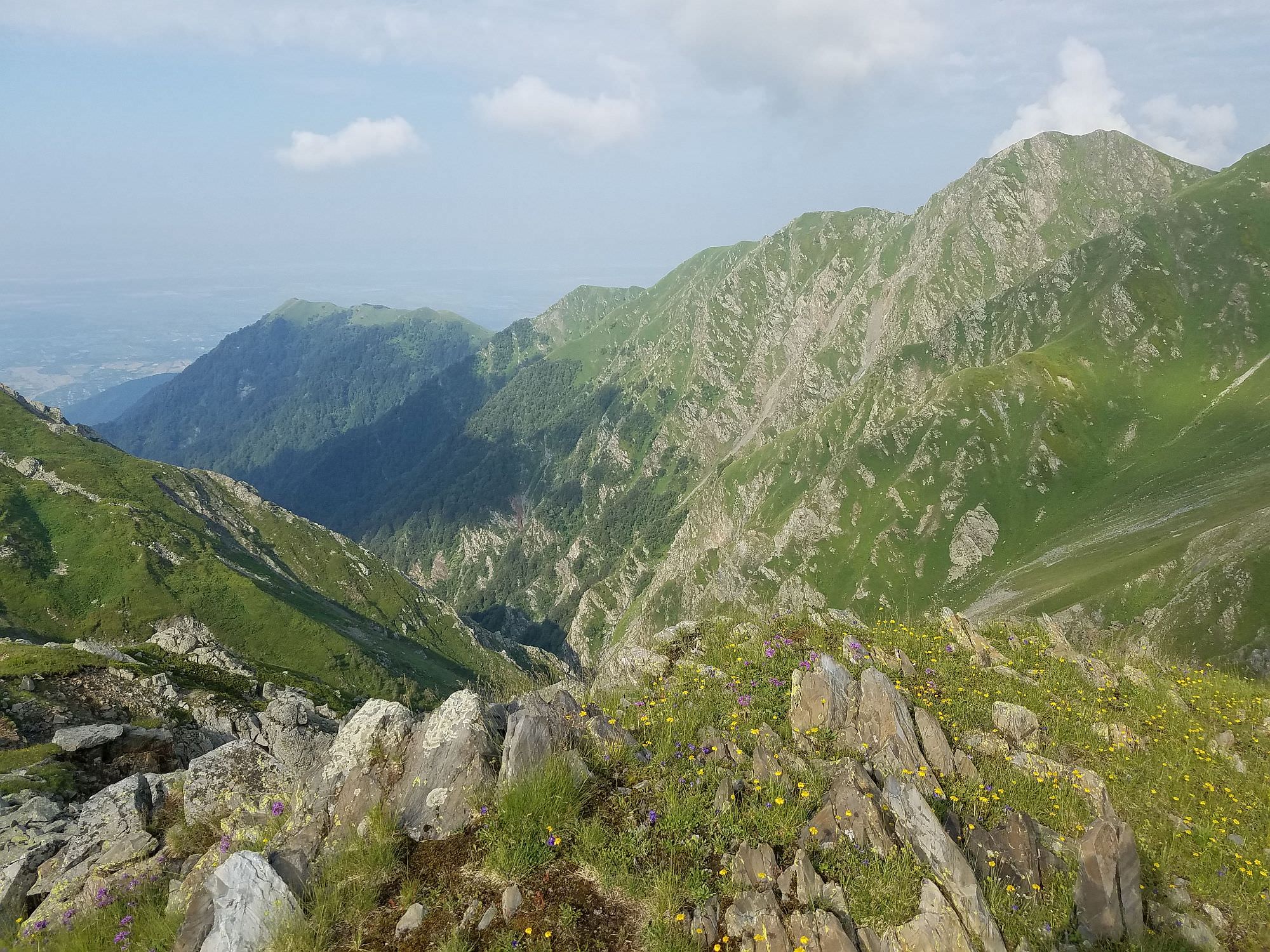
Grazing, wood cutting, and hunting have been banned in Lagodekhi reserve since 1912, making it the ultimate place to see Georgian flora and fauna in its most natural state. This well-maintained but seldom-used 38 km loop involves quite a large vertical gain, but the hard work pays off as you traverse a full ecosystem change from dense beech forest overflowing with wild blackberries to high alpine meadows dotted with wildflowers to the end destination - a crystal clear alpine lake shared by Georgia and Russia.
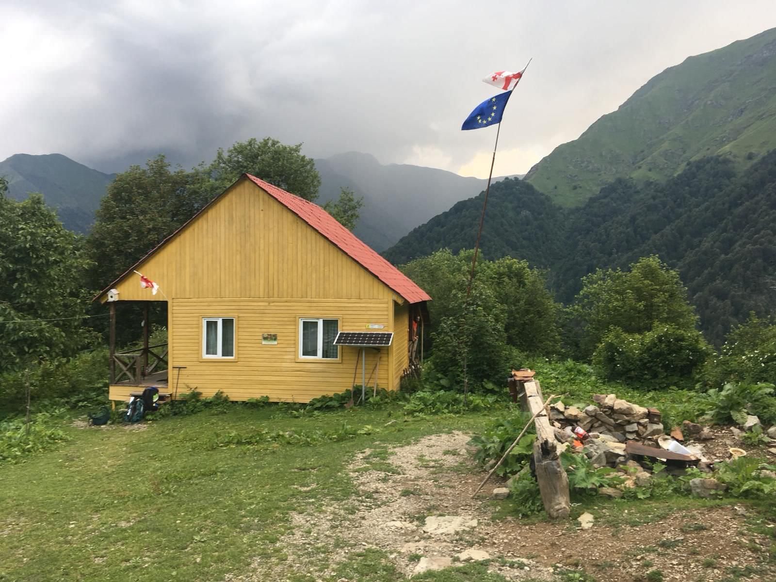
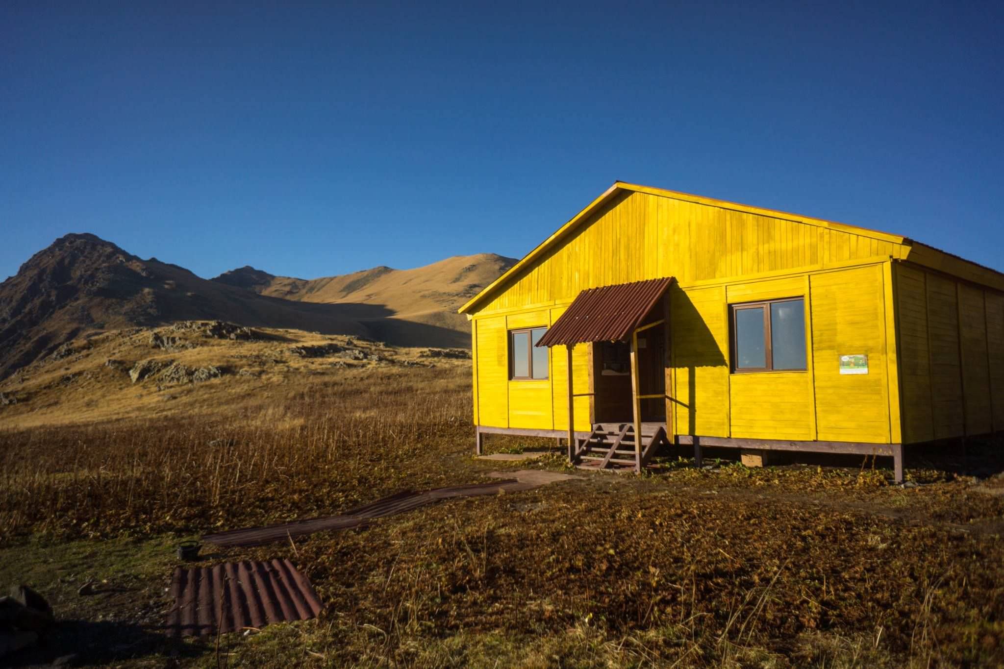
Two huts along the way mean that a tent is not necessary. Horses are available for hire from the information center.
An ambitious and fit hiker could complete the loop clockwise in 2 days by climbing 2100 vertical meters to Demidovo Shelter on the first day and then up to the lake and back down past Meteo Shelter without stopping on the second day. If you are not racing, the hike is more pleasant to complete in 3 days, as the vertical is quite a lot and the Meteo Shelter offers a pleasant atmosphere for a bonfire and relaxed evening.
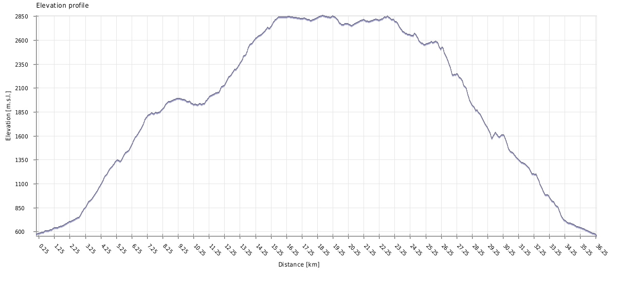
The trail is easy to follow and not technical, but requires almost 1500 vertical meters of climbing on the first day, 1000 up and 300 down on the second day, and 2100 meters of descent on the third day.
After rain, the trail gets quite slippery which makes the steep sections difficult to manage. In good weather the trail is very straightforward as long as you bring enough water and give yourself enough time.
A tent and mat is not necessary as two huts are located along the trail, furnished with bunk beds and mattresses (but no blankets). Meals are not provided so you must pack in your food and pack out your trash. Overnight in the huts costs 30 lari per person per night and camping in your own tent costs 5 lari per person per night. If you choose to camp, it is highly recommended to pitch your tent next to one of the huts, as they are located near clean water at logical stopping points, give you an option for shelter in case of a storm, and it would be a shame to trample the beautiful wildflowers if pitching your tent in a non-designated spot.
A few kilometers after Meteo Shelter is a tent with a few border guards. They will write down your ID information and send you on your way. Make sure to bring your passport or ID with you.
The 3-day hike is typically done counter-clockwise due to the locations of the huts. If you want to attempt it in 2 days, it’s best to go clockwise to do most of the uphill on the first day and downhill on the second day. The scenery is not significantly different in either direction.
Marshrutkas to Lagodekhi village depart in hourly intervals from Isani bus station in Tbilisi. The ride takes 2,5 hours and costs 15 GEL. The first one departs at 7:40, the last one at 18:30.
As an alternative, you can use also shared taxis which depart from the nearby parking lot. The ticket costs 12 GEL (or even more if the taxi is not full), but the ride is faster and more comfortable.
Lagodekhi also has marshrutka connection with other smaller cities such as Telavi (five times a day) or Rustavi.
Lagodekhi bus station is located on the main street, by the public service hall. From here, marshrutkas to Tbilisi depart in 45-minute interval (approximately, as always, everything depends on number of passengers). First marshrutka departs at 6:45, the last one at 17:30. There are also several marshrutkas a day to Telavi or Rustavi.
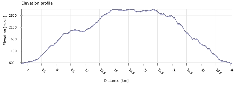
| Distance | 38,2km |
| Trail type: | Loop |
| Max. elevation: | 2857m |
| Min. elevation: | 569m |
| Total climb: | 2888m |
| Total descent: | 2888m |
The trek starts from the information center in Lagodekhi Nature Reserve, at the highest point of Lagodekhi Village. Make sure to buy all food for the hike in the village and then walk or take a taxi up to the Information center to register and pay the camping/hut fees. Fill up your water bottles here, as you will not have another opportunity until the hut.
The trail starts as a wide gravel path going towards the more popular day hike to Black Grouse Waterfall, but soon you will see a sign pointing to Black Rock Lake/Meteo Shelter to the right. From here, there is only one way to go, marked with red and white paint. After about 3 km of relatively flat terrain, you reach a river. Follow the rocky river bank upstream until the bridge, cross, and then head slightly downstream until the trail turns back upward.
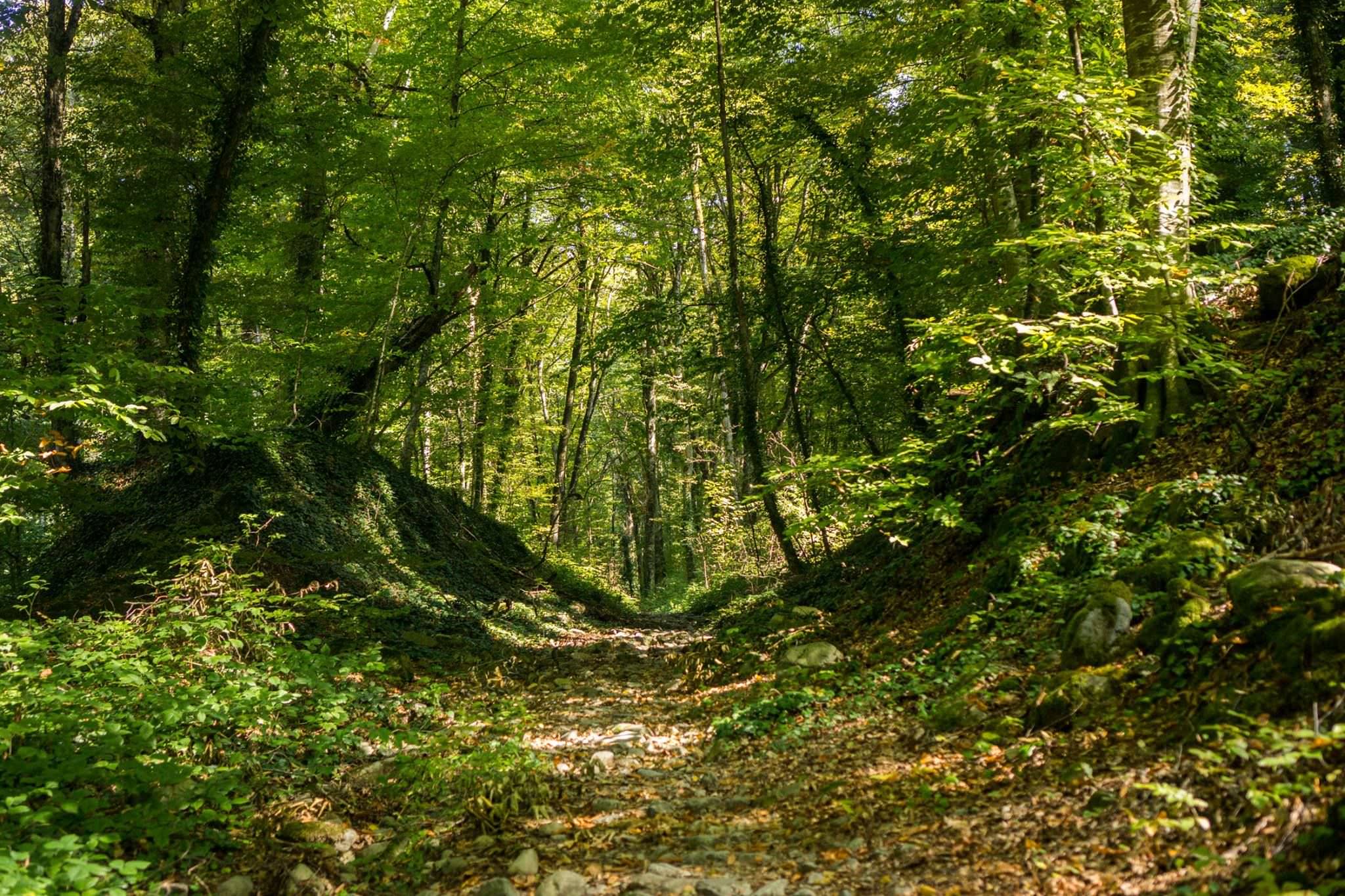
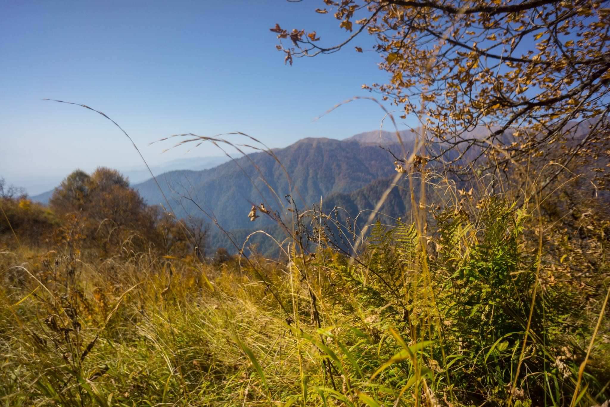
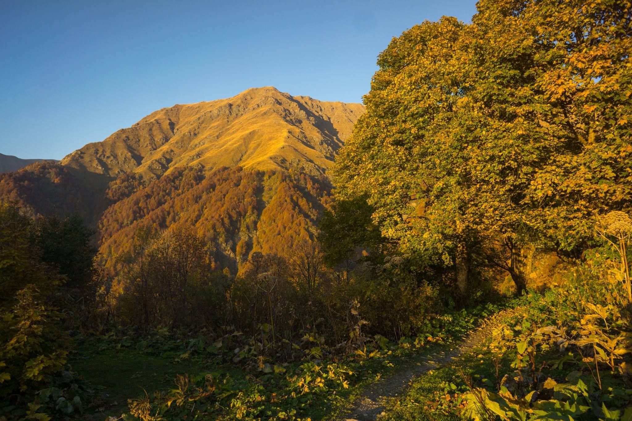
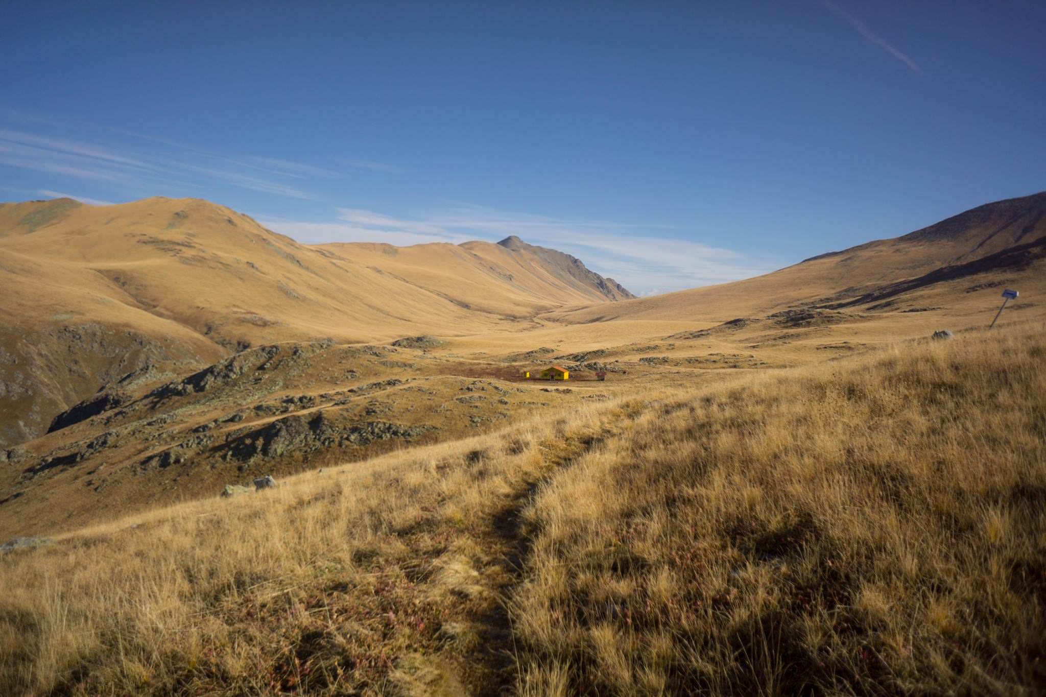
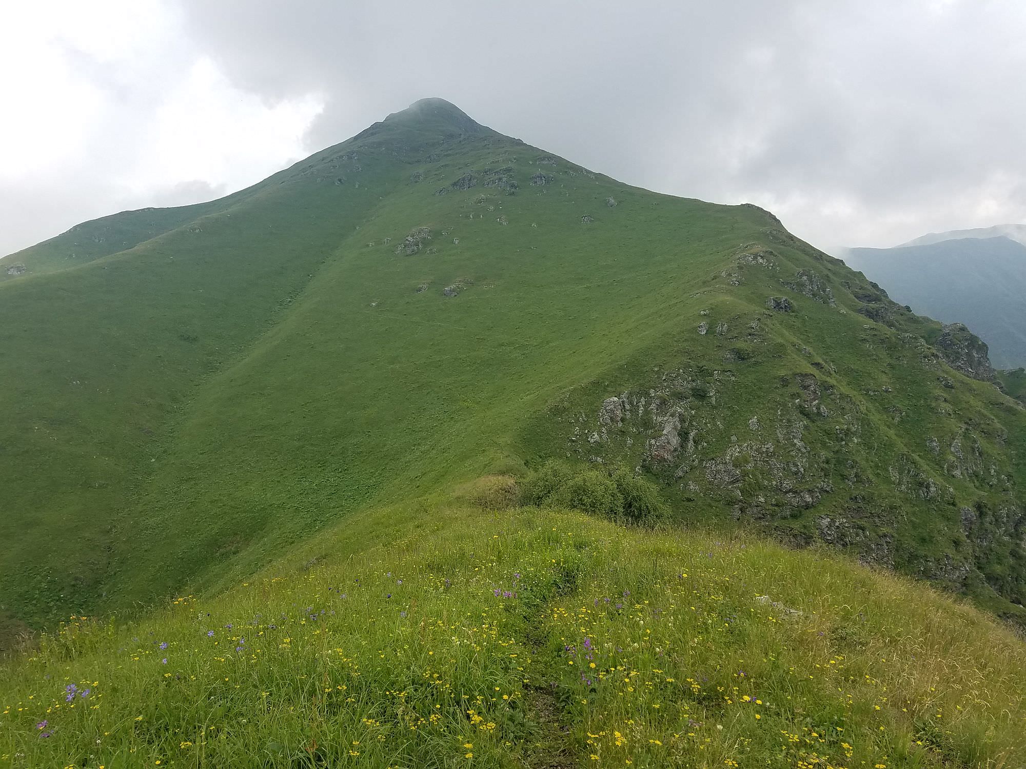
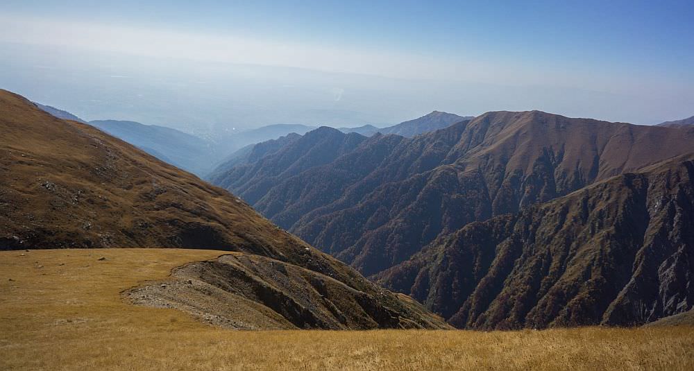
This is where the climb begins. For the next 8.5 km until the Meteo Shelter, you will continuously climb upward through the forest. After 6.5 km you will reach the first clearing with a magnificent view of the valley below; the first reference point of how far you have come. From here, it is only 2 km more of subalpine meadows interspersed with forest patches before the Meteo Shelter.
Check in with the ranger if he is at the shelter. Make yourself at home (or pitch your tent under a nearby tree), refill water bottles from a spring 200 m away (follow the signs), and collect dead wood if you would like to make a campfire.
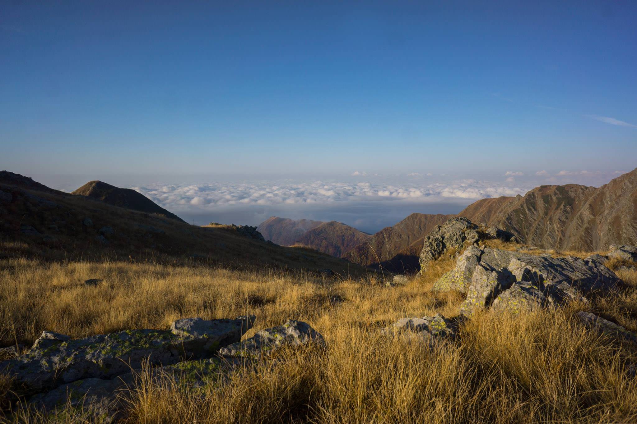
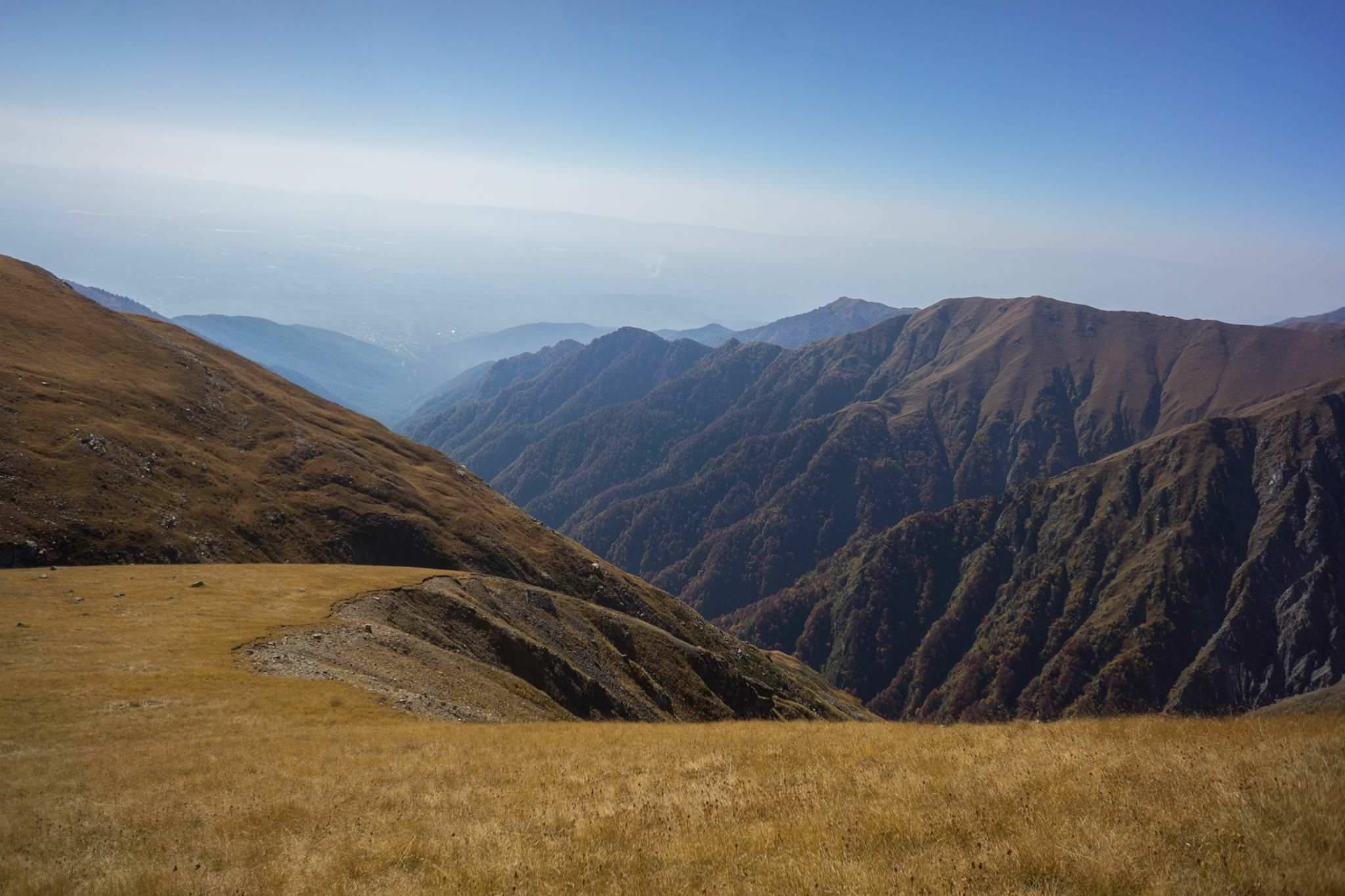
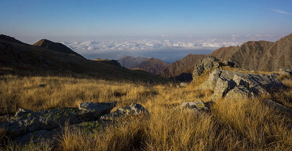
This is the easiest day, with about 6 km of steep ascent, 4 km of gentle ups and downs, and 3 km of descent to the next hut, Demidovo Shelter. If you will want to make a fire at Demidovo, you need to carry wood with you the whole way from Meteo (or hope that a group on horseback will show up with wood) as nearly all of this day’s hike is above tree line with open views of the valley far, far below.
The majority of elevation gain is in the first 6 km, and after that the trail flattens out with a few relaxing downhill sections. There is a spring to fill up water after 2.5 km (with a great view!) and another after 7km. Just before the end of the ascent, a tent for border guards is located about 300 m to the left of the trail. You’ll need to go to the tent and show them your ID in order to continue.
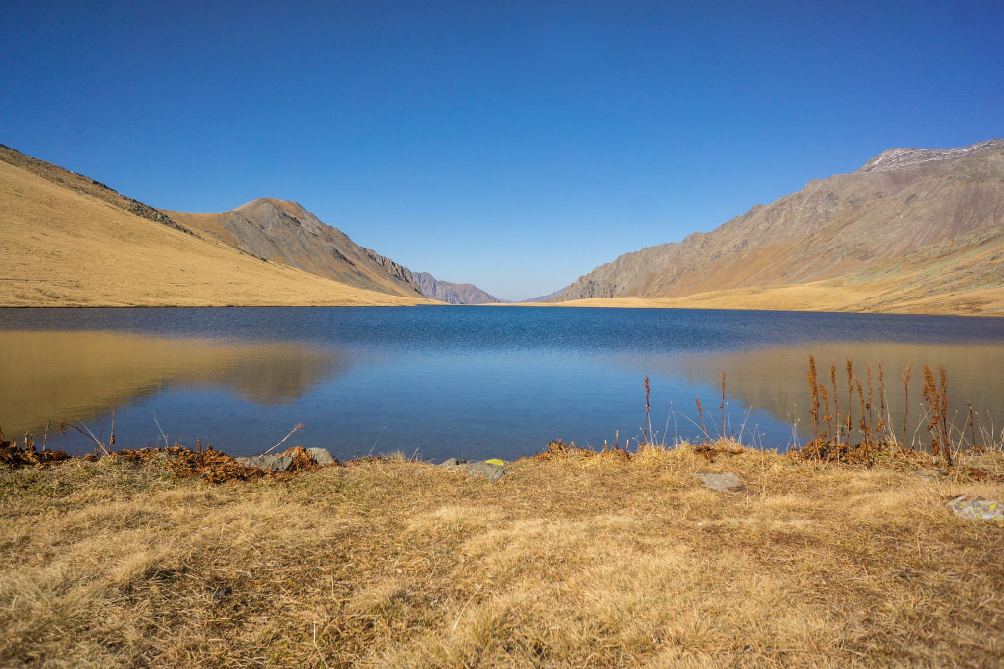
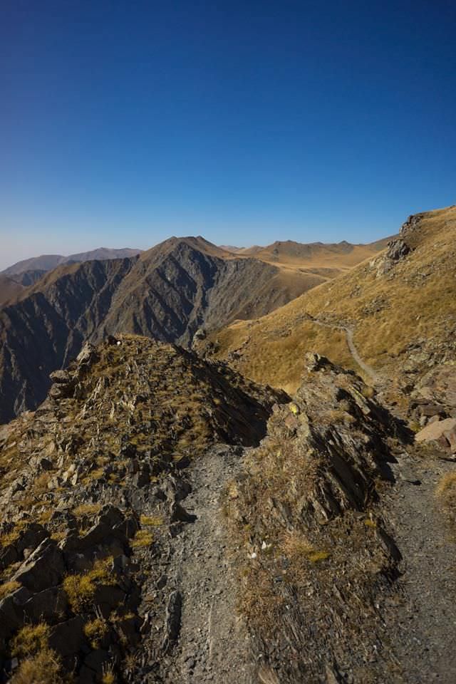
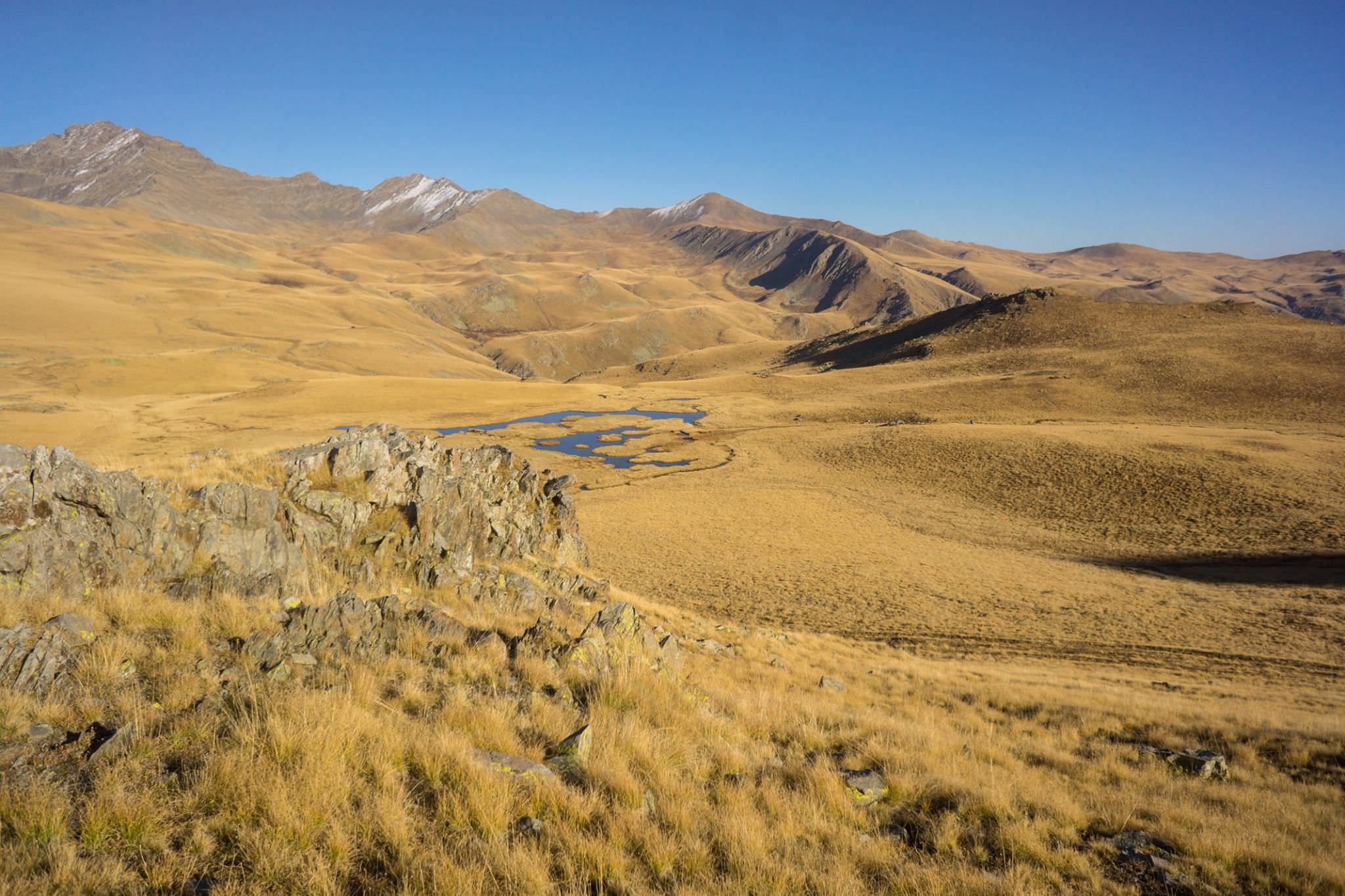
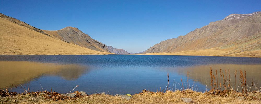
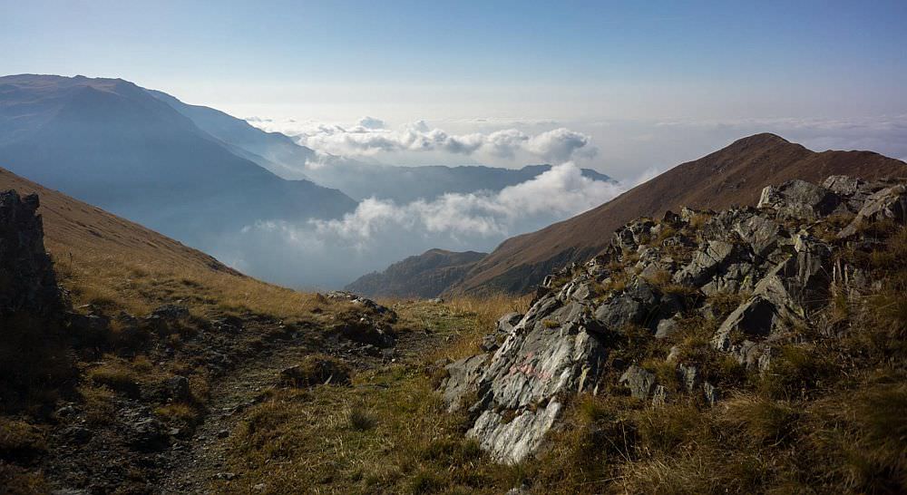
The final kilometers before Black Rock Lake pass by small glacier-formed lakes and wetlands, a pleasant change in environment. A very short and easy ascent after the ruins of an old hut brings you to the final pass with a panorama of the crystal clear water and Dagestan on the opposite shore.
After the obligatory picnic and cold water swim, keep right as you walk back away from the lake. The well marked trail takes you back over a small hill and down one short but steep descent from which the hut is easily visible in good weather. Trudge through the wetlands at the bottom of the hill to your destination, filling up water from any of the small streams near the hut. Take a stroll around and enjoy the view over steep valley below.
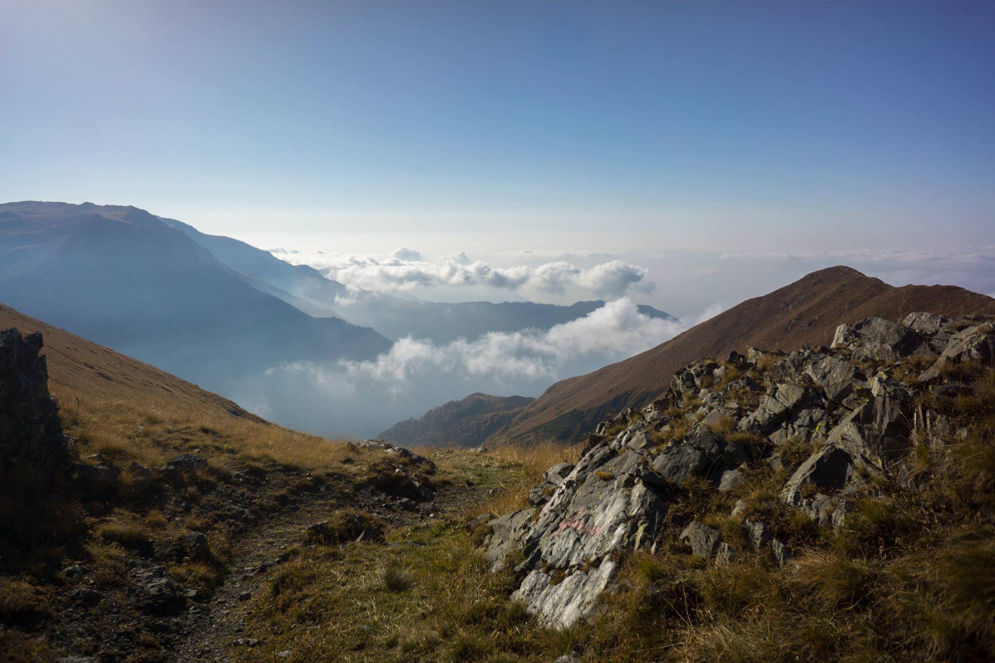
Morning stretching and yoga are highly recommended before diving into today’s 2100 meter descent. The steep sections can be tricky in wet conditions, so if it rained the night before then you will have to decide between waiting a few hours for the trail to dry a bit versus leaving early and giving yourself more time for the descent. In the worst case, you can go back the way you came past Meteo Shelter on the slightly less steep path.
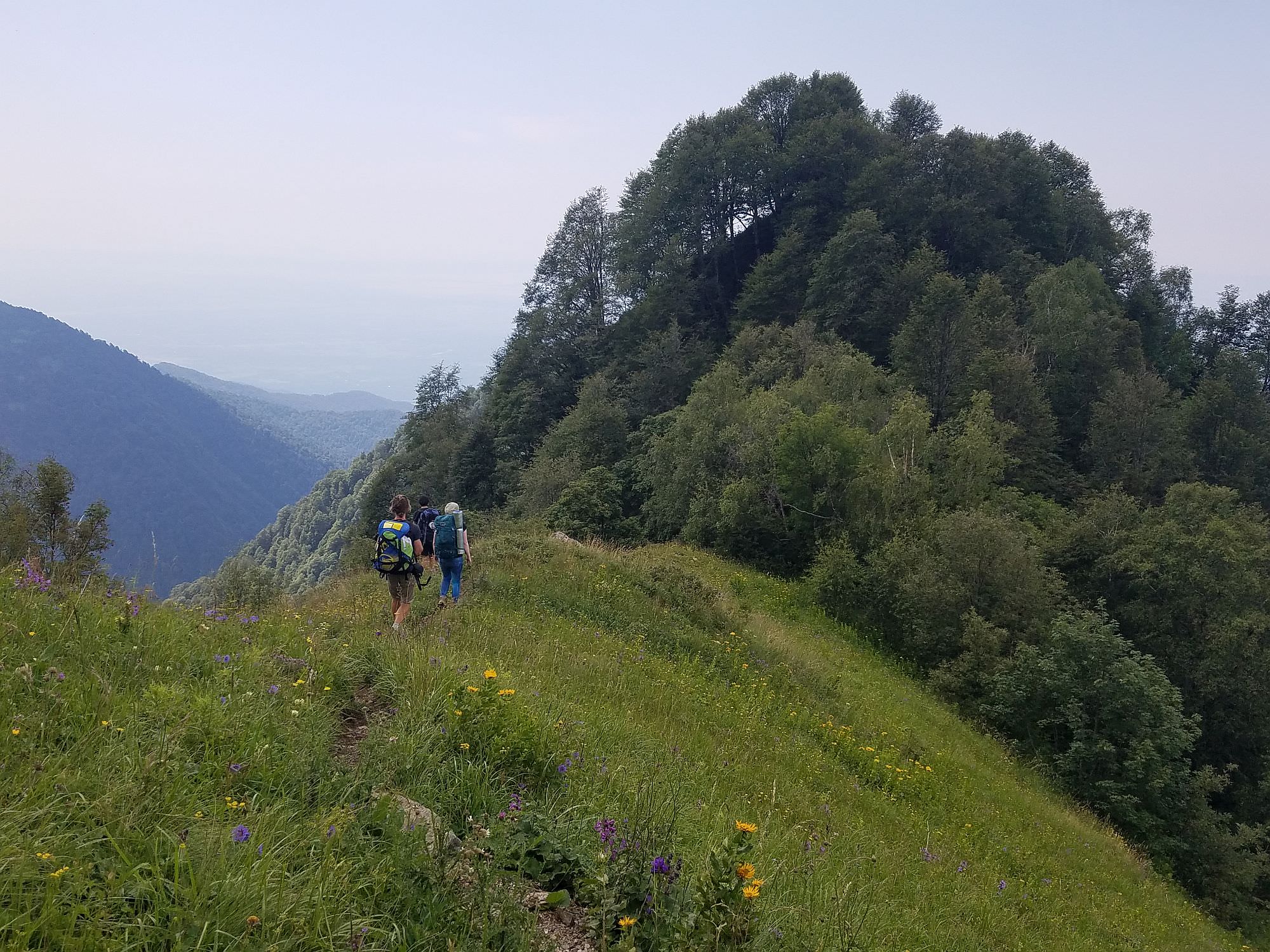
The hike begins with some lights ups and downs along a ridge with 360 degree views but soon the downhill begins. Switchbacks are carved into a steep slope, but the trail is well built with a smooth dirt and rock surface before the tree line. A small spring is located after this first switchback section, just a few minutes downhill from the first information sign. It’s best to take all the water you need from near the hut, though, as this spring is not guaranteed to flow after dry spells.
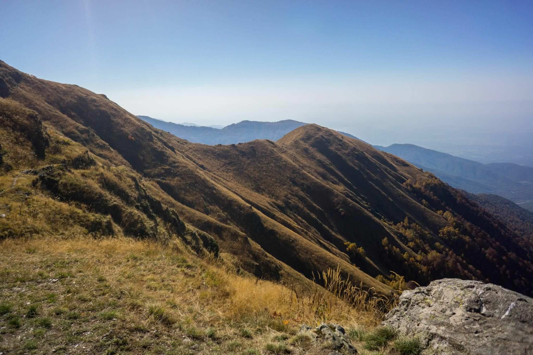
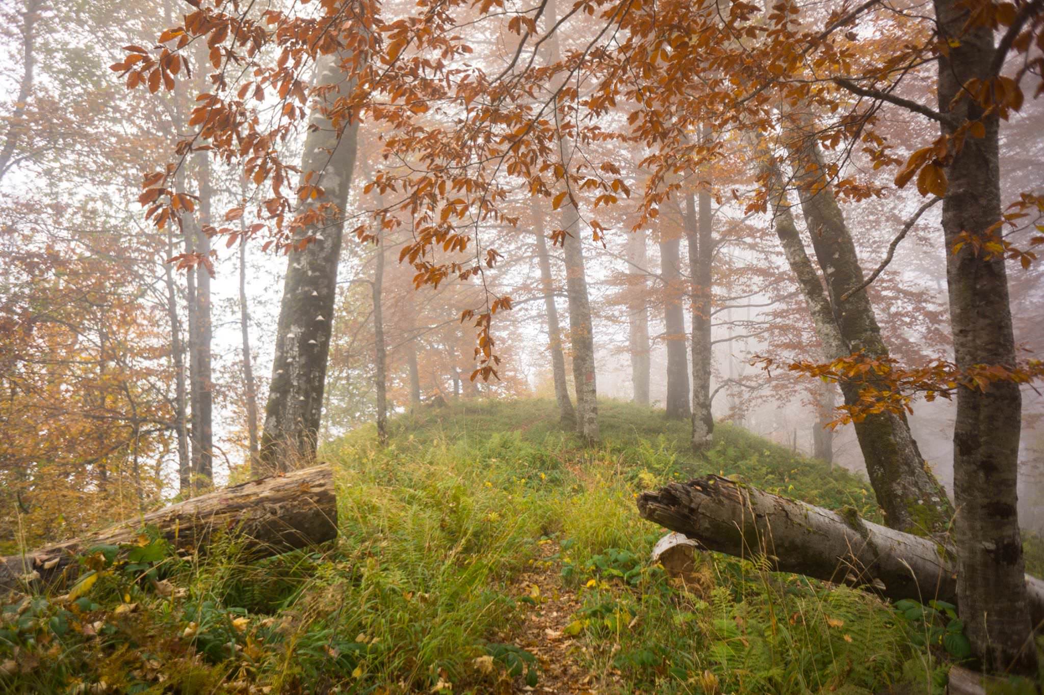
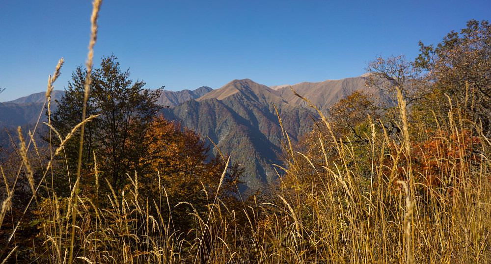
After 4 km you reach the tree line, the trail gets steeper, muddier, and continues to alternate between steep switchbacks and gentle flats for the next 8 km. Around halfway through this section, blackberries will begin to appear along the trail, creating nice opportunities for short breaks. At the end of the steep section, the trail meets the Black Grouse Waterfall trail, where it becomes much wider and flatter. This is the best place to take a short detour to the nearby river to relax in the cold water after a long sweaty hike. The remaining 2 km are very relaxed and easy.
Description of trail was written by Taylor Beckwith-Ferguson, a travel blogger and adventurer who spends his winters managing a ski school in Gudauri, Georgia and plans to open a tour company next summer for human-powered adventures. He also provided some photos - the remaining ones were taken by James Salvatore (don't be confused by clors on his photos - he visited in autumn. In summer, the area is much greener). Big thanks to both of them!