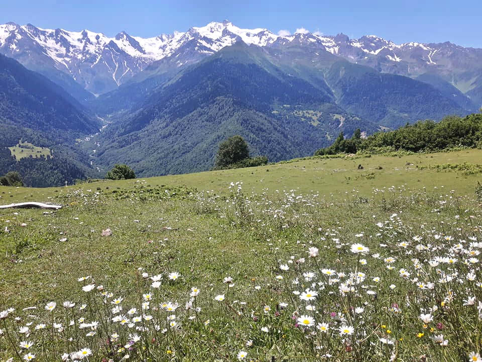
A pleasant walk in the foothills of Ushba mountains.
This trail offers the most direct connection between villages Svan Mazeri and Latali as well as some nice views of mt. Ushba. It doesn´t work too well as a stand-alone hike but could be useful to people who need to leave Mazeri village, don´t want to pay for a taxi and have few extra hours of time for some nice and pleasant walk.
The trail is quite short and elevation to overcome is more than manageable. Moreover, the terrain is easy - the trail follows forest roads and paths as well as the concrete road.
There is no public transportation to Mazeri. The closest road served by marshrutkas lies 7 kilometers away, at the mouth of Becho valley.
So, while you can take the morning marshrutka from Zugdidi to Svaneti and tell a driver to drop you at Becho community, it's not too convenient. A preferable transport, apart from walking, is the taxi, most easily arranged at Mestia. The ride will costs you some 80-100 GEL. If you want to take a taxi to Mazeri from Zugdidi, it will easily cost 300 GEL.
There are also are two nice day walks connecting Mazeri with neighboring villages - Mestia and Etseri.
If you need to get back to Mestia (as does a majority of people doing this trek), I recommend to hitchhike - the road is frequented and you shouldn’t wait too long. Of course, if you are a larger group, it may be more convenient to call a taxi.
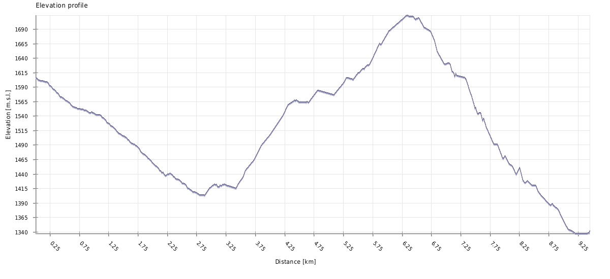
| Distance | 9,5 km |
| Trail type: | Roundtrip |
| Max. elevation: | 1714m |
| Min. elevation: | 1337m |
| Total climb: | 405m |
| Total descent: | 674m |
From Mazeri, follow the slowly descending asphalt road to the south for about 30 minutes (the least pleaant part of the hike), till you reach the bridge over Kheldra river. Cross it and descend a little more till the pointer in Ushkhvanari village that indicates a path on the left.
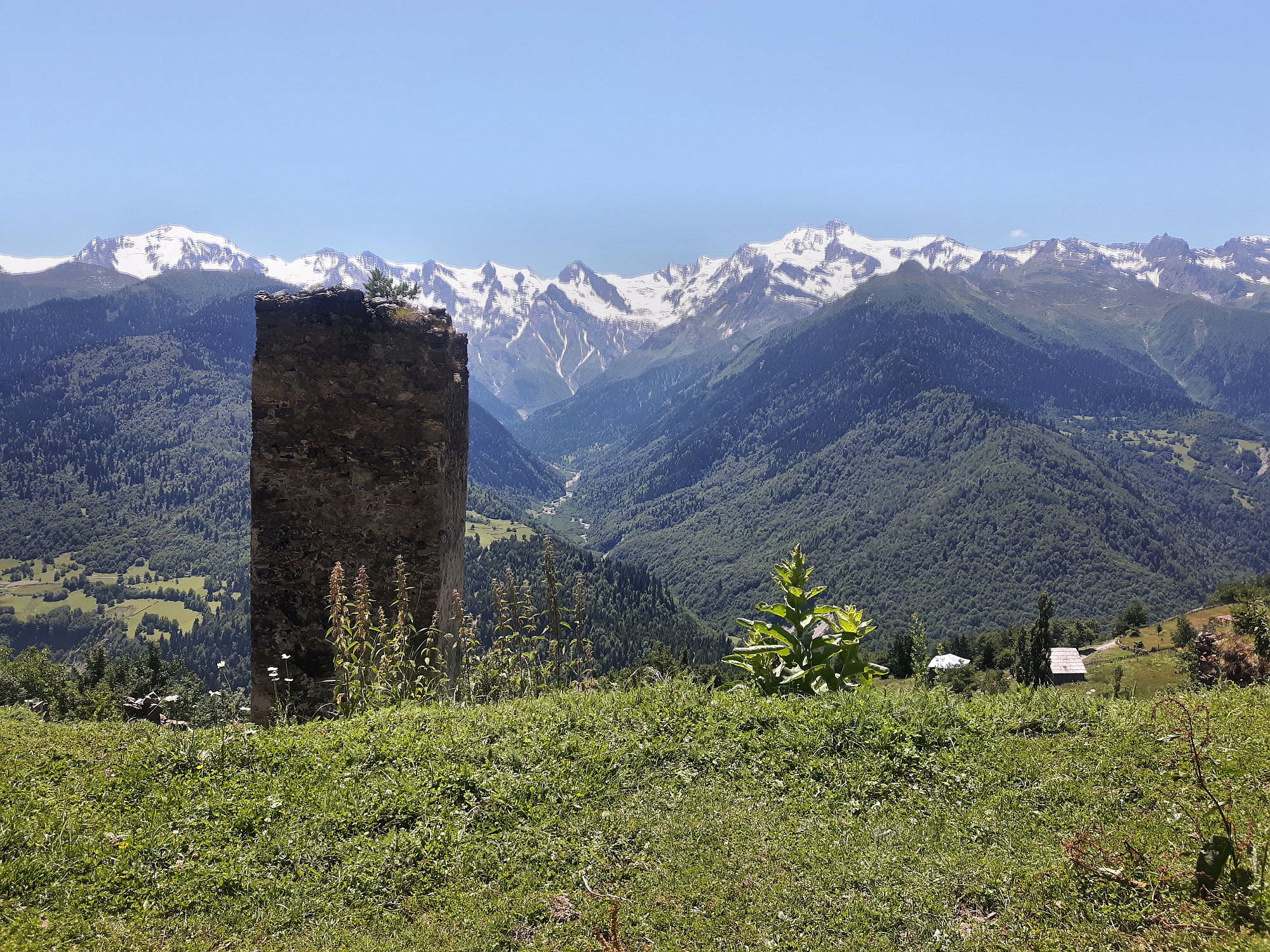
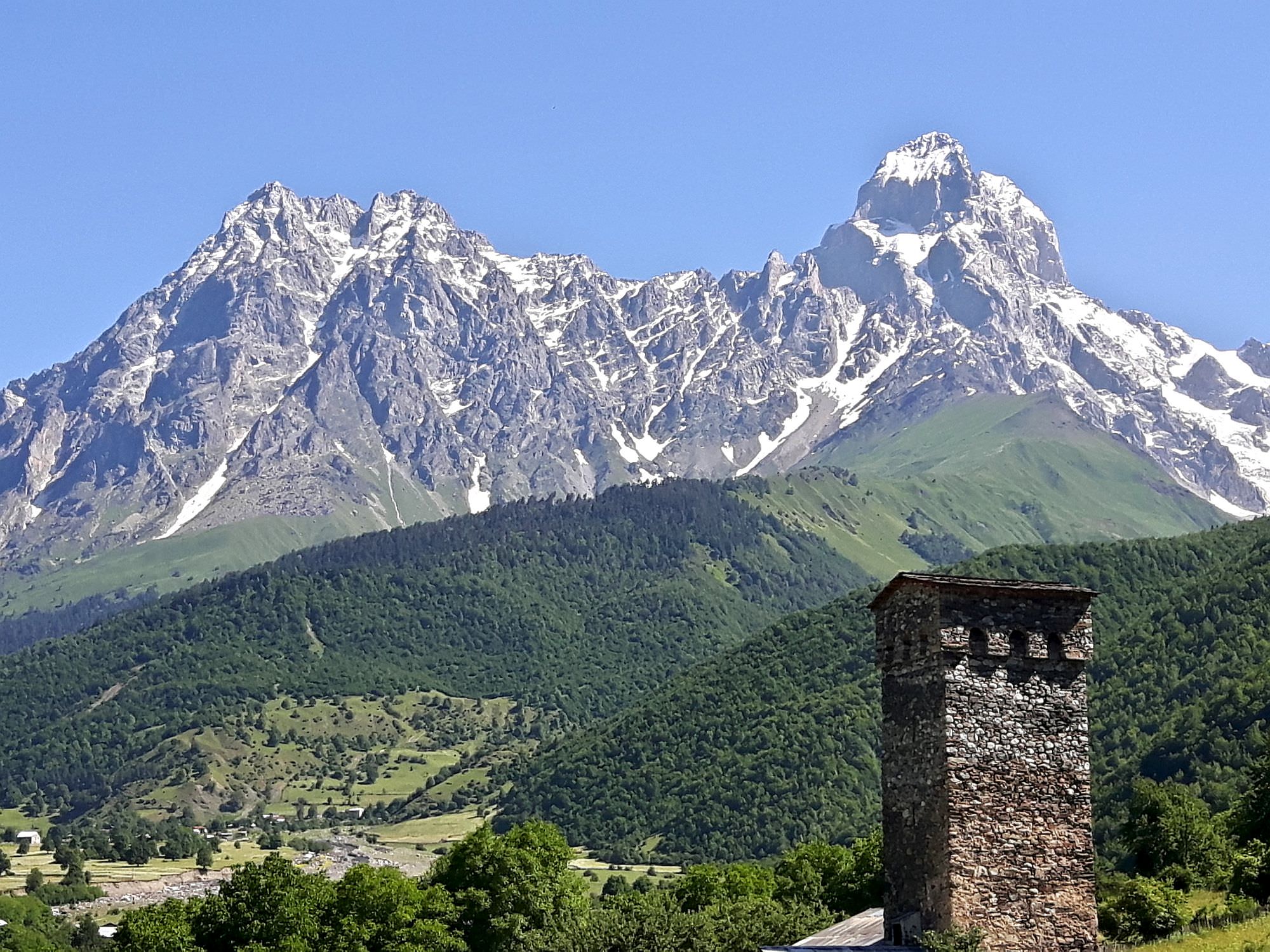
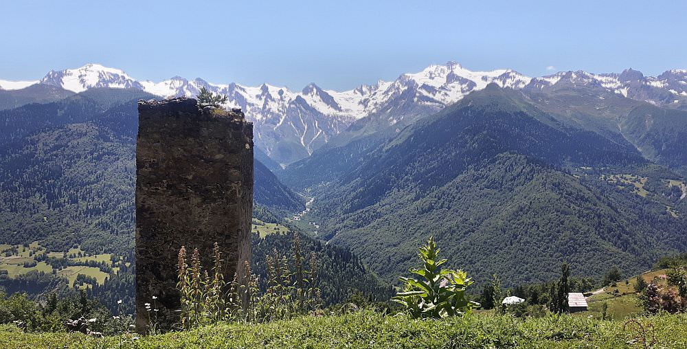
We pass through Ushkhvanari which turns out to be a pretty village, with the only defense tower in the whole valley in the same state than those in Mestia. Just before we pass the gate, is located a guesthouse with a balcony with superb views to Ushba, and very nice wooden garden furniture, inviting for a stop if in the mood for a drink. Don't forget to close the gate if you are alone.
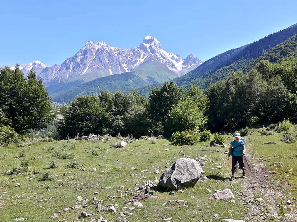
We penetrate a forest where the path keeps elevating. In the beginning, you will see some marks but they eventually disappear. We cross a clearing, and then we meet a couple of junctions that match no trail visible on maps. The first one elevates on the left (keep right), the second one descends somewhere to the right (keep left). Keep an eye on the GPS route if you aren't sure.
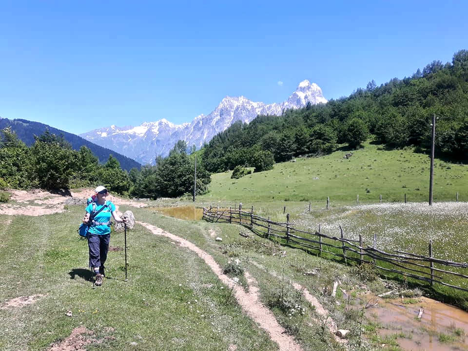
After a steep section, we end up on a wide clearing with a wooden hut, again with views to Ushba. We aim to the opposite end of the clearing where the trail, after a muddy part, gets into another clearing. From here, it leads to the highest part of the hike, where we join a land-rover track that appears from up left. Marks reappear (were they on that track ? it is possible that marks followed the first junction in the forest we ignored, and followed a higher alternate route in the forest).
We turn into the main valley overlooking villages near Latali. The path then descends to villages of Latali community - Nakvam-Zagrali, Shkaleri and after few steep turns, Lenashi. It is possible to go up a little to Ipkhi to see the St George church on the way. We can reach to the main road going straight down, but in order to avoid the dust, stay on the trail as long as possible in order to arrive at Lenashi.
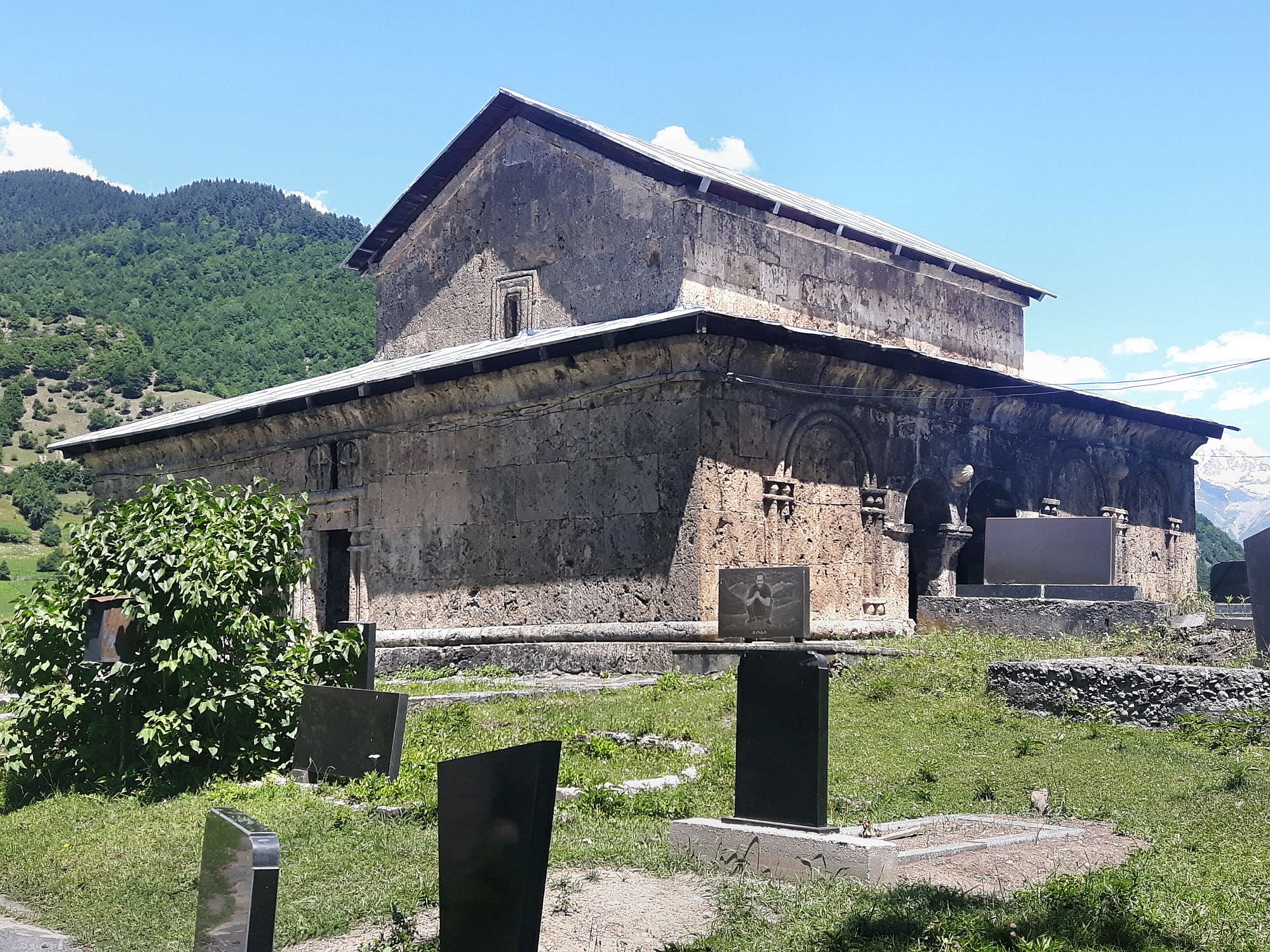
If you are hitch-hiking eventually, do not forget to visit the church in Lenashi before leaving, it is very beautiful. If you really would like to reach Mestia on foot, there is an option to walk east to the bridge and catch the trail going on the opposite side of the river Mulkhura. In Kashveti is a bridge that allows getting back on the left side of the river just before Mestia. This portion is 6km long, quite uphill according to our guesthouse owner, and described on some printouts in the tourist information in Mestia. Unfortunately I have not done it, but all together this makes a suitable one-day alternative to the Guli pass in case of bad weather.

Description of trail was written by Eric Visentin, who visited the area in summer 2019 with his family. He also provided all photos. Thanks a lot!