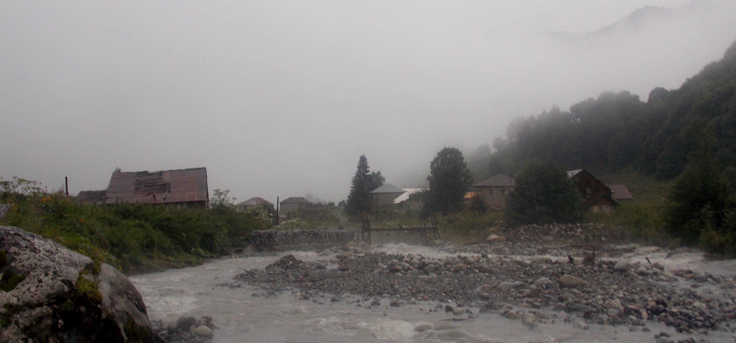
Day 8 - Lapuri pass. God protects drunks and fools
The morning was lovely foggy. I got going pretty fast and on my way took pictures of the ghost village swimming in the fog. I looked for the shortcut across the range that the Geoland trekking map promised, but it seems any info on non-drivable tracks is simply wrong on these maps. Well, at least in most places I checked. With such a map and compass I was now going to tackle two less-used passes of the most difficult part of my trek. Good I did not know it yet myself. There was no shortcut, so I marched to Zeskho along the big road. Even this was sufficiently steep and when I got there, Sun was already high up.
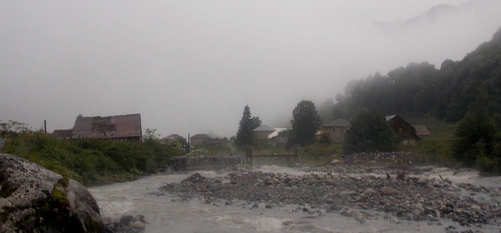
Tsana village in the morning fog
This made me wonder, if doing Lapuri pass today is a good idea. Maybe there is no need to hurry. Just in case stepped into a big house to ask what time is it. A young lady stood on the door. To my surprise she spoke good English and said the it is 11:02 AM. Then a younger man appeared and asked me to come in. The table was already covered. I do not know if it was breakfast or lunch, or just one continuous party. All of a sudden there was a plate in front of me, potatoes, some nice eggplant stuff I cannot name, suluguni and some meat. As it appeared, two of the jolly company were visitors from Tbilisi, rest of the 6-7 men more or less local (Zeskho has 4 full-time inhabitants).
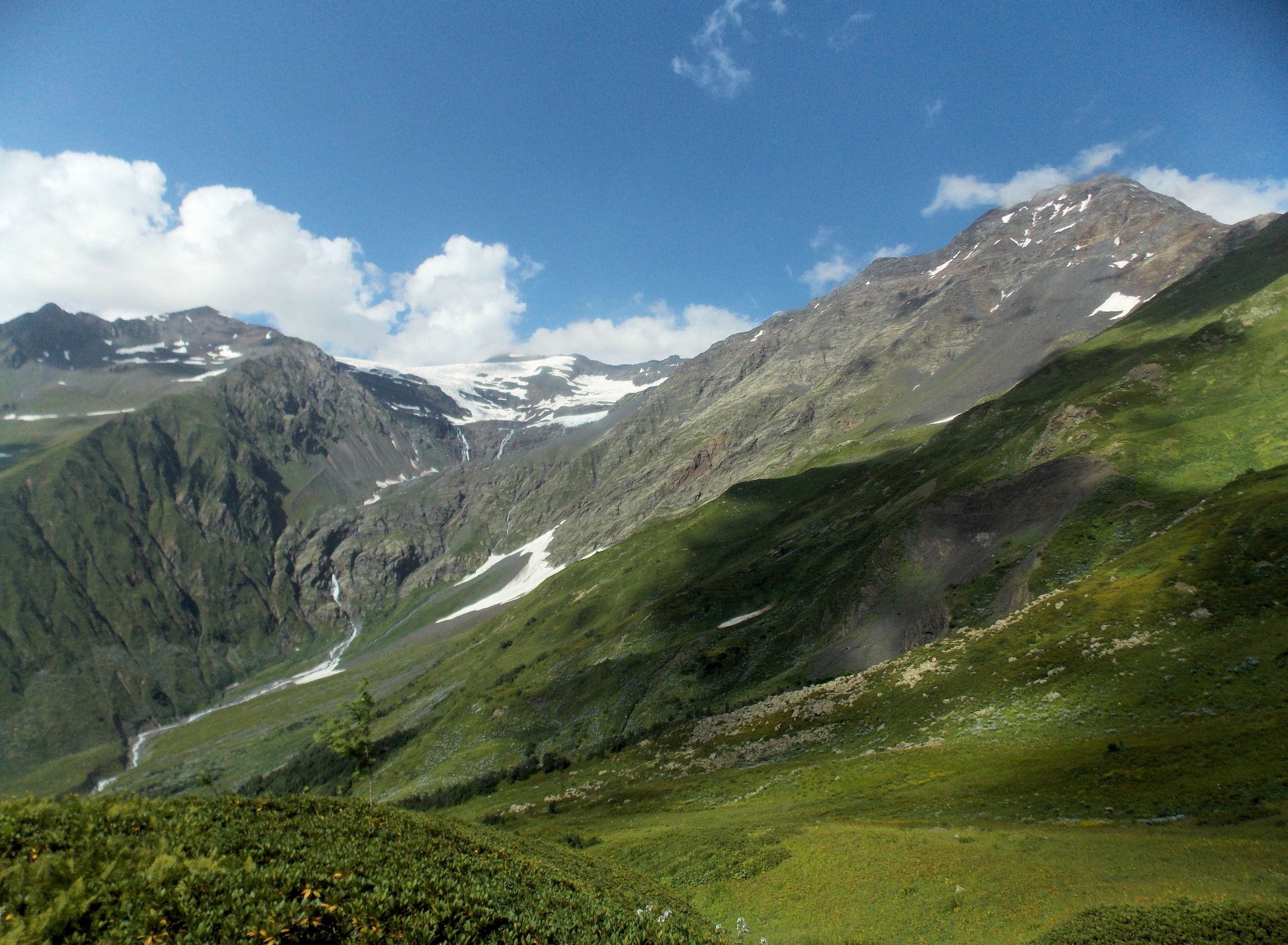
Now it was time for toasting, of course with good white wine that the landlord had specially brought from Kakheti. So the time went by, hour or even two, until I finally said my own parting toast and moved on. Below the pass there are nice fields, the men had said. It is about five kilometers from here, set up the camp there, tomorrow you can cross. Sounds sensible. Look for the huts, there you turn away from the river, pass the huts, then follow cow trail, then a creek up to the pass, the description said. OK, that does not seem complicated.
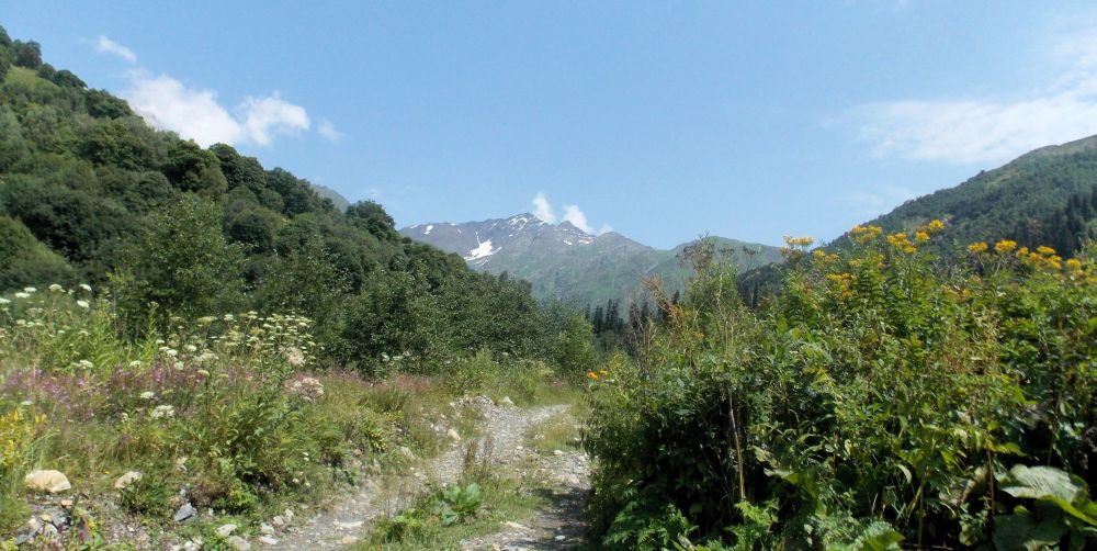
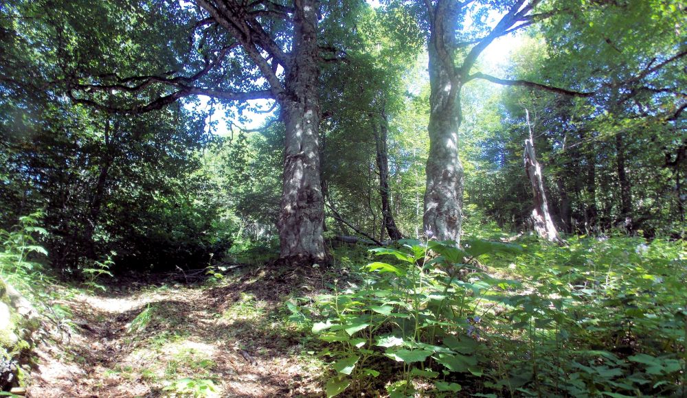
Track to the huts
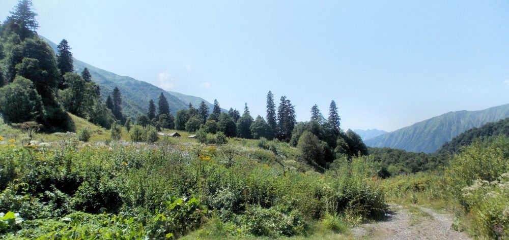
Shepherd's huts in the upper Zeshkura valley
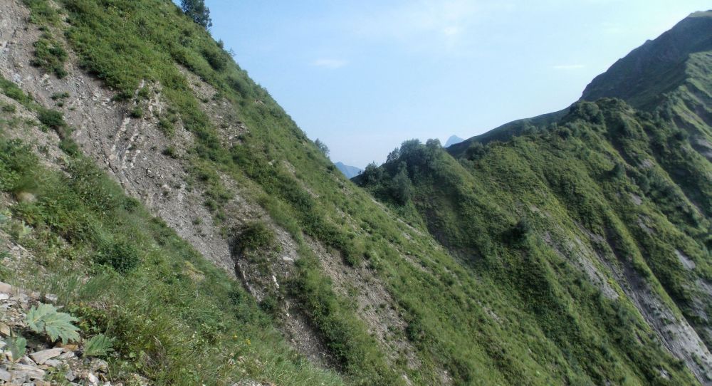
Found the huts, turned. No cow trail, but pretty clear car tracks. These kept to the left, along the ridge to my left. Looked at the Geoland maps. Indeed, the trail seemed to go along the ridge. So I followed the car tracks. Camping places were plenty, but now I realized that I had forgotten to bring water. Whether the reason was Kakheti wine or something else, but the pass did not look too bad so I decided to cross it anyway. Bush did not allow me to spot the actual pass on the ridge, though...
Car tracks soon ended in a gill. It had been raining heavily here and the slope was full of deep but dry gills, gorges and gravel. So far so good, picked one bigger flow trail that seemed to go in more or less sensible direction and started to climb. Soon it turned into a deeper and deeper gorge with banks full of impassable bush. View was non-existent. Then I was forced to climb in places, with my 25 kg pack it was not funny.
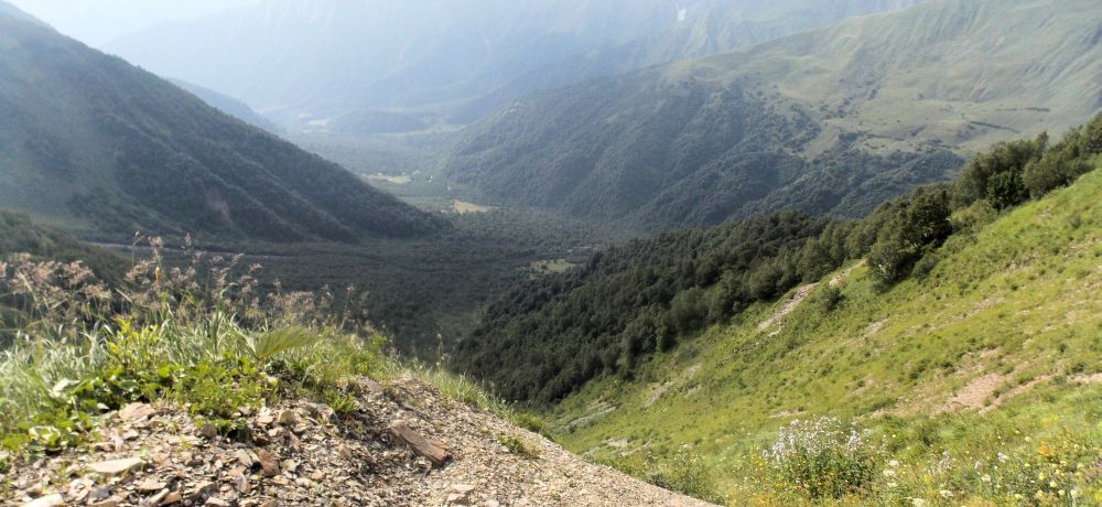
Zeskho village visible far below
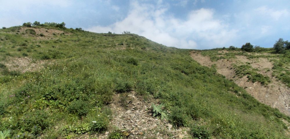
Climbing to the ridge on a nasty, steepening soil slope
Finally, I found a place where I managed to get up to the bank with some acrobatics. Slope was now damn steep. There was still quite a bit to the ridge and exact location of the pass I could only guess. I pushed on.
Russians have a saying that pizdec sneaks in silently. This is exactly what happened. Finally, I made it to the point where I saw the pass. I found myself on the pass saddle altitude, but good couple of hundred meters to the left of it. The slope was really steep soil, boots had no holds, mostly I had to move on my hiking poles. Arms and biceps were burning. I noticed an outcrop where I could take off the pack and rest. I had a choice. Descending on the poles is tricky, it was way too late to turn back now.
The best way out seemed to do a travers to the right, towards the pass. Unfortunately, another gill with almost vertical rocky banks was in between. Still, decided that this is the way to go.
The pass. So close and so damn far
When descending to the gill I almost fell. There were no holds for my hands, only soft soil, fortunately the feet found some rock on the last moment. Finally, I managed to push onto the grassy razor-sharp ridge, descending towards the pass.
Fortunately, the grass was not wet and my boots held nicely. I descended to the pass, that was a sharp dint in the narrow ridge. There was barely room to take my pack off.
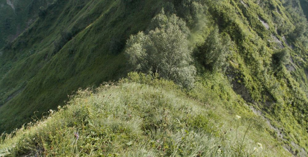
Finally, on the ridge
Now I know that initially my error was not that big – right creek went up just hundred meters to the right from the one I picked. Having a working GPS, I probably would have found it. Now I simply had lots of raw luck. Poles saved my sorry ass.
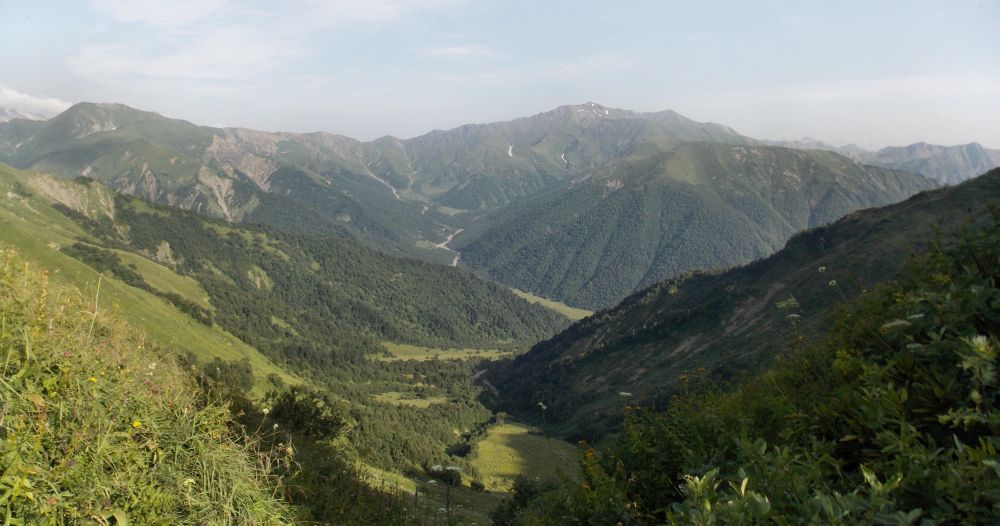
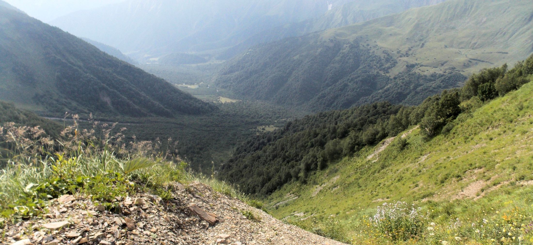
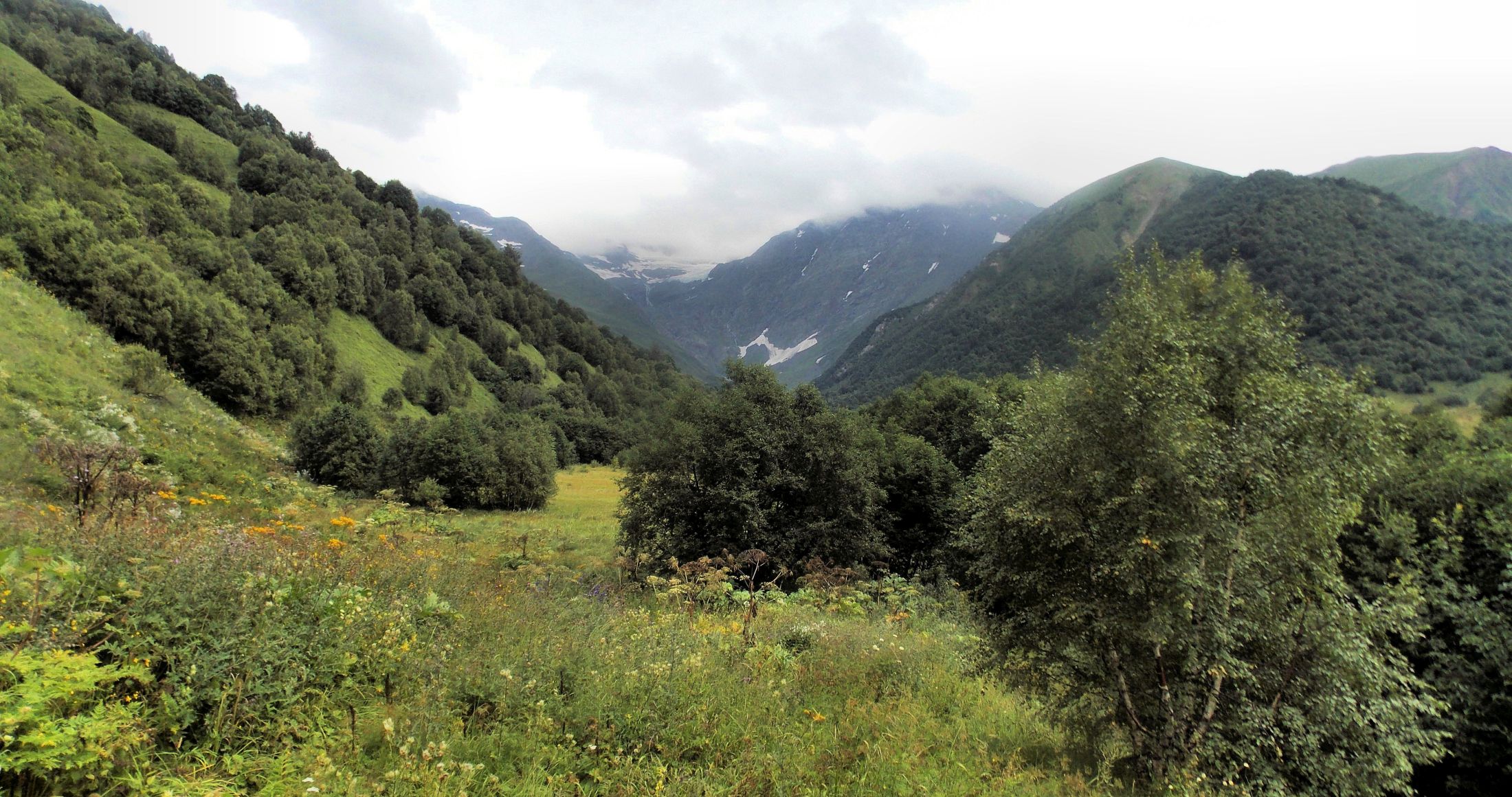
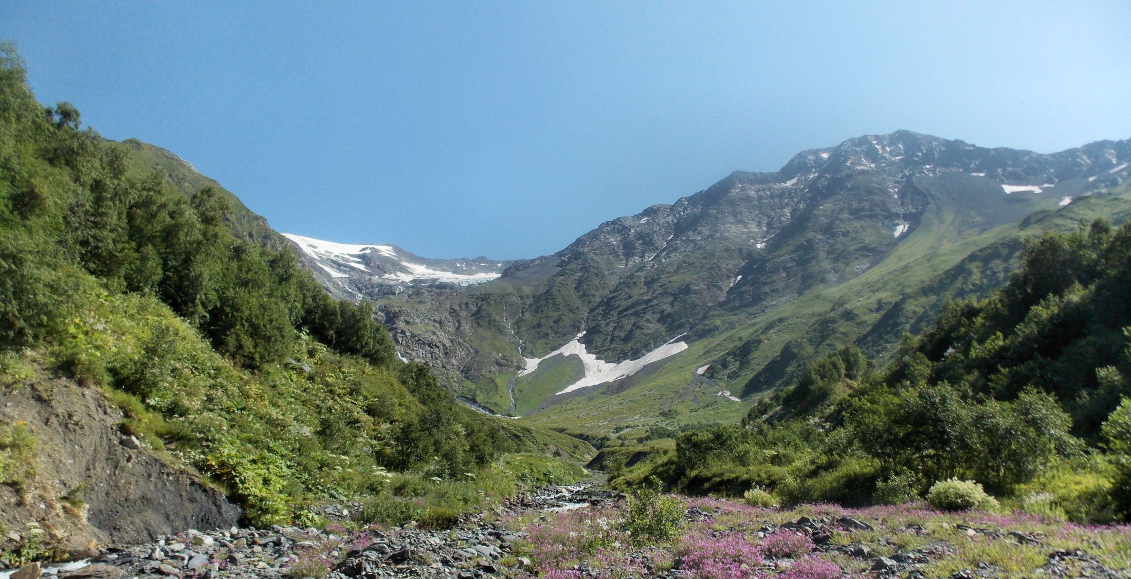
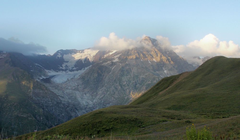
Tskhenistskali valley from Lapuri pass. The green slope on the left, farther ridge is the Vatsitsveri pass.
Path descending from the pass had also turned into a narrow gully that was slippery and unpleasant, although not dangerous. I fell and I fell, then I heard a crack and my fixed hiking pole was broken again. Wood had not held. Fortunately, some bigger group had gone here, there was strong trail and no danger of getting lost. Finally, this trail descended into a creek gully to my right, I got water and life seemed better again. With final gleam of the sun I reached Tsenitskhali river and put up a camp! Alive!
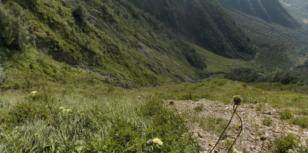
Descent into Tskhenistskali valley
Day 9 - Tskhenistskali valley. Washing day.
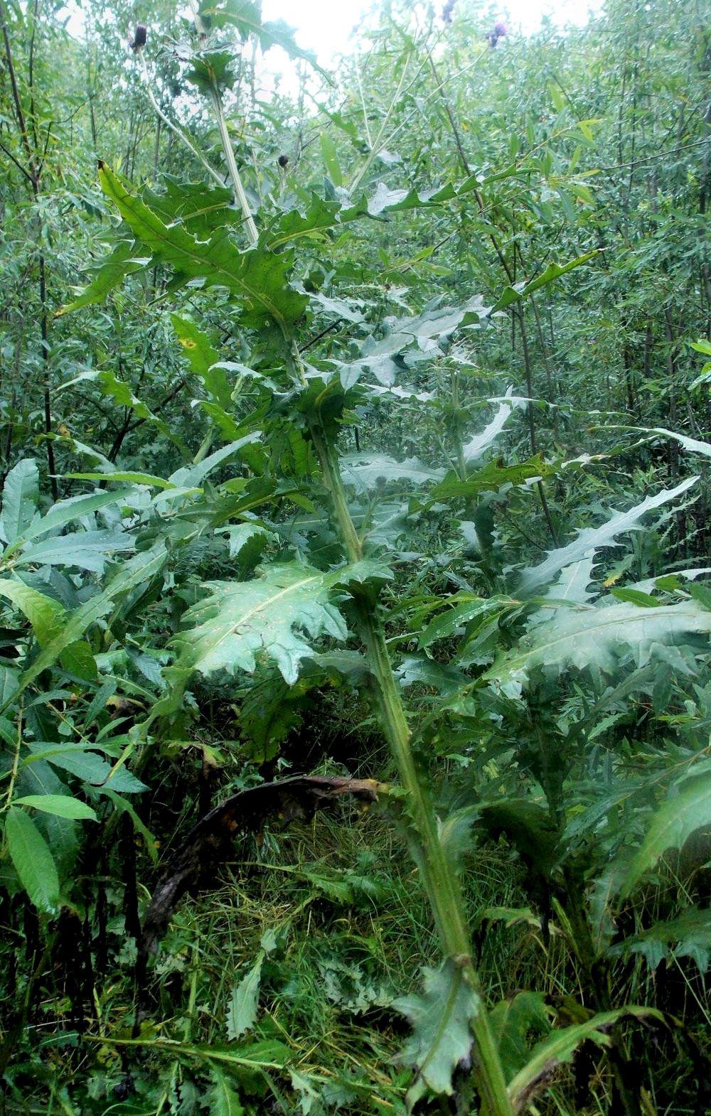
No, I did not squat, everything is THAT high. I am 186 cm, btw.
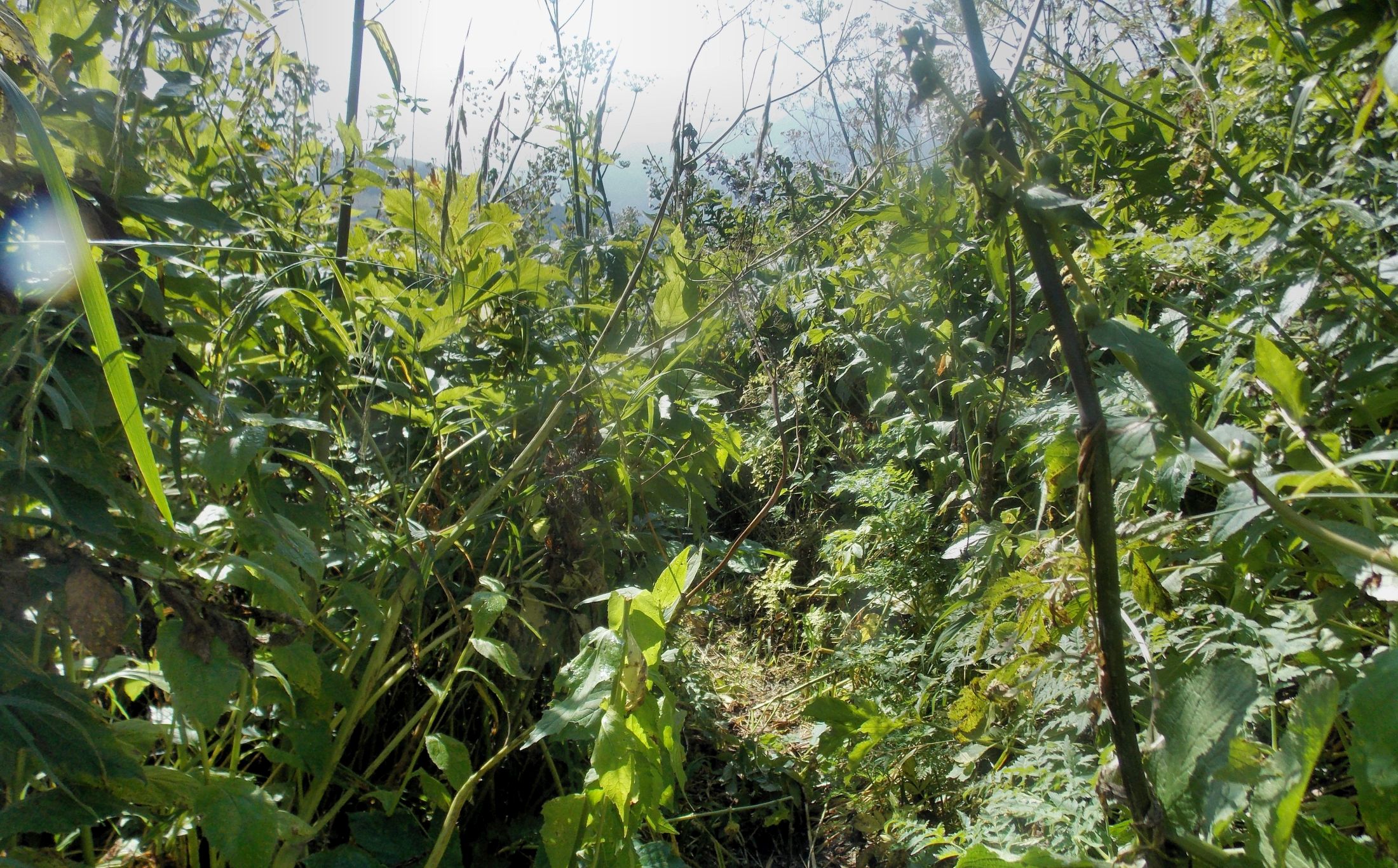
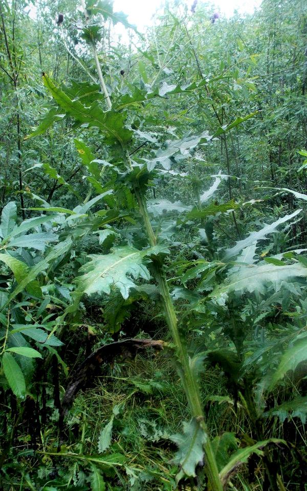
Upper part of the Tsenitskhali valley is uninhabited and locals come here only for fishing. I had been warned that there are lots of bears here, so I kept my eyes open, hoping to see some. No candy, of course. On this side of the Lapuri pass nature also changed. Instead of sparse vegetation of Svanetia here everything was huge. Three-meter cow parsnips, over-the-head thistles, nettles, rhubarb-size coltsfoot and various big flowers formed a jungle with zero visibility. Breaking through would require a machete. Then there is birch and alder brush-wood, where even machete would not help. All this jungle is wet and does not dry fully even on a sunny day. As soon as you enter you are completely wet. Out of the jungle you can only get higher up.
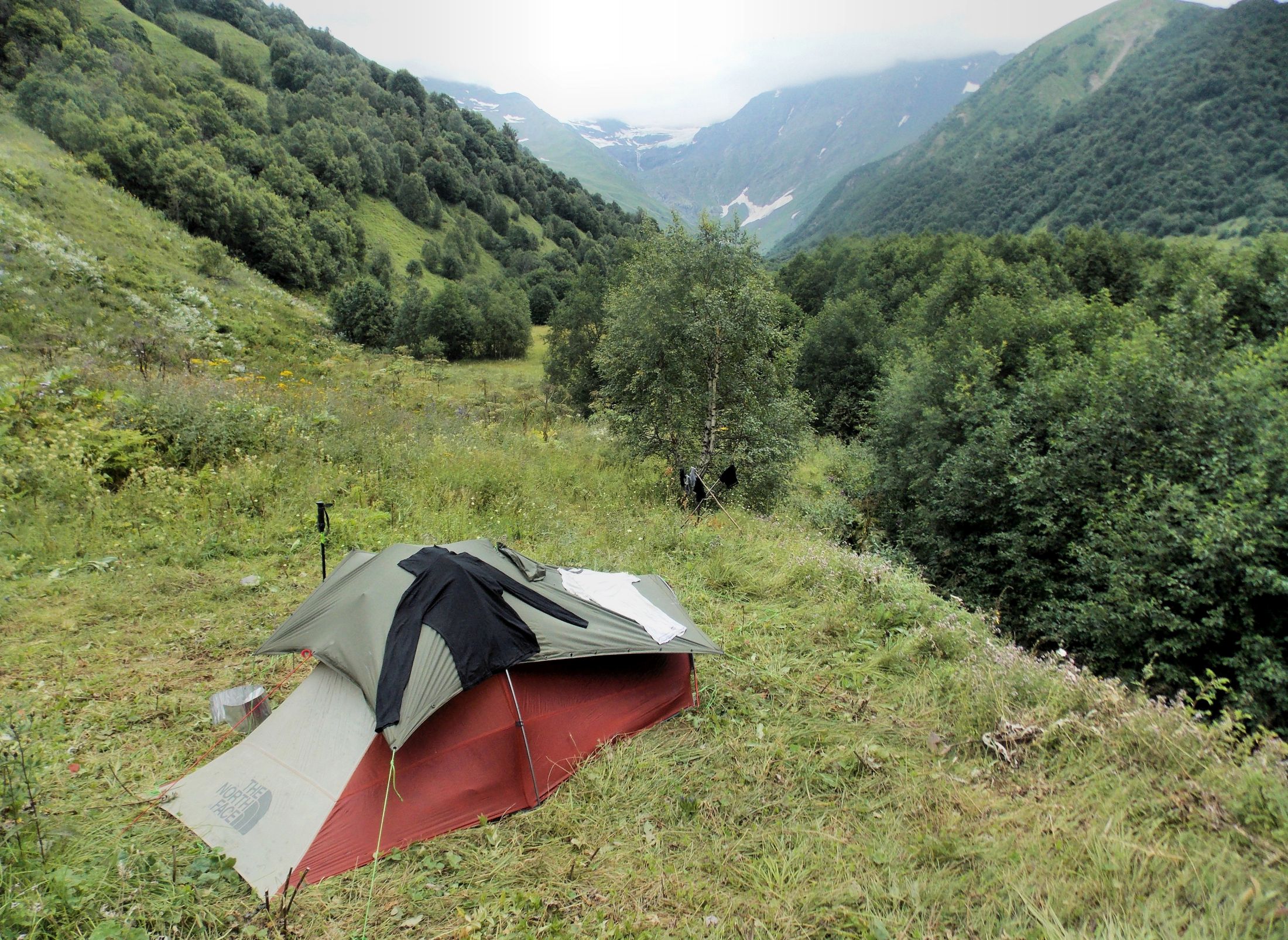
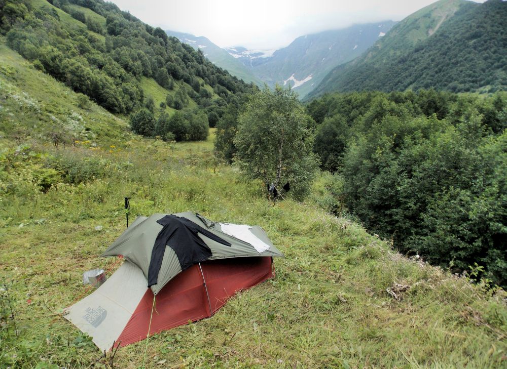
I found a campsite of a bigger group that had moved with horses and decided to take a rest day. First of all, I had to recover from the adventures on Lapuri pass, second, all my clothes were now totally sweaty and needed washing. Of course, the weather had its own ideas, most of the day was cloudy, there was some rain and washed stuff did not dry properly. I also managed to fix my pole. It was now somewhat shorter than the other one, but still usable on climbing.

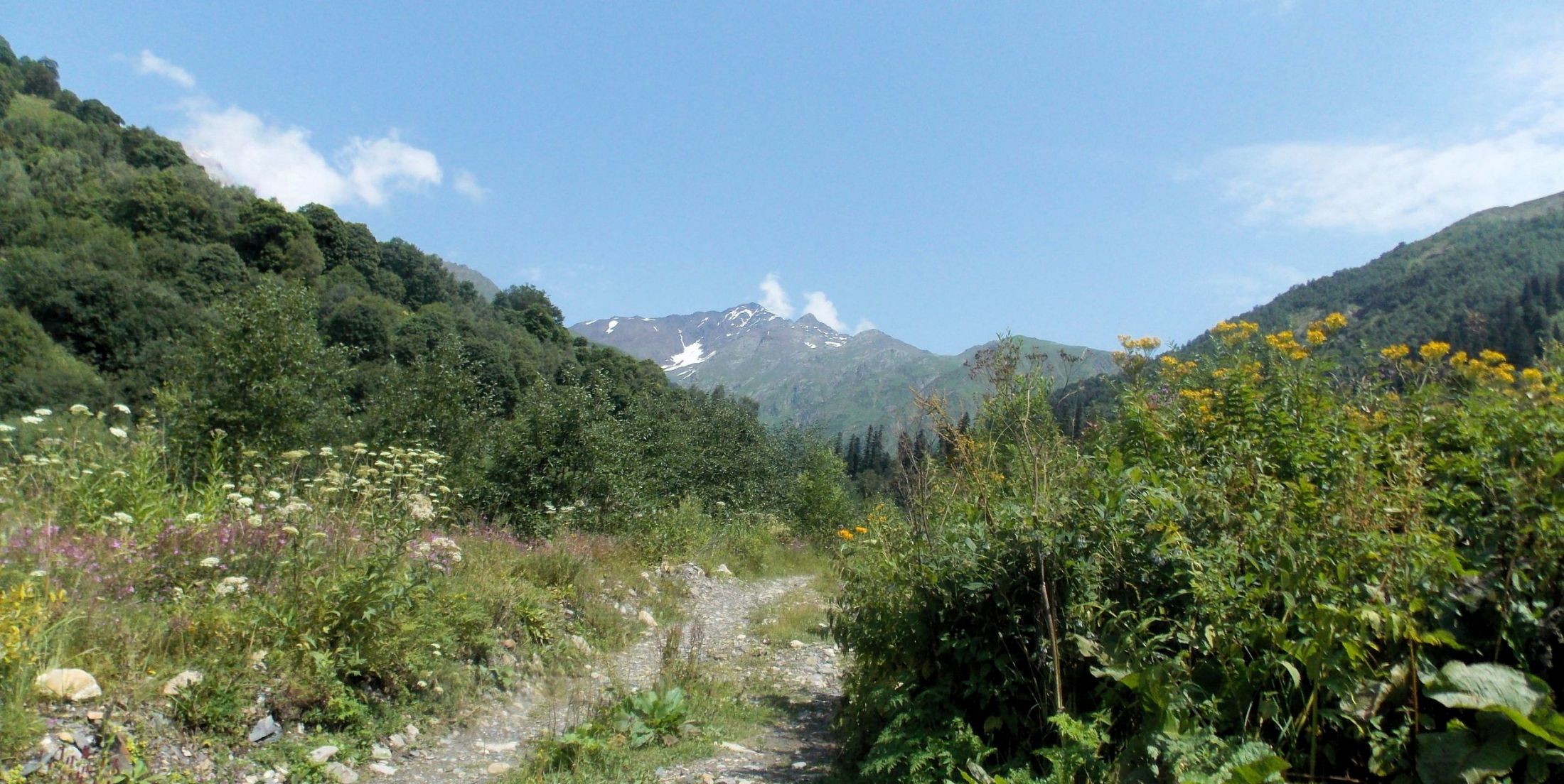
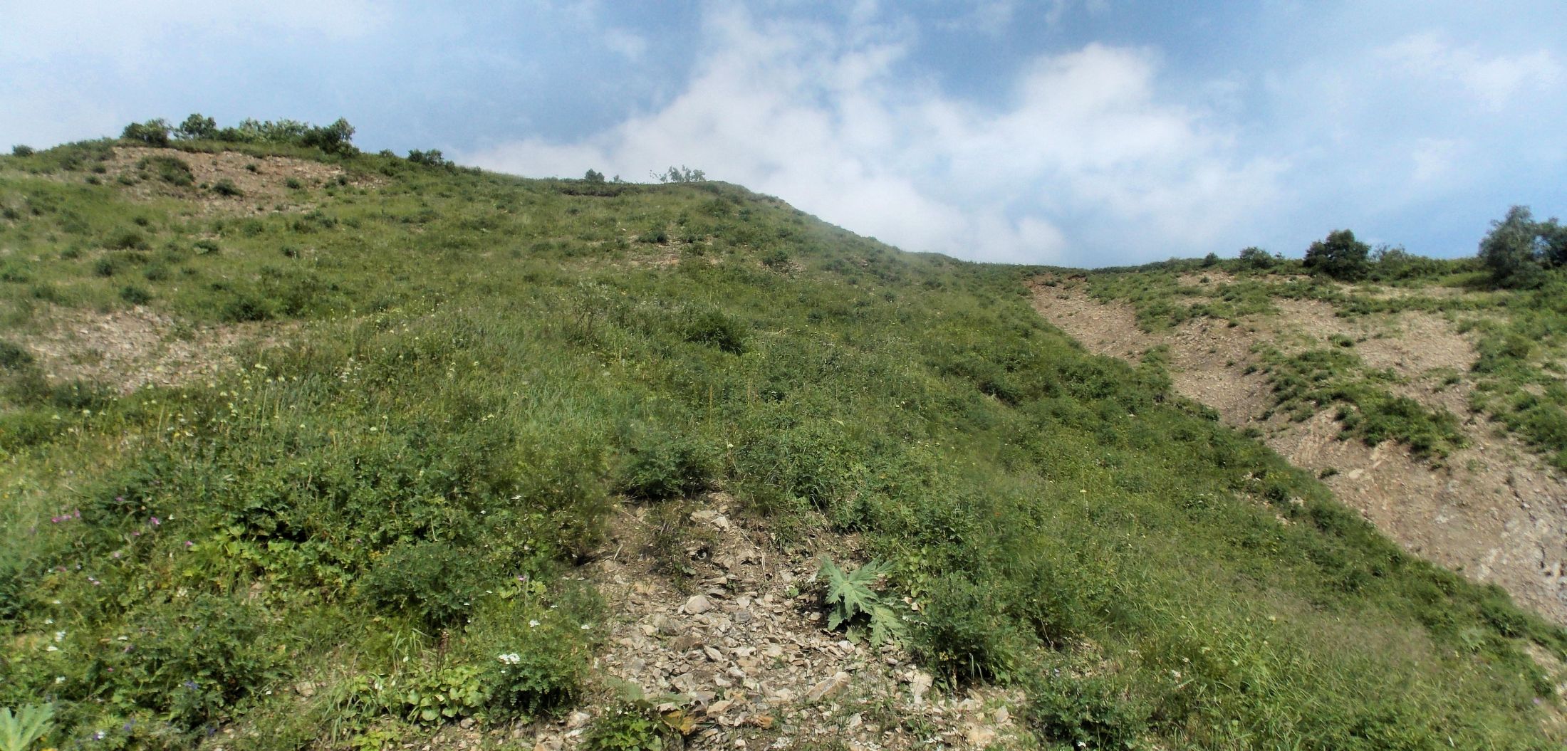
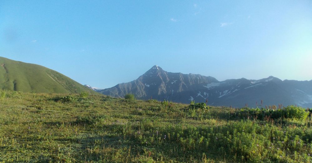
Path to the pass goes behind the forested ridge on the right, it is visible above the forested slope
Morning was spent on short recon. I found where the track moves up the river, towards the river crossing near the path to Vatsitsveri pass. Did not want to go far, though, barely after 100 meters I was totally wet. And the trail of a big group was visible so I did not worry about getting lost.
Rest of the day was spent on being lazy. In the afternoon three Dutch came from Lapuri, two men and a woman. I hoped they would camp with me so we could cross the pass together, but they wanted to camp somewhere higher up, near the crossing. In the evening Miguel arrived. He was on the way from Ghebi to Mestia. He camped next to me. Despite using GPS, he had got lost on the pass, had to do some rather nasty descents and seemed to be worried about Lapuri pass. Told him what I knew, we brewed some mint tea (mint grows everywhere there) and for the night I lent him my useless power bank. He did not want chacha, said that he had already got enough. He had wandered to buy some food in a small village and started to drink chacha with two locals, father and son. Unfortunately hosts fell in sleep so Miguel had poured himself the last one and left.
Washing day
Tsenitskhali valley is another example of how useless are Geoland trekking maps. According to the map, river crossing had to be somewhere next to my camp by the confluence. Even a quick glance said that here, right after the confluence of a major tributary, only an idiot would cross the river (last year another solo traveler died here) and the other side of the valley was so steep that most definitely there could not be a trail. These maps were only useful for determining your general location.
Day 10 - Vatsistsveri pass
In the morning I packed up and said goodbye to Miguel. According to the description there was about an hour of simple trail, without significant ascent to the crossing. As everything was wet, I put on my crossing sandals instead of boots. Stupid mistake. First, after the river crossing the boots got wet anyway, but worse was that the trail up the river was a nasty fight through the jungle, so in the end my feet were all badly scratched and had a painful rash. Big trail followed the river, at times turning to the jungle and I lost it soon. I got to the crossing all wet and in a bad mood. Not a good start for a hard day.
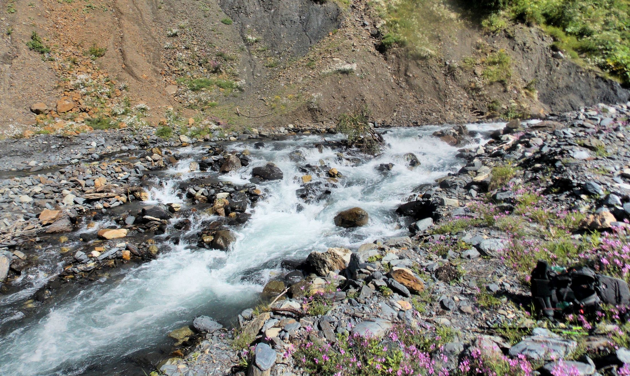
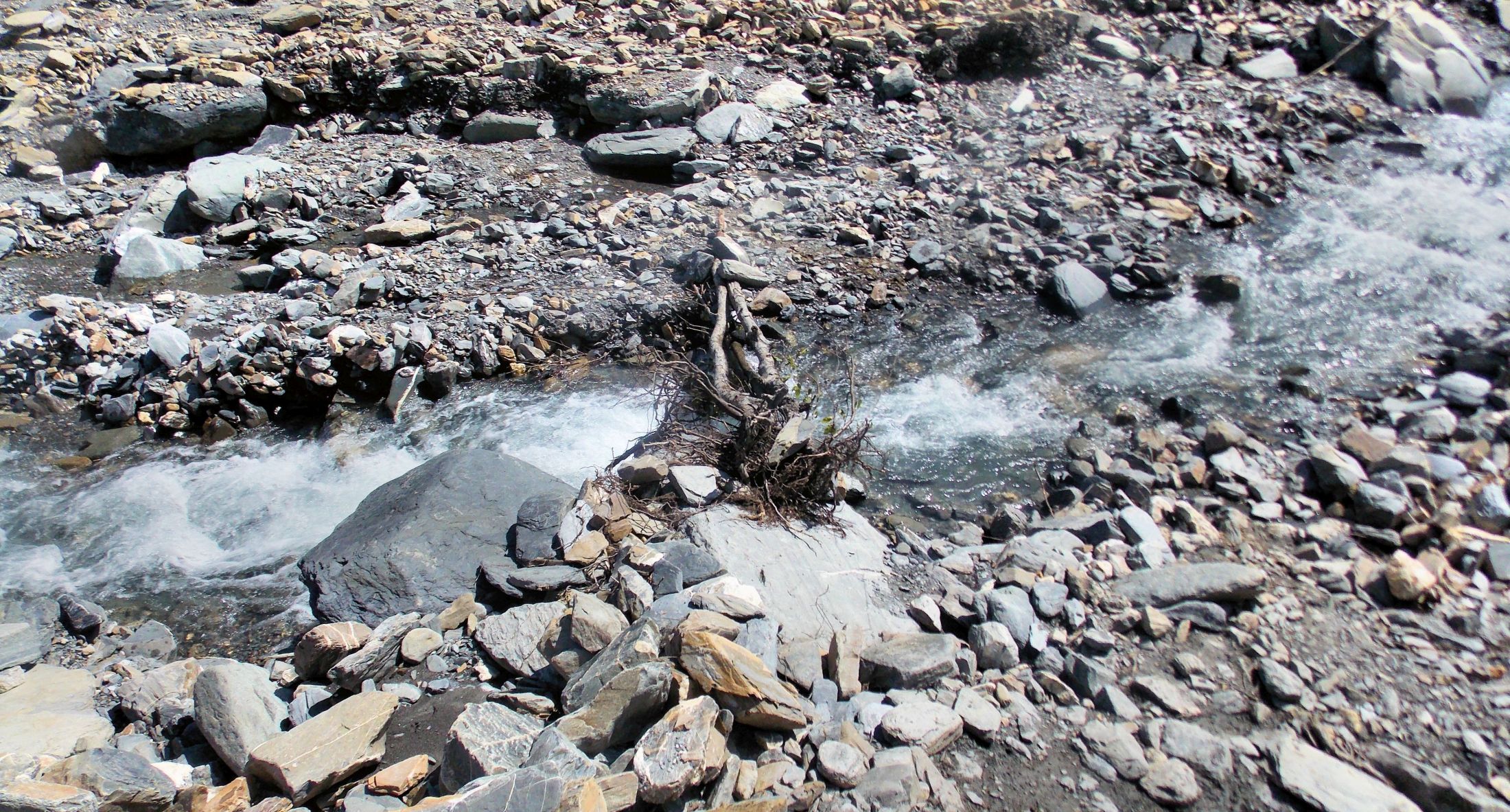
I found a good crossing point, that went smoothly.
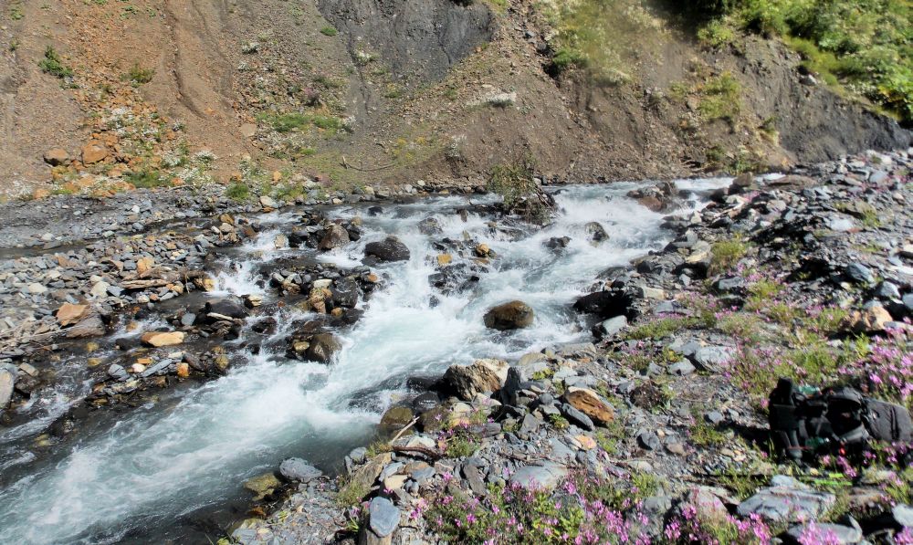
Next to this bush crossing was easy
The description said that now I should follow a riverbed of a tributary until there will be a turn to west (right). Unfortunately, there were two tributaries. I left the bag and went to recon. Along the high bank of a higher, larger tributary there seemed to be a weak trail.

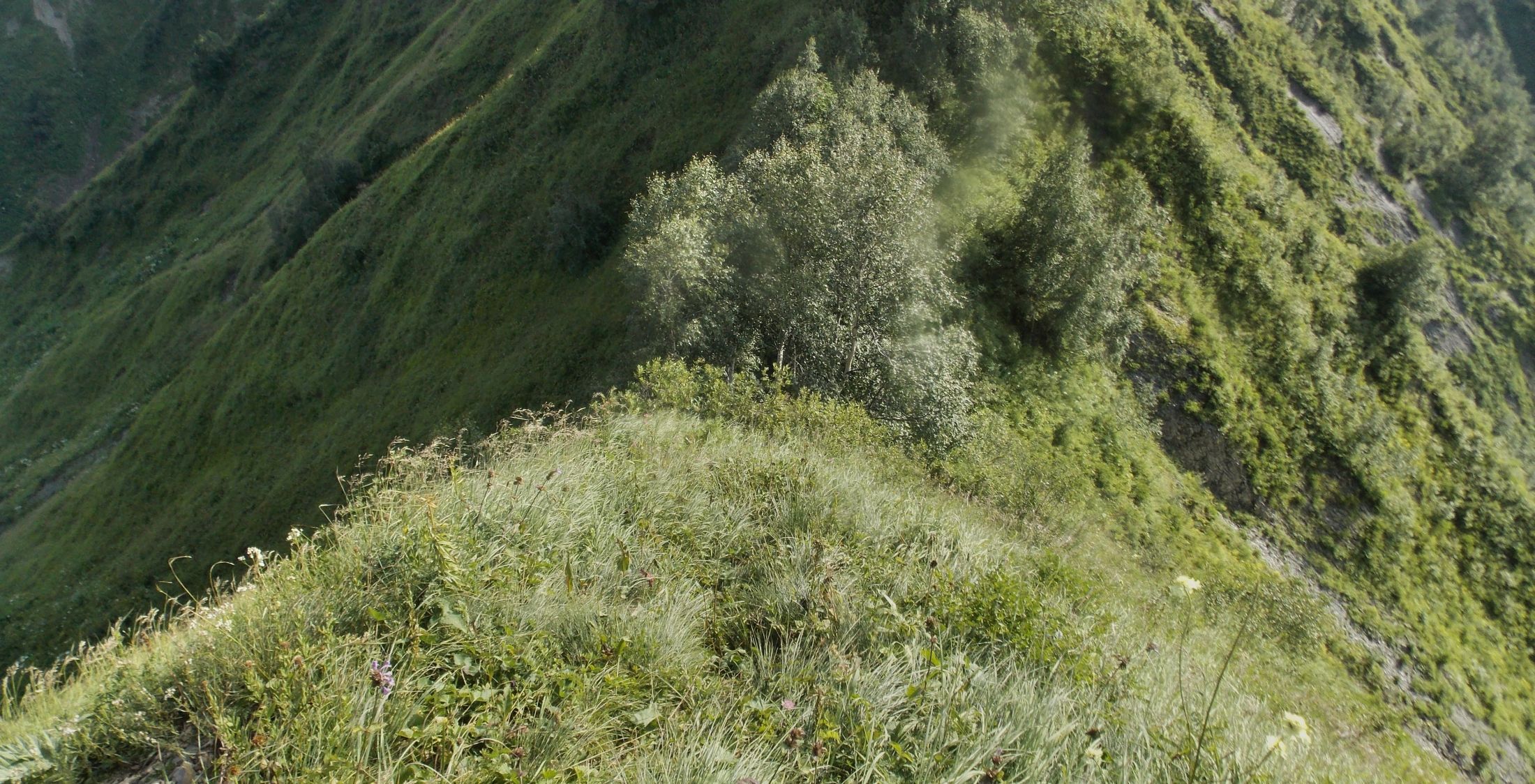
View from the crossing up the river. I have a nagging suspicion that up there, along the alpine meadows an easier route could have been found
Still, decided to try. Few hundred meters higher the trail disappeared, by that time I had reached the bank of a lower, smaller tributary where there was a worst kind of a jungle. Rushing ahead I can say that actually I should have descended to the creek bed and move on in it. Instead I turned back and tried my luck on the left bank of the smaller tributary. Stupid mistake number two. Soon I was fighting through even worse jungle. Once I made it back to the creek and found a strong trail left by the big group. This trail soon returned to the creek bed and I never found the spot where it exited again. When I reached a waterfall, I decided to pass it from the west, left bank. After all, my map showed that the trail should be somewhere there. Stupid mistake three. By now the elevation was sufficient for rhododendron to show up in the bush. Stems of the rhododendron lay down the hill, so that the snow can easily slip down.
Fighting up such slope is hard work, but by now I did not have much choice. Altogether it took me around 3-4 hours from the river. Utterly exhausted, I finally made it back to the creek and from my location on a high bank noticed an easier way down in the creek gully. Had to give back some 50 m elevation to get there. As I sat down on the grass (big vegetation was getting easier here), there was a Dutch trio coming up the creek.
Their GPS said that now I was perfectly on a right trail. Trail or not, in this spot there was not a single track, not a single broken grass. Which way the big group with horses had went I never found out. The Dutch had seen my river crossing, but then they got lost despite their GPS. For me this was really lucky accident. From there on we followed the creek bed. Banks lowered, finally the rhododendron fields ended and higher we saw a clear trail heading for the ridge to our right.
Looking back, I should have moved in the creek from the very beginning. It had seemed impossible, because the stones were very slippery. This was the only place where my boots had no traction whatsoever.
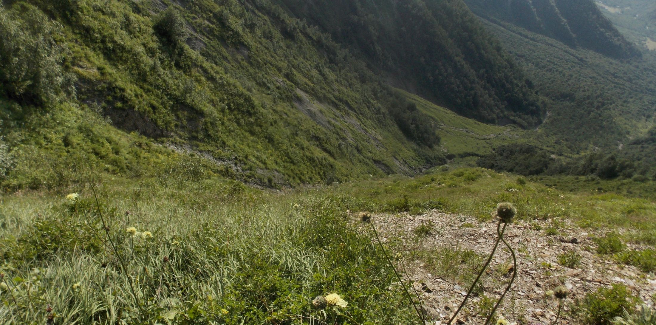
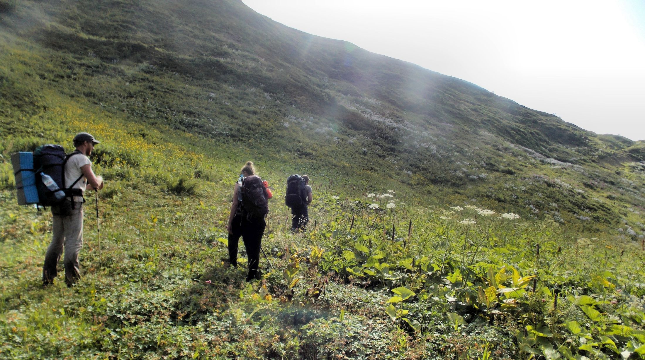
Finally, out of the creek, on our way to the ridge
There was a clear trail to the right, towards west
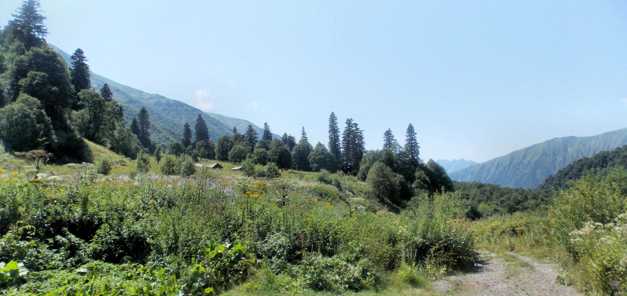
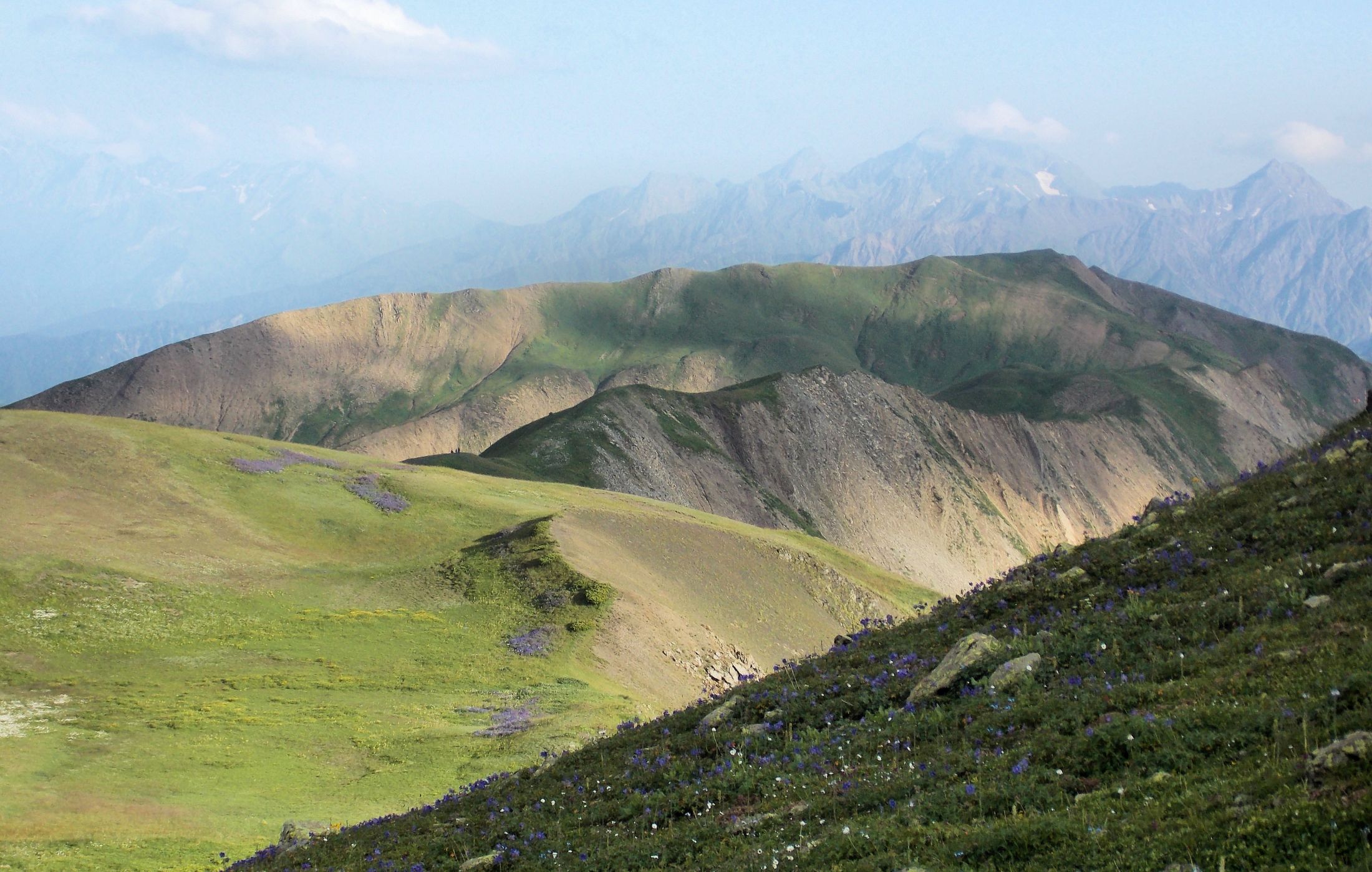
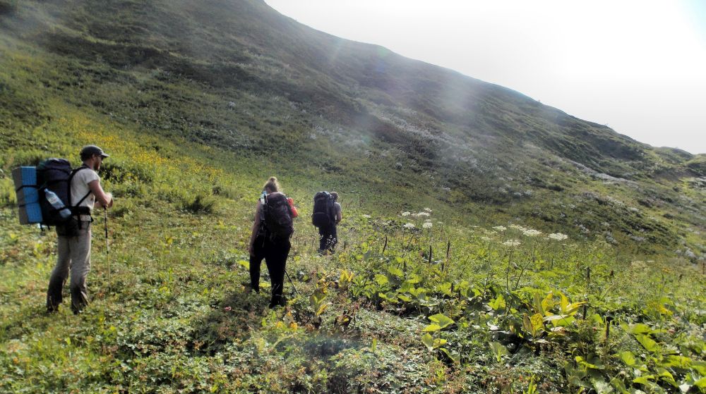
Higher up, on the alpine meadows it was possible to detect the old cart road in some places, but here it was easy to move even without the trail. We climbed to the pass and finally I got my very late lunch. The Dutch decided to keep to their own and had their lunch on the other side of a big rock. They got to move pretty fast and by the time I started moving they were already across the ridge. Ridge trail to Sasvano lakes is easy and beautiful

The trail from here follows the ridge, turns left to the ridge on the background and descends to Sasvano lakes
I soon caught the Dutch who were moving very slowly. Problem was, their girl had slippery casual sneakers and therefore had to move with extreme care. Here, during the final descent my ankle gave some pain. I had not hurt it, but probably the overload was doing its thing.

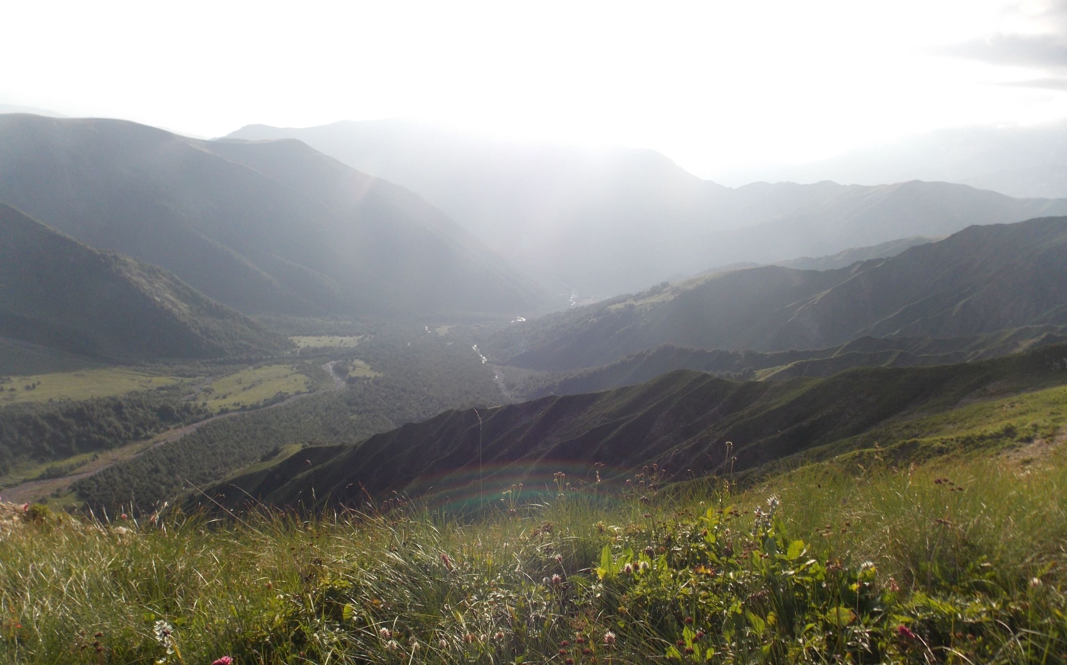
Rioni valley
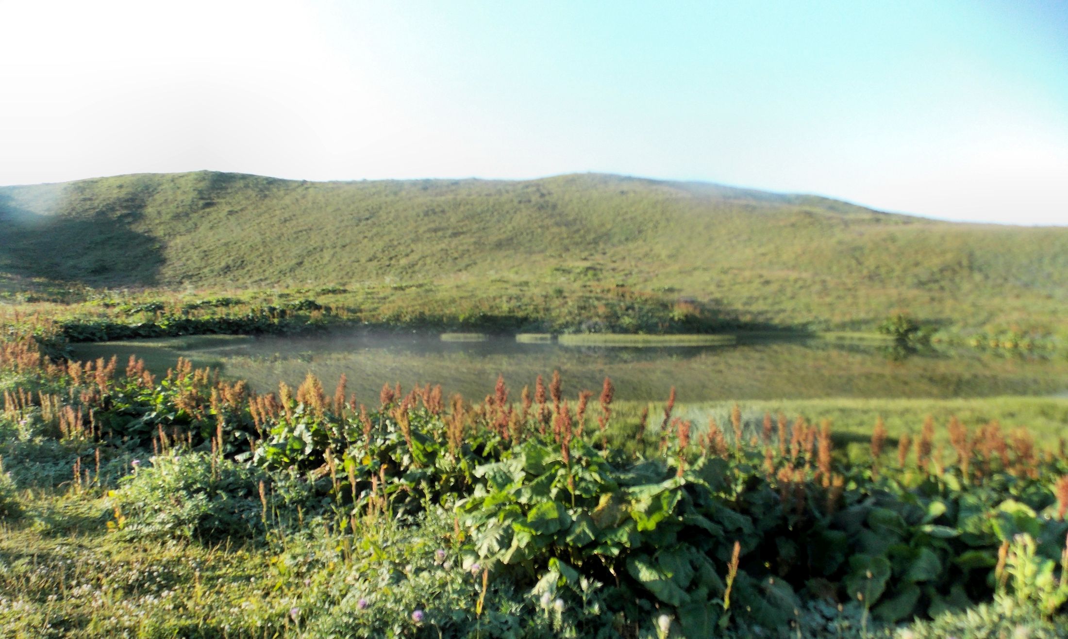
Therefore, I decided to camp by the upper lake where water is muddy and not drinkable without boiling. The Dutch continued to a lower, much more beautiful and clean lower lake. Still, the camp was superb, sky clear and the moon climbing up from behind the ridge towards Ghebi totally magical.
The evening is coming and time is running short
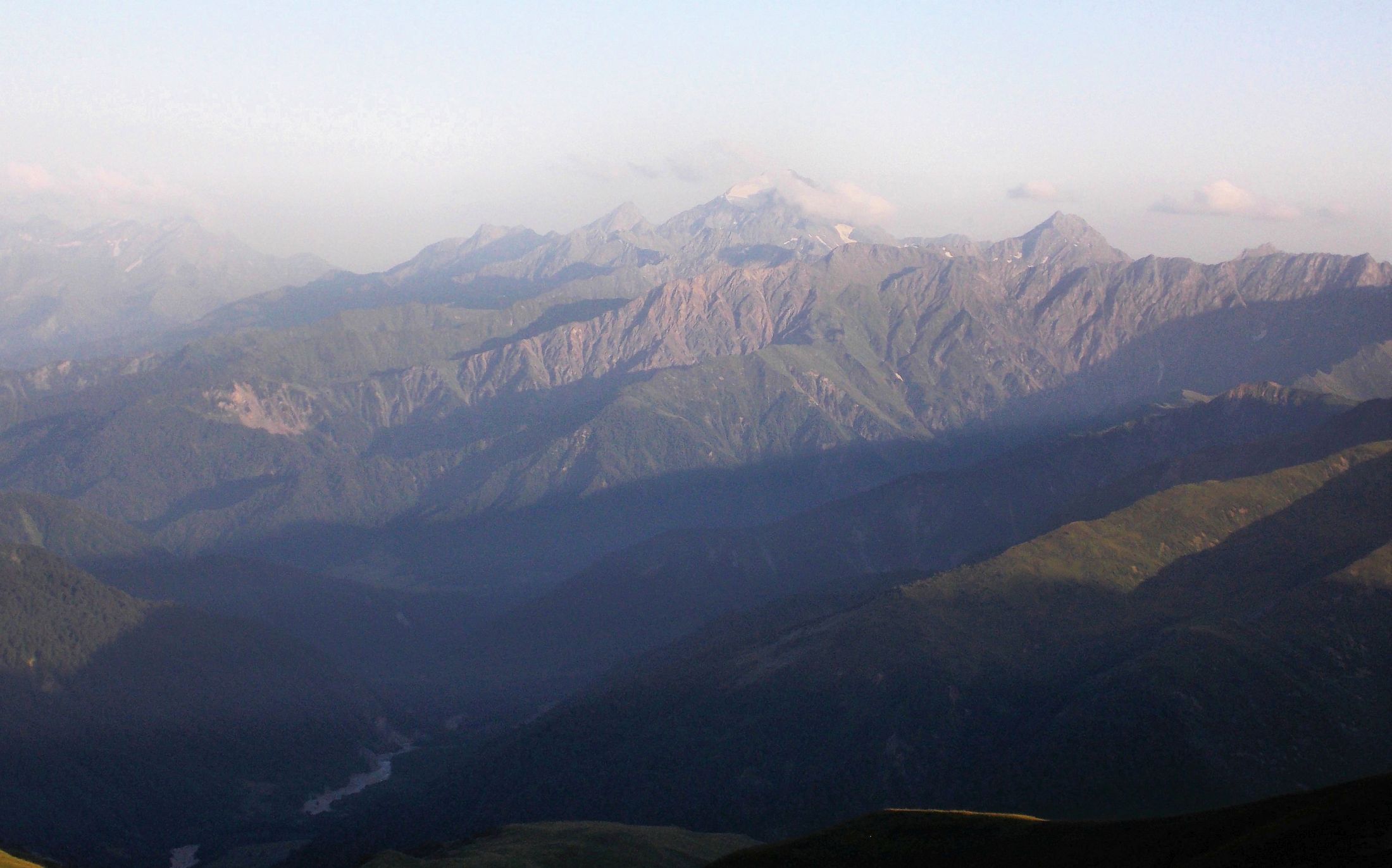
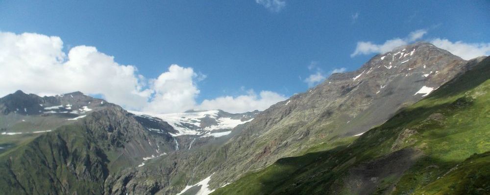
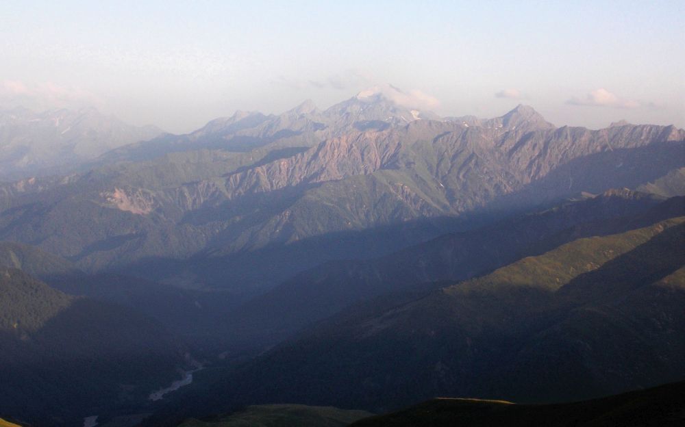
Across the Rioni valley there are some threethousanders. Behind the ridge - Russia

Upper Sasvano lake
Day 11 - Ghebi
Last day of the trek, coming out, sucks big time. Always. Probably you are fed up with your pack. Everything broken or hurt does hurt. And you know that the party is over. Not happy. At least for me.
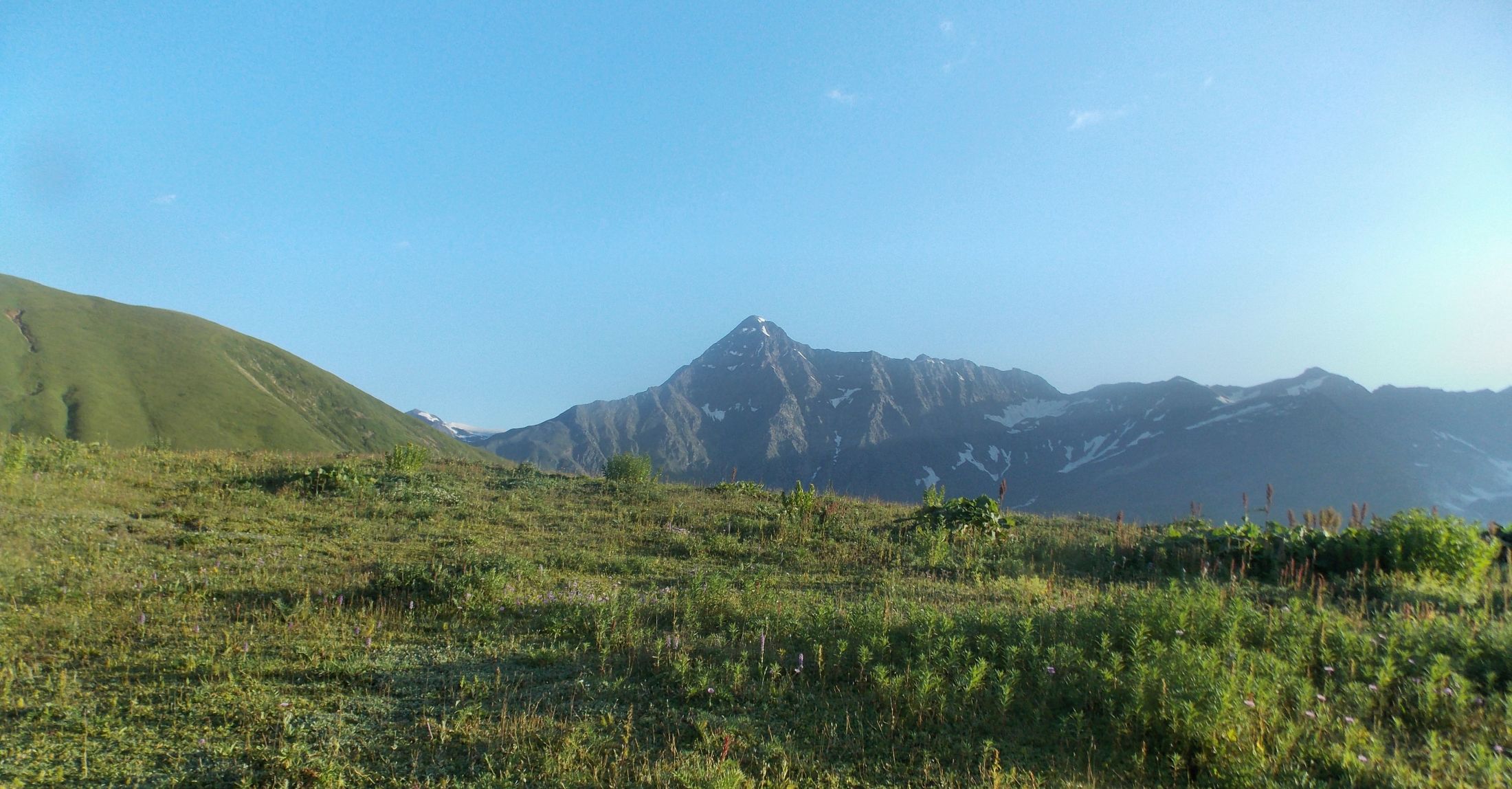
Morning view from Sasvano lake
Although I started to move when the Sun was high, Dutch were still drinking their morning coffee when I passed them. Soon the trail turned into an old cart road and going was easy, although here and there I still had to fight the jungle.
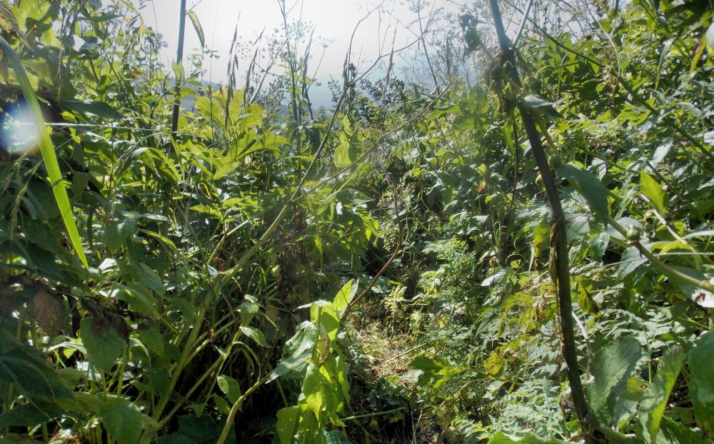
Jungle
Fortunately, the horses had been here and broken the trail. Little lower the forest started, with huge trees instead of a bush.
Old cart road in a forest
Just before reaching the valley I met four young Georgians on their way to Zeskho. First thing they asked, whether I had seen a young Georgian couple. These were lost in the same trail four days ago and search was on. I had seen neither the couple nor search party, unless this mysterious horse group was not the search party. This couple disappeared just as I was entering the area.
Rioni valley is beautiful, simple going with some river crossings. In one place crossing required making the feet wet, others were simple. In one place there was even a bridge. Kind of. Traces of a big flood were everywhere.

A bridge. Just that you understand :)
First inhabited point here is Brili. Approaching the houses, I heard some weird sound. Taking a closer look, I found that in front of one hut there were two harpi..., sorry, old ladies, calling me eagerly. Somehow Gerry Durrell came to mind. But OK, if they say zahodi, one must go.
They brought the bread and tomatoes. Conversation was kind of hard, as the lady knew only few words in Russian. Anyway, using an Oscar-worthy spectacle she traded my painkillers. OK, usually I do not need them anyway and one must help elder people.
Some batteries went to them as well. But when they wanted my hiking pole for a cheese I had enough. Only later I realized that my broken pole would have been good for her and I have nothing to do with it at home anyway. Sadly, the harpies did not want me to take pictures, they were really colorful :)
Last kilometers were already on a good trail and I was totally bored. Therefore, I was rather happy when a car stopped and took me to Ghebi village shop. It seems shop owner is the only one providing B&B there. Ghebi was also the most expensive place in Georgia. Although maybe the problem was that morally broken after the trek I was not simply trading enough.
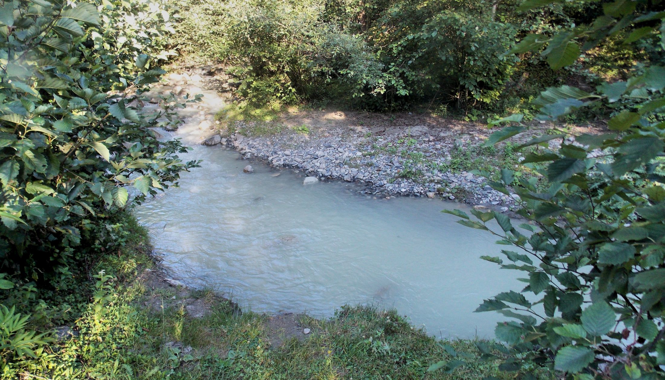
When I asked the landlord about the washing, she said there are none. Having seen youth passing by in big towels I asked if there is place for swimming. Yes! Yes! Very warm water! Warm my ass. But at least this water had flown some 10 km since the glacier... Pleasure was immense, although I endured barely 20 seconds in this water. Had I known about this place before, I probably would have just camped right there and saved some money.

Swimming place. Water up to the knee
The rest of the evening we sat with an old local man talking about local history, mountains and people. Some plans were planted in my head.