Day 3
The cock crew once and it crew loud and shrill and I woke in Georgia many miles from Spancil Hill. Another day, another hike. However, the weather was not looking promising so I went downstairs for breakfast and greeted my host.
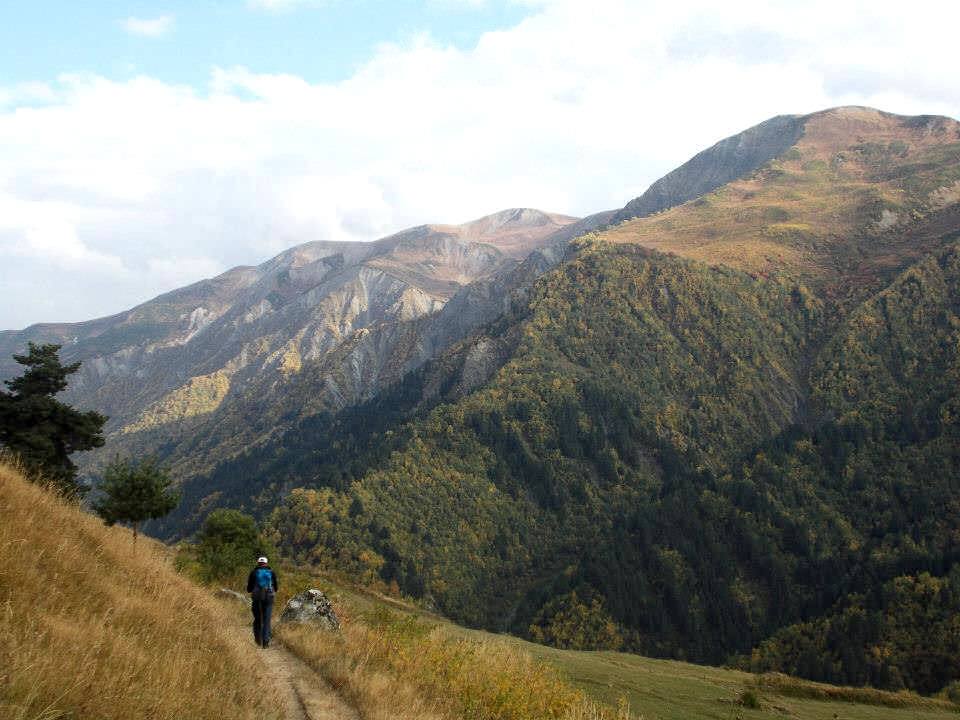
He set out our route with the tour group from Zhabeshi to Adishi, then to Khalde and then onto Ushguli. Now this looks wonderful, even if we were walking with a slow walking group. We will stay in a separate accommodation to theirs and I had already read that the route has been written about as spectacular. More beautiful scenery, more high altitude, more walking, more climbing. Remembering the maxim “It is not the altitude it is the attitude”, of course I was ready.
Steep climb ahead
We walked over to their hotel and waited for the 4 wheel drives to arrive. Once again, the Svaneti rough dirt roads were traversed with the Georgian driver´s own unique and intimidatable style and we arrived at the village of Zhabeshi. This village was at the base of the eastern slopes of Banguriani and was surrounded by 3,000 metre mountains on all sides but for today, unfortunately, that was not our concern. Their guide took up the rear of the group and I went up the front with the local guide. Then we started to climb through the wonderful golden autumn glow, seen as the trees were turning yellow and orange as they started to shed their autumnal load.
Also along with the group was a local horseman with two horses carrying provisions as the only way between Zhabeshi and Adishi was by foot or horseback (the horses had another use, but more about that later folks). The narrow and steep track winded through rocky outcrops, ravines, gullies, tree lined slopes and slowly but surely ascended into the clouds.
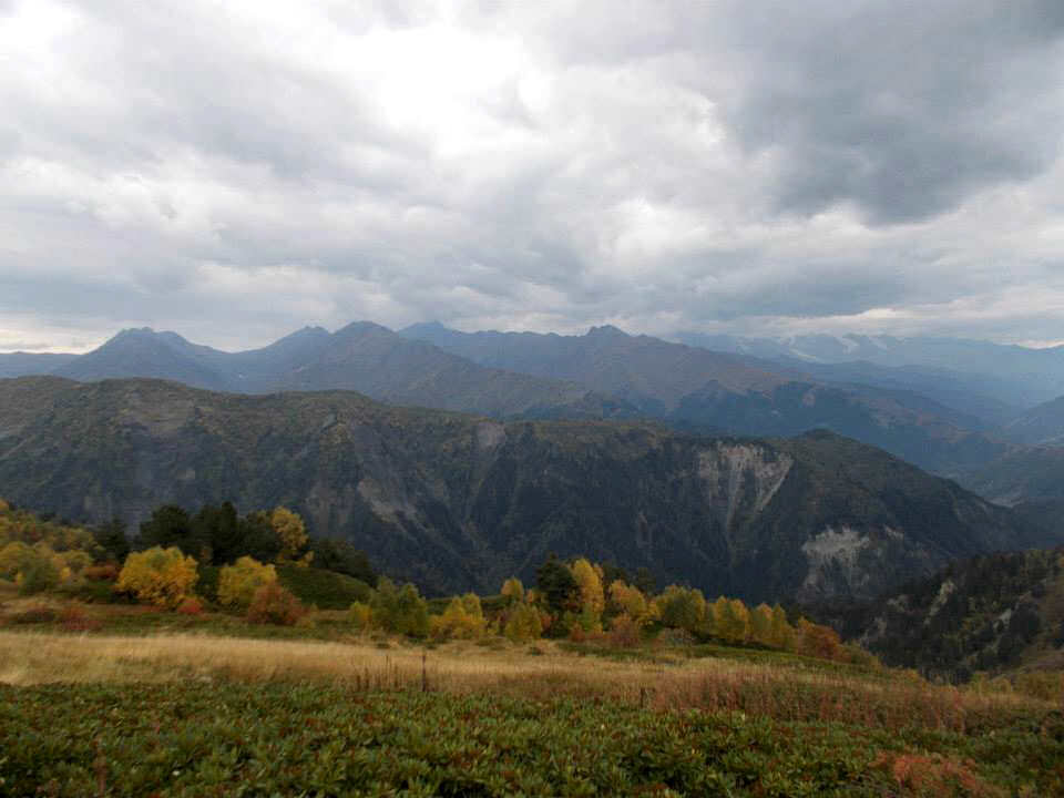
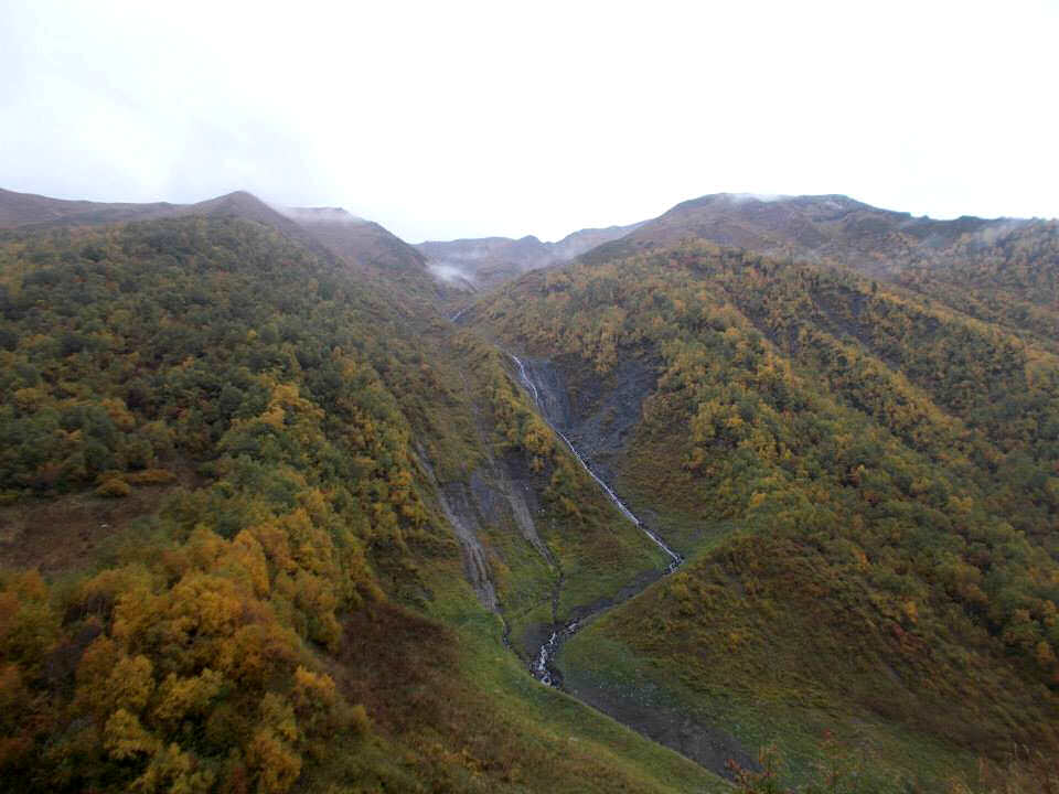
View from the ridge
Tsvlari range
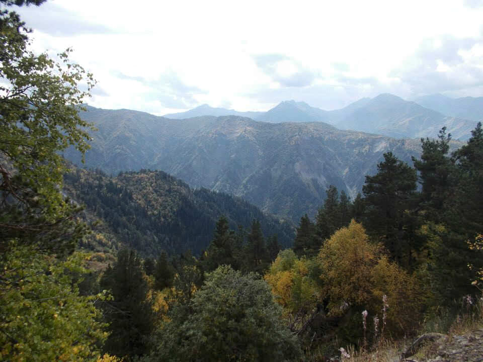
Eventually, we emerged from the trees into a deep gash in the hillside, where work was going on the construction of the new ski slopes on Tetnuldi. The environmental damage looked horrific, however I am sure this was only a temporary thing as progress must/must not continue? Shortly after living the gash, we arrived at the pass with the vista of rolling hills (mountains really) in front of us as far as we can see. Then we settled down at 2437 metres for a much needed lunch. The rain was spitting on and off, as we descended back into the golden autumn glow and entered a magical landscape of valleys and snow lined peaks. We entered the Adischala valley heading for the village.
Heading for Adishi village
This village is quite remarkable, as you wander along the valley until you get to the outcrop overlooking the village. It´s hard to imagine that you can’t see it due to its location until you are barely 500 metres from it.
This village is one of the slow success stories of this area and leads to the inevitable argument between conservationists and the pressures of business and tourism. As walking trips have increased over the last few years, both opportunities and potential for long lasting damage will occur.
The balance between conserving what you have (even if it deteriorates) or expanding (with the damage that can cause) is a debate that has taken place many times before in many places and will many times in the future on this planet. In fact, anyone can quote both examples of the former and examples of the latter.
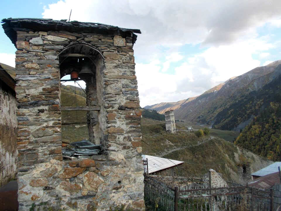
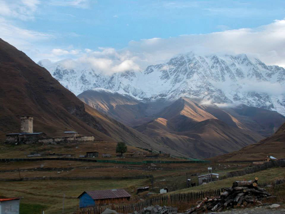
Bell tower in Adishi village
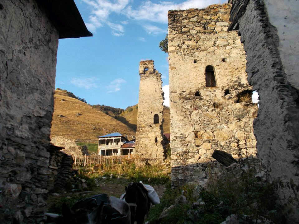
Dereliction in part of the village
However, Adishi is an example of the benefits that managed sustainable tourism can bring. A wonderful village in a stunningly beautiful location, which was heading for the precipice with just 2 families remaining. Now the population has recovered and 12 families live here.
The village was a mix of run-down buildings and scattered houses and guesthouses. Amongst the few restored houses there were others sadly scarred by neglect and decay. But the potential for a wonderful restored village in a few years can clearly be seen. I certainly wish this village luck in their endeavours.
Just to illustrate the point - even whilst we were there, two new guesthouses were being renovated and the Svan towers were slowly being restored. Amongst the ruin and decay there were some quite beautiful restored houses. We left the group in one of them and retired to the other for a good night’s sleep before the next day´s climb.
Day 4
Early morning
Eight o'clock precise
I see the lonely
October sun arise
After another breakfast table, groaning with local fresh organic delicacies, we were handed our lunch boxes (bags) with bread, cheese, tomatoes, eggs and the inevitable khachapuri and headed over to the other guesthouse to meet the group.
We had left them earlier that morning after a night interrupted by singing and drinking in the lounge area of their guesthouse. Eventually, we had proceeded by torchlight back to our guesthouse through the unlit streets and a few hours later I was up and heading for the next day’s walking and climbing.
We left this most impressive and picturesque of villages and walked down the valley floor just over the river, whilst horsemen passed us by. On either side of us steep landslide and river gorged ravaged slopes towered up to snow-capped mountains and Tetnuldi towering over them all.
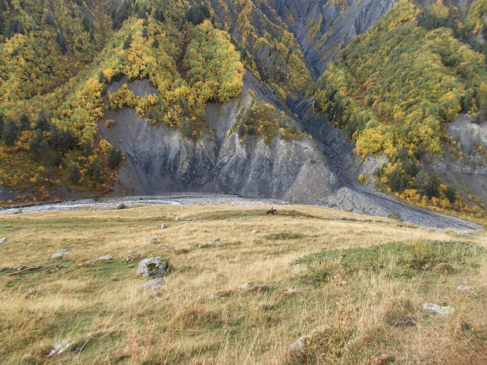
A local passes by
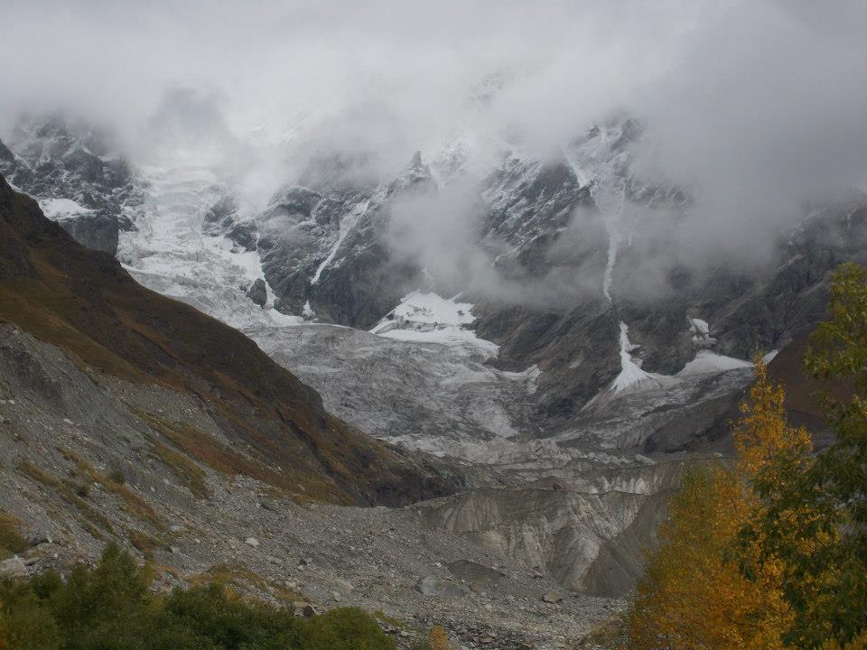
We crossed the most rickety and unsafe of bridges (which health and safety would not have approved of anywhere else in the rest of Europe) and proceeded for the head of the river and the Adischala glacier. Soon it came into view, held into place by towering rugged crags with eagles soaring majestically nearby. The glacier’s top was shrouded in mist as after a bright start, the day had turned grey and rain was clearly on the way.
This sight was truly awe inspiring - the white snow at the top of the glacier cascaded into the ice fall, which than in turn cascaded into the grey lower reaches, whereby the stone, rock, mud and ice melted and flowed into the river at the base.
As we approached the glacier, we could hear the sound of the numerous cracks and tears and splintering crevasses in the ice and the occasional avalanche booming and thundering around the valley. The spine-chilling full force of nature was on display here, not something to wander across or even stand upon nonchalantly, but something to observe from afar.
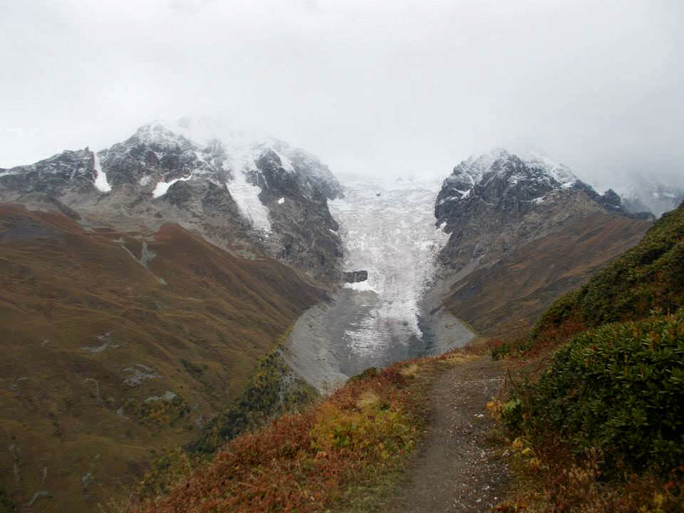
Adishi glacier
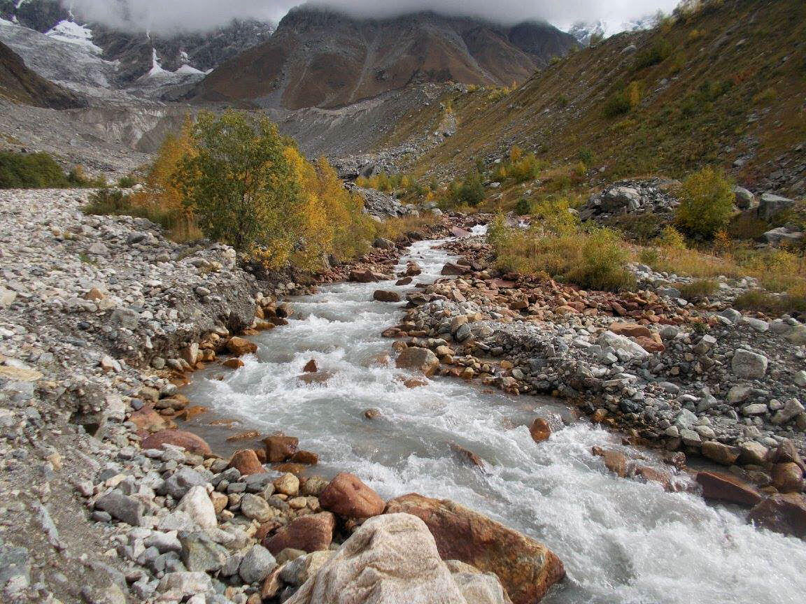
We stopped close by the base of it, where the light blue river flowed and raced along in a menacing fashion. The width and the speed of the water as it bubbled and gurgled along was certainly be a challenge.
So how would we cross, by foot? I briefly plunged my hand in the water and the glacier fed river ensured that the temperature was colder than a politically correct liberal’s view of common sense. But you may remember that on day 3 I had mentioned the two horses, well they were still with us. Having never been on a horse before, this turned out to be interesting to stay the least.
First I was hoisted onto the horse with my rucksack on my back and my boots tied around my neck. The horse then swam across the river behind the second horse. The water washed chillingly around my feet and with a huge surge of power in the horse as it swam. After five minutes we were on the other side. One thing for sure I will never consider complaining about - walking in the wet with cold feet again after that brief five minute vignette…Soon all 18 members of the group were transported across the river. Again we continued our inevitable march onwards and upwards, with occasional stops to photograph the ever changing views of the glacier as we headed up to the Chkhunderi pass. From here there was a wonderful view all along the Adischala river valley towards Adishi on one side and on the other side there was the Khalde river valley and surrounding mountains. Just before we stopped for lunch and whilst waiting for the stragglers, there was enough time for me to quickly hop up to the peak of the mountain at 2728 meters, from where a wonderful view of the surrounding area in all directions can be seen.
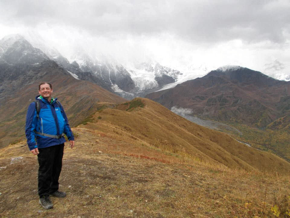
Fergal at the summit of Chkhunderi mountain (2825 meters)
Upper Khalde valley
I descended to join the rest at the pass to have a little lunch and now our downward trek into the valley started just as the rain commenced. After a few hours, when we got to the base of the valley, we rested beside some hunters huts and waited for the stragglers. At this point the rain was falling heavily so waterproofs were on just like home, although now view in the mist and rain could compare to this.
The valley floor was around 2000 meters and from there we walked along a rough track, scrambling over landslides which had cut off this section of the valley from Khalde. After a few hours walking along this track, ascending a few hundred meters with a large river canyon to our left, we arrived at the upper section of the village of Khalde.
There was a building at the entrance to this largely abandoned valley which was a shop, bar and restaurant all at once but most importantly, it was warm and dry. Something that was needed, as we waited for the 4x4 vehicles to take us on the 60 minute journey along the dirt track road to Ushguli. Which is Europe’s highest village, at an incredible height of 2,204 meters.
Day 5
Climb every mountain
Ford every stream
Follow every rainbow
Till you find your dream
The next morning broke early with strong, wonderful sunshine flowing into my room as my alarm went off at 6 am. Previous night we had arrived just as night fell. Ushguli, with its Svan towers and towering mountains was a village with the most end of world feel I have ever seen. With the exception, of course, of the isolated, desolate, backward and inward looking village of Drumlish.
The village consists of an upper and lower part and is the rumored burial place of the Georgian heroine Queen Tamar. The group we had travelled on were going elsewhere and as I rose early and headed for my days walk, the guide had advised the previous night that he would arrange the lift back to Mestia. I was to meet him back at the guesthouse at 15.00 or so.
I finished yet another wonderful breakfast, took my usual lunchbox of eggs, tomatoes cucumbers, gherkins, khachapuri, cheese and bread and headed up the valley. I passed by the church and the vista stretching in front of me, as the sun shone on the mountains, was breathtaking.
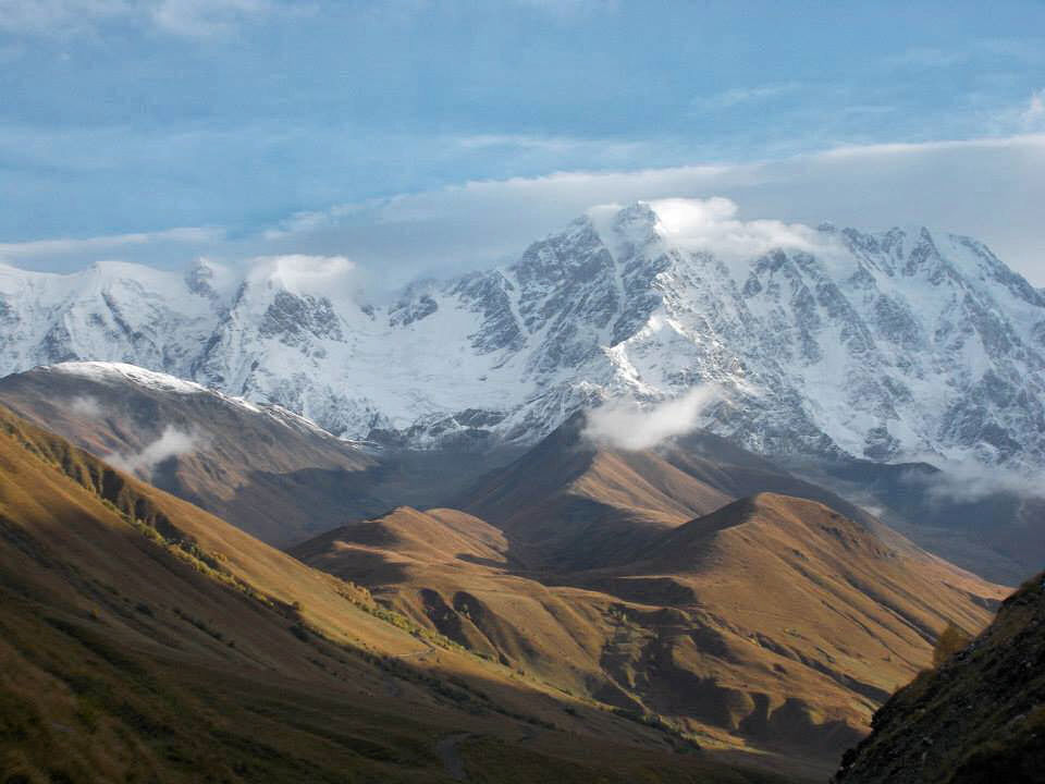
Stretched in front of me at the end of a valley of towering 15,000 foot mountains was Shkhara, which is Georgia’s highest at 5193 meters and also Dzhangi-Tau. This section of the Caucasus borders Russia and was easily one of the true wonders of the natural world. It was simply quite stunning, as the early morning sunshine showed it off in all its towering grandeur and glory.
Shkhara in sight
The hike this morning was not a particularly strenuous one, because in terms of height it was just 300 meters and even the distance at around 15 km was not difficult either. Probably just as well because it was at a height of well over 2, 000 meters. To be honest, as I walked along the dirt track along the flat valley floor, the splendid vista was nearly too much to take in all at one time. One that will live with me for many years.
As I walked along the valley, the towering grandeur of Shkhara and its numerous glaciers came more and more into focus. Even though the clouds were starting to cloud over and the sunshine was slowly fading away, the wilderness aspect of the valley was coming more and more into focus.
After a few hours of walking and wading through ice cold shallow streams my splendid solitude was interrupted by an old soviet style lorry with numerous people onboard, clearly heading for the few gentle slopes where numerous haystacks were assembled along the valley’s edges. They disappeared around a corner and then, after a while, I saw a pitchfork which had fallen off the lorry onto the road.
I had seen the lorry driving up to one of the slopes left of Shkhara glacier and I left the main track, where the lazy glacier fed river lazily turned left and headed in their direction. The mostly bare slopes of this valley had some silver birch trees scattered around and as the track was rougher, I was surprised to see one of the Georgians come around the bend.
When he saw the pitchfork, his eyes lit up, clearly he was sent back to get it before joining the rest in gathering grass. A brief conversation in both Georgian and Russian followed, in which the phrase Спасибо was used many times, to which I replied ничего. Naturally and inevitably, a bottle of Cha Cha appeared and I had a sup, sure it would have been rude not to drink. After a while we parted as I headed towards the glacier to get an overview and he gathered back to his work.
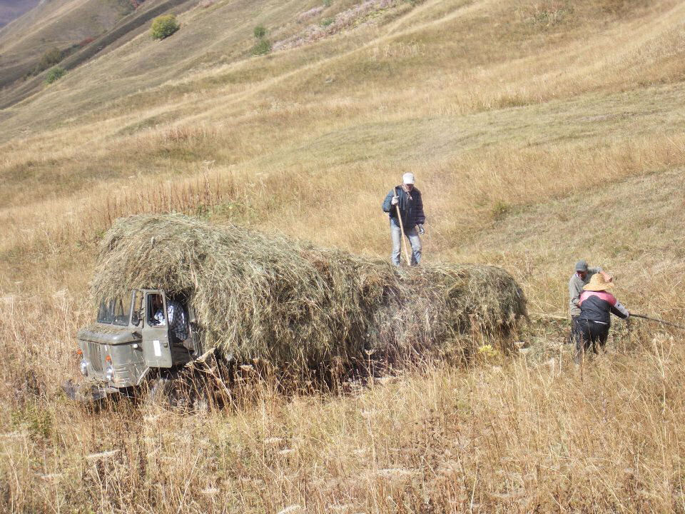
Filling the truck
When I reached a ridge, the sun had made a brief reappearance. Reaching into my lunchbox and sipping water, I tried to take in the pure force and wonderment that was the Shkhara glacier, the towering sides of the cliffs faces and the glistening snow over it. After nearly overloading on its sheer power and glory, I headed a few hundred meters down the steep slopes towards the valley floor and the by now very rough track, to continue up through the silver birch forest to the base of the glacier.
From here, there was yet more incredible views and shortly afterwards I turned around and headed back along the valley. As I traversed the valley floor back to Ushguli, periodically I was passed by Soviet era lorry overloaded with grass, beeping the horn and waving as they passed.

Shkhara glacier

The ice cold Inguri river exits the glacier
I reached back to the village at just around about three pm and there was a message in the guesthouse, head down to the pub in the village, where the guide was having a meeting with the other guides. I gathered my rucksack and things and strolled along the dirt track road until I found a sign for the bar/restaurant and souvenir shop. On entrance, a massive throne could be seen and to the rest, a chair was offered with the other guides..
After an hour or two it was time to leave. One of the tour guides went to get his 4 x 4 jeep, my guide went back to the guesthouse to get his rucksack and I sat on the terrace gazing at the splendor of 5000 meters.
After half an hour, my tour guide arrived and we waited for the jeep to arrive. Then I noticed that the jeep which had parked on a slopped ledge just over us was starting to slide downwards. I pulled the tour guide out of there as the jeep rolled forward and came close to toppling over the edge. Only a handily placed rock had fortunately prevented disaster that day.
Naturally, with a drive along a dirt track with numerous landslides to follow, this was by no means the most exciting or treacherous part of the day. When you overtake on a bend on a single track dirt track with a 600 meter drop on one side, I was glad that I already had a few drinks on board. Even my guide said to me on occasions with a sarcastic smile “That was totally safe!
The journey from Ushguli to Mestia takes 3 hours even though it is only 45 km in distance, because only 4 km of the route is actually fully paved road. The rest of the route is a minefield of muddy tracks, steep ravines, steep climbs, sharp bends, even steeper descents, landslides and the unique Georgian style of driving.
Continuation of diary, describing climb on Koruldi ridge can be found here.