Trek explores Keli plateau - a rocky piece of land west of Georgian Military Highway.
This trek, starting in picturesque Truso valley, explores the Keli volcanic plateau - barren, rocky, but incredibly colorful piece of land lying west of Georgian Military Highway. Only a few people ever come hiking here as this area is in the proximity of the separatist territory of South Ossetia (or, in Georgian, Samachablo) and the terrain is quite difficult. The highlight of the trip is a crossing of two 3400m high mountain passes and a visit to the glacial Kelitsadi lake.
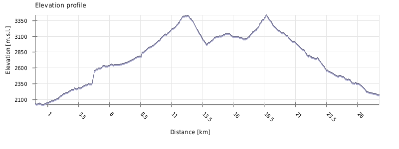
Distance (27 km) is more suitable for a 2-day trek, but there is no proper camping spot around Khorisar pass so most of the people split this trek into three days.
Not far on the map, but it´s necessary to cross two mountain passes and the area is pretty remote. Moreover, there is often no trail to follow.
There are no guesthouses or shelters along the route -> you will need a tent.
Since this trek crosses an elevated volcanic plateau, there are very few water sources - the only reliable ones are the Esikomi river and the lake itself. That means that you should carry about 4-5 liters when leaving Kvemo Okrokana, enough to get you to the lake. Along the way, you will pass several snowfields which can serve as an emergency source of water, but those may be dirty, so better take a water filter.
Entrance to Truso valley lies on Georgian Military Highway, some 20 km south of Kazbegi at the Kobi village. In theory, you can ask your marshrutka driver to drop you there, but you would be still 4km away from the Kvemo Okrokana village where starts the actual walk so I can´t recommend it. So, if you don´t have your own car, you are down to two options.
One of them is goold old taxi - you can easily hire one at Stepantsminda´s main square. Negotiate also a return trip, so they will wait for you at the entrance of the valley. Prices could vary quite a lot but "normal" one is about 80-100 GEL. This option makes sense if you are travelling in a group of three or more.
Couples and individual travellers will, on the other hand, prefer a daily shuttle arranged by Mountain Freaks Travel Agency that brings tourists to Kvemo Okrokana village. It departs twice a day, at 9:00 (return at 16:00) and 11:00 (return at 18:00) from their office in Stepantsminda (this is also the only place where you can buy a ticket, preferably one day in advance). The price of the return trip is 40 GEL and the bus departs when there are at least three passengers.
The shuttle or most taxi drivers won't go beyond Kvemo Okrokana, but if you have your own car, you can drive even further (a good car with a high clearance is strongly recommended). To get there, you can either drive through the valley (easier variant) or cross the hill south if the river, by a road shown on Google maps. Both routes meet close to the first travertines - this area is also a quite popular parking spot.
Easiest is to call a driver to pick you up. Otherwise, you will have to walk out of the valley and hitch something at the Georgian Military highway.
There is also an option to extend the trek by another three days and explore the gorges of Mna and Suatisi.
In the past years, a special permit from the Border department was necessary to finish this trek since it gets very close to the border of South Ossetia territory. However, from 2017, it is not required. Still, keep in mind that you will be trekking in the border zone, don't push your luck and don't venture closer to the border than necessary.
| Distance | 27,8 km |
| Trail type: | AB trip |
| Max. elevation: | 3437m |
| Min. elevation: | 2018m |
| Total climb: | 2061m |
| Total descent: | 2116m |
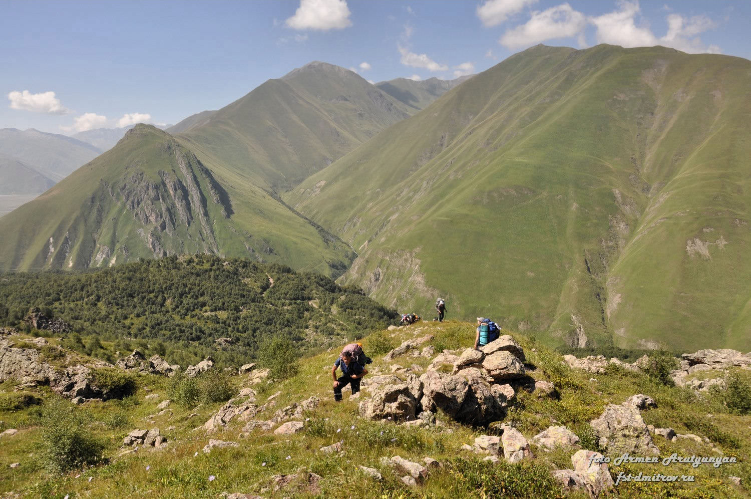
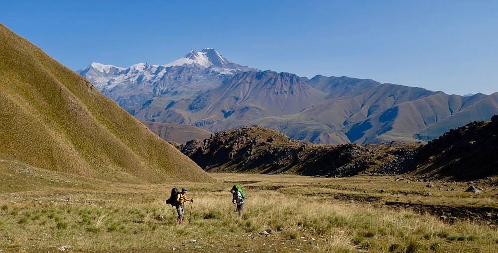
Trek starts at Kvemo Okrokana village. Walk on the main road some 500 meters to the southeast, towards the mouth of the valley. Here we turn right onto the hill serpentine, which climbs in the southwestern direction. As we climb higher and higher, nice views into the opposing Mna gorge open up in front of us.
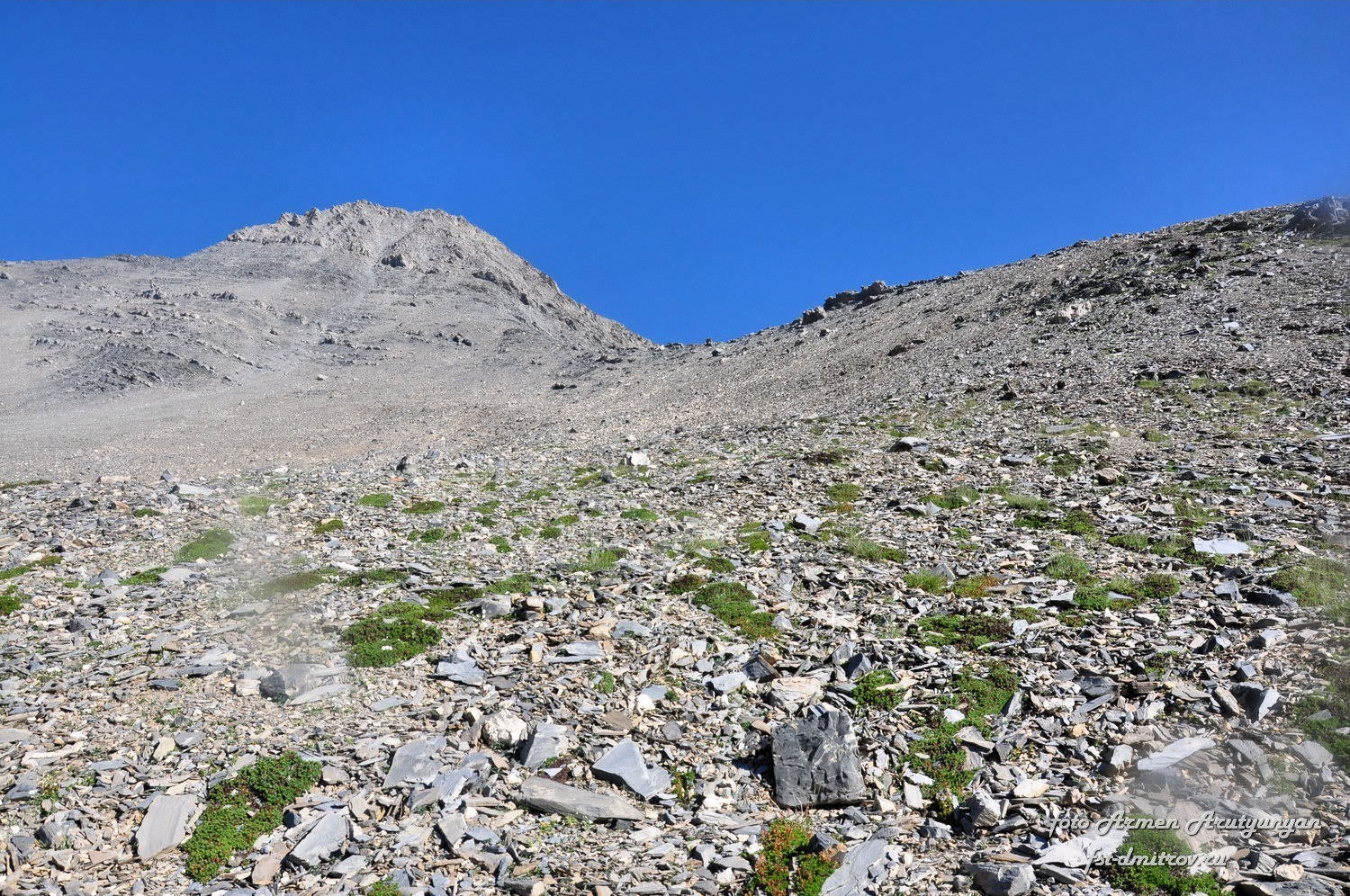
Serpentine leads to the upper part of Truso valley, bypassing the river gorge, but we don’t follow it all the way there. After one hour of walking, we turn left and start climbing on a steep slope, towards a large plateau beneath Mt. Khorisar. This turn-off is easy to overlook, so I recommend to use the GPS device - it lies at the elevation of about 2300m.
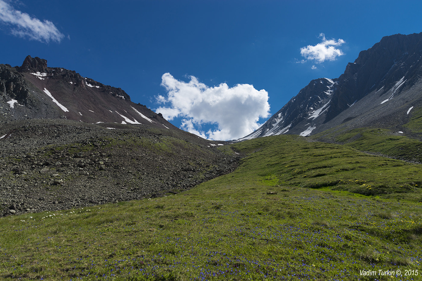
The plateau is covered by grass mixed with rocks - there is a chance that you will meet some shepherds here. We navigate the almost flat terrain to the small grassy/rocky ridge we see in the southeast. Cross the ridge and descend into the small gully. You may find water here, but don’t rely on it too much as it may be depending on the weather. Walk down the valley in the southern direction and eventually make a camp.
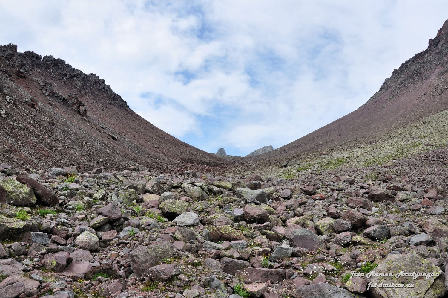
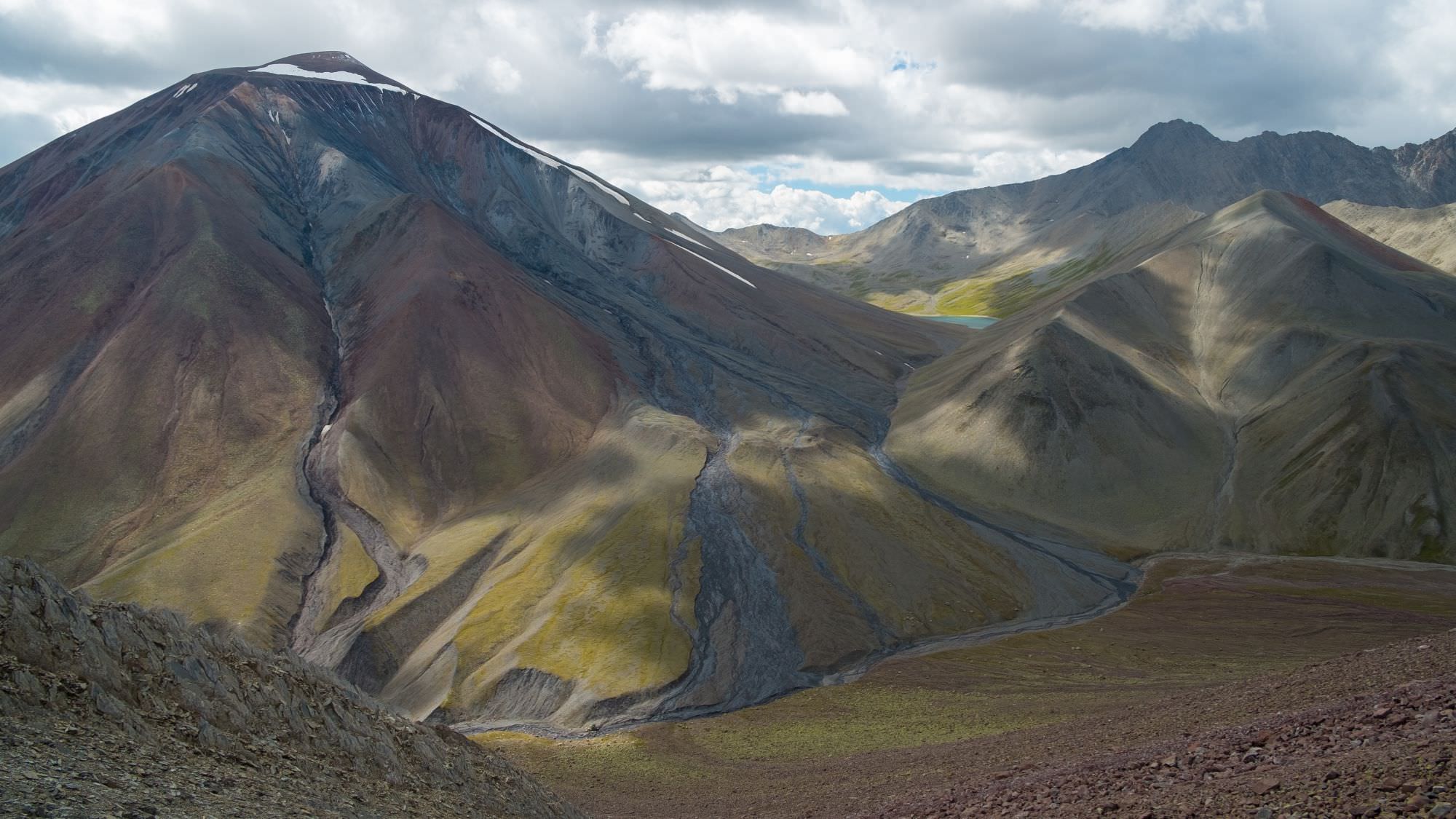
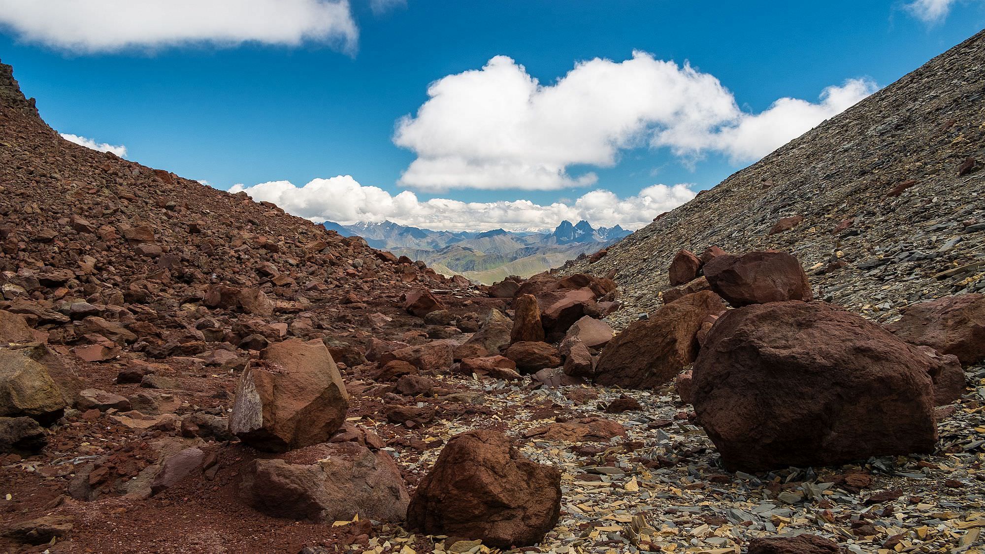
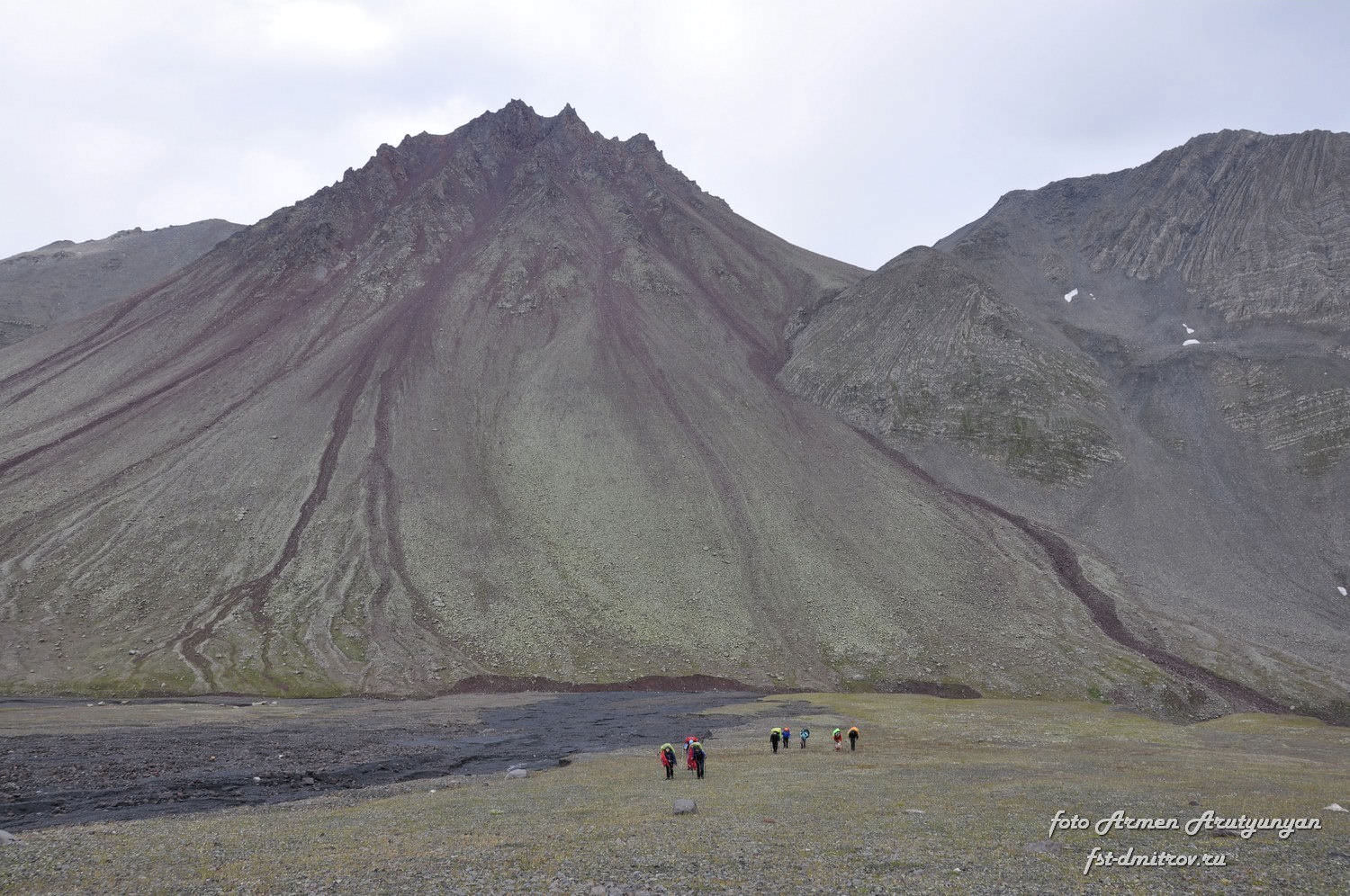
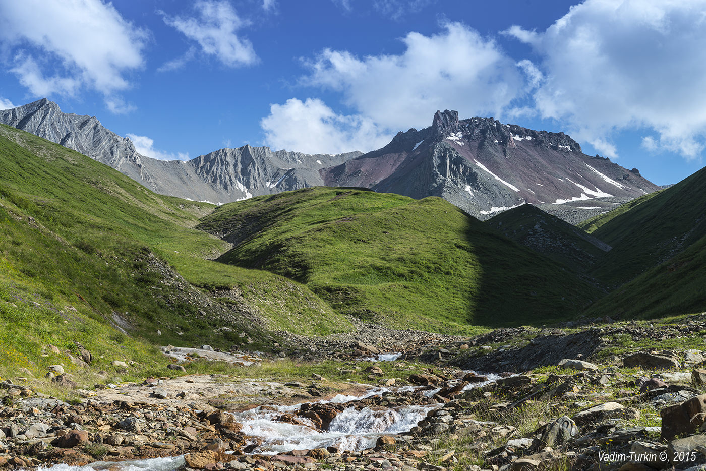
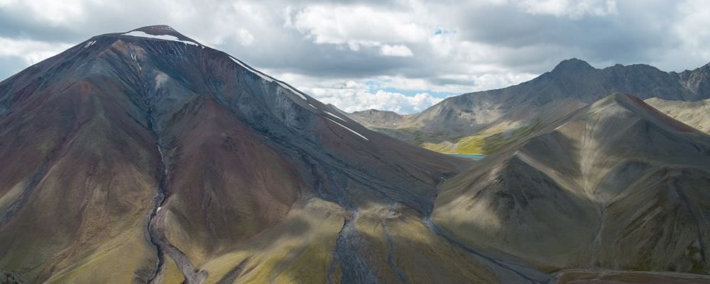
In the morning, continue walking south. Ahead of you, you see two volcanoes, both of distinctive red color - Higher Khorisar to the right and Lesser Khorisar to the left. You need to reach the saddle between both volcanoes - in the beginning, traverse the southern slopes of Higher Khorisar and then start climbing; the path is quite apparent. The terrain consists of volcanic scree, grade up to 30 degrees. Along the way, you might find some streams formed by the melting snowcap of Mt. Khorisar. These are often dirty and if you want to drink from them, you may need a water filter.
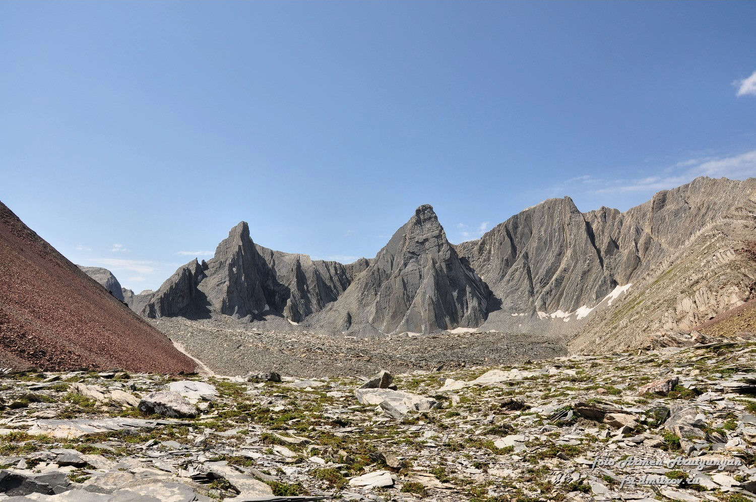
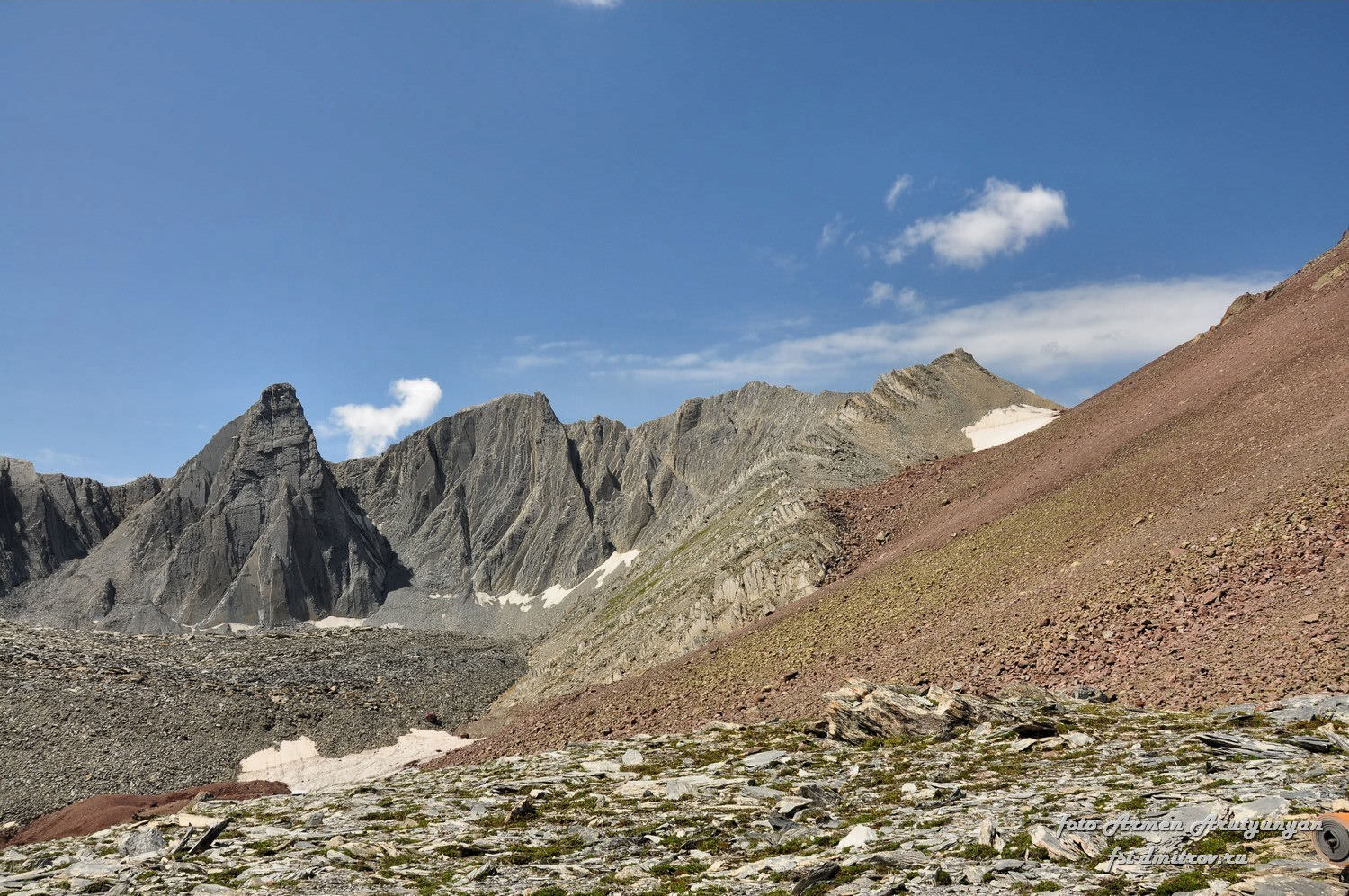
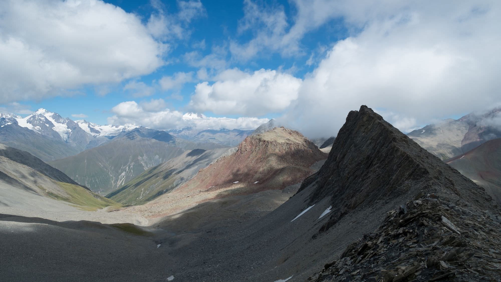
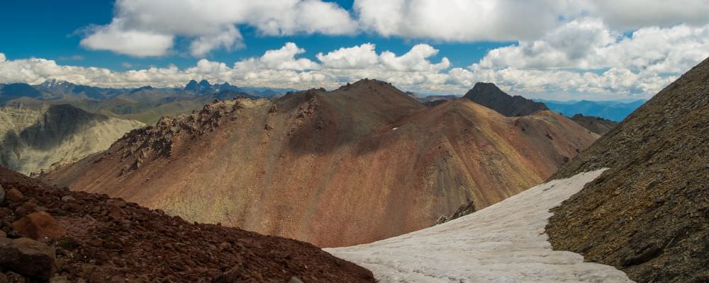
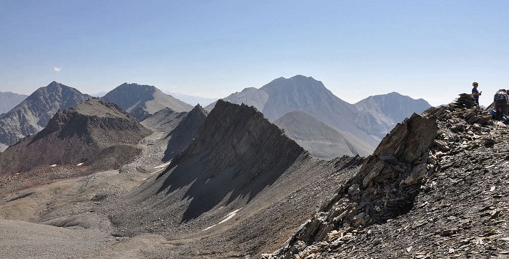
The saddle between Higher and Lesser Khorisar lies at the altitude of 3220m and provides a nice view over sharp granite peaks to the south. But you are not yet at the actual Khorisar pass - to reach it, you will have to climb another 200 height meters. Turn west and head to the small depression covered by a snowfield (this tends to last until late summer and is mostly clean), where the red rock of Greater Khorisar meets grey granite massif. It´s not too far, just a little more than 1km.
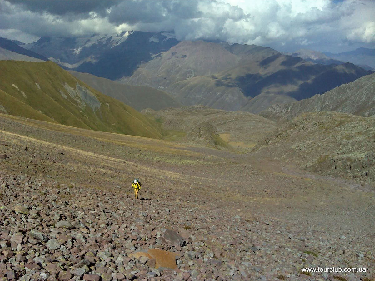
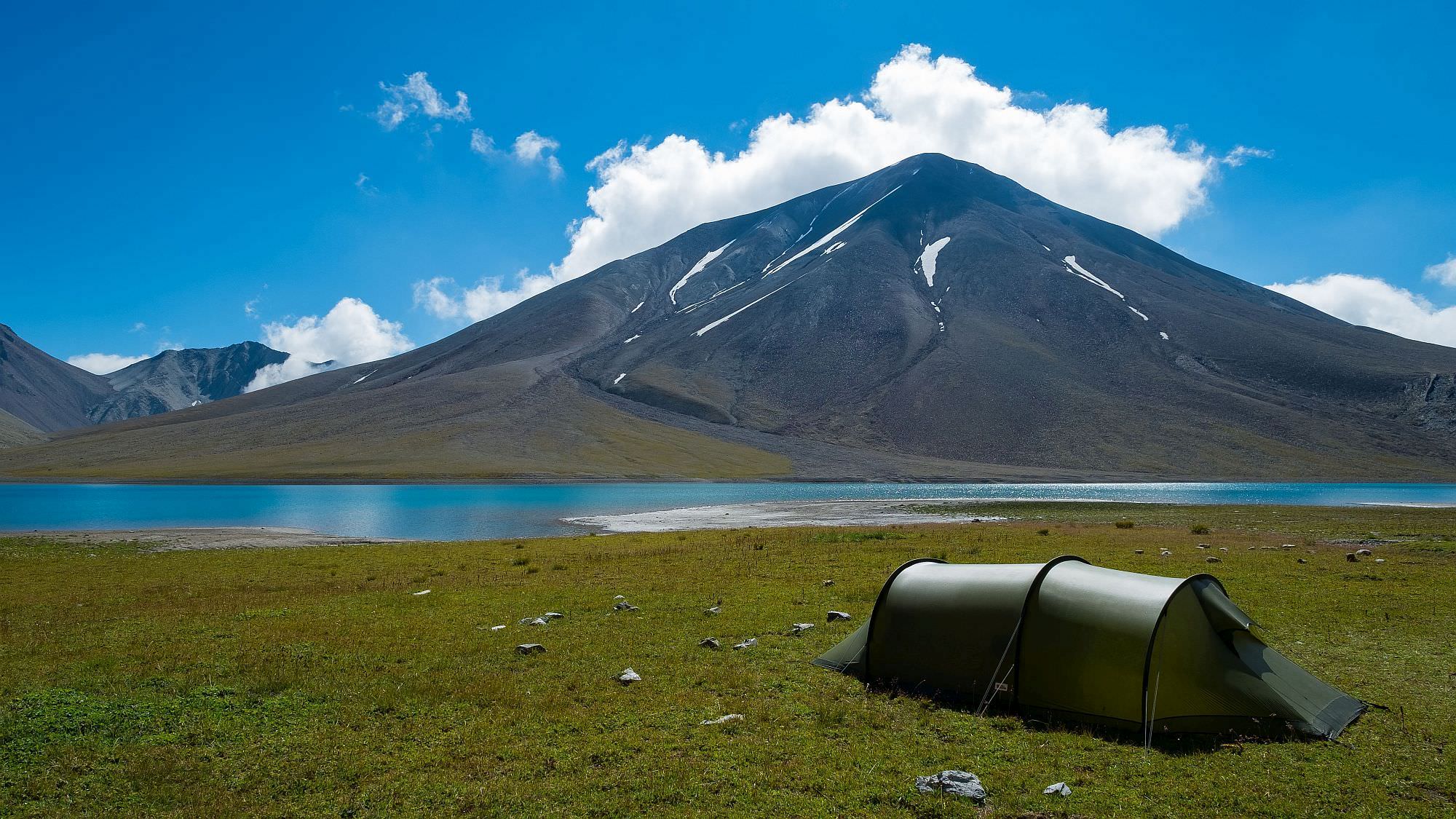
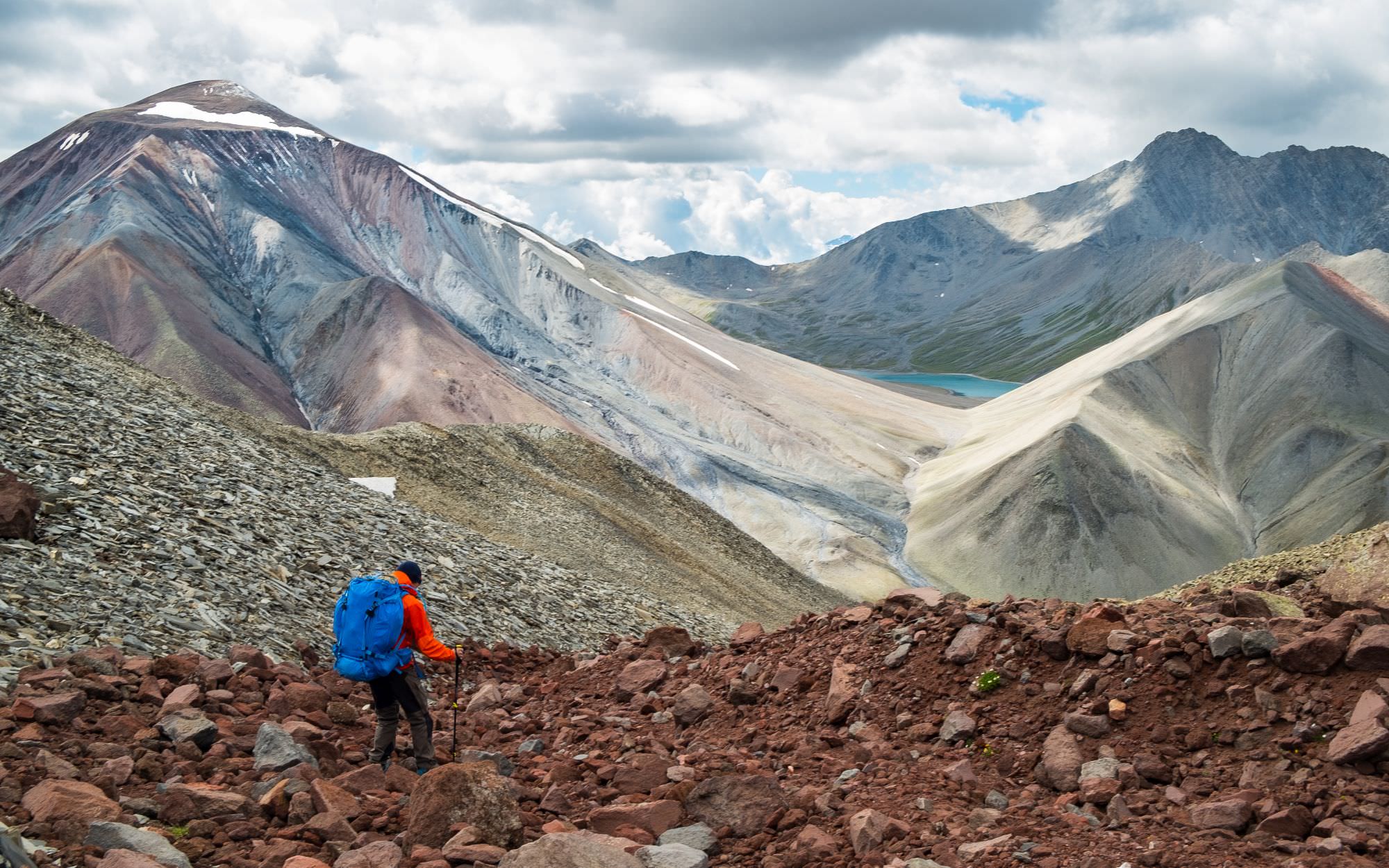
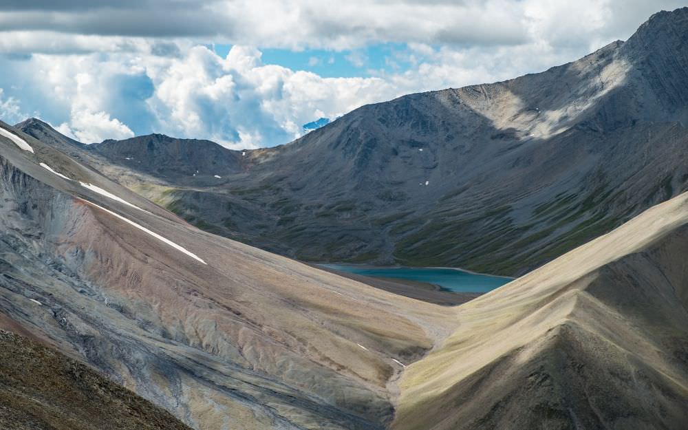
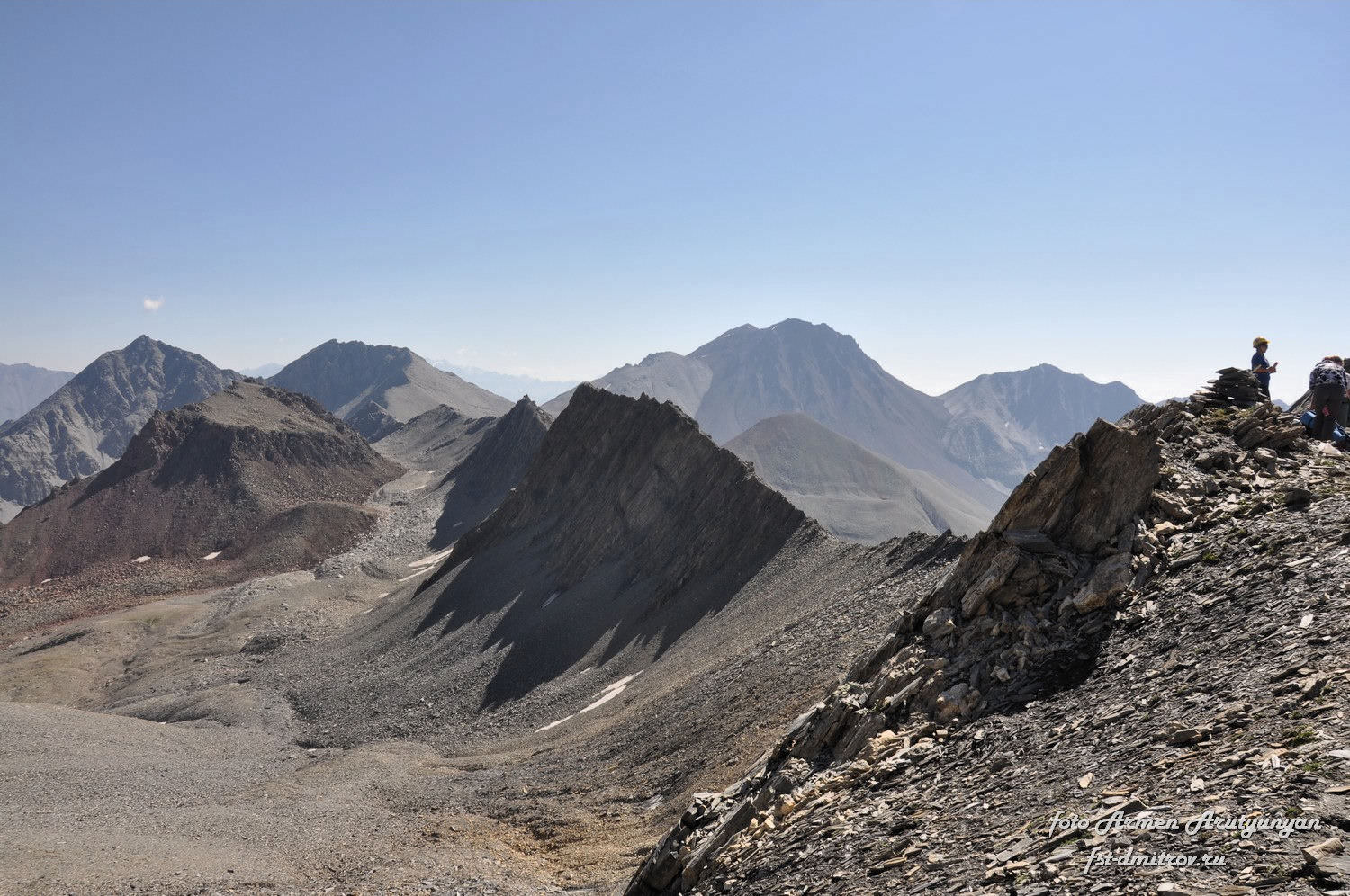
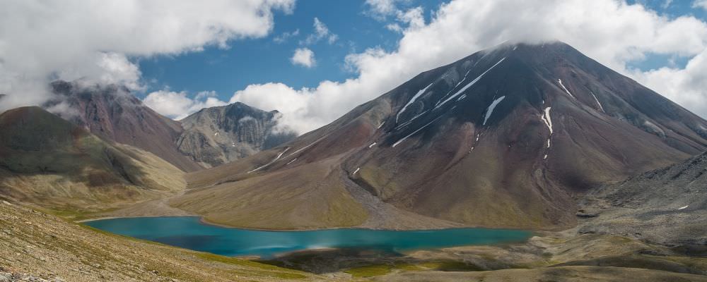
Khorisar pass lies at the elevation of 3429m. From there, you can already see the Kelitsadi lake to the west. The descent is steep and quite problematic as you have to hike down through the loose boulder field. Navigating this field is arduous, very time consuming and at times downright dangerous. Finally, after 1,5km you will reach the riverbed of White Aragvi river (often dry). Cross it and continue west, traversing northern slopes of Sherkhota volcano. After another 2km, you will come to the Kelitsadi lake - it will be your source of water so better have water filters or other water treatment tools ready.

Once leaving the lake, you need to be careful since the trail goes very close to the "occupation line" - if you lose your way here, climb the wrong pass and venture into South Ossetian territory, you may end up in Tskhinvali prison.
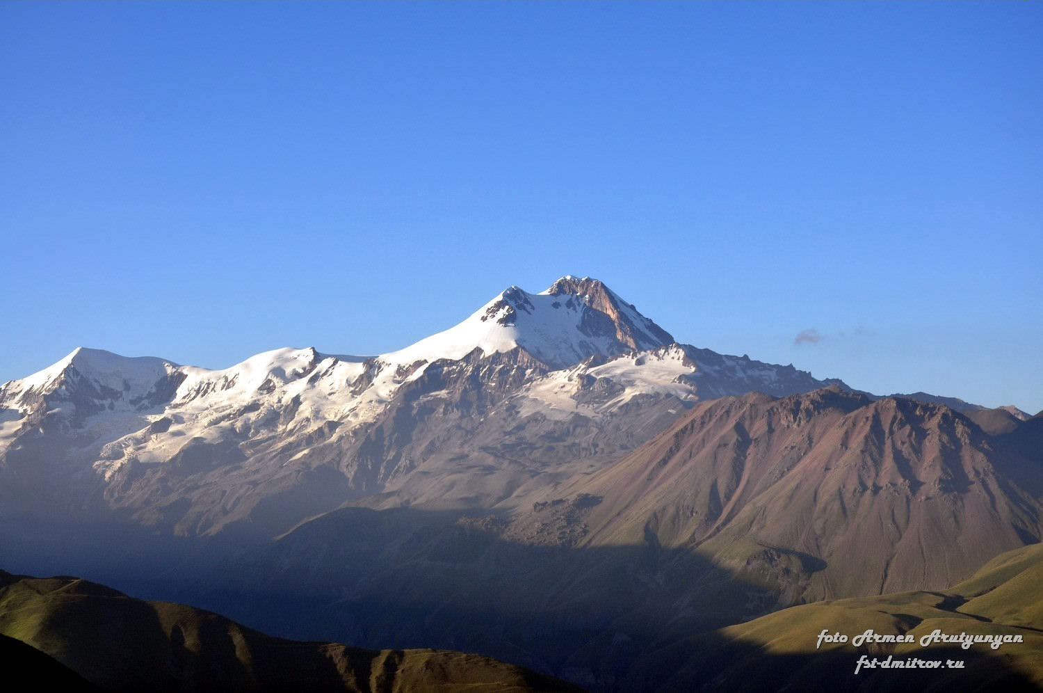
So, let's do it. Bypass the Kelitsadi lake from the north (or take a stroll around it, as you wish) and head north-west, towards the High Esi pass. You need to overcome some 350m of elevation, the terrain is mostly composed of screes which make the climb uncomfortable. The pass lies at the altitude of 3435m and offers superb views of Kazbeg massif to the north as well as of the mountains and lake behind. Colors of the landscape are particularly striking in the late afternoon.
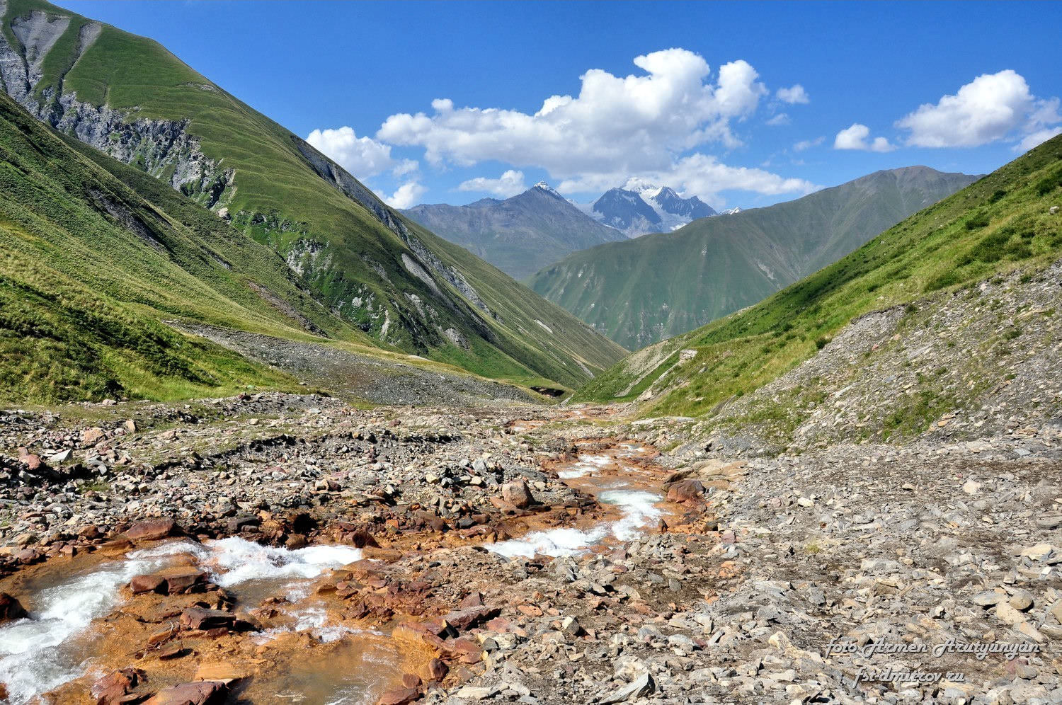
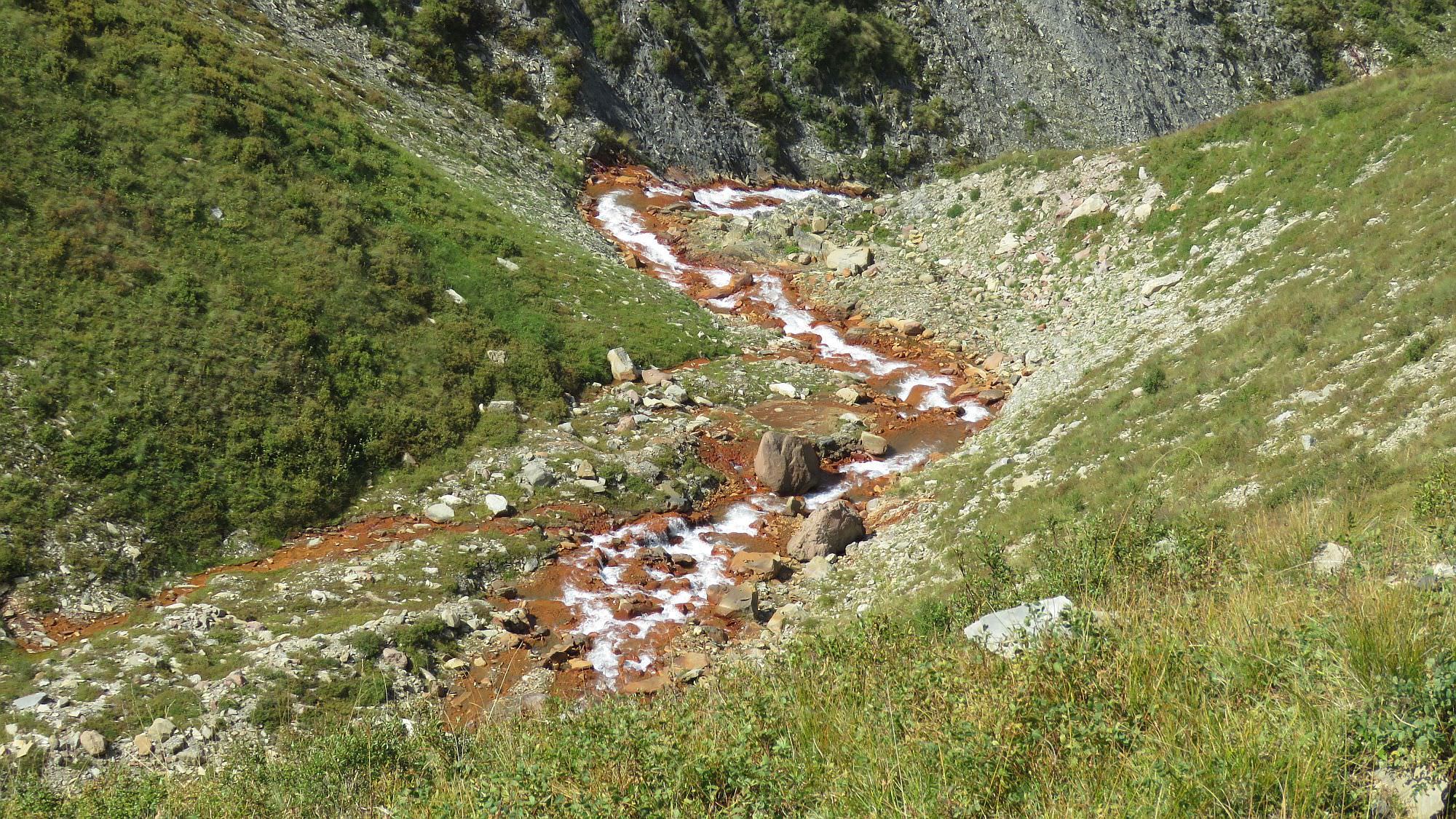
From the pass, the trail goes down to the left, along the rock wall. Then it disappears in the large boulder field - you need to cross it and reach the source of the Esikomi river. Water has a typical sulfur taste, stinks, and doesn’t taste that well. Despite this, however, it is safe to drink if no other spring water is available around.
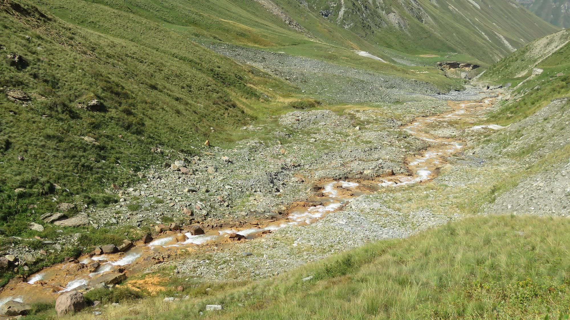
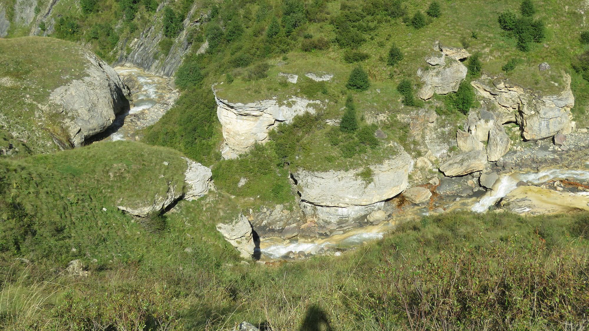
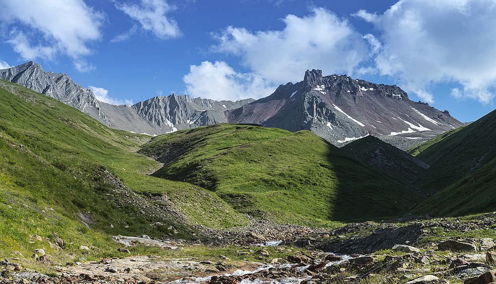
Follow the riverbed of the Esikomi river until you come to its confluence with another main tributary. Here, the river enters a rather narrow valley. At first, stick to the right bank (or just walk in the riverbed, as you see fit).
At the elevation of about 2450, you will see a wide flat spot at the left bank, in the otherwise quite narrow valley. This is a good time to cross to the left bank - you would be able to continue even on the right bank for a while, but then you will reach an impassable terrain and will be forced to the left bank anyway. There, you will find remains of an old trail. It's more or less fine, but even there are some unpleasant sections, potentially dangerous in bad weather.
Finally, you will reach the mouth of the valley. Use the wooden bridge to cross to the right bank of the Esi river and Ketrisi village lies right ahead...
This article is based on very detailed trekking report, published by "Federation of mountain tourism" from Dimitrovsk area, Moscow.
Many great photos were provided by Jussi Saha - here is the full album from his trek
Remaining photos were provided by Vadim Turkin and Sasha Rybakov. Thanks a lot!