Difficult trek connecting some of the most remote parts of Caucasus.
"Most of the long way down I spent upon my arse."
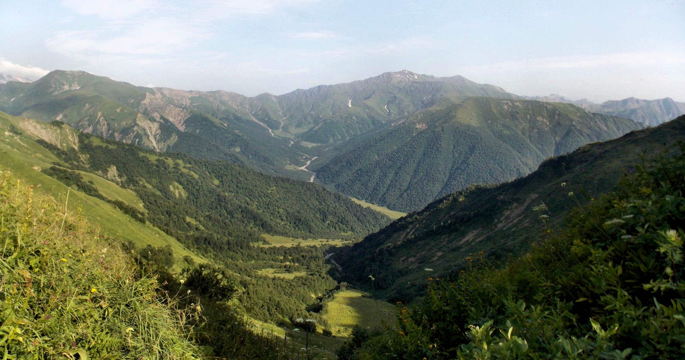
This beautiful, but very demanding trek takes you to some of the most remote parts of Caucasus. It follows the old road which once connected Zeskho village in Svaneti with Ghebi village in Racha, but fell into disrepair a long time ago.
Under the ideal circumstances, this trek can be finished in three days. But better have at least one day in reserve.
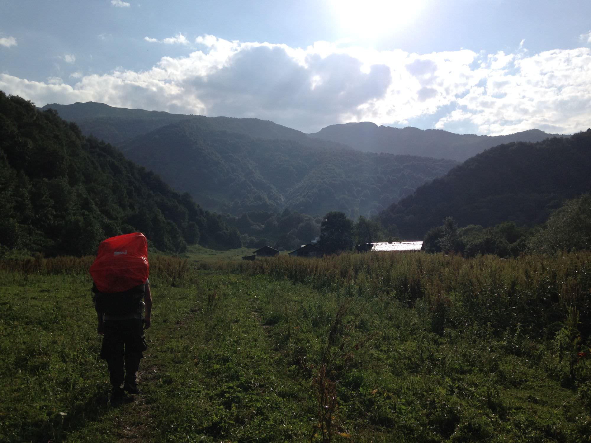
The trail crosses two steep mountain passes, but the biggest obstacle is the overgrown Tskhenistskali valley. The situation has somewhat improved in the past few years, but at some sections you ill still have to fight your way through the undergrowth of hogweeds, nettles and various others weeds.
There is no clear trail to follow once you descend to the Tskhenistskali valley, you will have to find your own. Therefore this trek is recommended only for experienced,
well-equipped hikers.
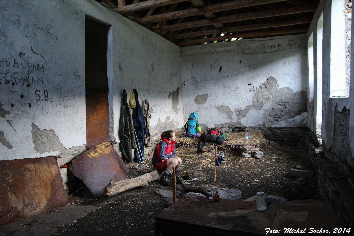
For this trek, you need a tent.
Doesn't matter that much, but walk starting from Zeskho is easier as this village lies higher than Ghebi.
You will need to hire a car in Mestia/Ushguli (Upper Svaneti) or Mele (Lower Svaneti).
You can also try to hitchhike, but the road through Zagar pass is barely used and cars riding through it are usually full of tourists.
Another option is just to walk from Ushguli or Mele to have a warm-up - it can be done in one long, tiring day.
The bus from Ghebi to Oni departs only on Thursdays - the days when the market takes place. The first time it departs around 9.am - this one takes the people to the market. It returns around 6.pm and immediately returns to Oni so this is your second chance to leave Ghebi.
On the other days, you will have to hitchhike or take a taxi - price for the transport to Oni should be about 60-70 GEL for a car.
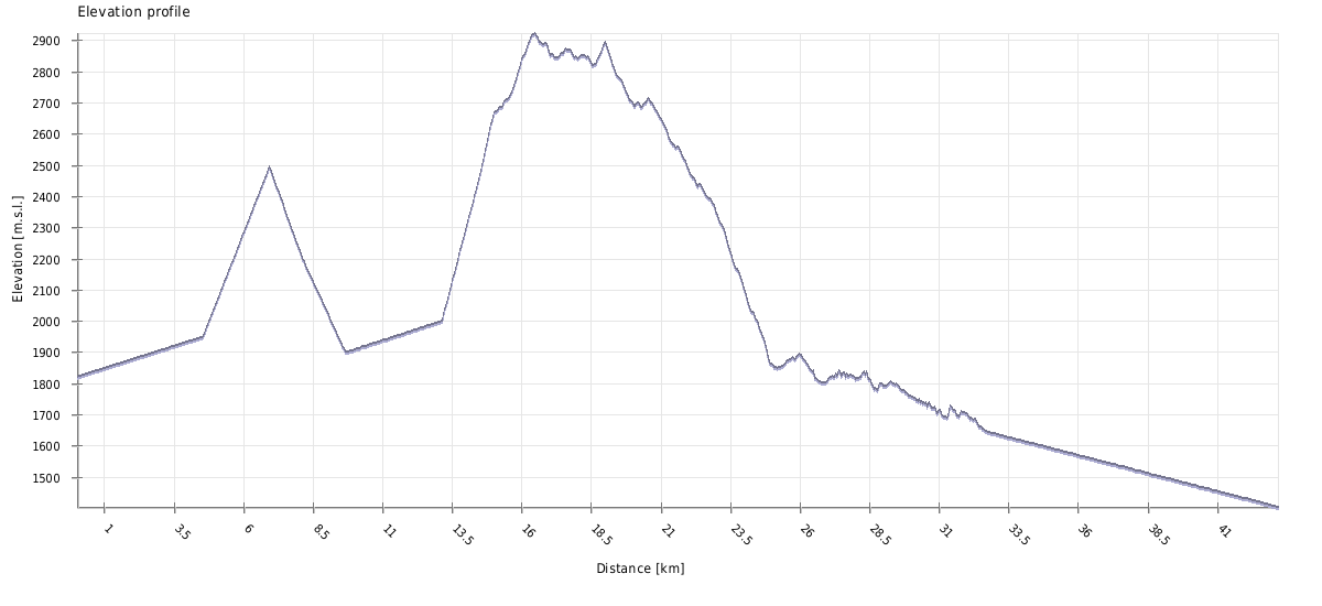
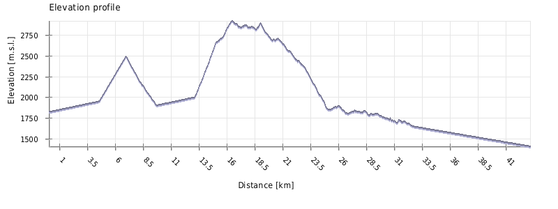
| Distance | 43,2 km |
| Trail type: | AB trip |
| Max. elevation: | 2922m |
| Min. elevation: | 1404m |
| Total climb: | 2062m |
| Total descent: | 2779m |
The trail starts at the almost abandoned Zeskho village; only four adults live here all year long. The road follows the river, crosses two bridges and after a mile comes to the mountaineering center (big building on the right side), which now serves also as a border guards checkpoint. Here, you will have to provide your passports.
Follow the road for another mile along the Zeskhura river, until you cross its smaller left tributary. Some 100 meters behind it is a meadow with ruined shepherds huts to the right and behind them also small trail heading to the southeast. Huts are overgrown and hard to spot when coming from Zeskho, so if you come to the bridge crossing to the right bank of the Zeskhura river, you have gone too far and need to return. On the way back you will spot these huts easily.
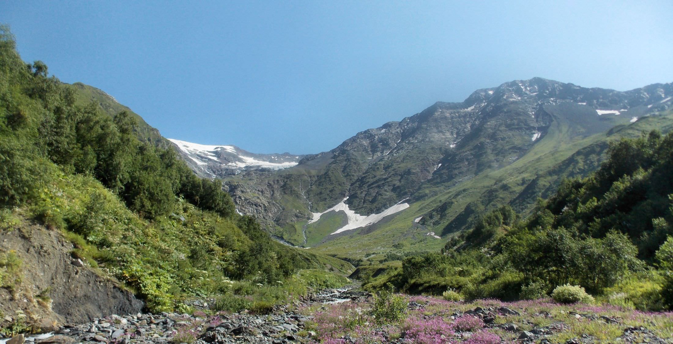
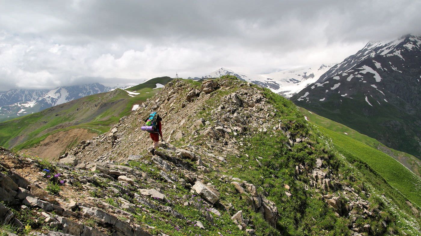
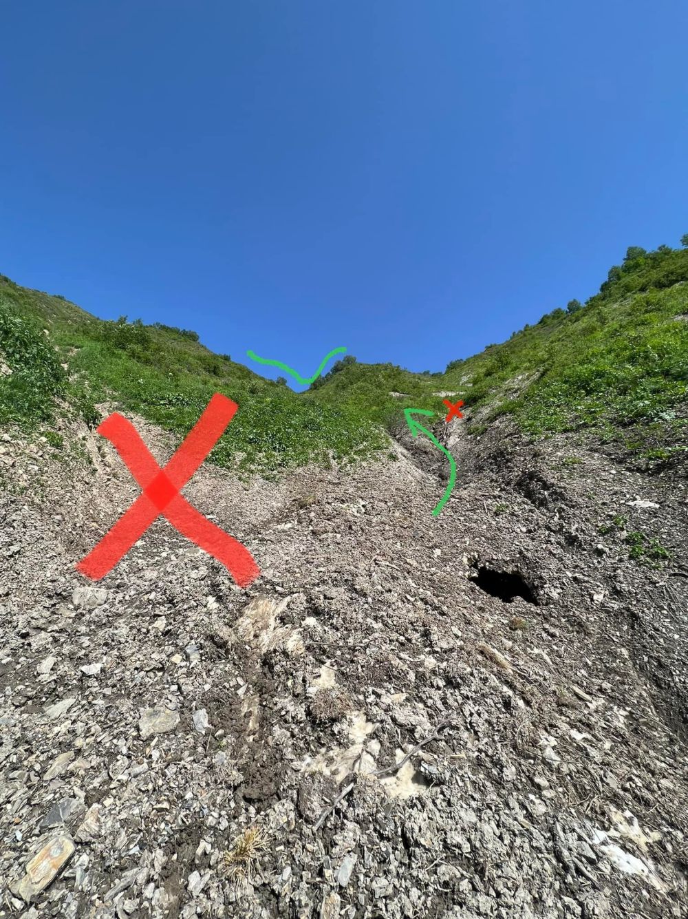
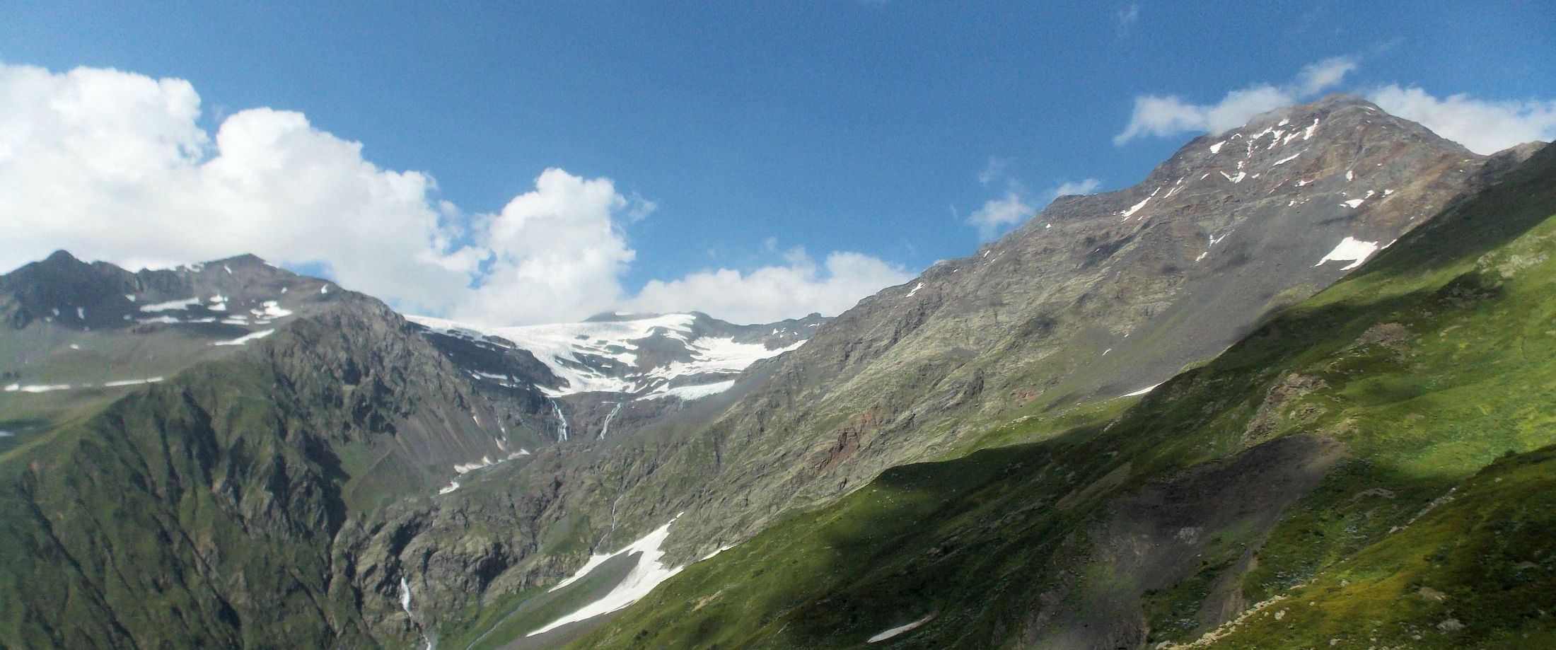
Follow the small trail heading past shepherd huts. At first, it's well visible (used by cows) but as the ascent becomes steeper, it will gradually disappear and you will have to fight your way through vegetation. There is also recent dirt track, but it doesn't lead to the pass - if you followed it, you would end up too far to the north. Eventually, you may find a small stream and follow it to the southeast - if you don't, just keep climbing up in its original direction, towards the lowest part of the ridge over you and you will eventually make it to the Lapuri pass at the elevation of 2500m (from 2018, there is also a steel cable to help you with the ascent).
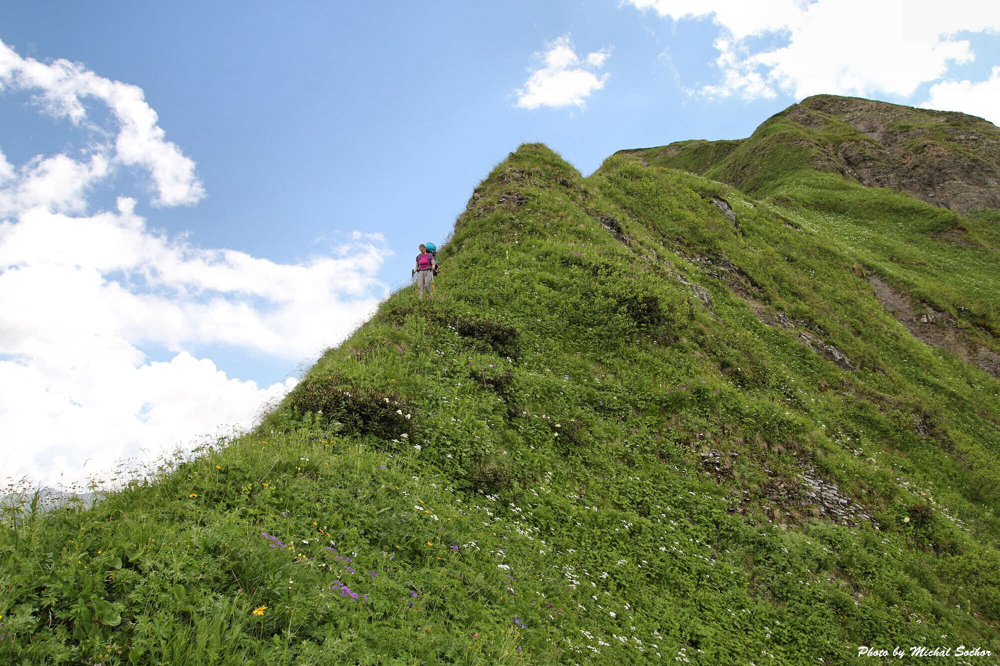
Of course, this is easier said than done. Of all hikers I spoke to, only one was able to hit the pass directly. The others (no matter from which direction they came) reached the top of the ridge several hundred meters north of the actual pass. So they were forced to do a very risky traverse on a steep, unstable slope. So keep an eye on the direction you are walking and try not to stray too far to the north. The pass is at the lowest point of the ridge, an approach is outlined on the photo below.
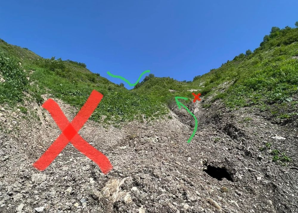
Approach to the Lapuri pass from the western side
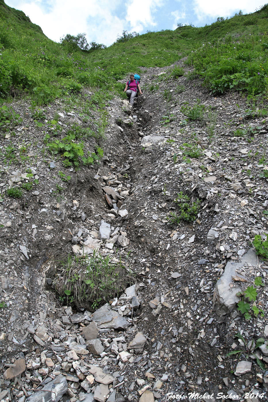
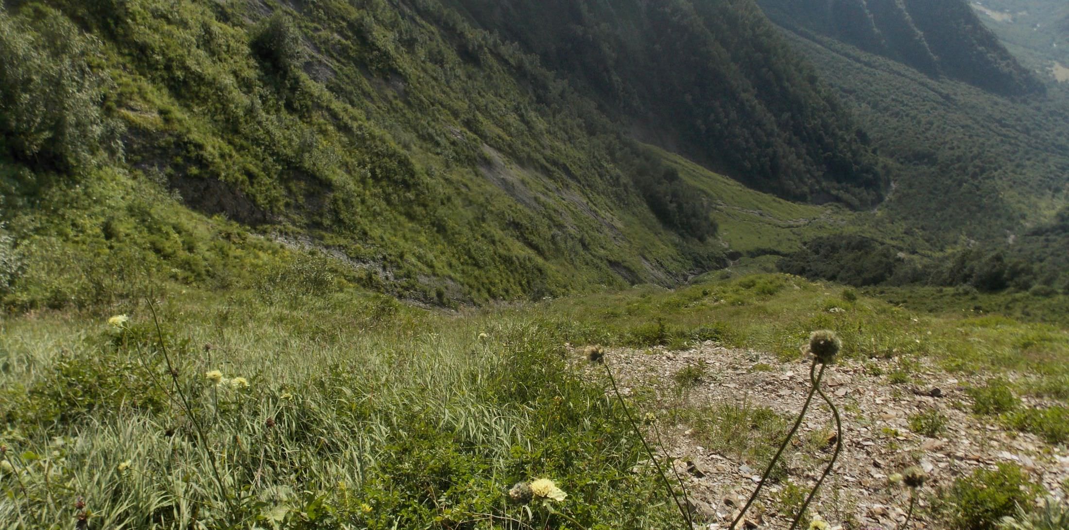
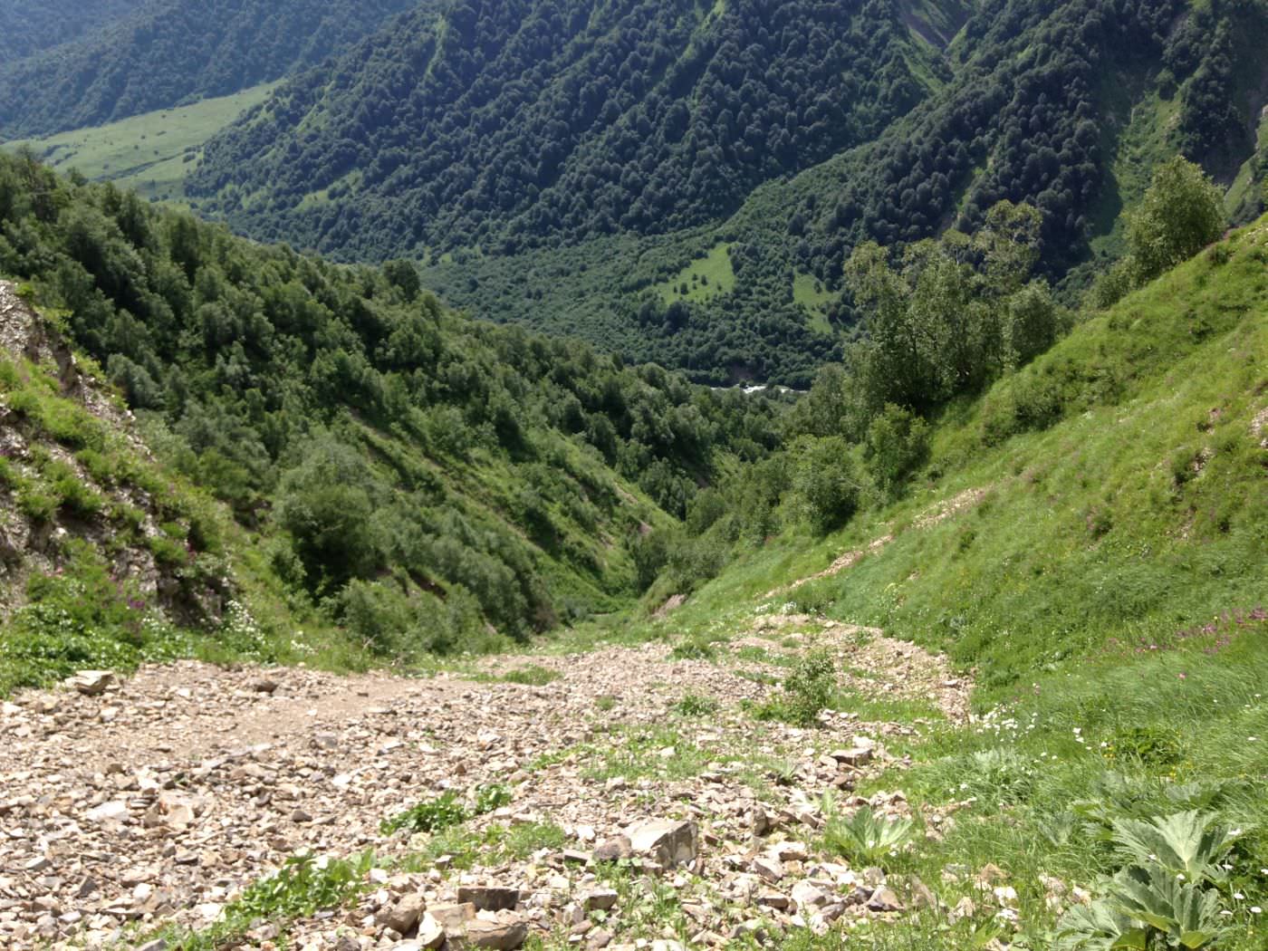
From the pass, descent to the southeast to the unnamed right tributary of Tskhenistskali river - this section is very steep, as the rains in the past years have changed a path into the deep ditch. Banks of the river are mostly overgrown, so it's much easier to simply walk in the riverbed as far as possible. Follow the tributary until you come to its confluence with Tskhenistskali river. Here is a good place to camp.
Also be aware that there are several bears living in the valley so take all standard measures to avoid any encounter.
In the morning, cross the nameless right tributary and walk upstream along the right bank of Tskhenistskali river. After some 4 km of slow ascent, you will see two left branches of Tskenistskali river - follow the lower, smaller one. And do not just follow - the best bet not to get lost is move right in the riverbed, even though it is slippery (out of the riverbed you'll need a good machete to break through).
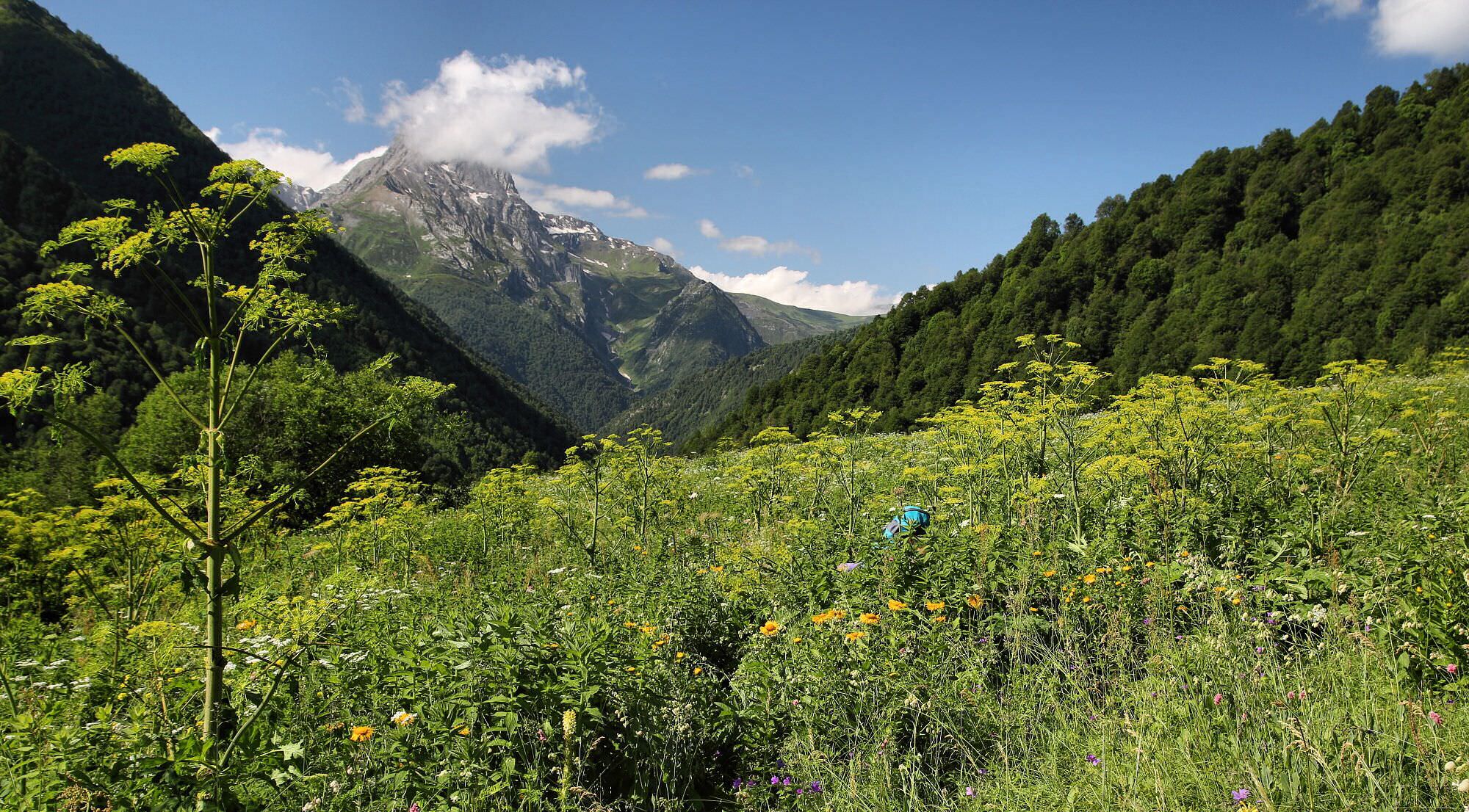
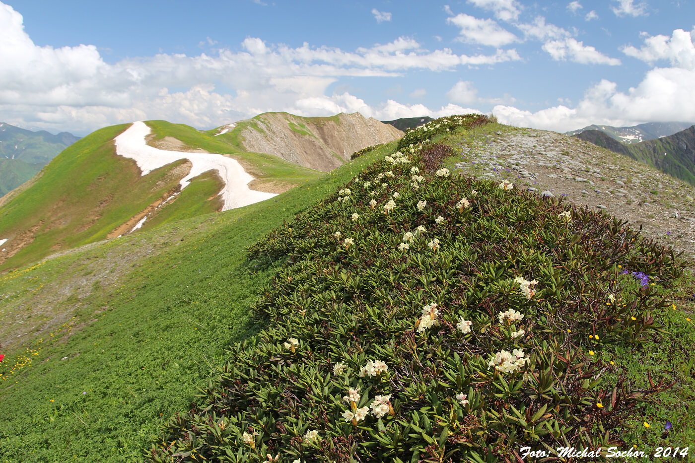
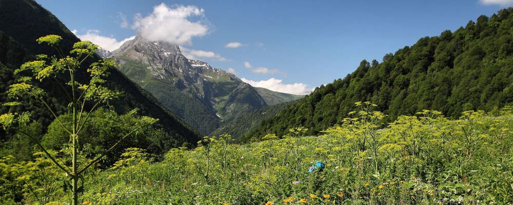
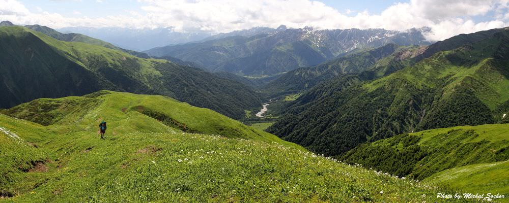
You'll have to exit this in few places, but do return to it asap. Higher up the creek splits in two, you follow the one to your right. Do not climb out of it before the rhododendron fields on the slope come to an end and you will see a path heading to your right, to a nose-like ridge. Then you'll follow this path and head for the big green hill in the southeast. That's the Vatsistsveri pass - even though the passes are usually the lowest part of the ridge, it is actually one of the highest parts. Here, you are already walking through alpine meadows where the movement is rather easy.
There is also an alternative route to the pass currently being upgraded by Transcacasian Trail project which is even easier, shorter and more straightforward (but less scenic). It crosses Tskhenistskali river by the camping spot and then follows the riverbed of Lapuri river (left tributary of Tskhenistskali). Then it turns norths and climbs through the maze of gullies to the main ridge some 2km behind the Vatsistsveri pass. It is added in the gpx log, but I also recommend visiting A Mountain a Day website where it is described in more detail.
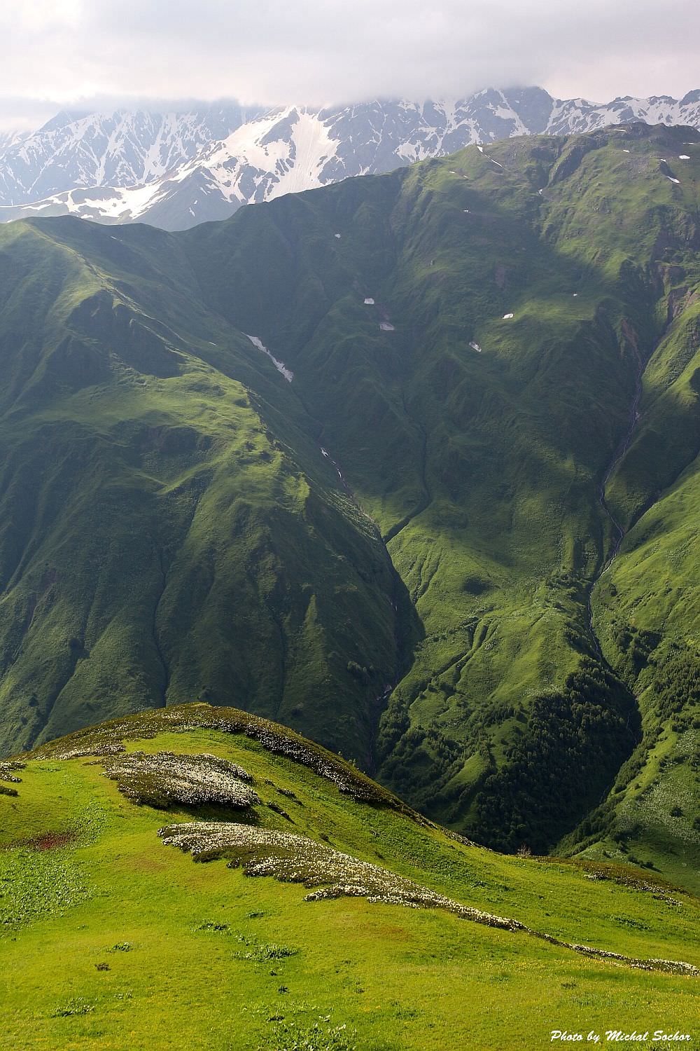
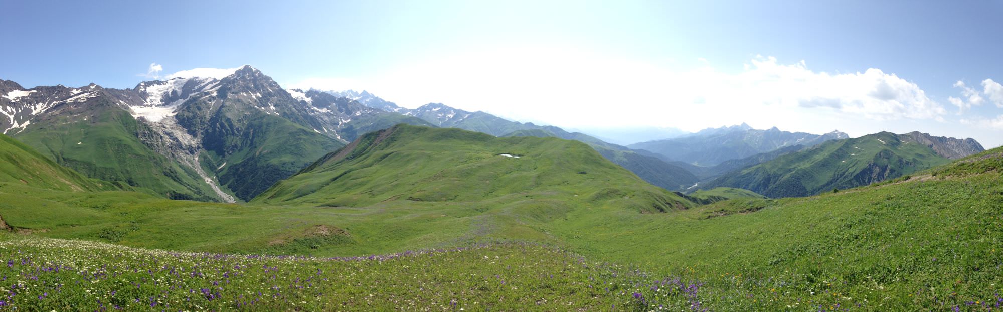
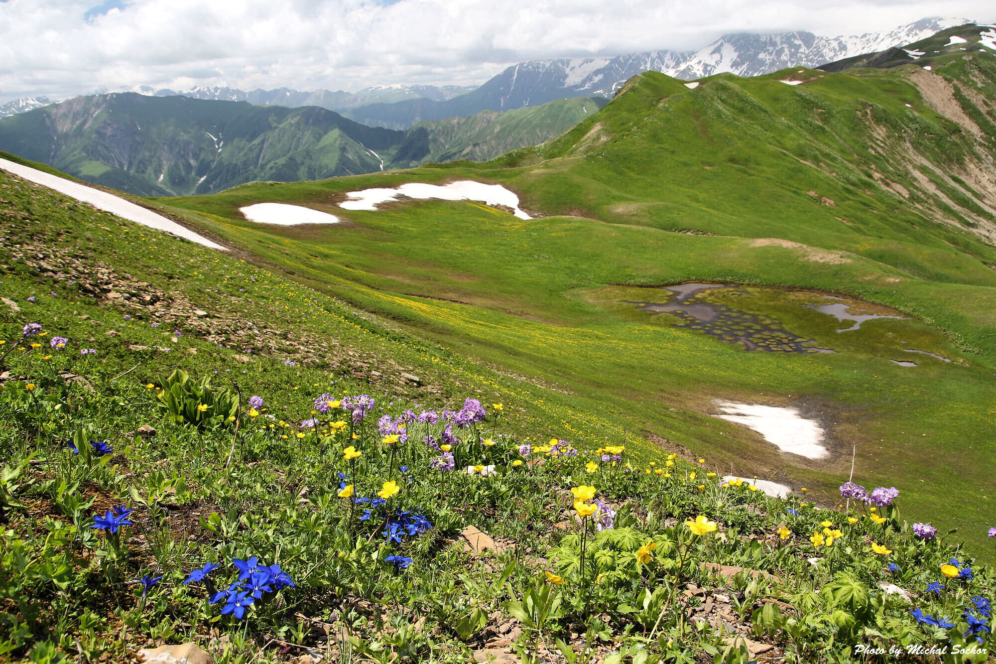
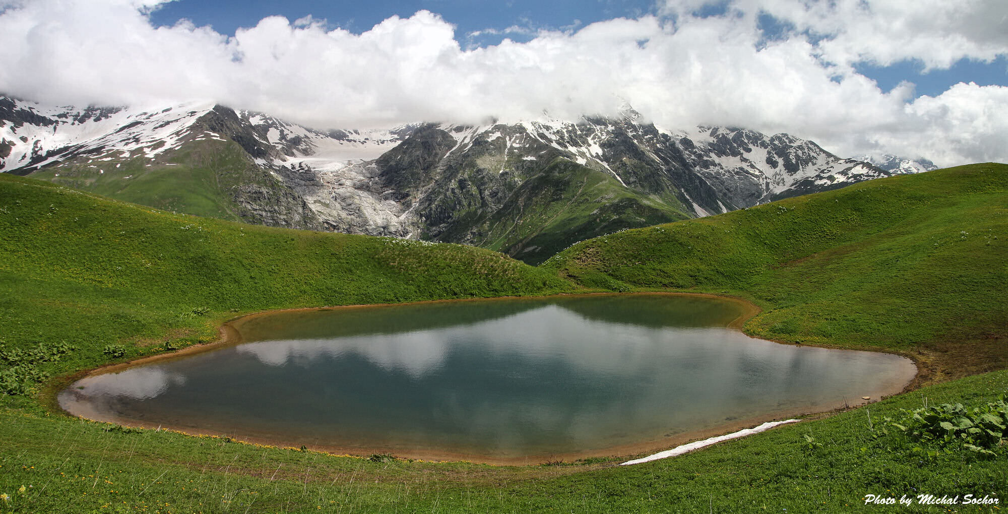
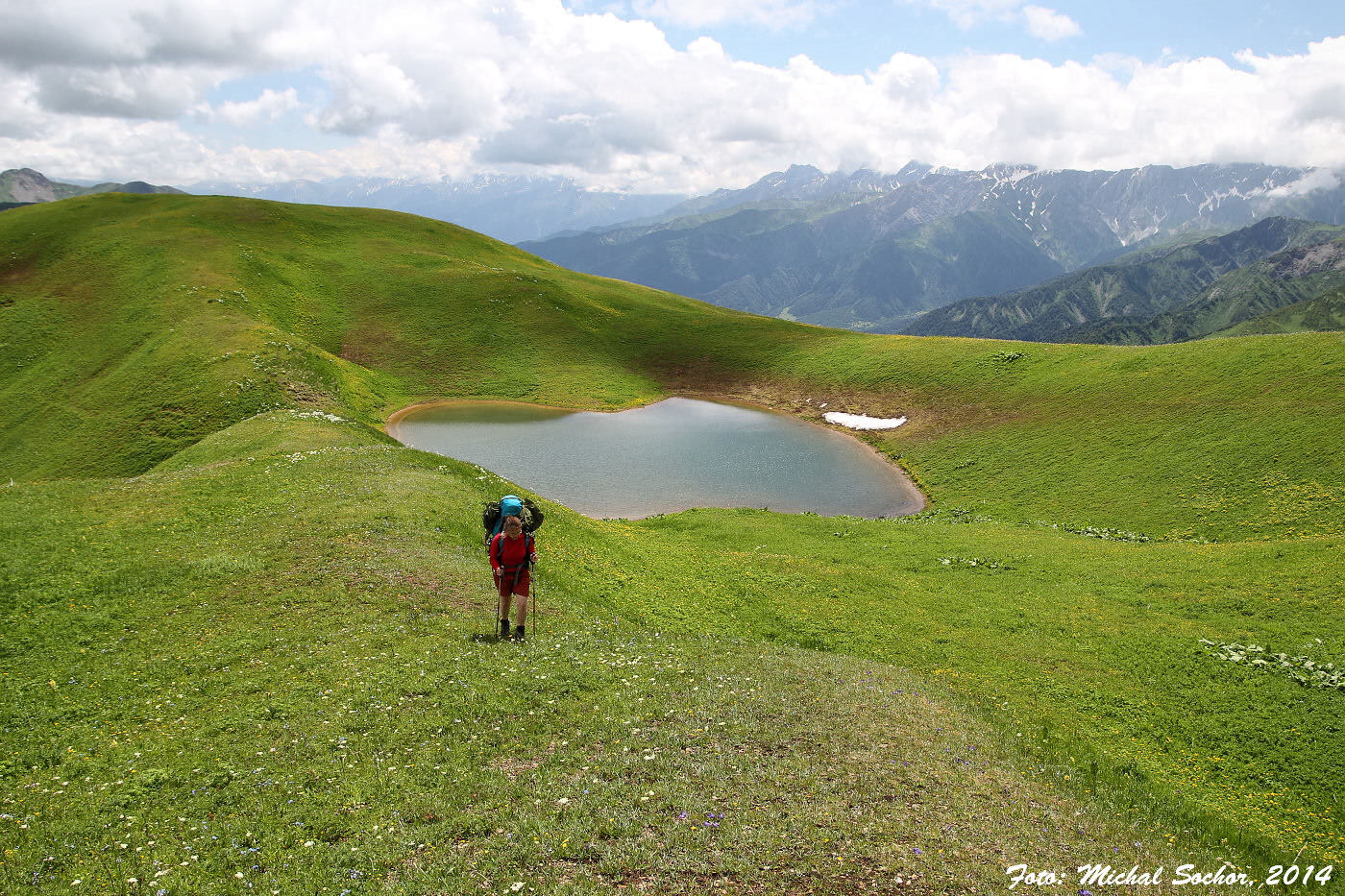
Once you make it to Vatsistsveri pass, the path is apparent. Just follow the narrow top of the ridge in the southeastern direction, soon you will see Sasvanotba lakes in the distance. At these lakes, you can break a camp and refill water (even though they are quite muddy and shallow).
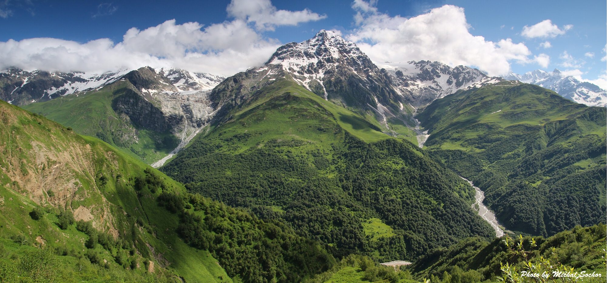
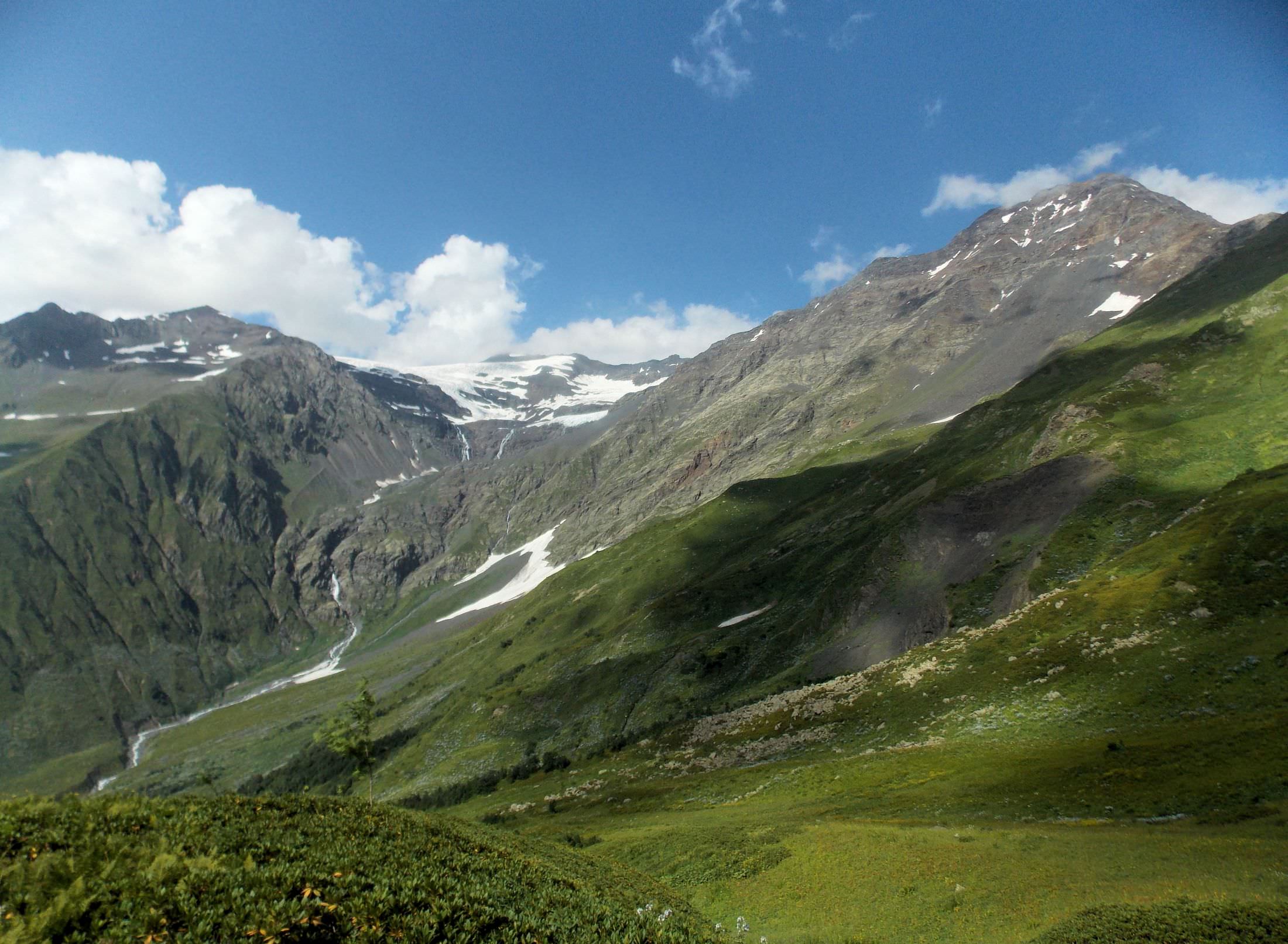
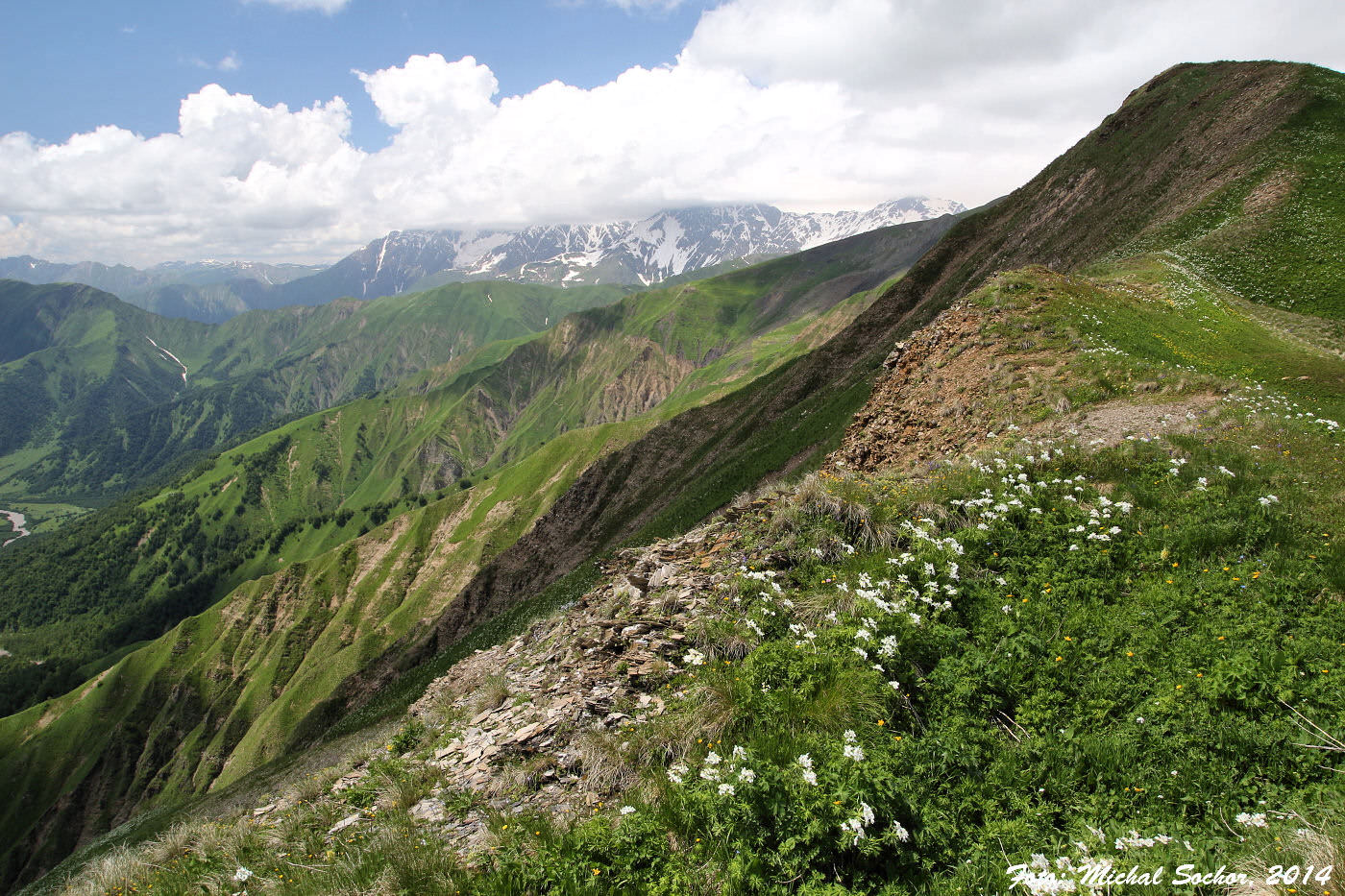
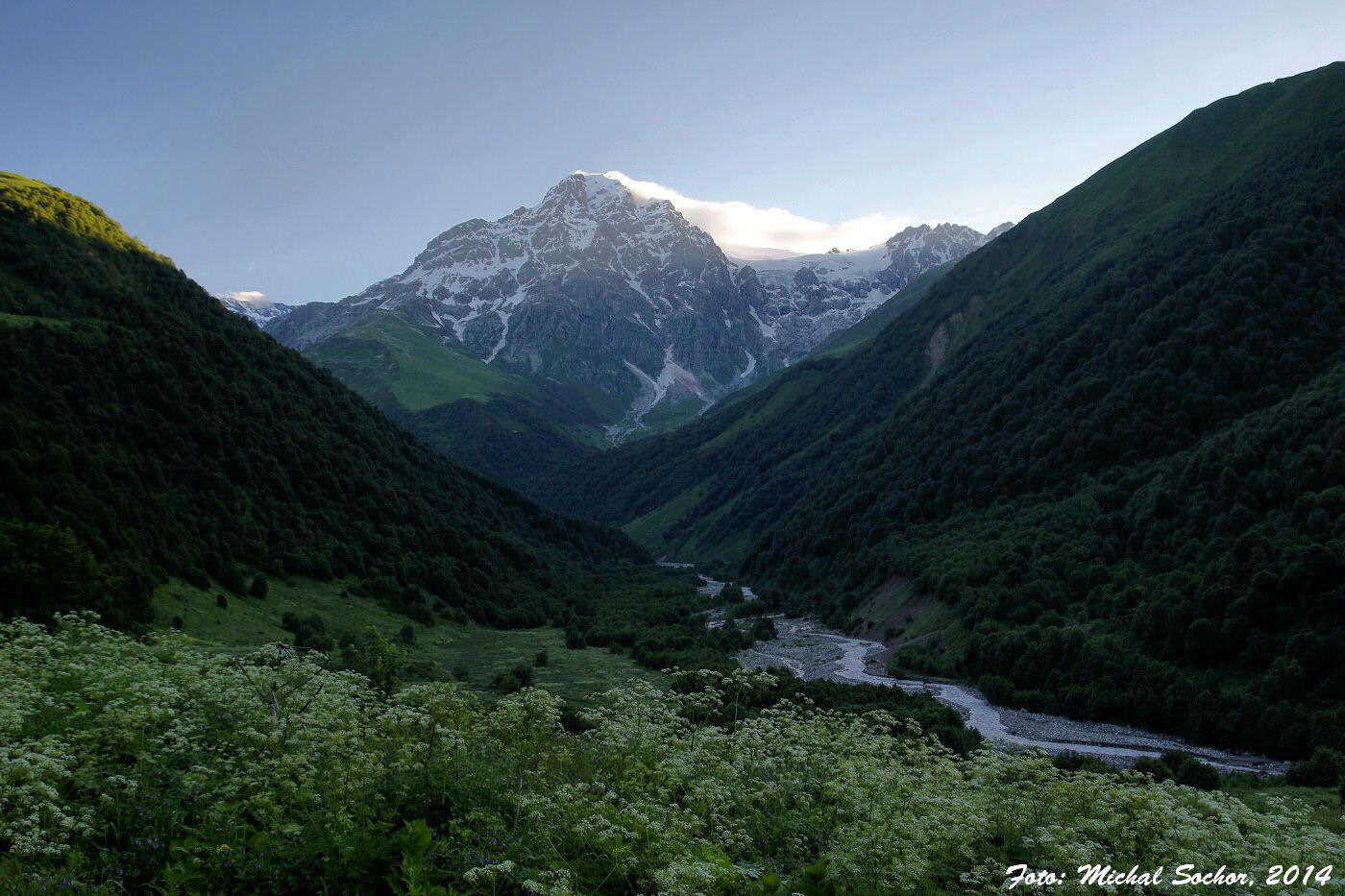
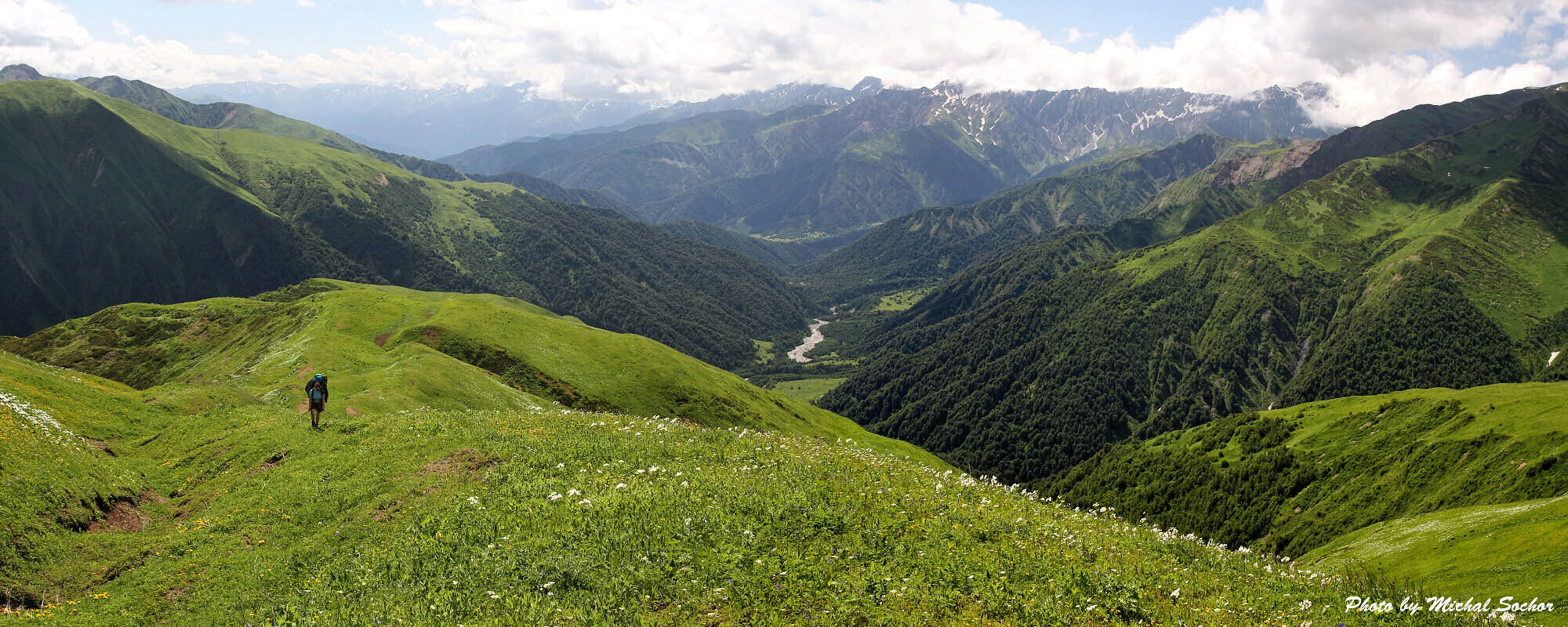
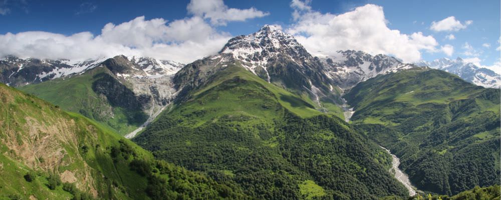
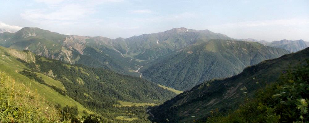
Continue descending on the ridge to the southeast - here you should see also remains of the old road. You will have gorgeous views of the Rioni valley, especially of the Edena peak and glacier to the north. Enjoy them while you can, because once the trail descents to lower elevations, you will once again get stuck in dense undergrowth. But just follow the top of descending ridge and "the trail" will eventually lead you into the Rioni gorge at the confluence of Rioni with Sasvanotskali river. Here are also remains of the tourist shelter where you can spend a night, if necessary.
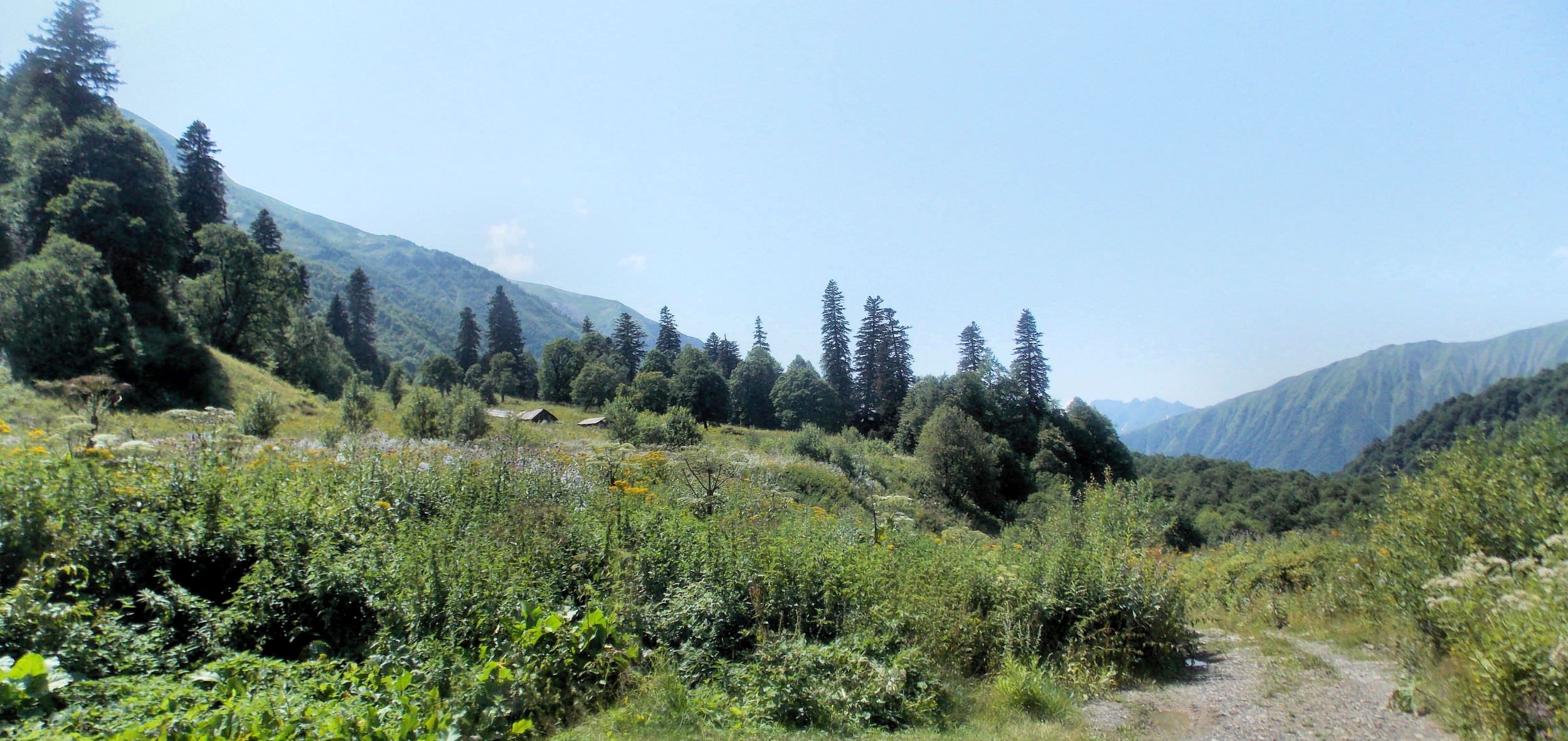
Follow the Rioni river, walking on the right bank - you will have to cross its several tributaries. Rivers first flows to the south, but after some 2 hours of walking bends to the east. Not far from here you will come to the group of houses - settlement Brili. Few kilometers behind Brili is a bridge on which you will cross to the left bank of Rioni river. Here you will find a solid road, which will comfortable lead you to Ghebi lying some 5 km downstream.
All photos provided by Zuzka Egertova and Michal Sochor. Except of those those by Lukas Bady and Vahur Lokk :)