
Day 1
“I shall be telling this with a sigh.
Somewhere ages and ages hence:
Two roads diverged in a wood, and I -
I took the one less traveled by,
And that made all the difference”
After a long flight via Warsaw, we were picked up at the airport at 04.00 am and a new Caucasus adventure began. This year we turned east from Svaneti and headed for Tusheti which borders the Russian federations of Dagestan, Chechnya, and Ingushetia. The journey to Omalo which is the ‘de facto’ capital of Tusheti took us over the Abano pass on an unpaved road which reaches a height of 2967 metres and is not one for the faint-hearted.
This road is subject to landslides, crashes and with mere plunges of hundreds of meters on many, many sections deservedly earns its place in the ’10 most dangerous roads in the world’ list. On occasions, cars have to reverse on the edge of cliffs to let other cars or lorries pass. The road is dotted with numerous memorials to people killed in accidents. Most of these have bottles of vodka, the local firewater called cha-cha and wine so people can raise a glass (or two) to those who have died.
The switchbacks were interesting, to put it mildly. There were also numerous waterfalls including a natural car wash, where most cars wait to try and get rid of the dust from the roads. Easily the most difficult thing was that when lorries passed, it got really challenging for the driver. The concept of ‘Passing Place’ does not really exist there, somehow as a driver, you must muddle through and try not to ensure total destruction of your car, passengers and all of its contents.
At the Abano pass
After the pass, the landscape opened up on our descent to Omalo. The distant peaks of Chechnya came into our sight. These mountains bring before their devotees that awe-inspiring vision of the imminence of dissolution that the hangman and his dreaded paraphernalia of gallows and drop could hardly hope to better.
Soon our 7-hour trip was over and we were in Tusheti. Mountains, the greenery, the river valleys, the people, the landscapes, the birdlife…… this was the place to be. After a few more switchbacks, we arrived in the village of upper Omalo and the guesthouse we were due to stay in. Upper Omalo had a church, a few guesthouses and numerous old houses, some of which were derelict and abandoned and some which were still lived in.
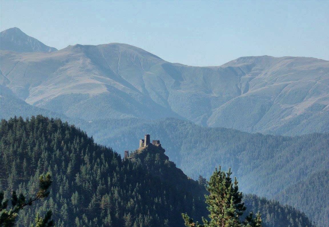
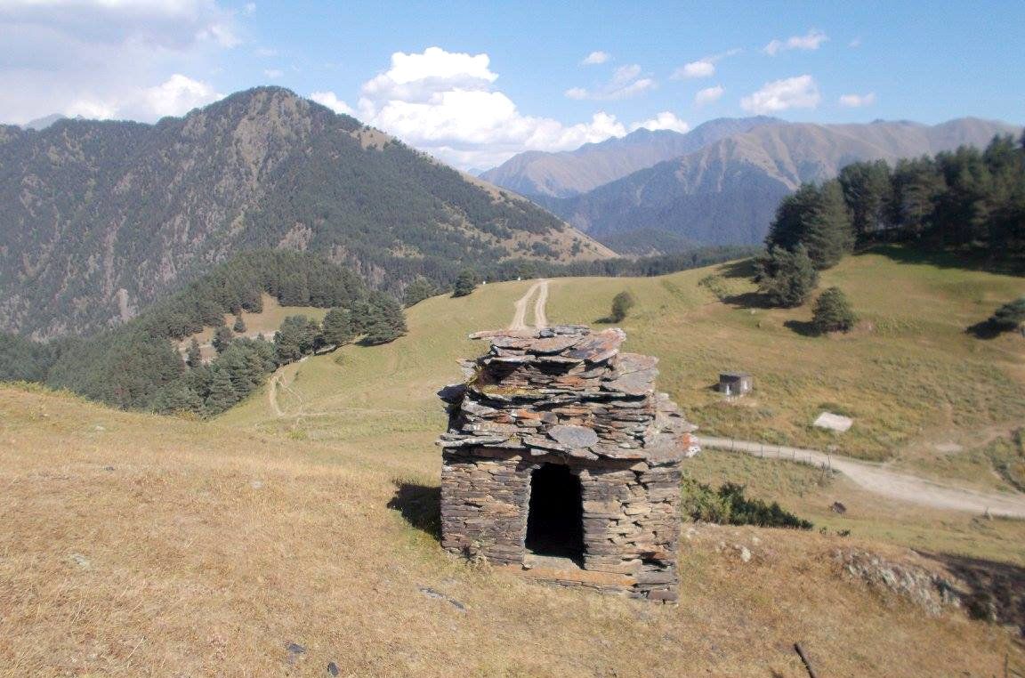
We were left at our guesthouse TLT by two Polish women Roza& Maria who would be our hostesses for the week. After leaving our bags in our room we decided to explore what is one of the more striking of sights (and there are many) in Tusheti. Dramatically located overlooking the village is a small hill fort called Keselo, a short walk up to 2071 meters. This had seven towers which were wonderful in appearance. Even more fantastic, once you got there were the views in all 4 directions - from Abano pass to Dagestan, from Chechnya to Ingushetia, all could be seen from this vantage point.
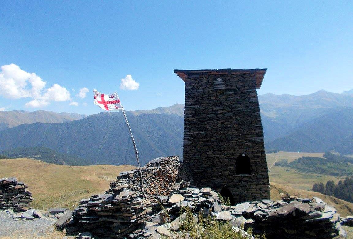
At the Keselo hill
After this short walk, it was down to the hostel for a very well earned drink and some food. We sat on the balcony and had our sumptuous Georgian food as Alexander Pushkin no less once said: “every Georgian meal is a poem”. Down below us was a small wooden fire because there was no electricity which meant the stars shone even more brightly due to a complete lack of light pollution.
Later on that night, some professional singers from Tbilisi called over and after clinking glasses in a toast gave a moving rendition of the traditional Georgian songs Gazapkhuli (Spring) and Khothbis Yelivit Lamosi (The bird with the beautiful neck). Their voices soared over the ether and echoed down through the eons. This was a scene that could have been hundreds of years ago, it could have been anywhere with the defiant and wonderful peoples that make up the Caucasus mountains. It could have been a song from anyone of the Azeri, Georgian, Ingush, Avar, Dargin, Lak, Lezgin, Kumyk,Armenian, Circassian, Nogai, Abkhaz or Ossetian peoples. As you listened to the voices soar and dip I am quite sure that the stars twinkled, just that little bit more than before.
Day 2
“Because it’s there”
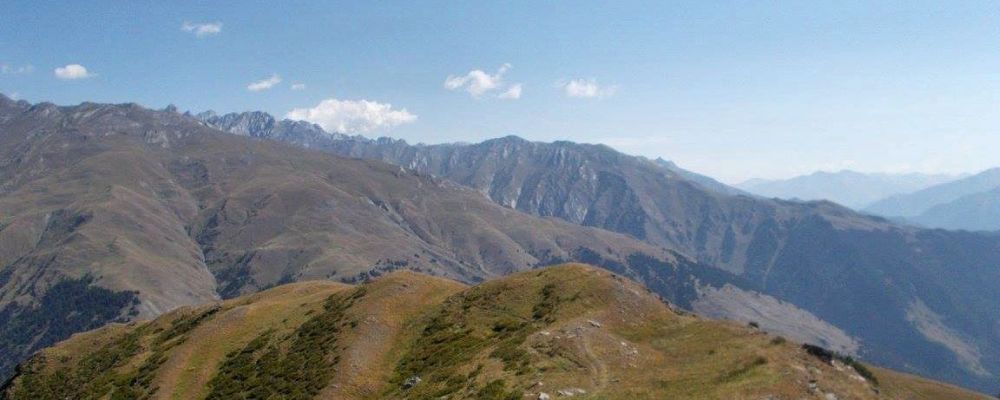
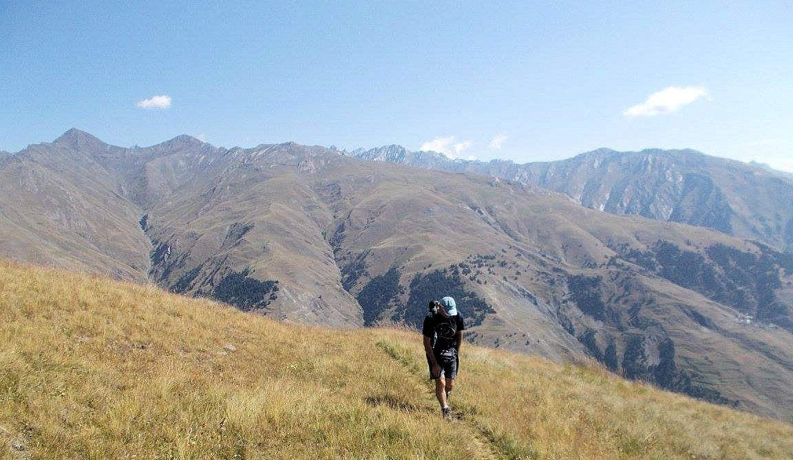
On this day we decided to climb the Pirikiti Ridge. We started by climbing to the col between the graveyard and Omalo hill and dropped down into the valley below. We ignored the track heading west and followed another horse trail through the forest until eventually, after climbing through numerous ridges, we arrived at a clearing. Here we found a dusty horse track which led through the meadows and up onto the ridge. We strolled through the meadow and reached our first peak at 2502 meters.
Morning in Omalo
Keselo fortress left behind...
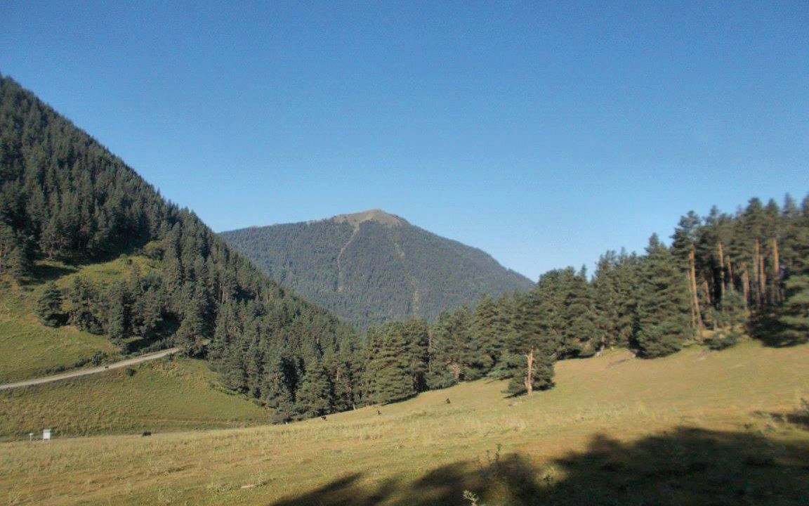
Samekehe Mountain in the distance
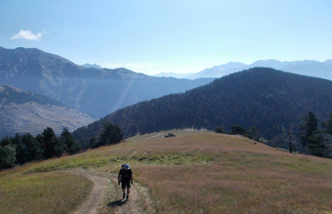
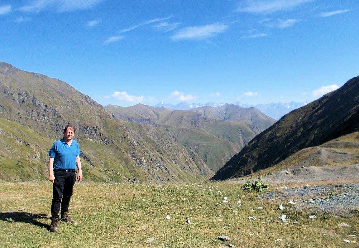
Martin heads up the hill
The panoramic view from this point was fantastic through all the valleys and also up to the 4000 meters plus peaks of the mountains bordering Chechnya, Ingushetia, and Dagestan.
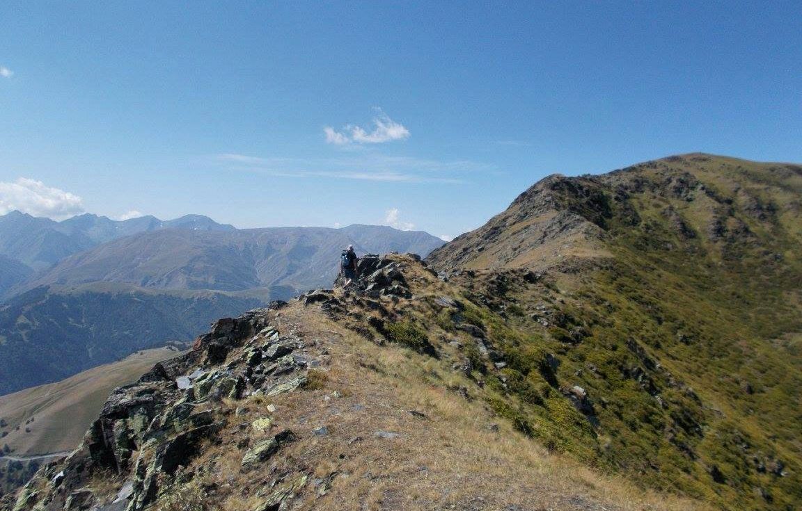
We then continued along the ridge until we approached a second peak of the way. It took a minor scramble to get there, but the steep drop below us down the river valley towards the famous village of Dartlo was phenomenal.
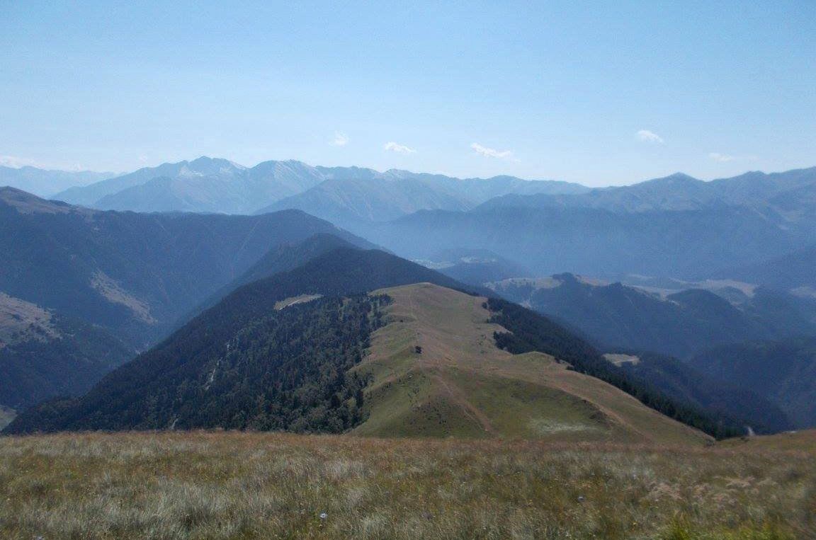
Looking back along the ridge
Martin and the ridge
The meadows we passed through was a kaleidoscope of color and countless insects flew, shuffled and crawled. They were to be seen in all direction from crickets to butterflies from brown to grey, from green to khaki and even a shocking pink insect could be spotted from time to time. After a rest at the summit of Sakhevi East (2821 metres), we proceeded up onto the plateau at the top where the peak of Sakhevi could be spotted.
Minor scramble ahead
Sadly, in contravention of all the national parks rules which are well signposted, an off-road vehicle and some scrambler bikes could be seen.
This idyllic scene was ruined by the noise and racket of these machines and a little more enforcement from the National Park rangers must ensure in future. We got to the peak (2925 metres), just after they left and rested at the "khati" near the summit just as it turned lunchtime.
Pagan khati shrines are a unique part of the Tushetian culture and are ubiquitous on the peaks scattered around the valleys. They are small stone cairns topped with a white crystal.
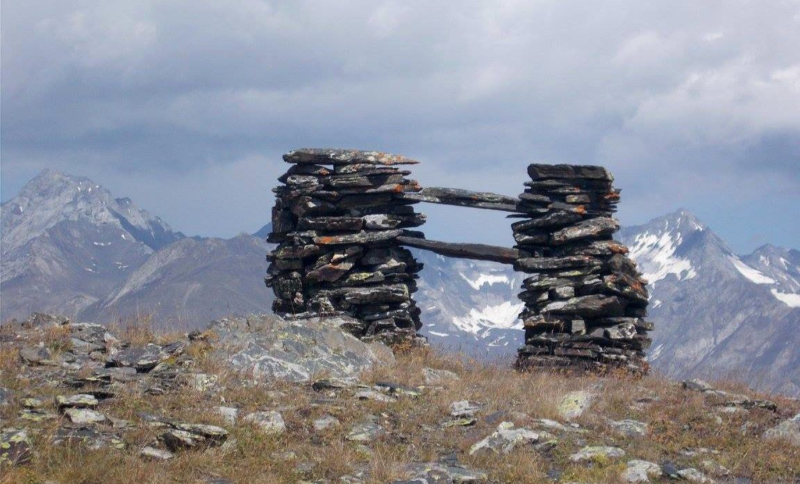
Khati shrine
I followed the ridge and climbed the other peak Pitsilanta (2996 metres) which again had fantastic views in all directions. During these climbs the whole time, we were circled by eagles overhead.
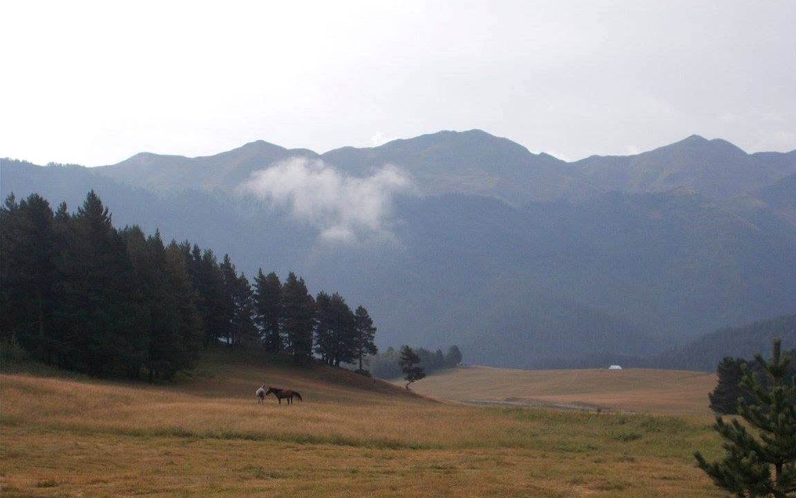
Then we dropped down to the valley below by following a track before we took a short cut down a steep embankment until we reached a lower track. We followed the track around and soon came to the village of Bochorna (2325 metres), the highest settlement in Europe. This has one permanent resident - a man who lives with his mother whose sole occupation is to make cheese.
From here it was a long walk back to the village of Upper Omalo where we had a nice beer. It was much needed of after 9 hours hiking to and from and even along the Pirikita ridge.
Day 3
The woods are lovely, dark and deep
But I have promises to keep
And miles to go before I sleep,
And miles to go before I sleep.
Stopping by woods on a snowy evening
Today we decided to try and climb the Sanoravani ridge, this was quite close as the crow flies but not so much so via road or track. So we followed the zig-zag track that led from Upper to Lower Omalo and then onto the river below. Naturally, not needing to follow the road, we took a few shortcuts on the way.
Eventually, once we arrived at the bridge at Tsikhis Gori tower, we realized that climbing the Sanoravani ridge was not feasible unless we got a lift to the starting point (But there would always have been the long walk back afterward!). So we decided to walk further along the valley until we got to the bridge at Khiso and we walked some of the local roads towards Zhevunta. From here access to the ridge beckoned but after a 14 km walk, we decided that this was not for us this day.
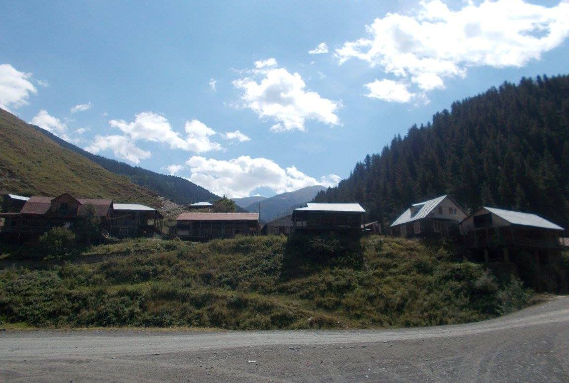
Khiso village
We walked back until we got to the tower at Khakhabo which was at the cliff overlooking the junctions of the Oristskali and Khiso Alazani rivers. We shortly passed by a man and his helper using a pickaxe and a shovel to extract slate from the sheer cliff face. This was then passed down to his helper below to be stacked. Most of the houses in Tusheti are made from a combination of slate laid on flat and wood.
Another Khati
Fergal in Omalo valley
Shortly afterward we took the long walk back up and up the ridge till eventually, we arrived finally at Upper Omalo village.
That evening, the feast of St. Mary took place in the sleepy village of Upper Omalo. The local Georgian Orthodox Bishop in his flowing robes came by to help celebrate the day in question. Here he was presented with a large black sack of presents by some of the local schoolchildren.
Later on, a wood fire was lit beside TLT and some local folk singers came and gave some fine renditions of local folk music as the stars once again twinkled overhead. The only other sound to be heard in the village that night was the occasional horse neighing.