Remote, little-known but beautiful trail going from Skuri to the Tobavarchkhili lake.
Another trail connecting Skuri village with Tobavarchkhili lake, one of the most beautiful mountain lakes in Georgia. However, there is one thing setting this route apart from the other, more established trails - it is not marked and also almost unknown to the hiking community.
It is not the shortest nor the easiest one so if your primary objective is just seeing the lakes, classic routes such as the one following Magana river might be a better option. But if you would like to enjoy even better views and explore some remote valleys along the way, it is a very interesting alternative. Another advantage is that since you are crossing rivers at much higher altitudes, you don´t have to worry about their water levels.
While fast trekkers might be able to finish the trek even in 2 days, better count with 3 days. However, this will be the only first half of a whole trek - no matter which return route you will choose, you will need two more days to get back to civilization.
I give this trek "Hard" rating because its middle section is remote, little-visited and sometimes hard to navigate - there is no trail and no markings. Okare pass is not easy to find so GPS navigation or a good map is a must. Also, while the distance is not that large, during the trek, you will have to overcome considerable elevation.
The most convenient would be to take train/marshrutka to Zugdidi and from there just to grab a taxi (buses are slow, travel once a day at most and won´t get you all the way to the trailhead). Also, since the Skuri village is quite "stretched" and the last segment of the road is the worst, make it clear that you need a ride to it´s very end, where the hiking trail starts. From Zugdidi, it shouldn´t cost more than 50 GEL.
You will have to walk for two more days. There are three basic routes to the Tobavarchkhili lakes so if you came from Skuri, you will probably want to continue either south to Mukhuri or north to Khaishi. Both routes are described in detail in the Trek to the Tobavarchkhili lakes post.
Well, it won´t be easy. From the last hiking pointer, you may have to hike another 5 km until you reach the main road. We hitchhiked, asked everybody we met about a taxi and eventually got a number of a driver willing to drive us to Zugdidi (he asked 40 GEL). To make it easier, while passing through Zugdidi (you will probably pass through here before your trek starts), hang around taxi drivers and ask a few of them for their phone numbers. You will really appreciate these numbers once the trek ends and you get stuck at a place such as Skuri.
In my opinion, it doesn't matter - the trail is viable and very nice no matter in which direction you hike.
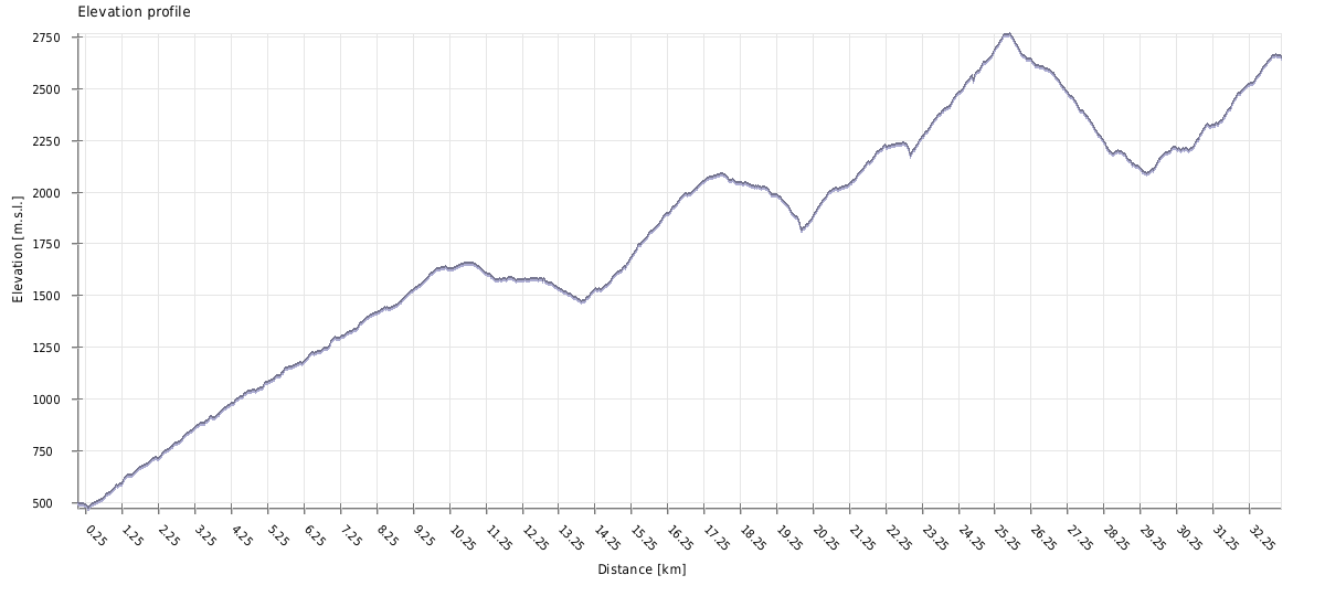
| Distance | 33.1km |
| Trail type: | AB trip |
| Max. elevation: | 2765m |
| Min. elevation: | 474m |
| Total climb: | 3583m |
| Total descent: | 1435m |
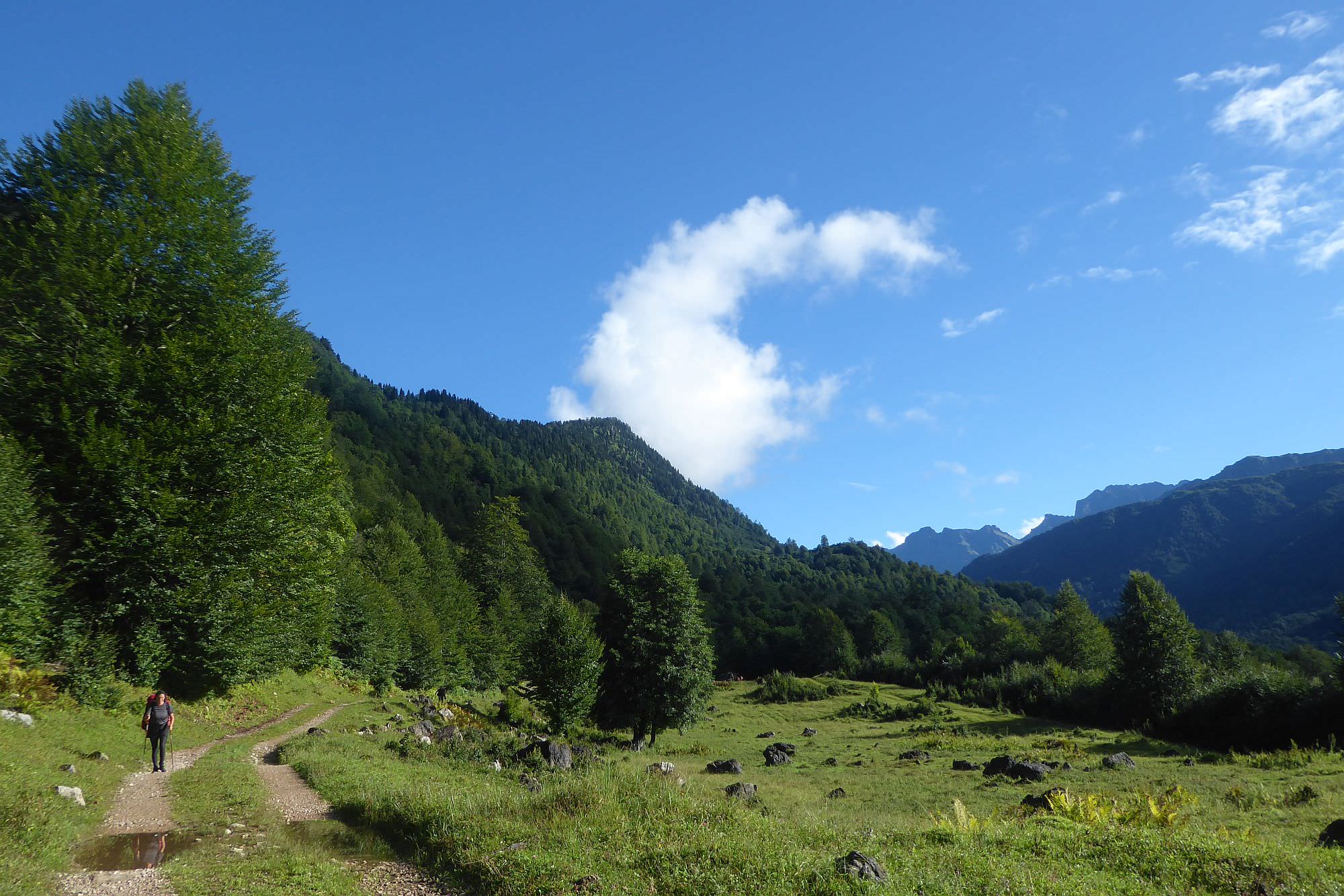
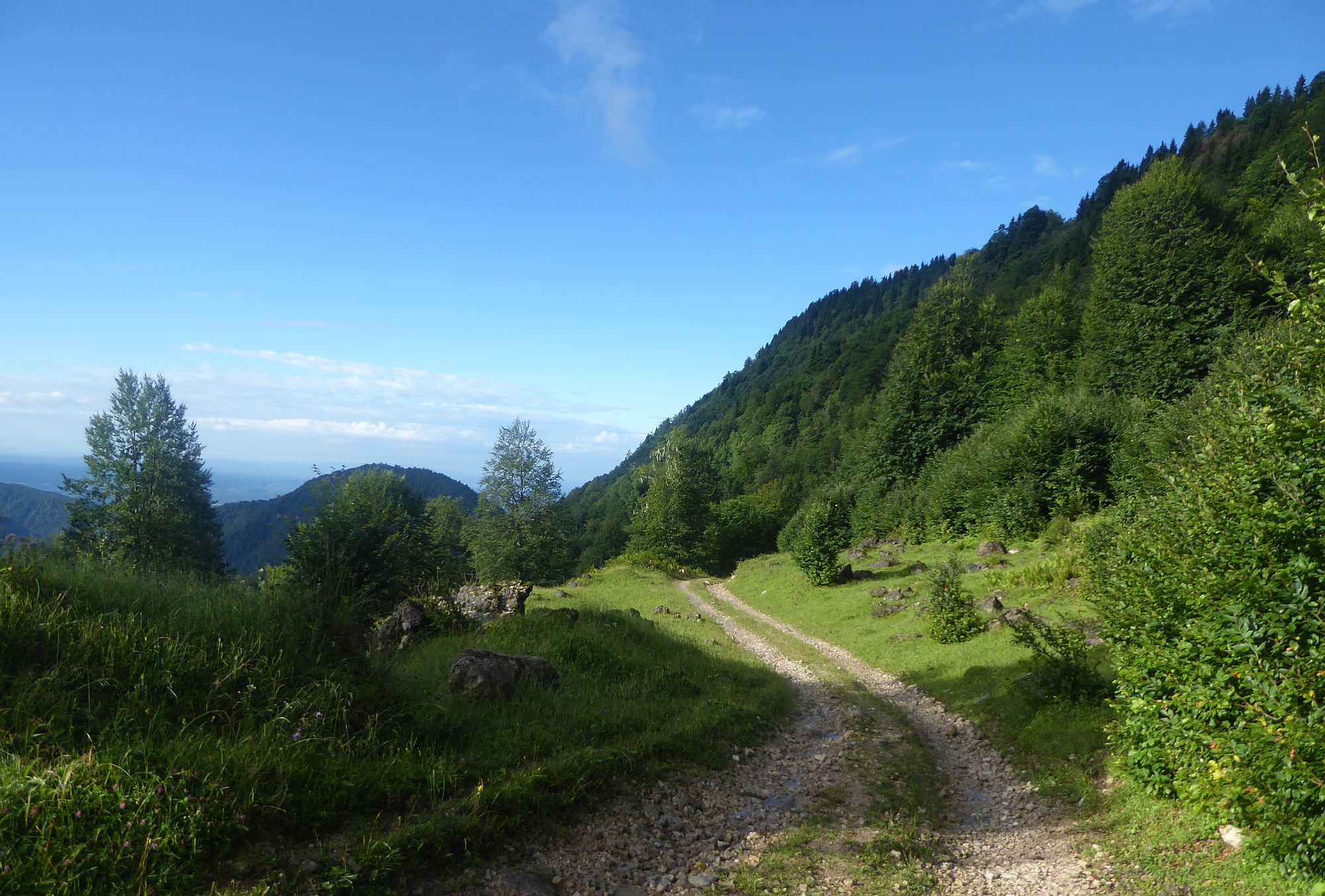
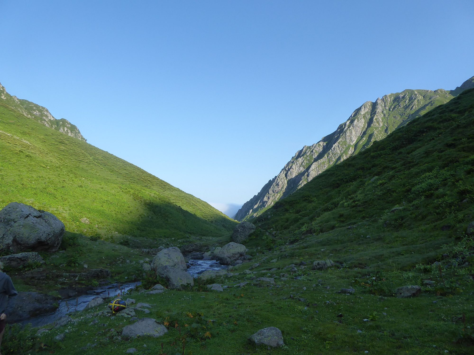
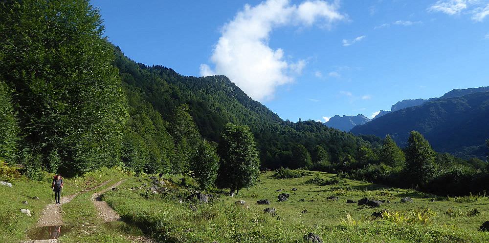
The trek starts at the very end of Skuri village (elevation letss than 500m) - there is a hiking pointer, a mineral spring and an old, dilapidated hotel (which you can explore). Follow the dirt road further to the north. After 200 meters, it crosses Tsentskari river - usually, it is easily fordable, but can become quite swollen after heavy rains.
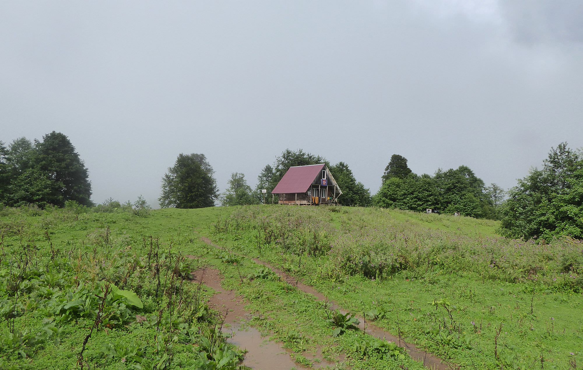
The dirt road steadily climbs through the forest until it leaves it at the elevation of 1300m. Then it circumvents the eastern side of Kvira mountain, finally reaching the local maximum at 1630m - from here, you can admire the first views of distant Egrisi mountains (and of deep river valleys lying in-between). After a slight descent, you will reach a T-junction. Turn right and then left some 50 meters later - the trail will soon lead you to "Kirnakhona", a modern and a quite clean tourist shelter. There is also a water spring nearby.
Also, it should be noted that this since this first section of the trek follows a dirt road, it can be skipped. However, you will need to arrange a truck or some other high-clearance vehicle, the ordinary jeep won´t do it since the road is in a bad condition. There is also a chance to hitchhike since this road is used also by workers bringing huge slabs of stone from a nearby quarry - the road leading to it branches off the main road not far before the highest point of the road.
Leave the shelter the way you came and when you come to the first junction, don´t turn right to climb onto the main road, but keep walking straight (here is also a good water spring). There is a muddy trail going down into the valley. You will see shepherd hut not far to the left but stick to the right and follow the track - soon, it will emerge onto pastures and disappear. Keep walking straight while keeping the elevation and after some 500 meters, you will reach a start of the dirt track, sharply dropping to the left. During the next kilometer, it loses over 100 elevation meters, crosses a small stream and then starts climbing again through the forest.
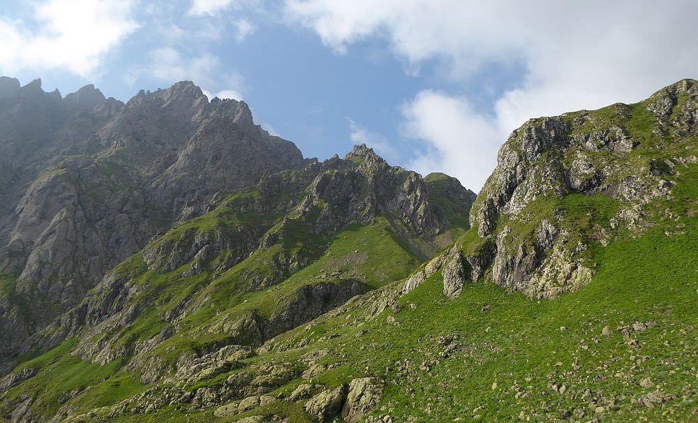
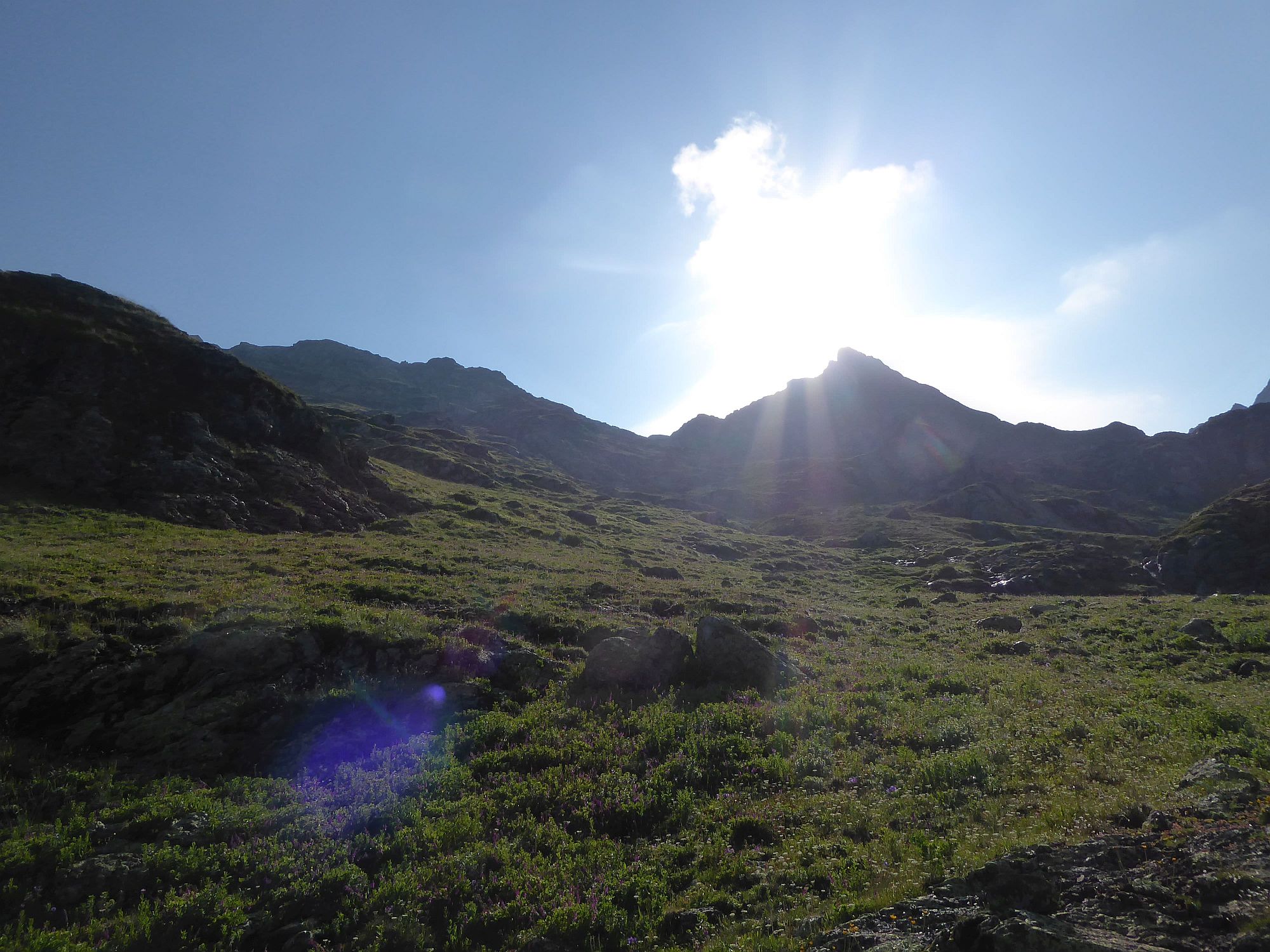
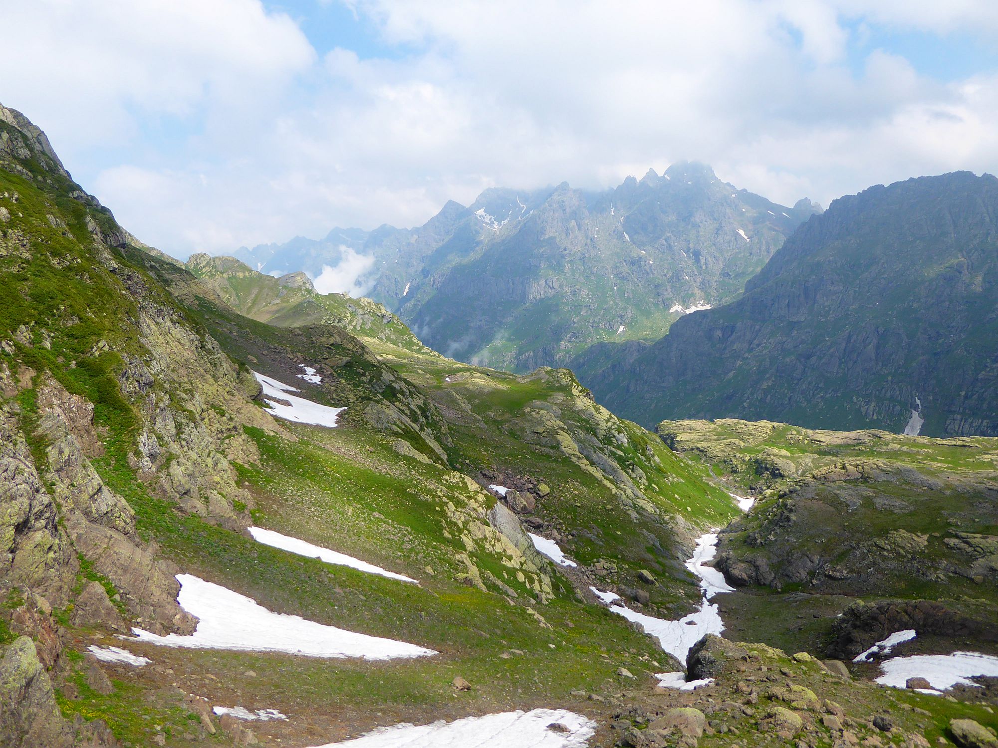
At these sections, the road is still quite wide and easy to follow. But once you climb to some 1800 meters, it turns into a narrow trail and has to be followed much more carefully. Once you approach the elevation 2000m, you will see a small pass ahead. However, you won´t climb it - before you reach it, the trail turns sharply to the right and bypasses the hill from the right side. On the top, you will again find nice, wide and only slowly climbing dirt track. Also, this place should offer nice views but we had a terrible fog the whole day so didn´t see anything. If you made some nice photos here, please let me know :)
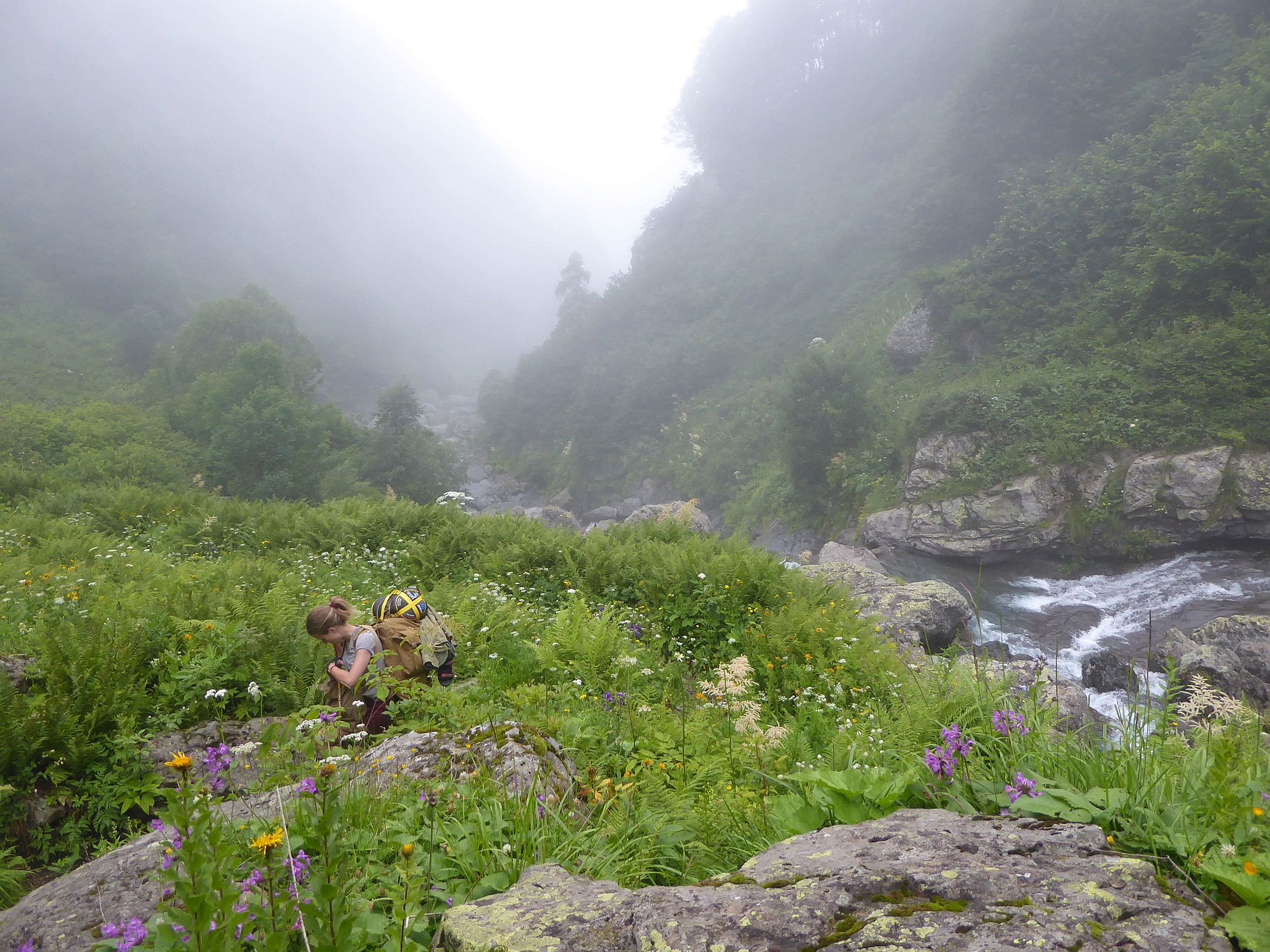
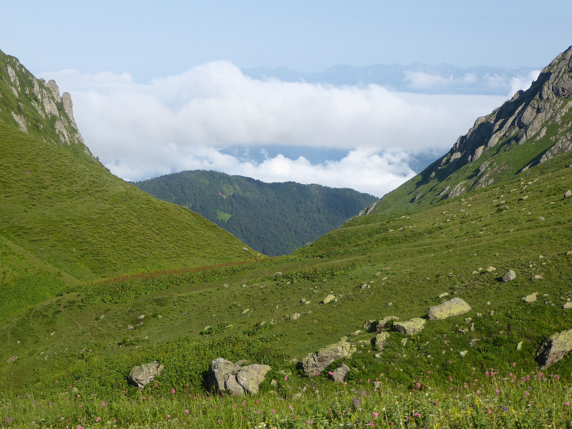
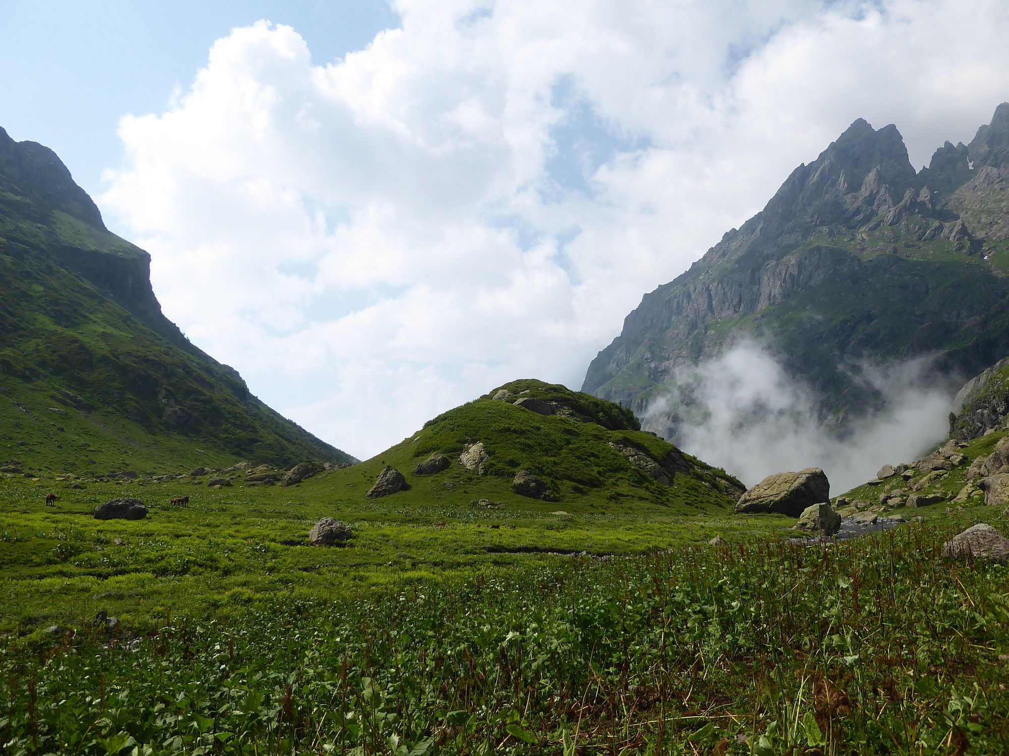
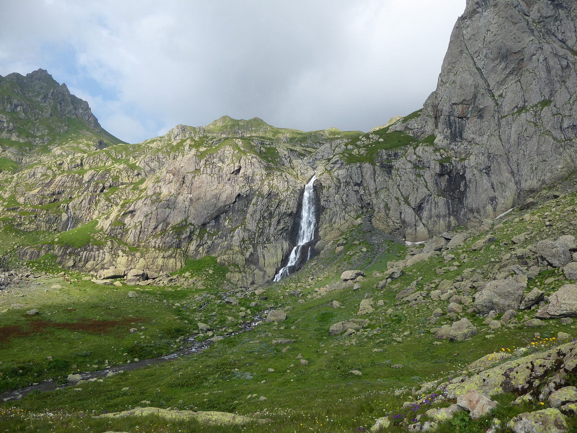
Walk for some 30 minutes through pastures till you see shepherd hut ahead. Now, you should see a river disappearing in a gorge to your left. This is the route you will take - cross the river to its left bank and descend by the steep trail you will find there. Soon, you will pass a waterfall - an ideal place for a shower on a hot, sunny day.
The trail soon enters the forest and in numerous switchbacks drops to the bed of Jolora valley. It becomes quite steep and, especially in rainy weather, quite slippery.
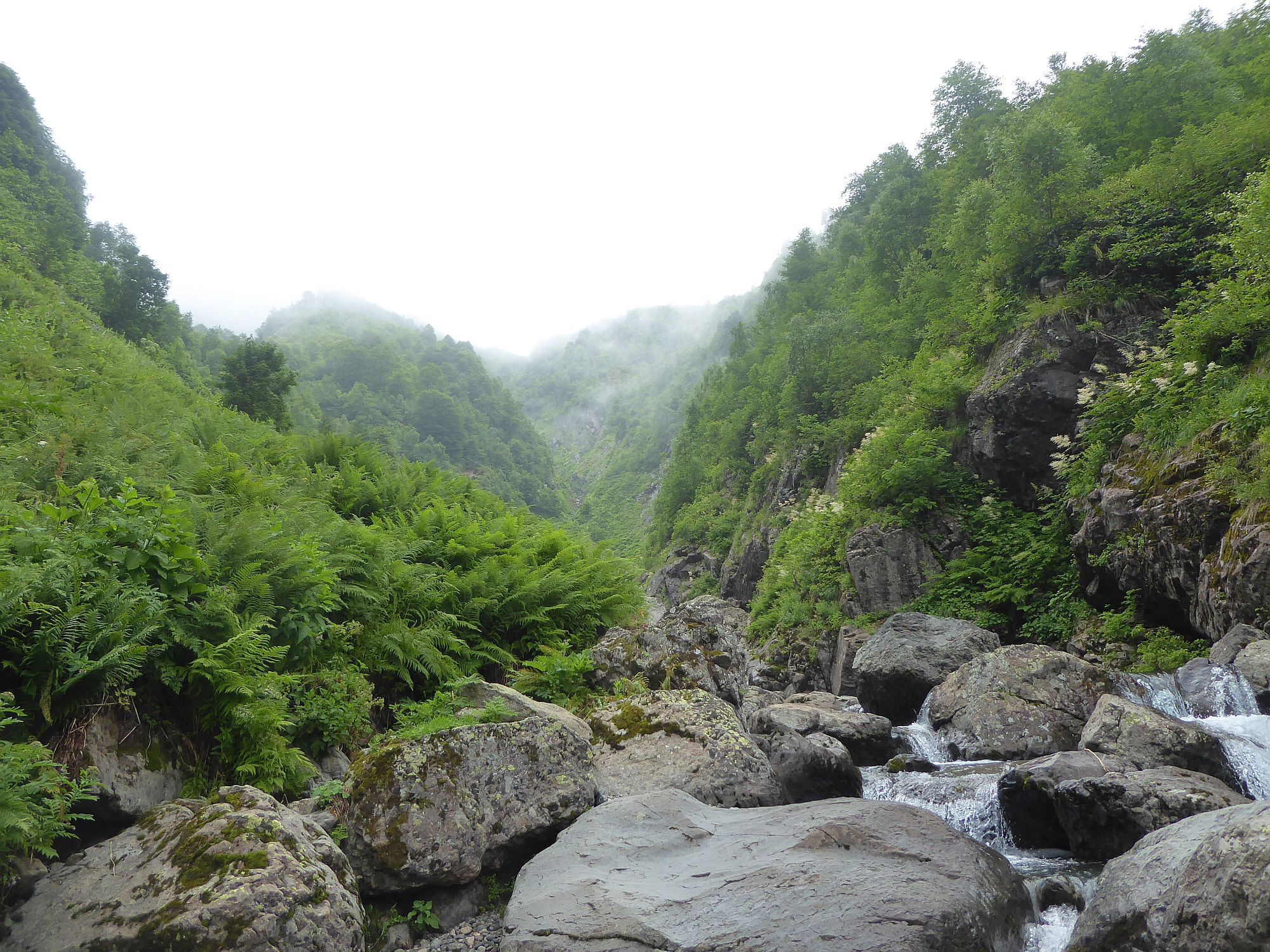
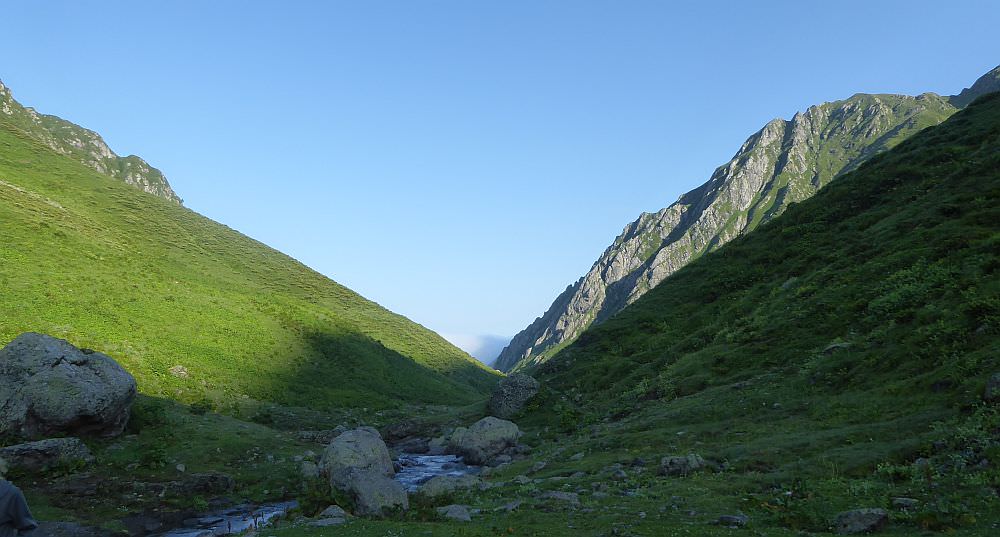
Once you get to the bottom of the valley, you will need to cross a nameless tributary and then, after crossing of a small elevation, also the Jolora river itself. Thanks to the fact that you are crossing the river at pretty high altitude (1850m), it should be passable even after several days of rainy weather (unlike the classic trail via Magana valley which crosses Jolora 1000 elevation meters lower).
Once you cross Jolora, the trail leaves the river and starts climbing through completely overgrown meadows. There, it essentially disappears. Climb some 70 elevation meters and then, once you pass the rocky elevation on your right, turn sharply right and start slowly approaching the river again. From here, you will traverse the hillside above Jolora river, sometimes close to the water, sometimes higher.
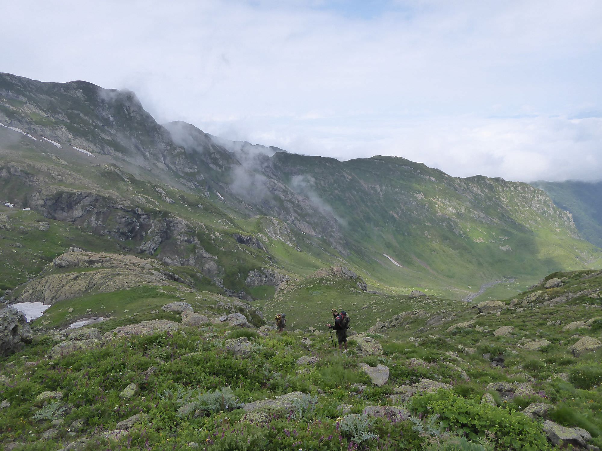
Walk in the Jolora valley is not easy to describe and not only because we couldn´t see shit. Basically, you try to keep the direction while never knowing if you are on a trail or not, because it´s barely visible, overgrown and "the trail" one meter higher or lower is just as good. After some time, you will reach a cow pen - turn left before it and climb a bit to get some altitude. Regarding cows, we saw a couple on the next day but the shepherding activities in the valley are very limited and water in small streams should be OK.
Once you reach the elevation of 2200m, you will see a nice, flat spot by the river. We descended to it and broke a camp, but if it´s still too early for you, you can keep traversing the hillside and try to reach another suitable spot at 2600m - it will take more than an hour to reach it.
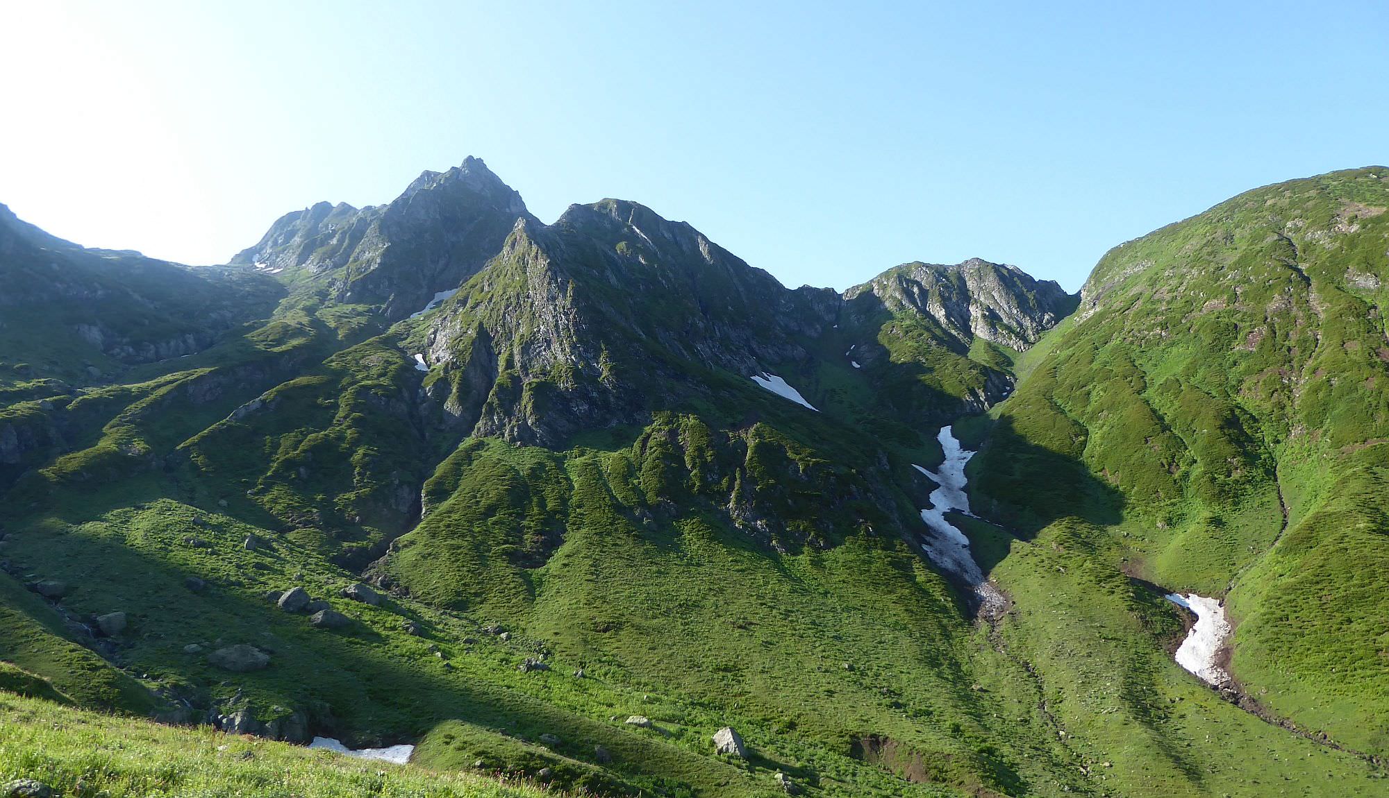
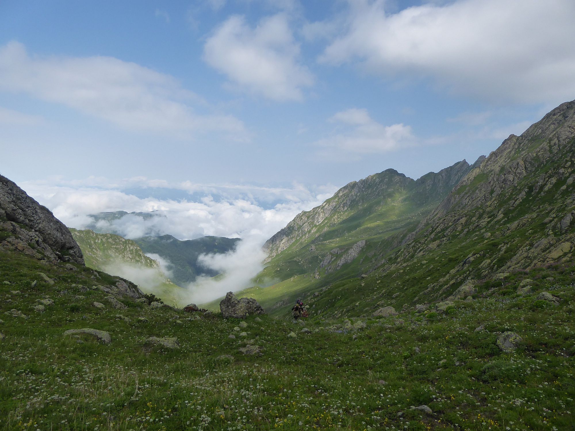
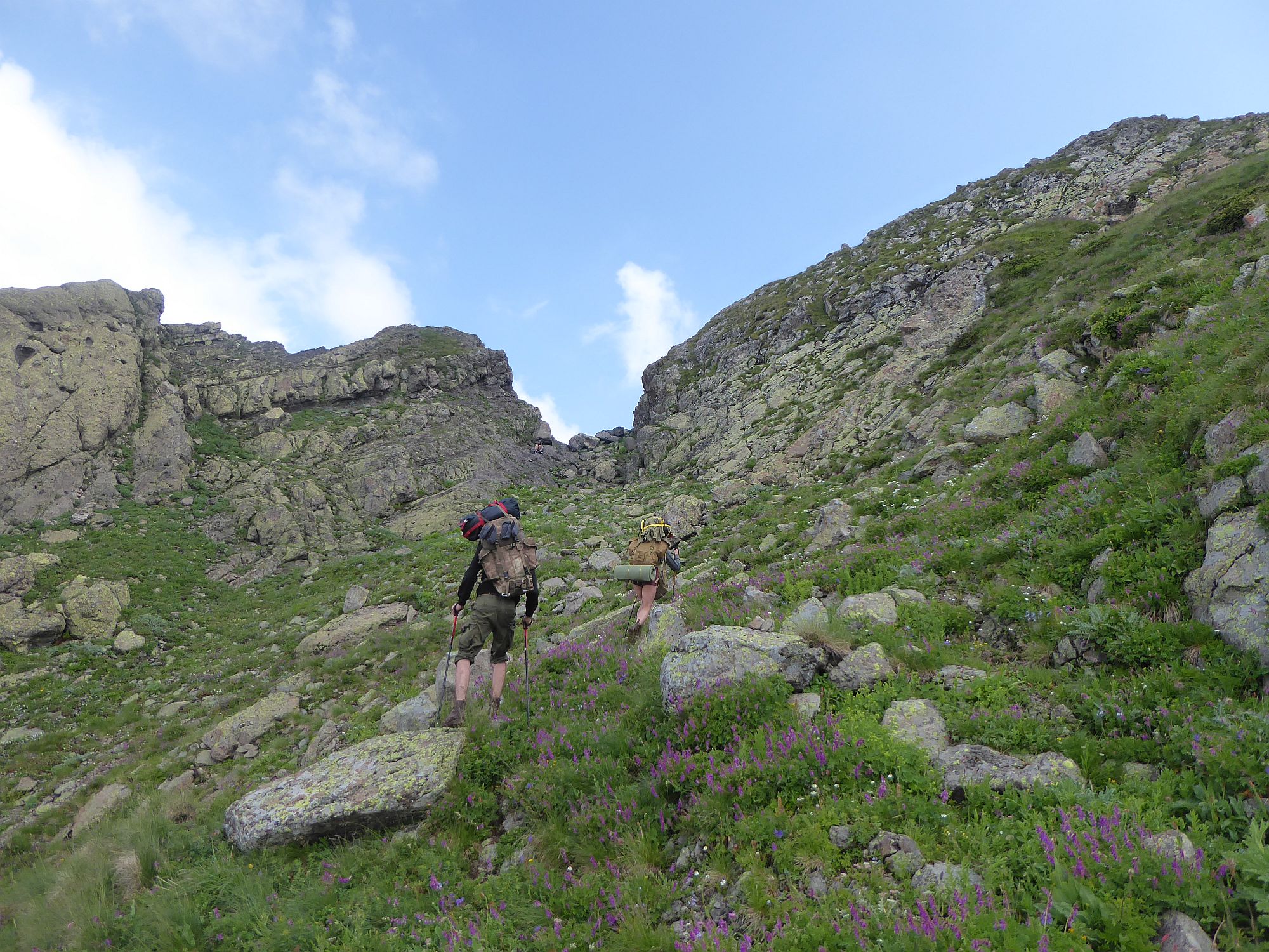
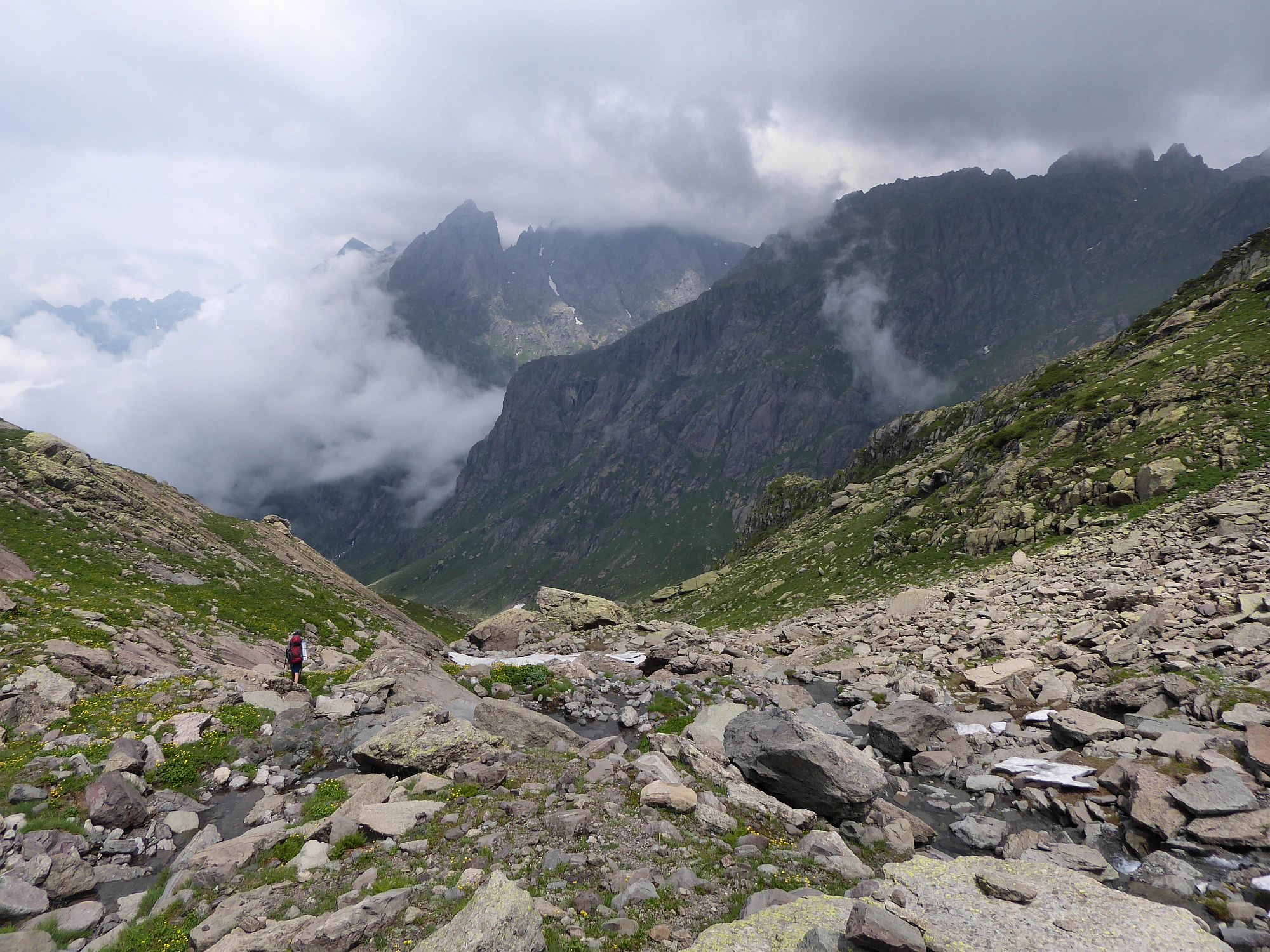
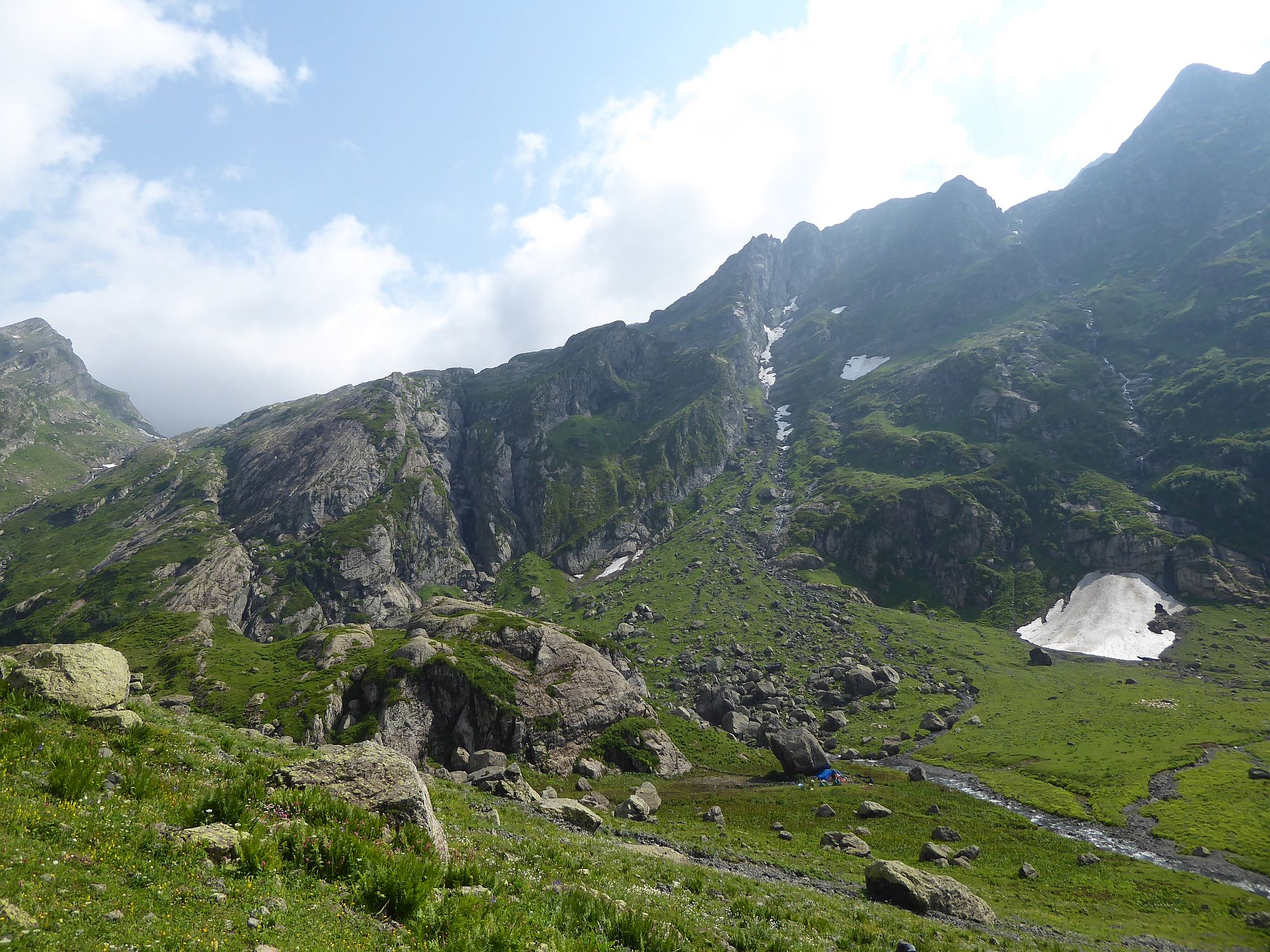
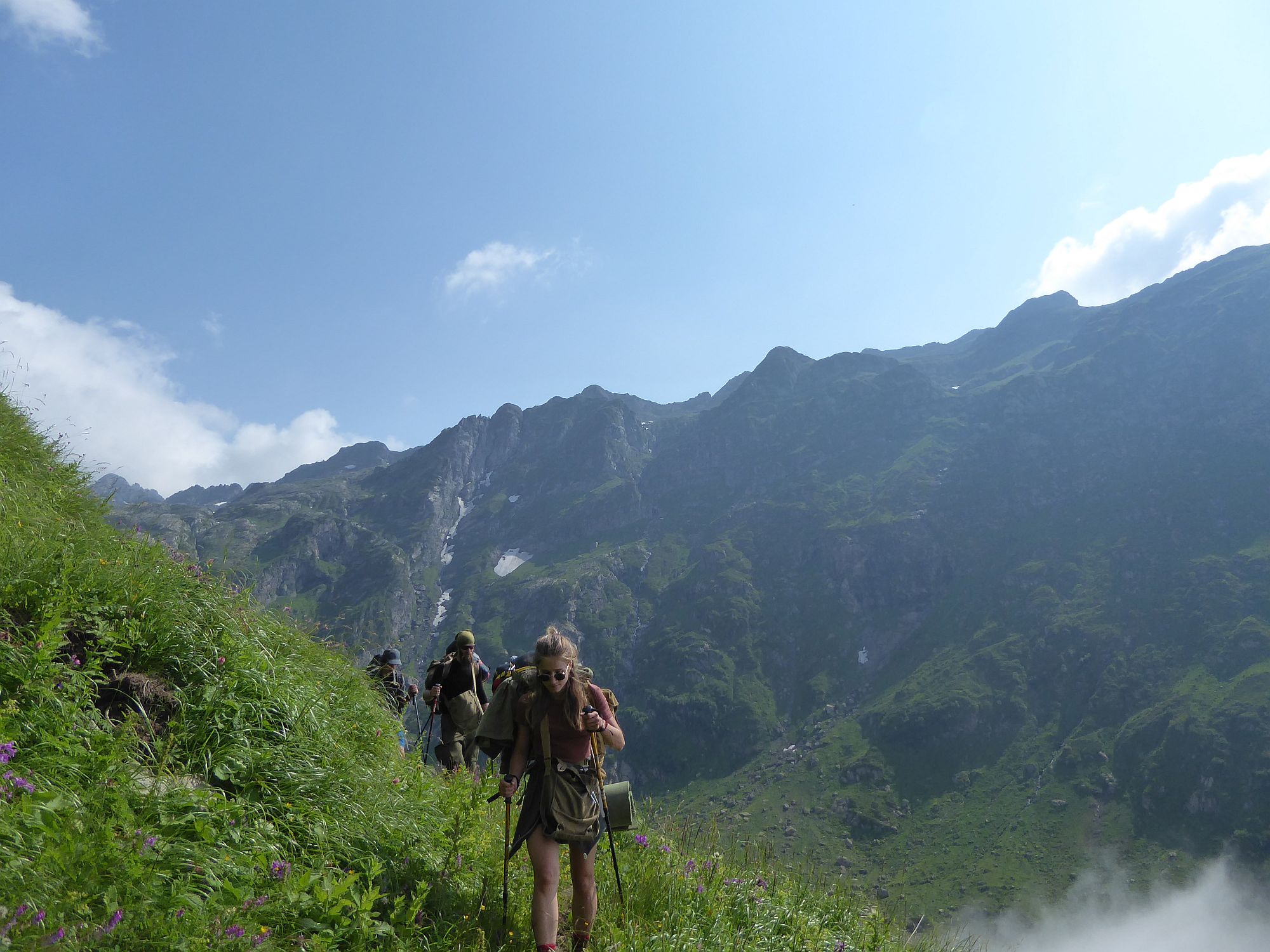
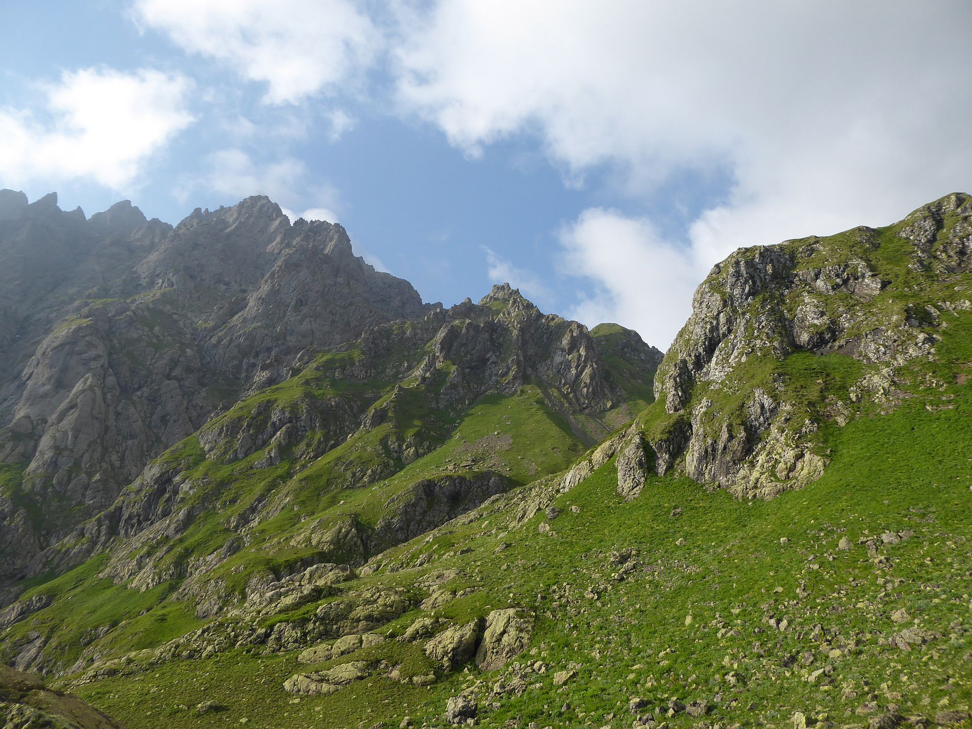
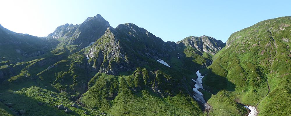
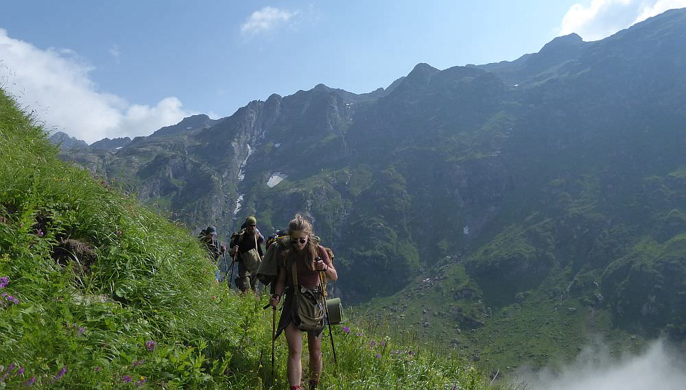
Rise and shine, this is a big day! Start climbing straight uphill. At the elevation of 2370m, the route turns right and climbs more slowly. But this is no respite - you are walking on rocks and stones, but can barely see then because of the dense vegetation. Then comes another steep climb and another problematic traverse (to make things more complicated, you will pass also several streams). Finally, you will climb to the left of a prominent rock at the elevation of 2570m. Here, you will find a mildly rolling mound - not particularly flat, but you could build a tent here if necessary. Also, this "campsite" offers terrific views of the valley.
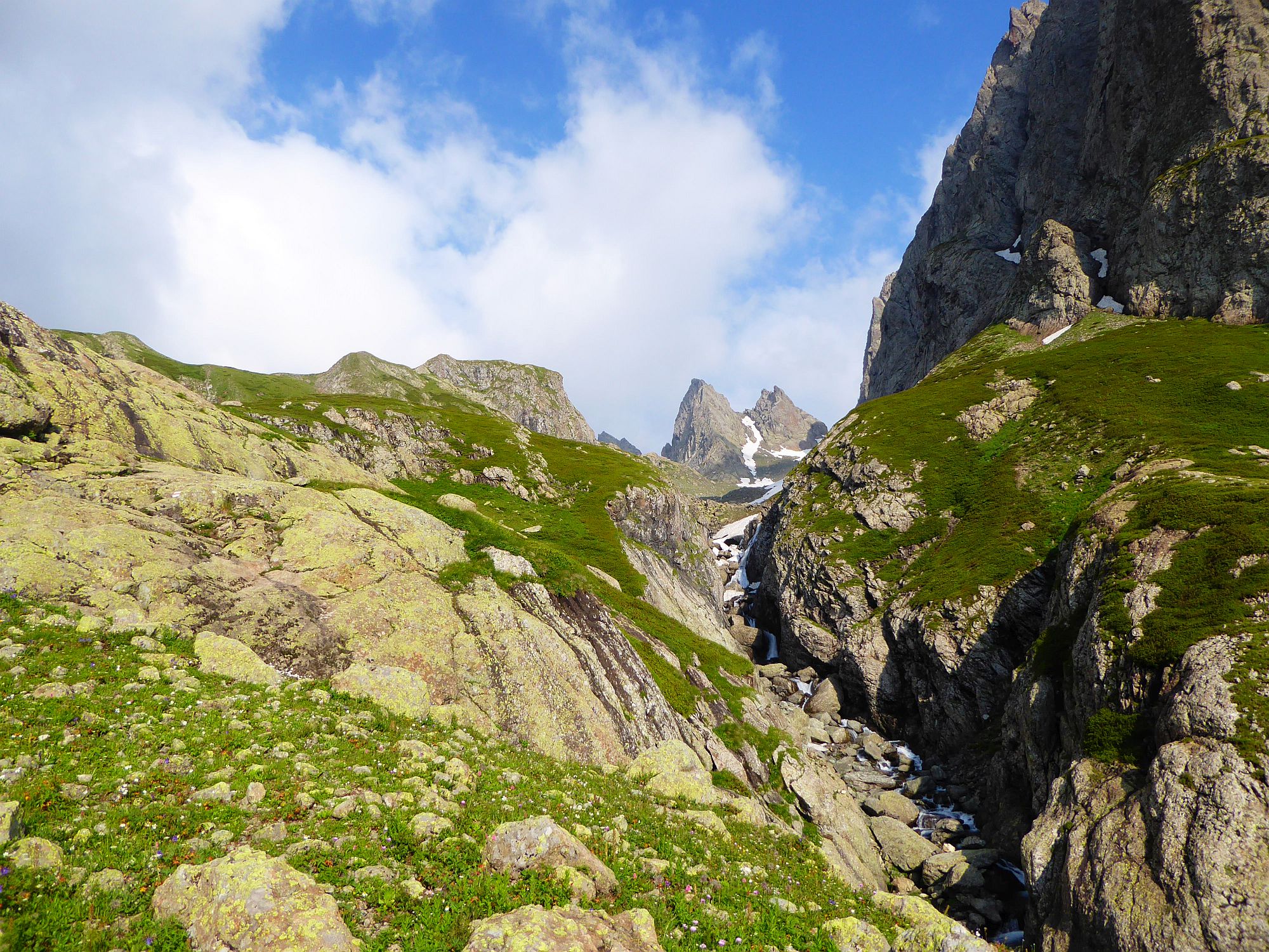
From the rock, the trail (I keep using the word "trail" for the lack of other, more suitable words) climbs straight uphill again. You see a pointy 2800+ mountain straight ahead and another stone ridge to its right, closer to you. But before you reach it, turn sharply to the left and start climbing to the Okare pass (2760m). You won´t see it first, but it will eventually come into sight - a single, narrow dent in the otherwise impassable mountain wall.
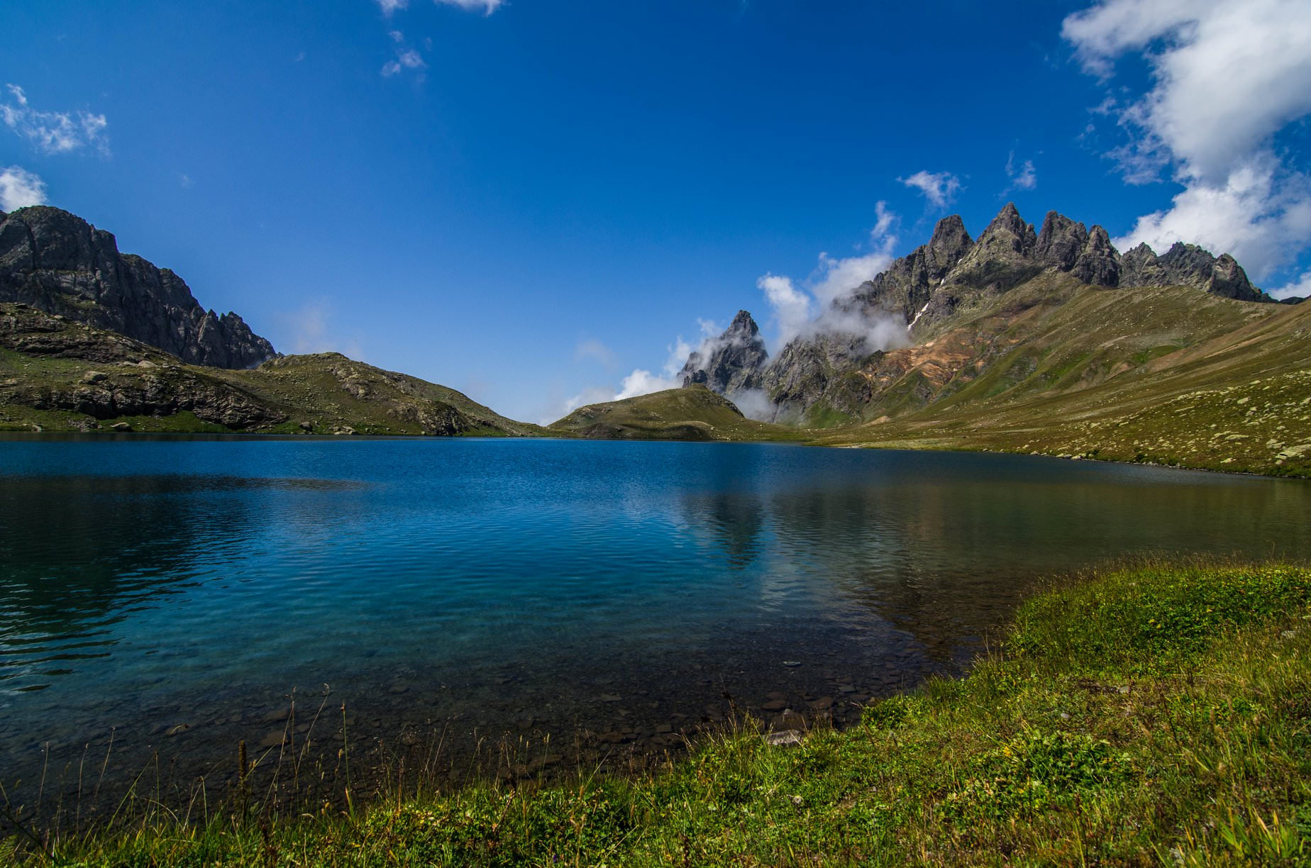
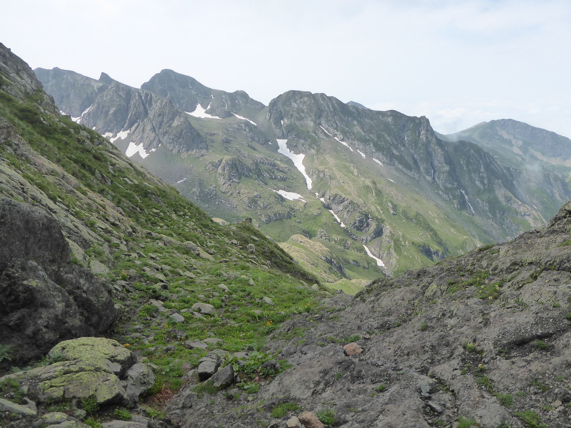
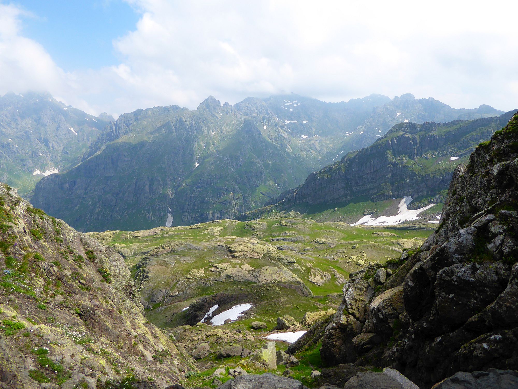
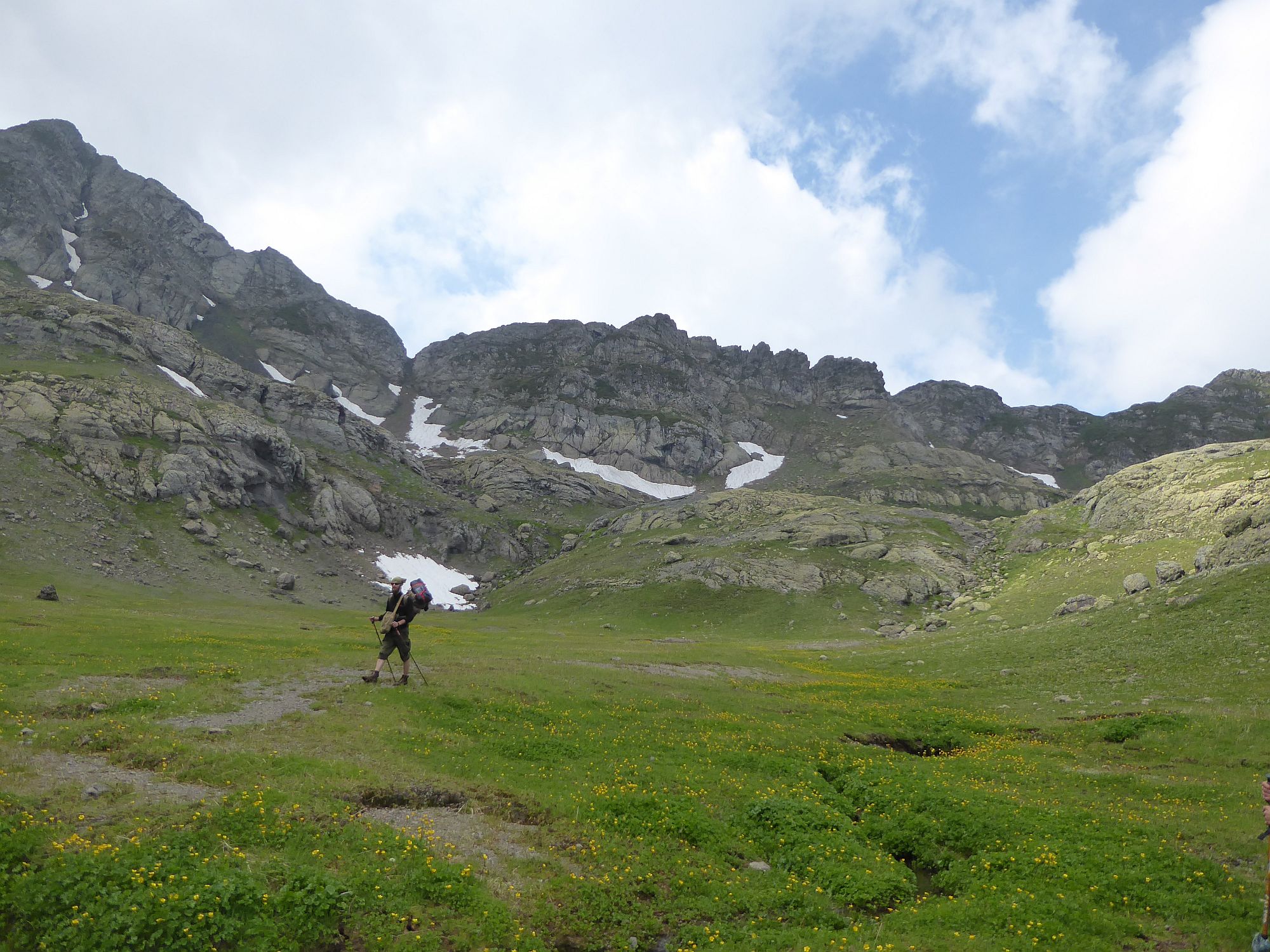
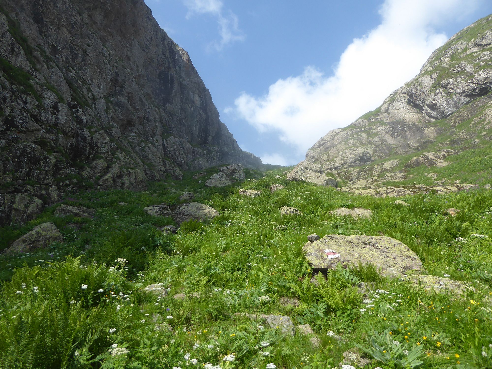
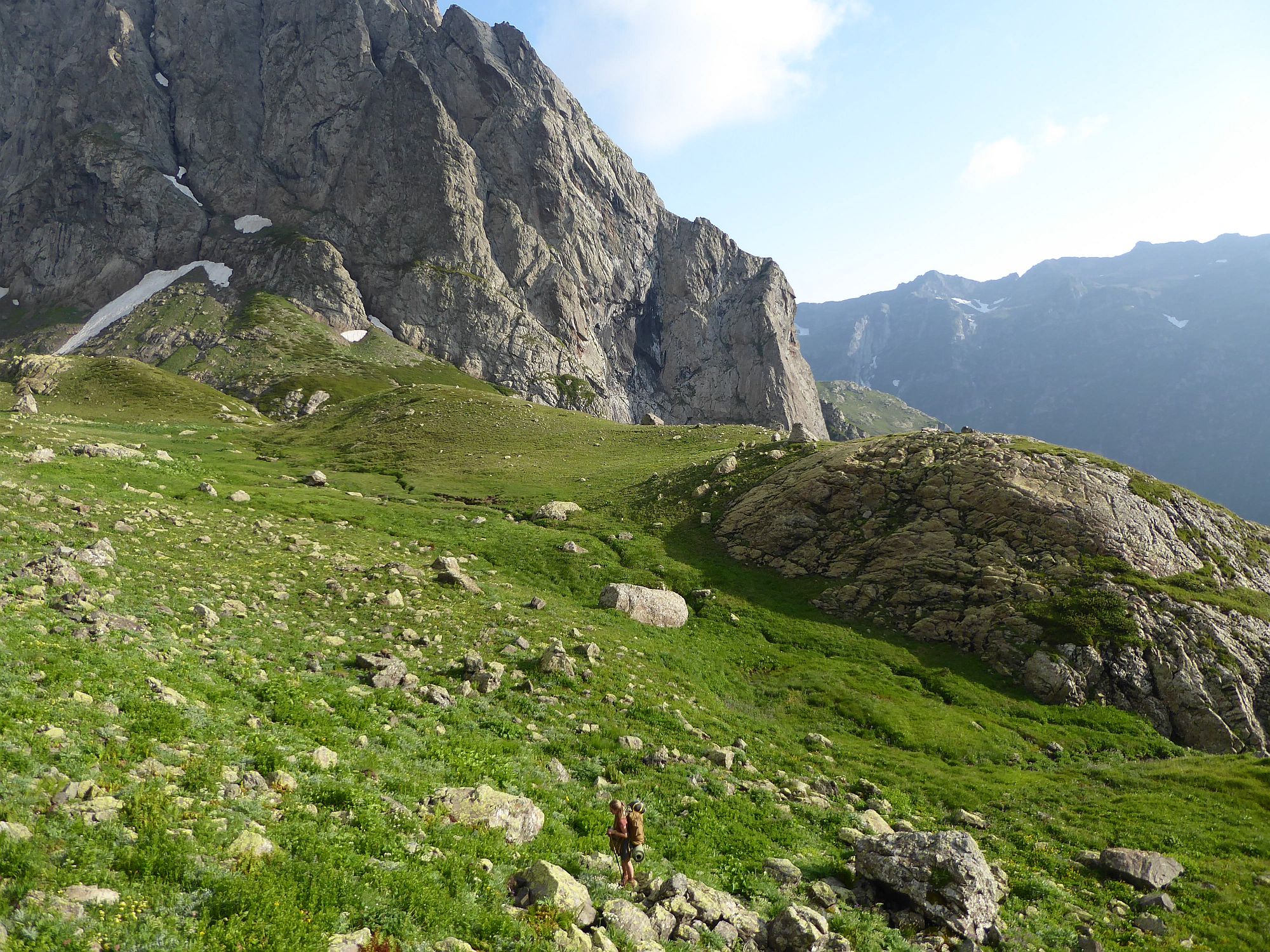
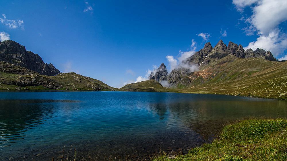
View to the other side reveals huge plateau some almost 200 meters below you. Start descending by the couloir but once it becomes quite steep some 30 meters later, look for a narrow trail between the rocks on your right. From here, descent to the right edge of the plateau, where you see a stream disappearing in the gorge. If you have some extra time, you can also make a detour and traverse to the Okare lake.
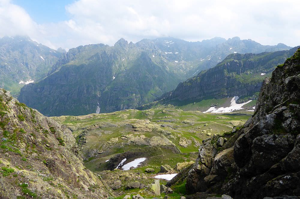
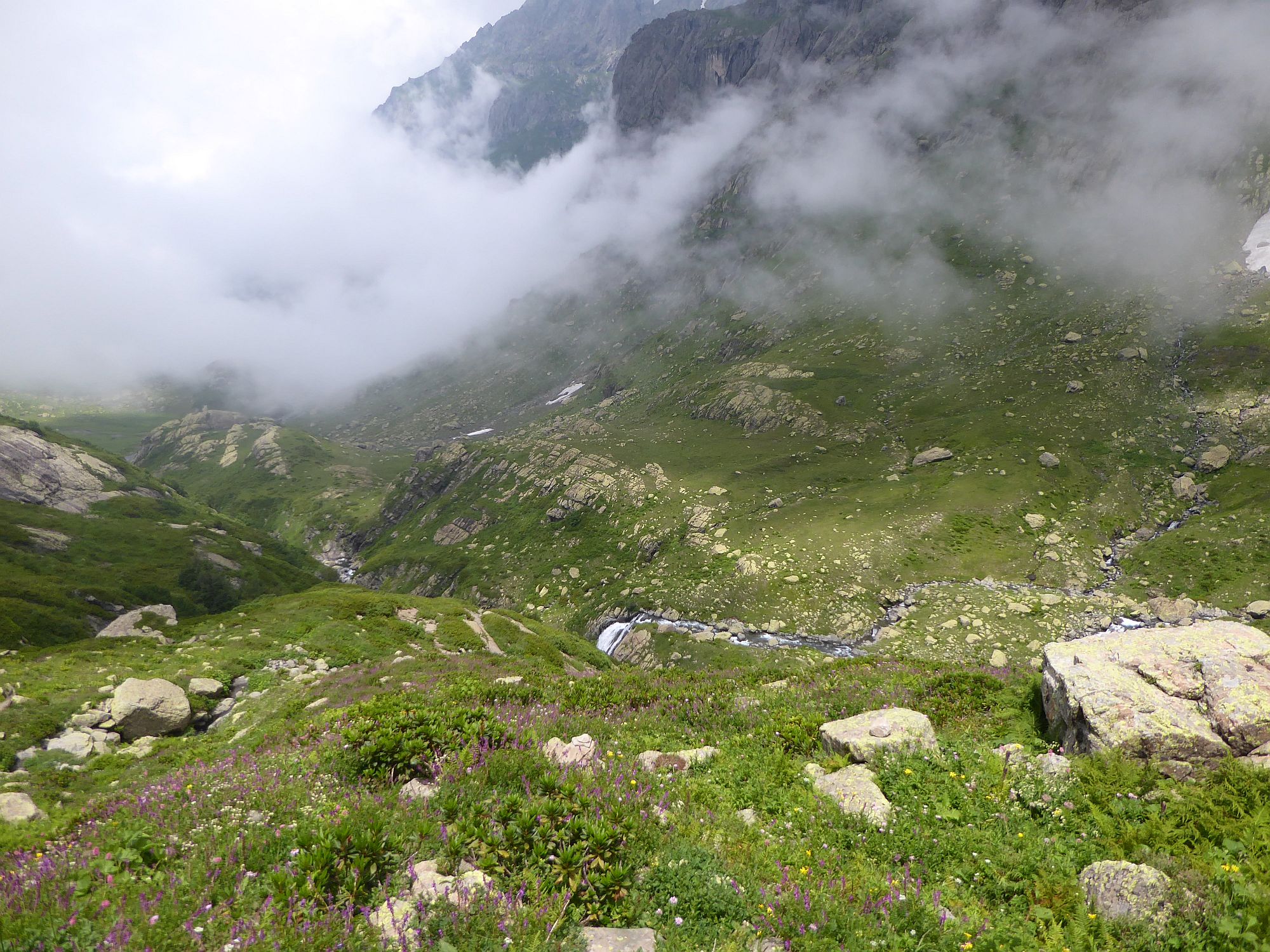
The plateau is covered with yellow flowers and offers numerous great camping spots. Follow the river until it turns north, into a steep canyon. Stay on the right bank of the river except for a short section where you will have to move to the other side in order to bypass a huge canyon. The terrain is at first solid and easy to walk on but gradually becomes more and more overgrown so you will be happy when you finally, at the elevation 2250m, find something resembling a trail.
Descend to the bottom of the valley and cross Magana river. The trail then heads to the northeast, down the valley, but it keeps its distance from the river. After one kilometer, you will reach the well-known shepherd hut known as Jikiri hut.
Jikiri hut is a well-known stopover, famous for its friendly inhabitants. Earlier, they regularly invited hikers for a meal and chat. With the recent increase in the number of tourists, this has naturally changed and they can´t host everyone - otherwise, they would spend a better part of the day just cooking elarji for the passing hikers. It still happens, just not so often. So don't expect any freebies, come with an open mind and see what happens - I really hope the people there will manage to profit from the passing people without sacrificing the authenticity of the place.
OK, back to the trek. From the Jikiri hut, the trail sharply turns to the north and follows the narrow but well-trodden trail across the mountainside until it reaches a steep gorge. Climb it and reach a plateau at the elevation of 2300m. Here, you can admire the 80m high Toba waterfall, formed by a Nashkara river flowing out of the lake. Cross the river again and head to the northwestern corner of the plateau. Here you will find a small trail climbing further up.
All you have to do now is to cover the last 200 elevation meters to the lake. The trail is well-trodden and marked by stone pyramids. First, it climbs in the direction of the river until it comes close to it. You will see a hill ahead, the last obstacle before the lake. You will need to sharply turn left and bypass it from the left side, by the valley formed by another nameless creek, emerging from the hillside not far from the lake. This creek is also a good source of drinking water.
Finally, you will climb onto the small elevation with a cross and a lake suddenly appears in from of you. The ground right in front of you is quite wet, but you will find several suitable further east, right at the bank of the lake. There are also 2 small shelters built of stones - one is incredibly dirty, but the second one can serve well as a sheltered cooking place. So, enjoy your stay. And congratulations :)