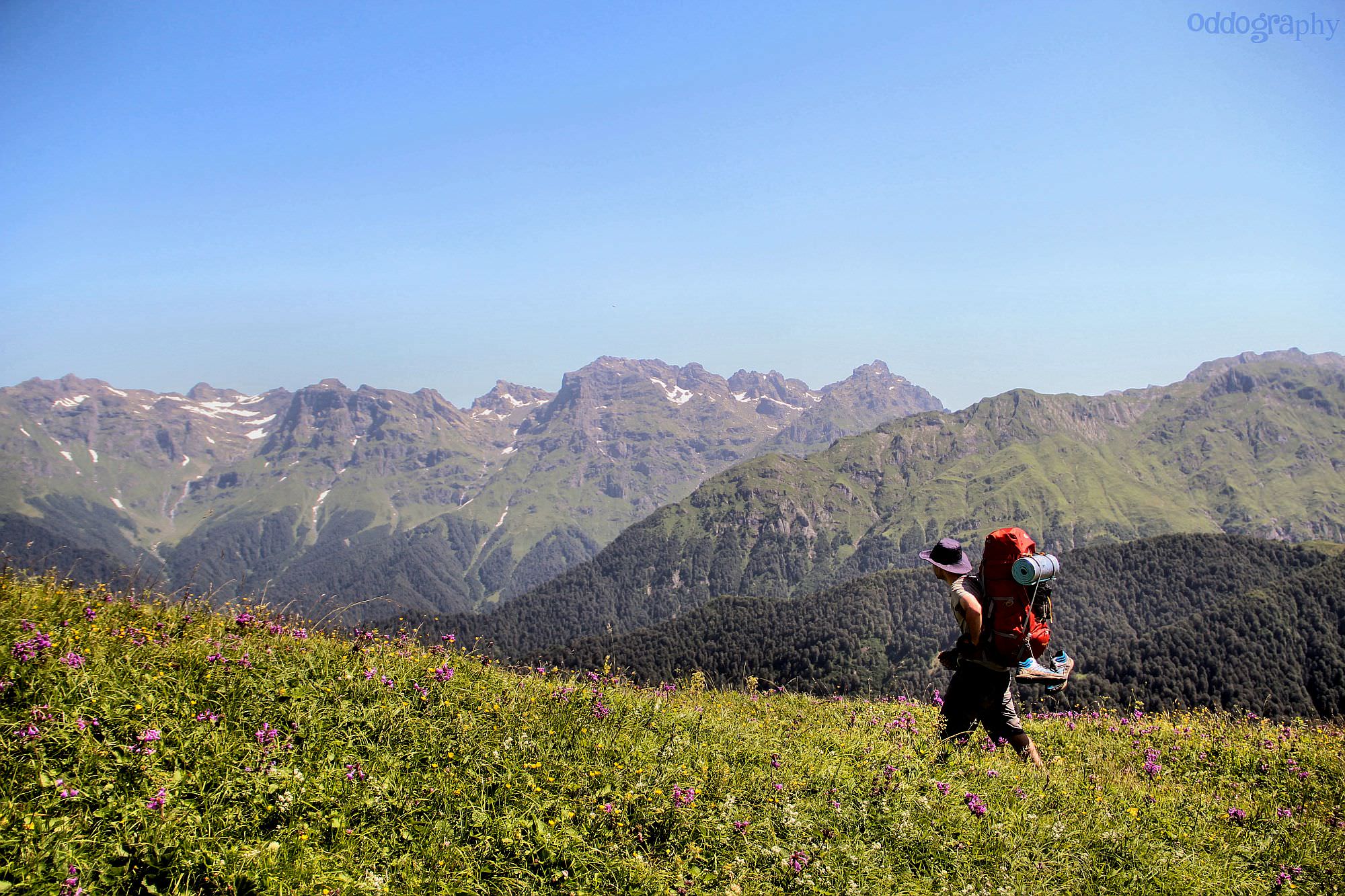
An interesting route exploring several landmarks of the Samegrelo region.
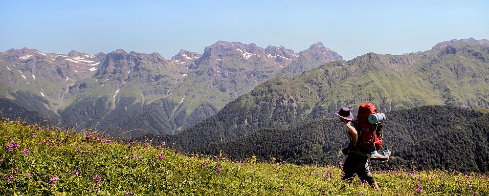
This little-visited hiking route climbs onto the 2000 meters high Mt. Kvira, the first major mountain rising from the lowlands of Samegrelo. From the top, you can admire panoramic views of the plains to the south and "real mountains" to the north - however, the views during the climb are limited. To compensate for that, you will visit several landmarks of Samegrelo such as the Intsra waterfall, the water spring hidden in the karst cave or Kuakantsalia - "The Swinging Stone".
The trail is newly marked by white/red rectangles. It works as a standalone trek if you have only a couple of days and don´t want to travel all the way to Svaneti. Another good option is to combine it with the Tobavarchkhili trek, there are two routes available - classic approach by Magana valley or longer and more scenic crossing of Okare pass.
The basic variant with departure from Chkvaleri and return to Skuri takes almost two days.
Climb of Mt. Kvira is straighforward, even though the trail disappears above the treeline. Problem is with going down - there is no trail, only a steep, overgrown hillside. I think it's manageable, but certainly not for everybody. Bbut if you think that this side of the mountain is too steep, you can still return the way you came.
Since there is no direct bus between Zugdidi and Chkvaleri, I would just take a taxi - the price should be up to 40-50 GEL. You could also take a marshrutka to Jvari (all buses going through Mestia are going through there) and take a taxi from there for some 20 GEL - could save you a few lari if you are traveling alone or as a couple.
The last, cheapest option is to take a marshrutka to Jvari and walk to Chkvaleri from there, but I can´t recommend it. It doesn't look far on the map but the road is narrow, surprisingly busy and constantly goes up and down.
Well, it won´t be easy. From the last hiking pointer, you may have to hike another 5 km until you reach the main road. We hitchhiked, asked everybody we met about a taxi and eventually got a number of a driver willing to drive us to Zugdidi (he asked 40 GEL). To make it easier, while passing through Zugdidi (you will probably pass through here before your trek starts), hang around taxi drivers and ask a few of them for their phone numbers. You will really appreciate these numbers once the trek ends and you get stuck at a place such as Skuri.
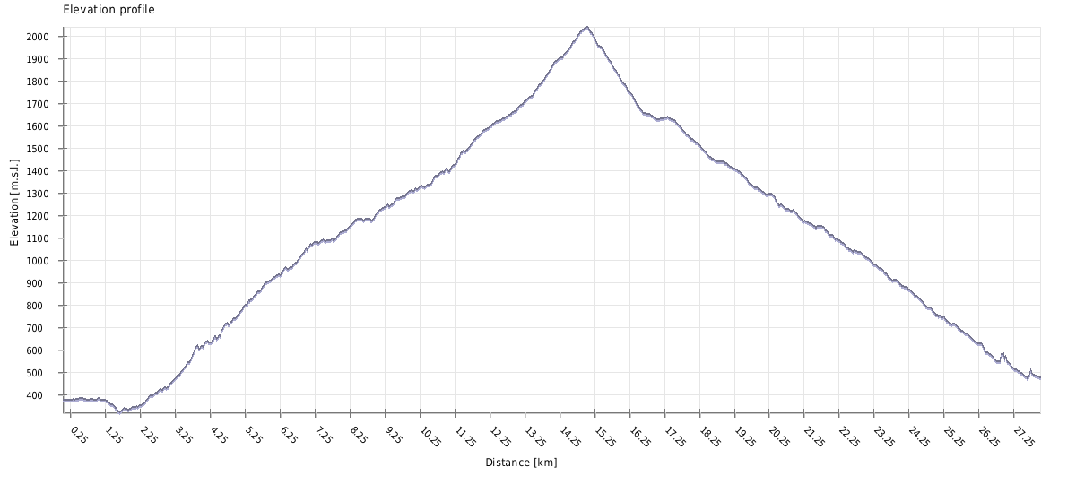
| Distance | 28km |
| Trail type: | AB trip |
| Max. elevation: | 2039m |
| Min. elevation: | 322m |
| Total climb: | 2213m |
| Total descent: | 2102m |
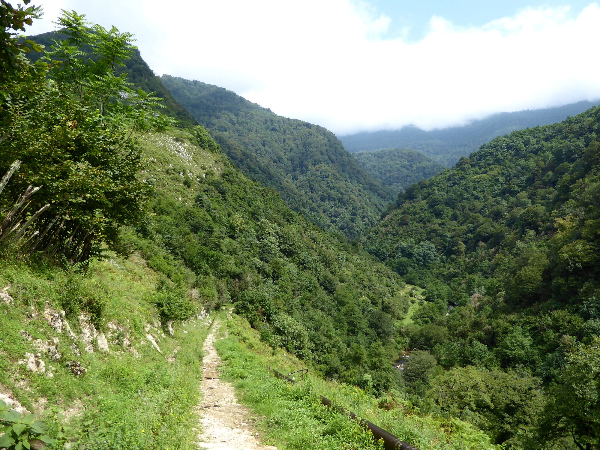
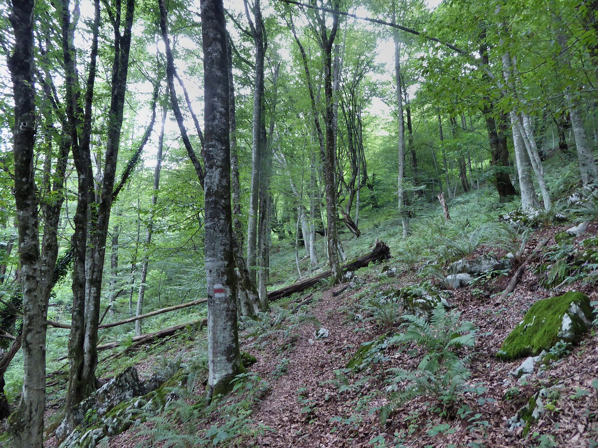
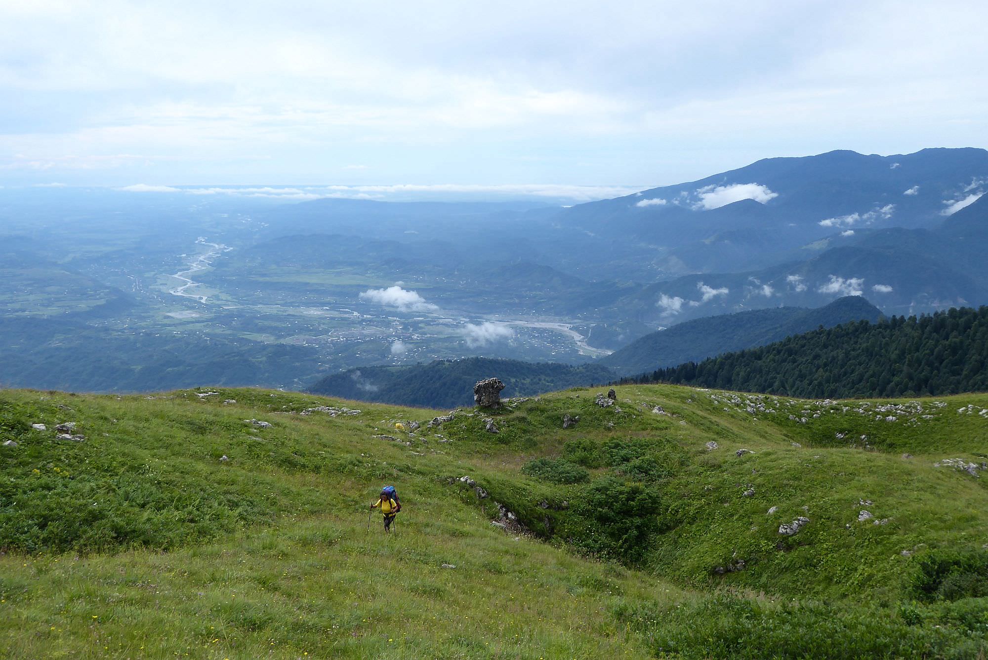
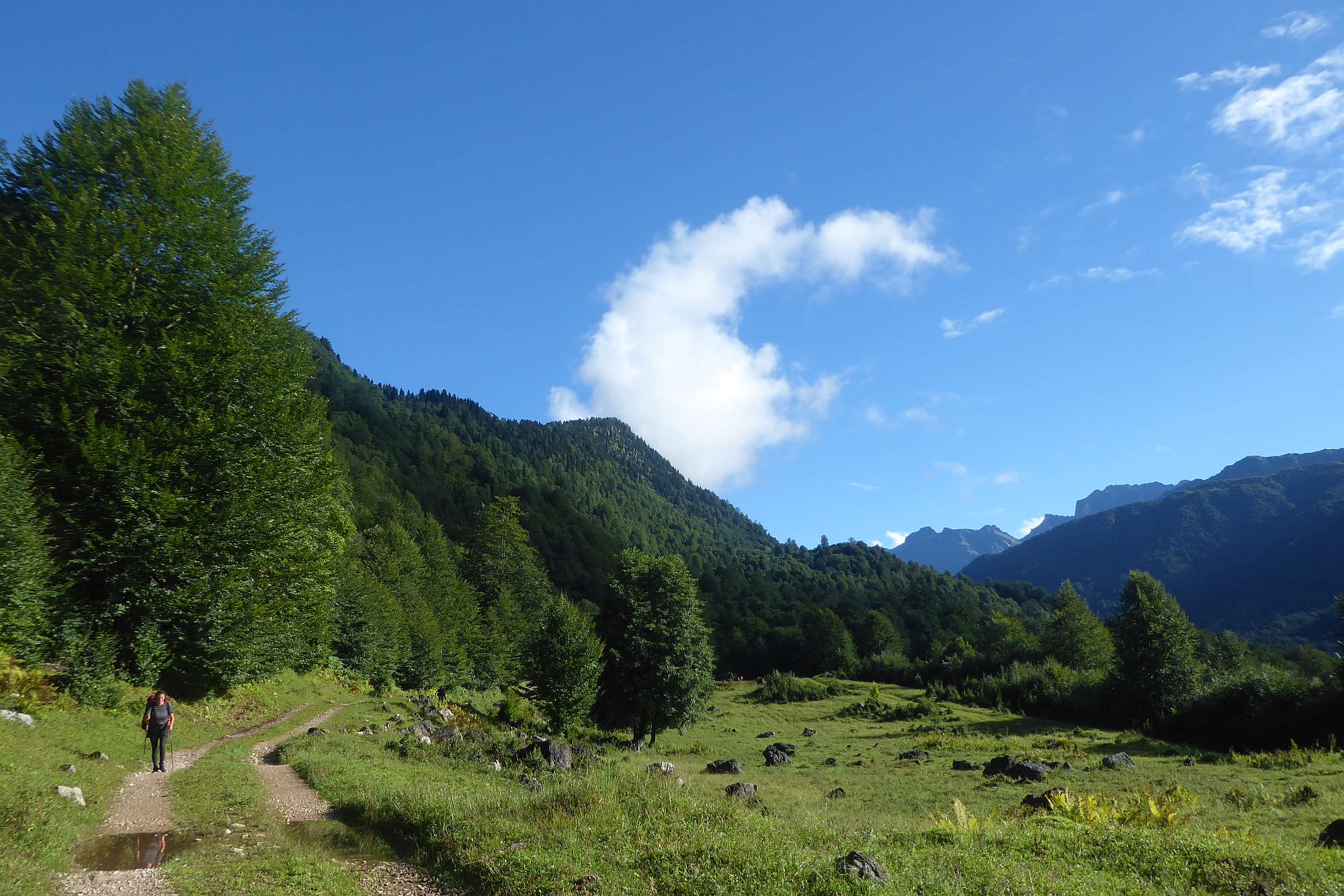
The trail starts by the hiking pointer in the Chkvaleri village. For the first three kilometers, it follows a stony track heading into the Intsra valley. In this section it is lined by a large water pipe. Finally, the track disappears and you will make it to a small meadow with another pointer. If you go straight ahead, you will soon reach Intsra waterfall - strongly recommended and totally feasible if you left Chkvaleri before noon (the whole visit with some bathing takes about an hour).
However, the visit to the waterfall is only a detour, a Kvira route doesn´t pass it. At the pointer on the small meadow, you have to turn left and follow the direction it shows - straight up steep, overgrown slope. The trail here is very faint and often overgrown with raspberry bushes. Luckily, it doesn´t take long - after 100m, you will reach a small trail. Follow it to the left and it will soon turn into an old stony track, passing through the forest. This track will bend first right, then to the left and suddenly, you will yourself in the hillside some 50 meters above the Intsra river. Then comes a nice section when you will follow an ancient track built in the steep hillside. All this time, you are walking by the steel pipe - sometimes visible, sometimes hidden beneath a thick layer of green moss.
Since this section is flat and you walk upstream, the river which you once heard deep below gets closer and closer. Finally, the trail crosses it and starts climbing steeply again, following a small forest path - pay attention to the terrain and the markings since there are two unexpected switchbacks where you could lose it.
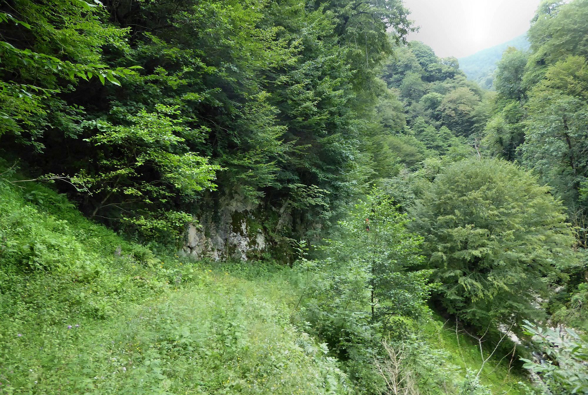
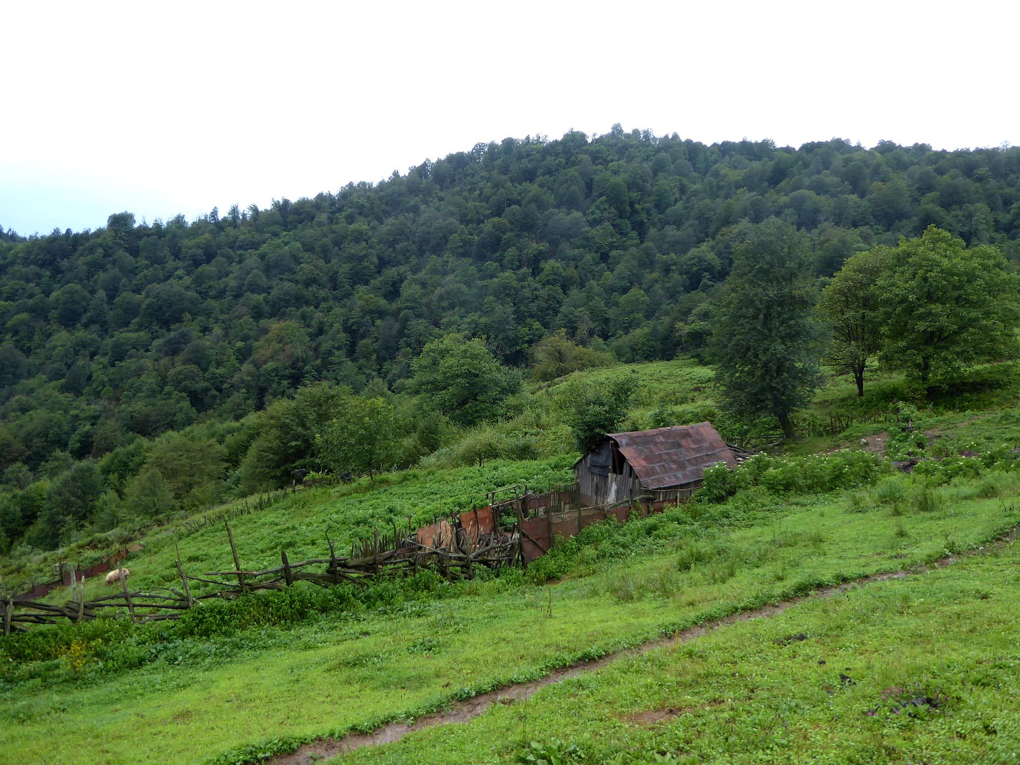
150 meters higher, you will reach a dilapidated wooden fence and once you pass it from the right side, an abandoned hut shows up ahead. Pass it from the right side and climb the pasture behind it (there is a tree with a small bench and marking halfway to the top). At the top, you will find another marking on a large tree - turn left and follow a narrow trail entering the forest. Fifteen minutes later, the trail emerges at another meadow (elevation 950m).
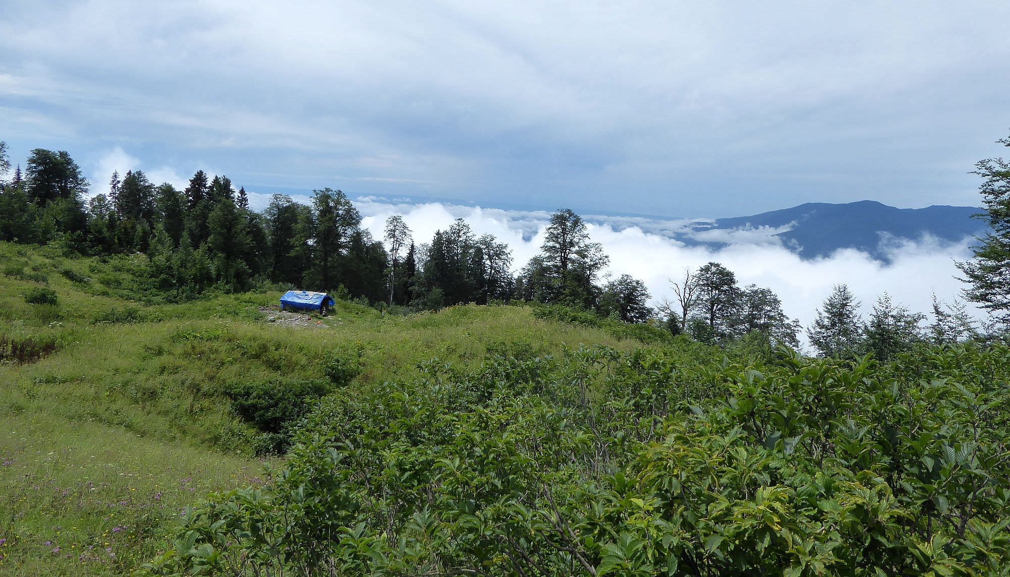
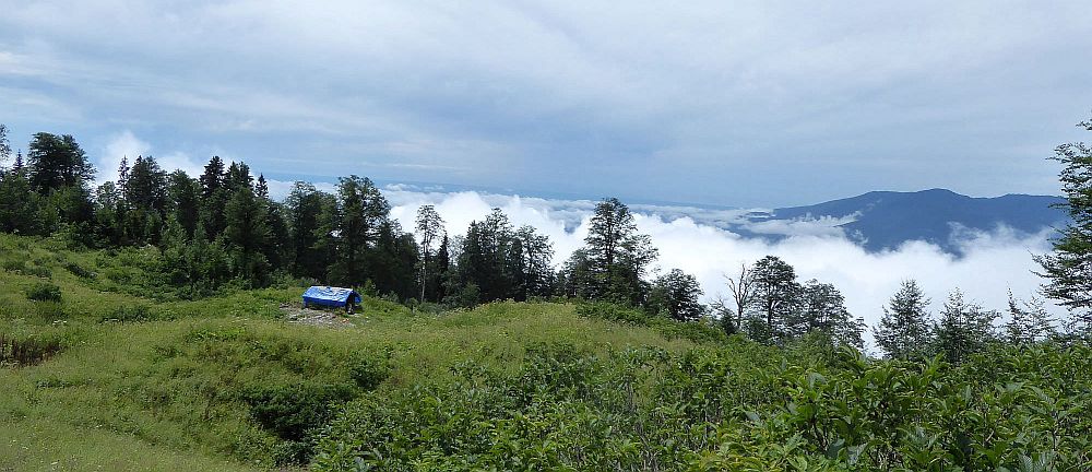
Climb it for some 100 meters till you reach the hiking pointer, then turn left. On your left, you will see a shepherd hut - it was occupied in 2018 but the shepherds (both over 70 years old) mentioned that they not returning for another year and there is no one to take over. There are some nice camping spots to the east of the hut and also a water spring, the last one for a few more hours. To find it, follow the contour line from the hut to the west, past a burned out hut. 100 meters later, you will find a small spring at the edge of the forest.
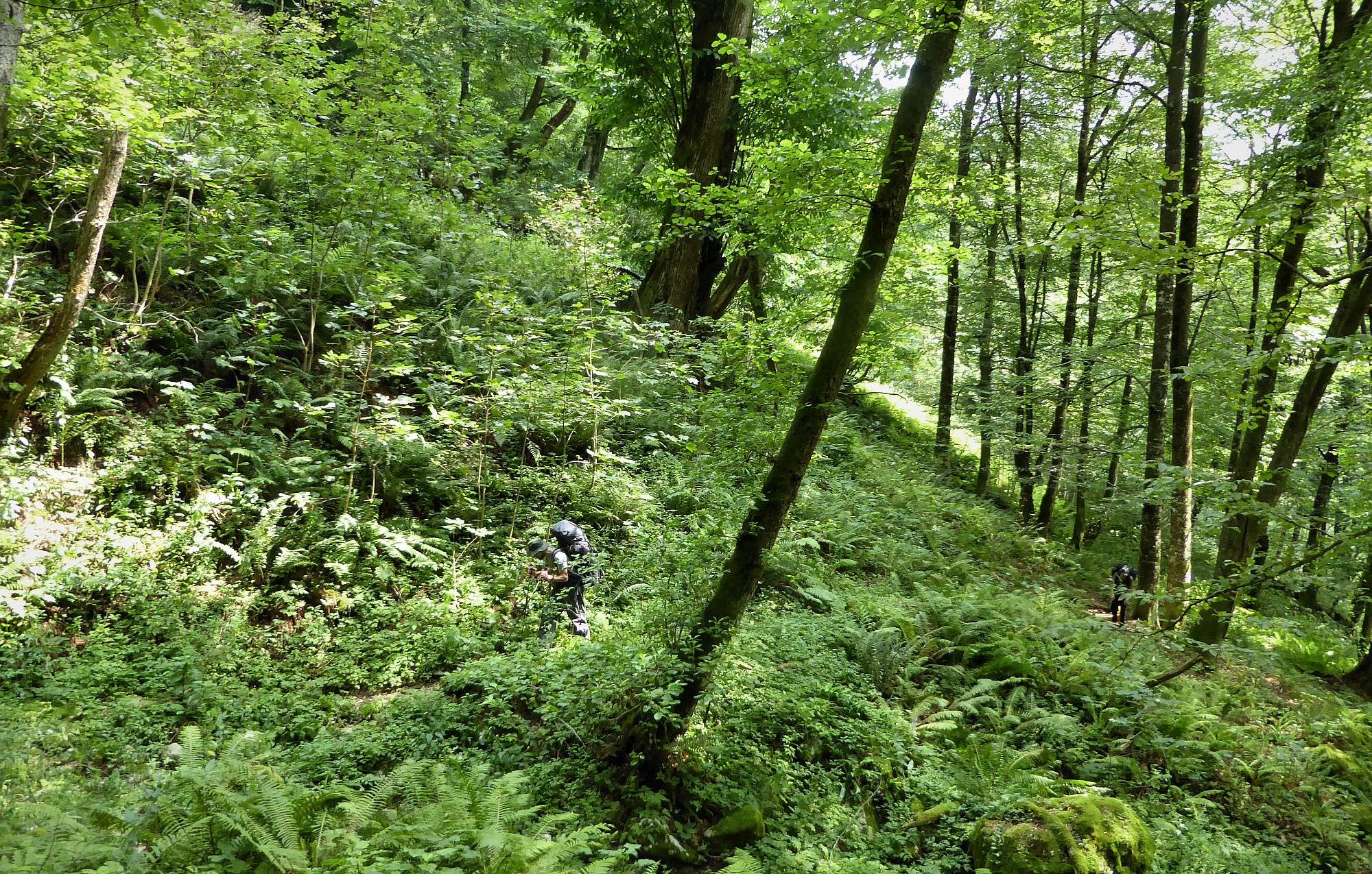
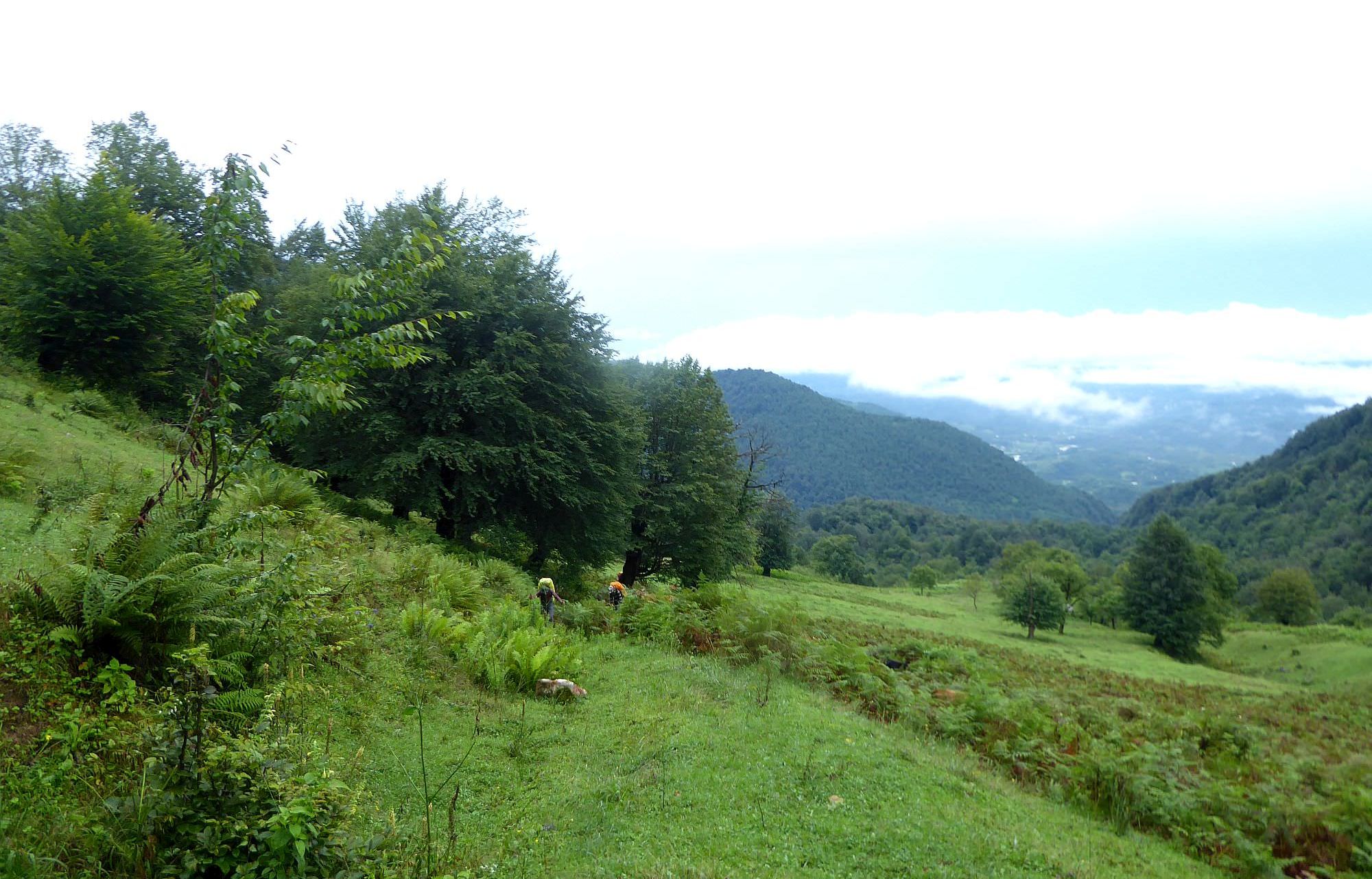
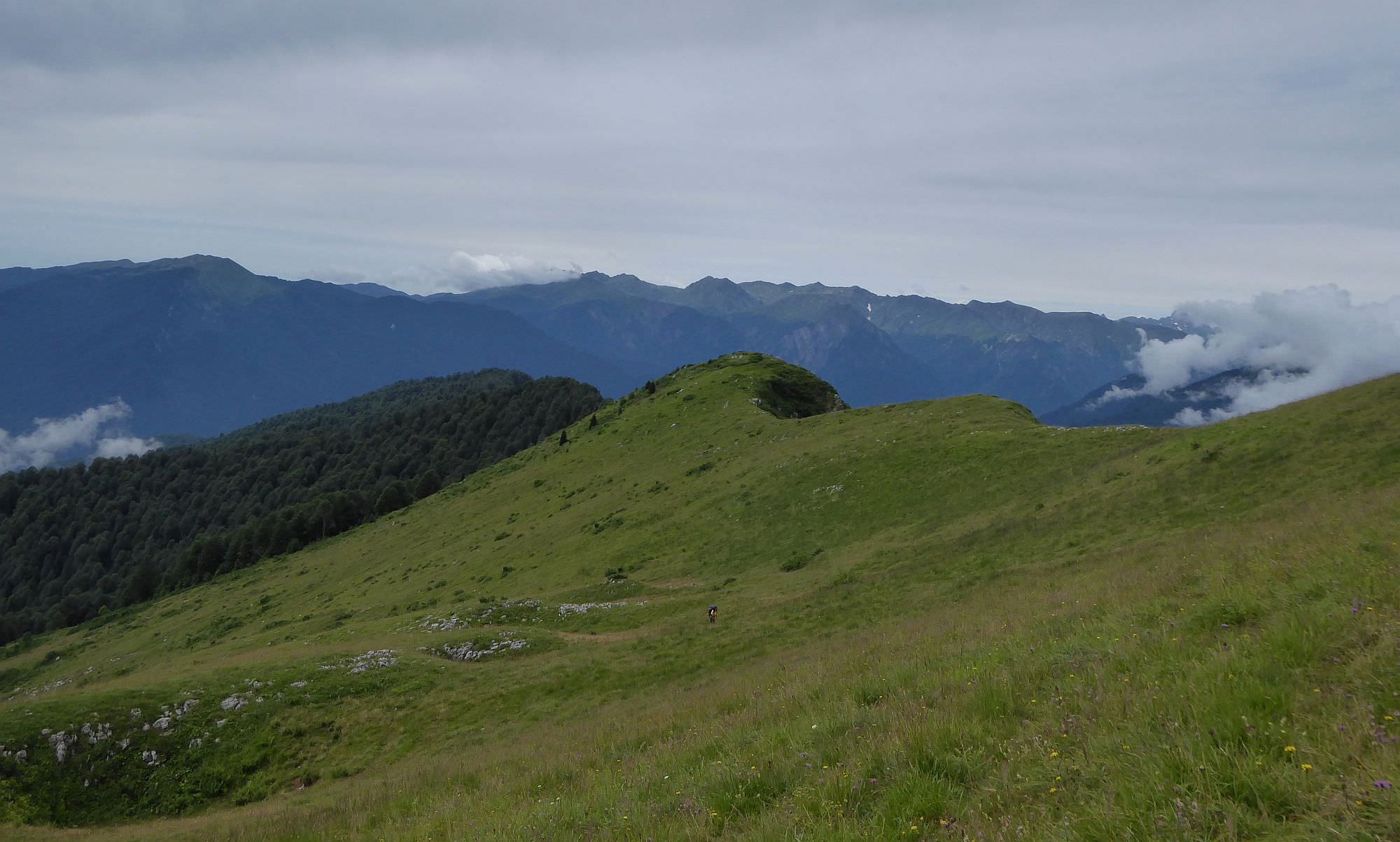
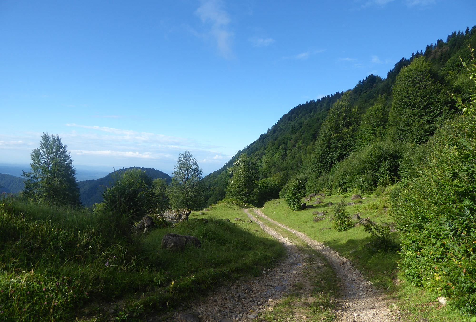
From the hut, walk some 150m across the meadow, climbing only slightly. Then, you should notice a small trail heading past a few trees to the northern edge of the meadow. Once it gets there, it sharply turns to the right. After a short but relatively steep climb, you will make it to the forest road, where you need to turn left.
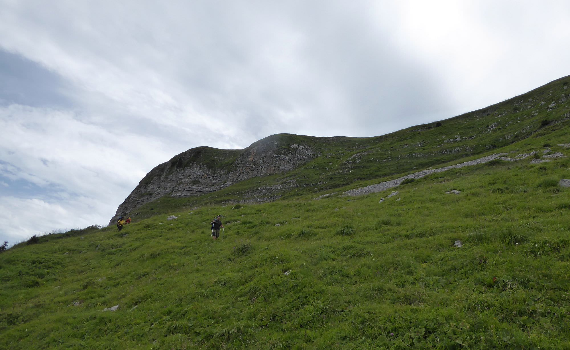
What comes next is a maze of several intertwining forest roads. Luckily, I don´t have to mention every intersection because the route is marked well by hiking pointers. After more than an hour on the road, it will turn into a steep, rocky chute. Not much later, you will reach another pointer which will send you to the right onto the small, overgrown trail. After the short, but steep climb, you will reach another road. Follow it for 400 meters to the next intersection, then turn right. From there, walk straight till you reach the edge of the treeline and soon after also the shepherd´s hut beneath Mt. Kvira.
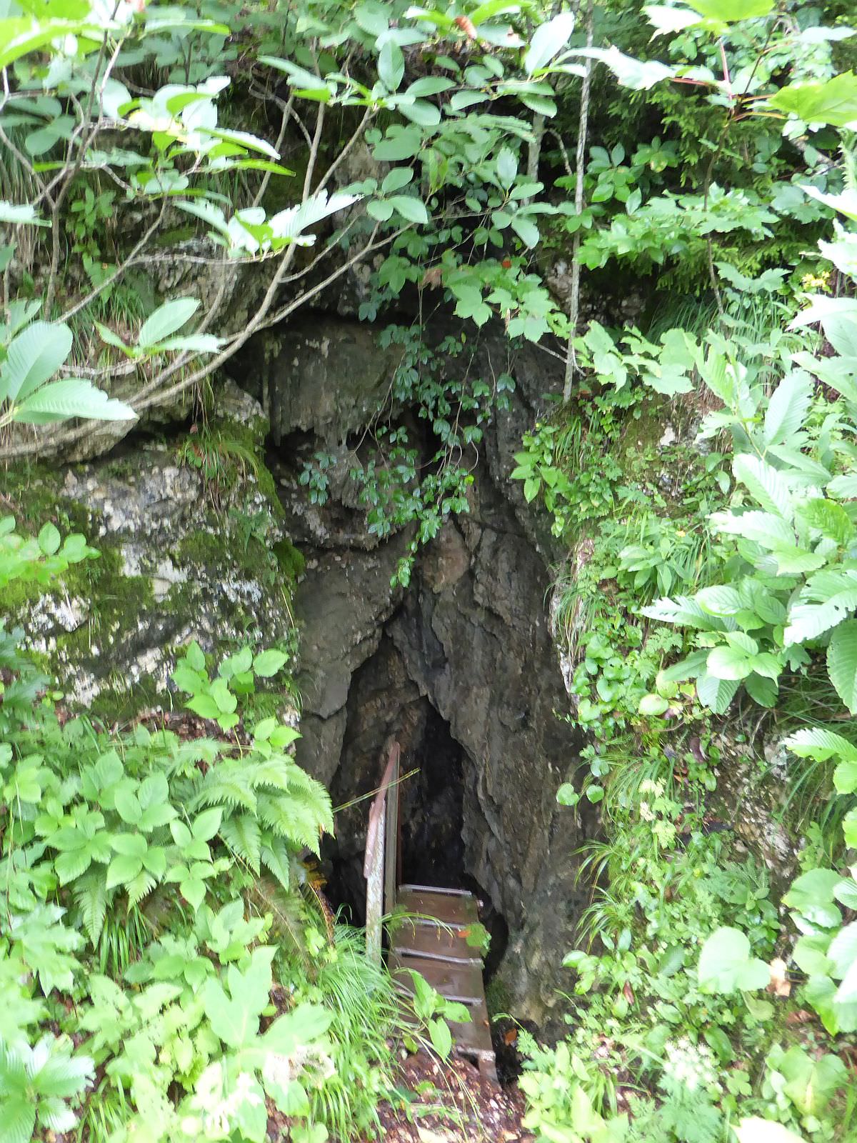
The proximity of the hut is a great place to spend a night (elevation 1650m). There is a lot of place for tents, you can finally enjoy some views and, most importantly, there is a water spring nearby. It lies at a very interesting location - at the bottom of a small karst cave. To find it, head from the hut downhill to the west, using the heavily overgrown trail. 70 meters from the hut, you should find an entrance to the cave with an iron ladder you need to climb.
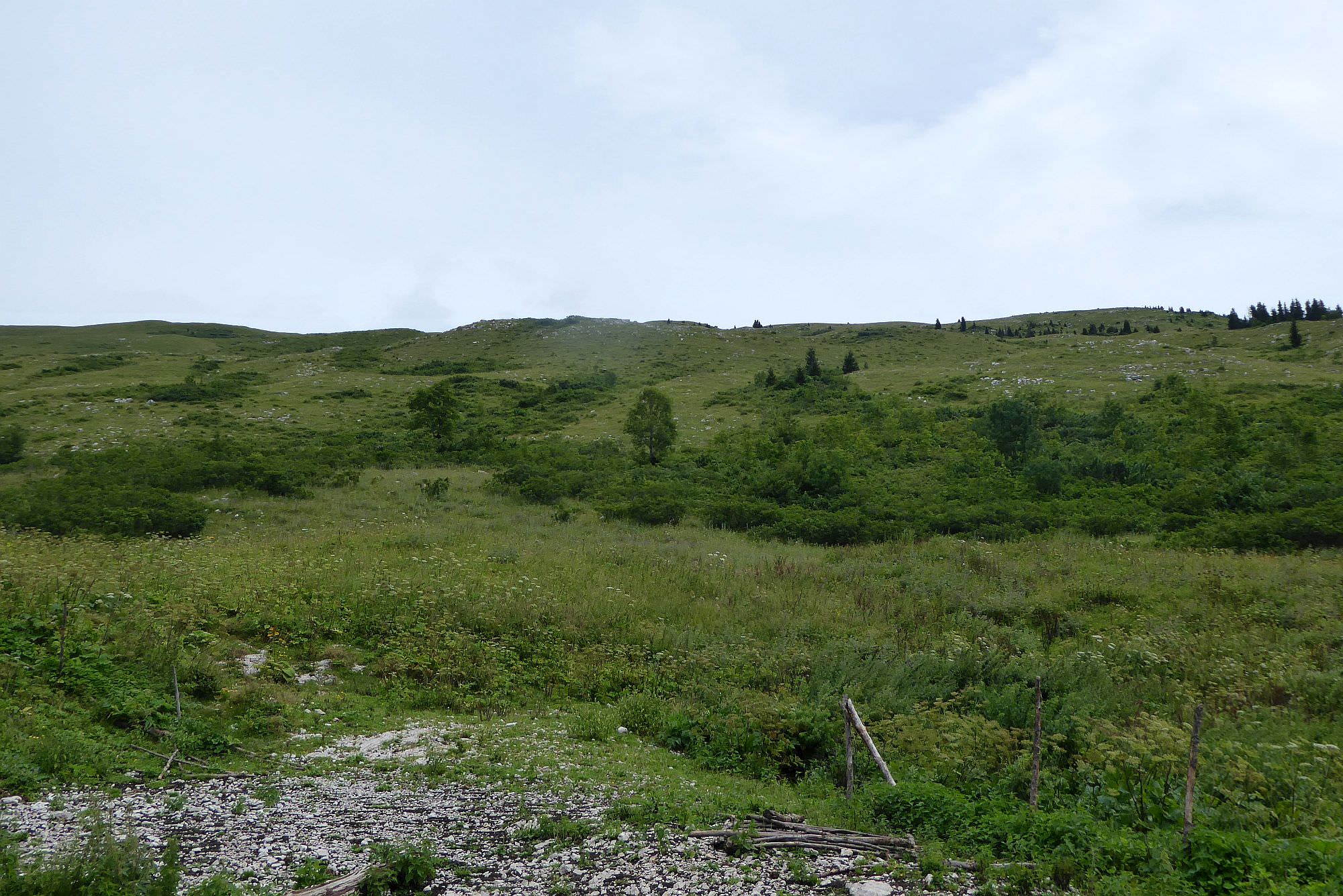
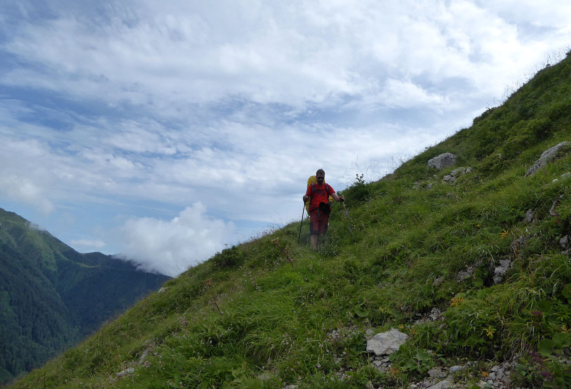
The first time you need to do today is to climb Mt. Kvira - the mountain lies to the northeast. The trail first heads to the north. It´s a bit hard to follow since it´s overgrown and markings are very sparse - the whole mountain is grassy and there are only a few places to put them.
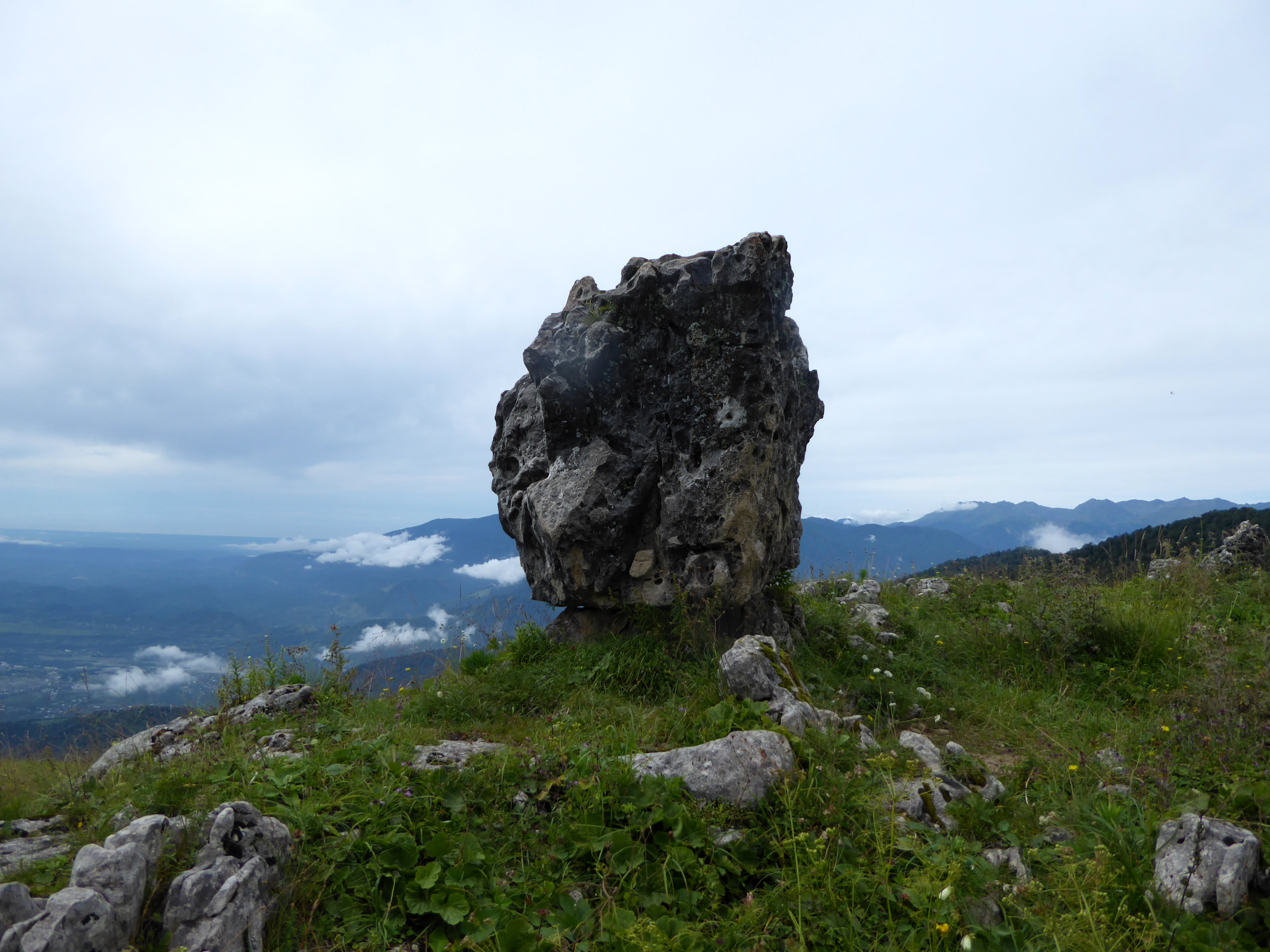
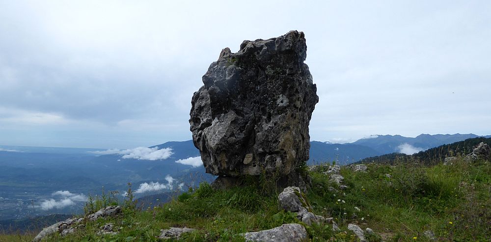
After a few hundred meters, you should see a hiking pointer on the small ridge ahead. The trail there turns to the right and starts climbing more steeply. 20 minutes later, you will reach an interesting geological landmark - Kuakantsalia, knows also as "the Swinging Stone". It is a 10-12 tonnes heavy limestone boulder, lying in a natural rock cradle. This cradle eroded just enough so when you push the boulder, you are able to swing it a bit (so it makes a knocking sound). But completely overturning it is a different story - many people tried, but no one succeeded. Feel free to try, but if you succeed, pls put it back again 🙂 Close to the stone, there are also some overgrown craters, be careful not to fall into one of them.
From Kuakantsalia, you need to cover another 150 elevation meters to the top of Mt. Kvira. The trail completely disappears here, you will have to improvise, but it´s not far.
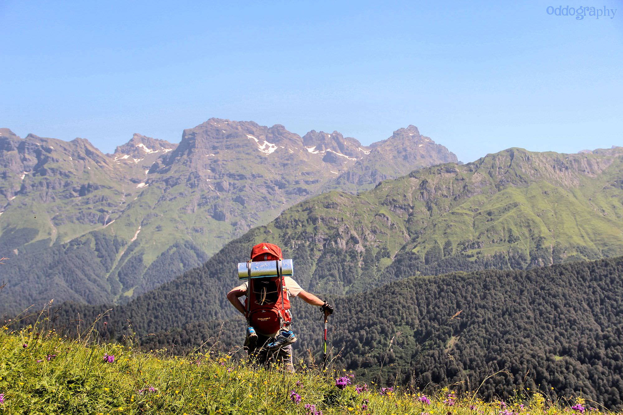
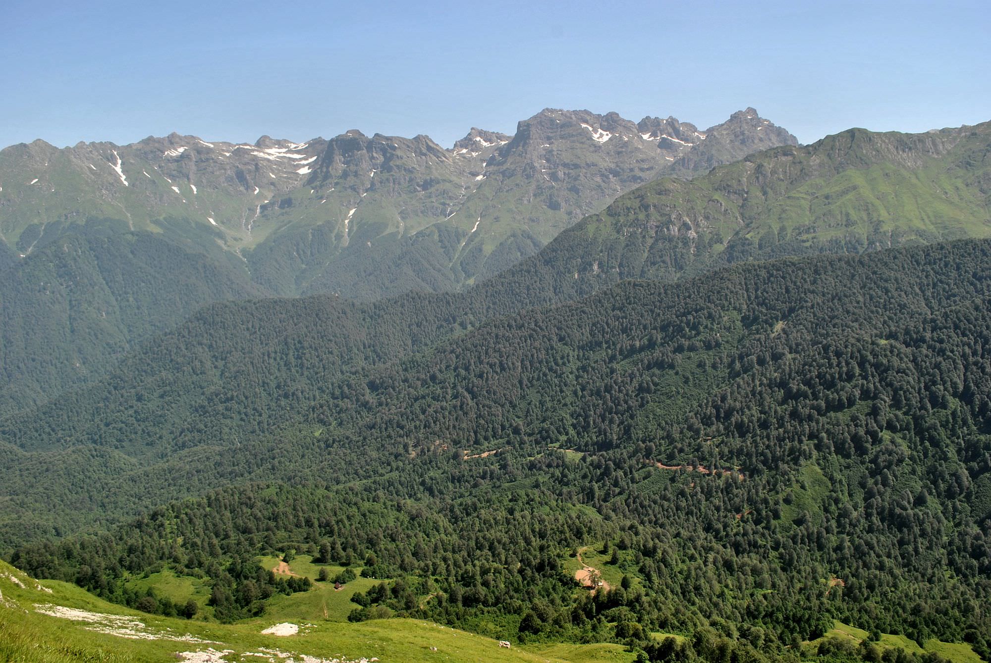
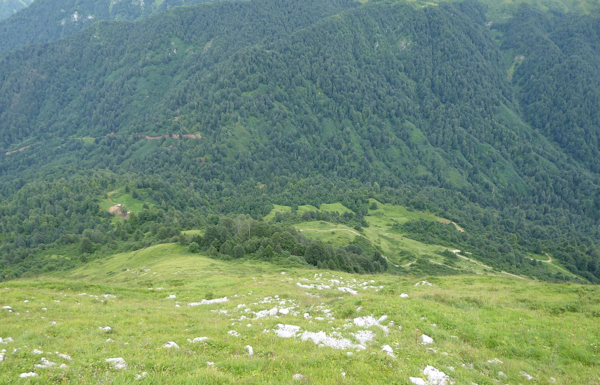
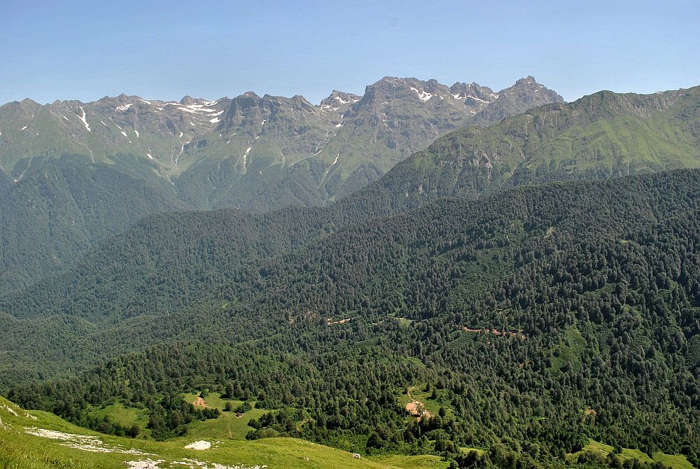
Mt. Kvira (2039m) offers a great, 360° views. The most interesting are, of course,Egrisi mountains to the north. To the west, you may be also able to see the dam wall of the Inguri reservoir.
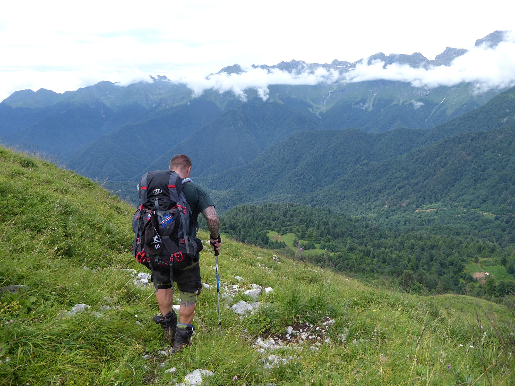
The descent from the mountain is the trickiest part of the trek. There is no trail and no markings. The descent starts a little west from the top of the mountain and navigates the relatively accessible northeastern side of the mountain. There is not much to tell - use the gpx log only for the basic sense of direction and pick your own route, depending on "how the mountain lets you". Overall, you need to lose 400 elevation meters - below, you will see the road you need to reach as well as Kirnakhona shelter further to the north.
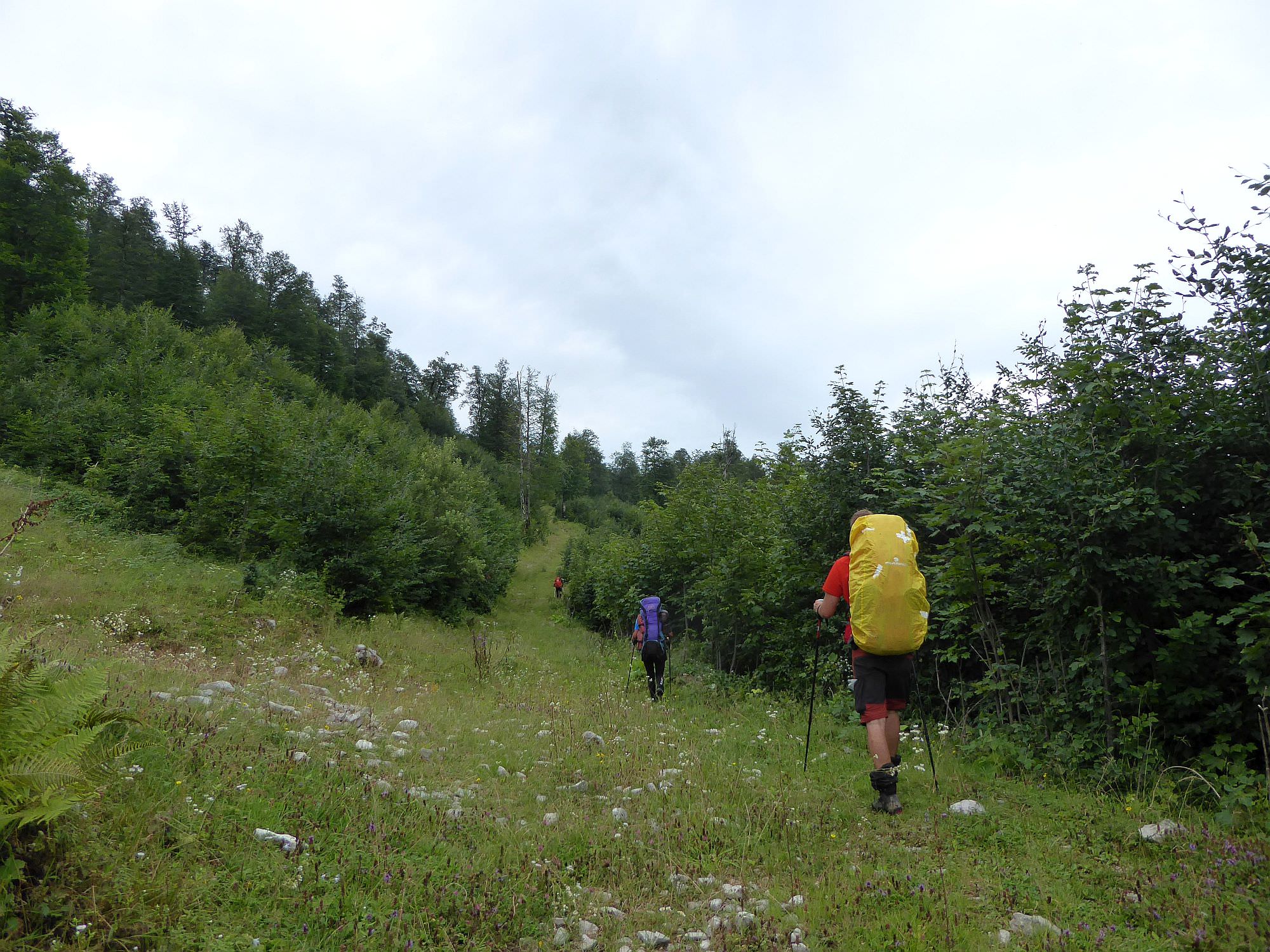
During the descent, you will see a small forest between you and the road for most of the time. If you try to bypass it from the left side, you should find a small trail which will lead you to the larger dirt road. From there, you have two basic options - you can either head north towards the Tobavarchkhili lakes or turn south and do the version described in this post. It´s pretty straightforward - simply follow a dirt road and after less than 3 hours, you will make it to Skuri.
I would like to thank Odd Todd - the weather during our visit was far from ideal so his photos came really handy.